What does the future hold for traditional style mappers?
1. What does the future hold
for traditional style mappers?
State of the Map 2013
6-8 September 2013
Birmingham,UK
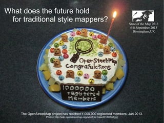
The OpenStreetMap project has reached 1,000,000 registered members, Jan 2013.
Photo / http://wiki.openstreetmap.org/wiki/File:Cake2013OSM.jpg
2. Self-introduction
I'm Ikiya.
I live in Fukushima, Japan.
I've mapped Japan and other countris.
Sorry, my english is not so fluent.
'Where did you contribute to OpenStreetMap? ' http://yosmhm.neis-one.org/?ikiya
3. This is my hometwon, Fukushima City.
We map towns in Fukushima.
Fukushima City is the prefectural capital.
280,000 people live in Fukushima City.
13. Yasukuni Shrine GPS Logs, in Tokyo.
Up until 2 or 3 years ago,
We could use only low resolution satellite photos in Japan.
Landsat pictures were not clear enough for detailed mapping.
15. Walking a lot and recording a lot of points was necessary
for detailed mapping in Japan.
I did a lot of walking and driving to record these GPS logs.
16. Tsuruga-jo Castle
in Aizu Wakamatsu, Fukushima
This is Tsuruga-jo castle in Fukushima, Japan.
You may have heard of Tsuruga-jo castle through OSM.
17. Tsuruga-jo Castle
in Aizu Wakamatsu, Fukushima
I spent 6 months mapping this castle using GPS logs
and data I collected on-site.
19. The outer perimeter of Tsuruga-jo Castle is about 2.5km.
I wanted to map it in detail mapping.
On some days I walked up to 23km collecting data from
the outer regions of the castle.
22. Creating maps from scratch using a GPS takes time and effort
but is very satisfying.
23. What does the future hold for traditional style mappers?
The introduction of Bing images - 2010
State of the Map 2013
September 2013 Birmingham,UK
24. In November 2010 we heard the big news
that we could use Bing satellite Images for OSM.
I was happy because using the Bing images expanded
mapping possibilities.
http://wiki.openstreetmap.org/wiki/Bing
25. Use of Bing images in OSM
But at the same time I was sad.
When I realized the amount of information and detail
collected through Bing images.
I could see that maps such as those I created on foot with a GPS
would start to replaced by maps created
using high resolution satellite images.
Yokomaha City
26. Use of Bing images in OSM
Many of the maps that I have spent months creating
using GPS logs and logging photos
cannot compete with the information and detail of Bing Images.
Tokyo Station
27. Tokyo, Kamakura, Yokohama・・・
Many of the places we spent time GPS mapping hold deep memories for us.
But with the advance of tracing using Bing images,
I can see that the maps I created will soon be replaced.
28. Even so, I'm a mapper!
I was happy to be able to use Bing Images in Japan
and have spent many hours tracing Bing Images,
and thinking about how I could trace best.
I have traced several thousand buildings and roads around Japan.
“Red = ikiya”
Yokohama, Japan
ito! OSM Mapper
http://www.itoworld.com/static/openstreetmap_tools/osm_mapper.html
29. In 9 months, I traced 16,000 buildings
in central Tokyo using Bing images. Red=ikiya
Tokyo, Japan
ito! OSM Mapper
http://www.itoworld.com/static/openstreetmap_tools/osm_mapper.html
31. What does the future hold for traditional style mappers?
The introduction of KIBAN - 2012
KIBAN Chizu Joho
(Fundamental Geospatial Data )
http://wiki.openstreetmap.org/wiki/JA:GSI_KIBAN
State of the Map 2013
September 2013 Birmingham,UK
32. http://wiki.openstreetmap.org/wiki/JA:GSI_KIBAN
In 2011, the Geospatial Information Authority of Japan (GSI)
decided to allow people to use the government's mapping data
called Kiban Chizu Joho (KIBAN), on OSM.
This would allow people to trace KIBAN illustrations
but would not allow the importing of data.
34. In 2012, it became possible to use KIBAN as an underlay
when editing data on TMS.
http://wiki.openstreetmap.org/wiki/JA:GSI_KIBAN/Using_GSI_KIBAN_WMS
35. Although KIBAN data is not as new as Bing Images,
it is more accurate and even in its coverage of cities.
Also, with Bing, it is necessary to interpret images
to determine roads or buildings.
However, because this is not necessary with KIBAN.
Map-making has become faster and more accurate.
In 10 months, I traced 70,000 buildings using KIBAN data.
Red=ikiya
ito! OSM Mapper
http://www.itoworld.com/static/openstreetmap_tools/osm_mapper.html
36. Looking back over my experiences over the last few years, I see this.
Maps created over many months with a GPS have replaced
with more accurate maps created using Bing.
Maps created over many months using Bing images have been replaced
with maps created using even more accurate data.
What do you, as OSM Mappers,
think of this?
To be honest, 'the mapper in me' feel sad.
37. What does the future hold for traditional style mappers?
Further Introduction of Data to OSM
in the Future
State of the Map 2013
September 2013 Birmingham,UK
38. Yokomaha City
It seems to me that we are moving more towards
open data and open governments.
I forsee that even more accurate and detailed data sources
will be used on OSM in the future.
Should this progress be stopped?
39. Bus stop data collected by riding buses for many months
May be replaced by even more detailed data released
by governments.
The same may be said of Street maps created over many
months using satellite images and GPS mapping.
40. What does the future hold for traditional style mappers?
Mappers and Change
State of the Map 2013
September 2013 Birmingham,UK
41. I have spent many hours thinking about this,
But as permission to use the data has been given,
I cannot find a reason not to use this
more detailed and accurate data.
Underlying this is my opinion that OSM should not be
a community just for mappers
- it should be a community for all people.
Even if long hours have been spent creating a map,
if a better map is produced, it should be the one used.
Oosu coast, Fukushima
42. As mappers who come into direct contact with mapping data,
our roles and presence will changes as OSM grows
and its environment changes.
The driving force behind OSM is the community and people,
and I hope it always will be.
43. The role of Mappers is to link OSM and people going about their daily lives.
If you look around, you will see that as mappers,
there are still many things we can do.
As for me,
I will continue to map with GPS and Bing trace and KIBAN trace as always.
44. Thank you for listening to
the ramblings of a mapper !
State of the Map 2013