Evaluation of the solar energy potential in urban settings by irradiation map production
•
1 like•722 views

Presentation given at the 2003 International Radiance Workshop in Berkeley, California (USA)

Recommended
More Related Content
Similar to Evaluation of the solar energy potential in urban settings by irradiation map production
Similar to Evaluation of the solar energy potential in urban settings by irradiation map production (20)
Recently uploaded
Recently uploaded (20)
Evaluation of the solar energy potential in urban settings by irradiation map production
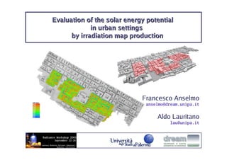
- 1. Evaluation of the solar energy potential in urban settings by irradiation map production Francesco Anselmo anselmo@dream.unipa.it Aldo Lauritano lau@unipa.it
- 2. Francesco Anselmo Summary 2 anselmo@dream.unipa.it Aldo Lauritano lau@unipa.it Opportunity of studying and applying irradiation maps production: recovery plan of the historical centre of Palma di Montechiaro (Sicily) - evaluation of photovoltaic and solar heating systems economics Radiance based procedures to evaluate solar access radmap: a Radiance based tool to produce irradiation and illumination maps Conclusions and future work
- 3. Francesco Anselmo 3 anselmo@dream.unipa.it Recovery plan of the historical centre of Aldo Lauritano lau@unipa.it Palma di Montechiaro Palma di Montechiaro 27 km. far from Agrigento 24.895 inhabitants 7.636 hectares population density: 326 inhabitants/km2 165 m above the sea-level The town was named Palma by Duke Carlo De Caro, who founded it in 1637, to honor his family's emblem represented by a palm tree, symbol of glory. Throughout the XVII century, the suburb belonged to the De Caro princes, until it passed through matrimony to the Lords Tomasi of Pelagie (Lampedusa and Linosa). In 1812 the town achieved its independence. The appositive "Montechiaro" was added in 1863 only, because of the proximity of the homonymous castle of the Chiaramonte family. The most outstanding monuments are the XVII century Palazzo Ducale, the neo-classic style Chiesa del SS. Rosario, the Chiesa Madre, that beholds the tomb of the astronomer Giovanni B. Odierna (1579-1660), the Benedictine Monastery of Maria SS. del Rosario, and the Torre di S. Carlo, that has been erected during the XVII century by Prince Carlo Tomasi of Lampedusa.
- 4. Francesco Anselmo 4 anselmo@dream.unipa.it Recovery plan of the historical centre of Aldo Lauritano lau@unipa.it Palma di Montechiaro Historical centre Recovery plan perimeter area
- 5. Francesco Anselmo 5 anselmo@dream.unipa.it Recovery plan of the historical centre of Aldo Lauritano lau@unipa.it Palma di Montechiaro the centre is located on a slope that faces SW poor quality of buildings located inside the centre, even if very close to monuments dissimilar heights presence of many surfaces that are suitable for solar systems integration
- 6. Francesco Anselmo Recovery plan of the historical centre 6 anselmo@dream.unipa.it Aldo Lauritano of Palma di Montechiaro (Sicily) lau@unipa.it Purposes: 1. Evaluation of solar energy systems economics 2. Definition of strategies and norms to promote the use of solar energy 1. Evaluation of photovoltaic and solar heating systems economics need for a method that can Study the whole area Predict long-term solar irradiation according to weather data, taking into accound shading and inter-reflection effects Present data in an easy and user friendly way (images) [almost completed] 2. Definition of strategies and norms to promote the use of solar energy need to Study small parts of the urban area (blocks) Consider particular situations and people behaviour [still working ...]
- 7. Francesco Anselmo Evaluation of solar access 7 anselmo@dream.unipa.it Aldo Lauritano lau@unipa.it The prediction of the utilisation potential of solar energy for both passive and active applications is usually based on tabular or analytical methods that use averaged irradiation data. These methods allow the user to get results only at specific points and are nearly useless when applied to urban sites, since the complexity of urban geometries and inter-reflection and shadowing effects cannot be accounted for easily. Recently, some Radiance based procedures have been proposed in order to obtain high dynamic range (HDR) images capable of quantifying solar access reliably and taking into account sky anisotropy, inter-reflection and shadowing phenomena and hourly or sub-hourly sequences of irradiance/irradiation data.
- 8. Francesco Anselmo Radiance based procedures 8 anselmo@dream.unipa.it Aldo Lauritano lau@unipa.it to evaluate solar access Procedure 1: 1. Classification of the sun and sky types and positions by analisys of the weather data 2. Rendering of several normalised irradiation maps according to the classification 3. Composition of all the timestep irradiation maps by multiplying the normalized maps by the magnitude of the radiant output of the source configuration 4. Composition of the final irradiation map as a sum of all the timesteps proposed by J. Mardaljevic et al.: - Mardaljevic, J. and Rylatt, M. - An Image-based Analysis of Solar Radiation for Urban Settings - Mardaljevic, J. - A New Image-based Technique to Predict Solar Penetration in Buildings http://www.iesd.dmu.ac.uk/~jm Procedure 2: 1. Hourly sky models generated by gendaylit using climatic data 2. Averaging process to obtain «average sky models» for different applications (PV, heating, daylighting) 3. Radiance simulation to obtain irradiance and/or illumination maps proposed by R. Compagnon et al.: - Scartezzini J.L., Montavon M., Compagnon R. - Computer Evaluation of the Solar Energy Potential in an Urban Environment - EuroSun 2002 - Bologna, Italy - Compagnon R., PRECIS: Assessing the potential for Renewable Energies in Cities - Technical Report, EIAF, Fribourg (2001) http://www.radiance-online.org/workshop/Compagnon
- 9. Francesco Anselmo Procedure 1: theoretical basis 9 anselmo@dream.unipa.it Aldo Lauritano lau@unipa.it For a fixed sun position, the irradiance map for an arbitrary radiance sun is a multiple of the normalized irradiance map (i.e. the irradiance map for a unit radiance sun). · magnitude of the radiant output of = the source configuration For a fixed arbitrary diffuse horizontal irradiance and circumsolar region position, the irradiance map for an arbitrary anisotropic sky (clear or intermediate) is almost equal to a multiple of the normalized irradiance map (i.e. the irradiance map for a unit diffuse horizontal irradiance sky and a fixed circumsolar region position). · magnitude of the radiant output of = the source configuration For a fixed arbitrary diffuse horizontal irradiance, the irradiance map for an arbitrary overcast sky is almost equal to a multiple of the normalized irradiance map. · magnitude of the radiant output of = the source configuration
- 10. Francesco Anselmo radmap 10 anselmo@dream.unipa.it Aldo Lauritano lau@unipa.it A Radiance based software package (radmap) has been developed and applied to the real case of urban planning in Palma di Montechiaro in order to estimate photovoltaics and solar heating systems economics. view file weather data 3D model (Satel-Light or EPW) (geometry + material) radmap python (oop) irradiation / illumination vtk data files map (data visualization)
- 11. Francesco Anselmo radmap 11 anselmo@dream.unipa.it Aldo Lauritano lau@unipa.it 1. Loading of the weather file (EPW or Satel-Light): n timesteps 2. Classification of the sun positions according to weather data 3. Classification of the skies according to weather data 4. Output of two VTK data files showing the classification of skies and sun positions 5. Calculation of the normalized irradiation maps for every occurring classified sun position: s sun positions 6. Calculation of the normalized irradiation maps for every occurring classified intermediate sky: a skies 7. Calculation of the normalized irradiation maps for every occurring classified clear sky: a skies 8. Calculation of a normalized irradiation maps for the overcast sky Total number of irradiance maps to be rendered: s + 2a + 1 9. Composition of n timestep irradiation maps by multiplying the normalized maps 10. Composition of the final irradiation map (sum) 11. Removal of the temporary irradiation maps
- 12. Francesco Anselmo radmap 12 anselmo@dream.unipa.it Aldo Lauritano lau@unipa.it Classification of sun positions according to weather data Palma di Montechiaro: 163 sun positions (9° subdivision)
- 13. Francesco Anselmo radmap 13 anselmo@dream.unipa.it Aldo Lauritano lau@unipa.it Classification of anisotropic skies according to weather data Palma di Montechiaro: 67 sky classes (15° subdivision)
- 14. Francesco Anselmo radmap: example of application 14 anselmo@dream.unipa.it Aldo Lauritano lau@unipa.it max roof tilt angle = 20° / no reliable source of information for roofs inclinations: ... all the roofs have been modelled as horizontal surfaces ...
- 15. Francesco Anselmo radmap: example of application 15 anselmo@dream.unipa.it Aldo Lauritano lau@unipa.it
- 16. Francesco Anselmo radmap: example of application 16 anselmo@dream.unipa.it Aldo Lauritano lau@unipa.it
- 17. Francesco Anselmo radmap: example of application 17 anselmo@dream.unipa.it Aldo Lauritano lau@unipa.it
- 18. Francesco Anselmo radmap: example of application 18 anselmo@dream.unipa.it Aldo Lauritano lau@unipa.it
- 19. Francesco Anselmo radmap: example of application 19 anselmo@dream.unipa.it Aldo Lauritano lau@unipa.it
- 20. Francesco Anselmo Conclusions 20 anselmo@dream.unipa.it Aldo Lauritano lau@unipa.it radmap pros Prediction of the total irradiation (annual, seasonal, monthly, ...) on every surface by using a validated simulation code (Radiance) Use of meteorological data (no timestep limitations) Use of standard sky radiance distributions Shading and inter-reflections are taken into account Possibility to use very detailed models and even dynamic models (more programming is required in this case) Semi-automatic process Production of images that are easy to be read and understood cons If the 3D model is not available, it is necessary to spend some time in modelling the scene with the correct level of detail It may be complex to define simulation parameters (need for a Radiance expert) Palma di Montechiaro About half of the building envelope (facades and roofs) is appropriate for the use of solar systems, despite building obstructions. The majority of roofs are suitable for solar applications.
- 21. Francesco Anselmo Future work 21 anselmo@dream.unipa.it Aldo Lauritano lau@unipa.it Link with GIS software (GRASS, ...) Error estimation Automatic view selection according to user-defined grid User interface for irradiation map production User interface for data browsing
- 22. Francesco Anselmo Contacts 22 anselmo@dream.unipa.it Aldo Lauritano lau@unipa.it Francesco Anselmo anselmo@dream.unipa.it radmap: http://www.dream.unipa.it/dream/pub/dot/anselmo/radiance/05.php it will be released as a free GPL'd program