Discrete Model of Two Predators competing for One Prey
Bf2420172020
1. International Journal of Modern Engineering Research (IJMER)
www.ijmer.com Vol.2, Issue.4, July-Aug 2012 pp-2017-2020 ISSN: 2249-6645
Wireless Sensor Networks for Paddy Field Crop Monitoring
Application in Kuttanad
Santhosh Simon1, K Paulose Jacob2
(Department of Computer Science, Cochin University of Science and Technology, Kerala, India)
Abstract :The evolution of wireless sensor network Manimala and Achenkovil, together with the lying areas
technology has enabled us to develop advanced systems for (marshes) in and around the Vembanad lake. Most of the
real time monitoring. In the present scenario wireless sensor vast expanse in this region is laying 1 – 1.5 m below mean
networks are increasingly being used for precision sea level, water-logged throughout the year, subjected to
agriculture. The advantages of using wireless sensor continued flood submergence during monsoon and saline
networks in agriculture are distributed data collection and water ingression during the summer month.
monitoring, monitor and control of climate, irrigation and
nutrient supply. Hence decreasing the cost of production and
increasing the efficiency of production.This paper describes
the application of wireless sensor network for crop
monitoring in the paddy fields of kuttand, a region of Kerala,
the southern state of India.
Keywords–Crop monitoring, Precision agriculture,
Wireless sensor networks, Zigbee.
Kuttanad, the rice bowl of Kerala, is unique among
the rice ecologies of the world; the biggest wetlands of the The vast area of paddy fields in Kuttanad extends
country, located 0.5 – 2.5 metres below mean sea level from 90 17‟ N to 90 40‟ N and 76019‟ E to 76033‟ E. These
(msl). Rice is grown by construction of bunds and are divided into “padasekharams” literally meaning groups
dewatering the so formed polders mainly during the puncha or blocks of paddy fields and are separated by canals, bunds
(rabi) season from Oct. – Nov. to Jan. – Feb. The soils of and water-logged masses. The puncha lands of Kuttanad are
Kuttanad are low to medium in fertility. Soil is enriched by classified under three categories based on elevation,
annual silt deposition during the mansoon floods. The soils geographical formation and soil characteristics, into
are alluvial with silty clay texture and are acid sulphate in Karappadoms, Kayal lands and Kari lands. The
nature with excessive iron content. The major problems Karappadoms are generally situated along with the
faced by Kuttanad rice are flood and lack of drainage, waterways and constitute the lower reached of the eastern
intrusion of saline water and soil acidity. In spite of the and southern periphery of Kuttanad, usually 1-2 m below
sharp decline in area under rice; Kuttanad rice bowl (53600 mean sea level. Vembanad Lake for agricultural purpose and
ha.) accounts for 18 per cent of the rice growing area and 25 the elevation ranges from 1.5 to 2.5 m below the mean sea
per cent of total production of the State.The major level. The Kari lands situated in Ambalappuzha, and
occupation in Kuttanad is farming. Rice is the important Vaikomtaluks is peaty and marshy in nature and are
agricultural product, giving Kuttanad the moniker of “The overgrown in many areas with wild weeds and grass and
Rice Bowl of Kerala”. Three crops are grown every year most of the Kari lands lie at or below mean sea level.
now instead of the traditional two per year. Large farming „Puncha‟ is the mean paddy crop in Kuttanad sown
areas near Vembanad Lake were actually reclaimed from the in November or December and harvested by the end of
lake. March. The „virippu‟ is the additional crop grown from
May to the end of June and harvested in September or
I. THE KUTTANAD REGION October. High yielding varieties of rice are sown in all the
Rice is the one of the most widely grown crops in areas of Kuttanad. The gap between demand and local
the world and is one of the major food crops grown production of rice in Kerala is widening primarily because
extensively in India. The most important rice producing of the continuous pace at which rice are giving way to
states of India are West Bengal, Andra Pradesh, Bihar, urbanization.
Tamil Nadu, Assamand Kerala. In Kerala, Palaghat, Trichur
and Kuttanad are the main rice producing regions. Kuttanad II. AUTOMATED WATER LEVEL REGULATION
popularly known as the rice bowl of Kerala, located in The soil of the paddy fields of Kuttanad is salty and
central Kerala, is a large wetland habitat comprising of is extremely acidic. The acidity is due to the production of
paddy fields, marshes, lakes and rivers. Kuttanad consists of sulphuric acid by microbiological oxidation of sulpher
54 revenue villages spread over 10 taluks in the districts of compound present in the soil. High amount of iron,
Alleppey, Kottayam and Pathanamthitta. It is separated from manganese, aluminum and sulphides are present in the soil.
the Arabian sea by a narrow strip of land and is deltaic This acidity of the soil is a major constraint which retards
formation of four river systems, namely Meenachil, Pampa, the production of rice in the Kuttanad area. Regular rinsing
of the soil by water can reduce the acidity and increase the
production.Rice is a crop which needs high amount of water
www.ijmer.com 2017 | P a g e
2. International Journal of Modern Engineering Research (IJMER)
www.ijmer.com Vol.2, Issue.4, July-Aug 2012 pp-2017-2020 ISSN: 2249-6645
for its growth. The main factor to be considered here is that IV. WIRELESS SENSOR NETWORKS FOR
the water should not be too much or too low. Periodic COMMUNICATION
monitoring and controlling water level is essential for the
Wireless sensor Network (WSN) is a major
healthy growth of the rice plant.
technology used for real time monitoring of environmental
Due to the socio-economic states prevailing in the
assets. WSN has the advantages of large scale deployment,
state of Kerala the labor community is getting narrower. The
low maintenance, scalability, adaptability, less power needs
paddy field owners are not able to recruit sufficient labors
etc. with the disadvantages of low memory, low power, low
for these processes. The initial activities like plowing,
bandwidth etc. They can be employed in hostile
seeding etc and the final activities like harvesting are done
environments and the features like use of low power and
as a group and hence can be easily coordinated. The periodic
low maintenance makes them the most suited technology for
monitoring of needs, controlling the pests and water level
real-time environmental monitoring. They can be highly
monitoring is a tedious process. Majority of the paddy field
useful in monitoring the water level in the paddy fields.
farmers are employed in some other activities or are
considering this activation as a secondary business. Hence ZigBee is the most commonly used network
their insolvent on a daily basis should be greatly reduced. standard today and it is a low-cost, low-power consumption,
Since the pumping of water to and from the field is low data-rate, two-way wirelessnetworking standard that is
the major activity from plowing to harvesting, automating aimed at remote control and sensor applications which is
the process can greatly reduce the load on farmers. suitable foroperation in harsh radio environments and in
Automated systems may monitor the water level and isolated locations. It builds on the IEEE standard802.15.4-
regulate the levels by sophisticated systems and can send 2003 which defines the physical layer and medium access
messages to the farmers. control sub layer.Above this, ZigBee defines the application
and security layer specifications enablinginteroperability
III. SENSORS FOR MONITORING WATER LEVEL between products from different manufacturers. There are
Paddy field is a large area and is nearly flat in
several different network topologies that a wireless sensor
nature. Normally the water level in a field will be uniform
network can form:star, tree, bus, ring, and mesh. All these
throughout the field. Water wells can be made as per the
topologies have their own individual benefits but themesh
need and the water level in each well can be monitored.
network topology is best suited in our case.A ZigBee WSN
Water level sensors can be used for sensing the levels. These
is shown in Fig 1.It consists of three types of nodes: a
sensors can monitor the level according to the user needs.
ZigBeeCoordinator, ZigBee Routers , and ZigBee End-
Normally there can be three levels, normal, high and low.
Devices.
These sensors are electro-mechanical devices. Even though
electronic sensors are available due to the environmental
conditions electro-mechanical devices are more applicable.
The mechanical part in the devices will float on water and
the electrical part will produce the signals based on the
portion of the floating device.
These values or signals generated by the sensor
needs to be transmitted to the farmers. Transmitting the
electrical signal from the device in the field to the farmer
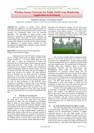
through copper wire is not practical, since it is so long and
we many wells and sensors at different locations in the field. Figure 1-Typical ZigBee WSN – Mesh Architecture
A farmer may have hectors of area as paddy field and need
hundred of sensors for monitoring. Hence wired devices are V. WSN SYSTEM ARCHITECTURE
not practical. Use of commonly used wireless In our project the water wells are constructed at
communication technology is also not advisable due to suitable location in the field and sensor columns are
complexity of the communication system and the high attached. The electro-mechanical sensors will measure the
power needs of such systems. Proving power supply or water level and the valves can be transmitted through the
having a solar panel is also not economical. High battery WSN for this the entire paddy field can be divided into a
power may be needed by such devices and regular charging number of clusters and these clusters can have number of
or replacement of the batteries is highly costly. Alternative water wells or sensor wells. Each cluster will have a cluster
solution is to provide power from a solar panel. The solar head and all sensor nodes in that cluster will communicate
panels are of high cost and hence are after prove to theft. the data to the cluster heads. The water level sensed by the
The paddy fields are of large area and ensuring security to sensor can be low, normal or high. These valves are sent to
each solar panel is also not possible. Low cost the cluster head then the cluster head aggregates these
communication devices which needs low power and less valves and compare them. If all the valves are normal then it
maintenance, which can operate on a wireless architecture is need not send any data to the user. If any valve is high or
the solution. The new generation wireless sensor networks low then it needs to be communicated to the user.For this
can be considered for the situation. the cluster head transmits the data to the sink node. The sink
node is the node which is connected to all the cluster heads
or in other words the cluster heads can communicate to the
sink node in one hop.
www.ijmer.com 2018 | P a g e
3. International Journal of Modern Engineering Research (IJMER)
www.ijmer.com Vol.2, Issue.4, July-Aug 2012 pp-2017-2020 ISSN: 2249-6645
packet from all its subordinate nodes will start analyzing the
Sink Node data. It compares the valves of water level with the
(Coordinator) Sink predetermined values. These predetermined values are fed to
Node the system by the farmer. These values will be different
according to different seasons and processes initiated by the
Cluster farmer, for example, the field needs to be dry for some days
Head CH2
CH1 CHn after de-weeding and more water needs to be present for
Nodes
applying fertilizer.
On analysis if the cluster head is finding the value
to be higher or lower than the predetermined value, it enters
Sensor into a state from normal to alert state. Otherwise it
Nodes continues to be in the normal state. On alert state the cluster
head sends the data packets to the sink node and the
Figure 2 – WSN Architecture remaining processes will be done by the sink node. It also
instructs the subordinate sensor nodes to sniff state. The
Different topologies can be adopted in the WSN. In sensor nodes are having two states, sniff state and sleep
our project we are using a mesh topology. The WSN state.
architecture used for the project is shown in fig 2. The
sensor nodes in on region will form a mesh structure and
each of these mesh structure will be a cluster. These nodes Node
will together have a head node called the cluster head.For OF Fail
example in a wireless sensor network with hundred nodes, F
Booting
System
Snif
/Shutd
the nodes can be divided region wire ten to twelve nodes can
Node
own
Fail
form a cluster which operate in a mesh topology. Each of f
these meshes will have a head node called the cluster head
node. Similarly another ten to twelve nodes form another
Monito Sleep
mesh cluster. Totally we may have eight to ten clusters and
their cluster heads. Then cluster heads are operating in the r
mesh topology so we have a mesh with two levels. These
cluster heads communicating to the sink node which is on Figure 3 – Sensor Node State Transition
top of the network architecture.
State Description
Sudden increase in the water level or decline in the
water level is not often occurred hence real-time monitoring Initial State of the system, Once booted
or a full time monitor is not necessary. The monitoring can OFF up the node reaches this state when the
be done on a six hour basis,that is four times a day and its node is shutdown or fails
remedial measures can be taken. The remedial measure in
the sense, pumping in water if water level is low and Normal operation - sensing and
pumping out water if water level is high. As stated earlier in Monitor
transmission at longer intervals
the introduction, Kuttanad area is lying below the mean sea
level. The water level in the surrounding water bodies of the Sensing and transmission at shorter
paddy field are higher than that of the paddy fields so Sniff
intervals
pumping in water is easy by just opening the inlet valves No sensing and transmission, a state of
located at the outer boundaries of the paddy fields. At Sleep
low power usage.
situation where water level is high the excess water needs to
be pumped out for this to happen there are electrical pump During sniff state, the sensors will be measuring the
stations at different locations. The paddy fields are water levels at a high rate i.e. at short intervals of time
connected each other through water canals and these canals Tsniff. It measures the valves and sends these valves to the
will have the pumping station. These pumps can be operated cluster head. During sleep state the sensor nodes will be idle
and the water can be pumped out. most of the time. Here the sensing intervals will be longer
with a larger valve for time, Tsleep. The sensor node will
Normally the low level sensor nodes will be in the initiate a counter for Tsleep and goes into sleep state, until
sleep state and will be active only on the sixth hourly basis. the counter valve is reached. It wakes up after Tsleep and
When active they sense the water level and send it to the repeats the process by sensing and transmitting
cluster head. After sensing and transmitting it goes to the data to cluster head.
sleep state for power usage optimization and will be active
in the next sixth hour slot or otherwise instructed by the The state transition fromsleep to sniff and reverse
cluster head. of the sensor nodes is instructed by the cluster head. The
cluster head does this after receiving an alert value from any
VI. DATA AGGREGATION of its sensor nodes. Then the cluster head enters into alert
Initially when the network gets booted up each low state and instruct the nodes to enter into sniff state. Along
level sensor node will measure the water level through the with this the data will be reported to the sink node by the
electro mechanical sensors and this valve will be sent to the cluster head. The sink node will not perform any analysis of
cluster head. The cluster head upon receiving the data the data. It just forwards the matter to the Field Control
www.ijmer.com 2019 | P a g e
4. International Journal of Modern Engineering Research (IJMER)
www.ijmer.com Vol.2, Issue.4, July-Aug 2012 pp-2017-2020 ISSN: 2249-6645
Centre (FCC). The Field Control Centre is a program which dacades of research under AICRP at Karumady Centre,
is running on the user computer. The FCC will receive the Kerala, March 2004.
data from all the cluster heads through the sink node. The [9] Anurag D, Siuli Roy and
FCC will process these data and decides the remedial SomprakashBandyopadhyay“Agro-Sense : Precision
Agriculture using sensor baseswireless mesh networks”
actions. It accesses the regions which are affected and then Indian Institute of Management Kolkatta
issue commands to the pumping stations of that region to [10] J. Burrell et al. Vineyard computing: sensor networks in
either pump in or pump out the water. agricultural production. IEEE Pervasive
Computing,3(1):38–45, Jan-Mar 2004.
Once the situation of the water level changes it will [11] D.D.Chaudhary,S.P.Nayse, .Waghmare“Application of
be reflected on the values received by the cluster heads from wireless sensor networks for greenhouse parameter
the sensor nodes. But it continues to be in the alert state control in precision agriculture” International Journal of
until all the sensor nodes are sending values within Wireless & Mobile Networks (IJWMN) Vol. 3, No.
predefined limit. When this situation is arrived it sends the 1,February 2011
message to the sink node and instructs all the sensor nodes [12] Kavi K. Khedo, Rajiv Perseedoss and AvinashMungur “A
wireless sensor network air pollution monitoringsystem”
to go to sleep state and enters into normal state. This state
International Journal of wireless and mobile networks
continues for a period of Tsleep and the above processes are (IJWMN) Vol.2, No.2, May 2010.
repeated. Once the situation of the field is under control the [13] AndrzejPawlowski, Jose L. Guzman, Francisco Rodriguez,
full network will be in a sleep state for a period of Tsleep. Manuel Berenguel, Jose Sanchezand Sebastian Dormido,
2009.Simulation of greenhouse climate monitoring and
VII. CONCLUSION AND FUTURE WORK control withwireless sensor network and event-based
India is developing at a faster rate but due to control.Sensors, 9(1): 232-252.DOI:10.3390/s90100232.
urbanization crop fields are getting converted to new forms [14] Carlos Serodio, J. Boaventura Cunha, Raul Morais, Carlos
of the urban world. Also farming community is becoming Couto, Joao Monteiro, 2001. Anetworked platform for
agricultural management systems.Computers and
narrower day by day due to better opportunities. The gap
Electronics inAgriculture, 31 (1): 75-90.DOI:
between need and production is increasing at a rapid rate. 10.1016/S0168-1699(00)00175-7.
These problems get elevated when production is decreased. [15] Hui Liu, ZhijunMeng, Maohua Wang, 2009. A Wireless
This paper discussed the environmental and socio Sensor Network for CroplandEnvironmental
economical back ground of Kuttanad, the problems faced in Monitoring.International Conference on Networks Security,
agriculture and proposed use of wireless sensor networks for Wireless Communications and Trusted Computing, 2009.
overcoming some difficulties. In the future this proposed NSWCTC '09, Volume 1: 65 - 68.
system will be fabricated, deployed and tested. DOI:10.1109/NSWCTC.2009.306
[16] Hui Liu, ZhijunMeng, Shuanghu Cui, 2007. A wireless
sensor network prototype forenvironmental monitoring in
REFERENCES greenhouses.Proceedings of the International Conference
[1] I. F. Akyildiz and E. P. Stuntebeck, “Wireless underground onWireless Communications, Networking and Mobile
sensor networks: research challenges,” Ad HocNetworks, Computing, 2007 (WiCom 2007), 21-25Sept. 2007, pp:
vol.4, no. 6, pp. 669–686, 2006. 2344 - 2347.
[2] H. R. Bogena, J. A. Huisman, H. Meier, U. Rosenbaum, [17] Hyun-joongKang ,Meong-hun Lee and Hyun Yoe, 2008.
and A. Weuthen, “Hybrid wireless underground Effect of Sensor Specific CropLocation on Wireless Sensor
sensornetworks:quantification of signal attenuation in soil,” Network Performance.Studies in Computational
Vadose Zone Journal, vol. 8, no. 3, pp. 755–761, 2009. Intelligence,Volume 131/2008: 219-229. DOI:
[3] J. Tiusanen, “Wireless soil scout prototype radio signal 10.1007/978-3-540-79187-4.
reception compared to the attenuation model,”
PrecisionAgriculture, vol. 10, no. 5, pp. 372–381, 2009.
[4] A. R. Silva and M. C. Vuran, “Empirical evaluation of
wireless underground-to-underground communication in
wireless underground sensor networks,” in Proceedings of
the 5th IEEE International Conference on Distributed
Computing in Sensor Systems (DCOSS ’09), vol. 5516 of
Lecture Notes in Computer Science, pp. 231–244, Marina
del Rey, Calif, USA, June 2009.
[5] Jacques Panchard “Wireless Sensor Networks for marginal
Farming in India” IngenieurDiplom´e en
Syst`emesdeCommunication (M.Sc.),
EcoleolytechniqueF´ed´ erale de Lausanne, Suisse A.
Arora, R. Ramnath, and.Ertin.Exscal: Elements of an
extreme scale wireless sensor network, 2005.
[6] I.F. Akyildiz, W. Su, Y. Sankarasubramaniam, and E.
Cayirci.A Survey on Sensor Networks.IEEE
Communications Magazine, Vol. 40, No. 8, 2002 J. Burrell,
T. Brooke, and R. Beckwith.
[7] J. Burrell, T. Brooke, and R. Beckwith. “Vineyard
computing: sensor networks in agricultural
production”.IEEE Pervasive Computing, 3(1):38–45, Jan-
Mar 2004.
[8] E K Mathew, Madhusudan Nair, T D Raju, U
Jaikumaran,”Drainage Digest” – A report based on two
www.ijmer.com 2020 | P a g e