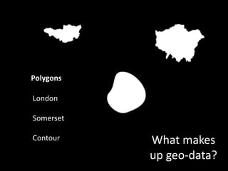
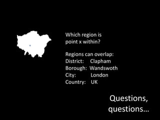
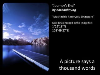


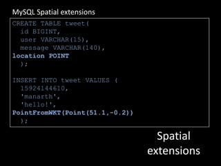
![$exif = exif_read_data('file.jpg');$long[‘deg’] = $exif['GPSLongitude'][0];$long[‘min’] = $exif['GPSLongitude'][1] / 60;$long[‘sec’] = $exif['GPSLongitude'][2] / 3600;$lat[‘deg’] = $exif['GPSLatitude'][0];$lat[‘min’] = $exif['GPSLatitude'][1] / 60;$lat[‘sec’] = $exif['GPSLatitude'][2] / 3600;Reading EXIF](https://image.slidesharecdn.com/manarth-whereintheworld-100612070855-phpapp01/85/Where-in-the-world-24-320.jpg)

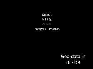
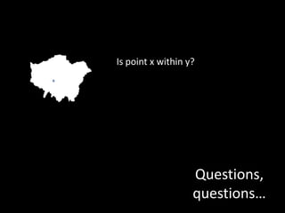
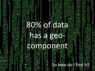
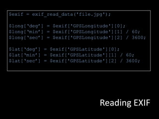
![WKT: Well Known TextPOINT(6 10) LINESTRING(3 4,10 50,20 25)WKB: Well Known Binary1010010001001010GeoJSON{ "geometry": { "type" : "Point", "coordinates" : [97.03125, 39.7265625] }}Write to disk?](https://image.slidesharecdn.com/manarth-whereintheworld-100612070855-phpapp01/85/Where-in-the-world-33-320.jpg)
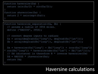
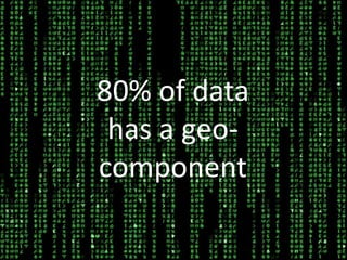
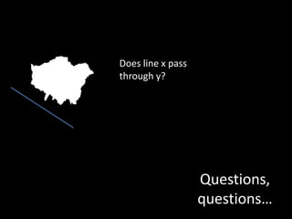
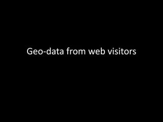
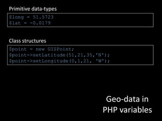
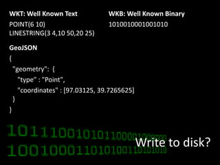
![function haversine($a) { return (sin($a/2) * sin($a/2));}function ahaversine($a) { return 2 * asin(sqrt($a));}function haversine_separation($a, $b) { // assume a radius of 3956 miles. define ('RADIUS', 3956); // convert degree inputs to radians $a = array(deg2rad($a['long']), deg2rad($a['lat'])); $b = array(deg2rad($b['long']), deg2rad($b['lat'])); $x = haversine($a['long'] - $b['long']) + (cos($a['long']) * cos($b['long']) * haversine(abs($a['lat'] - $b['lat']))); // $d (distance) is therefore R * inverse haversine($x) $d = RADIUS * ihaversine($x); return $d;}Haversine calculations](https://image.slidesharecdn.com/manarth-whereintheworld-100612070855-phpapp01/85/Where-in-the-world-39-320.jpg)


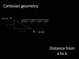
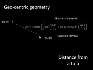
This document discusses various aspects of working with geo-data in PHP, including background on geographic coordinate systems, common data formats, techniques for extracting geo-data from IP addresses, image metadata, and text, storing geo-data in databases and file formats, performing spatial analysis and calculations, and visualizing geo-data on maps. It provides code examples for geocoding IP addresses, reading EXIF data, distance calculations, and more.