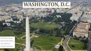
2. Background
Source: wikipedia.org
• Origin: George Washington,
Christopher Columbus
• Land Area: 100 square miles
• Peak population: 800,000
Currently
• Land Area:68.3 square miles
• Population: 632,323
• Median Household income
(2009) : $58,906
Source: wikipedia.org
5. City Layout
• Four quadrants
• Streets are set out in a grid pattern with
east–west streets named with letters
and north–south streets with numbers
Source: wikipedia.org
Source: maps.google.com
6. Land Use
Current zoning code in place since 1958
Draft of Proposed new zoning code
http://dc.gov/DC
http://dc.gov/DC
7. Transportation Agencies
• District of Colombia Department of Transportation (DDOT)
• Washington Metropolitan Area Transit Authority (WMATA)
Ddot.dc.gov
Wmata.com
18. Works Cited
• Census Information for Washington, DC, Suburban Maryland and Northern Virginia.
Washington D.C.: Rachel Cooper, 2010. Web.
http://dc.about.com/od/communities/a/CensusDC2000.htm
• Monack, D. McMillan Plan. Digital image. N.p., n.d. Web
• United States. Department of The Interior. National Park Service. N.p., n.d. Web.
http://lcweb2.loc.gov/pnp/habshaer/dc/dc0700/dc0776/data/dc0776data.pdf
• DC Office of Zoning. N.p., n.d. Web. 21 Oct. 2013.
http://dcoz.dc.gov/main.shtm
Editor's Notes
Origin: Name Washington was to first president George Washington while Columbia was reference to Christopher ColumbusPopulation: 632,323Median Household income (2009) : $58,906Land Area: 68.3 square miles
The original street layout designed by Pierre (Peter) Charles L'Enfant .Modeled in the Baroque style and incorporated avenues radiating out from rectangles, providing room for open space and landscaping.
The District is divided into four quadrants of unequal area: Northwest (NW), Northeast (NE), Southeast (SE), and Southwest (SW). The axes bounding the quadrants radiate from the U.S. Capitol buildingIn most of the city, the streets are set out in a grid pattern with east–west streets named with letters (e.g., C Street SW) north–south streets with numbers (e.g., 4th Street NW). Diagonal Streets are avenues
Tri-jurisdictional government agency that operates transit in Washington Metropolitan AreaService includes: Metrobus, Metrorail, paratransit
District of Columbia Department of Transportation (DDOT) agency of the government of the District of Columbia which manages and maintains publicly owned transportation infrastructure in the District of Columbia DDOT is the lead agency with authority over the planning, design, construction, and maintenance of alleys, bridges, sidewalks, streets, street lights, and traffic signals in the District of Columbia.Services include: DC street car
Building Height: New law limits building heights to the width of the right-of –way of the street or avenue on which a building fronts.Landmarks: White House, Capitol Hill, Supreme courtTopography:Climate: