Waseem khan
•Download as PPTX, PDF•
0 likes•6 views

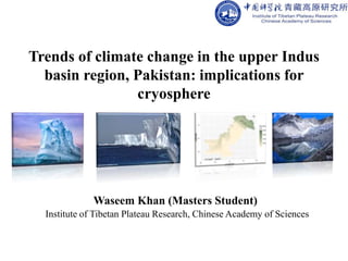
Trends of climate change in the upper Indus basin region, Pakistan: implications for cryosphere

Recommended
Recommended
More Related Content
Similar to Waseem khan
Similar to Waseem khan (20)
Recently uploaded
Recently uploaded (20)
Waseem khan
- 1. Trends of climate change in the upper Indus basin region, Pakistan: implications for cryosphere Waseem Khan (Masters Student) Institute of Tibetan Plateau Research, Chinese Academy of Sciences
- 2. CONTENTS • Introduction • Materials and methods Data collection • Study area – Weather station Gilgit – Weather station Skardu • Data analysis • Results • Discussion • Conclusions
- 3. Introduction • Global climate is undergoing significant changes as a response to increased concentrations of greenhouse gases in the whole atmosphere. The earth climate had experienced major shifts in geological history, but the current climate change is extraordinary and largely attributed to anthropogenic activities during postindustrial era to meet the demands of growing population for food and other life necessities (Mann and Jones 2003; Thorne et al. 2003). • Pakistan is among the countries most vulnerable to ongoing climate change (Pachauri 2009).
- 4. Introduction • Runoff in the upper Indus basin depends on the melting of seasonal snowpack, precipitations, and glacier melting (Archer 2003). • Goals of the study as follows: 1. How have climatic variables (MMT, OMT, MXT, RH, and precipitation) changed since the mid-twentieth century? 2. What is the effect of elevation on these variables? 3. Is the change in climatic variables fallow similar pattern in the both mountain ranges?
- 5. Materials and methods Data collection • The data regarding various climatic variables of two weather stations located in upper Indus basin (Fig) were kindly provided by Pakistan Meteorological department Lahore for the time period covering from 1953 to 2006. • Various climatic variables, mean minimum (MMT), mean maximum temperatures (MXT), mean monthly precipitation, and morning (8:00 am) and evening (5:00 pm) relative humidity (RH). The data regarding both MMT and MXT were subsequently utilized for the calculation of overall mean temperature (OMT) in the region.
- 6. Fig: The map of Pakistan showing the relative elevation and locations of the two weather stations in upper Indus basin from where the climatic data were collected. The map was drawn using open source software QGIS 3.1 available at https://www.qgis.org
- 7. Study Area Weather station Gilgit • The Gilgit (35° 55′ N and 74° 18′ E) is a small town, elevation of 1460 m above sea level. • Junction point of three mountain ranges Hindukush, Himalaya and karakorum. • There are some 40 glaciers located in this region. Some of the important glaciers present in this area are Siachin, Concordia, Gashabrum, and Rakaposhi to name a few (Armstrong 2010). • There are four peaks greater than 8000 m including K2 situated in the Pakistani part of Karakorum. • There are four rivers: Khunjrab, Nagar, and Hunza rivers discharge their water into the Gilgit River which finally meet with Indus River near Jaglot.
- 8. Weather station Skardu • The city of Skardu (35° 18′ 0″ N and 75° 37′ 0″ E) is situated at the edge of Western Himalaya at an elevation of 2250 m. • The major glaciers: Naga Parbat, the ninth highest mountain in the world Raikot, Rupal, Diamir, and Patro glaciers. • The major rivers of the area are Braldu, Shigar, and Basha Basna which all drain their discharge to the river Indus.
- 9. Data Analysis • Long-term changes in climate were assessed by dividing the whole 54-year data into two temporal halves which consisted of time span from 1953 to 1979 (first half) and from 1980 to 2006 (second half). • determined the means of all the climatic variables (MMT, MXT, OMT, precipitation, morning and evening RHs) for each month for the both temporal halves.
- 10. Results • Changes in mean minimum temperature at both weather stations
- 11. Changes in mean maximum temperature at both weather stations
- 12. Overall mean temperature changes at both weather stations
- 13. Mean precipitation changes at both weather stations
- 14. Discussion significant reductions in MMTs monitored during summer and fall seasons at both weather stations during the later temporal half compared to the previous one. MMTs were more at the weather station Gilgit than at Skardu