SlideShare a Scribd company logo
1
The Impact of Large Woody Debris on Chironomidae Larvae
Present at Spencer Island
Ethan Huffaker
University of Washington
Professional and Continuing Education
Wetland Science and Management
Practicum
June 4, 2015
2
Table of Contents
I. Introduction
a. Research Question and Hypothesis
II. Landscape Setting
III. Wetland/Habitat Characterization
a. General Site Characterization
b. Regulatory Setting
IV. Research of Macroinvertebrates
a. Opportunity at Site
b. Methods
c. Results
d. Interpretation and Discussion
e. Conclusion
V. Acknowledgements
VI. Literature Cited
VII. Appendix A: Figures
3
I. Introduction
The relationship between wetland wildlife and their food sources has been a topic that I
have become interested in through field and course work that I have participated in
throughout the last few years. Because salmon are such an integral part of the ecology and
economy of the Pacific Northwest, their food sources became the obvious driving force for
this study. Large Woody Debris (LWD) is an integral infrastructure in wetland and riparian
ecosystems. Historically, LWD used to be seen as detrimental to streams as it slowed water
down, and made waters hard to navigate, negatively impacted log transport from the
logging industry, and slowed down fish passage; thus debris has been removed from
waters for decades (Wick 2002). Recently, however, as LWD functions have been studied it
has become known how important this debris is for fish habitat, channel and bank stability,
and biological diversity (Connecticut Department of Environmental Protection 2015).
Through knowing how important LWD is in wetland and riparian ecosystems, the purpose
of this study became to evaluate how LWD relates to invertebrate prey known to be
consumed by juvenile salmonid species present at Spencer Island, just outside of Everett,
WA. This will be accomplished by attempting to show how LWD provides proper habitat
and structure for these invertebrate communities.
During research for this project, little was found directly relating to the benefits of
LWD to invertebrates in wetland environments; this presents the opportunity to conduct
research on a topic that may have been understudied previously. Much of the existing
literature I have come across deals with LWD and its importance on salmon rearing habitat,
but there has been little treatment on how it impacts fish food sources. Hrodey, Kalb, and
Sutton (2008) in their report on how the aquatic macroinvertebrate community responds
to LWD additions in streams discuss that it is indicative that LWD creates ideal habitat for
macroinvertebrates by adding size and complexity at several scales to the ecosystem. This
suggests the possibility of a strong relationship for abundant salmon feeding, since juvenile
salmonids feed heavily on small aquatic invertebrates (Vancouver Aquarium 2014). Half-
logs, a type of LWD installation, are also very viable sources for biofilm production
(Hrodey, Kalb and Sutton 2008); since biofilm is known to clean the surrounding water
(Antieau 2014), this could be beneficial to macroinvertebrates living in the surrounding
aquatic area, and as a result, to juvenile fish as well.
One factor to consider in the relationship between juvenile salmon and LWD is the
pools that form in flowing water as a result of LWD for habitat rearing. Mossop and
Bradford (2004) found that fish densities in the Yukon River Basin correlate most strongly
in areas where deep pools have formed as a result of LWD. These pooling areas are the
most suitable habitat areas for juvenile Chinook salmon in the Canadian boreal forests, and
through their research, Mossop and Bradford determined that LWD performs the same
functions in more temperate areas (2004); this would include areas in the Puget Sound
region such as Spencer Island. Because LWD structures provide food sources for
macroinvertebrates through algae (Connecticut Department of Environmental Protection
2015), and since LWD provides ample habitat for juvenile salmonids it would stand to
reason that there might be another strong connection salmon feeding on the
macroinvertebrates present in LWD communities.
4
The literature reviewed suggests that there will be a strong link between LWD
structures and the numbers of macroinvertebrate communities. Because the majority or
the studies areas of interest are located directly in streams, one concern in doing my
research will be to to connect my study directly to estuarine wetlands, since there seems to
be little research on the effects and functions of LWD in estuarine wetlands. However,
research suggests that the habitat functions LWD provides for macroinvertebrates will not
change based on these two different wetland classes. While the salinity changes and water
movement may change the types of macroinvertebrate species present, LWD habitat
functions should remain similar for the species that utilize those functions.
a. Research Question and Hypothesis
Juvenile salmonids utilize macroinvertebrates as a food source; the Chironomidae
(Midges) (Figure 1) family is one of these macroinvertebrate species that salmon feed on.
Through previous studies done at Spencer Island, Chironomidae larvae, among many other
invertebrate species, were found as an integral part of juvenile salmonids’ diet (Tanner, et
al. 2002). As the purpose of this study was to find a link between LWD structures
harboring greater numbers of macroinvertebrate species than areas without LWD
structures, I set out to achieve this by collecting benthic core samples next to LWD and
samples in bare ground with no LWD.
My hypothesis is that Chironomidae larvae assemblages will be greater in number in
the benthic samplings taken next to LWD structures as opposed to farther away from
woody debris, because woody structures are prime habitat for macroinvertebrate species.
It can be assumed from these samples, that if the Chironomidae populations are larger in
close proximity to LWD structures, than those areas will be a more habitable spot for
juvenile salmonids since the larvae are a priority food source for juvenile salmonids.
An alternative hypothesis was discussed between Mr. Cordell and I after taking the
benthic core samples. As the samples were being collected, we noticed that there was little
change in the amount of organic material present in the benthic cores. This led us to
discuss the possibility that there might be little to no change in the results, or possibly
negative results.
II. Landscape Setting
The site location of this study is Spencer Island in Everett, WA (47.988808, -
122.161567, S22 T29N R5E). Spencer Island is a wetland that has multiple classes present
in its system according to the National Wetlands Inventory (Figure 2). The Cowardin
classes present are PEMCd (Palustrine Emergent Seasonally Flooded, partially
drained/ditched), PEMAd (Palustrine Emergent Temporarily Flooded, partially
ditched/drained), and PFOA (Palustrine Forested, Temporarily Flooded) (U.S. Fish and
Wildlife Service n.d.). The HGM class present in the Spencer Island system is Tidal Fringe
(U.S. Army Corps of Engineers 2008).
On a large mapping scale, Spencer Island is a unique patch in the landscape in which
it is situated. Spencer Island is located in between the cities of Everett and West Lake
Stevens; the island is completely surrounded by the corridors of Union Slough and
5
Steamboat Slough, which are connected to the Snohomish River, another major corridor.
The matrix around Spencer Island is also very unique. While it is surrounded by two fairly
large cities, and a major interstate highway runs close to Spencer Island, the mosaic of
patches around Spencer Island is much greener, filled with a patchwork of small forested
lands, small homes, and farm fields. While this is not the ideal surrounding of completely
natural areas, it is a much better matrix than being totally surrounded by suburban and city
landscapes. In essence, this makes the matrix another corridor that can be easily accessed
by many different varieties of animals by land, water, and air, and have ample places for
them to rest, eat, and survive.
Spencer Island is an important aspect to its landscape setting for two main reasons:
fish and waterfowl. The area of Spencer Island is an important patch for juvenile salmon
and other fish species because it is a brackish to fresh-water estuary; there is plentiful
vegetation providing shade, large woody debris for shelter and food, and calm waters in
order to rest. This provides the fish a safe habitat to live in during adolescence, as well as
begin the acclimation process from fresh water to salt water. Water fowl also use Spencer
Island heavily for many of the same reasons. There is food available, calm waters to swim
in, and tall vegetation (i.e. Typha) to provide shelter for resting before traveling onwards.
In relation to this study, Spencer Island is very important in the landscape setting, as I am
studying the effect that Large Woody Debris has on macroinvertebrate communities for
food sources for juvenile salmonids. The Snohomish is a major hub for Bull Trout, and
Chinook, Coho, and Chum salmon (Washington State Department of Fish and Wildlife
2015), and without Spencer Island as an important estuary patch in this landscape, this
study would not be possible at this location. Spencer Island plays a pivotal role in the
rearing of juvenile salmonids.
Historically, the land became dyked in the 1920s in order to be used for agriculture
purposes. It was first attempted to be used for farming, which proved unsuccessful as the
land continued to flood, and the salinity of the water and soils proved too high to produce
profitable crop yield. The area was then switched to a grazing area for cattle, which also
proved unsuccessful (Hennessey and Antieau 2014). After both of these attempts failed, the
land was purchased in 1989 by Snohomish County Parks and Recreation Dept. and
Washington Dept. of Fish and Wildlife (WADFW), and split up between the two agencies to
become Spencer Island Park (Tanner, et al. 2002). The dikes were breached in order to
begin to restore the estuarine environment. The North side of the park now belongs to
WADFW for duck hunting, and the South end is a public Snohomish County park. Being
close by to Everett and the interstate, there are plenty of impervious surfaces to runoff into
the water ways connecting to Spencer Island, so pollutants will be heavier at this point in
its watershed than higher up in the Cascade Range. Spencer Island is also right next door to
Everett’s waste treatment facility, so the water quality is probably not of the highest
standard at this location; which adds even more importance to keeping such a large
wetland in good condition so that it can serve its ecological function of naturally helping
clean those toxins.
Spencer Island Park is an island surrounded by Union Slough and Steamboat Slough,
both of which connect to Puget Sound through the Snohomish River. Spencer Island is
6
regularly flooded as it is tidally influenced diurnally. The sources for Spencer Island’s
hydrology are from tidal waters, riverine systems, possible groundwater influence, and
precipitation. The main hydrologic source for Spencer Island comes from the sloughs that
surround the island. Union and Steamboat Slough are the water ways that surround the
island, with both connecting directly to Puget Sound from the north and stem from the
Snohomish River on the southern end of the island. With these water sources, the majority
of water supplying Spencer Island are freshwater, becoming brackish twice a day as the
tide comes in and out. Both the engineered breaches and the natural ones that have taken
place since the wetland reconstruction control the water patterns that occur within the
island. There are both unidirectional and bidirectional flows through the dikes on Spencer
Island. North of the cross-dike section of the island, there are still tide flaps which allow
only for unidirectional flow; however, in the southern side of the cross dyke site, a storm
caused a natural breach in the dyke, which Snohomish Co. decided to leave open, thus
allowing for bidirectional flow in and out of the area (Hennessey and Antieau 2014).
III. Wetland Habitat Characterization
a. General Site Characterization
1. Location
Spencer Island is an island just outside of Everett, WA that is located in between the
Union and Steamboat Sloughs that connect to the Snohomish River. Spencer Island is
located just east to Interstate-5, several agricultural fields, and right across the banks of
Steamboat Slough is the City of Everett’s waste treatment plant. The overall location of
Spencer Island is that of a very disturbed area, highly developed with significant human
impact, making the health of the island all the more important to be a successful ecosystem
that can provide positive habitat and ecological functions.
2. Hydroperiod
Spencer Island is regularly flooded as it is tidally influenced diurnally. The sources
for Spencer Island’s hydrology are from tidal waters, riverine systems, possible
groundwater influence, and precipitation, although the main hydrologic source for Spencer
Island comes from the sloughs that surround the island. Union and Steamboat Slough are
the water ways that surround the island, both of which connect directly to Puget Sound to
the north and stem from the Snohomish River on the southern end of the island. With
these water sources, the majority of water supplying Spencer Island is fresh water,
becoming brackish twice a day as the tide comes in and out. Both the engineered and
natural breaches that have taken place since the wetland’s reconstruction control the water
patterns that occur within the island. There are both unidirectional and bidirectional flows
through the dikes on Spencer Island. North of the cross-dike section of the island, there are
still tide flaps which allow only for unidirectional flow; however, in the southern side of the
cross-dike site, a storm caused a natural breach in the dike, which Snohomish Co. decided
to leave open, thus allowing for bidirectional flow in and out of the area (Hennessey and
Antieau 2014).
7
3. Soils
According to the Natural Resources Conservation Service (NRCS), the soil present
throughout the majority of Spencer Island is Puget silty clay loam (Figure 3). This is the
soil that was present in the section of Spencer Island that the benthic core samples for this
project were taken. According to the Official Soil Description (OSD) from the NRCS the
Puget series is a very poorly drained soil composed from alluvial deposits (Natural
Resources Conservation Service 2015). Soil pit data taken from October 18, 2014 shows
the hydric nature of the soils present at Spencer Island.
Soil Pit #1 was dug in a Palustrine Emergent setting on the south side of the cross-
dike of Spencer Island. From the soil profile, there were two determinable soil horizons.
The soil was mineral soil, with a silty clay loam texture, which concurs with the profile
setting of the NRCS soil survey. There were no redox features present in the soil, and it was
determined that the F1, Loamy Mucky Mineral field indicator was present, as well as A4
Hydrogen Sulfide indicator.
Soil Pit #1
Depth (in.
below
surface)
Munsell
Color
Texture Redox
Features
Hydric
Indicator
0 - 2 N/A Woody/Organic None
F1, A42 - 9 10YR 2+/1 Silty clay loam None
9 - 18 10YR 3/1 Silty clay None
The second soil pit was taken from a section of the island that contained Typic
Xerorthent soils, a highly drained soil from the Shedd series. Based on the OSD of this soil,
and in correlation with the soil survey report, it is most likely that this soil type is fill that
was transported in at some point during Spencer Island’s history (Natural Resources
Conservation Service 2015) (Natural Resources Conservation Service 2015). This pit was
dug close to Union Slough that runs along the west side of the wetland, and was in a
Palustrine Forested setting. The A horizon of the soil profile was a mineral silty loam soil.
At 5 in. below the ground surface, oxidized rhizospheres appeared until a depth of 10 in.;
the matrix turned darker shades of grey throughout the profile, and gley soils were
discovered in the bottom section of the soil profile. The field indicator F6, Redox Dark
Surface was determined to be present for this soil setting. (A note on Soil Pit table #2: it
was not possible to determine the exact depth of the layer break in between the 10YR 3/1
soil and the Gley soil, because the soil profile sample was not clean, the tide began
inundating the pit, and time constraints on site. Numbers given are estimation.)
8
Soil Pit #2
Depth (in.
below surface)
Munsell Color Texture Redox
Features
Hydric Indicator
0 - 5 10YR 2/2 Silty loam None
F65 - 10 10YR 2/2 Silty loam 5YR 3/4
10 - 16 10YR 3/1 Silty clay loam None
16 - 19 Gley scale Silty clay loam None
4. Vegetation Assemblages
As stated previously, there are two main Cowardin classes present at Spencer
Island, Palustrine Emergent being the dominant class present, and Palustrine Forested.
This allows for two different vegetation assemblages present throughout the site. In the
emergent wetland areas of Spencer Island, the dominant types of vegetation present are
Carex lyngbyei (Lyngbye’s sedge) Typha sp. (Cattail) and Lythrum salicaria (Purple
loosestrife) (Side Note: several large patches of Phragmites australis were also observed
throughout the wetland, which could be something to keep under observation, as that
species could become an invasive problem in the future). In the forested wetland sections
of Spencer Island, Alnus rubra (Red alder) dominated the tree strata with Tsuga
heterophylla (Western hemlock) and Thuja plicata (Western red cedar) peppered
throughout as well. Rosa nutkana (Nootka rose) and Lonicera involucrate (Twinberry)
dominated the shrub layer, and Phalaris arundinacea (Reed canary grass) was vastly
present in the emergent strata.
Although it is not a dominant class, Palustrine Scrub-Shrub is also present along the
sloped areas of the cross-dike and trails throughout Spencer Island. The principal
vegetation in these areas of the island are Salix sitchensis (Sitka willow), Spiraea douglasii
(Hardhack), and Rubus armeniacus (Himalayan blackberry).
b. Regulatory Setting
Based on Spencer Island’s location, the boundaries are within unincorporated
Snohomish Co., which puts the jurisdiction of the land under the Snohomish Co. Code (SCC).
Title 30 Chapter 30.62A Section(s) .010-.730 is where the wetland regulations for
Snohomish Co. are located (Snohomish County 2015).
SCC’s classification of wetlands is based on the state’s Dept. of Ecology (DOE)
Western Washington Rating Summary for rating wetland classifications based on habitat
and functions. SCC also states that if there are any discrepancies between SCC’s wetland
rating table and the DOE rating form, than the DOE’s rating summary takes precedence
(SCC, 30.62A.230). Based on an overview of the Western Washington Rating Summary,
Spencer Island would receive a Category I rating because of its functions rating. The
9
“Special Characteristics” section might be a possibility to score Spencer Island as an
Estuarine Wetland, but based on studies (Tanner, et al. 2002, Cordell, et al. 1998), salinity
levels are most likely not ≥0.5 ppt. for the Estuarine criterion to apply. The scale of salinity
at Spencer Island has been variable in the past (Tanner, et al. 2002), meaning further
testing would be needed to confirm the salinity levels. Nonetheless, as Spencer Island
would still receive a Category I rating, SCC’s standards and requirements for buffers are
located in 30.62A.320, and as Spencer Island is a low intensity land-use site, if would
require a minimum buffer of 150 ft.
Spencer Island would be and is regulated by the Corps of Engineers based on the
fact that the wetland is connected to a Water of the U.S. through Union and Steamboat
sloughs, which are connected to the Snohomish River. Spencer Island is also home to
Chinook, Chum, and Coho Salmon (Washington State Department of Fish and Wildlife
2015)along with a plethora of other fauna; the salmon alone make the island a special
habitat for federally listed species. If any project were to propose happening here, it would
require several permits before construction were to begin; sections 404 and 401 of the
Clean Water Act, the Endangered Species Act (ESA) would be triggered, the Shoreline
Mgmt. Act, and a Hydraulic Permit Application (HPA) would all be required. Along with all
state and federal permitting requirements, local ordinances through SCC also apply.
10
IV. Research of Macroinvertebrates
a. Opportunity at Site
I have been given the opportunity through the Wetland Science & Management
program to choose a topic of my own interest to study and research for my final Practicum.
My choice is to attempt and find a relationship between LWD as a habitat for
macroinvertebrates, specifically midges of the Chironomidae family, and how that impacts
juvenile salmonids at Spencer Island as a food source. With the help of Jeffery Cordell, one
of the principle research scientists at the University of Washington’s School of Aquatic and
Fishery Sciences as part of UW’s Wetland Ecosystem Team, and Bob Oxborrow, I will be
able to take and test samples to attempt to prove my hypothesis.
b. Methodology
The methodology employed in order to gain knowledge of the macroinvertebrate
assemblages next to LWD structures (Figures 4-8) will be through benthic core sampling.
With the assistance of Mr. Cordell, we used sampling techniques similar to the protocols
outlined in the Shoreline Monitoring Toolbox for benthic invertebrates (Washington Sea
Grant 2015). Using a piece of PVC piping of about 3 inches in diameter, we took core
samples from the soil surface to about 5 inch depths, and preserved them with a
formaldehyde-water mixture.
Benthic Core Sampling
In order to test my hypothesis I will take benthic core samples from directly next to
5 specimens of LWD and also 5 samples at a distance of 3-5 meters away from the
respective piece of LWD in an area where no living vegetation was present. Benthic core
samples will also be taken from inside clumps of Carex sp. to see if hydrophytic vegetation
has any effect on Chironomidae populations. The sampling will be for Chironomidae larvae
and pupae, which juvenile salmonids use as a sustainable food source.
c. Results
On May 3, 2015 Jeffery Cordell and I went to Spencer Island to take the benthic core
samples. The weather was a clear, sunny day with a temperature of around 67°F. We
walked along the cross-dike separating the north and south sections of Spencer Island; on
the southern side of the cross-dike we walked down to the toe of the slope, and chose our
pieces of LWD to sample from. For the Wood samples we oriented the sample point
directly along the side of wood closest to the dike; there appeared to be even more organic
material that had collected along the backside of the woody debris than along the front, so
it is possible that this could have had an impact on the results. We then took our Bare
samples away from the LWD structures, and our Carex sp. samples. The samples were
labeled Wood 1 (W1), Wood 2 (W2), etc. Bare 1 (B1), Bare 2 (B2), etc. and Carex 1 (C1),
Carex 2 (C2), etc. and will be referred to as such from here on.
Utilizing the Wetland Ecosystem Team Lab, I was able to clean and process the
collected samples. Unfortunately, due to time constraints, I was only able to process the
11
first four Wood samples, and the first four Bare samples. From these 8 samples the
numbers of Chironomidae larvae observed are as follows:
Sample Wood 1 Bare 1 Wood 2 Bare 2 Wood 3 Bare 3 Wood 4
Bare
4
Chironomidae 16 40 4 1 5 5 5 7
Wood Total:
30
Bare Total: 53
The standard deviation and a graph of the confidence interval essentially tell us that
there is no statistical evidence that can be gleaned from these results; there simply are not
enough data points sampled to gain a statistical analysis. The high standard deviation of the
Bare samples most likely indicates that the range of numbered results are spread out over
a wide range, but more data would be needed in order state any conclusive results.
d. Interpretation and Discussion
Based on these results, it becomes clear that my original hypothesis of finding larger
numbers of Chironomidae larvae in the benthic samples taken next to LWD was incorrect,
and the alternative hypothesis that Mr. Cordell and I discussed was more accurate.
Beginning to understand these results becomes the next step in this process.
Mean
Wood
Mean Bare SD Wood SD Bare 95% CI 95% CI
7.5 13.25 5.6862407 18.0069431 9.04807786 28.6530648
0
5
10
15
20
25
30
35
40
45
Wood Bare
12
One of the possible reasons explaining these results could be the amount of detritus
present throughout the samples. While studies have shown that Chironomidae larvae
utilize detritus as a food source (Anderson and Sedell 1979, Henriques-Oliverira,
Nessimian and Dorville 2003), I was unable to find information on whether a certain
amount of organic material became detrimental to invertebrate habitat. I theorized that
the excessive buildup of detritus along the backside of the LWD structures where the Wood
samples were taken might have a negative effect on the Chironomidae populations present,
but further research would be necessary to answer this question.
Another interesting observation is how both samples W1 and B1 appear to be
distinct outliers, since all other samples remain fairly consistent. The area from which
these two samples were taken (Figure 9) is closest to the inlet of Union Slough; all other
samples were taken further west of this location. The location of this sample area could
have had an impact on the Chironomidae populations because it is the closest to the inlet
and would receive the most tidal inundation, but again further research would need to be
done in order to test this.
There were a few unexpected elements that could have factored into some of the
results. While sifting through sample B2, what seemed to be oxidized iron deposits were
present throughout the benthic sample. As only 1 Chironomidae larvae was present
throughout the entire sample, this suggests that the presence of iron could have a negative
effect on invertebrate habitat. There were very few numbers of other invertebrate species
(i.e. Ceratopogonidae, Oligochaeta) present throughout this sample as well, which further
supports this theory. The area where the third samples were taken is the second
unexpected issue. While the numbers of Chironomidae present were the same for both W3
and B3, there seemed to be a large influx of Oligochaeta present throughout W3 and B3 as
opposed to the other samples (uncounted). The location for the third samplings had a
strong hydrogen sulfide smell that emitted from the soil. The reduction of sulfate to
hydrogen sulfide happens through small anaerobic bacteria throughout the soil, and while
hydrogen sulfide concentrations can be toxic to rooted plants and microbes (Mitsch and
Gosselink 2007), further research would need to be done to understand what, if any,
impact it has on Chironomidae larvae.
If I had the opportunity to do this study a second time, there are two procedures
that I would like to achieve. First, being able to fully process all the samples taken would
be a priority. It would be very interesting to see what kind of macroinvertebrate
assemblages would have been present in the Carex samples taken, to see if growing
hydrophytic vegetation had any impact on Chironomidae habitat. Secondly, I would like to
take samples on two separate dates around a month apart (one in April, one in May), to see
how the time of year impacts macroinvertebrate assemblages present.
e. Conclusion
Research from Roni, et al. suggests that LWD structures may be too localized of an
ecosystem in order to give any definitive proof that LWD provides either beneficial or
negative habitat functions for macroinvertebrate species in general (2014). However,
while the results of this study did not fulfill the initial hypothesis, this does not mean that
13
the results imply negative conditions for macroinvertebrates or the juvenile salmonids that
utilize them as a food source. Several Ceratopogonidae larvae were identified and counted
throughout the samples, and as seen through the study involving juvenile salmonid diets at
Spencer Island (Tanner, et al. 2002), both of these macroinvertebrate families, among
others, are important food sources for salmonids. The one definitive result shown through
this project, however, is that Spencer Island provides a healthy habitat for
macroinvertebrates to grow through their life cycles, which in turn allows for ample
macroinvertebrates present to be utilized as food sources for juvenile salmonids in the
Pacific Northwest.
14
V. Acknowledgements
I would like to thank Jeffery R. Cordell for being my faculty advisor through this
practicum and research process; without his help and guidance, I would have felt like a fish
out of water. I would also like to thank Bob Oxborrow and the rest of the Wetland
Ecosystem Lab Team for making me feel welcome in the lab, allowing me to utilize their
tools, and showing me how to process my samples. And of course, all the wonderful
professors who have helped me learn so much throughout the Wetland Science &
Management Certificate program. Thank you to all of these people, along with the
University of Washington Professional and Continuing Education Program, who have
helped grant me the opportunity to learn, grow, and continue down the career path I wish
to pursue.
15
VI. Literature Cited
Anderson, N.H., and J.R. Sedell. "Detritus Processing by Macroinvertebrates in Stream
Ecosystems." Entomological Annual Review, 1979: 351-77.
Antieau, Clay. "Introduction to Wetland Functions." Seattle, WA, November 4, 2014.
Connecticut Department of Environmental Protection. "Inland Fisheries Division Habitat
Conservation and Enhancement Program." Large Woody Debris Fact Sheet. May 30,
2015. http://www.ct.gov/deep/lib/deep/fishing/restoration/largewoodydebrisfactsheet.pdf.
Cordell, J.R., H. Higgens, C. Tanner, and J.K. Aitkin. Biological Status of Fish and Invertebrate
Assemblages in a Breaked-Dike Wetland Site at Spencer Island, Washington . Research
Report, Seattle: Fisheries Research Institute, 1998.
Google Earth. Google Earth. n.d.
Hennessey, D., and C. Antieau. "Spencer Island Field Trip." October 18, 2014.
Henriques-Oliverira, A.L., J.L. Nessimian, and L.F.M. Dorville. "Feeding habits of Chironomid
larvae (Insecta: Diptera) from a stream in the floresta daRijuca, Rio de Janeiro, Brazil."
Brazilian Journal of Biology, 2003.
Hrodey, P.J., B.J. Kalb, and T.M. Sutton. "Macroinvertebrate community to large-woody debris
additions in small warmwater streams." Hydrobiologia 605.1, 2008: 193-207.
Mitsch, W.J., and J.G. Gosselink. Wetlands 4th ed. Hoboken, NJ: John Wily & Sons, Inc., 2007.
Mossop B., M.J. Bradford. "Importance of large woody debris for juvenile Chinook salmon
habitat in small boreal forest streams in the upper Yukon River basin, Canada." Canadian
Journal of Forest Research, 2004: 1955-1966.
Natural Resources Conservation Service. Offical Soil Descriptions . May 10, 2015.
https://soilseries.sc.egov.usda.gov/OSD_Docs/P/PUGET.html.
—. Web Soil Survey. May 10, 2015.
http://websoilsurvey.sc.egov.usda.gov/App/WebSoilSurvey.aspx.
Roni, P., T. Beechie, G. Press, and K. Hanson. "Wood placement in river restoration: fact,
fiction, and future direction." Canadian Journal of Fisheries and Aquatic Sciences
(Canadian Journal of Fisheries and Aquatic Sciences), 2014: 466-478.
Royal Alberta Museum. Invertebrate Zoology: Research & Projects. May 6, 2015.
http://royalalbertamuseum.ca/research/lifeSciences/invertebrateZoology/research.cfm.
Snohomish County. Snohomish County Code. May 9, 2015.
http://www.codepublishing.com/wa/snohomishcounty/.
Tanner, C.D., J.R. Cordell, J. Rubey, and L.M. Tear. "Restoration of Freshwater Intertidal
Habitat Functions at Spencer Island, Everett, Washington." Restoration Ecology, 2002:
564-576.
16
U.S. Army Corps of Engineers. Hydrogeomorphic Approach for Assessing Wetlands Functions.
April 2008. http://el.erdc.usace.army.mil/wetlands/tidal.html (accessed May 31, 2015).
U.S. Fish and Wildlife Service. National Wetlands Inventory Mapper. n.d.
http://www.fws.gov/wetlands/data/mapper.HTML (accessed May 3, 2015).
Vancouver Aquarium. AquaFacts. November 12, 2014.
http://www.vanaqua.org/learn/aquafacts/fish/salmon (accessed November 12, 2014).
Washington Sea Grant. "Benthic Invertebrates." Shoreline Monitoring Toolbox. May 30, 2015.
https://docs.google.com/viewer?a=v&pid=sites&srcid=dXcuZWR1fHRvb2xib3h8Z3g6N
TJiMTM3MjhiZWE3NWM0Mg.
Washington State Department of Fish and Wildlife. WDFW Priority Habitats and Species
Report. April 13, 2015.
http://apps.wdfw.wa.gov/phsontheweb/jasper/jasper/PHSPlus.pdf?paramClipArea_ID=P
150413194706&clipPolyReportUrl=http://gispublic.dfw.wa.gov/agsoutputfwg/Geoproce
ssingServices/ExportWebMap_GPServer/_ags_86a4cd7c03d24b808bf20edee6f34c60.pd
f&phsReportLayerCo (accessed April 13, 2015).
Wick, Alicia J. "Ecological functions and spatial dynamics of large woody debris in ogliohaline-
brackish estuarine sloughs for juvenile Pacific salmon." Master's of Science Thesis,
Seattle, WA, 2002.
17
VII. Appendix A: Figures
Figure 1: Chironomidae larvae
(Royal Alberta Museum 2015)
18
Figure 2: Cowardin Classes present at Spencer Island
(U.S. Fish and Wildlife Service n.d.)
19
Figure 3: Mapped Soils
(Natural Resources Conservation Service 2015)
20
Figure 4: LWD Structure 1
21
Figure 5: LWD Structure 2
22
Figure 6: LWD structure 3
23
Figure 7: LWD structure 4
24
Figure 8: LWD structure 5
25
Figure 9: Estimated Location of Sample Area 1
(Google Earth n.d.)

More Related Content

What's hot

Petersohn_Megan - Celebration of Learning
Petersohn_Megan - Celebration of LearningPetersohn_Megan - Celebration of Learning
Petersohn_Megan - Celebration of LearningMegan Petersohn
 
Seminar eco 2015
Seminar eco 2015Seminar eco 2015
Seminar eco 2015
Robin Shin
 
Presentation1
Presentation1Presentation1
Presentation1
Robin Shin
 
Advancement2 2
Advancement2 2Advancement2 2
Advancement2 2
Robin Shin
 
Nisqually Chinook Population Response to Large-Scale Estuary Restoration
Nisqually Chinook Population Response to Large-Scale Estuary RestorationNisqually Chinook Population Response to Large-Scale Estuary Restoration
Nisqually Chinook Population Response to Large-Scale Estuary Restoration
Nisqually River Council
 
2010 effects of fish farming on the biological and geochemical properties of ...
2010 effects of fish farming on the biological and geochemical properties of ...2010 effects of fish farming on the biological and geochemical properties of ...
2010 effects of fish farming on the biological and geochemical properties of ...
earambulm3
 
The CARCACE project deepwater platforms - modular designs for in situ experim...
The CARCACE project deepwater platforms - modular designs for in situ experim...The CARCACE project deepwater platforms - modular designs for in situ experim...
The CARCACE project deepwater platforms - modular designs for in situ experim...Ædel Aerospace GmbH
 
Tulevech_Effects_of_Shoreline_Structure_on_Fish_Habitat_Use_and_Schooling_Beh...
Tulevech_Effects_of_Shoreline_Structure_on_Fish_Habitat_Use_and_Schooling_Beh...Tulevech_Effects_of_Shoreline_Structure_on_Fish_Habitat_Use_and_Schooling_Beh...
Tulevech_Effects_of_Shoreline_Structure_on_Fish_Habitat_Use_and_Schooling_Beh...Steven Tulevech
 
Leaver_Reimchen - Linnean society article
Leaver_Reimchen - Linnean society articleLeaver_Reimchen - Linnean society article
Leaver_Reimchen - Linnean society articleStephen Leaver
 
Final ppt of stream ecology 1
Final ppt of stream ecology 1Final ppt of stream ecology 1
Final ppt of stream ecology 1
Mamun Md
 
Swift etal 2008 SAJB
Swift etal 2008 SAJBSwift etal 2008 SAJB
Swift etal 2008 SAJBMari Brand
 
Gonczar_Argonne_Research_Paper_Final_ (1)
Gonczar_Argonne_Research_Paper_Final_ (1)Gonczar_Argonne_Research_Paper_Final_ (1)
Gonczar_Argonne_Research_Paper_Final_ (1)Michael Gonczar
 
Barnes june 2010 cws beaver presentation comp
Barnes june 2010 cws beaver presentation compBarnes june 2010 cws beaver presentation comp
Barnes june 2010 cws beaver presentation compcposton
 
Changing patch dynamics of Cape eelgrass Zostera capensis: impacts of loss on...
Changing patch dynamics of Cape eelgrass Zostera capensis: impacts of loss on...Changing patch dynamics of Cape eelgrass Zostera capensis: impacts of loss on...
Changing patch dynamics of Cape eelgrass Zostera capensis: impacts of loss on...
Joseph Galaske
 
Lan Nguyen Poster for Science Seminar revised
Lan Nguyen Poster for Science Seminar revisedLan Nguyen Poster for Science Seminar revised
Lan Nguyen Poster for Science Seminar revisedLan Nguyen
 

What's hot (20)

Petersohn_Megan - Celebration of Learning
Petersohn_Megan - Celebration of LearningPetersohn_Megan - Celebration of Learning
Petersohn_Megan - Celebration of Learning
 
Seminar eco 2015
Seminar eco 2015Seminar eco 2015
Seminar eco 2015
 
Presentation1
Presentation1Presentation1
Presentation1
 
Advancement2 2
Advancement2 2Advancement2 2
Advancement2 2
 
R_KingSpreeDayPoster'16
R_KingSpreeDayPoster'16R_KingSpreeDayPoster'16
R_KingSpreeDayPoster'16
 
Nisqually Chinook Population Response to Large-Scale Estuary Restoration
Nisqually Chinook Population Response to Large-Scale Estuary RestorationNisqually Chinook Population Response to Large-Scale Estuary Restoration
Nisqually Chinook Population Response to Large-Scale Estuary Restoration
 
2010 effects of fish farming on the biological and geochemical properties of ...
2010 effects of fish farming on the biological and geochemical properties of ...2010 effects of fish farming on the biological and geochemical properties of ...
2010 effects of fish farming on the biological and geochemical properties of ...
 
Rl 4
Rl 4Rl 4
Rl 4
 
The CARCACE project deepwater platforms - modular designs for in situ experim...
The CARCACE project deepwater platforms - modular designs for in situ experim...The CARCACE project deepwater platforms - modular designs for in situ experim...
The CARCACE project deepwater platforms - modular designs for in situ experim...
 
Tulevech_Effects_of_Shoreline_Structure_on_Fish_Habitat_Use_and_Schooling_Beh...
Tulevech_Effects_of_Shoreline_Structure_on_Fish_Habitat_Use_and_Schooling_Beh...Tulevech_Effects_of_Shoreline_Structure_on_Fish_Habitat_Use_and_Schooling_Beh...
Tulevech_Effects_of_Shoreline_Structure_on_Fish_Habitat_Use_and_Schooling_Beh...
 
Stream Ecology
Stream EcologyStream Ecology
Stream Ecology
 
Leaver_Reimchen - Linnean society article
Leaver_Reimchen - Linnean society articleLeaver_Reimchen - Linnean society article
Leaver_Reimchen - Linnean society article
 
Final ppt of stream ecology 1
Final ppt of stream ecology 1Final ppt of stream ecology 1
Final ppt of stream ecology 1
 
Swift etal 2008 SAJB
Swift etal 2008 SAJBSwift etal 2008 SAJB
Swift etal 2008 SAJB
 
Gonczar_Argonne_Research_Paper_Final_ (1)
Gonczar_Argonne_Research_Paper_Final_ (1)Gonczar_Argonne_Research_Paper_Final_ (1)
Gonczar_Argonne_Research_Paper_Final_ (1)
 
Barnes june 2010 cws beaver presentation comp
Barnes june 2010 cws beaver presentation compBarnes june 2010 cws beaver presentation comp
Barnes june 2010 cws beaver presentation comp
 
DE Poster Slide V4
DE Poster Slide V4DE Poster Slide V4
DE Poster Slide V4
 
Changing patch dynamics of Cape eelgrass Zostera capensis: impacts of loss on...
Changing patch dynamics of Cape eelgrass Zostera capensis: impacts of loss on...Changing patch dynamics of Cape eelgrass Zostera capensis: impacts of loss on...
Changing patch dynamics of Cape eelgrass Zostera capensis: impacts of loss on...
 
June 2016 Poster
June 2016 PosterJune 2016 Poster
June 2016 Poster
 
Lan Nguyen Poster for Science Seminar revised
Lan Nguyen Poster for Science Seminar revisedLan Nguyen Poster for Science Seminar revised
Lan Nguyen Poster for Science Seminar revised
 

Similar to UW WSM - Practicum final draft

Abundance of commercial bivalves
Abundance of commercial bivalvesAbundance of commercial bivalves
Abundance of commercial bivalves
Rodney Peñafiel
 
Rob Toonen Maui Ocean Awareness Training
Rob Toonen Maui Ocean Awareness TrainingRob Toonen Maui Ocean Awareness Training
Rob Toonen Maui Ocean Awareness Training
changingtides
 
Rob Toonen Ocean Awareness Training
Rob Toonen Ocean Awareness TrainingRob Toonen Ocean Awareness Training
Rob Toonen Ocean Awareness Training
changingtides
 
Feyrer et al. 2015 Splittail Ecology
Feyrer et al. 2015 Splittail EcologyFeyrer et al. 2015 Splittail Ecology
Feyrer et al. 2015 Splittail EcologyLenny Grimaldo
 
(FINAL) ROUGH DRAFT FOR SENIOR RESEARCH Jennifer Edit 4-14-15
(FINAL) ROUGH DRAFT FOR SENIOR RESEARCH  Jennifer Edit 4-14-15(FINAL) ROUGH DRAFT FOR SENIOR RESEARCH  Jennifer Edit 4-14-15
(FINAL) ROUGH DRAFT FOR SENIOR RESEARCH Jennifer Edit 4-14-15Jennifer Cherry
 
Zooplankton species composition and diversity in the seagrass habitat of Lawa...
Zooplankton species composition and diversity in the seagrass habitat of Lawa...Zooplankton species composition and diversity in the seagrass habitat of Lawa...
Zooplankton species composition and diversity in the seagrass habitat of Lawa...
AbdullaAlAsif1
 
Science-2015
Science-2015Science-2015
Science-2015
João Soares
 
Research Proposal - Are the Adélie penguin, Pygoscelis adeliae, populations w...
Research Proposal - Are the Adélie penguin, Pygoscelis adeliae, populations w...Research Proposal - Are the Adélie penguin, Pygoscelis adeliae, populations w...
Research Proposal - Are the Adélie penguin, Pygoscelis adeliae, populations w...
ElizabethHowarth1
 
23 Benthic Methods Freshwater Sci 2013
23 Benthic Methods Freshwater Sci 201323 Benthic Methods Freshwater Sci 2013
23 Benthic Methods Freshwater Sci 2013Jacob Villalobos
 
Joshua Seidman Honors Thesis Rough Draft 2.4 enm
Joshua Seidman Honors Thesis Rough Draft 2.4 enmJoshua Seidman Honors Thesis Rough Draft 2.4 enm
Joshua Seidman Honors Thesis Rough Draft 2.4 enmJoshua Seidman
 
BEAN Water & Biodiversity-Grade 6 and 92
BEAN Water & Biodiversity-Grade 6 and 92BEAN Water & Biodiversity-Grade 6 and 92
BEAN Water & Biodiversity-Grade 6 and 92Cameron A.T. Smith
 
MyctophidFeedingEcology
MyctophidFeedingEcologyMyctophidFeedingEcology
MyctophidFeedingEcologyWalter Conley
 
Maui, Hawaii - 100 Island Challenge - Coral Reef Baselin - Candidate Designation
Maui, Hawaii - 100 Island Challenge - Coral Reef Baselin - Candidate DesignationMaui, Hawaii - 100 Island Challenge - Coral Reef Baselin - Candidate Designation
Maui, Hawaii - 100 Island Challenge - Coral Reef Baselin - Candidate Designation
Clifton M. Hasegawa & Associates, LLC
 

Similar to UW WSM - Practicum final draft (17)

Grimaldo2009MCF
Grimaldo2009MCFGrimaldo2009MCF
Grimaldo2009MCF
 
Abundance of commercial bivalves
Abundance of commercial bivalvesAbundance of commercial bivalves
Abundance of commercial bivalves
 
Grimaldo tidal marsh
Grimaldo tidal marshGrimaldo tidal marsh
Grimaldo tidal marsh
 
Rob Toonen Maui Ocean Awareness Training
Rob Toonen Maui Ocean Awareness TrainingRob Toonen Maui Ocean Awareness Training
Rob Toonen Maui Ocean Awareness Training
 
Rob Toonen Ocean Awareness Training
Rob Toonen Ocean Awareness TrainingRob Toonen Ocean Awareness Training
Rob Toonen Ocean Awareness Training
 
Feyrer et al. 2015 Splittail Ecology
Feyrer et al. 2015 Splittail EcologyFeyrer et al. 2015 Splittail Ecology
Feyrer et al. 2015 Splittail Ecology
 
(FINAL) ROUGH DRAFT FOR SENIOR RESEARCH Jennifer Edit 4-14-15
(FINAL) ROUGH DRAFT FOR SENIOR RESEARCH  Jennifer Edit 4-14-15(FINAL) ROUGH DRAFT FOR SENIOR RESEARCH  Jennifer Edit 4-14-15
(FINAL) ROUGH DRAFT FOR SENIOR RESEARCH Jennifer Edit 4-14-15
 
Toft et al
Toft et alToft et al
Toft et al
 
Zooplankton species composition and diversity in the seagrass habitat of Lawa...
Zooplankton species composition and diversity in the seagrass habitat of Lawa...Zooplankton species composition and diversity in the seagrass habitat of Lawa...
Zooplankton species composition and diversity in the seagrass habitat of Lawa...
 
Science-2015
Science-2015Science-2015
Science-2015
 
Research Proposal - Are the Adélie penguin, Pygoscelis adeliae, populations w...
Research Proposal - Are the Adélie penguin, Pygoscelis adeliae, populations w...Research Proposal - Are the Adélie penguin, Pygoscelis adeliae, populations w...
Research Proposal - Are the Adélie penguin, Pygoscelis adeliae, populations w...
 
23 Benthic Methods Freshwater Sci 2013
23 Benthic Methods Freshwater Sci 201323 Benthic Methods Freshwater Sci 2013
23 Benthic Methods Freshwater Sci 2013
 
Joshua Seidman Honors Thesis Rough Draft 2.4 enm
Joshua Seidman Honors Thesis Rough Draft 2.4 enmJoshua Seidman Honors Thesis Rough Draft 2.4 enm
Joshua Seidman Honors Thesis Rough Draft 2.4 enm
 
BEAN Water & Biodiversity-Grade 6 and 92
BEAN Water & Biodiversity-Grade 6 and 92BEAN Water & Biodiversity-Grade 6 and 92
BEAN Water & Biodiversity-Grade 6 and 92
 
posterlayoutnew
posterlayoutnewposterlayoutnew
posterlayoutnew
 
MyctophidFeedingEcology
MyctophidFeedingEcologyMyctophidFeedingEcology
MyctophidFeedingEcology
 
Maui, Hawaii - 100 Island Challenge - Coral Reef Baselin - Candidate Designation
Maui, Hawaii - 100 Island Challenge - Coral Reef Baselin - Candidate DesignationMaui, Hawaii - 100 Island Challenge - Coral Reef Baselin - Candidate Designation
Maui, Hawaii - 100 Island Challenge - Coral Reef Baselin - Candidate Designation
 

UW WSM - Practicum final draft

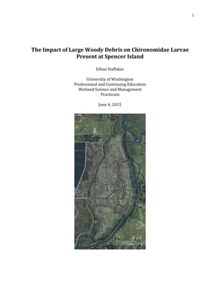
  • 1. 1 The Impact of Large Woody Debris on Chironomidae Larvae Present at Spencer Island Ethan Huffaker University of Washington Professional and Continuing Education Wetland Science and Management Practicum June 4, 2015
  • 2. 2 Table of Contents I. Introduction a. Research Question and Hypothesis II. Landscape Setting III. Wetland/Habitat Characterization a. General Site Characterization b. Regulatory Setting IV. Research of Macroinvertebrates a. Opportunity at Site b. Methods c. Results d. Interpretation and Discussion e. Conclusion V. Acknowledgements VI. Literature Cited VII. Appendix A: Figures
  • 3. 3 I. Introduction The relationship between wetland wildlife and their food sources has been a topic that I have become interested in through field and course work that I have participated in throughout the last few years. Because salmon are such an integral part of the ecology and economy of the Pacific Northwest, their food sources became the obvious driving force for this study. Large Woody Debris (LWD) is an integral infrastructure in wetland and riparian ecosystems. Historically, LWD used to be seen as detrimental to streams as it slowed water down, and made waters hard to navigate, negatively impacted log transport from the logging industry, and slowed down fish passage; thus debris has been removed from waters for decades (Wick 2002). Recently, however, as LWD functions have been studied it has become known how important this debris is for fish habitat, channel and bank stability, and biological diversity (Connecticut Department of Environmental Protection 2015). Through knowing how important LWD is in wetland and riparian ecosystems, the purpose of this study became to evaluate how LWD relates to invertebrate prey known to be consumed by juvenile salmonid species present at Spencer Island, just outside of Everett, WA. This will be accomplished by attempting to show how LWD provides proper habitat and structure for these invertebrate communities. During research for this project, little was found directly relating to the benefits of LWD to invertebrates in wetland environments; this presents the opportunity to conduct research on a topic that may have been understudied previously. Much of the existing literature I have come across deals with LWD and its importance on salmon rearing habitat, but there has been little treatment on how it impacts fish food sources. Hrodey, Kalb, and Sutton (2008) in their report on how the aquatic macroinvertebrate community responds to LWD additions in streams discuss that it is indicative that LWD creates ideal habitat for macroinvertebrates by adding size and complexity at several scales to the ecosystem. This suggests the possibility of a strong relationship for abundant salmon feeding, since juvenile salmonids feed heavily on small aquatic invertebrates (Vancouver Aquarium 2014). Half- logs, a type of LWD installation, are also very viable sources for biofilm production (Hrodey, Kalb and Sutton 2008); since biofilm is known to clean the surrounding water (Antieau 2014), this could be beneficial to macroinvertebrates living in the surrounding aquatic area, and as a result, to juvenile fish as well. One factor to consider in the relationship between juvenile salmon and LWD is the pools that form in flowing water as a result of LWD for habitat rearing. Mossop and Bradford (2004) found that fish densities in the Yukon River Basin correlate most strongly in areas where deep pools have formed as a result of LWD. These pooling areas are the most suitable habitat areas for juvenile Chinook salmon in the Canadian boreal forests, and through their research, Mossop and Bradford determined that LWD performs the same functions in more temperate areas (2004); this would include areas in the Puget Sound region such as Spencer Island. Because LWD structures provide food sources for macroinvertebrates through algae (Connecticut Department of Environmental Protection 2015), and since LWD provides ample habitat for juvenile salmonids it would stand to reason that there might be another strong connection salmon feeding on the macroinvertebrates present in LWD communities.
  • 4. 4 The literature reviewed suggests that there will be a strong link between LWD structures and the numbers of macroinvertebrate communities. Because the majority or the studies areas of interest are located directly in streams, one concern in doing my research will be to to connect my study directly to estuarine wetlands, since there seems to be little research on the effects and functions of LWD in estuarine wetlands. However, research suggests that the habitat functions LWD provides for macroinvertebrates will not change based on these two different wetland classes. While the salinity changes and water movement may change the types of macroinvertebrate species present, LWD habitat functions should remain similar for the species that utilize those functions. a. Research Question and Hypothesis Juvenile salmonids utilize macroinvertebrates as a food source; the Chironomidae (Midges) (Figure 1) family is one of these macroinvertebrate species that salmon feed on. Through previous studies done at Spencer Island, Chironomidae larvae, among many other invertebrate species, were found as an integral part of juvenile salmonids’ diet (Tanner, et al. 2002). As the purpose of this study was to find a link between LWD structures harboring greater numbers of macroinvertebrate species than areas without LWD structures, I set out to achieve this by collecting benthic core samples next to LWD and samples in bare ground with no LWD. My hypothesis is that Chironomidae larvae assemblages will be greater in number in the benthic samplings taken next to LWD structures as opposed to farther away from woody debris, because woody structures are prime habitat for macroinvertebrate species. It can be assumed from these samples, that if the Chironomidae populations are larger in close proximity to LWD structures, than those areas will be a more habitable spot for juvenile salmonids since the larvae are a priority food source for juvenile salmonids. An alternative hypothesis was discussed between Mr. Cordell and I after taking the benthic core samples. As the samples were being collected, we noticed that there was little change in the amount of organic material present in the benthic cores. This led us to discuss the possibility that there might be little to no change in the results, or possibly negative results. II. Landscape Setting The site location of this study is Spencer Island in Everett, WA (47.988808, - 122.161567, S22 T29N R5E). Spencer Island is a wetland that has multiple classes present in its system according to the National Wetlands Inventory (Figure 2). The Cowardin classes present are PEMCd (Palustrine Emergent Seasonally Flooded, partially drained/ditched), PEMAd (Palustrine Emergent Temporarily Flooded, partially ditched/drained), and PFOA (Palustrine Forested, Temporarily Flooded) (U.S. Fish and Wildlife Service n.d.). The HGM class present in the Spencer Island system is Tidal Fringe (U.S. Army Corps of Engineers 2008). On a large mapping scale, Spencer Island is a unique patch in the landscape in which it is situated. Spencer Island is located in between the cities of Everett and West Lake Stevens; the island is completely surrounded by the corridors of Union Slough and
  • 5. 5 Steamboat Slough, which are connected to the Snohomish River, another major corridor. The matrix around Spencer Island is also very unique. While it is surrounded by two fairly large cities, and a major interstate highway runs close to Spencer Island, the mosaic of patches around Spencer Island is much greener, filled with a patchwork of small forested lands, small homes, and farm fields. While this is not the ideal surrounding of completely natural areas, it is a much better matrix than being totally surrounded by suburban and city landscapes. In essence, this makes the matrix another corridor that can be easily accessed by many different varieties of animals by land, water, and air, and have ample places for them to rest, eat, and survive. Spencer Island is an important aspect to its landscape setting for two main reasons: fish and waterfowl. The area of Spencer Island is an important patch for juvenile salmon and other fish species because it is a brackish to fresh-water estuary; there is plentiful vegetation providing shade, large woody debris for shelter and food, and calm waters in order to rest. This provides the fish a safe habitat to live in during adolescence, as well as begin the acclimation process from fresh water to salt water. Water fowl also use Spencer Island heavily for many of the same reasons. There is food available, calm waters to swim in, and tall vegetation (i.e. Typha) to provide shelter for resting before traveling onwards. In relation to this study, Spencer Island is very important in the landscape setting, as I am studying the effect that Large Woody Debris has on macroinvertebrate communities for food sources for juvenile salmonids. The Snohomish is a major hub for Bull Trout, and Chinook, Coho, and Chum salmon (Washington State Department of Fish and Wildlife 2015), and without Spencer Island as an important estuary patch in this landscape, this study would not be possible at this location. Spencer Island plays a pivotal role in the rearing of juvenile salmonids. Historically, the land became dyked in the 1920s in order to be used for agriculture purposes. It was first attempted to be used for farming, which proved unsuccessful as the land continued to flood, and the salinity of the water and soils proved too high to produce profitable crop yield. The area was then switched to a grazing area for cattle, which also proved unsuccessful (Hennessey and Antieau 2014). After both of these attempts failed, the land was purchased in 1989 by Snohomish County Parks and Recreation Dept. and Washington Dept. of Fish and Wildlife (WADFW), and split up between the two agencies to become Spencer Island Park (Tanner, et al. 2002). The dikes were breached in order to begin to restore the estuarine environment. The North side of the park now belongs to WADFW for duck hunting, and the South end is a public Snohomish County park. Being close by to Everett and the interstate, there are plenty of impervious surfaces to runoff into the water ways connecting to Spencer Island, so pollutants will be heavier at this point in its watershed than higher up in the Cascade Range. Spencer Island is also right next door to Everett’s waste treatment facility, so the water quality is probably not of the highest standard at this location; which adds even more importance to keeping such a large wetland in good condition so that it can serve its ecological function of naturally helping clean those toxins. Spencer Island Park is an island surrounded by Union Slough and Steamboat Slough, both of which connect to Puget Sound through the Snohomish River. Spencer Island is
  • 6. 6 regularly flooded as it is tidally influenced diurnally. The sources for Spencer Island’s hydrology are from tidal waters, riverine systems, possible groundwater influence, and precipitation. The main hydrologic source for Spencer Island comes from the sloughs that surround the island. Union and Steamboat Slough are the water ways that surround the island, with both connecting directly to Puget Sound from the north and stem from the Snohomish River on the southern end of the island. With these water sources, the majority of water supplying Spencer Island are freshwater, becoming brackish twice a day as the tide comes in and out. Both the engineered breaches and the natural ones that have taken place since the wetland reconstruction control the water patterns that occur within the island. There are both unidirectional and bidirectional flows through the dikes on Spencer Island. North of the cross-dike section of the island, there are still tide flaps which allow only for unidirectional flow; however, in the southern side of the cross dyke site, a storm caused a natural breach in the dyke, which Snohomish Co. decided to leave open, thus allowing for bidirectional flow in and out of the area (Hennessey and Antieau 2014). III. Wetland Habitat Characterization a. General Site Characterization 1. Location Spencer Island is an island just outside of Everett, WA that is located in between the Union and Steamboat Sloughs that connect to the Snohomish River. Spencer Island is located just east to Interstate-5, several agricultural fields, and right across the banks of Steamboat Slough is the City of Everett’s waste treatment plant. The overall location of Spencer Island is that of a very disturbed area, highly developed with significant human impact, making the health of the island all the more important to be a successful ecosystem that can provide positive habitat and ecological functions. 2. Hydroperiod Spencer Island is regularly flooded as it is tidally influenced diurnally. The sources for Spencer Island’s hydrology are from tidal waters, riverine systems, possible groundwater influence, and precipitation, although the main hydrologic source for Spencer Island comes from the sloughs that surround the island. Union and Steamboat Slough are the water ways that surround the island, both of which connect directly to Puget Sound to the north and stem from the Snohomish River on the southern end of the island. With these water sources, the majority of water supplying Spencer Island is fresh water, becoming brackish twice a day as the tide comes in and out. Both the engineered and natural breaches that have taken place since the wetland’s reconstruction control the water patterns that occur within the island. There are both unidirectional and bidirectional flows through the dikes on Spencer Island. North of the cross-dike section of the island, there are still tide flaps which allow only for unidirectional flow; however, in the southern side of the cross-dike site, a storm caused a natural breach in the dike, which Snohomish Co. decided to leave open, thus allowing for bidirectional flow in and out of the area (Hennessey and Antieau 2014).
  • 7. 7 3. Soils According to the Natural Resources Conservation Service (NRCS), the soil present throughout the majority of Spencer Island is Puget silty clay loam (Figure 3). This is the soil that was present in the section of Spencer Island that the benthic core samples for this project were taken. According to the Official Soil Description (OSD) from the NRCS the Puget series is a very poorly drained soil composed from alluvial deposits (Natural Resources Conservation Service 2015). Soil pit data taken from October 18, 2014 shows the hydric nature of the soils present at Spencer Island. Soil Pit #1 was dug in a Palustrine Emergent setting on the south side of the cross- dike of Spencer Island. From the soil profile, there were two determinable soil horizons. The soil was mineral soil, with a silty clay loam texture, which concurs with the profile setting of the NRCS soil survey. There were no redox features present in the soil, and it was determined that the F1, Loamy Mucky Mineral field indicator was present, as well as A4 Hydrogen Sulfide indicator. Soil Pit #1 Depth (in. below surface) Munsell Color Texture Redox Features Hydric Indicator 0 - 2 N/A Woody/Organic None F1, A42 - 9 10YR 2+/1 Silty clay loam None 9 - 18 10YR 3/1 Silty clay None The second soil pit was taken from a section of the island that contained Typic Xerorthent soils, a highly drained soil from the Shedd series. Based on the OSD of this soil, and in correlation with the soil survey report, it is most likely that this soil type is fill that was transported in at some point during Spencer Island’s history (Natural Resources Conservation Service 2015) (Natural Resources Conservation Service 2015). This pit was dug close to Union Slough that runs along the west side of the wetland, and was in a Palustrine Forested setting. The A horizon of the soil profile was a mineral silty loam soil. At 5 in. below the ground surface, oxidized rhizospheres appeared until a depth of 10 in.; the matrix turned darker shades of grey throughout the profile, and gley soils were discovered in the bottom section of the soil profile. The field indicator F6, Redox Dark Surface was determined to be present for this soil setting. (A note on Soil Pit table #2: it was not possible to determine the exact depth of the layer break in between the 10YR 3/1 soil and the Gley soil, because the soil profile sample was not clean, the tide began inundating the pit, and time constraints on site. Numbers given are estimation.)
  • 8. 8 Soil Pit #2 Depth (in. below surface) Munsell Color Texture Redox Features Hydric Indicator 0 - 5 10YR 2/2 Silty loam None F65 - 10 10YR 2/2 Silty loam 5YR 3/4 10 - 16 10YR 3/1 Silty clay loam None 16 - 19 Gley scale Silty clay loam None 4. Vegetation Assemblages As stated previously, there are two main Cowardin classes present at Spencer Island, Palustrine Emergent being the dominant class present, and Palustrine Forested. This allows for two different vegetation assemblages present throughout the site. In the emergent wetland areas of Spencer Island, the dominant types of vegetation present are Carex lyngbyei (Lyngbye’s sedge) Typha sp. (Cattail) and Lythrum salicaria (Purple loosestrife) (Side Note: several large patches of Phragmites australis were also observed throughout the wetland, which could be something to keep under observation, as that species could become an invasive problem in the future). In the forested wetland sections of Spencer Island, Alnus rubra (Red alder) dominated the tree strata with Tsuga heterophylla (Western hemlock) and Thuja plicata (Western red cedar) peppered throughout as well. Rosa nutkana (Nootka rose) and Lonicera involucrate (Twinberry) dominated the shrub layer, and Phalaris arundinacea (Reed canary grass) was vastly present in the emergent strata. Although it is not a dominant class, Palustrine Scrub-Shrub is also present along the sloped areas of the cross-dike and trails throughout Spencer Island. The principal vegetation in these areas of the island are Salix sitchensis (Sitka willow), Spiraea douglasii (Hardhack), and Rubus armeniacus (Himalayan blackberry). b. Regulatory Setting Based on Spencer Island’s location, the boundaries are within unincorporated Snohomish Co., which puts the jurisdiction of the land under the Snohomish Co. Code (SCC). Title 30 Chapter 30.62A Section(s) .010-.730 is where the wetland regulations for Snohomish Co. are located (Snohomish County 2015). SCC’s classification of wetlands is based on the state’s Dept. of Ecology (DOE) Western Washington Rating Summary for rating wetland classifications based on habitat and functions. SCC also states that if there are any discrepancies between SCC’s wetland rating table and the DOE rating form, than the DOE’s rating summary takes precedence (SCC, 30.62A.230). Based on an overview of the Western Washington Rating Summary, Spencer Island would receive a Category I rating because of its functions rating. The
  • 9. 9 “Special Characteristics” section might be a possibility to score Spencer Island as an Estuarine Wetland, but based on studies (Tanner, et al. 2002, Cordell, et al. 1998), salinity levels are most likely not ≥0.5 ppt. for the Estuarine criterion to apply. The scale of salinity at Spencer Island has been variable in the past (Tanner, et al. 2002), meaning further testing would be needed to confirm the salinity levels. Nonetheless, as Spencer Island would still receive a Category I rating, SCC’s standards and requirements for buffers are located in 30.62A.320, and as Spencer Island is a low intensity land-use site, if would require a minimum buffer of 150 ft. Spencer Island would be and is regulated by the Corps of Engineers based on the fact that the wetland is connected to a Water of the U.S. through Union and Steamboat sloughs, which are connected to the Snohomish River. Spencer Island is also home to Chinook, Chum, and Coho Salmon (Washington State Department of Fish and Wildlife 2015)along with a plethora of other fauna; the salmon alone make the island a special habitat for federally listed species. If any project were to propose happening here, it would require several permits before construction were to begin; sections 404 and 401 of the Clean Water Act, the Endangered Species Act (ESA) would be triggered, the Shoreline Mgmt. Act, and a Hydraulic Permit Application (HPA) would all be required. Along with all state and federal permitting requirements, local ordinances through SCC also apply.
  • 10. 10 IV. Research of Macroinvertebrates a. Opportunity at Site I have been given the opportunity through the Wetland Science & Management program to choose a topic of my own interest to study and research for my final Practicum. My choice is to attempt and find a relationship between LWD as a habitat for macroinvertebrates, specifically midges of the Chironomidae family, and how that impacts juvenile salmonids at Spencer Island as a food source. With the help of Jeffery Cordell, one of the principle research scientists at the University of Washington’s School of Aquatic and Fishery Sciences as part of UW’s Wetland Ecosystem Team, and Bob Oxborrow, I will be able to take and test samples to attempt to prove my hypothesis. b. Methodology The methodology employed in order to gain knowledge of the macroinvertebrate assemblages next to LWD structures (Figures 4-8) will be through benthic core sampling. With the assistance of Mr. Cordell, we used sampling techniques similar to the protocols outlined in the Shoreline Monitoring Toolbox for benthic invertebrates (Washington Sea Grant 2015). Using a piece of PVC piping of about 3 inches in diameter, we took core samples from the soil surface to about 5 inch depths, and preserved them with a formaldehyde-water mixture. Benthic Core Sampling In order to test my hypothesis I will take benthic core samples from directly next to 5 specimens of LWD and also 5 samples at a distance of 3-5 meters away from the respective piece of LWD in an area where no living vegetation was present. Benthic core samples will also be taken from inside clumps of Carex sp. to see if hydrophytic vegetation has any effect on Chironomidae populations. The sampling will be for Chironomidae larvae and pupae, which juvenile salmonids use as a sustainable food source. c. Results On May 3, 2015 Jeffery Cordell and I went to Spencer Island to take the benthic core samples. The weather was a clear, sunny day with a temperature of around 67°F. We walked along the cross-dike separating the north and south sections of Spencer Island; on the southern side of the cross-dike we walked down to the toe of the slope, and chose our pieces of LWD to sample from. For the Wood samples we oriented the sample point directly along the side of wood closest to the dike; there appeared to be even more organic material that had collected along the backside of the woody debris than along the front, so it is possible that this could have had an impact on the results. We then took our Bare samples away from the LWD structures, and our Carex sp. samples. The samples were labeled Wood 1 (W1), Wood 2 (W2), etc. Bare 1 (B1), Bare 2 (B2), etc. and Carex 1 (C1), Carex 2 (C2), etc. and will be referred to as such from here on. Utilizing the Wetland Ecosystem Team Lab, I was able to clean and process the collected samples. Unfortunately, due to time constraints, I was only able to process the
  • 11. 11 first four Wood samples, and the first four Bare samples. From these 8 samples the numbers of Chironomidae larvae observed are as follows: Sample Wood 1 Bare 1 Wood 2 Bare 2 Wood 3 Bare 3 Wood 4 Bare 4 Chironomidae 16 40 4 1 5 5 5 7 Wood Total: 30 Bare Total: 53 The standard deviation and a graph of the confidence interval essentially tell us that there is no statistical evidence that can be gleaned from these results; there simply are not enough data points sampled to gain a statistical analysis. The high standard deviation of the Bare samples most likely indicates that the range of numbered results are spread out over a wide range, but more data would be needed in order state any conclusive results. d. Interpretation and Discussion Based on these results, it becomes clear that my original hypothesis of finding larger numbers of Chironomidae larvae in the benthic samples taken next to LWD was incorrect, and the alternative hypothesis that Mr. Cordell and I discussed was more accurate. Beginning to understand these results becomes the next step in this process. Mean Wood Mean Bare SD Wood SD Bare 95% CI 95% CI 7.5 13.25 5.6862407 18.0069431 9.04807786 28.6530648 0 5 10 15 20 25 30 35 40 45 Wood Bare
  • 12. 12 One of the possible reasons explaining these results could be the amount of detritus present throughout the samples. While studies have shown that Chironomidae larvae utilize detritus as a food source (Anderson and Sedell 1979, Henriques-Oliverira, Nessimian and Dorville 2003), I was unable to find information on whether a certain amount of organic material became detrimental to invertebrate habitat. I theorized that the excessive buildup of detritus along the backside of the LWD structures where the Wood samples were taken might have a negative effect on the Chironomidae populations present, but further research would be necessary to answer this question. Another interesting observation is how both samples W1 and B1 appear to be distinct outliers, since all other samples remain fairly consistent. The area from which these two samples were taken (Figure 9) is closest to the inlet of Union Slough; all other samples were taken further west of this location. The location of this sample area could have had an impact on the Chironomidae populations because it is the closest to the inlet and would receive the most tidal inundation, but again further research would need to be done in order to test this. There were a few unexpected elements that could have factored into some of the results. While sifting through sample B2, what seemed to be oxidized iron deposits were present throughout the benthic sample. As only 1 Chironomidae larvae was present throughout the entire sample, this suggests that the presence of iron could have a negative effect on invertebrate habitat. There were very few numbers of other invertebrate species (i.e. Ceratopogonidae, Oligochaeta) present throughout this sample as well, which further supports this theory. The area where the third samples were taken is the second unexpected issue. While the numbers of Chironomidae present were the same for both W3 and B3, there seemed to be a large influx of Oligochaeta present throughout W3 and B3 as opposed to the other samples (uncounted). The location for the third samplings had a strong hydrogen sulfide smell that emitted from the soil. The reduction of sulfate to hydrogen sulfide happens through small anaerobic bacteria throughout the soil, and while hydrogen sulfide concentrations can be toxic to rooted plants and microbes (Mitsch and Gosselink 2007), further research would need to be done to understand what, if any, impact it has on Chironomidae larvae. If I had the opportunity to do this study a second time, there are two procedures that I would like to achieve. First, being able to fully process all the samples taken would be a priority. It would be very interesting to see what kind of macroinvertebrate assemblages would have been present in the Carex samples taken, to see if growing hydrophytic vegetation had any impact on Chironomidae habitat. Secondly, I would like to take samples on two separate dates around a month apart (one in April, one in May), to see how the time of year impacts macroinvertebrate assemblages present. e. Conclusion Research from Roni, et al. suggests that LWD structures may be too localized of an ecosystem in order to give any definitive proof that LWD provides either beneficial or negative habitat functions for macroinvertebrate species in general (2014). However, while the results of this study did not fulfill the initial hypothesis, this does not mean that
  • 13. 13 the results imply negative conditions for macroinvertebrates or the juvenile salmonids that utilize them as a food source. Several Ceratopogonidae larvae were identified and counted throughout the samples, and as seen through the study involving juvenile salmonid diets at Spencer Island (Tanner, et al. 2002), both of these macroinvertebrate families, among others, are important food sources for salmonids. The one definitive result shown through this project, however, is that Spencer Island provides a healthy habitat for macroinvertebrates to grow through their life cycles, which in turn allows for ample macroinvertebrates present to be utilized as food sources for juvenile salmonids in the Pacific Northwest.
  • 14. 14 V. Acknowledgements I would like to thank Jeffery R. Cordell for being my faculty advisor through this practicum and research process; without his help and guidance, I would have felt like a fish out of water. I would also like to thank Bob Oxborrow and the rest of the Wetland Ecosystem Lab Team for making me feel welcome in the lab, allowing me to utilize their tools, and showing me how to process my samples. And of course, all the wonderful professors who have helped me learn so much throughout the Wetland Science & Management Certificate program. Thank you to all of these people, along with the University of Washington Professional and Continuing Education Program, who have helped grant me the opportunity to learn, grow, and continue down the career path I wish to pursue.
  • 15. 15 VI. Literature Cited Anderson, N.H., and J.R. Sedell. "Detritus Processing by Macroinvertebrates in Stream Ecosystems." Entomological Annual Review, 1979: 351-77. Antieau, Clay. "Introduction to Wetland Functions." Seattle, WA, November 4, 2014. Connecticut Department of Environmental Protection. "Inland Fisheries Division Habitat Conservation and Enhancement Program." Large Woody Debris Fact Sheet. May 30, 2015. http://www.ct.gov/deep/lib/deep/fishing/restoration/largewoodydebrisfactsheet.pdf. Cordell, J.R., H. Higgens, C. Tanner, and J.K. Aitkin. Biological Status of Fish and Invertebrate Assemblages in a Breaked-Dike Wetland Site at Spencer Island, Washington . Research Report, Seattle: Fisheries Research Institute, 1998. Google Earth. Google Earth. n.d. Hennessey, D., and C. Antieau. "Spencer Island Field Trip." October 18, 2014. Henriques-Oliverira, A.L., J.L. Nessimian, and L.F.M. Dorville. "Feeding habits of Chironomid larvae (Insecta: Diptera) from a stream in the floresta daRijuca, Rio de Janeiro, Brazil." Brazilian Journal of Biology, 2003. Hrodey, P.J., B.J. Kalb, and T.M. Sutton. "Macroinvertebrate community to large-woody debris additions in small warmwater streams." Hydrobiologia 605.1, 2008: 193-207. Mitsch, W.J., and J.G. Gosselink. Wetlands 4th ed. Hoboken, NJ: John Wily & Sons, Inc., 2007. Mossop B., M.J. Bradford. "Importance of large woody debris for juvenile Chinook salmon habitat in small boreal forest streams in the upper Yukon River basin, Canada." Canadian Journal of Forest Research, 2004: 1955-1966. Natural Resources Conservation Service. Offical Soil Descriptions . May 10, 2015. https://soilseries.sc.egov.usda.gov/OSD_Docs/P/PUGET.html. —. Web Soil Survey. May 10, 2015. http://websoilsurvey.sc.egov.usda.gov/App/WebSoilSurvey.aspx. Roni, P., T. Beechie, G. Press, and K. Hanson. "Wood placement in river restoration: fact, fiction, and future direction." Canadian Journal of Fisheries and Aquatic Sciences (Canadian Journal of Fisheries and Aquatic Sciences), 2014: 466-478. Royal Alberta Museum. Invertebrate Zoology: Research & Projects. May 6, 2015. http://royalalbertamuseum.ca/research/lifeSciences/invertebrateZoology/research.cfm. Snohomish County. Snohomish County Code. May 9, 2015. http://www.codepublishing.com/wa/snohomishcounty/. Tanner, C.D., J.R. Cordell, J. Rubey, and L.M. Tear. "Restoration of Freshwater Intertidal Habitat Functions at Spencer Island, Everett, Washington." Restoration Ecology, 2002: 564-576.
  • 16. 16 U.S. Army Corps of Engineers. Hydrogeomorphic Approach for Assessing Wetlands Functions. April 2008. http://el.erdc.usace.army.mil/wetlands/tidal.html (accessed May 31, 2015). U.S. Fish and Wildlife Service. National Wetlands Inventory Mapper. n.d. http://www.fws.gov/wetlands/data/mapper.HTML (accessed May 3, 2015). Vancouver Aquarium. AquaFacts. November 12, 2014. http://www.vanaqua.org/learn/aquafacts/fish/salmon (accessed November 12, 2014). Washington Sea Grant. "Benthic Invertebrates." Shoreline Monitoring Toolbox. May 30, 2015. https://docs.google.com/viewer?a=v&pid=sites&srcid=dXcuZWR1fHRvb2xib3h8Z3g6N TJiMTM3MjhiZWE3NWM0Mg. Washington State Department of Fish and Wildlife. WDFW Priority Habitats and Species Report. April 13, 2015. http://apps.wdfw.wa.gov/phsontheweb/jasper/jasper/PHSPlus.pdf?paramClipArea_ID=P 150413194706&clipPolyReportUrl=http://gispublic.dfw.wa.gov/agsoutputfwg/Geoproce ssingServices/ExportWebMap_GPServer/_ags_86a4cd7c03d24b808bf20edee6f34c60.pd f&phsReportLayerCo (accessed April 13, 2015). Wick, Alicia J. "Ecological functions and spatial dynamics of large woody debris in ogliohaline- brackish estuarine sloughs for juvenile Pacific salmon." Master's of Science Thesis, Seattle, WA, 2002.
  • 17. 17 VII. Appendix A: Figures Figure 1: Chironomidae larvae (Royal Alberta Museum 2015)
  • 18. 18 Figure 2: Cowardin Classes present at Spencer Island (U.S. Fish and Wildlife Service n.d.)
  • 19. 19 Figure 3: Mapped Soils (Natural Resources Conservation Service 2015)
  • 20. 20 Figure 4: LWD Structure 1
  • 21. 21 Figure 5: LWD Structure 2
  • 22. 22 Figure 6: LWD structure 3
  • 23. 23 Figure 7: LWD structure 4
  • 24. 24 Figure 8: LWD structure 5
  • 25. 25 Figure 9: Estimated Location of Sample Area 1 (Google Earth n.d.)