Recommended
PPSX
PPTX
Facilitates better retention of the information presented
PPTX
Chapter- 3 MAPS 1.pptx.pptx
PPTX
VI CLASS 3rd LESSON MAPS.pptx
PPTX
Art of the Map: Connecting us to our World
PPTX
Maps101 overview introduction
PPTX
PPTX
PPTX
Parts Of Maps for primary classes project.pptx
PPTX
Types of Maps and other Interpretation
DOCX
PPT
W5 types of maps for social studies grade level four
PPT
W5 types of maps for social studies grade level four
PPT
PDF
Value based course-guide to google kainat shaikh-32.pdf
PPTX
MAPS AND GLOBES PRESENTATION FOR SCHOOL STUDENTS
PDF
Rethinking the Power of Maps 1st Edition Denis Wood Phd
PPTX
PPTX
PPT
PDF
Transparencies ch02-pp192-201
PPT
Explore Maps: Presentation Makeover
PPTX
TEXTUAL AIDS GRADE10.pptx for teacher use
PPT
PDF
Transparencies ch01-pp182-191
PPTX
Honors geo. ch 1 (p.p.) pt. 2
PPTX
Maps101 - A remarkable cross-curricular learning tool.
PPT
PPTX
Powerpoint design and template (Chapman · SlidesMania).pptx
PPTX
ENGLISH8-QUARTER2-MODULE1_FACTVSOPINION.pptx
More Related Content
PPSX
PPTX
Facilitates better retention of the information presented
PPTX
Chapter- 3 MAPS 1.pptx.pptx
PPTX
VI CLASS 3rd LESSON MAPS.pptx
PPTX
Art of the Map: Connecting us to our World
PPTX
Maps101 overview introduction
PPTX
PPTX
Similar to Use of textual aids - English 10 Quarter 1 Module 2
PPTX
Parts Of Maps for primary classes project.pptx
PPTX
Types of Maps and other Interpretation
DOCX
PPT
W5 types of maps for social studies grade level four
PPT
W5 types of maps for social studies grade level four
PPT
PDF
Value based course-guide to google kainat shaikh-32.pdf
PPTX
MAPS AND GLOBES PRESENTATION FOR SCHOOL STUDENTS
PDF
Rethinking the Power of Maps 1st Edition Denis Wood Phd
PPTX
PPTX
PPT
PDF
Transparencies ch02-pp192-201
PPT
Explore Maps: Presentation Makeover
PPTX
TEXTUAL AIDS GRADE10.pptx for teacher use
PPT
PDF
Transparencies ch01-pp182-191
PPTX
Honors geo. ch 1 (p.p.) pt. 2
PPTX
Maps101 - A remarkable cross-curricular learning tool.
PPT
More from CherryMayTumabiene2
PPTX
Powerpoint design and template (Chapman · SlidesMania).pptx
PPTX
ENGLISH8-QUARTER2-MODULE1_FACTVSOPINION.pptx
PPTX
Writer's Purpose - Quarter 1 - Module 3 Presentation.pptx
PPTX
Using-Propaganda-Techniques Quarter 2 English 8.pptx
PPTX
English-8-Quarter-3-Lesson-1-EDITORIAL.pptx
PPTX
ENGLISH10_STORYELEMENTSLESSON_MODULE3.pptx
PPTX
Subject and Verb Agreement - English 8.pptx
PDF
Q3_LESSON_EXAMPLAR_English-8_Lesson-2_Week-2.pdf
PPTX
Elements of the Story - Pass the Ball.pptx
PPTX
Noting Context Clues English 8 Lesson.pptx
PPTX
Writer's Purpose - English 10 Quarter 1 Module 2
PPT
Elements-of-a-Short-Story English Lesson.ppt
PPTX
English Grade 8 LESSON 1 - Context Clues.pptx
PPTX
PowerPoint Tips & Tricks.pptx
PPTX
8-Parts-of-Speech english grade 8 lesson.pptx
PPTX
The sounds of speech.pptx
Recently uploaded
PPTX
Rectal Surgery in Senior Citiizens .pptx
PDF
Projecte de la porta de primer B: L'antic Egipte
PDF
BỘ TEST KIỂM TRA CUỐI HỌC KÌ 1 - TIẾNG ANH 6-7-8-9 GLOBAL SUCCESS - PHIÊN BẢN...
PDF
UKSG Forum 2025 - They asked for everything - The Case of the Systematic Revi...
PDF
The Tale of Melon City poem ppt by Sahasra
PPTX
Vitamins and mineral deficiency , signs and symptoms associated with exercise
PPTX
ELEMENTS OF COMMUNICATION (UNIT 2) .pptx
PDF
Blue / Green: Troop Leading Procedure (TLP) Overview.pdf
PPTX
How to Manage Line Discounts in Odoo 18 POS
PDF
Projecte de la porta d'i5B: Els animals marins
PPTX
TAMIS & TEMS - HOW, WHY and THE STEPS IN PROCTOLOGY
PPTX
10-12-2025 Francois Staring How can Researchers and Initial Teacher Educators...
PPTX
Semester 6 unit 2 Atopic dermatitis.pptx
PDF
1ST APPLICATION FOR ANNULMENT (4)8787666.pdf
PDF
IMANI Africa files RTI request seeking full disclosure on 2026 SIM registrati...
PPTX
How to use search_read method in Odoo 18
PDF
Analyzing the data of your initial survey
PPTX
Unit I — Introduction to Anatomical Terms and Organization of the Human Body
PPTX
ICH Harmonization A Global Pathway to Unified Drug Regulation.pptx
PPTX
Semester 6 UNIT 2 Dislocation of hip.pptx
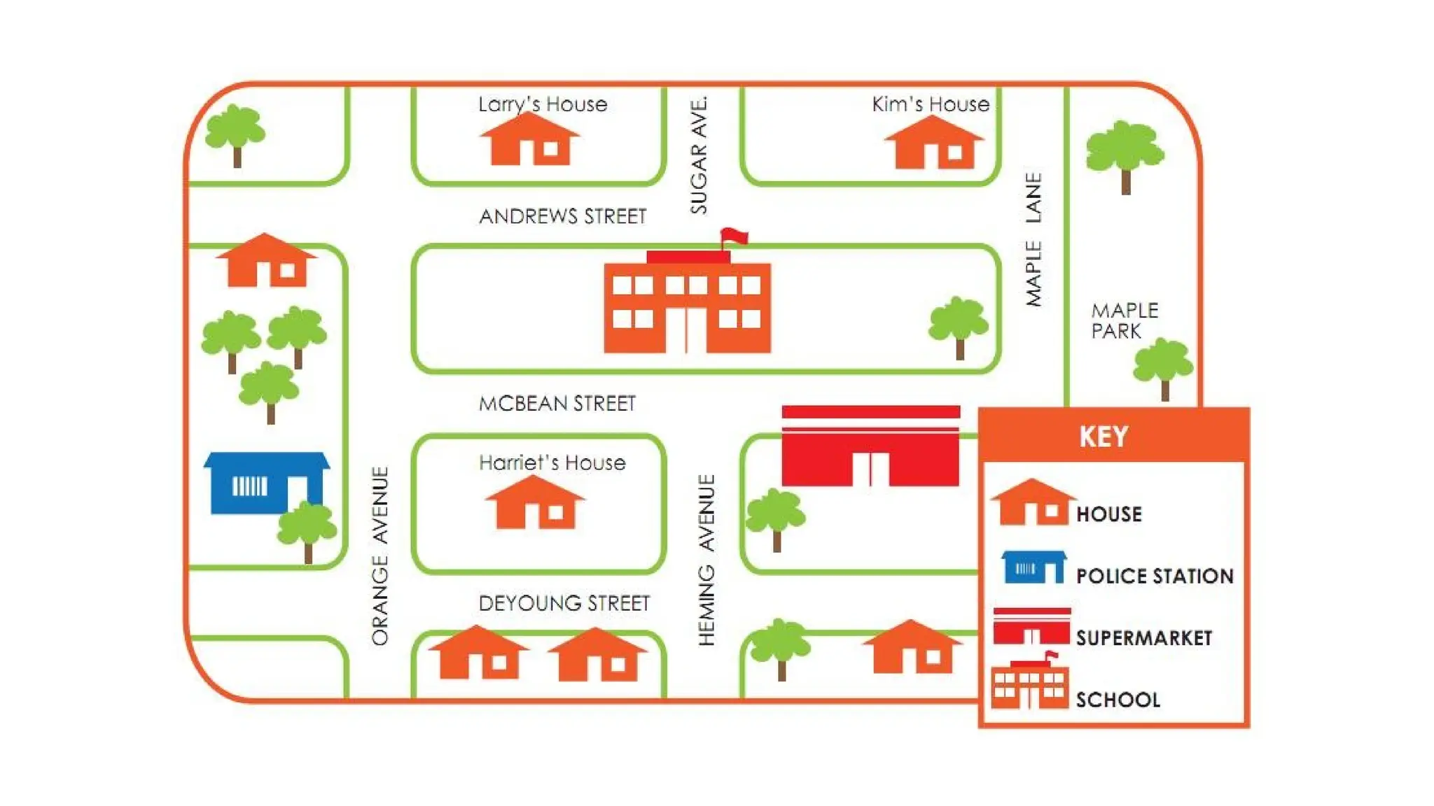
Use of textual aids - English 10 Quarter 1 Module 2 1. 2. Lesson 3 - Using Textual Aids
to Understand a Text: Maps
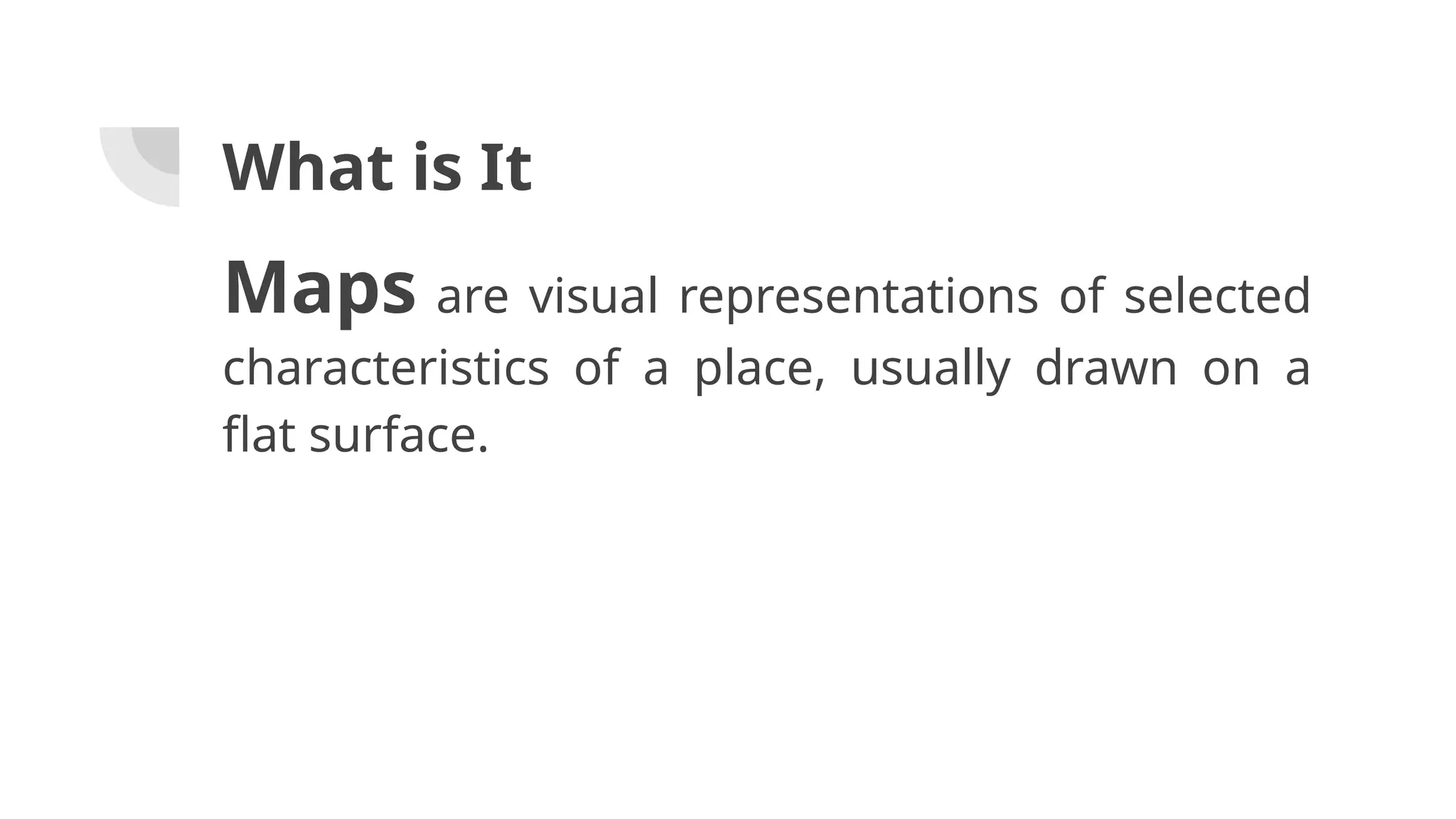
3. Maps are visual representations of selected
characteristics of a place, usually drawn on a
flat surface.
What is It
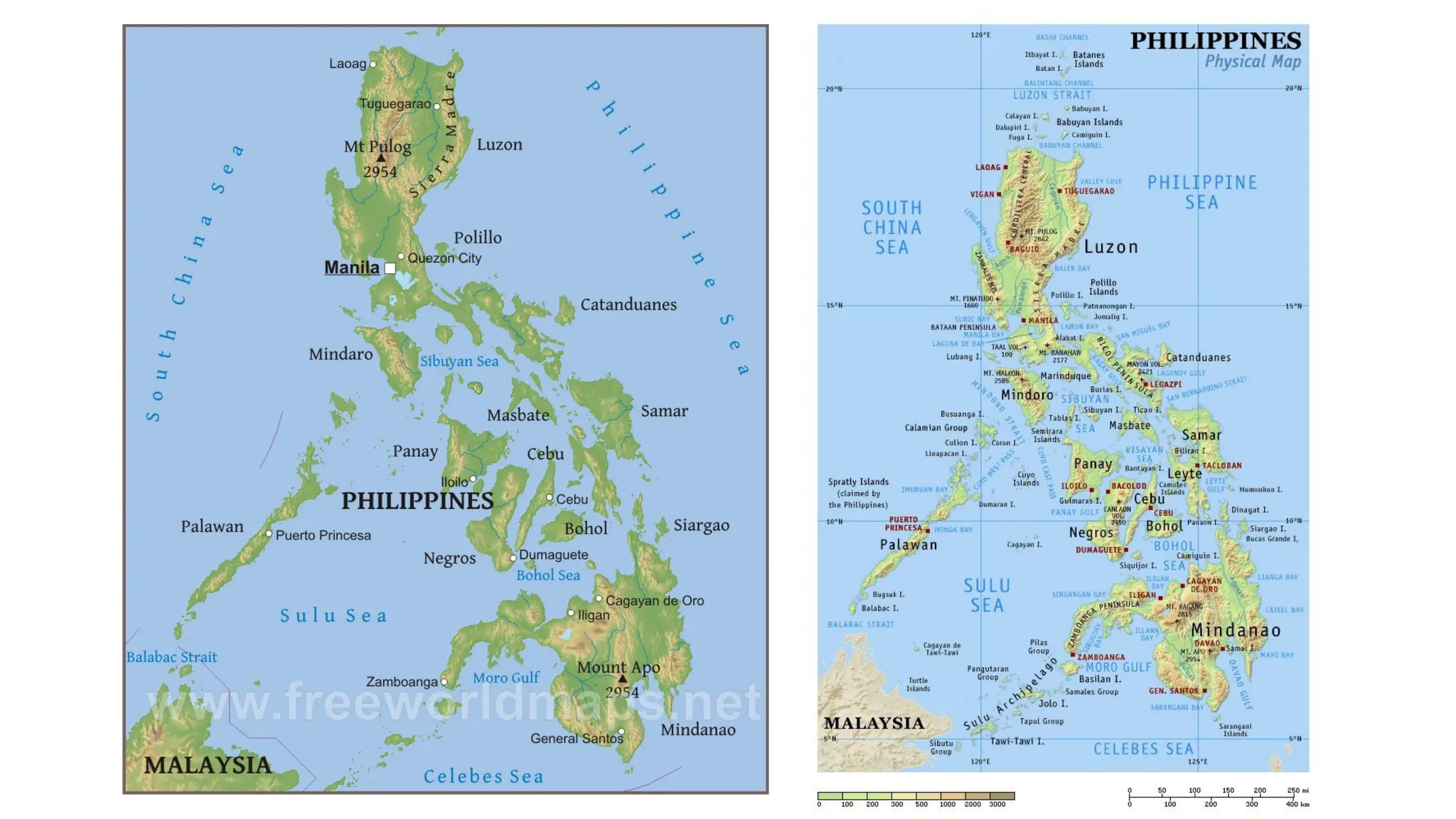
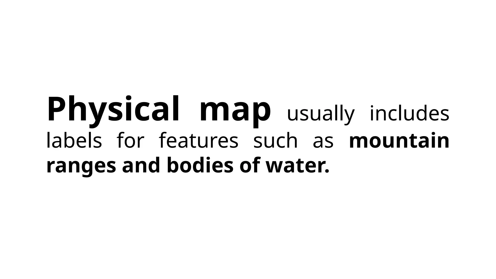
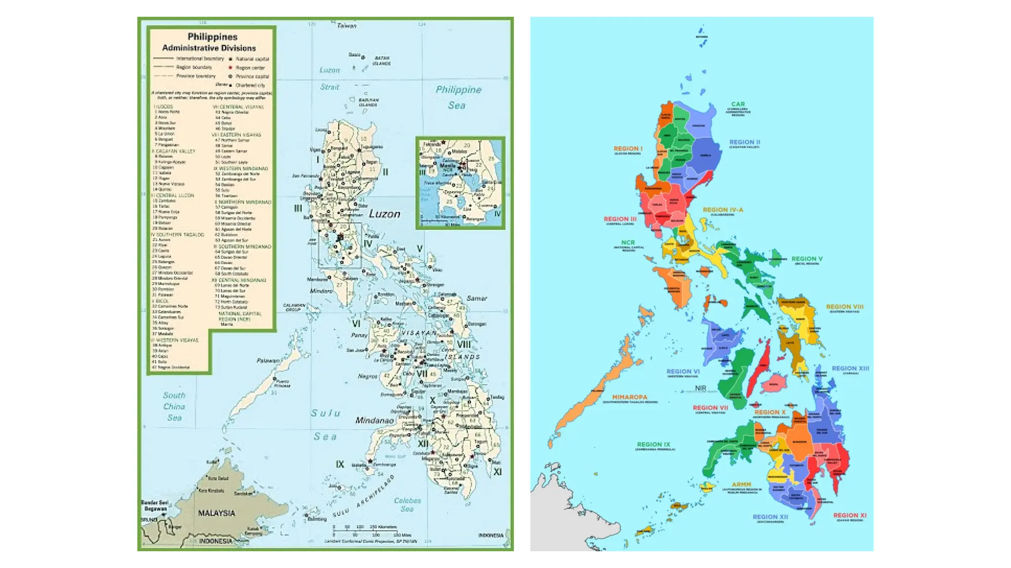
5. 7. Political map usually includes
labels for features such as cities and
major towns, units such as states or
provinces, and bodies of water. This
map clearly shows the boundaries
between and among the provinces of the
region.
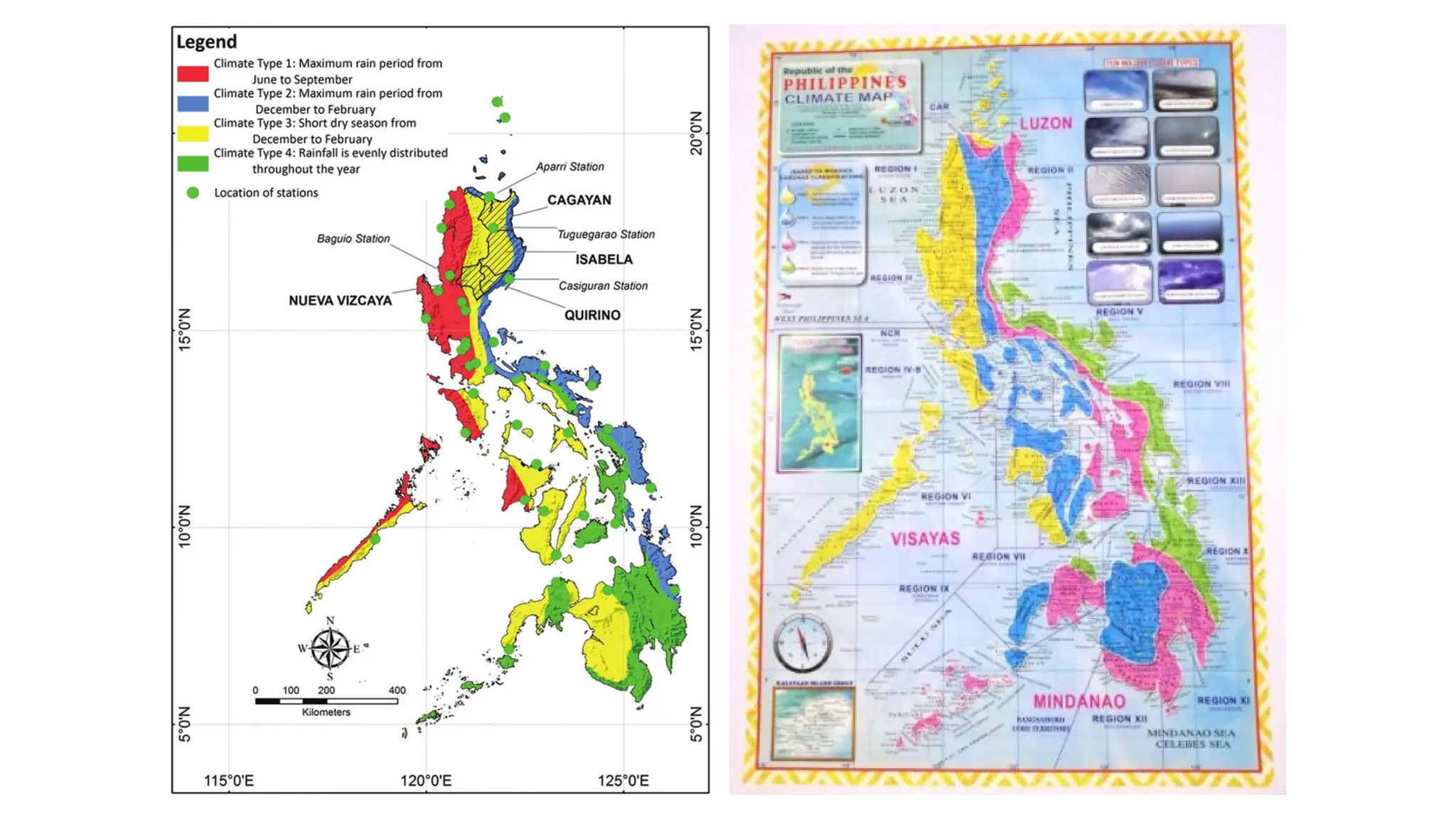
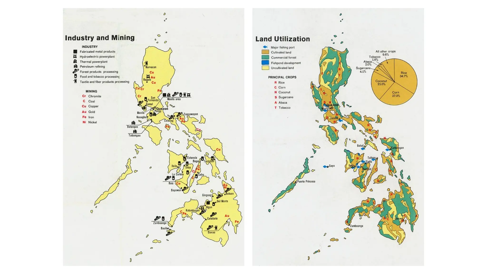
9. 11. An economic or resource
map shows the specific types of economic
activity or natural resources present in an area
through the use of different symbols or colors
depending on what is being depicted.
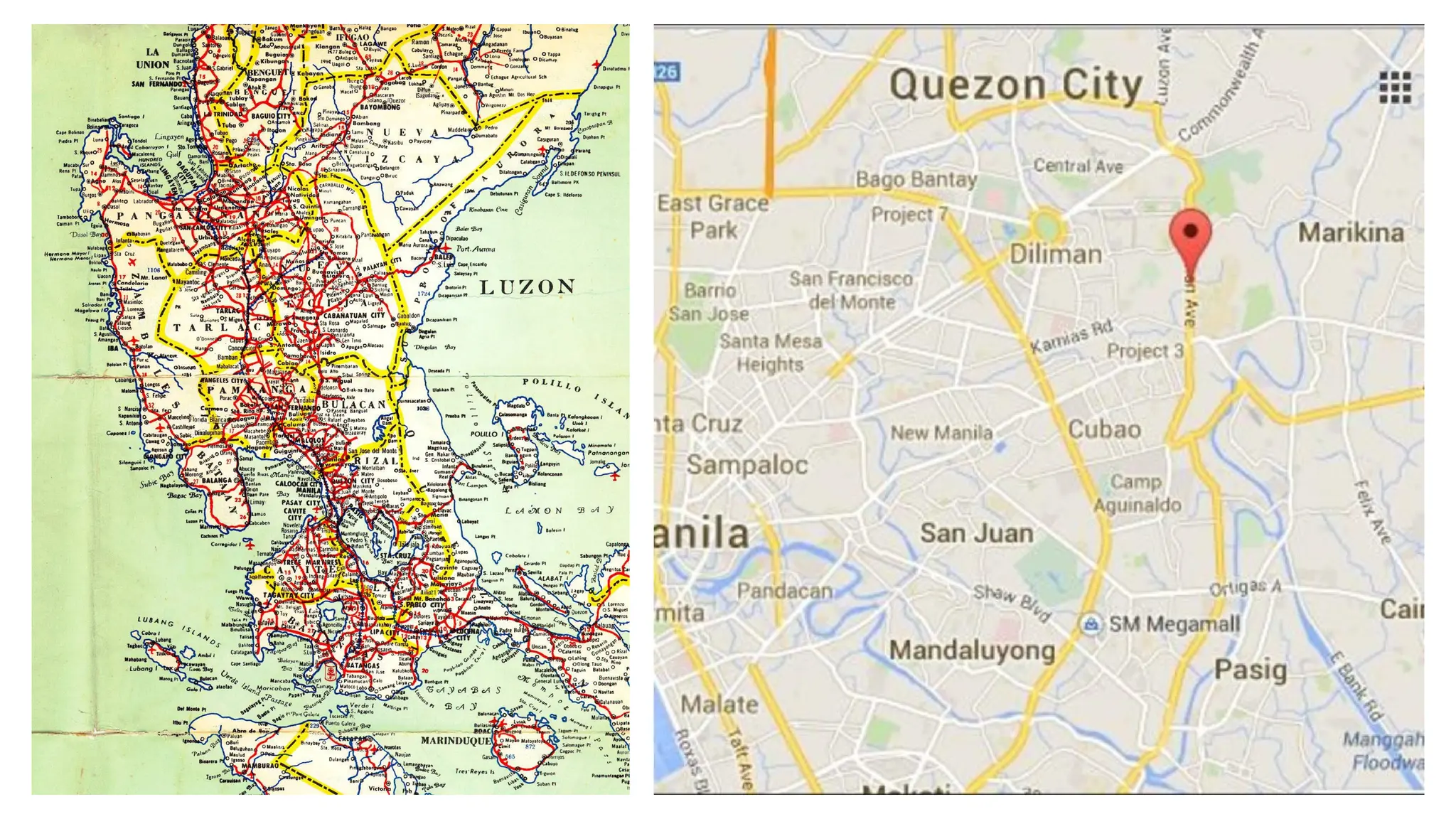
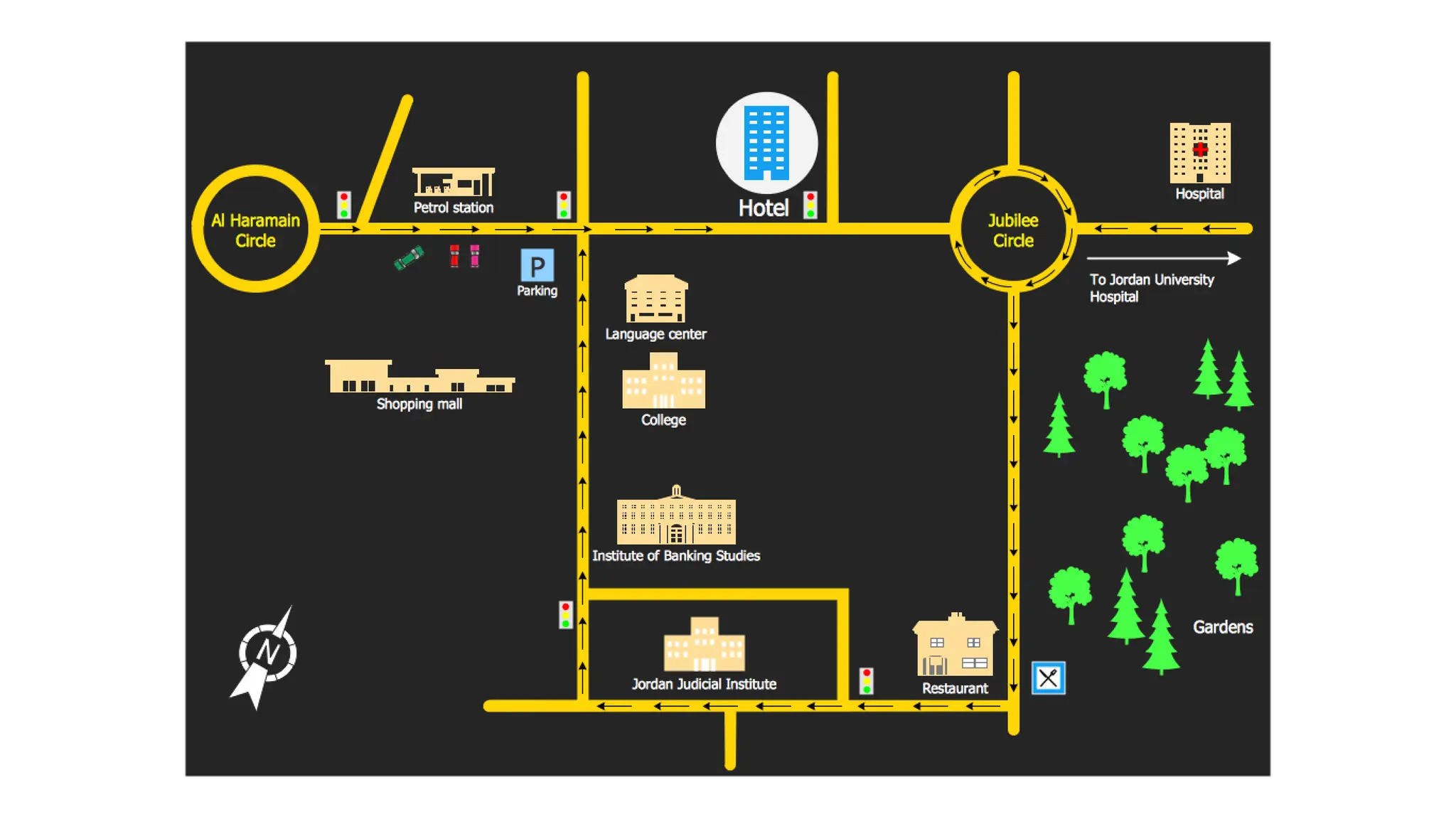
13. A road map is one of the most widely used
map types. These maps show major and minor
highways and roads (depending on the degree of
detail), as well as things like airports, cities, and points
of interest such as parks, campgrounds, and
monuments. Major highways on a roadmap are
generally shown with thick, red lines, while minor
roads are lighter in color and drawn with narrower
lines.
14. Lesson 3 - Using Textual Aids
to Understand a Text: Maps
15. 17. Draw the map going to your place
and below the map, write a
paragraph describing the way.
What I Can Do