The oceans cover approximately 71% of the Earth's surface and have an average depth of over 12,000 feet. The deepest point is in the Mariana Trench at over 36,000 feet deep. An underwater mountain range called the mid-ocean ridge stretches over 40,000 miles globally and forms the largest single feature on Earth. The tallest ocean mountain is Mauna Kea in Hawaii, which rises over 33,000 feet from the sea floor.
1) The Southern Grasslands region of South America includes Uruguay, Paraguay, and Argentina.
2) This region contrasts with the rest of South America in that the countries have more prosperous economies and larger European-heritage populations.
3) The geography includes grasslands, the Andes Mountains, and major rivers like the Rio de la Plata that form borders between countries.
The Andes Mountains stretch over 5,500 miles through South America and contain some of the tallest peaks outside of Asia, including Mount Aconcagua which is the highest in the Western Hemisphere. The mountain range splits the Andean countries of Ecuador, Peru, Bolivia, and Chile into distinct coastal, highlands, and jungle environments. These countries vary in their populations but many speak Quechua and practice subsistence farming in the highlands.
The document provides an overview of the regions of South America, including the Northern Tropics of French Guiana, Suriname, and Guyana as well as countries like Venezuela, Colombia, Brazil, and the Andean Countries. Key details include French Guiana being an overseas department of France, Suriname being a former Dutch colony, Guyana having English as its official language, Venezuela having a communist leader Hugo Chavez and oil as a major export, and Colombia producing coffee, cocoa, and cocaine while having a population that largely lives in the mountain valleys.
This document discusses the regions of Brazil. It describes the Northeast region as having a fertile coastal plain used for sugar cane plantations worked by African slaves, as well as an interior plain called the Sertao with a wet/dry climate and severe poverty. The Southeast region is described as having humid, sub-tropical climate suitable for growing crops like coffee, and containing the large cities of Rio de Janeiro and Sao Paulo. It also summarizes Brazil's economy, noting its growth in industry, manufacturing, and services sectors.
Central America is an isthmus connecting North and South America. It has a mountainous core with volcanoes over 13,000 feet high, creating distinct climate zones. The Caribbean coast has dense rainforests due to heavy rainfall from northeast trade winds, while the Pacific coast has a rain shadow effect producing both wet and dry tropical climates. Most Central Americans are poor and rely on agriculture, especially coffee, bananas, and cotton exports, while a small wealthy class owns most of the land and dominates the governments, leading to political conflicts.
Mexico has a diverse landscape ranging from mountainous interiors to coastal lowlands. The majority of the population lives along the southern central highlands and coasts where the climate is moderate and favorable for agriculture. Mexico has a long history, first dominated by the Aztec civilization, then conquered by the Spanish who established New Spain. Mexico gained independence in the 19th century but experienced political struggles and civil war until emerging as a democratic republic after the Mexican Revolution in the early 20th century. The economy has shifted from agriculture to include industries like petroleum extraction, tourism, and border assembly plants.
The Caribbean Islands consist of three main island groups - the Greater Antilles, Lesser Antilles, and Bahamas. The Greater Antilles contain the largest islands like Cuba and Hispaniola. The Lesser Antilles form an arc in the Caribbean Sea. Many islands were formed by volcanic activity or are coral islands. European colonization in the 15th century introduced African and Asian populations to the islands to work on sugar cane plantations. Today, tourism and agriculture are the main economic drivers for many independent Caribbean nations.
The document summarizes key information about the Canadian provinces and territories of Alberta, Manitoba, Saskatchewan, British Columbia, Northwest Territories, Yukon Territory, and Nunavut. It provides capitals and other significant locations for each area, as well as noting industries, geographic features, populations, and for the territories, information about the Inuit people.
The document summarizes four regions of Canada based on physical features, culture, and economy. The Atlantic Provinces border the Atlantic Ocean and contain 5% of Canada's land and 8% of its population. Fishing and tourism are major industries. The Great Lakes and St. Lawrence Provinces contain most of Canada's population and economic activity, centered around cities like Toronto and Montreal. Quebec and Ontario have economies based on farming, mining, and industry along waterways.
The South has a wet subtropical climate due to moisture from the Gulf of Mexico and Caribbean, which along with rich coastal plain soils supports agriculture. Cities grew on the Fall Line, where rivers ended and waterfalls began, because river transportation terminated and textile factories exploited the cotton industry. Oil production in Texas and Gulf states spawned petrochemical industries, though declining oil is replaced by growing petrochemical and rubber production. The South attracted industrial migration with newer, more efficient plants, cheaper land and labor costs due to fewer unions, fueling economic development. Tourism also thrives due to the climate. The population is richly diverse, including Mexicans, Cubans, and African Americans.
The Midwest has a rich agricultural industry due to its flat topography and humus-rich soil deposits which have made it the nation's breadbasket, producing grains like corn, soybeans, and wheat. Invention of machinery like the grain combine led to larger industrial farms and the decline of small farms, pushing many residents to cities. Major industries in the Midwest include steel production in Great Lakes cities, auto manufacturing centered in Detroit using iron ore from the region, and agriculture which dominates both landscapes and economies across the region.
The document summarizes some of the key physical features and cities of the Northeast United States. It mentions major lakes, rivers, and mountains like the Finger Lakes, Niagara Falls and Erie Canal, Mount Washington, and Mount Katahdin. Major cities highlighted include New York, Boston, and Philadelphia. The region has historically relied on resources like coal and fishing, as well as transportation along rivers, which led to the growth of factories, ports, dense population centers, and the establishment of a megalopolis in the Northeast.
The US economy shifted from agriculture to industry and manufacturing in the 1800s, causing populations to migrate from farms to cities. Railroads and canals in the mid-1800s facilitated transportation of goods and people, allowing cities along trade routes like Chicago and those around the Great Lakes to grow. Automobiles and highways in the mid-1900s increased mobility and suburban development, contributing to growth in cities across the Southeast and Southwest like Phoenix, Miami, and Atlanta.
Natural resources can be renewable or non-renewable. Renewable resources like wind and water are constantly regenerated by the environment while non-renewable resources like fossil fuels cannot be replaced within a reasonable time. Sustainability refers to using resources indefinitely through conservative use and planned regeneration to avoid depletion of important natural resources that power economic activities and satisfy human needs.
The document discusses different types of economic activities:
- Primary activities involve extracting raw materials like coal, wood, and iron.
- Secondary activities transform raw materials into goods through manufacturing.
- Tertiary activities provide services like retail, transportation, entertainment, banking, and healthcare.
- Quaternary activities involve intellectual work like research, education, and information technology.
It then covers levels of economic development from underdeveloped to developing to developed countries and contrasts commercial versus cottage industries as well as subsistence versus commercial farming.
#2 Introduction to Cultural (Human) Geography 2stanwood
The document discusses several key topics in human geography including demography, which is the study of populations; factors that determine a nation like sovereignty, government systems, and economic systems; and culture, which are the beliefs and actions that define a group's way of life. It also covers population dynamics such as density, birth rates, death rates, and migration. Finally, it examines urban and rural populations trends as well as components of culture like cultural hearths, language, religion, and social organization.
#1 Introduction to Cultural (Human) Geography 1stanwood
Human geography examines why people live in certain places and move between places. It studies five main themes: location, place, region, movement, and human-environment interaction. Location refers to a place's specific coordinates or its position relative to other places. Place is defined by unique physical and human characteristics that distinguish it. A region shares broad similarities across language, culture, or landscape within its boundaries. Movement involves the flow of people, goods, and ideas over time. Finally, human-environment interaction explores where and how people live in relationship with their surrounding environment.
Ecosystems consist of living organisms interacting with each other and their non-living environment. Living organisms include plants and animals, while the non-living environment includes water, air, rocks, minerals, soils, elevation, climate, sunlight, and temperature. Changes that affect one species can impact other organisms, as seen when wolves were removed and reintroduced in Yellowstone National Park. Biomes are large regions defined by similar climate, soil, plants and animals regardless of location. Major biomes include tropical and temperate forests, grasslands, deserts, and tundra.
Water, wind, and glaciers are the three main causes of erosion. Water erosion, through rain, rivers and oceans, is the greatest cause as moving water scours surfaces and carries sediment. Waves erode coastlines and pile up sand dunes. Wind erosion dries out land and blows away topsoil in sandstorms, though it can also deposit nutrient-rich dust. Glaciers scour out wide, u-shaped valleys as they move and leave behind moraines when retreating, which can form glacial lakes.
Weathering is the breakdown of rock at Earth's surface into smaller pieces through either mechanical or chemical processes. Mechanical weathering physically breaks rock into smaller pieces through processes like tree roots and frost wedging, while chemical weathering alters the mineral makeup of rock through reactions with water and carbon dioxide to form acids. Acid rain speeds chemical weathering and can damage forests, buildings, and pollute water supplies. Over time, weathering sculpts rock formations and wears down mountain peaks.
Earthquakes occur most frequently at plate boundaries where plates are separating, colliding, or sliding past one another. They also occur along faults within plates. The type and intensity of quakes depends on the plate boundary type. Divergent boundaries see frequent, mild quakes while convergent boundaries experience more intense quakes as pressure builds over time. Transform boundaries produce less predictable quakes ranging from frequent small ones to rare large ones. Magnitude is used to describe earthquake intensity and is measured using the Richter scale. Tsunamis are generated by undersea earthquakes and send waves of water onto coastlines, traveling great distances in short times.
Precipitation occurs through the water cycle as air parcels rise and cool. As air cools, water vapor condenses to form clouds and precipitation falls as rain, snow, sleet or hail. There are three main processes that drive precipitation: convection, orographic weather from air rising over mountains, and frontal boundaries when warm and cold air masses meet.
Convection currents in the atmosphere and oceans, wind patterns, and ocean currents work together to distribute heat throughout the Earth system and prevent large temperature differences between the polar and equatorial regions. Warm air and water rises at the equator, travels poleward and cools before sinking and returning to the equator, while global wind patterns and ocean currents help spread the warmth across the planet.
The Sun is the ultimate source of energy for life on Earth. It is 1 million times bigger than Earth but Earth only receives 1 billionth of its energy output due to its distance of 93 million miles. Some of the Sun's radiation is reflected or radiated back into space while enough remains to warm Earth and power its ecosystems. Earth's rotation causes day and night while its revolution around the Sun takes 365 days to complete. Its tilted axis and round shape cause the seasons as different hemispheres receive more direct sunlight throughout the year. Latitude affects climate zones, with the hottest temperatures at the equator and coldest at the poles due to the angle of the Sun's rays.
Weather refers to short-term atmospheric conditions varying daily, defined by temperature, moisture, wind speed and direction. Climate describes typical weather patterns over long periods in a region, influenced by elevation, latitude, nearby land and bodies of water. As Mark Twain said, "Climate is what you expect; weather is what you get."
This document discusses how hot spots and subduction zones can lead to earthquakes and volcanoes. It focuses on how volcanoes form, noting that emptying magma chambers can cause volcanoes to collapse into calderas. It provides Crater Lake in Oregon as an example of a volcanic caldera and discusses Mount St. Helens, a Cascade Range volcano that erupted in 1980, showing images of before and after the eruption.
Subduction zones occur when denser oceanic crust slides beneath less dense continental crust, forming volcanic mountain ranges along coastlines like the Andes and Cascades, or when oceanic crust subducts beneath other oceanic crust, forming island arc volcanoes such as the Aleutians and Japan. The Ring of Fire surrounds the Pacific Ocean and experiences many volcanoes due to its numerous subduction zones.
Unveiling the Dynamic Personalities, Key Dates, and Horoscope Insights: Gemin...my Pandit
Explore the fascinating world of the Gemini Zodiac Sign. Discover the unique personality traits, key dates, and horoscope insights of Gemini individuals. Learn how their sociable, communicative nature and boundless curiosity make them the dynamic explorers of the zodiac. Dive into the duality of the Gemini sign and understand their intellectual and adventurous spirit.
Starting a business is like embarking on an unpredictable adventure. It’s a journey filled with highs and lows, victories and defeats. But what if I told you that those setbacks and failures could be the very stepping stones that lead you to fortune? Let’s explore how resilience, adaptability, and strategic thinking can transform adversity into opportunity.
𝐔𝐧𝐯𝐞𝐢𝐥 𝐭𝐡𝐞 𝐅𝐮𝐭𝐮𝐫𝐞 𝐨𝐟 𝐄𝐧𝐞𝐫𝐠𝐲 𝐄𝐟𝐟𝐢𝐜𝐢𝐞𝐧𝐜𝐲 𝐰𝐢𝐭𝐡 𝐍𝐄𝐖𝐍𝐓𝐈𝐃𝐄’𝐬 𝐋𝐚𝐭𝐞𝐬𝐭 𝐎𝐟𝐟𝐞𝐫𝐢𝐧𝐠𝐬
Explore the details in our newly released product manual, which showcases NEWNTIDE's advanced heat pump technologies. Delve into our energy-efficient and eco-friendly solutions tailored for diverse global markets.
How are Lilac French Bulldogs Beauty Charming the World and Capturing Hearts....Lacey Max
“After being the most listed dog breed in the United States for 31
years in a row, the Labrador Retriever has dropped to second place
in the American Kennel Club's annual survey of the country's most
popular canines. The French Bulldog is the new top dog in the
United States as of 2022. The stylish puppy has ascended the
rankings in rapid time despite having health concerns and limited
color choices.”
❼❷⓿❺❻❷❽❷❼❽ Dpboss Matka Result Satta Matka Guessing Satta Fix jodi Kalyan Final ank Satta Matka Dpbos Final ank Satta Matta Matka 143 Kalyan Matka Guessing Final Matka Final ank Today Matka 420 Satta Batta Satta 143 Kalyan Chart Main Bazar Chart vip Matka Guessing Dpboss 143 Guessing Kalyan night
Digital Marketing with a Focus on Sustainabilitysssourabhsharma
Digital Marketing best practices including influencer marketing, content creators, and omnichannel marketing for Sustainable Brands at the Sustainable Cosmetics Summit 2024 in New York
The APCO Geopolitical Radar - Q3 2024 The Global Operating Environment for Bu...APCO
The Radar reflects input from APCO’s teams located around the world. It distils a host of interconnected events and trends into insights to inform operational and strategic decisions. Issues covered in this edition include:
NIMA2024 | De toegevoegde waarde van DEI en ESG in campagnes | Nathalie Lam |...BBPMedia1
Nathalie zal delen hoe DEI en ESG een fundamentele rol kunnen spelen in je merkstrategie en je de juiste aansluiting kan creëren met je doelgroep. Door middel van voorbeelden en simpele handvatten toont ze hoe dit in jouw organisatie toegepast kan worden.
Best Competitive Marble Pricing in Dubai - ☎ 9928909666Stone Art Hub
Stone Art Hub offers the best competitive Marble Pricing in Dubai, ensuring affordability without compromising quality. With a wide range of exquisite marble options to choose from, you can enhance your spaces with elegance and sophistication. For inquiries or orders, contact us at ☎ 9928909666. Experience luxury at unbeatable prices.
IMPACT Silver is a pure silver zinc producer with over $260 million in revenue since 2008 and a large 100% owned 210km Mexico land package - 2024 catalysts includes new 14% grade zinc Plomosas mine and 20,000m of fully funded exploration drilling.
Taurus Zodiac Sign: Unveiling the Traits, Dates, and Horoscope Insights of th...my Pandit
Dive into the steadfast world of the Taurus Zodiac Sign. Discover the grounded, stable, and logical nature of Taurus individuals, and explore their key personality traits, important dates, and horoscope insights. Learn how the determination and patience of the Taurus sign make them the rock-steady achievers and anchors of the zodiac.
Brian Fitzsimmons on the Business Strategy and Content Flywheel of Barstool S...Neil Horowitz
On episode 272 of the Digital and Social Media Sports Podcast, Neil chatted with Brian Fitzsimmons, Director of Licensing and Business Development for Barstool Sports.
What follows is a collection of snippets from the podcast. To hear the full interview and more, check out the podcast on all podcast platforms and at www.dsmsports.net
[To download this presentation, visit:
https://www.oeconsulting.com.sg/training-presentations]
This presentation is a curated compilation of PowerPoint diagrams and templates designed to illustrate 20 different digital transformation frameworks and models. These frameworks are based on recent industry trends and best practices, ensuring that the content remains relevant and up-to-date.
Key highlights include Microsoft's Digital Transformation Framework, which focuses on driving innovation and efficiency, and McKinsey's Ten Guiding Principles, which provide strategic insights for successful digital transformation. Additionally, Forrester's framework emphasizes enhancing customer experiences and modernizing IT infrastructure, while IDC's MaturityScape helps assess and develop organizational digital maturity. MIT's framework explores cutting-edge strategies for achieving digital success.
These materials are perfect for enhancing your business or classroom presentations, offering visual aids to supplement your insights. Please note that while comprehensive, these slides are intended as supplementary resources and may not be complete for standalone instructional purposes.
Frameworks/Models included:
Microsoft’s Digital Transformation Framework
McKinsey’s Ten Guiding Principles of Digital Transformation
Forrester’s Digital Transformation Framework
IDC’s Digital Transformation MaturityScape
MIT’s Digital Transformation Framework
Gartner’s Digital Transformation Framework
Accenture’s Digital Strategy & Enterprise Frameworks
Deloitte’s Digital Industrial Transformation Framework
Capgemini’s Digital Transformation Framework
PwC’s Digital Transformation Framework
Cisco’s Digital Transformation Framework
Cognizant’s Digital Transformation Framework
DXC Technology’s Digital Transformation Framework
The BCG Strategy Palette
McKinsey’s Digital Transformation Framework
Digital Transformation Compass
Four Levels of Digital Maturity
Design Thinking Framework
Business Model Canvas
Customer Journey Map
Profiles of Iconic Fashion Personalities.pdfTTop Threads
The fashion industry is dynamic and ever-changing, continuously sculpted by trailblazing visionaries who challenge norms and redefine beauty. This document delves into the profiles of some of the most iconic fashion personalities whose impact has left a lasting impression on the industry. From timeless designers to modern-day influencers, each individual has uniquely woven their thread into the rich fabric of fashion history, contributing to its ongoing evolution.
The Steadfast and Reliable Bull: Taurus Zodiac Signmy Pandit
Explore the steadfast and reliable nature of the Taurus Zodiac Sign. Discover the personality traits, key dates, and horoscope insights that define the determined and practical Taurus, and learn how their grounded nature makes them the anchor of the zodiac.
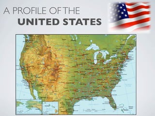
2. The United States:
is the world’s 4th largest country in area
(3,794,083 square miles)
is the world’s 3rd largest country in population
(313,104,975 people)
and has the highest GDP in the world
(followed by China, Japan, German, France, the UK, and Brazil). The US
GDP is nearly 3 times higher than that of China and Japan
3. Four Factors that give the
United States an advantage:
#1 Abundant Natural Resources
#2 Leading innovations in Transportation
#3 Leading innovations in Communication
#4 Respect for individual Freedoms
4. #1 Abundant Natural Resources At the time of the first
US census in 1790,
Rich, fertile soil...
more than three fourths
of US citizens lived on
farms.
Homestead Act
A government program
established in 1862 that
granted 160 of land to
any settler who agreed
to farm.
Today, fewer than one fourth of all
American live on farms, yet farms still
bring in over $50 billion annually.
Nearly half of the land in the US is
used for raising crops or animals.
90% of Nebraska is farmland -- the
highest of any state.
5. #1 Abundant Natural Resources
Forests...
From the time of the first settlers, forests
were cleared, beginning in the Northeast,
and then the South. Today, most of the
nation’s timber comes from the West.
From ships’ masts, to
housing and furniture
construction, to
medicinal chemicals,
forests in the US
provide a valuable
service...if managed
sustainably.
6. #1 Abundant Natural Resources
Mineral Resources... Gold
Copper
Coal - used as a source of energy
for industry, transportation and
homes. The US has 25% of the
world’s supply of coal.
Lead
and
Uranium
The US also extracts oil
and natural gas.
7. #2 Leading innovations in Transportation
Moving Resources, Goods and People...
Waterways...
Railroads
The trans-continental
RR was completed in
1869. By 1900, RRs
reached all parts of
the country.
and Canals Automobiles, invented in the 1890s gave individual
freedom to travel. Next, powerful diesel engines were
invented to drive heavy-duty modes of
transport...ships, trains, trucks and tractors.
8. #3 Leading Innovations in Communication
Telegraph
Telephone
invented in 1876 by
Alexander Graham
Bell. By 1915, telephone
wires connected coast
to coast.
invented in 1837 by Samuel
Morse, also aided the fledgling RR Modern day communication includes
industry computer technology, the internet, telephone,
and satellites.
9. #4 Respect for individual Freedoms
In 1789, the founding fathers established the notion that
individual equality, opportunity and freedom led to the belief
that people acting in their own best interests could serve the
needs of others -- which in turn led to an economic system
based on FREE ENTERPRISE or Capitalism.