UAV-IQ Vineyard Imagery Products
•
0 likes•352 views

UAV-IQ utilizes drones to collect multi-spectral imagery of agricultural fields to analyze crop health and assist farmers in improving yields. The document demonstrates for a vineyard client how UAV-IQ analyzed high-resolution NDVI imagery at the block and vine level, identifying areas of differing crop vigor that could indicate stress or soil issues. A viticulturalist's analysis summarizes differences between blocks in canopy size and cover crop treatment, and recommends early-season ground truthing of anomalies found in NDVI imagery to determine if interventions could aid crop development.
Report
Share
Report
Share
Download to read offline

Recommended
UAV-IQ: Due Diligence Primer
Case studies illustrating the returns on investment made by early adopters of precision viticulture technology and techniques.
Irrigreen Overview Brochure v28 4.4.14
The document describes a new irrigation system called the Genius system from IrriGreen. The Genius system conserves water by using a single sprinkler per zone located in the middle of the zone that precisely irrigates the exact shape of the lawn using digital technology. It can reduce water usage by up to 50% compared to conventional systems. The Genius sprinkler uses multiple digitally-controlled streams to uniformly water lawns and can be easily mapped to any lawn shape wirelessly.
The ABCs of UAVs
This presentation provides an introduction to UAVs and specifically their use in the world of GIS: what they are, the different kinds of UAV and what they are good at. Examples of their use, strengths and weaknesses are illustrated.
IVC_SC Poster
Wyeth Binder and Matthew McBee of Irvine Valley College modeled topography using UAV drone mapping and Civil 3D software to better understand water runoff and retention. They created 3D terrain models from drone images using Pix4D software. This allowed accurate mapping of elevation changes and identification of areas where water runoff concentrated. Placing retention basins in these areas could maximize water collection and reuse while limiting costs compared to traditional surveying. The method provides a low-cost way to predict runoff and plan vegetation or basins to reduce erosion.
Disrupting agriculture with flying robots
These are my slides from recent talks I gave at CTO School Melbourne, and Sydney Tech Leaders. They describe the needs of agriculture, the technology of flying robots, the promise and reality of applying the technology to the needs, and some general thoughts on disruption.
Capstone & Intern Presentation - Dhruv Godara (Cummins)
Dhruv Godara presented on his internship project with Cummins involving the rewriting of the Rapidserve Web application to enhance performance and security. He outlined his responsibilities which included project documentation, wireframing, testing, and content management. He contributed to risk mitigation and process standardization goals. Through the project, he learned the importance of pre-development analysis, communication, and interfacing between business and development teams.
Utilizing low-cost unmanned vehicle (UAV) to build orthophotos and Digital Su...
Utilizing low-cost unmanned vehicle (UAV) to build orthophotos and Digital Su...Britta Ricker, Ph.D.
Presentation given to the Washington Water Science Center USGS Tacoma on December 16, 2015. Here I describe the potential for UAV usage to improve maps for citizen science!
I will introduce methods of aerial imagery collection through the use of a low-cost and popular UAV systems. I will then focus on how to process the imagery to generate orthophotos and digital surface models (DSM) through the use of SfM software. I present decision considerations from beginning to end of a UAV mapping project.
http://faculty.washington.edu/bricker0/uav.html
http://wa.water.usgs.gov/seminar/seminar.html
Connected Agricultural services and internet of things..
This document discusses connected agriculture and the Internet of Things. It begins with an overview of global challenges in food production such as the need to increase food output 50% by 2025 to feed a growing population. It then discusses opportunities for connected solutions in agriculture to address issues like increasing productivity while using fewer resources. The document proposes a connected agriculture solution that would provide farmers technology and expert advice to better manage irrigation, seeds, pesticides, and make decisions. It outlines a functional architecture and implementation challenges for the solution.
poster_Aaron Capelouto
This project involved using an unmanned aerial vehicle (UAV) equipped with a multispectral camera to take aerial photos of wetlands and vegetation. The photos would then be processed to assess vegetation health using the Normalized Difference Vegetation Index (NDVI). The goal was to evaluate the feasibility of using UAVs for environmental monitoring and decision making in fields like transportation. Test flights were conducted and photos were taken of wetlands near Innisbrook, Florida. The NDVI values calculated from the aerial photos indicated generally healthy vegetation.
Grower Presentation 3
The Honeycomb Corp AgDrone system allows users to survey up to 800 acres in a single flight hour, collecting both NIR and RGB imagery simultaneously. The durable wing design with Kevlar exoskeleton enables exportable georeferenced data collection over entire fields. Imagery examples demonstrate the system's ability to detect crop stress, moisture variations, fungal growth, and differences in crop growth over time. The practical data collected by the AgDrone helps lower input costs and increase yields by enabling more targeted fertilizer and irrigation applications.
Airborne Imagery SPAA Precision Agriculture factsheet 2016
Airborne imagery taken from platforms like satellites, aircraft, and drones can provide high resolution digital images of crops and ground. These images include full color, color infrared (CIR), and vegetation indices like NDVI and SVI. Service providers process the images and land managers can use the data to monitor crop growth, health issues, and make management decisions. Key considerations before investing include the intended uses of the data, required image resolution, area to be mapped, and costs which vary by platform.
Remote sensing of sportsgrounds
Remote sensing using drones and specialized cameras can quickly assess turf health over large sports grounds through high resolution imagery. Metrics like NDVI quantify plant health by measuring light wavelengths reflected from vegetation. A recent study in Sydney used drone NDVI images of a field, revealing through 12 million data points that the northern turf was struggling due to soil contamination, corroborated by soil tests. Interpreting such images allows developing targeted management plans to address issues before they worsen.
Normalized Difference Vegetation Index (NDVI)
The document discusses the Normalized Difference Vegetation Index (NDVI), which is a measure of vegetation health based on how plants reflect different wavelengths of light. It provides the formula for calculating NDVI using near-infrared and red light reflectance values. NDVI values range from -1 to 1, with higher values indicating denser vegetation. The document also outlines sources of NDVI data, how to create an NDVI map in ArcGIS, applications of NDVI such as monitoring climate change and agriculture, and concludes that NDVI is a useful measure of greenness.
Hyperspectral Imagery For Production Agriculture
Hyperspectral Imagery can bu used in production agriculture to make more informed decisions, increase productivity and decrease costs.
Satellite Imagery Analysis for Ethiopian Green Legacy Monitoring.docx
atellite Imagery Analysis for Ethiopian Green Legacy Monitoring
CIF-IFC-SuccessStoriesV9
This document provides an overview of several Canadian forestry success stories that highlight innovations in the sector. It begins with an introduction from John Pineau, CEO of the Canadian Institute of Forestry, explaining that the stories showcase collaborative efforts to improve forestry practices through science, technology and peer learning. The document then presents short summaries of innovations at various Canadian forestry organizations, with a focus on improved operations and understanding of forestry issues. It aims to promote awareness of the good work being done in Canadian forests.
A Guide to Using Precision Viticulture Case Studies from the Grampians and Ya...
A Guide to Using Precision Viticulture Case Studies from the Grampians and Yarra Wine regions. SPAA Australia 2016
Crop Quest, Inc. Precision Ag Services
- Crop Quest Inc. provides precision agriculture services including field mapping, soil sampling, yield mapping, and imagery analysis to help farmers improve yields
- The services help identify limiting factors through analysis of elevation data, soil types, grid sampling results, and average normalized yields across years
- Data is collected using RTK GPS systems and sensors and compiled in Summit/Stratus software to create management zones and treatment recommendations
Precision Agriculture; Past, present and future
This document provides an overview of the history and future of precision agriculture. It discusses early efforts using soil testing and yield monitors in the 1990s. Current technologies like crop canopy sensors that measure biomass and chlorophyll are highlighted. The document also reviews ongoing work optimizing in-season nitrogen management. International collaboration between USDA-ARS and Embrapa Brazil on precision agriculture research is summarized.
NDVI
The document summarizes a study that obtained NDVI (Normalized Difference Vegetation Index) imagery from a UAV (unmanned aerial vehicle) using a modified digital camera. A Canon camera was modified by removing its internal filters, allowing collection of full-spectrum imagery. A yellow filter was added to block UV and blue wavelengths. This produced red, green, and infrared bands that could be used to calculate NDVI after processing. Imagery of a study site in Kansas was captured from a UAV and an NDVI image was produced, showing differences in vegetation growth that aligned with Google Earth imagery. However, further validation against ground measurements was needed to fully assess the accuracy.
Multispectral Imagery Data for Agricultural Surveying
Multispectral camera sensors on agricultural drones can capture visible and infrared images of crops to help farmers more effectively manage their fields. Specialized software analyzes the imagery to produce data on soil properties, crop health, and yield estimates. This allows farmers to monitor their fields, detect issues, and optimize fertilizer and pesticide use to improve crop production while reducing costs and environmental impact. Common multispectral bands analyzed include red, green, red-edge, and near-infrared wavelengths. Several datasets captured with drones are provided as examples.
Manual of blue nile crop assessment
The document is a manual that provides guidance to extension officers on how to estimate crop yields through rapid crop assessments using photographs to compare crop conditions and yields. It outlines a 5-step process for officers to classify crops as sole, intercrops, or mixed; estimate plant densities; determine if crops are good, medium, or poor; estimate yields by comparing to photo examples; and account for field variability. The goal is to help officers reliably estimate crop amounts and compare their assessments.
Crop monitoring for Agri Consultants
This slide-deck is about how remote sensing helps Crop Advisors:
1. Identify and prevent vegetation problems.
2. Identify diseases and pests.
3. Identify problem weeds.
4. Monitor seeding and manage soil bed.
5. Develop a fertilization strategy.
Weed Sensing SPAA Precision Agriculture Factsheet 2016
Weed Sensing SPAA Precision Agriculture Factsheet 2016
SPAA is a non-profit independent membership based group formed in 2002 to promote precision agriculture in Australia. www.spaa.com.au Twitter: SPAA_EO, SPAA_DO
Reference Strips and Precision Sensors for Nitrogen Management
This document summarizes a presentation on precision agriculture given by Olga Walsh. The presentation covered the benefits of precision agriculture for producers through tools like variable rate technology, current Idaho research projects on improving water and nitrogen use efficiency in wheat, and the future of precision agriculture with technologies like drones and robotics. Walsh discussed the concepts of yield goal versus yield potential and how crop sensors can help estimate yield potential to determine precise nitrogen needs. Reference strips and understanding common misconceptions about sensors were also covered.
Decentralized Crowdfunding with Professionals at DAISY_ Redefining Fundraisin...
In recent years, crowdfunding has emerged as a popular method for raising capital for various projects and initiatives. Traditionally, crowdfunding platforms facilitated fundraising campaigns by connecting project creators with a large number of contributors willing to support their endeavors financially. However, with the advent of blockchain technology, decentralized crowdfunding has emerged as a disruptive alternative to traditional crowdfunding models. In this blog, we will compare decentralized crowdfunding with traditional crowdfunding, exploring their differences, benefits, and drawbacks. DAISY Global
一比一原版(sfu毕业证书)西蒙菲莎大学毕业证如何办理
原版一模一样【微信:741003700 】【(sfu毕业证书)西蒙菲莎大学毕业证成绩单】【微信:741003700 】学位证,留信认证(真实可查,永久存档)原件一模一样纸张工艺/offer、雅思、外壳等材料/诚信可靠,可直接看成品样本,帮您解决无法毕业带来的各种难题!外壳,原版制作,诚信可靠,可直接看成品样本。行业标杆!精益求精,诚心合作,真诚制作!多年品质 ,按需精细制作,24小时接单,全套进口原装设备。十五年致力于帮助留学生解决难题,包您满意。
本公司拥有海外各大学样板无数,能完美还原。
1:1完美还原海外各大学毕业材料上的工艺:水印,阴影底纹,钢印LOGO烫金烫银,LOGO烫金烫银复合重叠。文字图案浮雕、激光镭射、紫外荧光、温感、复印防伪等防伪工艺。材料咨询办理、认证咨询办理请加学历顾问Q/微741003700
【主营项目】
一.毕业证【q微741003700】成绩单、使馆认证、教育部认证、雅思托福成绩单、学生卡等!
二.真实使馆公证(即留学回国人员证明,不成功不收费)
三.真实教育部学历学位认证(教育部存档!教育部留服网站永久可查)
四.办理各国各大学文凭(一对一专业服务,可全程监控跟踪进度)
如果您处于以下几种情况:
◇在校期间,因各种原因未能顺利毕业……拿不到官方毕业证【q/微741003700】
◇面对父母的压力,希望尽快拿到;
◇不清楚认证流程以及材料该如何准备;
◇回国时间很长,忘记办理;
◇回国马上就要找工作,办给用人单位看;
◇企事业单位必须要求办理的
◇需要报考公务员、购买免税车、落转户口
◇申请留学生创业基金
留信网认证的作用:
1:该专业认证可证明留学生真实身份
2:同时对留学生所学专业登记给予评定
3:国家专业人才认证中心颁发入库证书
4:这个认证书并且可以归档倒地方
5:凡事获得留信网入网的信息将会逐步更新到个人身份内,将在公安局网内查询个人身份证信息后,同步读取人才网入库信息
6:个人职称评审加20分
7:个人信誉贷款加10分
8:在国家人才网主办的国家网络招聘大会中纳入资料,供国家高端企业选择人才
办理(sfu毕业证书)西蒙菲莎大学毕业证【微信:741003700 】外观非常简单,由纸质材料制成,上面印有校徽、校名、毕业生姓名、专业等信息。
办理(sfu毕业证书)西蒙菲莎大学毕业证【微信:741003700 】格式相对统一,各专业都有相应的模板。通常包括以下部分:
校徽:象征着学校的荣誉和传承。
校名:学校英文全称
授予学位:本部分将注明获得的具体学位名称。
毕业生姓名:这是最重要的信息之一,标志着该证书是由特定人员获得的。
颁发日期:这是毕业正式生效的时间,也代表着毕业生学业的结束。
其他信息:根据不同的专业和学位,可能会有一些特定的信息或章节。
办理(sfu毕业证书)西蒙菲莎大学毕业证【微信:741003700 】价值很高,需要妥善保管。一般来说,应放置在安全、干燥、防潮的地方,避免长时间暴露在阳光下。如需使用,最好使用复印件而不是原件,以免丢失。
综上所述,办理(sfu毕业证书)西蒙菲莎大学毕业证【微信:741003700 】是证明身份和学历的高价值文件。外观简单庄重,格式统一,包括重要的个人信息和发布日期。对持有人来说,妥善保管是非常重要的。
Foresic Academy. Information Security Company in Punjab (INDIA)
Forensic Academy follows a broad vision of defending information from unauthorized access, use , disclosure,
disruption, modification, perusal, inspection, recording or destruction. The aim at Forensic Academy is to
provide information security solutions to clients with wide line-up of platforms: network, web application,
Android or IOS Application, Servers, Cloud and databases. Forensic Academy provides practical and interactive
training on Ethical hacking covering various subjects in information security and has structured customized
certification courses covering needs of newbies', students and corporate world- Forensic Academy aims to
cater to the need of all.
FORENSIC ACADEMY has a larger aim of expanding the IT Security which is not more that 10 years old in
INDIA. India has not more than 1000 cyber security experts which are quite less compared to the requirement
of more than 4 lakh experts. Increase in worldwide awareness in cyber security demands a growth in India
too.
sim owner details | +923099554040 | sim owner details pakistan
Whatsapp Number: +923099554040
sim owner details
sim owner details pakistan
nadra sim owner details
sim owner details by number
sim owner details online
sim owner details apk
sim owner details app
sim owner details online check pakistan
pak sim data sim owner details
zong sim owner details
check sim owner details
how to check sim owner details in pakistan
find sim owner details in pakistan
mobile sim owner details
how to check sim owner details
sim card owner details
sim card owner details online
sim owner details with name and address
track sim card owner details online
jio sim owner details
sim owner details software
check sim card owner details
find sim owner details
how to check airtel sim owner details
how to check sim card owner details
how to find a sim owner details
how to find sim owner details
how to know sim card owner details
how to know sim owner details
idea sim card owner details online
sim card owner details app
sim card owner details software
sim owner name details
ufone sim owner details
00923456435194 sim owner detail
ap to know the sim owners details
check sim number owner details
find out details of owner of sim card
finding sim registration owner details
full details of sim card owner pakistan
how to check my sim owner details
how to check owner detail through sim
how to check owner details of a sim
how to check owner details of jaz sim
how to check sim owner details who tease people
how to check sim owner name and detail warid
how to chek owner details of sim
how to find a sim owner details pakista
how to find a sim owner details pakistan
how to find sim card owner details in pakistan
how to get details of others sim owner in pakistan
how to trace a sim owner details pakistan
idea sim card owner details
iran sim details of owner
iran sim details of owner website
mobile phone number details sim owner name address
mobile phone number details sim owner name address location
online sim owner details.pakistan
pakistan prepaid sim owner details
pakistan sim owner details
phone number details sim owner name address location
search sim card owner and details using apk
sim card owner details app for pakistan
sim detail check online owner
sim details online by number owner name
sim number all details with owner name
sim number all details with owner name id card
sim owner call details online
sim owner details by contact number
sim owner details online with name and address
sim owner name full details
Ant Pest Control Services, Yorkshire, UK
If you suspect an ant infestation, Apex Pest Control can offer a comprehensive inspection. With our expertise in ant species identification, our ant control experts provide targeted ant treatments.
More Related Content
Similar to UAV-IQ Vineyard Imagery Products
poster_Aaron Capelouto
This project involved using an unmanned aerial vehicle (UAV) equipped with a multispectral camera to take aerial photos of wetlands and vegetation. The photos would then be processed to assess vegetation health using the Normalized Difference Vegetation Index (NDVI). The goal was to evaluate the feasibility of using UAVs for environmental monitoring and decision making in fields like transportation. Test flights were conducted and photos were taken of wetlands near Innisbrook, Florida. The NDVI values calculated from the aerial photos indicated generally healthy vegetation.
Grower Presentation 3
The Honeycomb Corp AgDrone system allows users to survey up to 800 acres in a single flight hour, collecting both NIR and RGB imagery simultaneously. The durable wing design with Kevlar exoskeleton enables exportable georeferenced data collection over entire fields. Imagery examples demonstrate the system's ability to detect crop stress, moisture variations, fungal growth, and differences in crop growth over time. The practical data collected by the AgDrone helps lower input costs and increase yields by enabling more targeted fertilizer and irrigation applications.
Airborne Imagery SPAA Precision Agriculture factsheet 2016
Airborne imagery taken from platforms like satellites, aircraft, and drones can provide high resolution digital images of crops and ground. These images include full color, color infrared (CIR), and vegetation indices like NDVI and SVI. Service providers process the images and land managers can use the data to monitor crop growth, health issues, and make management decisions. Key considerations before investing include the intended uses of the data, required image resolution, area to be mapped, and costs which vary by platform.
Remote sensing of sportsgrounds
Remote sensing using drones and specialized cameras can quickly assess turf health over large sports grounds through high resolution imagery. Metrics like NDVI quantify plant health by measuring light wavelengths reflected from vegetation. A recent study in Sydney used drone NDVI images of a field, revealing through 12 million data points that the northern turf was struggling due to soil contamination, corroborated by soil tests. Interpreting such images allows developing targeted management plans to address issues before they worsen.
Normalized Difference Vegetation Index (NDVI)
The document discusses the Normalized Difference Vegetation Index (NDVI), which is a measure of vegetation health based on how plants reflect different wavelengths of light. It provides the formula for calculating NDVI using near-infrared and red light reflectance values. NDVI values range from -1 to 1, with higher values indicating denser vegetation. The document also outlines sources of NDVI data, how to create an NDVI map in ArcGIS, applications of NDVI such as monitoring climate change and agriculture, and concludes that NDVI is a useful measure of greenness.
Hyperspectral Imagery For Production Agriculture
Hyperspectral Imagery can bu used in production agriculture to make more informed decisions, increase productivity and decrease costs.
Satellite Imagery Analysis for Ethiopian Green Legacy Monitoring.docx
atellite Imagery Analysis for Ethiopian Green Legacy Monitoring
CIF-IFC-SuccessStoriesV9
This document provides an overview of several Canadian forestry success stories that highlight innovations in the sector. It begins with an introduction from John Pineau, CEO of the Canadian Institute of Forestry, explaining that the stories showcase collaborative efforts to improve forestry practices through science, technology and peer learning. The document then presents short summaries of innovations at various Canadian forestry organizations, with a focus on improved operations and understanding of forestry issues. It aims to promote awareness of the good work being done in Canadian forests.
A Guide to Using Precision Viticulture Case Studies from the Grampians and Ya...
A Guide to Using Precision Viticulture Case Studies from the Grampians and Yarra Wine regions. SPAA Australia 2016
Crop Quest, Inc. Precision Ag Services
- Crop Quest Inc. provides precision agriculture services including field mapping, soil sampling, yield mapping, and imagery analysis to help farmers improve yields
- The services help identify limiting factors through analysis of elevation data, soil types, grid sampling results, and average normalized yields across years
- Data is collected using RTK GPS systems and sensors and compiled in Summit/Stratus software to create management zones and treatment recommendations
Precision Agriculture; Past, present and future
This document provides an overview of the history and future of precision agriculture. It discusses early efforts using soil testing and yield monitors in the 1990s. Current technologies like crop canopy sensors that measure biomass and chlorophyll are highlighted. The document also reviews ongoing work optimizing in-season nitrogen management. International collaboration between USDA-ARS and Embrapa Brazil on precision agriculture research is summarized.
NDVI
The document summarizes a study that obtained NDVI (Normalized Difference Vegetation Index) imagery from a UAV (unmanned aerial vehicle) using a modified digital camera. A Canon camera was modified by removing its internal filters, allowing collection of full-spectrum imagery. A yellow filter was added to block UV and blue wavelengths. This produced red, green, and infrared bands that could be used to calculate NDVI after processing. Imagery of a study site in Kansas was captured from a UAV and an NDVI image was produced, showing differences in vegetation growth that aligned with Google Earth imagery. However, further validation against ground measurements was needed to fully assess the accuracy.
Multispectral Imagery Data for Agricultural Surveying
Multispectral camera sensors on agricultural drones can capture visible and infrared images of crops to help farmers more effectively manage their fields. Specialized software analyzes the imagery to produce data on soil properties, crop health, and yield estimates. This allows farmers to monitor their fields, detect issues, and optimize fertilizer and pesticide use to improve crop production while reducing costs and environmental impact. Common multispectral bands analyzed include red, green, red-edge, and near-infrared wavelengths. Several datasets captured with drones are provided as examples.
Manual of blue nile crop assessment
The document is a manual that provides guidance to extension officers on how to estimate crop yields through rapid crop assessments using photographs to compare crop conditions and yields. It outlines a 5-step process for officers to classify crops as sole, intercrops, or mixed; estimate plant densities; determine if crops are good, medium, or poor; estimate yields by comparing to photo examples; and account for field variability. The goal is to help officers reliably estimate crop amounts and compare their assessments.
Crop monitoring for Agri Consultants
This slide-deck is about how remote sensing helps Crop Advisors:
1. Identify and prevent vegetation problems.
2. Identify diseases and pests.
3. Identify problem weeds.
4. Monitor seeding and manage soil bed.
5. Develop a fertilization strategy.
Weed Sensing SPAA Precision Agriculture Factsheet 2016
Weed Sensing SPAA Precision Agriculture Factsheet 2016
SPAA is a non-profit independent membership based group formed in 2002 to promote precision agriculture in Australia. www.spaa.com.au Twitter: SPAA_EO, SPAA_DO
Reference Strips and Precision Sensors for Nitrogen Management
This document summarizes a presentation on precision agriculture given by Olga Walsh. The presentation covered the benefits of precision agriculture for producers through tools like variable rate technology, current Idaho research projects on improving water and nitrogen use efficiency in wheat, and the future of precision agriculture with technologies like drones and robotics. Walsh discussed the concepts of yield goal versus yield potential and how crop sensors can help estimate yield potential to determine precise nitrogen needs. Reference strips and understanding common misconceptions about sensors were also covered.
Similar to UAV-IQ Vineyard Imagery Products (17)
Airborne Imagery SPAA Precision Agriculture factsheet 2016
Airborne Imagery SPAA Precision Agriculture factsheet 2016
Satellite Imagery Analysis for Ethiopian Green Legacy Monitoring.docx
Satellite Imagery Analysis for Ethiopian Green Legacy Monitoring.docx
A Guide to Using Precision Viticulture Case Studies from the Grampians and Ya...
A Guide to Using Precision Viticulture Case Studies from the Grampians and Ya...
Multispectral Imagery Data for Agricultural Surveying
Multispectral Imagery Data for Agricultural Surveying
Weed Sensing SPAA Precision Agriculture Factsheet 2016
Weed Sensing SPAA Precision Agriculture Factsheet 2016
Reference Strips and Precision Sensors for Nitrogen Management
Reference Strips and Precision Sensors for Nitrogen Management
Recently uploaded
Decentralized Crowdfunding with Professionals at DAISY_ Redefining Fundraisin...
In recent years, crowdfunding has emerged as a popular method for raising capital for various projects and initiatives. Traditionally, crowdfunding platforms facilitated fundraising campaigns by connecting project creators with a large number of contributors willing to support their endeavors financially. However, with the advent of blockchain technology, decentralized crowdfunding has emerged as a disruptive alternative to traditional crowdfunding models. In this blog, we will compare decentralized crowdfunding with traditional crowdfunding, exploring their differences, benefits, and drawbacks. DAISY Global
一比一原版(sfu毕业证书)西蒙菲莎大学毕业证如何办理
原版一模一样【微信:741003700 】【(sfu毕业证书)西蒙菲莎大学毕业证成绩单】【微信:741003700 】学位证,留信认证(真实可查,永久存档)原件一模一样纸张工艺/offer、雅思、外壳等材料/诚信可靠,可直接看成品样本,帮您解决无法毕业带来的各种难题!外壳,原版制作,诚信可靠,可直接看成品样本。行业标杆!精益求精,诚心合作,真诚制作!多年品质 ,按需精细制作,24小时接单,全套进口原装设备。十五年致力于帮助留学生解决难题,包您满意。
本公司拥有海外各大学样板无数,能完美还原。
1:1完美还原海外各大学毕业材料上的工艺:水印,阴影底纹,钢印LOGO烫金烫银,LOGO烫金烫银复合重叠。文字图案浮雕、激光镭射、紫外荧光、温感、复印防伪等防伪工艺。材料咨询办理、认证咨询办理请加学历顾问Q/微741003700
【主营项目】
一.毕业证【q微741003700】成绩单、使馆认证、教育部认证、雅思托福成绩单、学生卡等!
二.真实使馆公证(即留学回国人员证明,不成功不收费)
三.真实教育部学历学位认证(教育部存档!教育部留服网站永久可查)
四.办理各国各大学文凭(一对一专业服务,可全程监控跟踪进度)
如果您处于以下几种情况:
◇在校期间,因各种原因未能顺利毕业……拿不到官方毕业证【q/微741003700】
◇面对父母的压力,希望尽快拿到;
◇不清楚认证流程以及材料该如何准备;
◇回国时间很长,忘记办理;
◇回国马上就要找工作,办给用人单位看;
◇企事业单位必须要求办理的
◇需要报考公务员、购买免税车、落转户口
◇申请留学生创业基金
留信网认证的作用:
1:该专业认证可证明留学生真实身份
2:同时对留学生所学专业登记给予评定
3:国家专业人才认证中心颁发入库证书
4:这个认证书并且可以归档倒地方
5:凡事获得留信网入网的信息将会逐步更新到个人身份内,将在公安局网内查询个人身份证信息后,同步读取人才网入库信息
6:个人职称评审加20分
7:个人信誉贷款加10分
8:在国家人才网主办的国家网络招聘大会中纳入资料,供国家高端企业选择人才
办理(sfu毕业证书)西蒙菲莎大学毕业证【微信:741003700 】外观非常简单,由纸质材料制成,上面印有校徽、校名、毕业生姓名、专业等信息。
办理(sfu毕业证书)西蒙菲莎大学毕业证【微信:741003700 】格式相对统一,各专业都有相应的模板。通常包括以下部分:
校徽:象征着学校的荣誉和传承。
校名:学校英文全称
授予学位:本部分将注明获得的具体学位名称。
毕业生姓名:这是最重要的信息之一,标志着该证书是由特定人员获得的。
颁发日期:这是毕业正式生效的时间,也代表着毕业生学业的结束。
其他信息:根据不同的专业和学位,可能会有一些特定的信息或章节。
办理(sfu毕业证书)西蒙菲莎大学毕业证【微信:741003700 】价值很高,需要妥善保管。一般来说,应放置在安全、干燥、防潮的地方,避免长时间暴露在阳光下。如需使用,最好使用复印件而不是原件,以免丢失。
综上所述,办理(sfu毕业证书)西蒙菲莎大学毕业证【微信:741003700 】是证明身份和学历的高价值文件。外观简单庄重,格式统一,包括重要的个人信息和发布日期。对持有人来说,妥善保管是非常重要的。
Foresic Academy. Information Security Company in Punjab (INDIA)
Forensic Academy follows a broad vision of defending information from unauthorized access, use , disclosure,
disruption, modification, perusal, inspection, recording or destruction. The aim at Forensic Academy is to
provide information security solutions to clients with wide line-up of platforms: network, web application,
Android or IOS Application, Servers, Cloud and databases. Forensic Academy provides practical and interactive
training on Ethical hacking covering various subjects in information security and has structured customized
certification courses covering needs of newbies', students and corporate world- Forensic Academy aims to
cater to the need of all.
FORENSIC ACADEMY has a larger aim of expanding the IT Security which is not more that 10 years old in
INDIA. India has not more than 1000 cyber security experts which are quite less compared to the requirement
of more than 4 lakh experts. Increase in worldwide awareness in cyber security demands a growth in India
too.
sim owner details | +923099554040 | sim owner details pakistan
Whatsapp Number: +923099554040
sim owner details
sim owner details pakistan
nadra sim owner details
sim owner details by number
sim owner details online
sim owner details apk
sim owner details app
sim owner details online check pakistan
pak sim data sim owner details
zong sim owner details
check sim owner details
how to check sim owner details in pakistan
find sim owner details in pakistan
mobile sim owner details
how to check sim owner details
sim card owner details
sim card owner details online
sim owner details with name and address
track sim card owner details online
jio sim owner details
sim owner details software
check sim card owner details
find sim owner details
how to check airtel sim owner details
how to check sim card owner details
how to find a sim owner details
how to find sim owner details
how to know sim card owner details
how to know sim owner details
idea sim card owner details online
sim card owner details app
sim card owner details software
sim owner name details
ufone sim owner details
00923456435194 sim owner detail
ap to know the sim owners details
check sim number owner details
find out details of owner of sim card
finding sim registration owner details
full details of sim card owner pakistan
how to check my sim owner details
how to check owner detail through sim
how to check owner details of a sim
how to check owner details of jaz sim
how to check sim owner details who tease people
how to check sim owner name and detail warid
how to chek owner details of sim
how to find a sim owner details pakista
how to find a sim owner details pakistan
how to find sim card owner details in pakistan
how to get details of others sim owner in pakistan
how to trace a sim owner details pakistan
idea sim card owner details
iran sim details of owner
iran sim details of owner website
mobile phone number details sim owner name address
mobile phone number details sim owner name address location
online sim owner details.pakistan
pakistan prepaid sim owner details
pakistan sim owner details
phone number details sim owner name address location
search sim card owner and details using apk
sim card owner details app for pakistan
sim detail check online owner
sim details online by number owner name
sim number all details with owner name
sim number all details with owner name id card
sim owner call details online
sim owner details by contact number
sim owner details online with name and address
sim owner name full details
Ant Pest Control Services, Yorkshire, UK
If you suspect an ant infestation, Apex Pest Control can offer a comprehensive inspection. With our expertise in ant species identification, our ant control experts provide targeted ant treatments.
Findlay Evans Waterproofing with AIW - Article November 2017
Findlay Evans Waterproofing with AIW - Article November 2017MELBOURNE Commercial Waterproofers - Findlay-Evans Waterproofing
Advancing Waterproofing Expertise with AIW
Waterproofing Melbourne and beyond, the Australian Institute of Waterproofing (AIW) is proud to introduce an innovative commercial waterproofing course. Developed in collaboration with the Master Builders Association Vic, this course, led by Andrew Golle, is tailored for project managers overseeing balcony waterproofing, roof waterproofing, and concrete repair. Paul Evans emphasizes the critical nature of these roles in preventing costly post-construction issues. Private sessions for building supervisors are now available, addressing common mistakes due to poor applications and cost-cutting measures.
The course covers essential topics, including product selection, surface preparation, and the importance of basement waterproofing. Paul Evans highlights the recurring problems seen in the industry, where inadequate training and oversight lead to significant issues, from retaining wall waterproofing to lift pit waterproofing.
In response to these challenges, the AIW is developing a "Below Ground Waterproofing Standard" specific to Australia, inspired by UK standards. Paul Evans calls for industry-wide collaboration to ensure the standard encompasses diverse methods and materials, ultimately enhancing the quality and longevity of waterproofing work.
By equipping supervisors and builders with the right knowledge, AIW aims to improve the overall standard of waterproofing practices, reducing the risk of failures and the subsequent mental and financial stress on homeowners. This proactive approach is crucial for the sustainability and reliability of waterproofing in construction projects across Australia.Material Testing Lab Services in Dubai.pdf
Dubai is home to numerous advanced material testing labs, offering state-of-the-art facilities for a wide range of industries. These labs provide critical services such as mechanical testing, chemical analysis, and non-destructive testing, ensuring the quality and durability of materials used in construction, aerospace, and manufacturing.
StoneSelexNaturalStoneFauxStoneSiding.pdf
https://stoneselex.com/brick-and-stone/Dry-Stack-Stone-0615
https://stoneselex.com/brick-and-stone/faux-stone-panels-Toronto-0819
https://stoneselex.com/brick-and-stone/Fireplace-Stone-Refacing-1015
https://stoneselex.com/brick-and-stone/natural-stone-exterior-wall-cladding-GTA-0220
https://stoneselex.com/brick-and-stone/stacked-stone-fireplace-GTA-1219
https://stoneselex.com/brick-and-stone/stone-accent-wall-GTA-0120
https://stoneselex.com/brick-and-stone/Timber-Ledgestone-0813
https://stoneselex.com/brick-and-stone/White-Interior-Design-0216
https://stoneselex.com/Decorative-Accessories/Reclaimed-Wood-Mantel
https://stoneselex.com/Faux-Stone-Siding/Exterior-Stone-Siding
https://stoneselex.com/Faux-Stone-Siding/Stacked-Stone
https://stoneselex.com/Versetta-Stone-Siding
https://stoneselex.com/Decorative-Stone-Veneers/Interior-Stone-Veneers
https://stoneselex.com/Natural-Stone-Veneer
https://stoneselex.com/Stone-Veneer-Fireplace/Fireplace-Stone-Facing
https://stoneselex.com/Thin-Brick-Veneer
BOOST YOUR CREDIBILITY & TRUST WITH VIDEO TESTIMONIALS.pdf
BOOST YOUR CREDIBILITY & TRUST WITH VIDEO TESTIMONIALS.
Let authentic stories from satisfied clients elevate your brand and connect with your audience. Discover the power of genuine testimonials today.
We are Visual Entity, a video production house, a one-stop shop for all your video requirements. We venture into making unmatched content with our Corporate video, Animated Explainer video, Startup video, Kickstarter video, Product video, TV commercials, and Youtube campaign. We believe in story-driven films that help you make an authentic and meaningful connection with your audience.
Digitalz Pro Media & Technologies - Best Digital Marketing Company in Faridabad
"Digitalz Pro Media and Technologies Private Limited is the best Digital Marketing company in Faridabad. We are an end-to-end service provider in Digital Marketing.
Our Services range from:
- Website Development
- SEO
- Lead Generation
- Google Ads
- Social Media Management
- LinkedIn Networking
- Email Marketing
- Online Press Release"
Find herbal colors, organic colors, and non-toxic gulal wholesale supplier.pdf
Herbal colors, organic colors, and non-toxic gulal offer safer and more environmentally friendly alternatives to synthetic dyes. They are made from natural, organic, and non-toxic materials, making them gentle on the skin and less harmful to the environment. These colors are especially popular during cultural and religious festivals, in cosmetics, and in organic products.
#1 Call Girls in Islamabad || 03274100048 || Quick Booking at Affordable Price
Islamabad Call Girls Services – Available 24/7
One of the most educated and reliable Call Girls in Islamabad. They only work with real guys who want to enjoy the company of our high-class, sexy call girls with love and respect. Our call girls have enough experience to know how to make their guests happy at that time. Of course, we’re known for our genuine hospitality.
Our stylish Independent Islamabad call girls are available 24 hours a day, seven days a week. People who work for our agency will make you feel right at home as soon as you meet them. You’ll feel like you’re at a real Call Girl agency in Islamabad.
Our guests come back repeatedly, and no matter what megacity they visit, they always contact us to talk about the nightlife. If you’re in a big city by yourself and getting sexy in a hotel room. Our girls are so well-trained that they can go to a club, a party, or a DJ night with you and make you feel unforgettable.
Our VIP call girls are dedicated to their jobs and look forward to giving you a great experience and ensuring you’re delighted. We are quick at getting new gifts, which is why our customers love us so much. Before, you saw our girls’ portfolios and hot pictures, which made you want to do anything. Book your stay in Islamabad right now by calling.
Special Moments with Islamabad Call Girls
Customers are surprised by how satisfying, inspiring, and powerful Islamabad Call Girl’s minutes are, which makes them love her even more. Our agency’s name in the market is due to our excellent call girls, who keep clients coming back for life.
As a Call Girl service in Islamabad, Islamabad Nights Call Girl has been helping a wide range of clients for a long time. His work makes the value of the business easy to understand, appealing, and beautiful. The only thing that makes the firm successful is its dedication to giving clients excellent customer service.
The terms and conditions of the Islamabad Call Girls service are standard. Kids under 18 can’t get help from this government because it doesn’t want them; they have to be at least 18 years old. His agency only gives the power to mature people travelling with real sidekicks.
The people who work for this office are trained, responsible, and prepared for their jobs. They don’t like other Call Girls who only want money in exchange for giving clients beds. They serve both inside and outside people.
Ready to Meet Islamabad Call Girls Now!
You don’t need to wait. We’ll send hot Call Girls to your house if you call us. It’s easy for these young, pretty women to make guys happy.
No need to worry about how they treat you because they are all very friendly and work for a company. They know how to make every guy happy.
#call girls in islamabad #islamabad call girls #call girl in islamabad #islamabad call girl
How Live-In Care Benefits Chronic Disease Management.pdf
Explore how live-in care can significantly benefit chronic disease management, enhancing the quality of life for those affected and providing peace of mind for their families.
一比一原版(UIUC毕业证)UIUC毕业证香槟分校毕业证如何办理
原件一模一样【微信:176555708】【UIUC毕业证香槟分校毕业证(UIUC学位证)成绩单】【微信:176555708】(留信学历认证永久存档查询)采用学校原版纸张、特殊工艺完全按照原版一比一制作(包括:隐形水印,阴影底纹,钢印LOGO烫金烫银,LOGO烫金烫银复合重叠,文字图案浮雕,激光镭射,紫外荧光,温感,复印防伪)行业标杆!精益求精,诚心合作,真诚制作!多年品质 ,按需精细制作,24小时接单,全套进口原装设备,十五年致力于帮助留学生解决难题,业务范围有加拿大、英国、澳洲、韩国、美国、新加坡,新西兰等学历材料,包您满意。
【业务选择办理准则】
一、工作未确定,回国需先给父母、亲戚朋友看下文凭的情况,办理一份就读学校的毕业证【微信:176555708】文凭即可
二、回国进私企、外企、自己做生意的情况,这些单位是不查询毕业证真伪的,而且国内没有渠道去查询国外文凭的真假,也不需要提供真实教育部认证。鉴于此,办理一份毕业证【微信:176555708】即可
三、进国企,银行,事业单位,考公务员等等,这些单位是必需要提供真实教育部认证的,办理教育部认证所需资料众多且烦琐,所有材料您都必须提供原件,我们凭借丰富的经验,快捷的绿色通道帮您快速整合材料,让您少走弯路。
留信网认证的作用:
1:该专业认证可证明留学生真实身份【微信:176555708】
2:同时对留学生所学专业登记给予评定
3:国家专业人才认证中心颁发入库证书
4:这个认证书并且可以归档倒地方
5:凡事获得留信网入网的信息将会逐步更新到个人身份内,将在公安局网内查询个人身份证信息后,同步读取人才网入库信息
6:个人职称评审加20分
7:个人信誉贷款加10分
8:在国家人才网主办的国家网络招聘大会中纳入资料,供国家高端企业选择人才
→ 【关于价格问题(保证一手价格)
我们所定的价格是非常合理的,而且我们现在做得单子大多数都是代理和回头客户介绍的所以一般现在有新的单子 我给客户的都是第一手的代理价格,因为我想坦诚对待大家 不想跟大家在价格方面浪费时间
对于老客户或者被老客户介绍过来的朋友,我们都会适当给一些优惠。
选择实体注册公司办理,更放心,更安全!我们的承诺:可来公司面谈,可签订合同,会陪同客户一起到教育部认证窗口递交认证材料,客户在教育部官方认证查询网站查询到认证通过结果后付款,不成功不收费!
办理UIUC毕业证香槟分校毕业证(UIUC学位证)学位证【微信:176555708 】外观非常精致,由特殊纸质材料制成,上面印有校徽、校名、毕业生姓名、专业等信息。
办理UIUC毕业证香槟分校毕业证(UIUC学位证)学位证【微信:176555708 】格式相对统一,各专业都有相应的模板。通常包括以下部分:
校徽:象征着学校的荣誉和传承。
校名:学校英文全称
授予学位:本部分将注明获得的具体学位名称。
毕业生姓名:这是最重要的信息之一,标志着该证书是由特定人员获得的。
颁发日期:这是毕业正式生效的时间,也代表着毕业生学业的结束。
其他信息:根据不同的专业和学位,可能会有一些特定的信息或章节。
办理UIUC毕业证香槟分校毕业证(UIUC学位证)学位证【微信:176555708 】价值很高,需要妥善保管。一般来说,应放置在安全、干燥、防潮的地方,避免长时间暴露在阳光下。如需使用,最好使用复印件而不是原件,以免丢失。
综上所述,办理UIUC毕业证香槟分校毕业证(UIUC学位证)学位证【微信:176555708 】是证明身份和学历的高价值文件。外观简单庄重,格式统一,包括重要的个人信息和发布日期。对持有人来说,妥善保管是非常重要的。
Findlay Evans Waterproofing with AIW - Article July 2019
Findlay Evans Waterproofing with AIW - Article July 2019MELBOURNE Commercial Waterproofers - Findlay-Evans Waterproofing
Comprehensive Guide to Balcony Waterproofing Repairs
Addressing Leaking Balconies, Roofs, and Rooftop Terraces
Leaking balconies, roofs, and rooftop terraces can cause catastrophic damage to structures below. Water leaks may cause not only aesthetic and superficial damage but can also compromise the structural integrity of the building envelope. If a failed waterproofing membrane is the cause, re-grouting or surface sealing is merely a temporary fix. Such band-aid methods will eventually fail, causing cracks in tiles, grout, and membranes as the balcony moves.
In many cases, failed membranes require a complete strip-off, structural repairs if needed, reinstallation of waterproofing, and a new finish surface. Key considerations in this process include the strength of the subfloor and screed, presence of substrate dips and hollows, correct balcony slope and fall, window and door frame installation, door threshold sealing, adequate drainage, and the potential for underlying pipe leaks. Existing tiling and expansion joints should also be assessed to determine their role in the balcony failure.
Waterproofing Preparation
Proper preparation is critical for any waterproofing membrane installation. The substrate must be clean, free of dirt and other contaminants. This involves vacuum cleaning and/or diamond grinding to ensure a smooth, dry, and debris-free surface. In some cases, washing the substrate may be necessary.
Waterproofing Detailing
Before installing a waterproofing system, construction features that interrupt the membrane layer must be adequately protected and sealed. This includes:
Perimeter Upturns: Attachment points for railings and balustrades, joints between horizontal and vertical surfaces, and structural and expansion joints. Sealant should be applied 15mm wide to all junctions, reinforced with polyester or fiberglass mat to a DFT of 1.2mm, 100mm above finished floor height, or 25mm above the water line. The membrane system should be installed 200mm onto balcony floor areas.
Door/Window Step Downs: Similar to perimeter upturns, apply sealant 15mm wide to all junctions, reinforced with fiberglass mat to a DFT of 1.2mm, ensuring the membrane system is installed 200mm onto balcony areas.
Drains & Floor Waste Details: All floor wastes should have a recessed leak control flange installed, primed with appropriate primer, and the membrane system installed as per specifications.
Waterproofing Installation: Australian Standards
The installation of a Class 2/3 waterproof membrane system to external concrete must comply with AS 4654.2. Key considerations for installation include:
Installation Conditions: Avoid installation in extreme temperatures (below 10°C or above 35°C) to prevent accelerated or decelerated cure times.
Type of Membrane: Use a flexible waterproofing membrane capable of withstanding normal cyclic fluctuations and ponding water.OpenText Vulnerability Assessment & Penetration Testing
An OpenText™ Vulnerability Assessment provides organizations with a thorough understanding of the weaknesses and potential risks in their applications, systems, and networks. Armed with this insight, they can address vulnerabilities, enhance their cybersecurity defenses, and ensure compliance with insurance and regulatory requirements.
Alauddin Trust | Charity Empowering People in Need
Alauddin Trust is a nonprofit organization committed to carrying forward the vision of the revered Pir Mohammad Alauddin Siddiqui (Alayhi Rahma).
Findlay Evans Waterproofing with AIW - Article April 2017
Findlay Evans Waterproofing with AIW - Article April 2017MELBOURNE Commercial Waterproofers - Findlay-Evans Waterproofing
The AIW Delivers on the Importance of Waterproofing
On March 29, 2017, the AIW attended and presented at the ADEB (Architects Designers Engineers Builders) Waterproofing Breakfast Seminar in Sydney. The focus was on addressing commercial waterproofing and residential high-rise waterproofing failures and solutions.
Presentations and Key Points
Paul Evans, AIW President, gave an overview of the AIW's role in raising waterproofing standards in Australia. Robert McDonald, an AIW member, delivered a session on the “Australian Standards in Waterproofing.” These presentations covered:
Common defects in internal and external waterproofing
Priming and substrate moisture content
Inspection and testing of waterproofing
Drainage and waterproofing techniques
Product knowledge and standards compliance, including:
CA 55 - 1970 (Design and Installation of Bituminous Fabric Roofing)
AS 3740 (Waterproofing Wet Areas in Residential Buildings)
AS 4858 - 2004 (Wet Area Membranes)
AS 4654 - 2012 (Waterproofing Membrane)
The AIW remains dedicated to updating, providing current information, and educational resources for all industries involved with waterproofing.
Achieving Uniform Waterproofing Compliance Nationally
Achieving uniform waterproofing compliance across Australia involves collaboration with State and Territory Regulatory Authorities, which play a crucial role. Current licensing requirements are often disjointed, and in many states, not mandatory.
Local authorities and building surveyors request Waterproofing Application Certificates to certify compliance with BCA and Australian Standards. These certificates must be issued by a competent person, whose work falls under the scope of their license or who has formal qualifications to carry out the work. Training and qualifications are regulated under the National Qualifications Framework.Verified Call Girls Mumbai || +919920725232 || Quick Booking at Affordable Price
Verified Call Girls Mumbai || +919920725232 || Quick Booking at Affordable Price
Check SIM Owner Details | +447490809237 | Sim Details in Pakistan
Whatsapp Number for Paid Service:
+447490809237
How To Check SIM Owner Name And CNIC Of Any Mobile Number
Thanks to the Pakistan Telecommunication Authority’s (PTA) online verification facilities, obtaining SIM owner information has become much easier. Here’s how to find the CNIC and SIM owner details by number:
Compose an SMS to 667: Open a new message on your SIM card and write “MNP”.
Send the SMS: Send this message to the shortcode 667.
Receive Information: Wait for a reply. A message containing the name of the SIM owner associated with the specific SIM number will be sent to you.
Additionally, you can visit or call your network service provider’s local customer care center to confirm the SIM registration status and owner’s name. This simplified procedure eliminates the need for extensive documentation and offers a convenient way to obtain necessary SIM details in Pakistan.
Check SIM Owner Details With Name Online
In Pakistan, there are various Android apps and software solutions available to check the SIM owner’s name by mobile number online. However, it is important to note that most of these apps have not been approved by the Pakistan Telecommunication Authority (PTA), and their use is not recommended. If you choose to use these apps, proceed with caution. Remember, the current law only permits the registration of five SIMs under one identity.
Always verify the validity of any software or tool you decide to use, as unauthorized access to SIM owner credentials may have legal consequences.
Check Jazz SIM Owner Name Details 2024
To check Jazz SIM owner name and details online, follow these steps:
Open the Messaging App: On your mobile phone, open the messaging app.
Create a New Message: Type “667” in the recipient field.
Write the Message: Type “MNP” in the message body.
Send the Message: Send the message using your Jazz SIM.
Wait for a Response: You will receive a message containing the SIM owner’s name and CNIC number associated with the Jazz SIM you are using.
Terms:
Codes can change at any time. Check the Jazz website if the code above has an error.
For further information, call the Jazz helpline.
You can check the Jazz SIM owner, registered address, and location by calling the helpline.
Check Ufone Sim Owner Name Details 2024.
If you want to Check Ufone SIM Owner Name & Ufone SIM Owner Details online check it by the following steps:
Open the messaging app on your mobile phone.
Create a new message.
In the recipient field, type “667”.
In the message body, type “MNP”.
Send the message through your Ufone SIM.
Wait for a response. You will receive a message containing the SIM owner’s name and CNIC number associated with the Ufone SIM which is in your use.
#sim owner details
#sim owner details pakistan
#nadra sim owner details
#sim owner details by number
#sim owner details online
#sim owner details apk
#sim owner details app
#sim owner details online check pakistan
#pak sim data sim owner details
#zong sim owner details
Recently uploaded (20)
Decentralized Crowdfunding with Professionals at DAISY_ Redefining Fundraisin...
Decentralized Crowdfunding with Professionals at DAISY_ Redefining Fundraisin...
Foresic Academy. Information Security Company in Punjab (INDIA)
Foresic Academy. Information Security Company in Punjab (INDIA)
sim owner details | +923099554040 | sim owner details pakistan
sim owner details | +923099554040 | sim owner details pakistan
Findlay Evans Waterproofing with AIW - Article November 2017
Findlay Evans Waterproofing with AIW - Article November 2017
BOOST YOUR CREDIBILITY & TRUST WITH VIDEO TESTIMONIALS.pdf
BOOST YOUR CREDIBILITY & TRUST WITH VIDEO TESTIMONIALS.pdf
Digitalz Pro Media & Technologies - Best Digital Marketing Company in Faridabad
Digitalz Pro Media & Technologies - Best Digital Marketing Company in Faridabad
Find herbal colors, organic colors, and non-toxic gulal wholesale supplier.pdf
Find herbal colors, organic colors, and non-toxic gulal wholesale supplier.pdf
#1 Call Girls in Islamabad || 03274100048 || Quick Booking at Affordable Price
#1 Call Girls in Islamabad || 03274100048 || Quick Booking at Affordable Price
How Live-In Care Benefits Chronic Disease Management.pdf
How Live-In Care Benefits Chronic Disease Management.pdf
Findlay Evans Waterproofing with AIW - Article July 2019
Findlay Evans Waterproofing with AIW - Article July 2019
OpenText Vulnerability Assessment & Penetration Testing
OpenText Vulnerability Assessment & Penetration Testing
Alauddin Trust | Charity Empowering People in Need
Alauddin Trust | Charity Empowering People in Need
Findlay Evans Waterproofing with AIW - Article April 2017
Findlay Evans Waterproofing with AIW - Article April 2017
Verified Call Girls Mumbai || +919920725232 || Quick Booking at Affordable Price
Verified Call Girls Mumbai || +919920725232 || Quick Booking at Affordable Price
Check SIM Owner Details | +447490809237 | Sim Details in Pakistan
Check SIM Owner Details | +447490809237 | Sim Details in Pakistan
UAV-IQ Vineyard Imagery Products
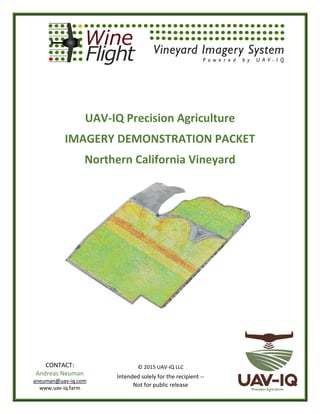
- 1. UAV-IQ Precision Agriculture IMAGERY DEMONSTRATION PACKET Northern California Vineyard © 2015 UAV-IQ LLC Intended solely for the recipient -- Not for public release CONTACT: Andreas Neuman aneuman@uav-iq.com www.uav-iq.farm
- 2. Introduction UAV-IQ utilizes unmanned aerial vehicles (UAVs) to collect multi-spectral imagery to assist agricultural clients make the critical decisions that dramatically affect their bottom line. When properly utilized, the products developed by UAV-IQ support cultivation and harvesting techniques that have provided double and triple-digit returns for early adopters of the technology. UAV-IQ is an early-cycle entrant into the precision agriculture industry offering a unique, cost effective, full service solution that utilizes data collected from unmanned aerial vehicles to provide actionable, high resolution imagery and analysis delivered through mobile enabled platforms to improve crop yields for vineyard owners. Why UAVs: Low operating costs Fly under cloud decks Fly lower to get better results Resolution as high as 2 cm/pixel Computer controlled collection Interchangeable sensors Operators can adjust flight patterns on site What is NDVI? NDVI stands for Normalized Difference Vegetation Index It analyzes the reflectance of near-infrared and visible light off vegetation Serves as an indicator of crop health (vigor) Healthier plants reflect more near-infrared light It can tell you how healthy crops are – row by row, vine by vine, plant by plant Detect what the naked eye can’t see…
- 3. 1. Crop Stress Northern California Vineyard Normalized Difference Vegetation Index (NDVI)
- 4. 2. NDVI Close-up Areas
- 5. 3. Close-Up Area 1 NDVI High Definition
- 6. 4. Close-Up Area 2 NDVI High Definition
- 7. 5. Close-Up Area 3 NDVI High Definition
- 8. 6. Close-Up Area 4 NDVI NDVI - HIGHER TRANSPARENCY
- 9. 7. Elevation Charts Vineyard Elevation – False Color
- 10. Vineyard Elevation – False Color Overlaid on High Definition Imagery
- 11. 8. Crop Stress with Topographical Detail NDVI with 1 Meter Contour Lines
- 12. 9. Hydrology Charts WATER FLOW DIRECTION - 25 FT AVERAGE WATER FLOW DIRECTION - 10 FT AVERAGE
- 14. UAV-IQ’s Viticulturalist’s Summary Analysis Overall view shows 5 distinct blocks. The large one to the south has more green canopy either because it is a larger trellis type or more advanced canopy. The 2 smaller blocks in the middle do not have much canopy and in this overall view the color is mostly from the mowed down cover crop (yellow) or disked in cover crop (brown). The top block looks similar to the bottom block. Looking at the 4 areas zoomed in on. Area 1- There is an obvious area of green cover crop re growth which could mean a leak. Area 2- Brown patches are the ground and showing areas of missing vines. Area 3- There is a section which looks likes like it could be a swale, greener areas look like cover crop regrowth. Vine canopy looks to be a little bigger. Area 4- Larger block has much more vigorous or more mature canopy then smaller block at the top. Area in larger block with more yellow cover crop showing looks like a weaker area, possible soil difference. The quality of the images is quite good and gives good detail. With the actual iPad app these areas that show up as different on the NDVI scale within blocks could be zoomed in on and then located for field ground truthing. I think these early season images would most likely be used for doing some basic field ground truthing early in the season to see if differences in canopy, vigor are areas where early interventions might help with crop development. With the app you could go to each of these areas in the field take notes and photos and determine if further investigation is needed. Early season on the canopy vigor differences between blocks may be due to variety, canopy and it looks like here what you decided to do with the cover crop. Because the canopies are not very developed yet most of the color is due to the cover crop where it is showing up yellow and the ground showing up brown.