
Recommended
Recommended
More Related Content
Similar to transportation impact study in city of toronto
Similar to transportation impact study in city of toronto (20)
Recently uploaded
Recently uploaded (20)
transportation impact study in city of toronto
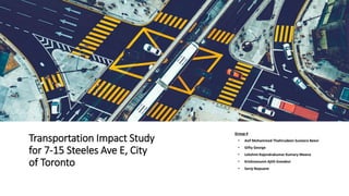
- 1. Transportation Impact Study for 7-15 Steeles Ave E, City of Toronto Group 4 • Asif Mohammed Thahirudeen Suneera Beevi • Gifty George • Lekshmi Rajendrakumar Kumary Meena • Krishnanunni Ajith Sreedevi • Saroj Nepuane
- 2. Objective • Evaluate the anticipated traffic impact • Assess municipal road implications • Recommend infrastructure enhancements • Provide comprehensive solutions
- 3. Traffic Impact Study (TIS) A TIS assesses the effects of proposed developments on the surrounding transportation infrastructure, including road networks, public transportation systems, and active transportation networks
- 4. What is to be constructed and Where? Figure 1 – Proposed Development Location • Research focus: Analyzing the impact of a new development at 7- 15 Steeles Avenue East • Current situation: 3 houses, an empty lot, and a two-story shop exist on-site, with plans to replace the shop with a 50-floor building housing 683 residential units and ground-level shops. • Transportation provisions: Designated parking for 123 cars and 520 bikes, utilizing a rear road for access and egress, located east of Yonge Street and south of Steeles Ave East. • Study objectives: Assess current traffic conditions, modes of transportation (e.g., buses, walking), traffic volume analysis, and predicting future traffic patterns resulting from the new development
- 5. Data Collection 1. Existing Road Network Yonge Street • Key north-south arterial road in the vicinity • Seven-lane configuration with three travel lanes per direction • Auxiliary left turn lane • Posted speed limit: 50 km/h near the subject site Steeles Avenue • East-west arterial road • Eight-lane configuration with four travel lanes per direction • Median left turn lanes and dedicated left turn lanes • Posted speed limit: 60 km/h near the subject site Dudley Avenue • Residential street • Two-lane configuration with one travel lane per direction • No left turn restrictions • Posted speed limit: 40 km/h near the subject site Nipigon Ave • Residential street • Two-lane configuration with one travel lane per direction • No left turn restrictions • Posted speed limit: 40 km/h near the subject site Fig – Existing Lane Configuration and Traffic Control
- 6. Data Collection 2 Existing Active Transportation Network Assessment • Pedestrian pathways are well-established and accessible in the vicinity of the subject site, including sidewalks along Nipigon Ave, Dumont Street, Yonge Street, and Steeles Ave E, contributing to a high walk score of 86 out of 100. • However, there is currently a lack of designated cycling facilities in the subject site and its surrounding area Existing Active Transportation Network in the Study Area
- 7. Data Collection 3. Current Public Transportation System Present Public Transportation System within the Study Zone Bus Accessibility: •Over 10 bus routes within a five-minute walk. •Adheres to Ministry of Transportation of Ontario's guideline for comfortable walking distances (400 meters to a bus stop, 800 meters to a transit station). TTC Routes: •Six TTC routes available, offering east-west and north-south options. •Consistent service throughout the day. •Nearest stop at Yonge Street and Athabaska Avenue, just a one-minute walk. YRT Routes & GO Bus: •Well-connected with YRT routes covering east-west and north-south directions. •YRT operates during peak hours with 20-25 minute frequencies. •GO Bus Route 32 Trinity Commons provides east-west connection with 1-hour frequency during peak hours. •All transit options accessible within a four to five-minute walk from the subject site.
- 8. Locatio n North Approach Totals East Approach Totals East Approach Totals South Approach Total Growth Factor Background Traffic Yonge St & Steeles Ave W Hour Ending Right Straigh t Left Grand Total Total Peds Right Straigh t Left Grand Total Total Peds Right Straigh t Left Grand Total Total Peds Right Straigh t Left Grand Total Total Peds 7:00:00 20 156 17 193 58 11 152 16 179 32 13 83 33 129 23 51 104 18 173 44 1.104 744.150 7:15:00 18 181 21 220 59 16 176 19 211 32 18 114 33 165 39 54 115 32 201 64 1.104 879.952 7:30:00 32 230 28 290 27 20 203 31 254 38 19 126 35 180 34 61 159 36 256 46 1.104 1081.999 7:45:00 18 243 38 299 43 25 197 23 245 46 25 165 46 236 37 74 161 31 266 51 1.104 1154.869 8:00:00 26 317 40 383 39 27 199 28 254 32 28 190 28 246 57 76 152 35 263 62 1.104 1265.277 8:15:00 28 265 47 340 34 22 241 38 301 53 27 155 42 224 50 77 220 50 347 53 1.104 1338.146 8:30:00 37 260 57 354 53 20 251 20 291 26 25 204 38 267 36 77 196 47 320 38 1.104 1360.228 8:45:00 52 304 53 409 32 27 270 41 338 25 20 205 37 262 36 67 157 47 271 60 1.104 1413.223 9:00:00 41 264 43 348 30 40 205 38 283 34 27 185 37 249 31 72 151 49 272 41 1.104 1271.901 9:15:00 40 245 40 325 25 36 212 42 290 38 16 187 39 242 37 54 156 53 263 34 1.104 1236.570 9:30:00 51 215 39 305 21 31 181 39 251 35 20 169 40 229 23 63 130 46 239 26 1.104 1130.579 9:45:00 49 195 30 274 34 46 185 46 277 29 16 166 37 219 31 56 135 44 235 40 1.104 1109.601 4:00:00 58 241 37 336 59 53 178 39 270 60 30 269 47 346 52 75 213 60 348 113 1.104 1435.305 4:15:00 54 220 43 317 39 52 212 40 304 53 24 242 46 312 58 58 214 61 333 66 1.104 1397.766 4:30:00 59 253 42 354 40 36 213 39 288 63 28 290 34 352 50 70 222 58 350 74 1.104 1483.885 4:45:00 40 249 37 326 52 39 206 50 295 55 20 287 38 345 61 71 217 64 352 67 1.104 1455.178 5:00:00 61 284 43 388 65 40 188 49 277 59 33 286 35 354 34 73 214 66 353 78 1.104 1514.799 5:15:00 38 275 42 355 63 42 224 38 304 68 13 302 38 353 65 78 251 49 378 92 1.104 1534.672 5:30:00 49 268 39 356 43 53 223 38 314 62 24 304 40 368 68 66 239 56 361 84 1.104 1544.609 5:45:00 55 268 43 366 44 47 181 36 264 46 21 312 37 370 57 81 229 62 372 75 1.104 1514.799 6:00:00 40 289 40 369 74 45 188 49 282 54 27 296 41 364 65 87 201 47 335 81 1.104 1490.509 6:15:00 44 283 48 375 59 41 189 43 273 57 25 268 42 335 56 79 231 46 356 80 1.104 1478.364 6:30:00 54 245 38 337 41 40 159 47 246 40 34 263 43 340 47 72 208 64 344 65 1.104 1398.870 6:45:00 43 209 42 294 45 43 139 40 222 46 28 263 45 336 50 89 190 53 332 64 1.104 1307.232 Totals: 1007 5959 947 7913 1079 852 4772 889 6513 1083 561 5331 931 6823 1097 1681 4465 1174 7320 1498 1.104 Steeles Ave E & Dudley Av & Dumon t St 7:00:00 3 0 1 4 2 0 202 2 204 0 4 0 1 5 1 0 109 1 110 1 1.104 356.618 7:15:00 7 0 3 10 1 1 208 2 211 0 3 0 0 3 1 6 150 1 157 0 1.104 420.655 7:30:00 4 0 3 7 2 2 236 1 239 0 8 0 0 8 0 3 182 0 185 0 1.104 484.691 7:45:00 3 1 1 5 6 3 268 2 273 1 4 0 1 5 2 6 192 0 198 0 1.104 531.063 8:00:00 1 1 2 4 4 9 264 2 275 0 6 0 0 6 5 6 227 0 233 0 1.104 571.914 8:15:00 6 0 4 10 13 10 274 2 286 0 16 1 1 18 2 10 180 5 195 1 1.104 561.977 8:30:00 8 4 3 15 10 13 216 19 248 0 39 9 0 48 1 4 148 3 155 0 1.104 514.502 8:45:00 7 12 3 22 5 17 207 16 240 0 18 8 1 27 1 4 149 6 159 2 1.104 494.628 9:00:00 7 10 3 20 1 11 199 15 225 0 16 9 6 31 5 3 145 2 150 0 1.104 470.338 9:15:00 6 10 3 19 4 12 204 7 223 0 24 11 2 37 4 3 136 9 148 2 1.104 471.443 9:30:00 7 17 7 31 5 18 221 3 242 0 13 3 1 17 3 4 139 7 150 0 1.104 485.796 9:45:00 5 16 8 29 2 22 187 15 224 0 13 4 1 18 5 5 129 12 146 0 1.104 460.402 4:00:00 2 0 0 2 2 20 225 5 250 0 13 1 1 15 8 7 286 2 295 0 1.104 620.493 4:15:00 7 3 0 10 5 15 220 2 237 0 10 1 2 13 4 8 302 2 312 0 1.104 631.534 4:30:00 3 4 3 10 8 34 216 5 255 1 14 0 1 15 12 8 228 2 238 0 1.104 571.914 4:45:00 7 1 1 9 2 23 216 9 248 0 12 1 2 15 4 8 269 3 280 0 1.104 609.453 5:00:00 3 1 4 8 5 30 187 9 226 0 8 1 0 9 8 9 283 2 294 0 1.104 592.891 5:15:00 2 4 0 6 8 20 216 12 248 1 13 3 0 16 8 9 276 2 287 0 1.104 614.973 5:30:00 4 1 1 6 9 22 172 11 205 0 12 0 1 13 6 13 290 2 305 0 1.104 584.059 5:45:00 1 3 4 8 5 14 180 15 209 0 16 4 0 20 6 6 259 4 269 1 1.104 558.665 6:00:00 6 1 1 8 4 19 198 16 233 0 16 2 4 22 3 9 257 6 272 1 1.104 590.683 6:15:00 4 0 2 6 2 8 202 6 216 0 14 2 2 18 6 14 251 2 267 0 1.104 559.769 6:30:00 7 1 3 11 4 13 190 10 213 0 15 1 2 18 14 10 250 2 262 0 1.104 556.457 6:45:00 5 2 2 9 11 4 180 7 191 0 10 1 0 11 5 6 237 2 245 0 1.104 503.461 Totals: 115 92 62 269 120 340 5088 193 5621 3 317 62 29 408 114 161 5074 77 5312 8 1.104 Traffic Volumes and Turning Movements
- 9. Nipigo n Ave & Dumon t St. 7:00:00 0 2 0 2 1 0 2 1 3 1 0 4 1 5 0 0 0 0 0 0 1.104 11.041 7:15:00 0 7 0 7 0 0 0 0 0 0 0 2 0 2 0 0 5 1 6 0 1.104 16.561 7:30:00 1 1 1 3 0 0 3 0 3 0 0 6 0 6 0 1 0 3 4 1 1.104 17.665 7:45:00 0 9 0 9 3 0 0 1 1 0 2 2 0 4 0 0 1 1 2 0 1.104 17.665 8:00:00 0 8 1 9 0 0 1 0 1 2 1 4 0 5 9 1 7 2 10 5 1.104 27.602 8:15:00 0 11 1 12 0 1 3 1 5 3 1 15 0 16 8 1 5 3 9 5 1.104 46.371 8:30:00 2 20 5 27 0 1 5 1 7 0 2 43 2 47 0 1 3 4 8 1 1.104 98.263 8:45:00 5 26 1 32 0 0 2 0 2 0 1 26 0 27 0 2 10 5 17 0 1.104 86.118 9:00:00 3 24 2 29 0 3 10 2 15 0 1 20 0 21 0 1 4 6 11 0 1.104 83.910 9:15:00 1 18 0 19 0 2 3 1 6 0 5 26 1 32 0 3 6 8 17 1 1.104 81.702 9:30:00 2 22 0 24 0 0 5 2 7 0 1 14 0 15 1 0 3 3 6 2 1.104 57.412 9:45:00 2 33 0 35 0 0 9 1 10 1 0 14 1 15 1 0 9 4 13 1 1.104 80.598 4:00:00 2 8 2 12 0 0 1 2 3 1 1 14 5 20 1 2 10 3 15 0 1.104 55.204 4:15:00 0 11 2 13 0 0 4 0 4 0 2 10 3 15 1 3 3 2 8 2 1.104 44.163 4:30:00 2 14 0 16 0 1 6 0 7 0 1 10 2 13 2 3 6 6 15 2 1.104 56.308 4:45:00 4 14 1 19 0 1 5 0 6 0 0 10 1 11 0 5 6 4 15 0 1.104 56.308 5:00:00 2 13 4 19 3 0 2 2 4 0 4 5 3 12 1 4 8 4 16 0 1.104 56.308 5:15:00 4 19 1 24 0 0 10 2 12 1 0 12 2 14 4 1 11 3 15 0 1.104 71.765 5:30:00 3 22 2 27 0 0 6 3 9 0 0 9 2 11 2 7 9 4 20 0 1.104 73.973 5:45:00 5 17 2 24 0 2 6 1 9 0 1 12 1 14 1 10 10 7 27 5 1.104 81.702 6:00:00 6 19 2 27 0 2 7 0 9 0 2 16 1 19 2 4 9 6 19 0 1.104 81.702 6:15:00 3 15 3 21 0 0 1 0 1 0 0 11 1 12 0 4 10 5 19 0 1.104 58.516 6:30:00 3 13 5 21 0 2 11 1 14 0 0 10 4 14 0 5 12 5 22 1 1.104 78.390 6:45:00 0 12 2 14 0 0 2 1 3 0 2 9 1 12 1 7 13 3 23 0 1.104 57.412 Totals: 50 358 37 445 7 15 104 22 141 9 27 304 31 362 34 65 160 92 317 26 1.104 Yonge St and Nipigo n Ave 7:30:00 5 306 1 312 0 4 0 2 6 15 4 188 2 194 0 1 0 0 1 5 1.104 566.393 7:45:00 2 311 2 315 0 1 0 0 1 7 4 238 4 246 0 1 0 1 2 8 1.104 622.702 8:00:00 8 345 1 354 0 1 0 1 2 7 7 241 3 251 0 2 0 0 2 2 1.104 672.385 8:15:00 7 350 0 357 0 1 0 0 1 10 5 260 1 266 0 2 0 0 2 5 1.104 691.155 8:30:00 4 350 3 357 1 1 0 0 1 15 3 254 1 258 0 0 0 0 0 8 1.104 680.114 8:45:00 16 328 2 346 0 1 0 1 2 12 6 276 3 285 0 4 0 1 5 10 1.104 704.404 9:00:00 13 293 2 308 0 4 0 0 4 5 5 263 8 276 0 3 0 0 3 13 1.104 652.512 9:15:00 8 285 3 296 1 1 1 0 2 15 5 251 2 258 1 11 0 0 11 5 1.104 626.014 4:00:00 25 331 2 358 0 5 2 2 9 11 11 310 9 330 0 22 0 0 22 19 1.104 793.834 4:15:00 22 320 3 345 0 9 0 2 11 25 9 353 13 375 0 26 0 0 26 15 1.104 835.789 4:30:00 17 336 0 353 0 8 0 2 10 14 4 347 5 356 1 27 0 0 27 14 1.104 823.644 4:45:00 19 368 4 391 0 1 0 1 2 31 3 376 6 385 0 20 0 0 20 21 1.104 881.056 5:00:00 15 388 1 404 0 5 0 2 7 22 7 371 4 382 1 32 0 0 32 23 1.104 910.867 5:15:00 24 425 5 454 0 8 0 1 9 28 8 365 8 381 1 17 0 0 17 26 1.104 950.614 5:30:00 21 378 3 402 0 6 1 2 9 31 6 348 2 356 0 23 0 0 23 24 1.104 872.224 5:45:00 19 367 1 387 0 9 0 0 9 32 6 366 3 375 0 18 0 0 18 18 1.104 871.120 Totals: 225 5481 33 5739 2 65 4 16 85 280 93 4807 74 4974 4 209 0 2 211 216 1.104 North Approach Totals East Approach Totals East Approach Totals South Approach Total Growth Factor Background Traffic Hour Ending Right Straigh t Left Grand Total Total Peds Right Straigh t Left Grand Total Total Peds Right Straigh t Left Grand Total Total Peds Right Straigh t Left Grand Total Total Peds Traffic Volumes and Turning Movements
- 10. Traffic Analysis and Future Traffic Peak hour Factor Calculation: • AM and PM peak factors are determined by comparing the highest 15-minute traffic volume to the average traffic volume during respective peak hours. • Formulas: Peak hour factor = Average traffic volume / Total traffic volume. • In our case, AM Peak hour values are used to calculate the traffic volume . • We got peak hour factor as 0.82. Future Traffic Calculation: • Growth factor calculation: Growth factor = (1 + r)^n, where r represents the annual growth rate (2% to 5%) and n is a multiple of 5, representing the number of years. • Background traffic calculation: Background traffic = Growth rate * total traffic • We assume Growth rate =2% & No. Of Years = 5 years • In our case, Growth factor =1.10
- 11. A comprehensive Traffic Forecast for 2028 Growth Factor Background Traffic 1.104 744.150 1.104 879.952 1.104 1081.999 1.104 1154.869 1.104 1265.277 1.104 1338.146 1.104 1360.228 1.104 1413.223 1.104 1271.901 1.104 1236.570 1.104 1130.579 1.104 1109.601 1.104 1435.305 1.104 1397.766 1.104 1483.885 1.104 1455.178 1.104 1514.799 1.104 1534.672 1.104 1544.609 1.104 1514.799 1.104 1490.509 1.104 1478.364 1.104 1398.870 1.104 1307.232 1.104 Grand Total 173 201 256 266 263 347 320 271 272 263 239 235 348 333 350 352 353 378 361 372 335 356 344 332 7320 Grand Total 129 165 180 236 246 224 267 262 249 242 229 219 346 312 352 345 354 353 368 370 364 335 340 336 6823 Grand Total 179 211 254 245 254 301 291 338 283 290 251 277 270 304 288 295 277 304 314 264 282 273 246 222 6513 Grand Total 193 220 290 299 383 340 354 409 348 325 305 274 336 317 354 326 388 355 356 366 369 375 337 294 7913 Location Yonge St & Steeles Ave W North Approach Totals East Approach Totals East Approach Totals South Approach Total Location
- 12. Traffic Analysis The proposed building is a tall building of 50-storey building, with a total of 683 residential dwelling units and 171 m2 GFA of retail on related ground floor. a. According to ITE Manual Sheet for the Land use code220 (Apartment) for A.M. Peak Hour, One Hour between 7and 9 A.M.:– 20% entering, 80% exiting, 0.51 Trip Generation Rate per Dwelling Unit. b. Here we have 683 dwelling units , so 0.51*683=348 trips generated Of which 20% entering = 0.2*348 =70 trips 80% exiting = 0.8*348 =278 trips c. Out of exiting trips , we assume 80% of 278 are joining the Steeles and Yonge intersection and 20% trips joins the Steeles Ave & Dudley . d. Considering the Yonge & Steeles intersection, assume equal number of 74 trips turn to each direction approaching from proposed building. e. Similarly the Steels & Dudley intersection, assume equal number of 9 trips turn to each direction approaching from proposed building. f. Out of entering trips , we assume 80% of 70 are coming from the Steels and Yonge intersection and 20% trips coming from the Steeles Ave & Dudley . g. Considering the Yonge & Steeles intersection, assume equal number of 18 trips turn from each direction towards the proposed building. h. Similarly the Steeles & Dudley intersection, assume equal number of 5 trips turn to each direction approaching from proposed building.
- 13. Synchro Data and results Fig: A synchro model
- 16. Study Findings and Conclusions Traffic Generation: • The traffic volume and future traffic (Veh/hr) are estimated high in all directions. • The LOS of the intersection is marked C & D indicating we have traffic and need to implement measures to reduce congestion. Impact on Traffic Delay: • Expected delay time of 32 sec. • impact on the current transportation network anticipated. Transit Impact: • High transit demands projected from the development. • Noticeable effect on existing transit service anticipated. • Future Yonge Steele Subway station expected to accommodate the development's transit demands.
- 17. Study Recommendation • Transportation Demand Management (TDM): • Implement measures and incentives promoting active transportation and transit, reducing single-occupant-vehicle trips. • Pedestrian and Cycling Connections: • Establish direct shared pedestrian and cycling connections from the development to Steeles Avenue as appropriate. • Implement fixed signal timing for intersections • Promote the use of public transport – Yonge and Steele’s subway – in a 300 m walk from the site proposed. • At Steels and Yonge, add Actuated signal system for left turning vehicle. • The future through traffic in main intersection is high so addition of a lane can be implemented.
- 18. Thank You