Lower Manhattan is described as New York City's premier transit hub, with extensive subway, bus, ferry, and bike infrastructure providing access to jobs. It has 13 subway lines, 2 PATH lines, 15 ferry routes, 28 Citi Bike stations, and over 2.3 miles of bike lanes. More than 90% of jobs are within a 5 minute walk of 7-9 subway or PATH lines, and nearly all jobs are close to multiple transit options. The dense transit network and options for commuting from across the city and region make Lower Manhattan well-connected and accessible.
This speaker provided comments on the Honolulu high-capacity transit corridor project at a public scoping meeting. The speaker expressed concern about the project alternatives being considered, citing their familiarity with the Vancouver SkyTrain system. Specifically, the speaker noted that the Vancouver SkyTrain's Millennium line extension was built from 1985 to 2000 for 12.6 miles at a cost of under $800 million, and recommended considering a similar rail technology for Honolulu's project.
Dylan Garritano examined the relationship between bus and light rail transit in six cities to determine if the two modes compete or cooperate. He analyzed three variables: number of vehicles operated, operational costs, and ridership. The results showed minimal competition between bus and light rail, as light rail did not negatively affect bus systems. Cities with both bus and light rail saw increasing ridership over time, unlike cities with only bus. This suggests light rail can improve public transportation networks when added to bus systems rather than competing with them.
The document proposes upgrading the Select Bus Service (SBS) on the Bx6 route in New York City to bus rapid transit (BRT). BRT would improve operations by reducing travel times, attracting more investment to surrounding neighborhoods, and better serving low-income communities along the route. Specifically, BRT could decrease the 56-minute commute on the Bx6 to 39 minutes by using dedicated bus lanes and other features. This upgraded service would provide economic opportunities for residents in Hunts Point and Morrisania, two of the lowest income areas in the city that are underserved by transit.
In 2009 I was the John J Marchi Visiting Scholar in Public Policy at the City University of New York. These are my slides from the public Marchi lecture I gave there focusing on justice in distribution of transit services, with Manhattan getting the lion's share compared to the other borough.
8 major public transportation expansion projectsJLL
U.S. submarkets with public transportation outperform the national office market for vacancy, rents and development levels. The reason? More and more workers are demanding offices served by public transportation and so are companies to recruit and retain talent.
This shift in market dynamics coincides with the push for more public transportation infrastructure by voters and elected officials across the country. Take a look at some of the largest public transportation projects across the United Sates.
- Limited public transit systems can still encourage smart growth near transit corridors if local policies, politics, and public support favor development. The economic impacts of transit are often concentrated near transit lines in the form of jobs and economic productivity.
- Studies have found positive correlations between public transit investment, employment density in city centers, and economic productivity. Every $1 billion invested in public transit operations creates over 41,000 jobs on average. Limited systems can still provide benefits if paired with parking management strategies.
- While public transit has some negative environmental impacts, it is more energy efficient than personal automobiles per passenger mile transported. This helps reduce pollution and traffic congestion. Kansas City once had an extensive streetcar system but highway expansion led
This document discusses the economic merits of public transportation systems, specifically subways. It begins by outlining the various modes of public transportation, including buses, light rail, subways, and more. It then focuses on subways, explaining that they provide fast transportation for large groups of people while avoiding collisions. The document lists several economic benefits of subways, such as generating jobs, increasing property values and business revenues. It also notes that subways are safer and can save households money compared to automobile use. In conclusion, while public transportation provides economic and environmental benefits, it also has some disadvantages such as lack of late night service in some areas.
Supported by The Rockefeller Foundation, this ebook highlights a dozen of CityLab's favorite stories from the 2014 series on how Americans will travel tomorrow.
This document analyzes subway ridership data from the MTA to understand passenger flow patterns in the NYC subway system. The authors use three datasets: subway schedules and station locations, turnstile entry/exit counts from 487 stations over 10 months in 2014-2015, and NYC census data. They classify stations as commercial, residential, or links based on entry/exit patterns. Commercial stations see much higher volumes than residential stations. By calculating net exits and incorporating census data, the authors show populations in areas like Midtown increase 10x at noon while residential areas decrease. Finally, they model subway flow as a minimum cost network and find morning flows are inbound to Midtown while evening flows are outbound to residential neighborhoods.
TheInsAndOutsOfTheNewYorkCitySubwaySystemEiman Ahmed
This document analyzes subway ridership data from the MTA to understand passenger flow patterns in the NYC subway system. The authors used three datasets: subway schedules and station locations, turnstile entry/exit counts from 487 stations over 10 months in 2014-2015, and NYC census data. They classified stations as commercial, residential, or links based on entry/exit patterns. Commercial stations had higher volumes than residential stations. Analyzing net exits and census data together showed midtown populations increasing 10x at noon while outer borough residential areas decreased. Modeling subway flows as a minimum cost network revealed flows into Manhattan in mornings and to outer boroughs at night, consistent with the higher volumes at commercial stations near Manhattan.
This document discusses the need for improved public transit options in New York City neighborhoods that are currently underserved by the subway system. It notes that the city's population and job centers have increasingly shifted to the outer boroughs, but the subway system was designed based on mid-20th century land use patterns. As a result, over 750,000 city residents now commute over an hour each way, disproportionately impacting low-income families. The document proposes bus rapid transit (BRT) as a more affordable solution that could significantly increase mobility and access to jobs/opportunities in transit-starved areas, outlining eight priority corridors for further BRT planning and implementation.
This document discusses increasing shuttle bus services to connect with the MTA's Metro-North Railroad and Long Island Rail Road. It summarizes population growth trends in the New York region, including increases in commuting trips. It also discusses rising ridership on Metro-North and LIRR that has exceeded projections. However, parking availability is constrained at many railroad stations. Expanding shuttle bus services can help reduce parking demand and traffic congestion by providing transportation connections to more stations. The report evaluates existing shuttle services and identifies factors that contribute to successful operations. It provides recommendations to improve shuttle services and station access.
This document provides an overview of the Orange Line light rail project in Portland, Oregon. Key points:
- The Orange Line is a 7.3 mile light rail line that connects downtown Portland to suburbs in southeast Portland and Milwaukie.
- A highlight is the new Tilikum Crossing bridge, the first new bridge in Portland in 40 years, which is dedicated to transit, cycling, and pedestrians but not cars.
- The project involved landscape architects throughout planning, design, and construction. Stations were designed as places, not just transit stops.
- The $1.49 billion project employed sustainability practices like stormwater treatment and helped stimulate development along the line.
This document summarizes the history of rail transit planning in Honolulu from Frank Fasi's proposed heavy rail system in the 1990s to the current driverless metro system being built by the Honolulu Authority for Rapid Transit (HART). It discusses the various proposals for light rail, bus rapid transit, and metro-light rail under different city administrations. It also compares Honolulu's rail project to the successful driverless metro system in Copenhagen, Denmark, noting their similar operating speeds, frequencies, and fully automated trains without drivers. Ridership numbers for TheBus and Copenhagen Metro are also presented, showing higher ridership for the metro system.
The document discusses advertising opportunities on the New York City commuter rail system, which includes the Long Island Rail Road and Metro-North Railroad. It notes that commuters on these rails come from upscale neighborhoods and have high average incomes. The summary highlights that advertising on these rails allows businesses to reach affluent commuters twice daily during their average 40-minute commutes, in a less cluttered environment than other media. Options mentioned include interior car cards, platform posters, and station dominations.
This document contains a summary of two articles and citations for four sources related to urban planning and transportation issues. The main article summarized is by Donald Shoup discussing how minimum parking requirements imposed by cities actually hurt the poor. Shoup argues that by requiring free parking, cities subsidize car ownership which increases various social costs while raising costs for those who cannot afford a car. The cost of building the required parking spaces can exceed the net worth of many low-income households. The document also briefly summarizes an article about collaboration between LA Metro and the California High Speed Rail project to coordinate transportation and community development investments.
The document discusses the economic and transportation benefits of restoring passenger rail service between New Orleans and Baton Rouge. It notes that over 58,000 people commute between the two cities each day, and that number is growing rapidly. Passenger rail could accommodate these commuters more effectively than the increasingly congested highways. It would also provide transportation options for the many low-income and car-less residents across the region. Restoring passenger rail service would cost around $260 million to implement, far less than the over $1 billion it would take to expand the highways. It is presented as a more fiscally responsible and resilient transportation solution that could also spur economic development around stations.
Economic benefits-of-hrrc-passenger-service stephan sheppard 2010Barrington Institute
This document analyzes the potential economic benefits of establishing passenger rail service along the Housatonic Railroad route between Danbury, CT and Pittsfield, MA. It finds that the proposed rail service would:
- Increase total economic output in the region by over $625 million in the first decade by stimulating business activity related to construction, operation, and tourism.
- Support an average of 610 new jobs across various sectors during this period, with a maximum of 733 new jobs during initial construction and upgrades.
- Generate nearly $29.5 million in additional tax revenues for state/local governments and $55 million for the federal government in the first decade.
- Increase property values within a few miles
Mass transit is less utilized in North America compared to Europe due to lower population densities and more sprawling suburban development patterns that favor automobile use. Only 62.7% of Americans live in cities, and many cities are highly suburbanized with infrastructure designed around cars rather than public transportation. Additionally, many streetcar systems that existed in the early 20th century were dismantled, further reducing mass transit infrastructure. Rural areas have very low population densities that cannot support localized transit. Suburban developments also tend to be unsupportive of mass transit due to lack of proximity to stations and right-of-ways for tracks. Redeveloping infrastructure, such as underground subways, or improving existing systems is needed to better support mass transit in North
Minneapolis, Minnesota is located on the banks of the Mississippi River. It has a rich water resources and was once a major flour milling center. The population growth of Minneapolis has increased the city's ranking among largest metro areas in the Midwest. Minneapolis fits the Burgess Concentric-Zone Model of urban land use with transportation networks radiating out from the central business district. Biking, walking, buses, light rail, and highways have all played important roles in the transportation system of Minneapolis throughout its development.
RV 2014: Public Officials Learning Network- The Challenge of Public Leadershi...Rail~Volution
Rail~Volution’s Public Officials Learning Network Part 1. The Challenge of Public Leadership: You're Not Alone
Gaining public support, setting priorities, maintaining momentum and exercising effective leadership are all challenges facing public officials. As an official, you may feel unprepared and alone in your quest to implement transit and livability projects. Here's your chance to swap stories with other elected and appointed officials -- mayors, commissioners, council members and transit officials -- about the complexities you face. At this first of two sessions, we'll identify specific topics for deeper discussion at Tuesday's public officials networking lunch. Sharpen your leadership skills, build your network and get inspired.
Moderator: Kristin Jacobs, State Representative, Florida
William M. Velasco, Chair of Board TOD Committee, DART, Dallas, Texas
Michael Opat, Commissioner, Hennepin County, Minneapolis, Minnesota
Lou Ogden, Mayor, City of Tualatin, Oregon
Russ Johnson, Councilman, City of Kansas City, Missouri
Breene Harimoto, Councilman, District 8, City of Honolulu, Hawaii
Subways provide significant economic benefits to cities. Every $1 billion invested in subways supports over 50,000 jobs and increases business sales. They also save individuals and households money by reducing transportation costs. Using subways rather than driving can save a household nearly $10,000 per year and cut gasoline consumption by 50 gallons annually. Subways enhance mobility and access opportunities while reducing carbon emissions.
Proposed Stations For a High-Speed Train along I-25jmcgough52
The document proposes stations for a high-speed train along Interstate 25 between Cheyenne, Wyoming and Albuquerque, New Mexico. It describes each city along the proposed route and notes that a high-speed rail could interconnect their commercial centers, promote business and population growth, and provide easier access to Denver International Airport. A railway may also spur development in smaller communities and reduce cars and flights and benefit the environment along the interstate.
1. The proposal removes the upper deck of the Gardiner Expressway to create a new boulevard called Lakeshore Boulevard, reconnecting the city to the waterfront.
2. A new transit hub called the Transferium is proposed at the intersection of key transit lines to increase transportation connectivity and unlock growth.
3. Several new districts such as the Arts District and Heritage Market are planned along Lakeshore Boulevard to promote development and link cultural points across the city.
Towns buildings, freeways and railroads - la città 1Mario Fissore
This document provides information about various cities and transportation hubs around the world. It mentions cities like Geneva, Los Angeles, Chicago, Boston, Tokyo, Dhaka, Paris, New York City, Rome, Milan, Turin, Florence, Bologna, Naples, Venice, and Verona. It also discusses transportation stations like Grand Central Terminal in New York City, Rome Termini station, and Milan Centrale station. Finally, it mentions the European railway network in the mid-19th century and the development of train stations and sports stadiums in Turin, Italy.
Andrew - Allegheny County Transit AnalysisAndrew Ritchie
This document analyzes public transit access and economic mobility in Allegheny County, PA. It finds that areas with longer average commute times have lower odds of escaping poverty. Maps show population density and changes from 2000-2010 overlaid with bus routes. Denser urban areas have better transit access while outlying suburbs have poorer access. Advocacy groups call for improved safety and expanded routes/service in areas like Penn Hills and Garfield that suffer from lack of adequate transit. Millennials moving to the region will increase demands on public transit. Future funding through Act 89 aims to improve service.
This editorial discusses commuter rail as a potential solution to ease Atlanta's traffic congestion. It summarizes that commuter rail systems are common in many large cities and a 2007 study proposed a 429 mile commuter rail network for Atlanta serving 55 communities with over 40,000 daily riders. While an initial capital cost was estimated at over $2 billion, commuter rail is cheaper than new rail lines because it uses existing railroad infrastructure. The editorial argues commuter rail merits further exploration and discussion as one part of the region's transportation solutions.
36,778 sq. ft. building; Zoning: SE (Suburban Employment): The (SE) District allows numerous commercial site uses; Passenger elevator; Private and common restrooms; Fully sprinkled; Data center with a grounded floor and a specialized HVAC system; 60 KVA back-up generator; Building/pylon signage; Potential to purchase adjacent parcels; Sale Price: $4,413,360
This document analyzes subway ridership data from the MTA to understand passenger flow patterns in the NYC subway system. The authors use three datasets: subway schedules and station locations, turnstile entry/exit counts from 487 stations over 10 months in 2014-2015, and NYC census data. They classify stations as commercial, residential, or links based on entry/exit patterns. Commercial stations see much higher volumes than residential stations. By calculating net exits and incorporating census data, the authors show populations in areas like Midtown increase 10x at noon while residential areas decrease. Finally, they model subway flow as a minimum cost network and find morning flows are inbound to Midtown while evening flows are outbound to residential neighborhoods.
TheInsAndOutsOfTheNewYorkCitySubwaySystemEiman Ahmed
This document analyzes subway ridership data from the MTA to understand passenger flow patterns in the NYC subway system. The authors used three datasets: subway schedules and station locations, turnstile entry/exit counts from 487 stations over 10 months in 2014-2015, and NYC census data. They classified stations as commercial, residential, or links based on entry/exit patterns. Commercial stations had higher volumes than residential stations. Analyzing net exits and census data together showed midtown populations increasing 10x at noon while outer borough residential areas decreased. Modeling subway flows as a minimum cost network revealed flows into Manhattan in mornings and to outer boroughs at night, consistent with the higher volumes at commercial stations near Manhattan.
This document discusses the need for improved public transit options in New York City neighborhoods that are currently underserved by the subway system. It notes that the city's population and job centers have increasingly shifted to the outer boroughs, but the subway system was designed based on mid-20th century land use patterns. As a result, over 750,000 city residents now commute over an hour each way, disproportionately impacting low-income families. The document proposes bus rapid transit (BRT) as a more affordable solution that could significantly increase mobility and access to jobs/opportunities in transit-starved areas, outlining eight priority corridors for further BRT planning and implementation.
This document discusses increasing shuttle bus services to connect with the MTA's Metro-North Railroad and Long Island Rail Road. It summarizes population growth trends in the New York region, including increases in commuting trips. It also discusses rising ridership on Metro-North and LIRR that has exceeded projections. However, parking availability is constrained at many railroad stations. Expanding shuttle bus services can help reduce parking demand and traffic congestion by providing transportation connections to more stations. The report evaluates existing shuttle services and identifies factors that contribute to successful operations. It provides recommendations to improve shuttle services and station access.
This document provides an overview of the Orange Line light rail project in Portland, Oregon. Key points:
- The Orange Line is a 7.3 mile light rail line that connects downtown Portland to suburbs in southeast Portland and Milwaukie.
- A highlight is the new Tilikum Crossing bridge, the first new bridge in Portland in 40 years, which is dedicated to transit, cycling, and pedestrians but not cars.
- The project involved landscape architects throughout planning, design, and construction. Stations were designed as places, not just transit stops.
- The $1.49 billion project employed sustainability practices like stormwater treatment and helped stimulate development along the line.
This document summarizes the history of rail transit planning in Honolulu from Frank Fasi's proposed heavy rail system in the 1990s to the current driverless metro system being built by the Honolulu Authority for Rapid Transit (HART). It discusses the various proposals for light rail, bus rapid transit, and metro-light rail under different city administrations. It also compares Honolulu's rail project to the successful driverless metro system in Copenhagen, Denmark, noting their similar operating speeds, frequencies, and fully automated trains without drivers. Ridership numbers for TheBus and Copenhagen Metro are also presented, showing higher ridership for the metro system.
The document discusses advertising opportunities on the New York City commuter rail system, which includes the Long Island Rail Road and Metro-North Railroad. It notes that commuters on these rails come from upscale neighborhoods and have high average incomes. The summary highlights that advertising on these rails allows businesses to reach affluent commuters twice daily during their average 40-minute commutes, in a less cluttered environment than other media. Options mentioned include interior car cards, platform posters, and station dominations.
This document contains a summary of two articles and citations for four sources related to urban planning and transportation issues. The main article summarized is by Donald Shoup discussing how minimum parking requirements imposed by cities actually hurt the poor. Shoup argues that by requiring free parking, cities subsidize car ownership which increases various social costs while raising costs for those who cannot afford a car. The cost of building the required parking spaces can exceed the net worth of many low-income households. The document also briefly summarizes an article about collaboration between LA Metro and the California High Speed Rail project to coordinate transportation and community development investments.
The document discusses the economic and transportation benefits of restoring passenger rail service between New Orleans and Baton Rouge. It notes that over 58,000 people commute between the two cities each day, and that number is growing rapidly. Passenger rail could accommodate these commuters more effectively than the increasingly congested highways. It would also provide transportation options for the many low-income and car-less residents across the region. Restoring passenger rail service would cost around $260 million to implement, far less than the over $1 billion it would take to expand the highways. It is presented as a more fiscally responsible and resilient transportation solution that could also spur economic development around stations.
Economic benefits-of-hrrc-passenger-service stephan sheppard 2010Barrington Institute
This document analyzes the potential economic benefits of establishing passenger rail service along the Housatonic Railroad route between Danbury, CT and Pittsfield, MA. It finds that the proposed rail service would:
- Increase total economic output in the region by over $625 million in the first decade by stimulating business activity related to construction, operation, and tourism.
- Support an average of 610 new jobs across various sectors during this period, with a maximum of 733 new jobs during initial construction and upgrades.
- Generate nearly $29.5 million in additional tax revenues for state/local governments and $55 million for the federal government in the first decade.
- Increase property values within a few miles
Mass transit is less utilized in North America compared to Europe due to lower population densities and more sprawling suburban development patterns that favor automobile use. Only 62.7% of Americans live in cities, and many cities are highly suburbanized with infrastructure designed around cars rather than public transportation. Additionally, many streetcar systems that existed in the early 20th century were dismantled, further reducing mass transit infrastructure. Rural areas have very low population densities that cannot support localized transit. Suburban developments also tend to be unsupportive of mass transit due to lack of proximity to stations and right-of-ways for tracks. Redeveloping infrastructure, such as underground subways, or improving existing systems is needed to better support mass transit in North
Minneapolis, Minnesota is located on the banks of the Mississippi River. It has a rich water resources and was once a major flour milling center. The population growth of Minneapolis has increased the city's ranking among largest metro areas in the Midwest. Minneapolis fits the Burgess Concentric-Zone Model of urban land use with transportation networks radiating out from the central business district. Biking, walking, buses, light rail, and highways have all played important roles in the transportation system of Minneapolis throughout its development.
RV 2014: Public Officials Learning Network- The Challenge of Public Leadershi...Rail~Volution
Rail~Volution’s Public Officials Learning Network Part 1. The Challenge of Public Leadership: You're Not Alone
Gaining public support, setting priorities, maintaining momentum and exercising effective leadership are all challenges facing public officials. As an official, you may feel unprepared and alone in your quest to implement transit and livability projects. Here's your chance to swap stories with other elected and appointed officials -- mayors, commissioners, council members and transit officials -- about the complexities you face. At this first of two sessions, we'll identify specific topics for deeper discussion at Tuesday's public officials networking lunch. Sharpen your leadership skills, build your network and get inspired.
Moderator: Kristin Jacobs, State Representative, Florida
William M. Velasco, Chair of Board TOD Committee, DART, Dallas, Texas
Michael Opat, Commissioner, Hennepin County, Minneapolis, Minnesota
Lou Ogden, Mayor, City of Tualatin, Oregon
Russ Johnson, Councilman, City of Kansas City, Missouri
Breene Harimoto, Councilman, District 8, City of Honolulu, Hawaii
Subways provide significant economic benefits to cities. Every $1 billion invested in subways supports over 50,000 jobs and increases business sales. They also save individuals and households money by reducing transportation costs. Using subways rather than driving can save a household nearly $10,000 per year and cut gasoline consumption by 50 gallons annually. Subways enhance mobility and access opportunities while reducing carbon emissions.
Proposed Stations For a High-Speed Train along I-25jmcgough52
The document proposes stations for a high-speed train along Interstate 25 between Cheyenne, Wyoming and Albuquerque, New Mexico. It describes each city along the proposed route and notes that a high-speed rail could interconnect their commercial centers, promote business and population growth, and provide easier access to Denver International Airport. A railway may also spur development in smaller communities and reduce cars and flights and benefit the environment along the interstate.
1. The proposal removes the upper deck of the Gardiner Expressway to create a new boulevard called Lakeshore Boulevard, reconnecting the city to the waterfront.
2. A new transit hub called the Transferium is proposed at the intersection of key transit lines to increase transportation connectivity and unlock growth.
3. Several new districts such as the Arts District and Heritage Market are planned along Lakeshore Boulevard to promote development and link cultural points across the city.
Towns buildings, freeways and railroads - la città 1Mario Fissore
This document provides information about various cities and transportation hubs around the world. It mentions cities like Geneva, Los Angeles, Chicago, Boston, Tokyo, Dhaka, Paris, New York City, Rome, Milan, Turin, Florence, Bologna, Naples, Venice, and Verona. It also discusses transportation stations like Grand Central Terminal in New York City, Rome Termini station, and Milan Centrale station. Finally, it mentions the European railway network in the mid-19th century and the development of train stations and sports stadiums in Turin, Italy.
Andrew - Allegheny County Transit AnalysisAndrew Ritchie
This document analyzes public transit access and economic mobility in Allegheny County, PA. It finds that areas with longer average commute times have lower odds of escaping poverty. Maps show population density and changes from 2000-2010 overlaid with bus routes. Denser urban areas have better transit access while outlying suburbs have poorer access. Advocacy groups call for improved safety and expanded routes/service in areas like Penn Hills and Garfield that suffer from lack of adequate transit. Millennials moving to the region will increase demands on public transit. Future funding through Act 89 aims to improve service.
This editorial discusses commuter rail as a potential solution to ease Atlanta's traffic congestion. It summarizes that commuter rail systems are common in many large cities and a 2007 study proposed a 429 mile commuter rail network for Atlanta serving 55 communities with over 40,000 daily riders. While an initial capital cost was estimated at over $2 billion, commuter rail is cheaper than new rail lines because it uses existing railroad infrastructure. The editorial argues commuter rail merits further exploration and discussion as one part of the region's transportation solutions.
Similar to Transit report layout 2017 final single pages (20)
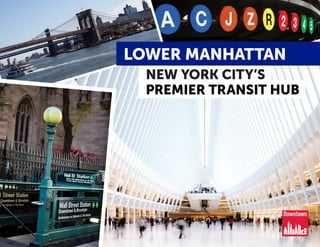
36,778 sq. ft. building; Zoning: SE (Suburban Employment): The (SE) District allows numerous commercial site uses; Passenger elevator; Private and common restrooms; Fully sprinkled; Data center with a grounded floor and a specialized HVAC system; 60 KVA back-up generator; Building/pylon signage; Potential to purchase adjacent parcels; Sale Price: $4,413,360
The SVN® organization shares a portion of their new weekly listings via their SVN Live® Weekly Property Broadcast. Visit https://svn.com/svn-live/ if you would like to attend our weekly call, which we open up to the brokerage community.
Selling your home can be easy. Our team helps make it happen.Eric B. Slifkin, PA
Why hire one realtor when you can hire a team for the exact cost? Our team ensures better service, communication, and efficiency, which can make all the difference in finding your perfect home or securing the right buyer. See how we market homes for sellers.
Anilesh Ahuja Pioneering a Paradigm Shift in Real Estate Success.pptxneilahuja668
Anilesh Ahuja journey is a testament to the power of vision, resilience, and unwavering determination. As a visionary leader, he continues to inspire and empower others to dream big and challenge the status quo. His legacy extends far beyond the realm of real estate, leaving an indelible mark on the industry and the world at large.
Expressways of India: A Comprehensive Guidenarinav14
India’s expressway network is a testament to the nation’s dedication to improving infrastructure and connectivity. These high-speed corridors facilitate seamless travel across vast distances, reducing travel time and fuel consumption
Andhra Pradesh, known for its strategic location on the southeastern coast of India, has emerged as a key player in India’s industrial landscape. Over the decades, the state has witnessed significant growth across various sectors,
🌟 Find Your Balance with Oree Reality
Happy International Yoga Day! 🌿 At Oree Reality, we believe in the harmony of mind, body, and home. Just as yoga brings balance and peace, finding the perfect home can do the same for your life.
Why is Revit MEP Outsourcing considered an as good option for construction pr...MarsBIM1
Outsourcing MEP modeling services require effective collaboration and coordination amongst multiple engineering trades. The engineers and the designers often change the details of the MEP projects, but the work of Revit MEP drafting services is having the master plan and model of the complete project. To have proper coordination and installation, there is a need to execute the project effectively. Hence, the work of Revit family creation facilitates the MEP engineers.
Signature Global TITANIUM SPR | 3.5 & 4.5BHK High rise Apartments in Gurgaonglobalsignature2022
Signature Global TITANIUM SPR launched a high rise apartments in Gurgaon . In this project Signature Global offers 3.5 & 4.5 BHK high rise Apartment at sector 71 Gurgaon SPR Road. Signature Global Titanium SPR is IGBC Gold certified, a testament to our commitment to sustainability.
Listing Turkey - Piyalepasa Istanbul CatalogListing Turkey
We are working around the clock to transform a long-time dream into reality. As a result, Piyalepasa Istanbul will be the largest privately developed urban regeneration project in Turkey.
THE NEIGHBORHOOD WE HAVE BEEN LONGING FOR IS COMING TO LIFE
The good old days of the Piyalepasa neighborhood are being brought back to life with Piyalepasa Istanbul houses, residences, offices, hotels and a pedestrianized shopping avenue.
The wide streets of this 82.000 square meter development conveniently face the main boulevard in a prime Beyoglu location. “Piyalepaşa İstanbul” stands out as the only project designed to offer a neighborhood lifestyle, complete with its grocers, bagel sellers and greengrocer. Piyalepasa Istanbul has all the values to make it an authentic neighborhood, our very own community.
A NEIGHBORHOOD FULL OF LIFE, IN THE HEART OF THE CITY!
“Piyalepaşa İstanbul” is a “mixed-use” concept containing all the elements for a vibrant social life with houses, residences, offices, hotels and high street shopping.
“Piyalepaşa İstanbul” will take the liveliness of Istanbul into its heart. The elegant sparkle of Nisantasi, the young and colorful Besiktas, the variety and multicultural heritage of Istiklal Street will all be contained within the streets of this neighborhood.
“Piyalepaşa İstanbul” bears traces of the most beautiful examples of Turkish architecture from the Seljuks to the Ottomans and from Anatolia to Rumelia. With its graded facades, wide eaves, bay windows, pools, and interior courtyard systems, it offers a new living space without disrupting the city’s silhouette and neighborhood.
“Piyalepaşa İstanbul” is the new attraction of this splendid city.
TO BE AT THE CENTER OF ISTANBUL… THIS IS REAL LUXURY!
With its proximity to D-100 highway, connecting roads and tunnels, “Piyalepaşa İstanbul” is only minutes away from Kabatas, Besiktas, the Golden Horn and Karakoy.
“Piyalepaşa İstanbul” is close to the prestigious new Istanbul Court House, a major hospital, the Perpa trade center and the city’s most lively neighborhoods. With its shuttle service to Okmeydani Metrobus station, Sishane and the Court House subway stations, “Piyalepaşa İstanbul” will provide you with the most convenient transport connections.
https://listingturkey.com/property/piyalepasa-istanbul/
Experience Premier Urban Lifestyle at Kohinoor Satori, Mahalungegraphicparadice786
Experience a harmonious blend of luxury and tranquility at Kohinoor Satori Apartments, situated in the rapidly developing locality of Mahalunge, Pune. These thoughtfully designed residences are crafted to offer a premium living experience, merging modern aesthetics with functional elegance.
Our mail-id-directsite369@gmail.com
Our Website- https://kohinoor.directsite.in/pune/kohinoor-satori-mahalunge/
Gianluigi Torzi | Managing Director and Head of Capital MarketsGianluigi Torzi
Gianluigi Torzi is a prominent figure in the financial industry, known for his strategic leadership as Managing Director and Head of Capital Markets for the Middle East and Africa. Gianluigi Torzi extensive experience in investment banking equips him with the skills to navigate complex financial landscapes and deliver exceptional results for clients
Eco Green Builders in Sydney By Marvel HomesMarvel Homes
Marvel Homes is dedicated to revolutionizing the construction industry with cutting-edge, eco-friendly practices. We specialize in designing and building energy-efficient, sustainable homes and commercial spaces that minimize environmental impact. Our projects feature renewable energy solutions, superior insulation, and innovative green technologies. Committed to reducing carbon footprints, Eco Green Builders combines expertise, innovation, and a passion for sustainability to create spaces that are as environmentally responsible as they are beautifully crafted. Join us in building a greener, more sustainable future.
https://marvelhomes.com.au/our-services/
2. 2Lower Manhattan: NYC’s Premier Transit Hub DowntownNY.com
13 MTA
subway
lines &
2 PATH
lines
3 commuter
ferry landings
with 15 total
routes
28 Citi Bike
stations &
more than
2.3 miles of
bike lanes
260 AM/PM
peak period
trips via MTA
commuter &
express bus
routes
EXTENSIVE TRANSIT INFRASTRUCTURE
Downtown
Connection -
free circulator
with 36 stops
Lower Manhattan’s transportation network provides an unparalleled combination of convenient access to employment, fast commutes and a wide breadth of
transportation options. Home to 13 subway lines, two PATH lines, 15 commuter ferry routes, 28 Citi Bike stations, more than 2.3 miles of bike lanes, four major
vehicle crossings and a major limited access highway, Lower Manhattan is among the most easily accessible business districts in America. And with a direct, 36-minute
transit link to Newark Liberty International Airport in the planning stages, there will soon be another way for the world to come to Lower Manhattan.
Today, workers across the city and region can access Lower Manhattan’s 89 million square feet of office space with commutes that are shorter or equal to the metro
area average commute time. In the next few years Lower Manhattan’s transportation advantages could only grow. Six subway lines servicing the district have the
potential to add capacity, and several of these lines connect Lower Manhattan employers to high growth neighborhoods with more than 22,000 planned or under
construction housing units.
MORE THAN 90 PERCENT OF LOWER MANHATTAN’S JOBS ARE WITHIN A FIVE MINUTE WALK OF SEVEN TO NINE SUBWAY/PATH LINES
Lower Manhattan’s compact size and dense transit network create a wealth of commuting options. More than 90 percent of jobs are a five minute walk or less from
seven to nine different subway or PATH lines. This is unique among Manhattan’s major business districts. Only 49 percent of jobs in Midtown East and less than 30 percent
of Hudson Yards jobs provide the same subway access. Nearly 100 percent of jobs are a five minute walk from one to three subway lines and 41 percent of jobs are within
five minutes of ten or more subway or PATH lines. This unparalleled access extends to ferries as well. With the East and Hudson Rivers on both sides, Lower Manhattan
is at an advantageous location when it comes to commuting by water—more than 97 percent of jobs in the neighborhood are within a 10 minute walk of a
ferry landing.
LOWER MANHATTAN’S REDUNDANT NETWORK PROVIDES OPTIONS NO MATTER THE DESTINATION
Lower Manhattan’s rich transportation infrastructure benefits commuters by providing multiple modes and routes. This redundancy is a boon to commuters dealing
with a regional network challenged by record ridership and ongoing capital work. This makes the district a smart choice for decision makers looking for an office
location served by a wide variety of transit options, many of which offer a one seat ride for employees.
Not only can Lower Manhattan commuters choose from among 13 subway lines and two PATH lines, they can also get to work by driving over the Brooklyn or Manhattan
bridges or through the Holland or Hugh L. Carey tunnels. Drivers can use the FDR Drive while bus riders can take advantage of the 260 AM/PM peak period trips on MTA
commuter & express Bus Routes. Once downtown, the free Downtown Connection bus service (operated by the Downtown Alliance) provides convenient transportation
across the district.
LOWER MANHATTAN’S TRANSPORTATION NETWORK PROVIDES
3. 3DowntownNY.com
1
WTC
2
WTC
3
WTC
4
WTC
September 11
Memorial
R
1
2
2
3
4
6
R
W
A
E
J
Z
WestSt
F
D
R
Dr
MottSt
John
St
Vesey St
Warren St
Pine St
Front St
TrinityPl
Bowery
Beaver St
Grand St
SEndAve
CatherineSt
GreenwichSt
SpruceSt
Bridge St
Exchange Pl
Pell St
WhitehallSt
Henry St
Murray St
2nd Pl
OliverSt
Old
Slip
E Broadway
Liberty St
Stone St
Cliff St
Rector Pl
Morris St
WashingtonSt
Water St
Broadway
NEndAve
F D
R
Dr
W
ater St
Front St
WashingtonSt
PearlSt
BatteryPl
East
River
Hudson
River
Brooklyn
Bridge
Fulton
Center
Fulton
St
Fulton
C
5
By Comparison:
10thAve
W
34th St
W
42nd St
9thAve
11thAve
8thAve
W
22nd St
W
22ndSt
Hudson
River
PennStation
7
C
A
E
PortAuthority
2
1
3
B
D
F
M
3rdAve
5thAve
MadisonAve
6thAve
LexingtonAve
E 57th St
E 54th St
E 49th St
E 47th St
W
55th St
W
52nd St
E 43rd St
W
46th St
W
44th St
W
42nd St
2ndAve
1stAve
Grand
Central
GrandCentral
6
5
4
E
7
S
B
F
M
D
R
W
N
F
3
2
1
A
M
MORE THAN 90% OF JOBS
ARE WITHIN A
5 MIN OF
7-9 SUBWAY/
PATH LINES
Just 49% of Midtown East’s jobs...
& 28% of Hudson Yards’ jobs
have the same access.
AN UNMATCHED COMBINATION OF CHOICE, EASE & SPEED
Business district boundaries based on adjacent
census tracts. Jobs data comes from the U.S. Census,
OnTheMap and LEHD 2014
4. 4Lower Manhattan: NYC’s Premier Transit Hub DowntownNY.com
AVERAGE DAILY RIDERSHIP
282,000
MTA Subway Riders
79,000
Ferry Commuters
44,000
NJ PATH Riders
MTA
PANYNJ
LOWER MANHATTAN’S NETWORK PROVIDES SWIFT,
EFFICIENT OPTIONS FOR COMMUTING ACROSS ENTIRE REGION
ALL “ROADS” LEAD TO LOWER MANHATTAN
of Lower Manhattan’s
workforce is a NYC
resident
>70%
within a 10 minute
walk of at least one
ferry landing
> 97% of Jobs
Public transit travel times to key urban and suburban
markets from Lower Manhattan are below or equal
to the NYC metro region average. According to the
American Community Survey, commuters traveling
by subway in the New York metro region spend an
average of 48 minutes in transit. Commutes to Lower
Manhattan from Jersey City and key neighborhoods
like Park Slope and Greenpoint are all 38 minutes
or less.
The same advantage exists for commuter rail
riders who work in the neighborhood. Average travel
time for commuter rail riders in the metro region is
72 minutes. Commuter rail travel times to Lower
Manhattan from signature bedroom communities
like New Rochelle, NY and Montclair, NJ are shorter
than the average and Hicksville, Long Island is
on par.
Travel times via car to major commuter markets
across the region are all a little more than an hour
or less. In timed trials to six major urban and
suburban commuter markets shown to the right,
five out of six commutes by car were approximately
an hour or less. While drivers represents a small
percentage of Lower Manhattan’s commuting
population (less than 16 percent), average suburban
travel times range from 59 minutes from New Rochelle
to 79 minutes from Hicksville. Commutes from
popular urban markets can be made in less than half
these times. They range from 23 minutes from Park
Slope to 32 minutes from Jersey City.
More than 70 percent of Lower Manhattan’s
workforce commutes within NYC. The majority
of Lower Manhattan’s workforce lives in New York
City. These commuters can get here via Lower
Manhattan’s 13 subway lines, the newly launched
NYC Ferry service and on the MTA’s 23 express and
commuter bus routes serving Lower Manhattan.
More than 17 percent of the workforce commutes
from New Jersey. New Jersey is the second largest
commuter market for Lower Manhattan. PATH service
out of World Trade Center makes Lower Manhattan
the only business district with direct access to
Hoboken, rapidly growing Jersey City and Newark.
New Jersey Transit commuters have two options for
completing their trips to Lower Manhattan. Riders
can travel into Hoboken and transfer to the PATH or
connect to the six subway lines at New York Penn
Station that serve the neighborhood.
About 12 percent commute from Long Island
and New York City’s northern suburbs. Most of
the remaining share commute from Long Island
or suburban counties north of New York City. Long
Island commuters also have multiple connecting
points for Lower Manhattan, including New York Penn
Station and Brooklyn’s Atlantic Terminal. The latter is
approximately an 11 minute subway ride away from
Fulton Center. Commuters from the northern suburbs
can connect to Lower Manhattan from Metro-North
to the Lexington line at Grand Central Terminal. On
an express train, it is a 12 minute ride from there to
Fulton Center.
Source of workers by residence is CTTP data, based on 2010 ACS 5-Year Estimates.
Daily ridership figures are for 2016. Ferry and subway ridership provided by NYC DOT and PATH ridership provided by PANYNJ.
Source of average commute times for the NYC Metro Region is 2015 American Community Survey 5-year Estimates.
Commute times from key locations to Lower Manhattan come from Sam Schwartz’s sample trip analysis.
5. 5DowntownNY.com
Lower Manhattan
New Rochelle, NY
1:1200Hicksville, NY
1:0900 Montclair, NJ
1:08 00
Greenpoint
Lower Manhattan
Park Slope
0:1900
Jersey City
0:2700
0:3800
REGIONAL RAIL COMMUTES
TO KEY SUBURBAN LOCATIONS
EQUAL TO OR SHORTER THAN
NYC METRO AVERAGE
SUBWAY/PATH COMMUTES
TO KEY URBAN LOCATIONS
SHORTER THAN
NYC METRO AVERAGE
1:1200
0:4800
6. DowntownNY.com 6
SUBWAY
51%
COMMUTER RAIL
13%
BUS
12%
+
WALK + BIKE
5%
FERRY
2%
OTHER
1%
AUTO/TAXI
16%
82% COMMUTE BY PUBLIC TRANSIT
MODAL SPLIT OF LOWER MANHATTAN WORKFORCE
Modal split data comes from 2010
Census. Ferry’s share expected to rise
with increases in service in future data.
LOWER
MANHATTAN’S
TRANSPORTATION
NETWORK SERVES
square feet
of commercial
office space
higher education
students
unique annual
visitors
shops, bars
& restaurants
hotel rooms
235,000
private sector
employees
public sector
employees
42,000
89 million
residents
61,000
1,200
14.8
million
56,000
6,600
8. 8Lower Manhattan: NYC’s Premier Transit Hub DowntownNY.com
> 750,000
college-educated,
young professionals
living within a 30
minute commute of
Lower Manhattan
SHIFTING REGIONAL DEMOGRAPHICS SUPERCHARGE
LOWER MANHATTAN’S ADVANTAGES AS A BUSINESS LOCATION
TALENT & TRANSIT DRIVE LOWER MANHATTAN’S TRANSFORMATION
6 Subway Lines
with additional
capacity in
Lower Manhattan
643 Relocations
since 2007, accounting
for over 15.6 million
square feet of office
space
Since 2000, Lower Manhattan and its surrounding
environs have changed dramatically. Neighborhoods
easily accessible via Lower Manhattan’s dense
transportation network—Manhattan below 34th
Street, Brownstone Brooklyn, Williamsburg and
waterfront cities in New Jersey—have also grown
at impressive rates. This growth, combined with
Lower Manhattan’s transit access, has put the
neighborhood in a place to compete for the region’s
most desirable talent pool.
Lower Manhattan is at the epicenter of an area
that has experienced the greatest gains in young,
educated professionals and those working in
creative and professional fields. Since 2000, the
number of college-educated adults between the
ages of 18 and 44 living in a 30 minute commute
of Lower Manhattan has grown by 39 percent to
more than 750,000. The same trend has occurred in
creative and professional industries. More than a half
million people, working in those industries now live
within a 30-minute commute, an 18 percent jump
since 2000. About a quarter of the metro region’s
college educated adults and workers in creative and
professional fields live within a 30 minute transit
commute of this business district.
Companies relocating to Lower Manhattan to
appeal to potential employees are transforming
Lower Manhattan’s office market. The district has
welcomed an increasingly diverse array of companies
including those in technology, advertising, media
and information (TAMI) who have responded to the
above demographic trend by relocating to Lower
Manhattan, helping the district reach its highest
private sector employment since the end of 2001.
Many have moved to be closer to where their
employees live. Today, TAMI occupies 13 percent of
Lower Manhattan’s office space, more than twice
the footprint in 2008 (5 percent). Finance, insurance
and real estate (FIRE) is down to 37 percent from
55 percent in 2008, as TAMI, as well as fashion and
merchandising, healthcare and professional services
have expanded south of Chambers Street.
Capacity on WTC-bound PATH lines expected to
expand with current and planned improvements,
providing greater service from rapidly growing
Hudson County to Lower Manhattan. Current
improvements, including the installation of a state-
of-the-art signalling system, construction of a new
Harrison Station, and a planned expansion of the
Grove Street Station will expand capacity on World
Trade Center-Newark PATH service, whereas there is
little that can be done to expand uptown service.
Lower Manhattan’s subway network directly
connects to areas of strong housing growth along
lines that have potential to add capacity. The
accessible labor force is poised to expand further
as neighborhoods on Lower Manhattan subway lines
continue to add residential units. Based on available
subway schedules and MTA data on effective
maximum track capacity (trains per hour), there are
more subway lines serving Lower Manhattan with
additional capacity than those serving Midtown
East and Midtown West, combined. Six subway
lines servicing Lower Manhattan (the 1, A, J, Z, R
and W trains) can accommodate additional trains
with improvements in infrastructure and signaling
systems. Several of these lines connect Lower
Manhattan to high-growth neighborhoods with over
22,000 planned or under construction housing
units. Notably, Lower Manhattan is the only business
district in the city served by the J and Z lines and
easily accessible to workers in neighborhoods
as diverse as the Lower East Side and Bushwick.
“It’s really where things are
moving. It’s clearly to us the
center of New York City at this
point. Every single subway line
converges around City Hall.”
- Gregg Pasquarelli, Co-founder, SHoP Architects
LM
9. 9DowntownNY.com
Lower Manhattan
JERSEY CITY
+99%
Transit:
19 min
BROOKLYN
HEIGHTS
FORT GREENE
+69%
Transit: 13 min
PROSPECT
HEIGHTS
+123%
Transit:
20 min
LONG
ISLAND
CITY
+57%
Transit:
30 min
HARLEM
+200%
Transit:
30 min
BEDFORD
STUYVESANT
+222%
Transit:
20 min
Lower Manhattan’s subway system connects
to several areas undergoing robust housing
growth over the next several years, including
neighborhoods on subway lines that have the
potential for additional capacity:
A
MIDTOWN WEST
4,800 new housing units in pipeline
R
DOWNTOWN BROOKLYN
10,000 new housing units in pipeline
J/Z
LOWER EAST SIDE
4,700 new housing units in pipeline
39%
IN COLLEGE EDUCATED, YOUNG
PROFESSIONALS LIVING WITHIN A
30 MINUTE COMMUTE SINCE 2000
LABOR FORCE WITHIN A
30 MINUTE COMMUTE
WILL CONTINUE TO GROW
Demographic data on the growth of creative, professional workers and college-educated adults comes from the 2000 Census
and American Community Survey 2013 3-year estimates
Fulton Center
34th Street/
Penn Station
South Ferry
Atlantic Ave/
Barclays Center
Broad Street
Essex Street/
Delancey Street
10. 10Lower Manhattan: NYC’s Premier Transit Hub DowntownNY.com
MAJOR INVESTMENTS PAY OFF
LOWER MANHATTAN’S TRANSPORTATION NETWORK HAS
ADVANCED GREATLY AFTER TWO DECADES OF MAJOR INVESTMENT
ONE-SEAT RIDE TO NEWARK LIBERTY
INTERNATIONAL AIRPORT IN 2026
Lower Manhattan will gain direct transit access to
an international airport when the PATH extension
is complete, which is anticipated in 2026. The
Port Authority of New York New Jersey approved
$57 million in its 2017 budget to fund planning
and design work for the two-mile extension of the
PATH system from Newark Penn Station to Newark
Liberty International Airport. This direct transit
link will raise Lower Manhattan’s profile, as the
business district will join the ranks of other world
class cities with similar access. The travel time
from the World Trade Center Transportation Hub
to Newark Liberty International Airport is expected
to be under 40 minutes, besting current commute
times from Penn Station to both JFK and Newark
airports. The ease and value of doing business in
Lower Manhattan will rise with this capital project.
Events like September 11 and Superstorm Sandy
in 2012 challenged the neighborhood. Subsequent
massive infrastructure investments have yielded a
greatly improved transportation system for Lower
Manhattan. Several planned and funded projects will
enhance Lower Manhattan’s already extraordinary
transportation advantages. And with continued
investment, Lower Manhattan’s centuries old tradition
of connectivity can continue to provide the district’s
businesses and residents with even better access to
the region and beyond.
More than $6.9 billion has been invested in Lower
Manhattan’s multi-modal transportation network.
Since 2001, billions in public investment has
transformed Lower Manhattan’s transportation
network. The area now features two of New York’s
premier transit facilities - the World Trade Center
Transportation Hub and Fulton Center. Investments
have been made at all three of the district’s ferry
landings, to the bike network, most prominently
expanded along the East River waterfront, and to
major thruways like West Street and Broadway.
The aftermath of Superstorm Sandy necessitated
major improvements in the transportation network’s
resiliency. These upgrades include the rebuilt South
Ferry subway station with new flood resistant features,
and flood mitigation measures at the Hugh L. Carey
Tunnel, on West Street and the Battery
Park Underpass.
The World Trade Center Transportation Hub, Fulton
Center and underground connections are important
amenities for the district. The unveiling of the
World Trade Center Transportation Hub and Fulton
Center elevated the commuting experience in Lower
Manhattan and enriched the area’s civic architecture
and public space. The underground connections
and concourse are an amenity, providing cover from
inclement weather, an alternate route to traverse the
neighborhood from east to west, and direct access to
895,000 square feet of retail and an adjacent 16.4
million square feet of office space at the World Trade
Center and Brookfield Place.
Waterborne transportation has expanded greatly
with addition of NYC Ferry Service. Wall Street’s Pier
11 rose to new prominence with the launch of NYC
Ferry service in May 2017. Currently hosting nine
ferry routes, New York’s “Grand Central” for ferries
experienced a 15 percent year-over-year increase in
ridership in June 2017 after the launch of three of the
planned six routes.
The New York City Department of Transportation
is currently installing series of bike routes that will
connect the Battery to the Brooklyn Bridge, further
improving access in the district.
IMPROVED BIKE CONNECTIONS TO
BROOKLYN BRIDGE IN THE WORKS
Source of Map: NYC DOT
36 Minutes
direct to Newark Liberty
International Airport in
2026 from WTC Hub
Source of Map: Regional Plan Association
11. 11DowntownNY.com
KEY TRANSPORTATION INVESTMENTS SINCE 2001
Expansion of Ferry Service
Ferry Terminal Improvements
World Trade Center
Transportation Hub
South Ferry Subway Station Fulton Center
Route 9A / West Side
Highway Improvements
Bicycle Infrastructure
Battery Park City
12. DowntownNY.com
From its beginnings as a Dutch trading post
nearly 400 years ago to its emergence as a
global financial center, transportation has
been at the heart of Lower Manhattan’s story.
Lower Manhattan’s superior connections to the
region, the country and the world have been
central to its growth into one of the world’s
premier business districts. Lower Manhattan
has been defined by transportation innovation
for centuries, ranging from the earliest
steamship to the first East River crossing and
the desegregation of transit in NYC.
This spirit of innovation and investment has
propelled the neighborhood forward over the
centuries and most recently helped Lower
Manhattan reach new heights after September
11th. Maintaining the district’s economic
strength requires continued investment in our
transportation network and bold thinking for
the neighborhood and city. Turning vision into
action requires continued partnership between
the public and private sectors, advocacy
and engagement among Lower Manhattan’s
business and community leaders and the
foresight to plan the best transportation
network for the next 10 as well as 100 years.
Stone Street—New York’s first paved
street completed by Peter Stuyvesant
in 1658.
Fulton Ferry—the first steamship ferry
route by Robert Fulton that connected
Manhattan and Brooklyn in 1814, making
Brooklyn Heights “America’s first suburb”.
In 1854, Elizabeth Jennings Graham,
“Lower Manhattan’s Rosa Parks,” boarded
a segregated streetcar at Pearl Street and
Chatham Square (today’s Park Row) which
led to a landmark court case and eventual
desegregation of all NYC transit by 1865.
The Ninth Avenue El, the first elevated railway
in New York City opened in 1868, running from
Battery Place to Cortlandt Street.
The Third Avenue El opened in 1878,
running from South Ferry to Grand Central.
1658
1814
1854
1868
1878
Map of “New Amsterdam in 1661”
A HISTORY OF INNOVATION
13. 13DowntownNY.com
The following projects would further
enhance the quality, accessibility and
efficiency of Lower Manhattan’s network:
• Fully funding the Second Avenue Subway
to ensure the line runs from 125th Street
to Hanover Square in Lower Manhattan;
• Increase in current rolling stock to allow
for more trains on lines where extra capacity
is possible, and add more cars to lines that
run less than full-length trains.
• Installation of state of the art signalling and
train control equipment on all subway lines
in order to accommodate increased capacity
(trains per hour);
• Integrate the NYC and Hudson River ferry
systems to build on the tremendous success
of NYC Ferry and create a rational and
connected waterborne transportation
network serving the entire region;
• Work with all stakeholders to reduce vehicle
congestion in Lower Manhattan by identifying
creative new ways to handle freight delivery
in the neighborhood;
• Install an east-west bike lane to further fill
out the bike network in the neighborhood;
• Improving district-wide wayfinding and
pedestrian connections to the Brooklyn Bridge
and Chinatown;
• Better organization of tour buses including
limiting licenses and regulation of stops;
• Reconnect Greenwich Street to neighborhood
street grid.
Brooklyn Bridge—the first steel-wire
suspension bridge and longest suspension
bridge in the world at the time of its
construction, opened in 1883.
The Hudson and Manhattan
RR (now the PATH) began service
between Exchange Place in Jersey
City and Lower Manhattan’s
Hudson Terminal in 1909. This was
the first Hudson River passenger
tunnel.
First NYC Subway line opened running from
City Hall to 145th Street and Broadway.
1904
1883
1909
1950
Brooklyn-Battery Tunnel—the Robert
Moses highway project that opened
in 1950, connecting Battery
Park to Brooklyn’s Red Hook
neighborhood.
2014-
2016
Fulton Center and WTC
Hub debut, offering
modern and seamless
underground connections
to several transit lines and
office buildings
13
14. DowntownNY.com
MORE THAN 90% OF
LOWER MANHATTAN JOBS
ARE WITHIN A 5 MINUTE WALK OR
LESS OF 7 - 9 SUBWAY/PATH LINES
“Downtown was the 19th
century center of New York
and it’s the 21st century
center of New York.”
- Gregg Pasquarelli, Co-founder, SHoP Architects
“People just love the
accessibility of this area. It
makes their day easier. They
don’t have to travel far to get
to everyone and everywhere
that they need to go.”
- Dhanusha Sivajee, EVP, Marketing, XO Group
“Lower Manhattan is the future
of New York City, the future
of what’s next.”
- Philippe von Borries,Co-founder, Refinery29
15. 15DowntownNY.com
MORE THAN 97% OF
LOWER MANHATTAN JOBS
ARE WITHIN A 10 MINUTE WALK OR
LESS OF A FERRY LANDING
“It was important to us that all
of our employees could get to
work. Subway access was the
first thing.”
- Alexa Hirschfield, Co-founder, Paperless Post
“We have a lot of young
employees. They were thrilled
with the commute. It cut their
commute by 20 minutes.”
- John Barker, Founder, Barker DZP
“You want great space great
services, easy transportation.
It’s all here. This is the original
part of the city.”
- Andrew Essex, CEO of Tribeca Enterprises,
former CEO Droga5
16. DowntownNY.com
Contributing Staff
Andrew Breslau, Senior Vice President, Communications and Marketing
Josh Nachowitz, Vice President, Economic Development
Alison Baumann, Assistant Vice President, Research
Jarrod Grim, Senior Research Analyst
Joseph Ferris, Editorial Manager
Bathsheba Parker, Graphic Design
Board of Directors
Hon. Bill de Blasio | Hon. Gale A. Brewer | Hon. Margaret S. Chin | Hon. Scott M. Stringer
Cameron Blanchard | Betty Cohen | John V. Connorton Jr. | Fern Cunningham | K. Thomas Elghanayan
David V. Fowler | Brett S. Greenberg | Francis J. Greenburger | Erik Horvat |Thomas M. Hughes
Steven Hurwitz | Rev. Phillip A. Jackson | Stephen Lefkowitz | Andrew S. Lynn | Miguel McKelvey
Ross F. Moskowitz | Anthony Notaro | Dan Palino | Antonio Perez | Edward V. Piccinich | Seth Pinsky
Charles C. Platt | Peter A. Poulakakos | William C. Rudin | Frank J. Sciame | Cynthia Rojas Sejas
Allan G. Sperling | Kent M. Swig | Angela Tribelli | Matthew Van Buren
Ric Clark, Chairman | Jessica Lappin, President
Sam Schwartz Engineering conducted a comprehensive accessibility and
transportation study and provided source material for this report.
This report as well as other research on Lower Manhattan are available here:
http://www.downtownny.com/research-statistics
Photo Credits:
Mark Weinberg for Utopia, The Agency - cover, 5, 11, 13, 14
MTA - 11
NYC Ferry - 11, 15
New York Public Library Digital Archives - 12, 13
Museum of the City of New York - 12