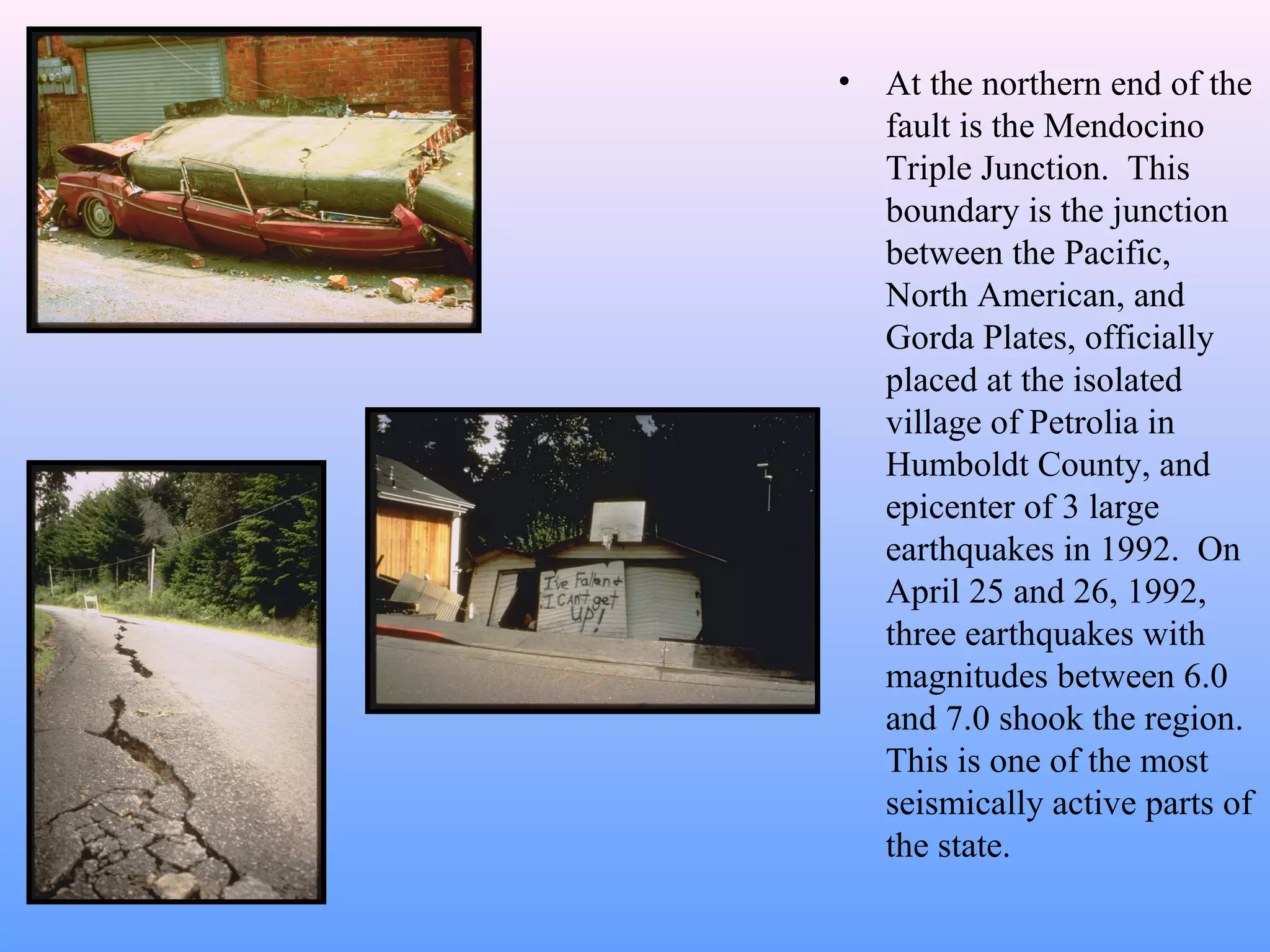
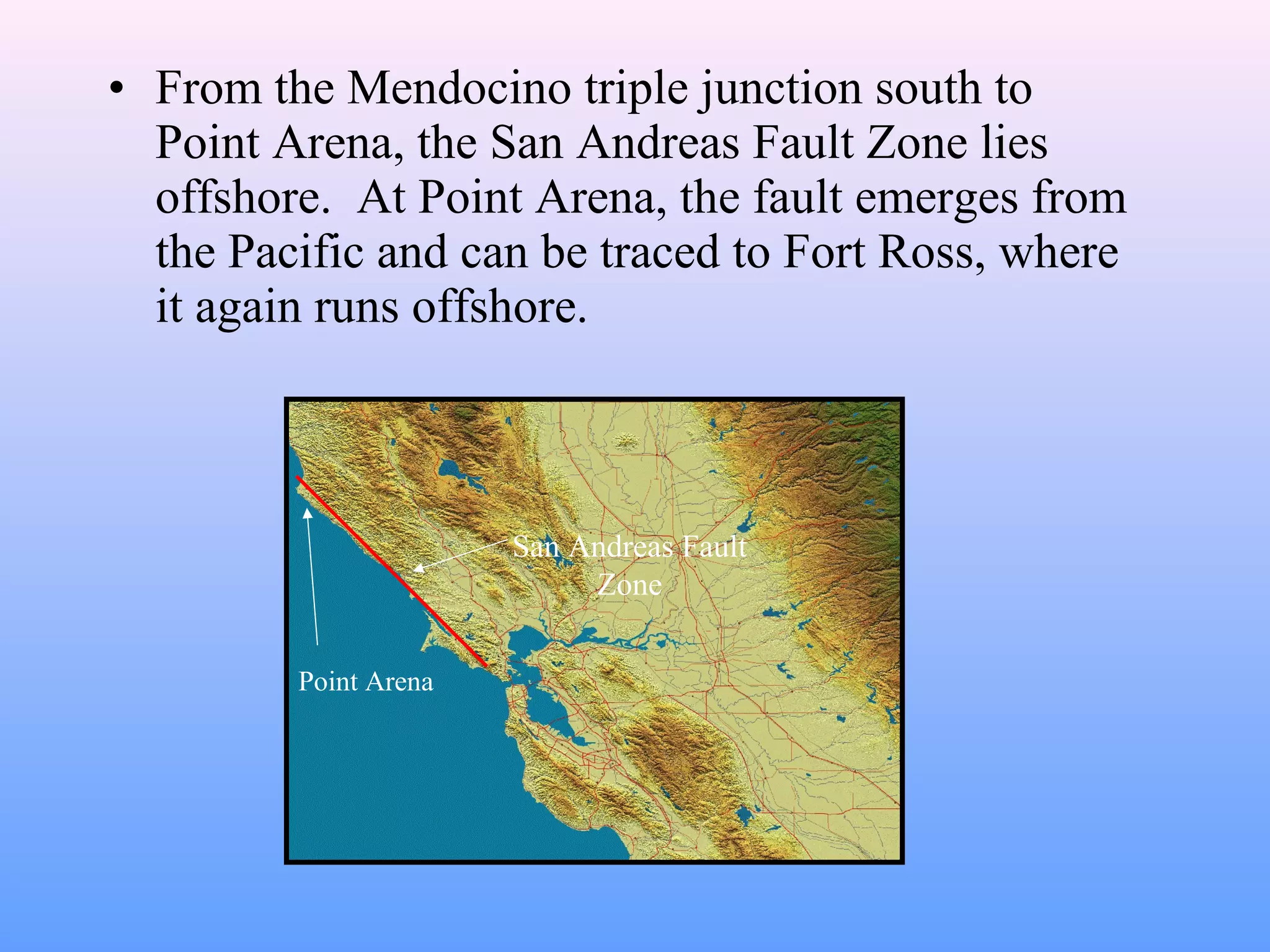
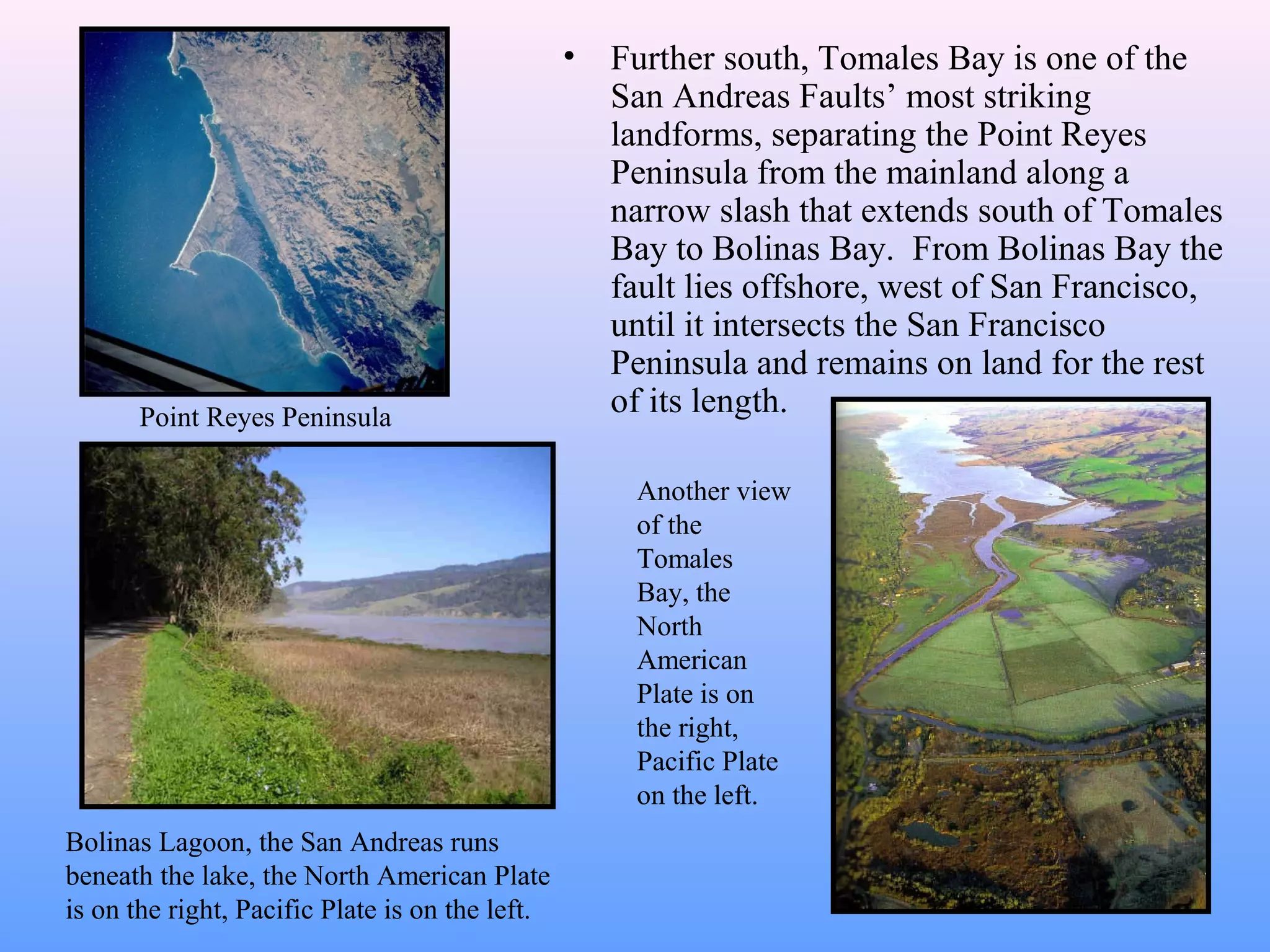
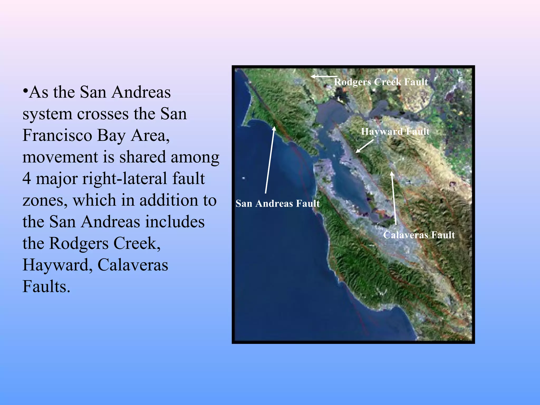
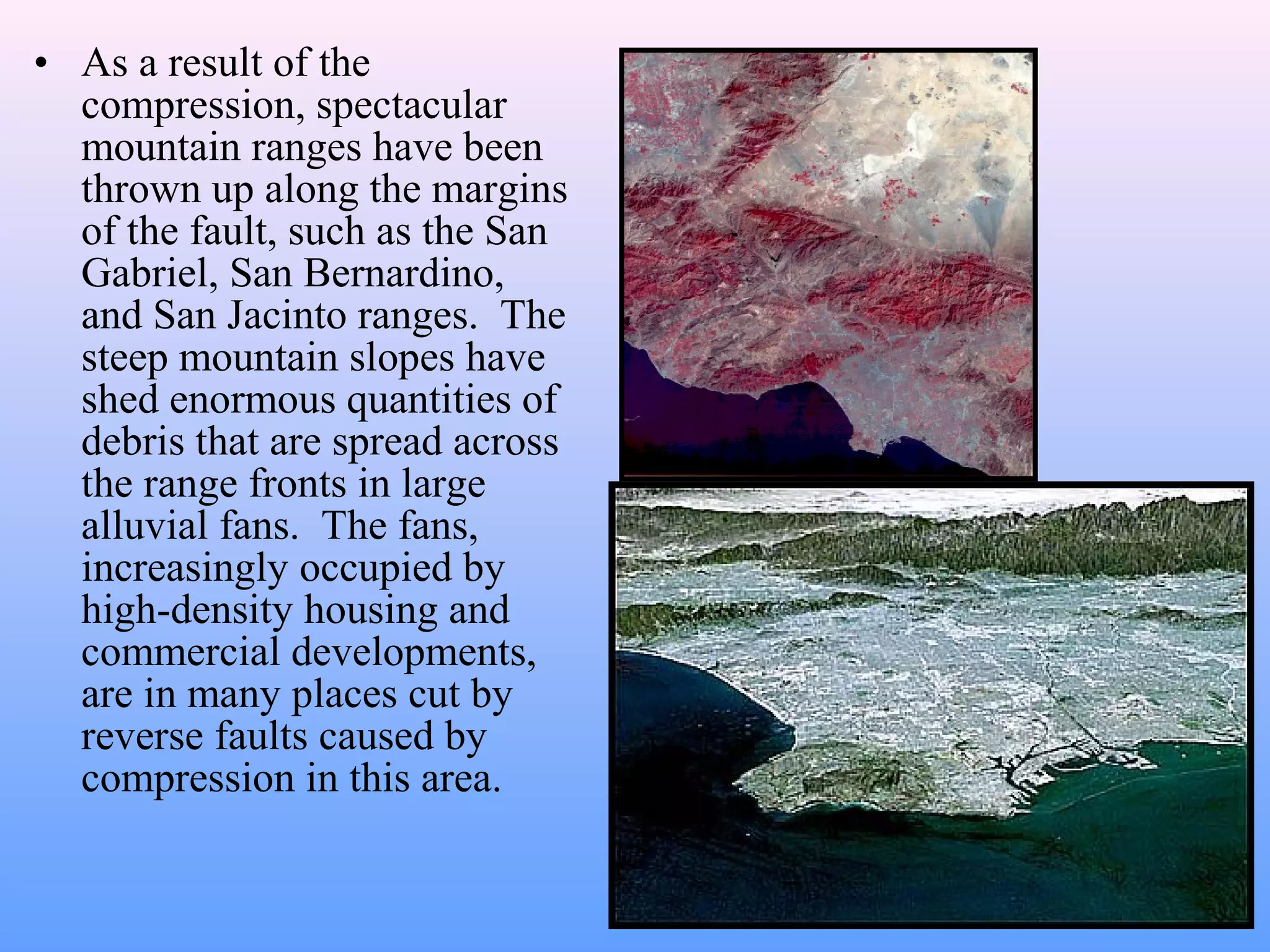
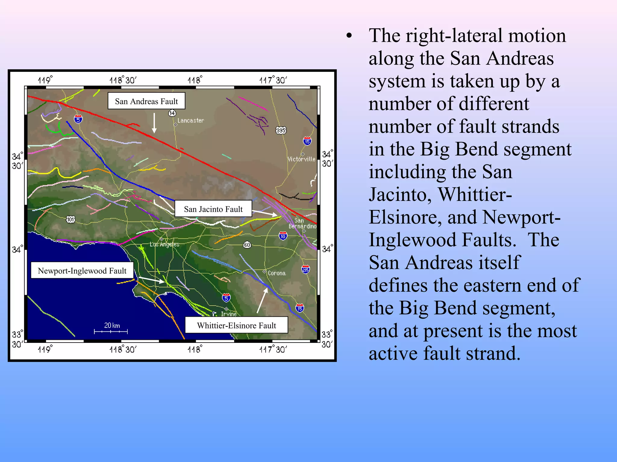
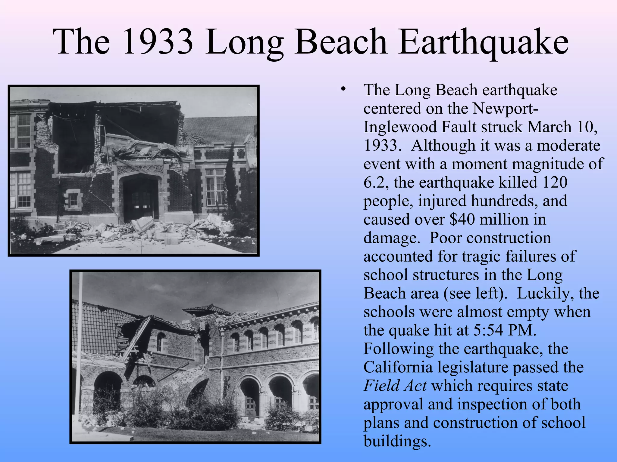
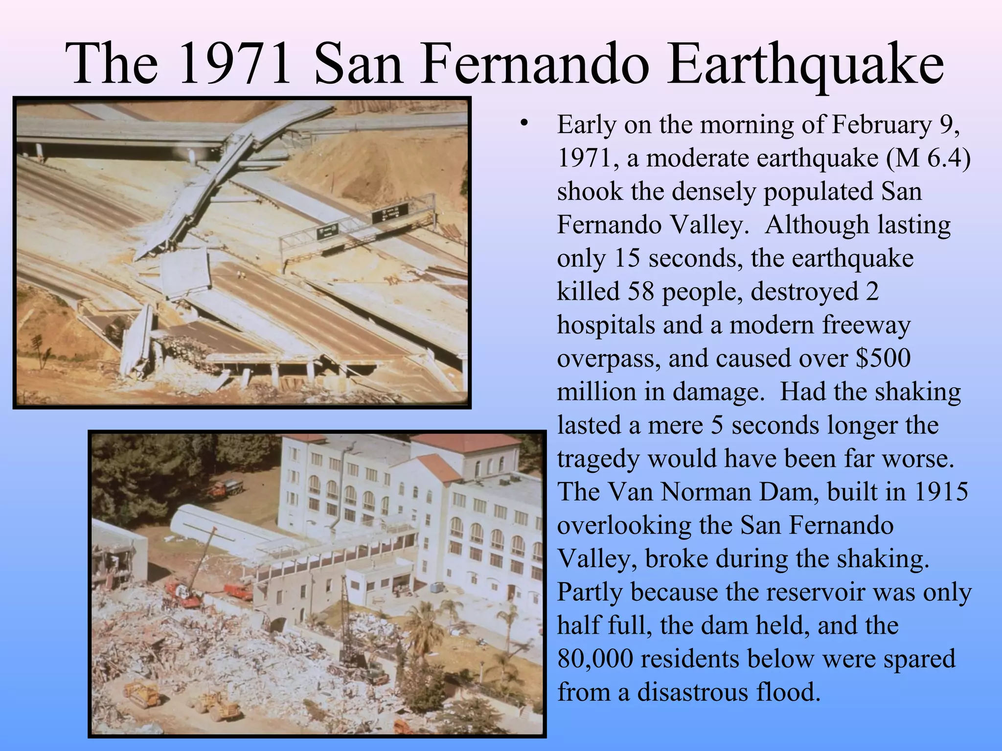
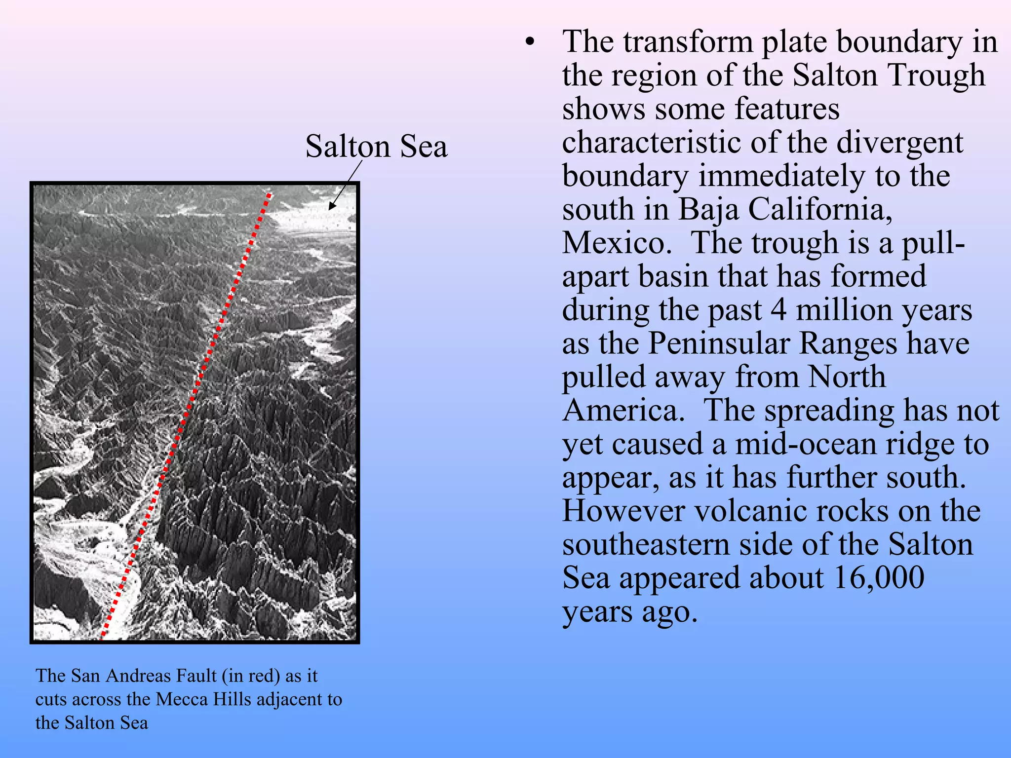
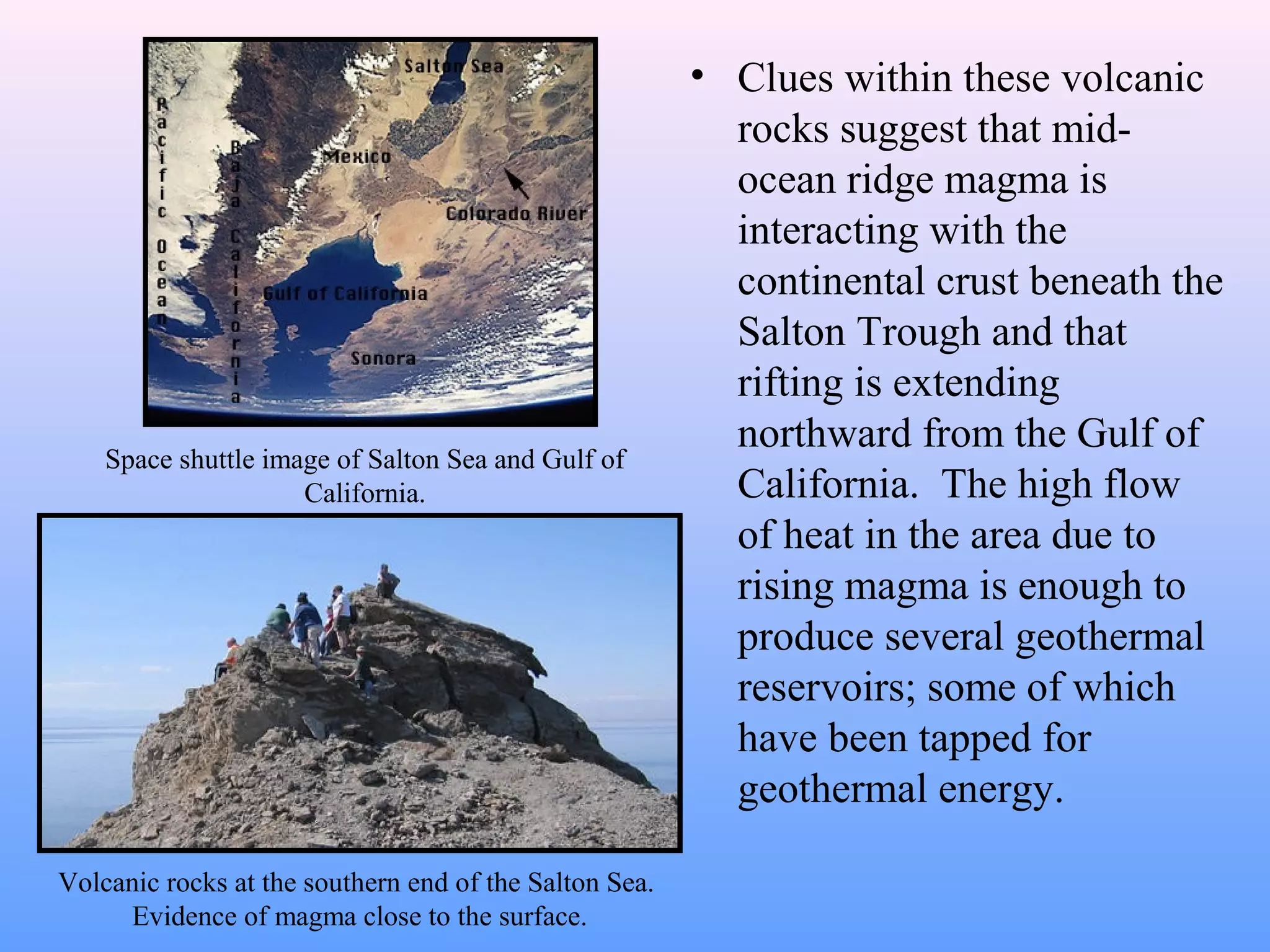
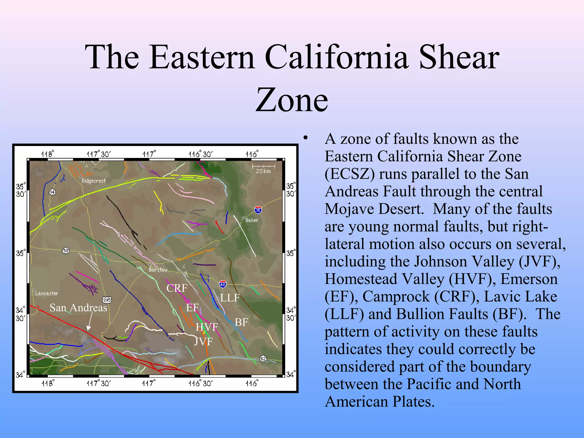
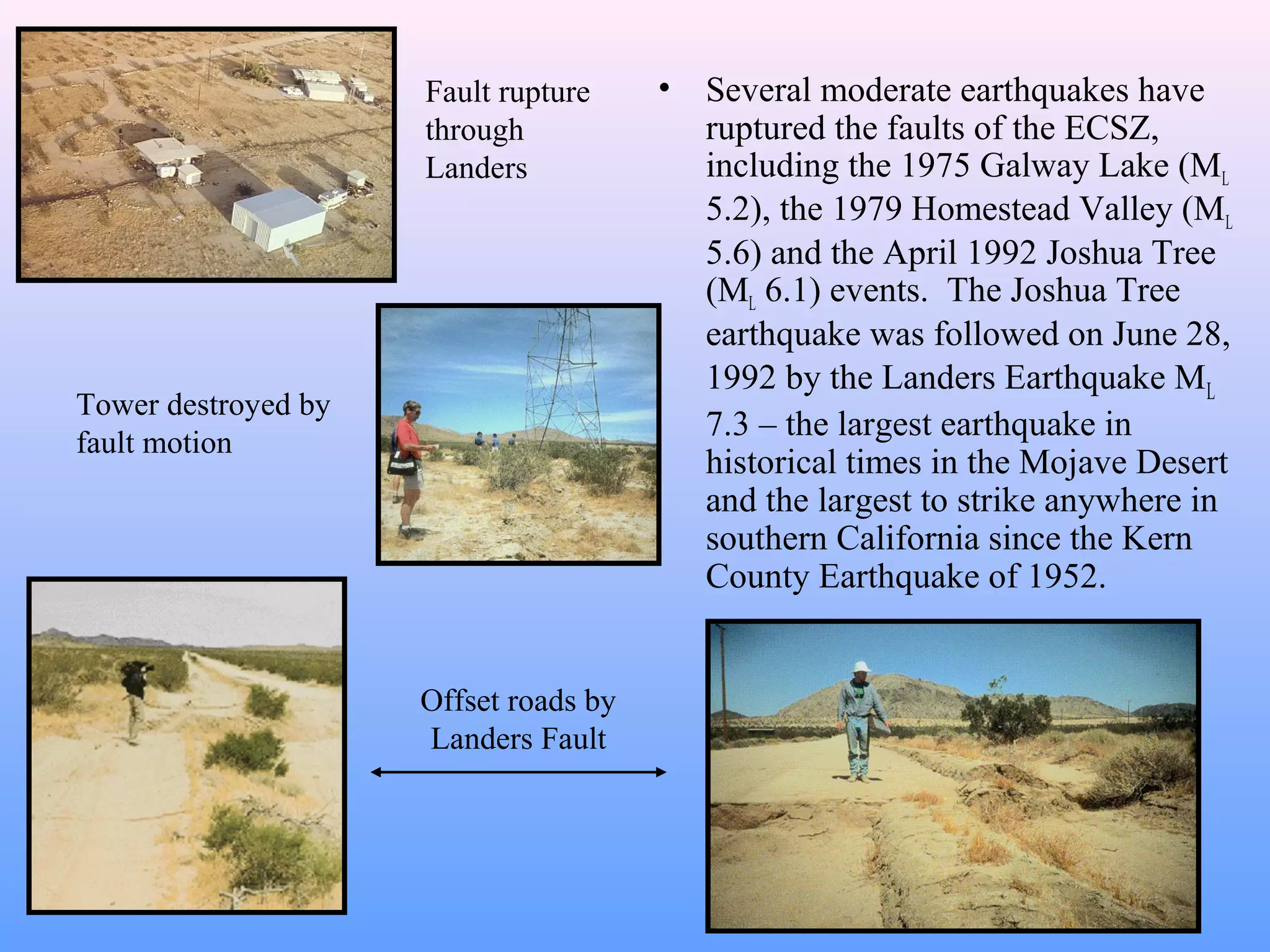
The document provides an overview of the San Andreas Fault system in California, describing its topography, fault characteristics, earthquake history, and major earthquakes. Some key points:
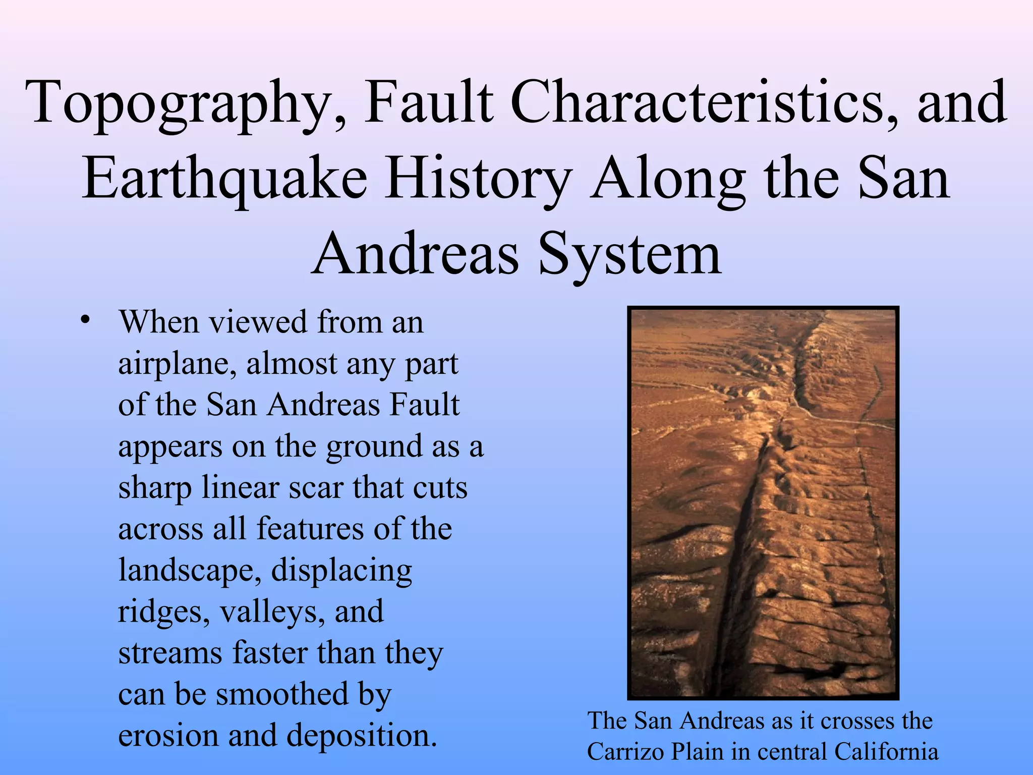
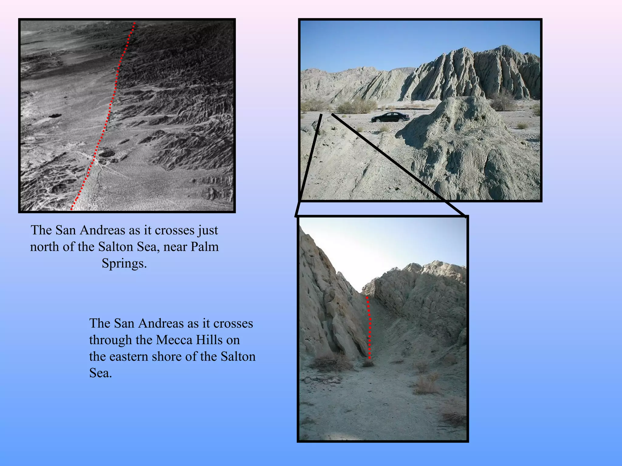
- The San Andreas Fault is visible on the ground as a sharp linear feature that cuts across the landscape.
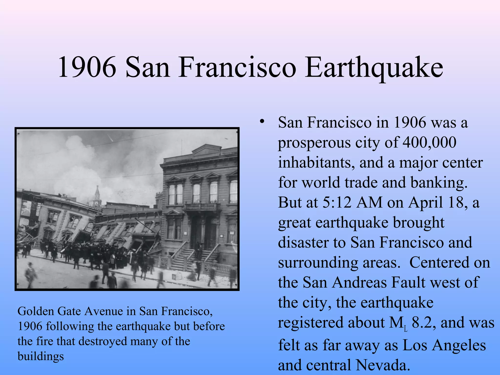
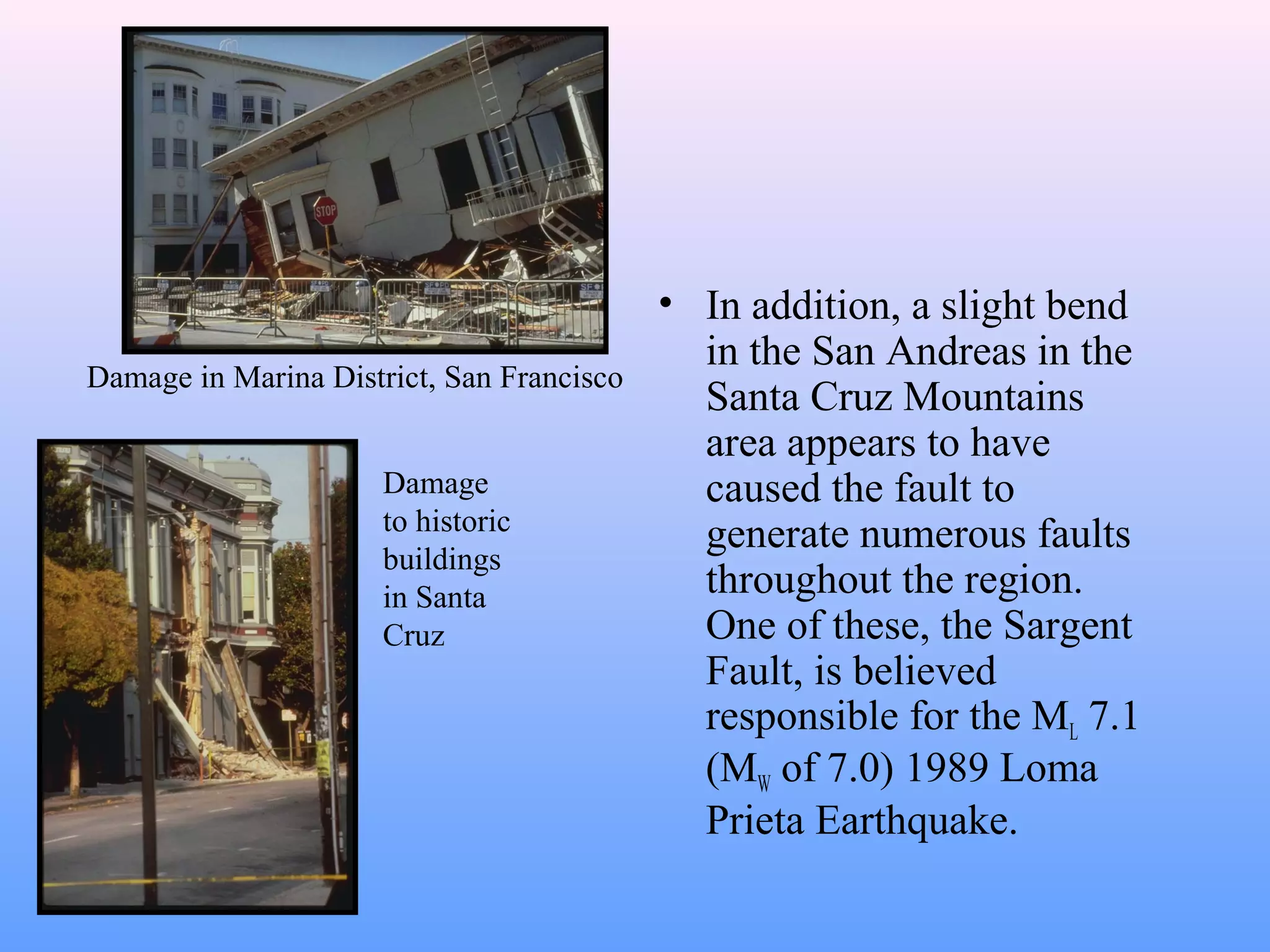
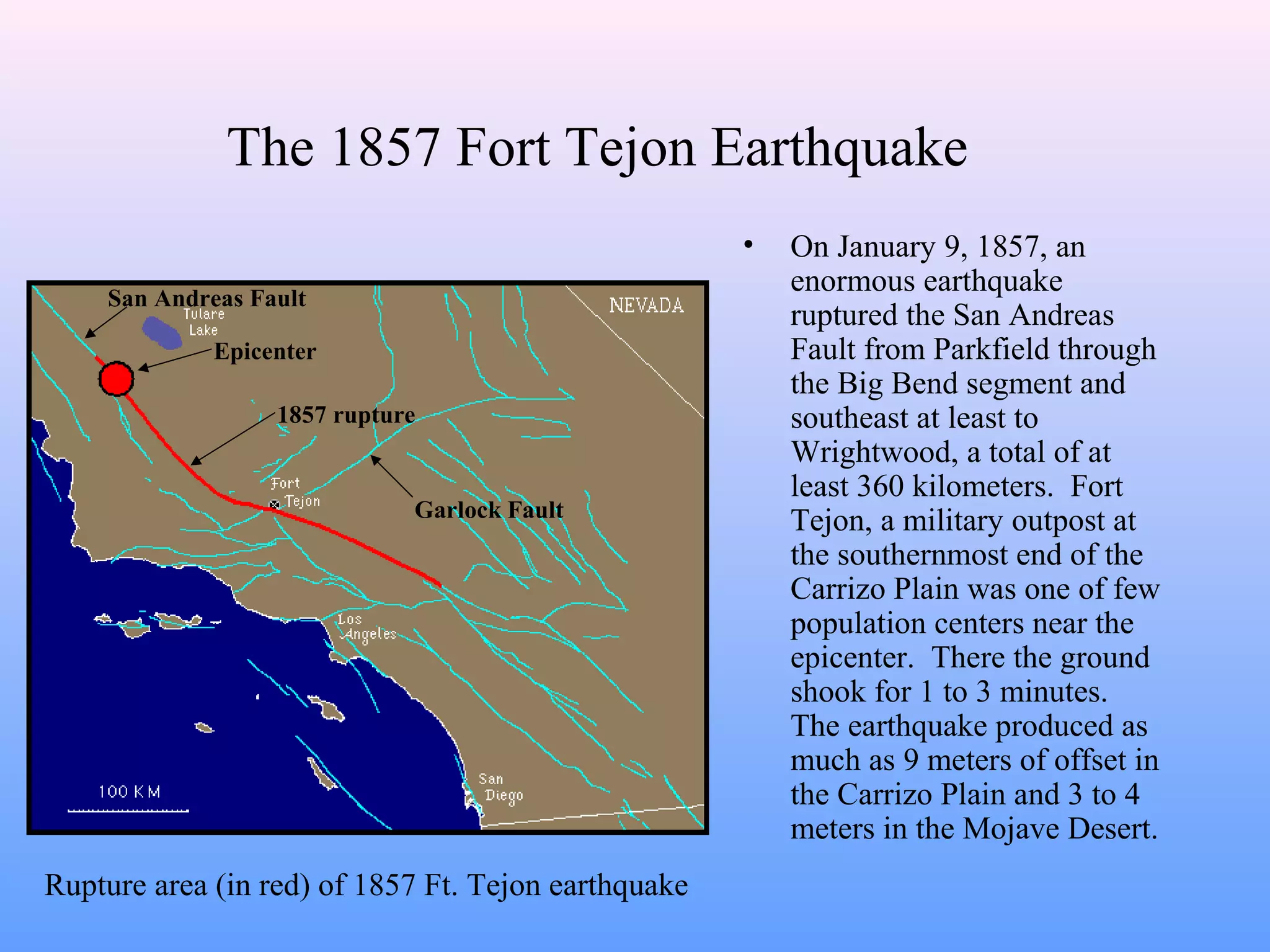
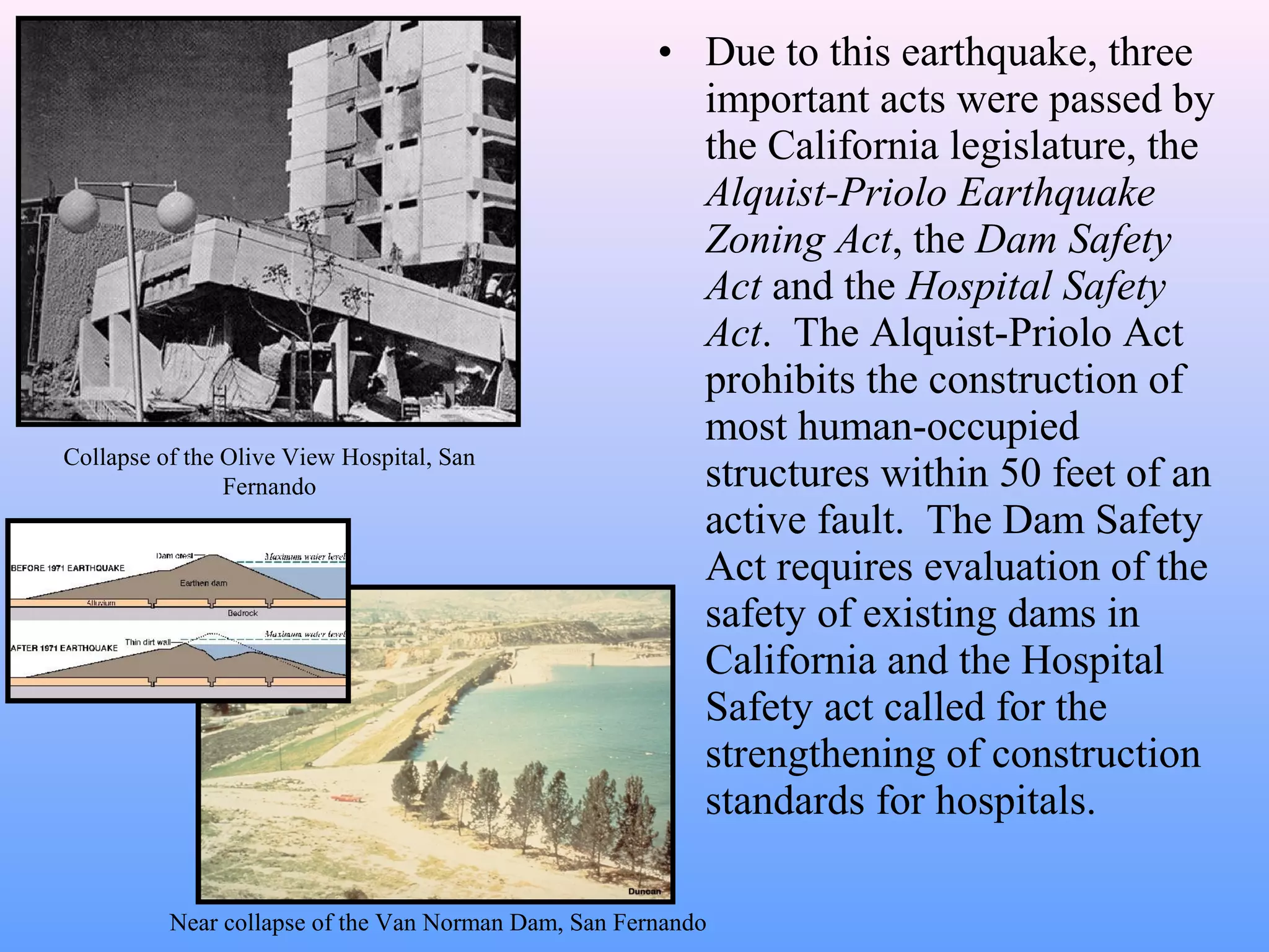
- Major earthquakes on the fault include the 1906 San Francisco earthquake (Magnitude 7.9), the 1857 Fort Tejon earthquake (Magnitude 7.9), the 1971 San Fernando earthquake (Magnitude 6.4), and the 1989 Loma Prieta earthquake (Magnitude 6.9).
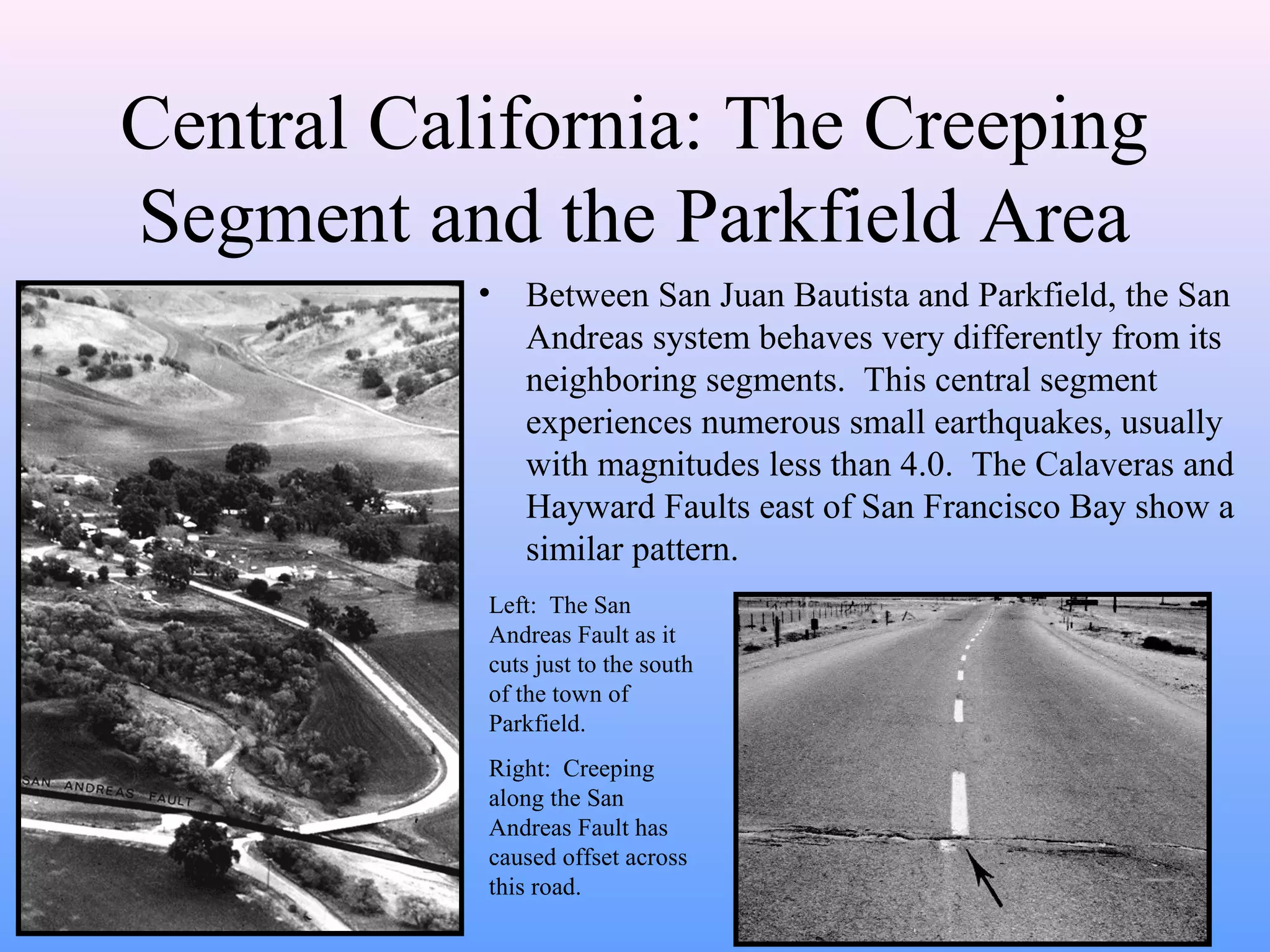
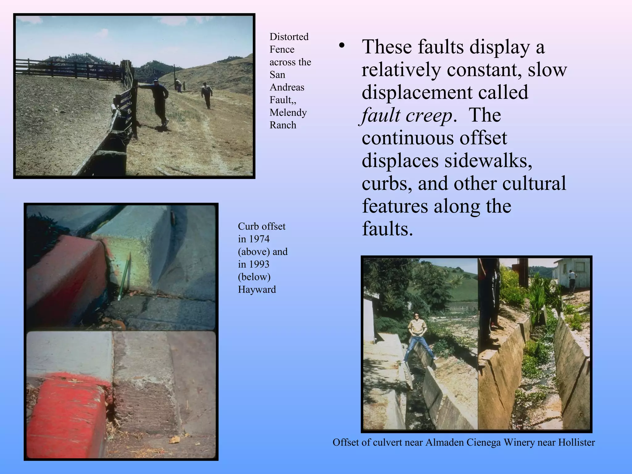
- The section of the fault between Parkfield and San Juan Bautista displays "fault creep", or continuous slow displacement without