
Recommended
Recommended
More Related Content
What's hot
What's hot (20)
Viewers also liked
Viewers also liked (16)
Similar to SPRC Equity Booklet (2015)
Similar to SPRC Equity Booklet (2015) (20)
SPRC Equity Booklet (2015)
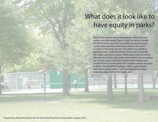
- 1. 1 What does it look like to have equity in parks? Most of the factors surrounding equity within the park system are interrelated. Equity could be used as a guide for determining areas that exemplify our growing park system and areas that need improvement. Because it is a topic of growing concern, this will act as a guide in gaining a basic understanding of some ways to identify the equity spectrum in parks. While observing the current effectiveness of the park system this booklet aims to explain our chosen equity indicators and provide readings and visuals of how to break down the complex subject of equity in parks. The identified readings, videos, and podcasts attempt to build a better understanding of how these indicators play a role in the equity story. Prepared by Alexandra Olson for the Saint Paul Riverfront Corporation August 2015
- 2. 2 WHY EQUITY?......................................................... 3 Explanation on park leadership and where we can go WHERE TO START................................................... 4 Thoughts on how to begin thinking about equity in parks VISUALIZING EQUITY...................................... 5-10 A breakdown of equity indicators Environmental Justice.............6 Public Health......................... 7 Accessibility...........................8 Economic Development........ 9 Sustainability.........................10 TO THE FUTURE.................................................... 11 Questions to guide thoughts on how equity can be addressed ACCESSIBILITY EXPERIMENT..................... 12-15 Destination Park .......................12 Comparing Parks .................. 13 Access via Bus .........................14 Access via Bicycle ........................15 EXPLORATION LIST ............................................ 16 Readings, Podcasts, and videos to dive deeper REFERENCES .........................................................17 Table of Contexts
- 3. 3 The Twin Cities park systems can be looked at as a place that tries to integrated best practices at a city level. The Trust for Public Land’s parkscore is an impressive 84 out of 100 for both Saint Paul and Minneapolis placing them first on the list of the 75 largest cities in the United States. The groups most affected by unequal access to parks through distance, programming, infrastructure or amenities offered are often face many social disparities. Evaluating the how effective our parks are currently serving these communities will help find ways to continue to provide spaces that have and continue to move the equity conversations. Studies have shown that interactions with green spaces“promotes psychological restoration, enhanced mood, improved attention, and reduced stress and anxiety” (Wolf, 2014). When park access can begin to bridge gaps in health disparities between different socioeconomic classes, a high importance should be placed on the amenities offered throughout the city (Wolf, 2014). The seven-county Minneapolis-St. Paul region has been an innovator in creating a shared and equitable future (PBS Newshour, 2015). When the Minnesota Legislature created the Fiscal Disparity tax and put it into law in 1971, it was intended to improve equity by reducing stresses on lower income and newly developing neighborhoods that lacked the wealth seen in affluent neighborhoods (Metropolitan Council, 2015). That same ideology can be used to improve on the strong building blocks that have created the current park system. We are seeing a demographic shift in people of color moving from 17% of the population in 2000 to 24% in 2010 (Policylink, 2014). As obesity rates in the Twin Cities rise to a disproportionate 19% in the white population to 39% in the black U.S. born population the need for places people feel comfortable participating in physical activities could help reduce these numbers (Rose, 2013). Many of these families currently reside in lower income neighborhoods. Because these neighborhoods have higher rates associated with a lack of physical activity the need to have more attention on the educating and allowing access to high quality spaces could positively affect the families living here. Leadership of the Twin Cities 3
- 4. 4 To achieve an equitable park system everyone must be able to enjoy the same degree of access to quality parks that are free of health hazards and provide an environment that promotes physical activities to be enjoyed by all cultures and ages. The quality of the parks that are well loved can be used as a bar for the programming, infrastructure, and maintenance for many low income predominantly minority neighborhoods that have some level of deprivation amplification. The parkscore is a great start when addressing the concerns of a city, but“poorer neighborhoods may not be disadvantaged by the location of specific resources, it may be that they are disadvantaged in terms of quality; for example outdoor playgrounds may be less attractive, have less equipment or have equipment in greater need of repair, or be seen as more dangerous, in poorer areas”(Macintyre, 2007). Keeping social equity at the forefront of progress and linking it to important metrics that benefit all citizens can move the park system toward a sustainable system that promotes the health and enjoyment of the people around it. To continue to be seen as a leading and innovative city anticipation of the community needs could be used to start conversations on the direction and growth of the future. How do we move toward success? 4
- 5. 5 Visualizing Equity It can be confusing trying to understand the how to look at a park and identify the ways that it is addressing equity. The complexity of the subject has been broken down into five indicators that have been identified as areas that leaders in the field are currently talking and writing about. Going through each indicator there is a description of how it relates to the issue of equity in the park system alongside photographs from a sampling of parks in Saint Paul. These photos show a spectrum of how well the Saint Paul park system is meeting these indicators and where there could be improvement to strengthen these ideas. 5
- 6. 6 Environmental Justice Environmental justice defined by the EPA as the“fair treatment and meaningful involvement of all people regardless of race, color, national origin, or income with respect to the development, implementation, and enforcement of environmental laws, regulations, and policies”(EPA, 2015). New studies highlight the importance of extending environmental justice efforts beyond old parameters such as: dealing with environmental hazards, toxins and sites such as brownfields, factories, and old dumping sites. Whereas the original environmental justice alliance focused on prevention of illness due to industrial pollutants, the new alliance would be principally aimed at managing and preventing chronic disease, including mental illness and those brought on by sedentary lifestyles and choices. Chemical Treatment Near Water Runoff Education Water Runoff Hazards Plant IntegrationPollinator PlantingsErosion Watershed Education 6
- 7. 7 Public Health Public health impact is vital when examining how parks and other green spaces should be located, planned, and operated. All of these spaces impact public health by filtering air pollution, reducing stress, providing positive emotional responses, and providing healthy foods (Alcock, 2013). These effects, and more, can be heightened in communities currently most impacted by the negative health impacts of the low income and systematic inequities. The effects of low income status on health can include higher rates of health disparities and chronic stress due to poverty, joblessness, and reduced education opportunities closely relating to differences in lower and upper income levels (Wolf, 2014). Local Playground Health Warnings Bike Tune UpEnvironmental Information Trail Information Bike Tune Up 7
- 8. 8 Accessibility Accessibility to parks could be defined by physical location of a park and how one gets to it, but it can also be used to identify a creative and diverse range of experiences attractive to a wide range of people through programming or amenities. Open spaces for games, playgrounds, community centers, access points, and programming should work around the interests of the community while filling in the gaps that draw in users from different cultures. Each community must have physically accessible spaces. These parks become an information hub to the rest of the city to may users. If a destination park is the next step there should be information available at this local level to more the users forward. At a system wide level, destination parks and open spaces must be accessible from a variety of transit modes and income levels. If we focus on providing resources that connect target communities to promote equity within and beyond the local parks to groups without traditional access. Analysis and intervention to address accessibility requires greater collaboration between park organizations and with other interest groups such as traffic planners and bus services. Trail AccessTrail Access Car Access Local Access Facility Access Facility Access 8
- 9. 9 Economic Development Promoting equity within and beyond the parks, particularly in urban locations is important, but being able to incorporate economic development in the proper way in can be a force working for the good of the neighborhood instead of just for the companies. Workforce development can help create neighborhoods of opportunity throughout the city. Recreation and conservation create opportunities for workforce development through both public job training and private employment organizations. Robust parks can also be positioned to help support or even incubate local business in the environmental, recreation, and entertainment sectors and beyond. These types of economic endeavors can help offset gentrification, tourist activity, or other socioeconomic changes that may accompany opens space improvement. Rentals Renovation River Entertainment River Industry Advertising Artist Support Local Business Support 9
- 10. 10 Sustainability Future parks must be supported by a wider coalition of people from a variety of backgrounds looking at both the community and global issues that will continue to effect our homes. Designing programming to adjust and react to changes while adapting usefulness through the changing context of the city will test the effectiveness on these places over time. Understanding the way a park can evolve and draw people in, as well as, deter individuals from using the space pushes us to meet our unknown needs and redesign the way people interact with and use parks. We can design spaces that meet the needs of users for more than just a generation. Spiritual, recreational, and visual aspects of the park space can be used to round out the way our parks can support unique experiences. Local Business Support New Technology Access to ResourcesEducation New Plantings Restoration 10
- 11. 11 Questions can be used as a tool to direct how we understand the needs of any given space. The questions provided are a starting point when discussing the needs and wants of the communities and park system. Who are the users and how do they use the parks? Are the parks set up inter-generationally? Inter-racially? Who are the parks“marketed”towards? Are they for the populations currently using the space? Are they trying to draw in a new demographic and what does that mean for the residents? How are people getting to the park systems? Is public or alternative transit a prioritized option? How far are park users traveling? Are the parks within walking distance meeting the needs of the users? What type of park is it? What are the desired outcomes for programming and amenities? Who is using the park during different times of the day? Gaining a better understanding of the types of green spaces that could create more shared spaces for the community would be a starting point for efforts concerning how urban planning can be prioritized. Biophilia suggests that natural environments have direct contributions to human health so becoming a biophilic city would be a forward step in the continued support of a greener and healthier city. Saint Paul is in a strong position to push the connections of the green and blue spaces of the city. Through the lakes and the Mississippi River there are many opportunities to create connections through education, infrastructure, and conservation. Increased public transportation, bike paths, tours, and parklets could provide opportunities to educate and encourage people to build environmental values and relationships within the community. As communities develop deeper values for these green and blue spaces the national park could provide a connection at the city’s heart similar to the daylighting of the rivers in Oslo, Norway where they plan to create quiet zones and connections between the river and the city (Clancy, 2014). Forward Thinking Time to ponder Harriet Island Griggs Playground
- 12. 12 Destination Park Located along the Mississippi river, Harriet Island offers visitors free access to a part of the Mississippi National River and Recreation Area an area maintained in part by the National Park Service. Centrally located in the heart of Saint Paul, Harriet Island serves as a main access point to the Mississippi River. It offers visitors may different ways to enjoy the outdoors including biking, hiking & walks, history & culture, boating & canoeing, picnicking, and tours through the National Park Service. It also plays host to a number of cultural festivals, sponsored runs, family friendly events, weddings and more. As the park stands, it is used by a wide variety of residents and visitors of the city. However, Harriet Island is still not easily accessible by bus and can be confusing to get to when not using a car. We used this location as point to evaluate the way- finding experiences of travellers from two chosen locations. We selected two communities within comfortable biking distance to Harriet Island, our destination park. We started the routes at Edgecomb Park and West Minnehaha Community Recreation Center. These Parks are in neighborhoods located on opposite ends of the economic spectrum. Old Growth TreesFamily FriendlyPublic BikesRiver Entertainment Water AccessOpen Event Space 12
- 13. 13 Macalester Groveland Baseball Field Playground Bus Access Recreation Center When comparing West Minnehaha Community Recreation Center with Edgecombe park we can find our equity indicators in various forms. These parks are located in neighborhoods that are opposite the socioeconomic spectrum. West Minnehaha Community Recreation Center has been a part of the neighborhood since 1937 providing a space for the community to host events, local school teams, and public recreation. It was designed and built during Clarence“Cap”Washington’s tenure, who was regarded as the nation’s first African-American Municipal Architect (McClure, 2015). It is also home to the Frogtown Neighborhood Association. Edgecombe Recreation Center is tucked away in a quiet residential section of the Macalester-Groveland neighborhood. It host many activities mainly for its younger visitors that include summer programs, classes, and camps. It is also the home of the MacalesterGroveland Community Council. The two parks both demonstrate a positive presence and a gathering place for ideas in the communities. Each park was seen as a great starting point in the equity discussion and was used as a point in our accessibility study on commuting between these neighborhoods to Harriet Island. Public Art Baseball Field Playground Bus Access Recreation Center Public Art Thomas-Dale (Frogtown) 13
- 14. 14 North End Payne-Phalen Dayton's Bluff Thomas-Dale Summit-University Downtown West Side Battle Creek-Highwood Greater East Side St. Anthony Park Hamline-Midway West Seventh Merriam Park, Lexington-Hamline Highland Como Macalester-Groveland Summit Hill Median Income (Thousands of Dollars) 32 705540 86 78 50 21 PercentWhite Bus route used in study Bus stop within quarter mile of park Other bus route Actual route taken Access Via Bus When traveling by bus the rides were similar. Each trip was close to 30 minutes, and to get closer to the park both trips would have needed to transfer to cross the river. Neither bus route offered a route straight to Harriet Island and both dropped the rider off with a walk across a bridge and unclear way-finding to the park itself. There was a notable difference in the sidewalks of the bus stops of the two communities. Map Prepared by Benjamin Levin and Soren Walljasper for the Saint Paul Riverfront Corporation August 2015 Thomas-Dale Mac-Groveland
- 15. 15 Median Income (Thousands of Dollars) 32 705540 86 78 50 21 PercentWhite Seperated Bike Trail Bike Blvd. On Road Bike Path No Bike Path North End Payne-Phalen Dayton's Bluff Thomas-Dale Summit- University Minnehaha Rec Center Edgecumbe Park Harriet Island Downtown West Side Battle Creek- Highwood Greater East SideSt. Anthony Park Hamline-Midway West Seventh Lexington- Hamline Highland Como Macalester- Groveland Summit Hill Bike lane on Minnehaha Ave discontinues through Thomas-Dale. A lot of shattered glass and potholes on the road, making for a stressful ride Path of Least Resistance: Sidewalks are narrow and discourage walking Green space along the street limited Evaluating Accessibility of Different Neighborhoods in St. Paul Bike lane is under construction on Como Ave, However general conditions improved from Minnehaha Ave Confusing signage and Autocentric design around Capitol Hill. Lack of bike lanes makes riders feel unsafe while biking through Downtown to stop more than they go. It’s extremely hard to feel like one is getting a good workout Getting from the bike path across the river is the biggest challenge with few stops. It’s designed for biking. Although a large portion of the ride considered a“Bikeway,”meaning that the street is consciously designed for bicycle and pedestrian safety and ease This map sets out to identify pitfalls in the bike routes between Harriet Island and two neighborhoods, Thomas-Dale and Macalester- Groveland. These neighborhoods are on opposite ends of the socio- economic spectrum, Thomas-Dale being low-income and racially diverse while Macalester- Groveland has higher income Access Via Bike The suggested bike route on Google maps does not account for the closer of the Wabasha bridge, so the rider had to go out of the way to get across the river. Biking between the two locations required a lot of stopping while on city streets making it difficult to get a good workout. However the bike lane on Como avenue created a good condition to follow. There was little green space on the Frogtown ride creating a less than desirable view. Map Prepared by Benjamin Levin and Soren Walljasper for the Saint Paul Riverfront Corporation August 2015
- 16. 16 Further Explorations Environmental Justice “Environmental Equality Briefing”- Nature Sacred “What Makes a Biophilic City?” - Landscape Architects Network “Places to Play: Environmental Justice and the Distribution of Urban Parks and Recreation in Los Angeles - American Institute of Architects Public Health “Park Improvements and Park Activity: A Natural Experiment.”- American Journal of Preventive Medicine “Green Space, Urbanity, and Health: How Strong Is the Relation”- Journal of Epidemiology & Community Health “The Health and Social Benefits of Recreation” - parks.ca.gov “Reflect &Restore”- Nature Sacred Accessibility “Why Are Our Parks So White?”- The New York Times “National Parks Try to Appeal to Minorities.”- The New York Times Episode 09: 99% Private -99percentinvisible.org Episode 51: The Arsenal of Exclusion - 99percentinvisible.org Economic Development Economic development - www.planning.org “Planning the Urban Forest: Ecology, Economy, and Community Development”- American Planning Association Economic Benefits of Green Spaces - Projectevergreen.org Sustainability Biophilic Cities: Integrating Nature into Urban Design and Planning - Beatley, Timothy The Nature of Cities - Throughline Productions How Public Spaces Make Cities Work - Ted.com/ Creating 8-80 Cities, From Thinking to Doing - TEDxCarlton Below is a curated list of readings, videos, and podcasts that have been identified to further understand the way these equity indicators are impacting the park system. This list is meant to be a way to quickly understand how these indicators are being studied and talked about. Lower Landing Mattoks Park Irvine Park Keller Park 16
- 17. 17 References Readings: Alcock, Ian et al.“Longitudinal Effects on Mental Health of Moving to Greener and Less Green Urban Areas.”Environmental Science & Technology 48.2 (2014): 1247–1255. CrossRef. Web. American Planning Association.“How Cities Use Parks for ... Economic Development.”Planning. org. N.p., n.d. Web. 10 July 2015. Beatley, Timothy. Biophilic Cities: Integrating Nature into Urban Design and Planning. Washington, DC: Island Press, 2011. Print. Clancy, Joseph.“What Makes a Biophilic City?”Landscape Architects Network. N.p., n.d. Web. 9 July 2015. EverGreenAdmin.“Economic Benefits of Green Spaces.”Project EverGreen. N.p., n.d. Web. 20 Sept. 2015. “Green Space, Urbanity, and Health: How Strong Is the Relation? -- Maas et Al. 60 (7): 587 -- Journal of Epidemiology & Community Health.”N.p., n.d. Web. 22 Aug. 2015. “Inequality Isn’t Just Bad for the Economy — It’s Toxic for the Environment | Grist.”N.p., n.d. Web. 28 July 2015. Johnson, Kirk.“National Parks Try to Appeal to Minorities.”The New York Times 5 Sept. 2013. NYTimes.com. Web. 23 June 2015. Minnesota Compass Disparities Overview. N.p. Web. Nelson, Glenn.“Why Are Our Parks So White?”The New York Times 10 July 2015. NYTimes.com. Web. 15 Aug. 2015. “Places to Play: Environmental Justice and the Distribution of Urban Parks and Recreation in Los Angeles - AIACC.”N.p., n.d. Web. 20 Sept. 2015. PolicyLink.“Minnesota’s Tomorrow: Equity Is the Superior Growth Model.”policylink.org. N.p., 2014. Web. 9 July 2015. Rose, Jonathan M. Disparity Analysis: A Review of Disparities between White Minnesotans and Other Racial Groups. N.p., 2013. Google Scholar. Web. 30 June 2015. State of California Resources Agency.“The Health and Social Benefits of Recreation”parks. ca.gov. N.p., n.d. Web. 23 Aug. 2015. “St Paul, MN Parkscore.”26 Mar. 2015. Web. 9 July 2015. US EPA, OECA.“Environmental Justice.”Announcements & Schedules. N.p., n.d. Web. 9 July 2015. Veitch, Jenny et al.“Park Improvements and Park Activity: A Natural Experiment.”American Journal of Preventive Medicine 42.6 (2012): 616–619. ScienceDirect. Web. Wolf, Kathleen.“Environmental Equality Briefing.”Nature Sacred. N.p., n.d. Web. 30 June 2015. Wolf, Kathleen, and Elizabeth Housley.“Reflect & Restore.”n. pag. Google Scholar. Web. 22 Aug. 2015. Videos: “How Public Spaces Make Cities Work with Amanda Burden.”Ted Talks Psychology. N.p., n.d. Web. 20 Sept. 2015. TEDx Talks. TEDxCarlton - Gil Penalosa - Creating 8-80 Cities, from Thinking to Doing. N.p., 2011. Film. The American Dream Is Alive in the Twin Cities, but Not for Everyone. PBS, 2015. Film. The Nature of Cities. Boulder, Colo: Throughline Productions, 2009. Film. Podcasts: “99% Private.”99% Invisible. N.p., n.d. Web. 20 Sept. 2015. “The Arsenal of Exclusion.”99% Invisible. N.p., n.d. Web. 20 Sept. 2015. 17