This document provides information on 15 self-guided trails located within Cape Cod National Seashore. For each trail, it lists the name, length, location, key features, and conditions. The trails range from short and easy loops suitable for families to longer and more difficult routes offering scenic vistas. Conditions include surfaces of dirt, sand, boardwalks or pavement and level of difficulty. Restroom locations are also identified. Guidelines are provided at the end regarding trail etiquette and safety.
Cranbrook to Baynes Lake, BC TCT Route ProposalTrails BC
This 2005 PPT/Photo Album outlines the rational that Trails BC used in rerouting the proposed TCT route between Cranbrook and Baynes Lake from the east side of the Kootenay River to the West Side.
Gray Creek to Kimberley Trans Canada Trail PhotoAlbum PresentationTrails BC
This 2005 and revised in 2008 Trails BC photo album/PowerPoint Presentation looks at the potential of a Trans Canada Trail routing option between Gray Creek and Kimberley BC
I will upload a more current version, as this one was written 5 years ago
As Tahoe's Geotourism Liaison (appointed by National Geographic Center for Sustainable Destination in May 2007), and Executive Director of Sustainable Tahoe, my mission is to inspire the Tahoe traveler to choose activities, adventures and experiences that will sustain or enhance the unique geographical, cultural, aesthetic, heritage and local well being of the Lake Tahoe watershed.
Please let me know how this has enlightened you easy fun ways YOU can deepen your connection to the 8 Wonders of Tahoe, while reducing your carbon footprint.
In Service to Sustainable Prosperity with Water Clarity,
Jacquie
Dominican Dolls has the most beautiful & satisfying Dominican Republic escorts on the planet. The Dominican escort you choose will provide you with the ultimate GFE experience in the world.
Ομιλία-Παρουσίαση: Δώρα Τουρτόγλου, Clinical Research Manager, Ιατρικό Τμήμα, AstraZeneca Ελλάς
«Επενδύοντας στις κλινικές μελέτες στην Ελλάδα της κρίσης : Το παράδειγμα της ΑstraΖeneca Ελλάδας»
로봇, 교육에 대한 한 꼭지와 소셜, 지도, 관심지도, 힐링, 의료 정보, 관광 등의 한 꼭지로 나누어져 구성되었습니다.
본 강의는 교육정보특론의 13-14주에 해당하는 뒷부분으로서 그간 배운 소셜 네트워크와 웨어러블 그리고 빅데이터 등의 기반 기술을 연결하여 사고하고 응용하는 능력을 배우는 시간이 될 것입니다.
Bend, Oregon is a beautiful place to get outdoors! Here is an excellent map depicting the variety of trails Bend, OR has to offer - as well as a collection of local parks to take man's best friend to meet a play mate. If you are considering a real estate purchase, be sure to visit http://www.BendRealEstate.com to view the latest homes for sale w/ local Realtor Greg Broderick or call 541-280-2363 to speak with Greg direct.
Long-distance Hiking Trails in the USA; With so many awe-inspiring trails, the issue lies in where to go next. For expert advice, Active Times consulted two experienced hikers, Philip Werner and Rick McCharles.
10 Best Hikes in Olympic National Park.pdfkumarvijayiti
SlideShare is an online platform for sharing presentations, with a community of over 60 million unique visitors per month
It allows users to upload, share, and embed presentations, webinars, lectures, research projects, and more on personal websites
Founded in 2006, SlideShare has grown into a top destination for professional content, with over 18 million uploads in 40 content categories
Some key features of SlideShare include:
Wide range of content: Users can upload various formats, such as PDFs, PowerPoint slides, videos, and others, as presentations
Search and sharing: Presentations can be searched, viewed, and shared by anyone, making them accessible to a global audience
Customization: SlideShare allows users to create custom templates for their presentations, making them easily recognizable and consistent
Visual appeal: Presentations with eye-catching images and attractive layouts tend to get more attention and engagement
To add captions to a SlideShare video presentation, you can follow these steps
Submit your video for captioning and upload it to a platform like 3Play Media.
Add closed captions to your YouTube video by editing the video and uploading an .srt file.
Embed your YouTube video with closed captions in your SlideShare presentation by copying the URL and pasting it into the appropriate area.
SlideShare is free to use, but it also offers a premium version that includes video uploads, analytics, and other features
Very Cool Michigan High Adventures 05 (Scouts)Steve Lagreca
Exciting, adventurous campouts for Michigan Scouts, Venturers, and those who enjoy the outdoors.
- Michigan's Tri-county area
- Within a (long) day’s drive
Includes descriptions, photos, areas of interest, and patches.
Its running cost is among the diverse vital aspects you must consider before buying an electric scooter. Calculate the cost of getting e-scooter charge for your regular usage to calculate its economic efficiency, similar to people who investigate the mileage of petrol or diesel-driven scooters.
MC INTERNATIONALS | TRAVEL COMPANY IN JHANGAshBhatt4
Experience the world with MC Internationals travel and tourism. From foreign getways to cultural concentration, we tailor unforgettable journeys for every traveler. Let us turn your dream into reality and create lasting memories. Explore with us today. #TRAVEL,COMPANY #BEST,TRAVEL,COMPANY #VISIT,VISA #EMPLOYMENT,VISA #STUDY,VISA #HAJJ,AND,UMRAH
4 DAYS MASAI MARA WILDEBEEST MIGRATION SAFARI TOUR PACKAGE KENYABush Troop Safari
Join our 4-day Masai Mara Wildebeest Migration Safari in Kenya. Witness the incredible wildebeest migration, enjoy exciting game drives, and stay in comfortable lodges. Get up close and personal with one of nature's most amazing exhibits! Book Your Safari Today at - https://bushtroop-safaris.com/
Discover Palmer, Puerto Rico, through an immersive cultural tour that unveils its rich history and vibrant traditions. Experience lively festivals, savor authentic cuisine, and explore local markets. Visit historical landmarks, museums, and stunning colonial architecture. Engage with friendly locals, enjoy live music, and hike scenic nature trails, all while participating in cultural workshops and discovering unique artisan crafts.
London Country Tours, the foremost travel partner offers customized Stonehenge tours from London coming with private tour guides and direct access to the inner circles. Visit: https://www.londoncountrytours.co.uk/tour/tours-to-stonehenge-oxford/
Discover the wonders of the Wenatchee River with a variety of river tours in Monitor, WA. Whether you're seeking thrilling whitewater rafting, peaceful kayaking, family-friendly float trips, or scenic sunset cruises, there's something for everyone. Enjoy fishing, wildlife spotting, bird watching, and more in this beautiful natural setting, perfect for outdoor enthusiasts and families alike.
During the coldest months, Italy transforms into a winter wonderland, providing visitors with a very unique experience. From the Settimana Bianca ski event to the lively Carnevale celebrations, Italy's winter festivities provide something for everyone. Enjoy hot cocoa, eat hearty comfort foods, and buy during winter deals. Explore the country's rich cultural past by participating in Settimana Bianca, and Carnevale, sipping hot chocolate, shopping during winter deals, and indulging in winter comfort foods. Visit our website https://timeforsicily.com/ for more information.
Exploring Montreal's Artistic Heritage Top Art Galleries and Museums to VisitSpade & Palacio Tours
Montreal boasts a vibrant artistic heritage, showcased in its top art galleries and museums. From the expansive collections at the Montreal Museum of Fine Arts to the cutting-edge exhibits at the Musée d'art contemporain, discover the city's rich cultural landscape. Experience dynamic street art, indigenous works, and contemporary pieces, reflecting Montreal's diverse and innovative art scene.
The Cherry Blossom season in Hunza begins in the second week of March and lasts until the end of April, varying with altitude. During this enchanting period, tourists from around the world flock to Hunza Valley to witness its transformation into a vibrant tapestry of white, pink, and green. The valley comes alive with cherry blossoms, creating a picturesque and mesmerizing landscape that captivates visitors.
About the Company:
The Cherry Blossom season in Hunza starts in the second week of March and extends until the end of April, depending on the altitude. During this enchanting period, tourists from around the globe travel to Hunza Valley to witness its transformation into a vibrant tapestry of white, pink, and green. The valley comes alive with cherry blossoms, creating a picturesque and mesmerizing landscape that captivates all who visit. For the best experience, join Hunza Adventure Tours, the top tour company in Pakistan, and immerse yourself in this breathtaking seasonal spectacle.
Antarctica- Icy wilderness of extremes and wondertahreemzahra82
In this presentation, we delve into the captivating realm of Antarctica, Earth's southernmost continent. This icy wilderness stands as a testament to extremes, with record-breaking cold temperatures and vast expanses of pristine ice. Antarctica's landscape is dominated by towering glaciers, colossal icebergs, and expansive ice shelves. Yet, amidst this frozen expanse, a rich tapestry of unique wildlife thrives, including penguins, seals, and seabirds, all finely attuned to survive in this harsh environment. Beyond its natural wonders, Antarctica also serves as a vital hub for scientific exploration, providing invaluable insights into climate change and the Earth's history
How To Change Name On Volaris Ticket.pdfnamechange763
How to change name on Volaris ticket? This is one of the most common questions asked by travelers flying with Volaris Airlines. The mentioned details can help you with your name rectification on the airline ticket. If you are still facing difficulties call the consolidation desk at +1-800-865-1848.
TRAVEL TO MT. RWENZORI NATIONAL PARK WITH NILE ABENTEUER SAFARIS.docxnileabenteuersafaris
Let’s explore the captivating Rwenzori Mountains National Park in Uganda with Nile Abenteuer Safaris. This UNESCO World Heritage Site, also known as the “Mountains of the Moon,” offers unparalleled beauty and diverse ecosystems. 🌿🏔️
Key Features of Rwenzori Mountains National Park:
Majestic Peaks:
Mount Rwenzori, Africa’s third-highest peak, dominates the landscape. Its snow-capped summits and glacier-draped slopes provide a challenging yet rewarding adventure for trekkers and climbers.
Ascending these peaks allows you to witness breathtaking vistas and experience the thrill of high-altitude trekking.
Biodiversity:
Explore the park’s rich biodiversity, which includes montane forests, alpine meadows, and towering cliffs.
Encounter rare and endemic species such as the Rwenzori turaco, Rwenzori red duiker, and Rwenzori three-horned chameleon.
Trekking Trails:
Embark on immersive trekking experiences along a network of trails. Choose from leisurely walks to multi-day expeditions.
Traverse verdant valleys, moss-draped forests, and marvel at cascading waterfalls as you ascend toward the summit.
Cultural Heritage:
Engage with local communities of the Bakonjo and Bamba people. Gain insight into their traditional way of life and cultural practices.
Discover the rich history and folklore surrounding the Rwenzori Mountains.
Planning Your Visit:
Trekking and Climbing:
Select from various trekking routes tailored to different skill levels and durations.
Experienced guides and porters ensure a safe and enjoyable journey to the summit.
Wildlife Viewing:
Embark on guided nature walks to spot diverse wildlife, including primates, birds, and endemic plant species.
Keep an eye out for the Rwenzori hyrax, blue monkeys, and various bird species.
Accommodation:
Rest and rejuvenate in comfortable lodges, campsites, and guesthouses within and around the park.
Experience warm hospitality amidst the tranquility of nature.
Conservation:
Support conservation efforts by adhering to park regulations and practicing responsible tourism.
Your visit contributes to preserving this pristine wilderness for future generations.
Embark on an Unforgettable Adventure:
Whether you seek the thrill of summiting Africa’s legendary peaks or the serenity of exploring remote landscapes, Mount Rwenzori promises an unforgettable journey into the heart of nature’s majesty. Start planning your expedition today and unlock the secrets of this captivating natural wonder!
Visit
https://nileabenteuer.com/tour_destination/mount-rwenzori-national-park/
https://www.rwenzoriexpeditions.com/treks/rwenzoris-gorilla-trek/
For more information;
WhatsApp: +256 752 397520
Email: info@nileabenteuer.com
Website: www.nileabenteuer.com
TRAVEL TO MT. RWENZORI NATIONAL PARK WITH NILE ABENTEUER SAFARIS.docx
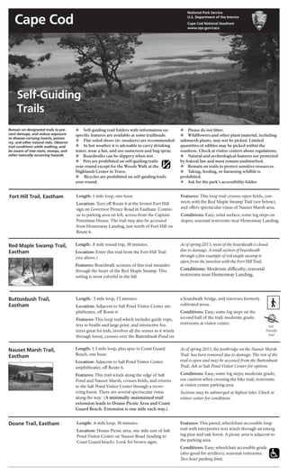
NostalgicOutdoors™-Self guiding trails, CAPE COD NATIONAL SEASHORE
1. Cape Cod
National Park Service
U.S. Department of the Interior
Cape Cod National Seashore
www.nps.gov/caco
Fort Hill Trail, Eastham Length: 1 mile loop, one hour.
Location: Turn off Route 6 at the brown Fort Hill
sign on Governor Prence Road in Eastham. Contin-
ue to parking area on left, across from the Captain
Penniman House. The trail may also be accessed
from Hemenway Landing, just north of Fort Hill on
Route 6.
Features: This loop trail crosses open fields, con-
nects with the Red Maple Swamp Trail (see below),
and offers spectacular vistas of Nauset Marsh area.
Conditions: Easy; solid surface; some log steps on
slopes; seasonal restrooms near Hemenway Landing.
Doane Trail, Eastham Length: .6 mile loop, 30 minutes.
Location: Doane Picnic area, one mile east of Salt
Pond Visitor Center on Nauset Road (leading to
Coast Guard beach). Look for brown signs.
Features: This paved, wheelchair-accessible loop
trail with interpretive text winds through an emerg-
ing pine and oak forest. A picnic area is adjacent to
the parking area.
Conditions: Easy; wheelchair accessible grade
(also good for strollers); seasonal restrooms.
Two hour parking limit.
Length: 1.3 mile loop, plus spur to Coast Guard
Beach, one hour.
Location: Adjacent to Salt Pond Visitor Center
amphitheater, off Route 6.
Features: This trail winds along the edge of Salt
Pond and Nauset Marsh, crosses fields, and returns
to the Salt Pond Visitor Center through a recov-
ering forest. There are several spectacular vistas
along the way. (A minimally-maintained trail
extension leads to Doane Picnic Area and Coast
Guard Beach. Extension is one mile each way.)
Nauset Marsh Trail,
Eastham
kid-
friendly
trail
As of spring 2013, most of the boardwalk is closed
due to damage. A small section of boardwalk
through a fine example of red maple swamp is
open from the junction with the Fort HillTrail.
Conditions: Moderate difficulty; seasonal
restrooms near Hemenway Landing.
As of spring 2013, the footbridge on the Nauset Marsh
Trail has been removed due to damage. The rest of the
trail is open and may be accessed from the Buttonbush
Trail. Ask at Salt Pond Visitor Center for options.
Conditions: Easy; some log steps; moderate grade;
use caution when crossing the bike trail; restrooms
at visitor center parking area.
Sections may be submerged at highest tides. Check at
visitor center for conditions.
a boardwalk bridge, and traverses formerly
cultivated areas.
Conditions: Easy; some log steps on the
second half of the trail; moderate grade;
restrooms at visitor center.
v Self-guiding trail folders with information on
specific features are available at some trailheads.
v Flat-soled shoes (ie: sneakers) are recommended.
v In hot weather it is advisable to carry drinking
water, wear a hat, and use sunscreen and bug spray.
v Boardwalks can be slippery when wet.
v Pets are prohibited on self-guiding trails
year-round except for the Woods Walk at the
Highlands Center in Truro.
v Bicycles are prohibited on self-guiding trails
year-round.
v Please do not litter.
v Wildflowers and other plant material, including
saltmarsh plants, may not be picked. Limited
quantities of edibles may be picked within the
seashore. Check at visitor centers about regulations.
v Natural and archeological features are protected
by federal law and must remain undisturbed.
v Remain on trails to protect sensitive resources.
v Taking, feeding, or harassing wildlife is
prohibited.
v Ask for the park’s accessibility folder.
Remain on designated trails to pre-
vent damage, and reduce exposure
to disease-carrying insects, poison
ivy, and other natural risks. Observe
trail conditions while walking, and
be aware of tree roots, stumps, and
other naturally-occurring hazards.
Red Maple Swamp Trail,
Eastham
Length: .8 mile round trip, 30 minutes.
Location: Enter this trail from the Fort Hill Trail
(see above.)
Features: Boardwalk sections of this trail meander
through the heart of the Red Maple Swamp. This
setting is most colorful in the fall.
Length: .3 mile loop, 15 minutes.
Location: Adjacent to Salt Pond Visitor Center am-
phitheater, off Route 6.
Features: This loop trail which includes guide rope,
text in braille and large print, and interactive fea-
tures great for kids, involves all the senses as it winds
through forest, crosses over the Buttonbush Pond on
Buttonbush Trail,
Eastham
Self-Guiding
Trails
2. Salt Pond Visitor Center, Route 6, Eastham, MA 02642, 508 - 255 - 3421
Province Lands Visitor Center, Race Point Road, Provincetown, MA 02657, 508 - 487 - 1256
E X P E R I E N C E Y O U R A M E R I C A
Length: 1.2 mile loop, one hour.
Location: At stop light, turn east off Route 6 into the
Marconi Station Area, South Wellfleet. Follow brown
signs to the Marconi Site and White Cedar Swamp.
Features: This trail descends through a stunted oak
and pine forest into a mature woodland, leads to a
boardwalk that winds through the picturesque
Atlantic White Cedar Swamp, and returns via the
historic “Wireless Road” (a sand road) to the start-
ing location.
Conditions: Moderate difficulty; some steep stairs;
return route is ½ mile in soft sand; swamp portion
of this trail is boardwalk; seasonal restrooms.
Atlantic White Cedar
Swamp Trail, Wellfleet
Small’s Swamp Trail,
Truro
Length: .6 mile loop, 30 minutes.
Location: In North Truro, turn off Route 6 at the
Pilgrim Heights area sign off Route 6. Walk begins
and ends at the covered shelter.
Features: Chosen by Native People for living sites for
thousands of years for water, protection, and food
sources, early-European settlers also sought to make
a living on this landscape. Gradually, the soil gave
out, farms were abandoned, and the landscape
began its slow recovery. The forest here now hides
most, but not all, of the former land uses in this area.
Conditions: Easy; some log steps; moderate grade;
short boardwalk surface; picnic area and seasonal
restrooms in adjacent parking area.
Pilgrim Spring Trail,
Truro
Length: .7 mile loop, 30 minutes.
Location: In North Truro, turn right off Route 6
at the Pilgrim Heights area sign. Walk begins at the
covered shelter. Upon exiting the trail near the
restrooms, proceed ahead across the parking area to
your vehicle.
Features: Path leads to a site representative of where
the Pilgrims drank their first fresh water
in New England. This short loop trail winds
through the recovering pine and oak forest, and
passes a marker which commemorates the Pilgrim’s
initial exploration of this area.
Conditions: Easy; some log steps; moderate grade;
picnic area and seasonal restrooms in parking area
at end of trail.
Pamet Area Trails,
Truro
Length: .6 miles each way, plus extensions, 45 min-
utes. Adjacent fire roads offer additional miles of
walking opportunities.
Location: Take Truro Center/Pamet Roads exit off
Route 6 in Truro. Proceed 1½ miles on North Pamet
Road to the end. Trail begins at the parking area
adjacent to the Environmental Education Center (a
hostel in summer).
Features: The Bearberry Hill overlooks offer spec-
tacular views of the Pamet landscape, with views
of the Atlantic and the glacial terrain of the Pamet
valley, and a former boghouse from the era of com-
mercial cranberry harvesting. Outdoor exhibits and
a folder keyed to trail markers describe the area.
Conditions: Moderate difficulty; log steps; steep
grade to overlook. No restrooms.
Woods Walk at
Highlands Center,
Truro
Length: 1 mile, 30 minutes
Location: Take Route 6 to the Highland Light Exit
in North Truro. Go East on Highland Road. Turn
right onto South Highland Road. After 0.6 miles,
turn left onto Old Dewline Road. The Highlands
Center is at the end of the road.
Features: This trail winds through the back woods
of the emerging Highlands Center for arts, science,
and education. It offers a glimpse of the Cold War
past amidst forest, heathlands, and dramatic ocean
bluffs.
Conditions: Moderate difficulty; paved and un-
paved roads; sections with fairly steep terrain.
No restrooms. Leashed dogs are permitted.
Beech Forest Trail,
Provincetown
Length: 1 mile loop, (pond loop ¾ mile, extension
loop ¼ mile), one hour.
Location: In Provincetown, turn right off Route 6
at traffic light onto Race Point Road. Proceed ap-
proximately ½ mile to the Beech Forest parking area
on left.
Features: Journey into the heart of a picturesque
beech forest, and enjoy great bird watching
opportunities, especially in spring and fall.
It skirts the shallow Beech Forest Pond.
Conditions: Easy; extension loop has steep log
steps; some soft sand; picnic area and seasonal
restrooms at trailhead; Province Lands bicycle
trail can be accessed from parking area.
Great Island Trail,
Wellfleet
Length: 3.9 - 8.8 miles round trip (3.9 for tavern loop
round trip to parking area; 8.8 for round trip to Jer-
emy Point overlook and including tavern loop.)
Allow three to five hours to explore Great Island.
Location: From Route 6, follow green signs to Well-
fleet Center; turn left onto East Commercial Street
(follow signs to Wellfleet Harbor); continue along the
shoreline from town pier via Chequessett Neck Road
to the Great Island parking area. (Keep water view on
left after leaving Route 6.)
Features: This trail follows sandy stretches be-
tween the elevated heights of Great Island and
Great Beach Hill. Its higher elevations punctuate
spectacular vistas which emerge from an even-
aged, pitch-pine forest. Part of this trail leads to a
colonial-era tavern site (no remains visible). Other
sections skirt salt marsh embayments.
A picnic area is adjacent to parking area.
Conditions: The park’s most difficult trail; mostly
soft sand; some log steps; portions are submerged
at high tide; hats, sturdy footgear and drinking
water advised; portable toilets.
CAUTION: Trail options can
be confusing. Check tide table.
Do not attempt to walk to Jer-
emy Point if the tide is rising.
* BEACH ACCESS VIA DESIGNATED TRAIL
ONLY. Do not traverse dune to reach beach (en-
forced). Stay on designated trails to protect frag-
ile resources. Temporary detours and closures
may be in effect during shorebird nesting periods.