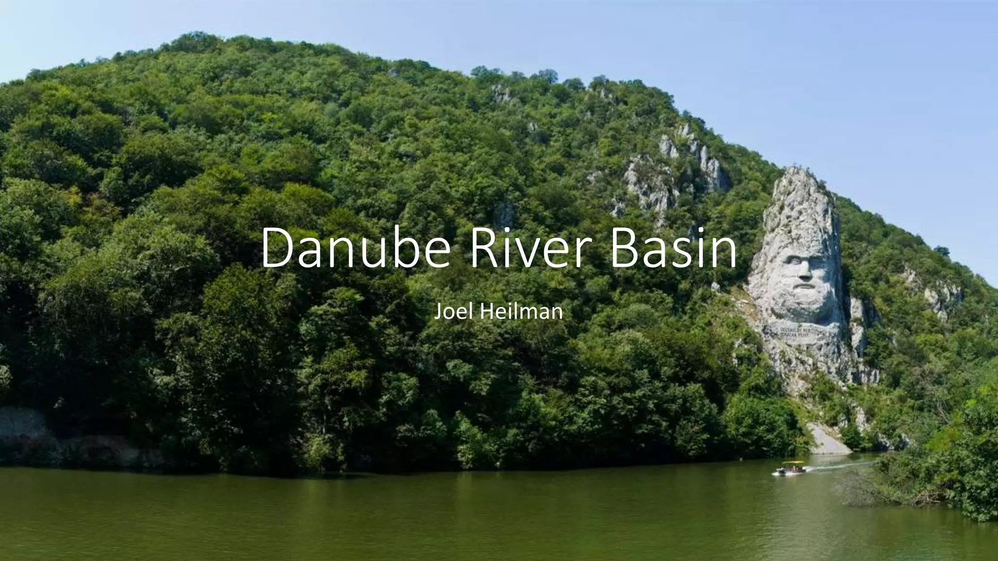
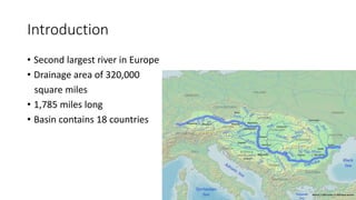
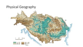
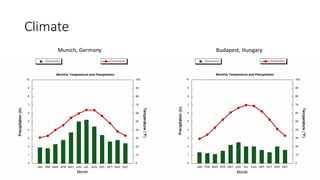
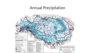
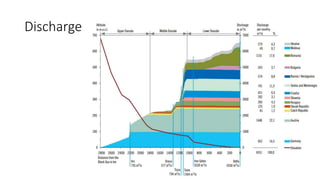
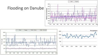
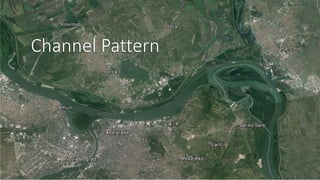
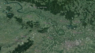
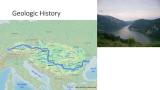
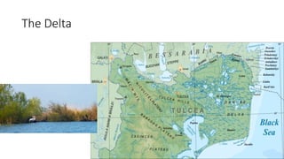
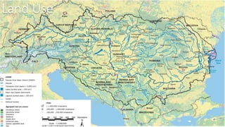
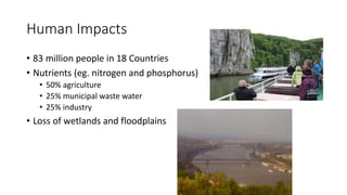
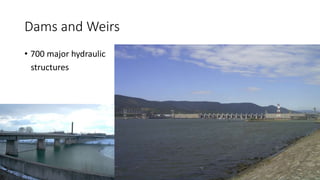
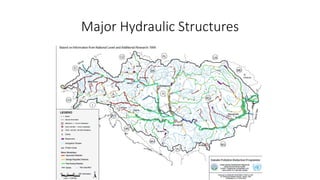
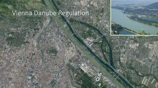
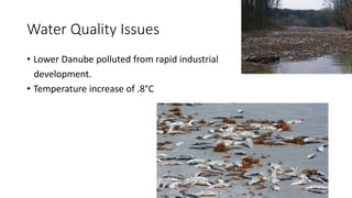
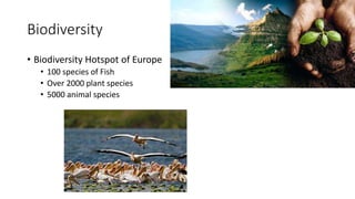
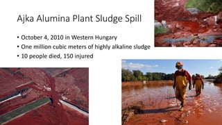
Danube River Basin
Joel Heilman
Outline
• Introduction
• Physical Geography
• Climate Characteristics
• Discharge
• Channel Pattern
• Geologic History
• Land Use and Human Impacts
• Water Quality Issues
• The Shoes on the Danube Bank
Introduction
• Second largest river in Europe
• Drainage area of 320,000
square miles
• 1,785 miles long
• Basin contains 18 countries
Physical Geography
Climate
Munich, Germany Budapest, Hungary
Annual Precipitation
Discharge
Flooding on Danube
Channel Pattern
Geologic History
The Delta
Land Use
Human Impacts
• 83 million people in 18 Countries
• Nutrients (eg. nitrogen and phosphorus)
• 50% agriculture
• 25% municipal waste water
• 25% industry
• Loss of wetlands and floodplains
Dams and Weirs
• 700 major hydraulic
structures
Major Hydraulic Structures
Vienna Danube Regulation
Water Quality Issues
• Lower Danube polluted from rapid industrial
development.
• Temperature increase of .8°C
Biodiversity
• Biodiversity Hotspot of Europe
• 100 species of Fish
• Over 2000 plant species
• 5000 animal species
Ajka Alumina Plant Sludge Spill
• October 4, 2010 in Western Hungary
• One million cubic meters of highly alkaline sludge
• 10 people died, 150 injured
Difficulties
• Civil War in Yugoslavia
• Many new governments
• Socio-economic and cultural diversity
The Shoes on the Danube Bank
• Memorial to Jews killed in World War II.
Questions?

Rivers Project Presentation

Editor's Notes

  • #2 “King Decebalus, made by Dragan”
  • #4 Known as: Donau, Duna, Dunav, Dunărea, Dunai, Dunaj Vienna, Bratislava, Budapest (largest), Belgrade Drains area of 320,000 square miles Major tributaries: Drava, Sava, Tisa- triple flow Danube means “River”
  • #5 Originates in town Donaueschingen which is in the Black Forest of Germany—at the confluence of the rivers Brigach and Breg Divided into 3 sections. Upper Section: From spring to Devín Gate. Danube remains a characteristic mountain river until Passau, from Passau to Devín Gate the gradient Middle Section: From Devín Gate to Iron Gate. The riverbed widens and the average bottom gradient lessens Lower Section: From Iron Gate to Sulina, with average gradient even smaller
  • #6 Munich Budapest wetter summers Upper regions- Atlantic climate Easter part- continental climate- lower precipitation and cold winters Drava and Sava- Mediterranean
  • #7 General Idea of which areas get more precipitation
  • #8 Austria- 22.1%, Romania- 17.6% High precipitation in Alps and Carpathians. Inn contributes more than Danube mouth the Danube has an average discharge of about 6,500 m3/s
  • #9 June 2013 flood- 372,000 cu ft/s in Bratislava
  • #10 Belgrade, Serbia (middle) Very sinuous, braided
  • #11 Danube in Germany (upper)
  • #12 Pannonian Sea formed 30 million years ago and drained through Danube 600,000 years ago. River swamps and marshes. Throughout that time the Carpathian-Balkan ranges were slowly rising up, and the Danube was, at approximately the same speed, cutting its magnificent gorge Before last ice age, Waters that feed Rhine flowed into Urdonau (original Danube). Large channel. Water changed direction to Rhine. Upper Danube much smaller now. Swabian Alb mostly porous limestone. Rhine lower than Danube. Much of today’s subsurface water flows to Rhine. In future- Upper Danube may flow to Rhine.
  • #13 Sediment brought by river and by waves 1860s- leaders internationalized Danube region and dredged navigable channel- Sulina Arm Delivers just 30 percent of original load of water and sediment Modern delta began to form in after 4000 BC Alluvial plain- mostly wetlands and water. 40% of delta built in last 1,000 years 3 channels: Chilia, which carries 63 percent of the total flow; the Sulina, which accounts for 16 percent; and the Sfintu Gheorghe (St. Geroge), which carries the remainder Starts 80km from sea
  • #14 53% arable land, 32% forest, 6% urban
  • #15 pollution from agriculture, industry and municipalities affect the water supply for communities, irrigation, hydropower generation and industry, as well as opportunities for transportation, tourism and fishing Cultural diversity main sources of nutrients in the Danube are agriculture (50%), municipal waste water (25%) and industry (25%). The total nitrogen load in the Danube is between 537,000 and 551,000 tonnes per year and the total phosphorus load is 48,900 tonnes per year. navigate 2,411 km, or 87%, of the length of the Danube Loss of wetlands and floodplains Drinking water for 20 million- too difficult to clean-pollution-only Romania
  • #16 Austria almost 2/3 hydropower, other countries still thermal power Approximately 700 major hydraulic structures (dams and weirs >15 m), including 156 large hydropower dams, have been built in the DRB Iron Gate dams retain approximately two-thirds of the suspended. solidssediment delivery to the Delta decreased from 53 to 18 million tone/year, resulting in severe coastal erosion
  • #18 Before: 5 mile wide wetlands, as a patchwork of numerous streams meandering through the area  First dams/levees built 1870-75. Major project 1872-88 created New Danube and Danube Island.
  • #19 Lower Danube good until 1970s rapid industrial development. Temp increase of .8°C by raising the level of nitrates in the groundwater and indirectly by causing eutrophication of surface waters, including the Black Sea nitrate level in the Danube has increased four to fivefold during the last 30 years, but still safe—Agriculture fertilizer main causes of hazardous chemicals entering the Danube water system arises from industrial activities, such as mining, smelting, electroplating (metals) and pulp and paper, pharmaceuticals and chemical processing (organic micropollutants). main sources of nutrients in the Danube are agriculture (50%), municipal waste water (25%) and industry (25%). The total nitrogen load in the Danube is between 537,000 and 551,000 tonnes per year and the total phosphorus load is 48,900 tonnes per year. Oil pollution from destruction of oil refinery in Yugoslavia in 1999. The prime cause of microbial pollution is from untreated or inadequately treated municipal sewage cyanide accident in the Tysa River Basin in January 2000 caused massive harm to the environment and had a substantial impact on the economy of the entire region. This clearly demonstrated the need for better preparedness against such events.
  • #20 100 species of fish from the total of 227 found in Europe Biodiversity hotspot of Europe Over 2,000 plant species and 5,000 animal species live in or by the waters Dalmatian pelican Especially Delta wetlands
  • #21 October 4, 2010. caustic waste reservoir wall collapsed releasing one million cubic meters of highly alkaline sludge. 10 people died. 120-150 injured. Reached Danube on October 7. Headed downriver
  • #22 Solutions: Enhancing regional/international cooperation, integrated river basin approach, mobilizing national financial/human resources, and obtaining support from international organizations Yugoslavia civil war, many new governments. Economies are behind Europe Socio-economic and cultural diversity
  • #23 Memorial conceived by film director Can Togray and created by him & sculptor Gyula Pauer in Budapest. Honors Jews killed by fascist militiamen during WW II. Ordered to take off shoes. Shot at edge and fell into river. Represents shoes left. 60pairs of iron shoes