REGENERATION: FRIEND OR FOE? How has the regeneration of Peckham affected the area’s sustainability?
•
1 like•958 views

Feasibility study looking at the sustainability of Peckham Town Centre. It looks at how the regeneration of this part of Peckham sparked the development of the area as whole and considers how it has contributed towards the rise of its status within London.

Recommended
More Related Content
Similar to REGENERATION: FRIEND OR FOE? How has the regeneration of Peckham affected the area’s sustainability?
Similar to REGENERATION: FRIEND OR FOE? How has the regeneration of Peckham affected the area’s sustainability? (20)
Recently uploaded
Recently uploaded (20)
REGENERATION: FRIEND OR FOE? How has the regeneration of Peckham affected the area’s sustainability?
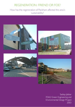
- 1. Sadiqa Jabbar FDA2 Green Engineering and Environmental Design Project 2003 REGENERATION: FRIEND OR FOE? How has the regeneration of Peckham affected the area’s sustainability?
- 2. REGENERATION: FRIEND OR FOE? Synoposis History of Peckham Transport Local Community Local Ecology Pollution Energy Utilised Sustainable Future? CONTENTS 2
- 3. SYNOPOSIS For a long time Peckham was under developed and a passer-by may have just driven straight through the area without giving it another thought. However, a few years ago Southwark Council decided that enough was enough and eventually began a redevelopment programme to update the area and bring it into the twenty-first century. The area of study within this project is Peckham Square and the immediate surrounding area. This incorporates the Peckham Library, Peckham Pulse (a fitness centre) and the linear park and the Square beneath the Arch (see annotated map). This area has seen a complete redevelopment within the past few years, which has raised the morale of the people who reside in Peckham; thus conveying that Peckham is not a ‘dump inhabited with low lives’. The point of this study is to find out what has changed within the area, how, and what resources have been utilised. How much embodied energy has been used? Is it possible to use less energy within the area and still function as normal? In doing so, the following will need to be examined: • the effect on the local community i.e. health, lifestyle and amenities • local ecology i.e. what happened to the trees, plants and grass areas? • pollution levels created by the development i.e. noise, chemical (if at all) and vehicle • the provision of transport In order to explore the area, various resources will need to be gathered such as images of the area before and after the regeneration programme, recordings of the traffic and the number of people, the Farmers’ market and the local ecology. Primary sources, such as first hand research, and secondary sources, such as the Environment Department of Southwark Council, the local studies library, the RIBA, and the Internet are possible forms of research for this investigation. Aerial map of Peckham Town Centre Diagrammatic map of Peckham Town Centre site How has the regeneration of Peckham affected the area’s sustainability? 3
- 4. REGENERATION: FRIEND OR FOE? OSmap of the site courtesy of Digimap, 2003 (nts - original 1:1250) Overview of the site from behind the library 4
- 5. HISTORY OF PECKHAM How has the regeneration of Peckham affected the area’s sustainability? The name ‘Peckham’ derives from two Old English words, “peac” meaning ‘hill’, and “ham” meaning ‘village’. It roughly translates to “village by a hill”. It was first mentioned in the Domesday Book between 1085 and 1087 as ‘Pechecha’, a small plain of two acres of meadow. In John Rocque’s 1750 map of the area, Peckham was a small Surrey village, most of which was clustered around the High Street. The village had been used as a last stop over for cattle drovers who were on their way to the London markets. It allowed the animals to graze one last time before being sold. At the north end of Old Kent Road a gas works company was situated on the bankside. By 1842, according to Dewhirst’s map, many houses and buildings were constructed. However the land was still very much used for cultivation and garden markets. By the 1870s more land was developed; streets were formed and buildings were constructed. During this period the first Ordnance Survey at a large scale was undertaken. More and more people were moving away from London’s overcrowded inner-city into suburbs like Peckham where the air was fresh and the water clean. London was rapidly growing the population increased from 865,000 in 1801 to 4.5 million in 1901. Consequently, Peckham was fast becoming part of the metropolis, and as Peckham Registration Sub District it grew from 12,563 in 1841 to 93,033 by 1901. By the second half of the twentieth century, little land was left in the heart of Peckham as many houses had been built to cater for the rising population. Among the buildings constructed two were breweries situated on the High Street. The gas works and timber yards situated along the canal head provided local employment; positions for boatmen also arose. Before its rapid urbanisation, Peckham had been quite a rich suburb. But due to population growths leading to densification and overcrowding, the area’s wealth deteriorated. Consort Road (Albert Road as it was then) used to be fields, workers used to travel to the city centre for work because of cheap workmen’s fares on the railways. But by the 1880s, industries were moving away from the centre out to the suburbs thus creating more grid-like street patterns. More roads were being constructed that aided specialist services in and around Peckham. Rye Lane was fast becoming the main shopping area, taking the glory away from the High Street. During this period many schools were being established although many Dewhirst map of the Parish of Camberwell, 1842 Ordnance Survey map, 1914 5
- 6. were private. In 1750 people mostly travelled by foot, horseback or by horse-drawn carriages. By1825 coaches were in use although omnibuses overtook them in the 1830s, as more passengers were able to travel within them at lower fares. After the introduction of railways, this became the most efficient form of transport as one could travel faster and further. The twentieth century brought better transport as trams, trains, and buses were developed. London Transport’s first post-war bus garage opened in Peckham in 1951 but it was later demolished in 1995/6 to make way for Safeway’s extension. The Peckham branch of the Grand Surrey Canal opened in 1826 and was used to transport industrial materials such as coal, timber, and road metal. Whitten Timber Ltd has been along Canal Head for the last eighty-two years selling various types of softwood. Improvements within the transport industry saw Peckham’s population decline in the early twentieth century. This meant that more people were able to travel further distances resulting in many commuting for work in the centre from the outskirts of the city. The 1914 Ordnance Survey map shows the extent to which the area was becoming densely populated. Emphasis on public services was rising; on July 9 1925 a fire station opened along Peckham Road (it was the first to introduce shift work schedules in London), a number of cinemas and theatres opened and closed in various locations, and in 1935 the Pioneer Health Centre opened on St Mary’s Road. Small parks were created within residential areas so that people had access to open spaces much closer to home. Residential development comprised the introduction of flats to replace the old Victorian houses as the area became denser and the need for more housing due to the bombing during the Second World War. Consequently the 1960s and 1970s saw the rise in the construction of council estates. Southwark Council was established in 1965 and took jurisdiction over Peckham from Camberwell Council. This created problems in the long run as the notorious North Peckham Estate proved. The design of the North Peckham Estate was ill conceived. Difficult access to local amenities isolated the residents from the ‘outside’ world. The long concrete walkways fostered crime due to the lack of visibility and vigilance. This resulted in the neglecting of estate maintenance and the consequent run down appearance Rye Lane and Peckham High Street junction Some of the housing that replaced the North Peckham Estate A linear park replaced the canal when it was filled in 1972 and remains in good condition REGENERATION: FRIEND OR FOE?6
- 7. of the blocks. Southwark Council recognised the need for redevelopment and in 1995 a seven-year regeneration programme began to demolish the estate and replace it with open terraced houses and gardens (in sharp contrast to the dingy, dark, isolating estate of the past). The regeneration programme included the development of Peckham Town Centre, the shopping areas, and the Town Square (Peckham Arch, Peckham Library and Peckham Pulse - the first healthy living centre in Britain). The Peckham Library marked the end of the regeneration programme and won the RIBA Stirling Award for Architecture The regeneration incorporated the development of the clear open space on the square comprising modern landscape design The Peckham Pulse fitness centre opened in 1999 How has the regeneration of Peckham affected the area’s sustainability? 7
- 8. LOCAL COMMUNITY REGENERATION: FRIEND OR FOE? The Peckham Arch was constructed in 1995 to mark the entrance into the Square Peckhamites have had a boost of confidence due to the regeneration of Peckham Town Centre. The area is more aesthetically pleasing that evokes a sense of pride. No part of the site is particularly overcrowded which may lend itself to the low levels of crime. With CCTV in operation, a safer neighbourhood environment is promoted. These could lend a hand to lifting Peckham out of its notorious reputation. The Peckham Library and Peckham Pulse have created more local amenities for residents. The Pulse provides health and fitness amenities for people of all ages promoting a healthier lifestyle for a resident or non-residents alike. Both of these buildings promote Peckham. They allow more youth activities encouraging young people off the streets and out of trouble. The Library has a learning centre that enables the unemployed to develop new skills assisting to improve their employability and career prospects. The design of the buildings also encourages young children and adults alike to enjoy using the facilities and spaces. The Library facilitates IT equipment allowing low-cost Internet access, free for school children doing homework. The Peckham Square provides an open space in Peckham that feels quite rare in a mainly residential area. It acts as a meeting place, a space for socialising, recreational activities or just perhaps for some peace and quiet. Although peace and quiet may be difficult to achieve as two major transport routes surround the Square. The Linear Park is more ideal for tranquillity as no major roads surround it and is relatively more peaceful. As traffic is not permitted within the area, people are free to walk or jog without worrying about passing vehicles. One can walk all the way to Burgess Park by following the park’s route. The site is utilised as a throughway where pedestrians can walk through to access Peckham Hill Street, Peckham High Street, Ryle Lane or one of the two resident buildings. One can also access the site via a gateway into the adjacent residential to the East. Some residents can overlook part of the site from their windows. The Peckham Arch and Peckham Library’s upper floors provide shelter from adverse weather. The spaces below the structures provided shelter from rain/sleet/ snow and shade from the sun. Below the Arch weekend markets operate; the Arts and Craft market on Saturdays, Some of the produce on sale at the Farmers’ Market Farmers’ Market held on site every Sunday mornings 8
- 9. How has the regeneration of Peckham affected the area’s sustainability? and the Farmers’ Market on Sundays. The low-rising steps improve accessibility for people of all ages from the elderly, young children to people of various disabilities. Ramps enable easier access for wheelchairs or pushchairs. Bicycle racks are provided in front of the Library to encourage the use of cycles and/or public transport to reduce congestion on the Peckham roads. Bicycle racks in the Square Seating and shelter beneath the Library 9
- 10. LOCAL ECOLOGY REGENERATION: FRIEND OR FOE? Residential property adjacent to the Linear Park The Park’s pathway follows the route of the canal leading to Burgess Park The natural and artificial barrier between the Linear Park and residential area Parks were constructed during various stages of history to create social and recreational spaces for social interaction. The site consists of an area designated to a Linear Park over the route of the Peckham branch of the Grand Surrey Canal. The Park is landscaped with bands of trees, foliage, and a pathway running along the boundary to the residential area. It creates a pleasant environment, away from the hustle and bustle of the Town Centre. The Park allows some free space for locals to experience a nature. The Linear Park in a way makes up for the land built-over to replace the canal, Peckham got back an element of nature albeit man-made. However one has to consider the environmental impacts left by the canal when the Park was created. The soil may be contaminated with disease and chemicals from the construction process. Diseases created by people and objects falling into the water and cases of death by drowning leading to the gradual degradation of the water quality. Therefore the canal water is likely to have become contaminated. One must also consider the fact that the living conditions in Victorian Britain were very poor within densely populated areas. Industries such as timber, coal and building materials were located along the bank so as to take advantage of the water transport linking to the Surrey Docks. It is a possibility that chemicals and produce owned by these businesses may have been thrown into the canal by accident or foul play. Consequently this will have a likely impact on the quality of soil on which the Linear Park was built. Before the construction of the canal, the area had been used to cultivation and garden markets. Consequently the amount of land available for people to cultivate their own produce was reduced. Peckham’s location between the bustling city of London and the countryside, meant that it was inevitable that it would become part of the growing metropolis; especially at a time when people were leaving the city for a cleaner and fresher environment to live. Even so the banks of the canal were still able to be cultivated with fresh water (perhaps when initially built) to irrigate the crops. The site boundary comprises two major busy roads, Peckham High Street and Peckham Hill Street, to the South and West and the residential area to the East. To make the area safe it has been pedestrianised allowances only for maintenance and emergency vehicles. The area also allows safe access for cyclists; bike racks in front of 10
- 11. How has the regeneration of Peckham affected the area’s sustainability? Rich shrubbary along the Linear Park area Unused area adjacent to the site beyond the fence the Peckham Library encourage cycling as a mode of transport. Before a company can consider the possibility of developing any part of the site, they have to be aware that the area is considered to be of archaeological importance. Even though no artefacts have been found, it is still considered of archaeological importance. The images on the right show an undeveloped plot of land. It appears to be unmaintained and plants left to overgrow. It is located beyond the boundary of land within this study and so will not be mentioned further. 11
- 12. POLLUTION REGENERATION: FRIEND OR FOE? Bins provided along various parts of the sire, especially areas near seating Large refuse bins located in the area in front of the Library Pollution can occur in various forms; noise, chemical, and vehicle. Noise pollution generated by the traffic will affect the spaces in the Square closer to Peckham Hill Street and Peckham High Street. There is no barrier to filter out the noise as it is an open space therefore it becomes difficult to hold a conversation. The Linear Park provides some respite as the plants and fence on the West, bordering the residential area, create an acoustic barrier. The two resident buildings also act as noise barriers. Within the fitness centre machines and people using the gym facilities substitute the traffic noise. The Peckham Library will by default be quiet any noise would filter from the issue desk, computers and people in other parts of the building. During peak times (morning and evening rush hours) vehicle pollution in the form of diesel fumes, will affect anyone getting closer to the streets and roads. The chemicals from the fumes once inhaled could be detrimental to a person’s health in the long run. Chemical pollution occurs as mentioned above from car diesel fumes flowing into the square. This form of pollution can also occur in the form of the pollutants from industrial pollutants that could still exist within the soil that fills up the canal and forms the park. Gas works and timber merchants were located on the banks of the canal. If the area was dug up again, health could be at risk if the industrial pollutants are still active. The canal area could still be contaminated with any form of bacteria created from people drowning, produce falling into the waters and the Victorian’s attitude towards cleanliness in densely populated areas. So digging up the site could reactivate these bacteria into the air and if coming in contact with skin the bodies of people carrying out the task. Litter bins are provided in various parts of the site, where there is seating there is a litterbin close by. It would seem obvious to insert more bins in an area if there are more people to create environmental damage to an area. The market days are potential periods when the square would need some clearing up as many people attend the markets and therefore more likely for litter and rubbish to fall to the ground. 12
- 13. ENERGY UTILISED How has the regeneration of Peckham affected the area’s sustainability? Whitten Timber warehouse as seen from site with grafittied walls Various energy sources have been utilised within the redevelopment processes. The transportation of goods to and from the site would use energy of the vehicles that the goods are carried in and the labour that undertakes the construction and design processes also needs to be considered. For examples the workers who carry out the physical labour of machine work, laying down the bricks, and constructing the buildings. The machines also take up energy such as lifting, digging, and demolishing. The drainage of the canal and the actual construction of it would have used up a great deal of energy as back then the technology was not as advanced as it is today. The maintenance of the square and the buildings will use up energy of the workers undertaking the care such as emptying bin bags, brushing up the litter, cleaning up graffiti if there is any, and looking after the park by gardening regularly. No energy will used for ventilation or natural light provision as the square is out in the open and there is no need for this. However street lighting and the like may be required for the night so that people can feel safe walking in the dark within the area. Therefore, electricity is another form of energy used within the buildings and street lighting on the square. Changes made over the years to change the landscape of the area will have accumulated a large amount of energy in various forms some of which have been discussed earlier. 13
- 14. SUSTAINABLE FUTURE? REGENERATION: FRIEND OR FOE? Overview of the site looking from the Square with the new estates in the background I believe that the area can be sustainable for the future as the buildings have been designed so that they have little impact on the environment. Compared to past developments, not a large amount of energy is likely to have been used. The design of the square is simple and modern. The buildings provide amenities for the local community such as healthcare, academic resources, access to computers and the Internet, training for IT skills for those who do not have current jobs, and open space which is rare in Peckham. The developers have also considered a park for locals as it creates more activities for people to do. The whole regeneration has assisted in the morale boost for locals, which can be seen as just the start of improving Peckham’s notorious reputation. The rise in house prices within the area suggests that the area is worth investing in. There are a range of leisure facilities in addition to the park, fitness centre and library, such as the cinema and the shops. The regeneration has created job opportunities for people and invited more than the locals to inhabit the houses. There are plans to extend the East London and Bakerloo lines to Peckham in order to increase public transport access to and from Central London. These could be enforced within the next few years. There is also a proposal for a new Peckham Wharf to be developed on the site of the current industrial wharf, which is not in use. 14
- 15. REFERENCES Images: All images created by author unless stated below. Maps: Digimap, 2003, page 4 Local studies Library, 2003, Dewhirst and 1914 Ordnance Survey maps, page 5 Multimap, 2003, aerial base map, page 3 Photo: Farmers' market bottom image page 8: internet search, source unknown at time of editing 2013 (possibly scan of a Southwark newsletter photo) Links: CABE: http://webarchive.nationalarchives.gov. uk/20110118095356/http:/www.cabe.org.uk/case- studies/peckham-library Duffy, Jonathon;, 2002, Return of the 'guardian angels', http://news.bbc.co.uk/1/hi/uk/2317109.stm Maps: http://www.bing.com/maps/?l vl=16&cp=51.4760381641931~- 0.068271067112904&FORM=MMREDR (link is updated from original used) MRV: http://www.mvaconsultancy.com (website no longer holds the Peckham Town Centre Improvements article) Peckham Partnership: http://www.southwark.gov.uk/ future/pp1.htm (link no longer works) Peckham Unitary Development Plan: http://www. southwark.gov.uk/udp/html/Peckham.pdf (link no longer works) Southwark: http://www.southwark.gov.uk/future/index. html (link no longer works) Southwark October 2001 Newsletter: http://www. southwark.gov.uk/future/October.pdf (link no longer works) Sustainable Southwark: http://www.southwark.gov.uk/ future/sust.htm (link no longer works) Urban Catalyst (for property prices): http://www. urbancatalyst.com (website has been updated since last visit in 2003) Documents: Southwark Council, 2003, Local Action Plan: Peckham and Nunhead How has the regeneration of Peckham affected the area’s sustainability? 15
- 16. DISCLAIMER: Original report submitted in 2003 as part of a module FDA2 Green Engineering and Environmental Design at University of Greenwich on the BA (Hons) Architecture programme. The text has been edited with a new report layout by the original author in 2013. www.sadiqajabbar.com sadiqajabbar@gmail.com S A D I Q A J A B B A R