
Recommended
More Related Content
Similar to presentation for Urban renewal project .
Similar to presentation for Urban renewal project . (20)
Recently uploaded
Recently uploaded (20)
presentation for Urban renewal project .
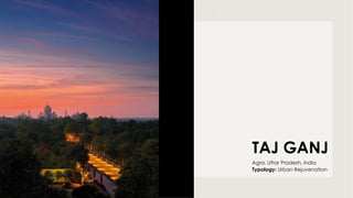
- 1. TAJ GANJ Agra, Uttar Pradesh, India Typology: Urban Rejuvenation
- 2. • Taj ganj is a 400 year old market district sharing the peripheral skyline of the Taj Mahal. • It includes clusters of bastis (neighborhoods) which originally started with the four ‘katras’ or quadrants down towards the southern gate of the Taj Mahal. • It has since then expanded consistently and also in the process have developed groups of slum dwellings around the area. Specific area under consideration for the Urban redevelopment of Taj Ganj extends from Western gate Road of theTaj Mahal to the Eastern gate Fatehabad Road which includes the Taj Ganj area and the slums around.
- 3. • The active ‘streets as connectors’ align visitors to the ethos of the ordinary people as heirs to the cultural legacy along with the Taj. • Like all roads, they lead to it; but more importantly through this, begin urban networking, and eventually, they weave the fabric of the entire city of Agra. • The proposals includes urban scale development of streets by resurfacing the carriage way provision of pedestrian foot paths, • cycle tracks, Landscape parks, seatings, toilets, security infrastructure etc. Street as a spatial spine
- 4. proposes a coherent but non-uniform urban design along stretches leading to it, giving priority to non-motorised mobility through a radical change in the visual texture of the place. Cobbling ensures that vehicular traffic explicitly slows down; backed by footpaths merging seamlessly with the road but delineated by bollards, the street is a walker’s paradise. But allowing for multiple modes of transport.
- 5. AUTORICKSHAW STAND EAST GATE TOILET BOCK HORSE CART PARKING WEST GATE PARKING TO VIP CHOWK SOUTH GATE STREET SHILPGRAM PLAZA
- 6. • Amenities such as landscaped seating areas, parking/ boarding areas for tangas, Cycle rickshaws and battery operated carts, security check posts. Toilet blocks and drinking water facilities have been located at various places across the project extent. • Lighting and signage add stimulating layers of navigation and experience to the place. • The conflicting densities of the built and the green fabrics, swarms of pedestrians and the restricted vehicular movement. • Street pavements, the emphasis has been on vernacular materials- red sandstone, cobblestone, perforated jail, and urban greening while simultaneously preserving the existing green spaces.
- 7. CHEONGGYECHEON- Stream Ecological Restoration Seoul, South Korea Typology: URBAN RESTORATION
- 8. The restoration of Seoul’s Cheonggyech eon, in South Korea,is about the return of a historic canal to the city that had been buried by a large highway . The stream was used to play area by the children, and folk events .took place in and along its banks. These events happened during the annual and seasonal holidays Population increase, industrialization degraded the water quality and the banks became slums. The stream was nick named ‘ city’s cncer’ people demanded cover the stream,butit was ignored by the Japanese authorities until mid 1930s. The construction to cover it finally began in 1958 and was completed in 1977.Cheonggyecheon became Cheonggye road, and markets and factories were built to it to lead korea’s industrialization.
- 9. The Cheonggye elevated Motorway, built above the Cheonggye Road, symbolized Seoul’s progress and korea’s modernization for a long period of time and building constructed next to the highway . Downtown Seoul was a place of deterioration and pollution, forcing business HQs t shift to Gangnam, new sub- center . Industries here lost competitiveness. Maintenance of the aging highway was another big concern. An in depth safety checkup conducted in august 2000 revealed cracks and exfoliation in the upper slab. And insufficient load carrying capacity due to the worn out concrete beams,imlying an inevitable full-scale reconstruction.
- 10. The debate shifted from reconstruction of the highway to restoration of the stream. Later, goals like historical values, eco-friendliness, optimization in each sector. Along with the deconstruction of the highway and restoring the stream, the elements of heritage like stones bridges and monoliths were also dug up and made use in the restoration. Stream open again for the people of Seoul. Its not for pedestrian only public space bringing water and vegetation into the center of a dense metropolitan area of 25 million.
- 11. STREAM The natural river that lived its most glorious life during the 14th century had slowly diminished into becoming a drain during the industrial revolution, as an origin for various diseases, poor hygiene and sanitation HIGHWAY Now the river was restored into a clean waterways by demolishing the highway that was constructed over it. AFTER BEFORE
- 12. • Improve air quality ,water quality and quality of life. • Reconnect the two parts of the city that were previously divided by road infrastructure • Reintroduce flora fauna species in ecosystem. • Creation of an extensive new open space along the stream. • Creation of pedestrian amenities and recreational spaces • Construction of new bridges, reconnecting the urban fabric. • Removal of elevated highway concrete structure.