2. Azavea is an award-winning
geospatial software design and
development company based in
Philadelphia. The firm was
organized in 2000 to create
technologically advanced solutions
for web-based geospatial data
visualization and analysis.
OPENTREEMAP:
COLLABORATIVE DATA MANAGEMENT FOR
THE URBAN FOREST
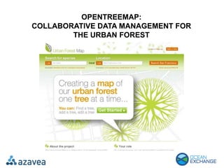
One of those solutions is OpenTreeMap, an open source
software system that makes it easier and more affordable for
urban communities to manage tree planting and renewal efforts
that support their local ecosystems and improve the quality of
life for all citizens.
3. The key unmet need for OpenTreeMap is the provision of low-
cost, user-friendly, web-based tools for collaborative urban
forestry management and long-term ecosystem benefits
assessment. In many cities, local citizens, students, and
nonprofit organizations that are passionate about greening
their communities supplement government tree tending
activities by performing inventories, planting and caring for
new trees, and providing other vital support.
Prior to OpenTreeMap, these activities had been difficult to
coordinate, tended to be focused in only a few geographic
areas, and did not have the long-term continuity necessary to
generate a substantial impact over time. OpenTreeMap
provides the necessary tools that government and non-
government stakeholders need to work together
effectively, share critical information, and document ongoing
progress.