
Recommended
More Related Content
Similar to October 2023 Maps and More
Similar to October 2023 Maps and More (20)
More from NZSG
More from NZSG (20)
Recently uploaded
Recently uploaded (20)
October 2023 Maps and More
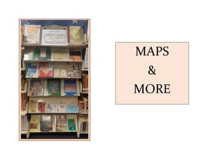
- 1. MAPS & MORE
- 2. TOWN and CITY MAPS OF THE BRITISH ISLES 1800 – 1855 Ashley Baynton-Williams Published 1992
- 3. Pigot & Co’s BRITISH ATLAS COUNTIES OF ENGLAND comprising the counties of England with additional maps of England and Wales, and London 1840
- 4. IRELAND Cartography and Surveys Published by Geography Publications Dublin, Ireland C1997 With an introduction by Raymond Gillespie 1st edition Published 2000 – 112 pages
- 5. Published 1999 by Parkgate Books Author Sean DUFFY Published 2000 by Gill & McMillan Dublin, Ireland
- 6. The Dent Atlas of Jewish History by Gilbert Martin Tracing the world-wide migrations of the Jews from ancient Mesopotamia to modern Israel, this atlas spans over 4000 years of history. With over 130 maps, the atlas depicts Jewish achievements and the Jewish way of life, presenting a clear picture of their persecution and their reaction to it. Published 1993 – 5th edition (1st pub 1969)
- 7. Where Once We Walked: A Guide to the Jewish Communities Destroyed in the Holocaust by Gary Mokotoff and Sallyann Amdur Sack Documents more than 21,000 towns in Central and Eastern Europe where Jews lived before the Holocaust. Pinpoints each town’s location by providing the exact latitude and longitude of the town and its direction and distance from the closest major city. 1st edition, published 1991
- 8. A Literary and Historical Atlas of Europe by J G Bartholomew (1923) In addition to maps illustrating the changing face of Europe from the Middle Ages through to 1923, when the book was published, there are maps covering the great battles of the world, of Medieval and Revolutionary Paris and a map of London, as it was rebuilt after the Fire and up to the end of the eighteenth century. It also includes a gazetteer of towns and places in Europe having a literary and historic interest.
- 9. Cambridge Illustrated Atlas WARFARE Renaissance to Revolution 1492-1792 By Jeremy Black (1996) An introduction to military and naval history covering the period from the European Renaissance to the revolutionary wars of the late eighteenth century, including the effects of European military expansion on the rest of the world. Before Endeavours Fade Guide to the Battlefields of World War One By Rose E Coombs (1990) Guide to the battle sites and monuments, graves of the known and unknown, of the battlefields of France and Flanders.
- 10. MAPS A teeny sample of the more than 900 in our library. Genealogical Gazetteer of the Kingdom of Hungary Compiled by Jordan Auslander Published 2005 by Bergenfield New Jersey, USA
- 11. A miniscule sample of the hundreds of maps in our library collection
- 12. Parish Life in 18th Century Scotland A Review of the Old Statistical Account Scottish Cultural Press 1995 In 1790 Sir John Sinclair of Ulbster sent an exhaustive questionnaire to every parish minister in Scotland, covering such diverse subjects as lifestyle, customs, industry, agriculture, geology and wildlife. His aim was to use the answers for the positive benefit of Scotland, showing up strengths as well as weaknesses and, by demonstrating to the government areas in which specific action was required ‘to add to the quantum of happiness’ in the country. The results were gathered together and published as the Old Statistical Account, a massive 20-volume work. A selection from the wealth of sociological information contained in the OSA is presented here in a lively and accessible form, with extensive quotation from all parts of the country. It is a remarkable and unique insight into the lives of Scottish people from very diverse parishes – urban and rural, rich and poor, highland and lowland. The original questionnaire is included in facsimile as an appendix. “This book is an essential resource for those studying social history and will be of immense interest to all those wishing to learn more of Scotland in earlier times” (from book jacket).
- 13. Villages of Glasgow By Aileen Smart 1997 Homeland of the Clans by Gerald Warner 1980
- 14. Explore Historic Australia by Margaret Barca Published by George Philip & O’Neil Pty Ltd 1984