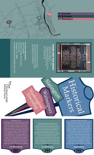
This document lists 38 historical markers located across Slatington, Walnutport, and Washington Township that commemorate people and events from the area's history. The markers cover topics related to the slate industry, local settlers, transportation routes, civic structures, and more. Brief descriptions are provided for each marker's location and significance. Additionally, the document provides short summaries of the histories of Slatington, Walnutport, and Slatedale, highlighting how the slate industry shaped development in these towns.
Parma Heights Centennial Master Slides For Short Small 20 Minute Version Man...kennethlavelle
The document provides a presentation on the history of Parma Heights, Ohio from 1810 to 2011, covering topics such as local political authorities, mayors, roads, landmarks, and population figures. It discusses the transition from Parma Township to the villages of Parma and Parma Heights and highlights important historical sites along Wooster Pike, including houses, barns, churches, and schools from the early 1800s.
The slideshow walking tour follows a path from the corner of King and James down the north side of King Street to Catherine Street and back from Catherine Street to James Street along the south side.
The document provides a historical overview of Rocky Mount, North Carolina from its founding in the early 1800s through the 1950s. It describes how the town grew around cotton mills and the railroad industry, and later became known for tobacco markets. Major developments included the establishment of schools, hospitals, libraries, and other institutions in the early 1900s. The document then highlights aspects of Rocky Mount during the 1940s and 1950s, including the impacts of World War II and trends like drive-in movies and rock and roll music.
We hope that you have enjoyed the “Monuments of Gore Park” walking tour as we traced the history of the public monuments in Gore Park from the earliest days in 1860 to the present day.
Farming and cranberry cultivation were important industries in Sherborn in the 17th-19th centuries. Cranberries thrived in Sherborn's swamps and bogs, with up to eight farmers cultivating over 100 barrels annually for $28 per barrel. Dairy farming also specialized in Sherborn, with 200 cans of milk shipped daily by train. Apples were a major crop as well, including the Porter apple developed in Sherborn, with many apples used to make cider in Sherborn's 20 small mills. Water power from local brooks drove several grist, saw, and cider mills over the centuries.
The document summarizes the history of banks in Plaquemine, Louisiana from 1837 to 1977. It discusses the Union Bank of Louisiana, the first bank established in 1837. It also mentions the Bank of Plaquemine founded in 1891, People's Bank built in 1899, Iberville Bank and Trust Company founded in 1892, Iberville Trust & Saving Bank chartered in 1931, Citizens Bank & Trust Company located on Main Street which underwent renovations in 1923 and 1952, and Plaquemine Bank & Trust Company chartered in 1968. Additionally, it notes that Confederate currency was issued by Plaquemine and Iberville Parish during the Civil War.
Sherborn, Massachusetts has a long history of public education dating back to 1709. Over 300 years, the town transitioned from one-room schoolhouses scattered throughout the town to a centralized school system. Key developments included the first public schoolhouse being built in 1727, the establishment of multiple one-room schoolhouses in the 1700s-1800s to serve different districts as the population grew, the construction of Center School in the early 1900s to consolidate smaller schools, the use of horse-drawn then motorized school barges to transport children, and the building of Pine Hill School in 1957 and additions to create the current K-8 school. Since the 1960s, Sherborn has participated in the regional Dover
The Holbrook Cider Mill in Sherborn, Massachusetts operated from 1853 to 1909 and became the largest refined cider mill in the world. It employed 50 people during cider season and produced over 1.28 million gallons of cider annually by the 1890s. The mill prospered due to innovations like a steam-powered cider press and the arrival of the railroad in the 1860s, which allowed Jonathan Holbrook and his sons to import apples from wide areas and ship cider internationally. At its peak, the mill sold one-third of its cider in Europe and one-third each in the eastern U.S. and western U.S.
This document provides a history of the wooden barrel and box making industry in Hammonds Plains, Nova Scotia from the late 1700s to the late 1900s. It describes how the early settlers brought coopering skills and how mills and standalone shops produced barrel pieces and boxes that were used for shipping fish and other goods. At its peak in the early 20th century, there were over 30 cooper shops and box factories in the area. However, the industry declined in the mid-20th century due to the Great Depression, introduction of plastic, and decline of fish stocks. The last cooper shop closed in the late 1970s and the last box factory closed in the 1990s, marking the end of this important part of the local heritage
The document provides a historical overview of 14 different motel and tourist court sites located along Baltimore Avenue in Berwyn Heights, Maryland. For each site, it provides the name of the property, addresses if known, brief details about when it was established and operated, and what currently exists at the location. It describes how many of the sites started as small cabins or cottage courts in the 1930s-1950s to cater to travelers along Route 1, and over time some were expanded into larger motels, while others have since been demolished or redeveloped for other uses.
Many small industries, stores, and crafts flourished in 19th century Sherborn, located along North and South Main Streets. These included grist mills, saw mills, blacksmiths, carriage shops, wheelwrights, ox yoke and sled makers, rope braiders, tanners, whip makers, shoemakers, gunsmiths, willow weavers, straw weavers, and general stores. Industries utilized the town's waterways and resources, with tanners soaking hides in swamp pits and willow weavers growing osier trees to supply their weaving business. Over time, some industries like shoemaking declined as machines replaced handcrafted methods and small producers could not
This document provides an overview of the history of Gore Park in Hamilton, Ontario through a series of images and captions spanning from the 1800s to present day. It describes the individuals and events that have shaped the park, including its founding, the addition of monuments and statues such as the Sir John A Macdonald statue and Cenotaph, and the evolution of the central fountain area over time. A walking tour is provided with insights from the archivist at the local history archives.
Hamilton Public Library, Local History & Archives - Buildings of the Gore Wal...HamiltonPublicLibrary
The slideshow walking tour follows a path from the corner of King and James down the north side of King Street to Catherine Street and back from Catherine Street to James Street along the south side.
The document describes several events involving flooding and levee construction/reinforcement in and around Plaquemine, Louisiana between 1897 and 1927. It notes that in 1898 buildings were torn down after the levee was moved further back from the river. In 1912 workers brought dirt to reinforce the levee. During flooding in 1912, 1922 and 1927, efforts were made to sandbag levees, rescue stranded people by boat, drive cattle to higher ground, and repair breaks in levees along the Mississippi River and Bayou Plaquemine.
The document provides a historical overview of Chicago from 1770 to the present through images and captions. It discusses the Great Chicago Fire of 1871 and the rebuilding that followed. It also summarizes the 1893 World's Columbian Exposition and some of the iconic buildings constructed for the fair. Other topics covered include the Stockyards, State Street, early public transportation systems, parks and beaches, sports teams like the Cubs and White Sox, and landmarks such as the Tribune Tower, Merchandise Mart and Buckingham Fountain.
Throughout the 1700s and 1800s, Sherborn remained a small farming community with few industries besides small mills. Many colonial-era houses from the 1600s and 1700s still stand today, preserved because the town was relatively poor in later centuries. Important early town roles included fence viewers to settle property disputes and a field driver to round up stray livestock, which were held in the town pound. Schools started as private homes but the first public schoolhouse was built in 1727, and the town began funding education in 1709 through taxes.
1921 Punta Gorda - A Walk Around Town Part 1GeneMurtha
This document provides a summary of what Punta Gorda, Florida looked like in 1921 based on a walk around Marion Avenue from Nesbit Street to northbound US 41. Some key points summarized:
- The Smith Bakery, restaurant, and hotel occupied a two-story building on Marion Avenue between King St. and Taylor St.
- The Charlotte Harbor bridge construction had started in the area where Laishley Park is now, with a causeway being used as a staging area. The bridge opened for traffic on July 4, 1921.
- Along Nesbit St., there were buildings housing Wrenn-Williams Furniture and Hewitt Bros., with the Olive Hotel in the middle.
Overton Park in Memphis, Tennessee was established in 1901 when the city purchased 342 acres of forested land from the Lea family. Landscape architect George Kessler designed Overton Park according to the City Beautiful movement's principles of preserving natural spaces. Over the decades, various institutions and facilities were added to the park, including the Memphis Zoo (1906), Brooks Museum of Art (1915), and Overton Park Shell (1936). However, the park was threatened in the 1950s when part of its land was condemned for a highway project, sparking controversy over preservation of the urban green space.
The document provides a history of the Hammonds Plains Baptist Cemetery in Halifax County, Nova Scotia from its establishment in the 1820s to 2000. It details how Amos and Dorothy Melvin donated land for a burial ground and schoolhouse. Over time, the Baptist Church took over maintenance and secured ownership of the cemetery. The document also provides biographies of important individuals buried in the cemetery and notes about the cemetery's expansion and guidelines.
The document provides a historical overview of businesses in Plaquemine, Louisiana between the late 19th century and mid-20th century. It describes various stores, factories, hotels, and other commercial establishments. Photos show the buildings and people associated with these businesses, such as general stores, bakeries, pharmacies, foundries, and ice cream factories. The document highlights the economic development of Plaquemine over this period through the growth and changes of local enterprises.
William McConnell was a pioneer of Moscow, Idaho who built the historic McConnell-McGuire Building in the 1890s to house his mercantile business. Over the decades, the building has housed various retail stores, offices, and apartments. After being renovated in the 1980s, it now contains Mingles Bar and Grill on the ground floor and offices and apartments above. The building remains a landmark in downtown Moscow with its arched windows and stained glass accents preserving its historic architecture.
This document provides a walking tour of Marion Avenue in Punta Gorda, Florida from 1921. It describes the prominent buildings that lined the street at that time including the Hotel Punta Gorda, various stores, the Merchant Bank, Seminole Pharmacy, Johnson Building, and Plaza Theater. It also discusses how the area was changing from horse-drawn vehicles to automobiles in 1921 and highlights some community events and infrastructure developments occurring around that time, such as the opening of the Charlotte Harbor Bridge.
Bushaway Presentation To Council By Ron Anderson 1dec08reawiki
The document summarizes the history of Bushaway Road in Wayzata, Minnesota from pre-1700 to present day. It describes the early Native American settlements in the area, the establishment of the road in the 1850s, and the construction of historic homes and estates along the road from the late 1800s to mid-1900s. Many of the homes were commissioned by prominent local families and designed by renowned architects. The document highlights the road's cultural and historical significance to the community.
The document contains images and captions that describe various events, groups, and locations in Plaquemine, Louisiana between 1906 and 1940. Some of the images show floats from Mardi Gras parades in 1906, 1912, 1915, and 1917. Other images depict bands from around 1910-1931. Additional images include excursion boats that traveled on the Mississippi River in the 1940s, a diver performing in 1903, a race track from 1929, a baseball team from around 1900, and a 1916 high school football team.
The work of three historians — Mary MacKenzie, Lee Manchester and Janet Null — has been combined in this survey of the historic architecture of Main Street, Lake Placid, in the heart of New York's Adirondacks. Rich in both current and archival photographs, the book includes a section of comparative streetscape images, placing full-page archival shots side-by-side with current views of the Olympic Village. TO PURCHASE A BOUND, PRINTED EDITION, GO TO http://stores.lulu.com/marymackenzie
The document summarizes the history of the Aiken-Rhett House in Charleston, South Carolina. It describes how the house was originally built in 1820 for John Robinson and later purchased by William Aiken and his wife in 1833. They extensively renovated and expanded the house, including moving the front entrance, reconfiguring rooms, and adding a large addition. The house remained in the Aiken family until it was donated to the Charleston Museum in 1975 and then purchased by the Historic Charleston Foundation in 1995. It provides details about the architectural features and renovations of the historic property.
- Fallingwater is a house designed by famous American architect Frank Lloyd Wright and built between 1936-1939 over a waterfall in Pennsylvania.
- The house was commissioned by the Kaufmann family, who owned Kaufmann's Department Store, as a vacation home. Wright's unconventional design placed the home directly over the waterfall, with cantilevered balconies extending over the falls.
- Upon its completion, Fallingwater instantly became famous and was featured on the cover of Time magazine in 1938, capturing the public's imagination with its daring design integrated into the natural surroundings.
Arlington, Texas has a long history as an entertainment destination, beginning with horse racing at Arlington Downs Racetrack in the 1930s. Today, it is home to major attractions like Six Flags Over Texas, The Ballpark in Arlington, and Cowboys Stadium. Traces of Arlington's entertainment past can still be seen, such as the decorative water trough that is all that remains of the old racetrack, located near Six Flags Drive. Arlington continues to build on its identity as a top spot for fun and leisure activities in the state.
This document provides a summary of seven stops along the Rexford Ramble tour route, highlighting points of historical interest in Clifton Park, New York. The stops include the Vischer Ferry Firehouse site, the oldest home in Clifton Park dating to 1740, Lock 7 of the Barge Canal and remains of the Erie Canal, Riverview Orchard highlighting the area's agricultural history, the former site of Rexford Amusement Park from the early 1900s, the Schenectady Yacht Club located along the Erie Canal, Grooms Corners featuring the first town meeting place, and the Abraham Best House from 1815. The tour route spans over 15 miles and provides insights into the development of the area from
Class 5 early hotels mile markers boats 2015Tahoe_History
The document discusses the history of transportation around Lake Tahoe from the 1850s to the 1940s. It describes the various sailboats and steamers that operated on the lake, transporting passengers, mail, cargo and logs. Some of the earliest vessels included the sailboat Iron Duke in the 1860s and the steamer Governor Blasdel in 1863. Over time, larger and more advanced steamers were launched, such as the Tahoe in 1896, until commercial operations ceased in 1940 when the last vessels were scuttled.
2011 Parma Heights Walking Tour Update With Maps 6 And Do Not Copy Watermark ...kennethlavelle
The document summarizes a walking tour of Parma Heights, Ohio that highlights several historical sites and structures along the route, including:
1) The Tollgate House replica, which commemorates the original tollgate along the Brooklyn & Parma Plank Toll Road.
2) A bust of George Washington in front of the library and a time capsule placed there in 1976.
3) Several other stops highlighting the Eternal Flame monument, the route of an abandoned railroad, and the Ohio Historical Marker designating the first rural brick road in the U.S.
4) Local churches, schools, and other structures that show the area's history of settlement and development.
This document provides a summary of a 31-day, 7,693 mile summer tour through the Northwest United States and Canada in 1998. It describes visits to various historic sites, museums, and national parks along the route, including locations related to Abraham Lincoln in Illinois, Native American and frontier history sites in the Dakotas and Montana, and cultural attractions in Minnesota, Manitoba, and Ontario.
A Power Point presentation featuring images of the Erie Canal in the mid to l...LauraFlynn
1) The village of Fort Plain, New York prospered greatly after the opening of the Erie Canal in 1825, as the canal brought commerce and industry to settlements along its banks.
2) The original Erie Canal was 363 miles long and included 83 locks to allow boats to travel between the Hudson River and Lake Erie, rising 568 feet in elevation.
3) A library in Fort Plain has taken a particular interest in the history of the Erie Canal, as the village was located on the canal and relied on it for trade and transportation until the 1950s.
This document provides a history of Sparrows Point in Baltimore County, Maryland from the 1600s to the 1950s. It describes how the land was originally granted and settled by Native Americans and European colonists for farming and hunting. In the late 1800s, the land was purchased to establish the Maryland Steel Company (later Bethlehem Steel) due to its proximity to shipping routes for importing raw materials. The steel mill and company town grew dramatically through the early 20th century, employing thousands, with schools, housing, and other infrastructure for workers and their families. The document highlights some of the economic, social, and labor issues faced by the mill and workers over time, such as accidents, unions, strikes, and later challenges leading to
This document provides information about various places, people, and events related to Michigan's Upper Peninsula. It discusses the iron mining industry that bolstered the region's economy. It profiles notable figures from the area like scientist Glenn Seaborg from Ishpeming and author Robert Traver who wrote Anatomy of a Murder based on a real trial in Big Bay. It also describes landmarks like the Longyear Mansion that was originally built in Marquette before being moved to Massachusetts, and conservationist George Shiras III's love of the U.P. woods and waters.
Dearborn Street History for Garden WalkTim Weitzel
Adapted from “A Dearborn Street History,” The Long View, June 2007,
Longfellow Neighborhood Association, by Tim Weitzel for the 2997 Longfellow Neighborhood Garden Walkabout. The Longfellow Neighborhood has a long history and a tradition of telling that history, describing important events, persons, architecture and gardens.
Fort Allen Park: Evolution of a 120-year-old landscapeEasternPromenade
Fort Allen Park: Evolution of a 120-year-old landscape.
Authors: Martha Lyons Landscape Architecture LLC & Regina S. Leonard Architecture & Design.
Client: Friends of the Eastern Promenade.
Date: August 2011
This document discusses the origins of place names in Hammonds Plains, Nova Scotia. It begins by explaining that Hammonds Plains was named after Sir Andrew Snape Hamond, a British naval officer and politician who served as Lieutenant Governor of Nova Scotia in the late 18th century. It then provides details on Hammonds Plains areas, hills, lakes, and other landmarks, tracing their names back to early settlers and landowners. The document aims to uncover the mysteries behind additions to Hammonds Plains' name over time and how the term "Plains" came to be associated with it.
The document provides details of a 21-day, 4,174 mile road trip through the Heartland region of the United States from May 27 to June 16, 1996. It includes an itinerary with stops in 13 states, highlighting attractions visited and overnight camping locations. Journal entries describe sights seen in cities like Cumberland, MD, Charleston, WV, Louisville and Frankfort, KY, Dodge City, KS, Colorado Springs and Denver, CO, as well as state capitol buildings toured along the way.
Mapping Main Street Moscow, By Aubree Winkles and Karrah Rustaubreewinkles
This document provides a historical overview of buildings located on the 5th and 6th blocks of Main Street in Moscow, Idaho. It details the origins and early uses of structures including the Henry Building (1889), Crystal Theatre (1909), Economical Pharmacy (1910), Masonic Temple (1911), Kenworthy Theatre (1926), Odd Fellows Hall (1926), Sterner's Studio (1926), NuArt Theatre (1935), and Scott's House of Flowers (1940). Today, these buildings house a variety of businesses like bakeries, salons, bookstores, and cafes. The document concludes by noting One World Cafe opened in 2005 at the corner of 6th and Main, which has become an integral part of
The document summarizes a tour of the Park Hill Fire Station & Water Co. complex in Little Rock, Arkansas. It describes how businessman Justin Matthews developed the Park Hill neighborhood in the early 1900s. In the late 1930s, the Park Hill Water Co. constructed the Mediterranean-style fire station, water company office, and two reservoirs to serve the community and lower fire insurance rates. The Works Progress Administration provided labor to build the complex, which was listed on the National Register of Historic Places in 1993. The fire station and water company building retain many original architectural features and were restored in the late 1990s.
Fort Lauderdale a Brief History (100 Years)Starmark
- Fort Lauderdale was originally settled in the 1830s and incorporated in 1911 when thousands of people arrived for a land sale of former Everglades land that had been drained.
- In the early 20th century, Fort Lauderdale grew as a farming and shipping town known as the "Winter Vegetable Shipping Capital of the South."
- The 1920s real estate boom and the rise of tourism transformed the city's economy from farming to real estate and tourism, and downtown was rebuilt after a devastating 1912 fire. Fort Lauderdale continued developing through subsequent decades as a tourist destination and rapidly growing suburb of Miami.
The document provides the itinerary for a 13-day, 2,037 mile spring tour along the Ohio River Valley in April 2001. Key stops included historic sites and museums in Pennsylvania, Maryland, West Virginia, Virginia, Tennessee, Kentucky, Indiana and Ohio related to the Civil War, American presidents like James Buchanan and Andrew Johnson, and the early industrial history along the Ohio River.
This document provides a summary of the human and cultural history of the Carmans River in Long Island, New York. It describes the Native American tribes that lived in the area, including the Algonquians who numbered around 6,000-7,000 in the 1600s. It then discusses the early European settlers who began purchasing land from the Native Americans in the 1640s-1680s, and how the mills, roads, and industries like salt hay farming developed along the river from the 1700s onward. It provides details on specific mills, properties, and landowners that shaped development along the Carmans River over the centuries.
Texas Culture Day Presentation Of History Of TaylorJennifer Krupala
The document provides a history of Taylor, Texas from 1876 to the present. It notes that Taylor began as a railroad station called Taylor Station in 1876, and discusses the establishment of farms and businesses like cotton gins in the late 1800s which led to growth. Industries like cotton became the mainstay of the economy. The document then briefly outlines some of Taylor's development over the decades including utilities in the 1880s, streets and buildings in the early 1900s, and citizens and landmarks through the mid-20th century.
Texas Culture Day Presentation Of History Of TaylorJudy Schroeder
The document provides a history of Taylor, Texas from 1876 to the present. It notes that Taylor began as a railroad station called Taylor Station in 1876. As more people arrived to settle on the rich farmland, the town grew and established churches, schools, and businesses. Cotton became the main economic driver from the 1800s onward. The document then highlights several notable events, locations, and citizens in Taylor's history over the decades, including the establishment of utilities in the 1880s, the development of downtown areas and residential neighborhoods, and prominent figures like governors, athletes, and doctors from the town.
Texas Culture Day Presentation Of History Of Taylor
NLFF Brochure
1. 1. RICHARD JONES Local MARKER
Walnut Street Playground, 125 S. Walnut
Street, Slatington.
Commemorating Richard “Dick” Jones,
a member of the famed 1954 “Iron Men”
Basketball team.
2. Warrior’s Path Local Marker
Main & Factory Streets, Slatington.
Commemorating the path once used by
Indians as a travel and trade route.
3. First School Slate
Factory State Marker
Main & Factory Streets, Slatington.
Commemorating the first factory to
produce school slates in 1847.
4. Kern Home Local Marker
In front of 332 Main Street, Slatington.
Commemorating the first and oldest
surviving home erected in 1824.
5. Kern Barn Local Marker
Aside of Barn at Diamond & Main
Streets, Slatington. Slatington’s oldest
surviving structure built circa 1807.
6. Trucker’s Mill State Marker
General Morgan Bridge, Slatington.
Commemorating the saw mill built
before 1755 and used as a station for
troops during the French and Indian War.
7. Berksey Rail Line Local Marker
On the Slate Heritage Trail underneath
the General Moragan Bridge, Slatington.
A former extension of the Vally Railroad
used to ship slate products.
8. Firemen’s Drinking Fountain
Local Marker
550 Main Street (At Firemen’s
Curve), Slatington. Commemorating
service, vigilance, and humanity, to all
volunteering Firemen.
9. Northern Lehigh Firemen’s
Memorial Bell Local Marker
550 Main Street (At Firemen’s Curve),
Slatington. Commemorating the
community’s first fire alarm. Now it
stands as a tribute to every fireman who
has served his or her community.
10. Robert McDowell Local Marker
Main & Dowell Streets, Slatington.
Commemorating the namesake for
Dowell Street, Robert McDowell.
He was a slate industry pioneer and
developed most of the homes near the
Fireman’s Statue on Main Street.
11. Hose Co. #1/Borough
Hall Local Marker
At the corner of East Church & Fourth
Street. Commemorating the site of
Slatington’s first fire company and
municipal offices. The building was
dedicated on November 28, 1899.
12. The Neff House Hotel Local Marker
Located at700 Main Street. Constructed
in 1850 by John Remaley, grandson
of original Slatington settler Ambrose
Remaley. Basement housed Slatington’s
oldest licensed barroom.
13. Daniel Jones Local Marker
East Church & First Streets, Slatington.
Commemorating Daniel Jones who is
credited with originating the name of
the town, Slatington.
14. The Old Reservior (Fish Pond)
Local Marker
1100 block of Main Street (aside of
Springside Fire Company), Slatington.
Commemorating Slatington’s first
source of drinking water.
15. Remaley Settlers Local Marker
At steps leading into Victory Park (1200
Block of Main Street), Slatington.
Commemorating Ambrose Remaley,
who emigrated to America in 1749. He
happened to be the second principle
landowner in Slatington.
16. Victory Park Local Marker
Along entrance road to park, just off
Grove Street, Slatington.
Originally known as Kern’s Grove,
Victory Park was envisioned as a
memorial to WWI veterans in 1919.
The park hosted many events.
17. Vigilant Fire Company Firemen
Monument Local Marker
Union Cemetery – ½ mile south
of Slatington along Route 873,
Washington Township. Dedicated in
1909 to honor deceased firemen.
18. Freidens Local Marker
Near Friedens Fire Company, 3158
Friedens Road, Washington Township.
This region was originally part of
Heidelberg Township.
19. Slatedale Local Marker
Slatedale Fire Company, 3922 Main
Street, Slatedale, Washington Township.
Named for the region’s slate quarries.
Originally called Labarsville. Locke
Slate Company purchased most of the
village and renamed it Slatedale.
20. Penn Big Bed Slate Company
Local Marker
Brown Street, Slatedale at Penn Big
Bed Quarry Entrance, Washington
Township. Commemorating the only
remaining slate quarry still in operation
out of more than 100 slate quarries that
once operated in Northern Lehigh.
21. Lehigh Furnace Local Marker
Intersection of Mountain & Furnace
Roads, Washington Township.
A charcoal Furnace was erected on this
site in 1826. At the time it was believed
to be the only one in the entire country.
22. Emerald Local Marker
Along Main Street – underneath the
Turnpike Bridge, Washington Township.
Originally known as Franklin, it is
situated along the Slatedale Branch of
the Lehigh Valley Railroad. In 1885,
Franklin was changed to Emerald
because no two post offices in a state
could have the same name.
23. Ed Kraus Local Marker
Along Slate Heritage Trail at
intersection with N. Seventh Street,
Slatington. Commemorating where the
National School Slate Co. once stood.
24. Tunnel Quarry Local Marker
Along Welshtown Road at quarry
entrance, Washington Township.
Commemorating the area’s first slate
quarry. This quarry operated from 1845
to 1866 and contained some of the
darkest slate found in the region.
25. Chain Bridge Local Marker
On Lehigh River Bridge on Route 873
in Lehigh Gap, Washington Township.
The chain toll bridge was erected in
1826 and spanned the Lehigh River. It
provided the only river crossing and
access to the canal until 1854.
26. William Best Local Marker
North Best Avenue & Gap Streets. Best
emigrated from Switzerland to the
U.S.A. and was the area’s first settler.
27. William Kuntz Local Marker
200 Block of South Lehigh Gap Streets,
Walnutport. Built in 1820, this stone
structure served as the Kuntz family
homestead. He sold part of his land for
the construction of the Lehigh Canal.
28. Poughkeepsie Bridge Local Marker
On southbound Towpath where
Poughkeepsie Bridge crosses River and
tow path – Approximately ¾ mile south
of Lock Tender’s House, Walnutport.
The South Mountain and Boston
Railroad ran from Harrisburg to Boston.
29. Diamond Fire Company
Local Marker
Main & Washington Streets,
Walnutport. The fire company was
chartered in 1896. The building was
constructed in 1910 using salvaged
lumber from the former Citizens
Electric Company.
30. Walnutport Local Marker
100 block of Main Street near the
railroad tracks, Walnutport.
Incorporated in 1909, Walnutport was
originally part of Lehigh Township.
Walnutport was established as a boat
repair center.
31. Pennsylvania House/Slate
Exchange Hotel Local Marker
103 Main Street, Walnutport.
Constructed in 1894, it provided lodging
for the railroad and canal passengers. In
1977, it was raised for construction of
the Diamond Fire Company Social Hall.
32. Anchor Hotel Local Marker
1 Main Street (Main & N. Canal Streets),
Walnutport. Built in 1834, it originally
served as a rest stop and a tavern for
both canal boat crews and passengers.
It has served as an inn, tavern, bed and
breakfast, and a personal care home.
33. Lehigh Canal Local Marker
At Earl Snyder Park (along Main Street
at the Lehigh Canal), Walnutport.
Completed in 1829, this 46 mile canal
was constructed in 2 years. The hand-
dug canal contained 52 locks.
34. Lehigh River Local Marker
Marker Lehigh Street – Near Lehigh
River Bridge, Walnutport. Owned
by the Lehigh Coal and Navigation
Company, it was the only privately
owned river in the U.S.
35. Lock tender’s House Local Marker
Canal Street, Walnutport.
Built in 1828, it is one of the only two
lock houses remaining along the canal.
36. Island Park Horse Race
Track Local Marker
In pavilion parking lot near Lehigh
River, pass Lock Tender’s House on
Lehigh Street, Walnutport. Island Park
is the track of land between the Lehigh
River and the Canal.
37. Slate Industry State Marker
Main and Railroad Streets (by Lehigh
River Bridge), Slatington.
Commemorates the largest slate
producing center in the United States.
38. Kern Settlers Local Marker
At the intersection of D&L Rail Trail &
Main Street, Slatington
Commemorating the area’s first settler,
Nicholas Kern. Present day Slatington
was originally known as Kern’s Mill.