My Mountains And Rivers Project
•Download as PPT, PDF•
0 likes•300 views
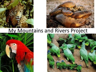
This document outlines a student project about mountains and rivers. It contains 3 pages, with the first two pages featuring pictures and the third page presenting facts about mountains and rivers along with additional pictures.
Report
Share
Report
Share

Recommended
Speech (What I Think)
The student received feedback on a speech they delivered in class. They were rated highly in their organization but could have improved their opening and use of paragraphs. While they provided details, they could have better supported their arguments with facts. To improve, the student aims to slow down their delivery, speak louder, and reduce fidgeting. They recognize not asking questions in their opening was weak compared to peers. To prepare, they practiced their speech aloud and in front of others. Their refutation section was most effective at changing opinions. The student remains uncomfortable giving speeches due to physical nerves.
Mountains 97
Mountains are geological formations that rise prominently above their surroundings. They are formed through tectonic forces or volcanism and eroded by weather and glaciers over extremely long periods of time. The highest mountain on Earth is Mount Everest, located in the Himalayas, which reaches an elevation of 8,848 meters (29,029 feet) above sea level.
Honors Speech Final!
The student gave a self-assessment of a speech they delivered. They rated themselves highly in several areas including structure and organization, opening, use of paragraphs, detail, and arguments/conclusion. They thought they could have improved delivery by speaking louder and more expressively. They were nervous watching other speeches but felt prepared from practicing, including video recording themselves. They were pleased with the quality of writing and argument in their speech. The student feels scared but excited about giving speeches if they know their material is good, as they did for this speech.
Upload Example
The document discusses 21st century learning initiatives for students in Year 6. It aims to enhance learning by teaching future skills, ensuring online safety, giving access to online resources, motivating students to learn, and through partnerships with parents. Skills for the future and internet safety will be taught.
N4n0r21s Speech
The document discusses shark fin soup and includes a self-assessment of a speech. The self-assessment questions how the speaker could have improved their delivery, what stood out about other speeches, how they prepared, what they did well, and their feelings about public speaking.
My Year 6 Speech Assessment[1]
Gabe assessed his Year 6 speech and identified areas for improvement. He felt his opening was strong but his conclusion was weak by abruptly transitioning to it. While he included paragraphs and details as instructed, he did not memorize his speech fully. In delivering the speech, Gabe paused for long periods and skipped over parts, indicating a need for better preparation and practice to overcome nerves. He recognized strong elements in peers' speeches like expression but also saw examples of stage fright.
Rivers
The document is an invitation to look at a book. The author, Honor Faye Easton, offers to show their book to the reader if they would like to take a look at it. The reader is asked to see the author so that the author can show them the book.
Mount Everest Project by Maddi
To climb Mount Everest, one needs proper equipment and supplies to handle the extreme conditions, and there are dangers to watch out for such as avalanches and altitude sickness. The first people to reach the summit of Everest were Edmund Hillary from New Zealand and Tenzing Norkay from Nepal in 1953. Extra facts provided about Everest include its formation process, different parts of mountains, and types of mountains.
Mount Everest!!!!!!![1][1]
Mount Everest is the tallest mountain in the world and in 1953 Sir Edmund Hillary and Tenzing Norgay were the first people to reach its summit. Some key facts about Mount Everest include that it is located in the Himalayas and spans the border between Nepal and China.
Types of Mountains
Dome mountains form when magma pushes up from below the earth's crust, creating a dome shape by pushing up on the underlying rock without breaking through the surface. The magma pushes upwards, causing the mountain to grow taller over time. The most well-known example of a dome mountain is Black Dome Mountain.
Mount Everest Project By Maddi
To climb Mount Everest, one needs proper equipment and supplies to handle the extreme conditions, and there are dangers to watch out for such as avalanches and altitude sickness. The first people to reach the summit of Everest were Edmund Hillary from New Zealand and Tenzing Norkay from Nepal in 1953. The document also provides extra facts about Everest such as how it was formed and its various parts, as well as background on the history of climbs up the mountain.
The River Nile
The document discusses the impact of climate change on coastal communities. Rising sea levels threaten to submerge low-lying areas and increase the frequency and severity of coastal flooding. Without significant reductions in greenhouse gas emissions, climate change is expected to displace millions of people living in coastal regions over the coming decades.
The River Nile
The document discusses the challenges of summarizing longer form content into concise summaries. Specifically, it aims to extract only the most important and essential information while maintaining readability and flow. The goal is to give readers a high-level understanding of the key topics and takeaways in as few sentences as possible.
Project Andes Mountains
The document discusses the wildlife and culture of the Andes mountains, including camels that live at high altitudes where oxygen is scarce, and the Andean condor. It also mentions the geological formation of the Andes from tectonic plate subduction and how the mountains contain both fold mountains and volcanic mountains.
The Himalayas, Mountains And Rivers Project - Carver
This document provides an overview of the different regions of the Himalayas, including the Greater Himalayas, Lesser Himalayas, Outer Himalayas, Indian Himalayas, Nepalese Himalayas, and Tibetan Himalayas. It includes a table of contents listing the topics and pages for sections on the general details of the Himalayas and each specific region. Credits are provided at the end for the production team that created the document.
Mount Everest Project. By: Maddi
To climb Mount Everest, one needs proper equipment and supplies to handle the extreme conditions, and there are dangers to watch out for such as avalanches and altitude sickness. The first people to reach the summit of Everest were Edmund Hillary from New Zealand and Tenzing Norkay from Nepal in 1953. The document also provides extra facts about Everest such as how it was formed and its various parts, as well as background on the history of climbs up the mountain.
Mt Everest Slideshow
Mount Everest is the tallest mountain in the world at 8,848 meters. It is located in the Himalayas between Nepal and Tibet. Mount Everest was formed 60 million years ago when the Indian plate collided with the Eurasian plate, pushing up the land and forming the Himalayan mountain range. The first successful ascent of Mount Everest was made in 1953 by Sir Edmund Hillary and Tenzing Norgay. Reaching the summit requires careful planning and navigation to deal with challenges like high altitude, low oxygen, extreme cold, and dangerous conditions.
Amazon River Powerpoint 2003
This document provides information about the major rivers of the Amazon River system, including their lengths and countries they flow through. It lists the longest rivers, such as the Amazon River, Purus River, and Madeira River. The document also mentions some tributaries and canals connected to the Amazon River system.
The Himalayas
The Himalayas are a mountain range in Asia that separates the Indian subcontinent from the Tibetan Plateau. Stretching across five countries, the Himalayas contain over 100 peaks rising above 7,000 meters including Mount Everest, which at 8,848 meters is the highest point on Earth. The Himalayas are geologically young and highly active mountains created by the collision of the Indian subcontinent with Eurasia.
Enrique, Maddi and Megan's Pres
Dome mountains form when magma pushes up from below the earth's crust, creating a dome shape by pushing up on the underlying rock without breaking through the surface. The magma continues pushing upwards, causing the mountain to grow taller over time. The best known example of a dome mountain is Black Dome Mountain.
The Amazon River By Steven Green 97 2003 Powerpoint
The Amazon River flows through 7 South American countries before emptying into the Atlantic Ocean. At over 6,400 km long, it is the second longest river in the world. The river begins in the Andes Mountains in Peru and passes through dense rainforest before reaching its enormous mouth, which is over 60 km wide and larger than the length of the Thames River in London. The Amazon River is home to many species of wildlife including bull sharks, anacondas, piranhas, and Amazon river dolphins.
Mount Everest
This document discusses a person named Sophie as the author. No other details are provided about the content of the document itself within the given text. There is insufficient information to construct a meaningful summary beyond stating the author's name.
Mountain Project
There are five main types of mountains: fold mountains like the Himalayas which are formed by colliding tectonic plates; volcanic mountains such as Mount St. Helens which are formed by volcanic eruptions; dome mountains like Mount Kea that form when magma forces up from below; plateau mountains in places like New Zealand which form from erosion of flat plains pushed upwards; and block mountains exemplified by the Sierra Nevada range that are created by cracks filling with rock and magma.
The Pyrenees
The Pyrenees mountains span the border between France and Spain. They form a natural border between the Iberian Peninsula and continental Europe. The Pyrenees range features many peaks over 10,000 feet in elevation and is home to diverse wildlife including bears, wolves, and golden eagles.
Mountains Project For 2 Days
There are three main types of mountains: volcanic mountains, dome mountains, and fold mountains. Volcanic mountains are formed from volcanic eruptions that pile lava and ash into cone-shaped peaks. Dome mountains form when magma pushes up from below but cannot penetrate the earth's crust, hardening into rounded summits. Fold mountains such as the Himalayas, Andes, and Rockies are created by tectonic plate collisions that crumple the edges of plates upward.
PCOS corelations and management through Ayurveda.
This presentation includes basic of PCOS their pathology and treatment and also Ayurveda correlation of PCOS and Ayurvedic line of treatment mentioned in classics.
More Related Content
More from year 6 DBIS
Mount Everest Project by Maddi
To climb Mount Everest, one needs proper equipment and supplies to handle the extreme conditions, and there are dangers to watch out for such as avalanches and altitude sickness. The first people to reach the summit of Everest were Edmund Hillary from New Zealand and Tenzing Norkay from Nepal in 1953. Extra facts provided about Everest include its formation process, different parts of mountains, and types of mountains.
Mount Everest!!!!!!![1][1]
Mount Everest is the tallest mountain in the world and in 1953 Sir Edmund Hillary and Tenzing Norgay were the first people to reach its summit. Some key facts about Mount Everest include that it is located in the Himalayas and spans the border between Nepal and China.
Types of Mountains
Dome mountains form when magma pushes up from below the earth's crust, creating a dome shape by pushing up on the underlying rock without breaking through the surface. The magma pushes upwards, causing the mountain to grow taller over time. The most well-known example of a dome mountain is Black Dome Mountain.
Mount Everest Project By Maddi
To climb Mount Everest, one needs proper equipment and supplies to handle the extreme conditions, and there are dangers to watch out for such as avalanches and altitude sickness. The first people to reach the summit of Everest were Edmund Hillary from New Zealand and Tenzing Norkay from Nepal in 1953. The document also provides extra facts about Everest such as how it was formed and its various parts, as well as background on the history of climbs up the mountain.
The River Nile
The document discusses the impact of climate change on coastal communities. Rising sea levels threaten to submerge low-lying areas and increase the frequency and severity of coastal flooding. Without significant reductions in greenhouse gas emissions, climate change is expected to displace millions of people living in coastal regions over the coming decades.
The River Nile
The document discusses the challenges of summarizing longer form content into concise summaries. Specifically, it aims to extract only the most important and essential information while maintaining readability and flow. The goal is to give readers a high-level understanding of the key topics and takeaways in as few sentences as possible.
Project Andes Mountains
The document discusses the wildlife and culture of the Andes mountains, including camels that live at high altitudes where oxygen is scarce, and the Andean condor. It also mentions the geological formation of the Andes from tectonic plate subduction and how the mountains contain both fold mountains and volcanic mountains.
The Himalayas, Mountains And Rivers Project - Carver
This document provides an overview of the different regions of the Himalayas, including the Greater Himalayas, Lesser Himalayas, Outer Himalayas, Indian Himalayas, Nepalese Himalayas, and Tibetan Himalayas. It includes a table of contents listing the topics and pages for sections on the general details of the Himalayas and each specific region. Credits are provided at the end for the production team that created the document.
Mount Everest Project. By: Maddi
To climb Mount Everest, one needs proper equipment and supplies to handle the extreme conditions, and there are dangers to watch out for such as avalanches and altitude sickness. The first people to reach the summit of Everest were Edmund Hillary from New Zealand and Tenzing Norkay from Nepal in 1953. The document also provides extra facts about Everest such as how it was formed and its various parts, as well as background on the history of climbs up the mountain.
Mt Everest Slideshow
Mount Everest is the tallest mountain in the world at 8,848 meters. It is located in the Himalayas between Nepal and Tibet. Mount Everest was formed 60 million years ago when the Indian plate collided with the Eurasian plate, pushing up the land and forming the Himalayan mountain range. The first successful ascent of Mount Everest was made in 1953 by Sir Edmund Hillary and Tenzing Norgay. Reaching the summit requires careful planning and navigation to deal with challenges like high altitude, low oxygen, extreme cold, and dangerous conditions.
Amazon River Powerpoint 2003
This document provides information about the major rivers of the Amazon River system, including their lengths and countries they flow through. It lists the longest rivers, such as the Amazon River, Purus River, and Madeira River. The document also mentions some tributaries and canals connected to the Amazon River system.
The Himalayas
The Himalayas are a mountain range in Asia that separates the Indian subcontinent from the Tibetan Plateau. Stretching across five countries, the Himalayas contain over 100 peaks rising above 7,000 meters including Mount Everest, which at 8,848 meters is the highest point on Earth. The Himalayas are geologically young and highly active mountains created by the collision of the Indian subcontinent with Eurasia.
Enrique, Maddi and Megan's Pres
Dome mountains form when magma pushes up from below the earth's crust, creating a dome shape by pushing up on the underlying rock without breaking through the surface. The magma continues pushing upwards, causing the mountain to grow taller over time. The best known example of a dome mountain is Black Dome Mountain.
The Amazon River By Steven Green 97 2003 Powerpoint
The Amazon River flows through 7 South American countries before emptying into the Atlantic Ocean. At over 6,400 km long, it is the second longest river in the world. The river begins in the Andes Mountains in Peru and passes through dense rainforest before reaching its enormous mouth, which is over 60 km wide and larger than the length of the Thames River in London. The Amazon River is home to many species of wildlife including bull sharks, anacondas, piranhas, and Amazon river dolphins.
Mount Everest
This document discusses a person named Sophie as the author. No other details are provided about the content of the document itself within the given text. There is insufficient information to construct a meaningful summary beyond stating the author's name.
Mountain Project
There are five main types of mountains: fold mountains like the Himalayas which are formed by colliding tectonic plates; volcanic mountains such as Mount St. Helens which are formed by volcanic eruptions; dome mountains like Mount Kea that form when magma forces up from below; plateau mountains in places like New Zealand which form from erosion of flat plains pushed upwards; and block mountains exemplified by the Sierra Nevada range that are created by cracks filling with rock and magma.
The Pyrenees
The Pyrenees mountains span the border between France and Spain. They form a natural border between the Iberian Peninsula and continental Europe. The Pyrenees range features many peaks over 10,000 feet in elevation and is home to diverse wildlife including bears, wolves, and golden eagles.
Mountains Project For 2 Days
There are three main types of mountains: volcanic mountains, dome mountains, and fold mountains. Volcanic mountains are formed from volcanic eruptions that pile lava and ash into cone-shaped peaks. Dome mountains form when magma pushes up from below but cannot penetrate the earth's crust, hardening into rounded summits. Fold mountains such as the Himalayas, Andes, and Rockies are created by tectonic plate collisions that crumple the edges of plates upward.
More from year 6 DBIS (20)
The Himalayas, Mountains And Rivers Project - Carver
The Himalayas, Mountains And Rivers Project - Carver
The Amazon River By Steven Green 97 2003 Powerpoint
The Amazon River By Steven Green 97 2003 Powerpoint
Recently uploaded
PCOS corelations and management through Ayurveda.
This presentation includes basic of PCOS their pathology and treatment and also Ayurveda correlation of PCOS and Ayurvedic line of treatment mentioned in classics.
RHEOLOGY Physical pharmaceutics-II notes for B.pharm 4th sem students
Physical pharmaceutics notes for B.pharm students
BBR 2024 Summer Sessions Interview Training
Qualitative research interview training by Professor Katrina Pritchard and Dr Helen Williams
South African Journal of Science: Writing with integrity workshop (2024)
South African Journal of Science: Writing with integrity workshop (2024)Academy of Science of South Africa
A workshop hosted by the South African Journal of Science aimed at postgraduate students and early career researchers with little or no experience in writing and publishing journal articles.Main Java[All of the Base Concepts}.docx
This is part 1 of my Java Learning Journey. This Contains Custom methods, classes, constructors, packages, multithreading , try- catch block, finally block and more.
Pengantar Penggunaan Flutter - Dart programming language1.pptx
Pengantar Penggunaan Flutter - Dart programming language1.pptx
Advanced Java[Extra Concepts, Not Difficult].docx
This is part 2 of my Java Learning Journey. This contains Hashing, ArrayList, LinkedList, Date and Time Classes, Calendar Class and more.
Exploiting Artificial Intelligence for Empowering Researchers and Faculty, In...
Exploiting Artificial Intelligence for Empowering Researchers and Faculty, In...Dr. Vinod Kumar Kanvaria
Exploiting Artificial Intelligence for Empowering Researchers and Faculty,
International FDP on Fundamentals of Research in Social Sciences
at Integral University, Lucknow, 06.06.2024
By Dr. Vinod Kumar KanvariaChapter wise All Notes of First year Basic Civil Engineering.pptx
Chapter wise All Notes of First year Basic Civil Engineering
Syllabus
Chapter-1
Introduction to objective, scope and outcome the subject
Chapter 2
Introduction: Scope and Specialization of Civil Engineering, Role of civil Engineer in Society, Impact of infrastructural development on economy of country.
Chapter 3
Surveying: Object Principles & Types of Surveying; Site Plans, Plans & Maps; Scales & Unit of different Measurements.
Linear Measurements: Instruments used. Linear Measurement by Tape, Ranging out Survey Lines and overcoming Obstructions; Measurements on sloping ground; Tape corrections, conventional symbols. Angular Measurements: Instruments used; Introduction to Compass Surveying, Bearings and Longitude & Latitude of a Line, Introduction to total station.
Levelling: Instrument used Object of levelling, Methods of levelling in brief, and Contour maps.
Chapter 4
Buildings: Selection of site for Buildings, Layout of Building Plan, Types of buildings, Plinth area, carpet area, floor space index, Introduction to building byelaws, concept of sun light & ventilation. Components of Buildings & their functions, Basic concept of R.C.C., Introduction to types of foundation
Chapter 5
Transportation: Introduction to Transportation Engineering; Traffic and Road Safety: Types and Characteristics of Various Modes of Transportation; Various Road Traffic Signs, Causes of Accidents and Road Safety Measures.
Chapter 6
Environmental Engineering: Environmental Pollution, Environmental Acts and Regulations, Functional Concepts of Ecology, Basics of Species, Biodiversity, Ecosystem, Hydrological Cycle; Chemical Cycles: Carbon, Nitrogen & Phosphorus; Energy Flow in Ecosystems.
Water Pollution: Water Quality standards, Introduction to Treatment & Disposal of Waste Water. Reuse and Saving of Water, Rain Water Harvesting. Solid Waste Management: Classification of Solid Waste, Collection, Transportation and Disposal of Solid. Recycling of Solid Waste: Energy Recovery, Sanitary Landfill, On-Site Sanitation. Air & Noise Pollution: Primary and Secondary air pollutants, Harmful effects of Air Pollution, Control of Air Pollution. . Noise Pollution Harmful Effects of noise pollution, control of noise pollution, Global warming & Climate Change, Ozone depletion, Greenhouse effect
Text Books:
1. Palancharmy, Basic Civil Engineering, McGraw Hill publishers.
2. Satheesh Gopi, Basic Civil Engineering, Pearson Publishers.
3. Ketki Rangwala Dalal, Essentials of Civil Engineering, Charotar Publishing House.
4. BCP, Surveying volume 1
How to Fix the Import Error in the Odoo 17
An import error occurs when a program fails to import a module or library, disrupting its execution. In languages like Python, this issue arises when the specified module cannot be found or accessed, hindering the program's functionality. Resolving import errors is crucial for maintaining smooth software operation and uninterrupted development processes.
BÀI TẬP BỔ TRỢ TIẾNG ANH LỚP 9 CẢ NĂM - GLOBAL SUCCESS - NĂM HỌC 2024-2025 - ...
BÀI TẬP BỔ TRỢ TIẾNG ANH LỚP 9 CẢ NĂM - GLOBAL SUCCESS - NĂM HỌC 2024-2025 - ...Nguyen Thanh Tu Collection
https://app.box.com/s/tacvl9ekroe9hqupdnjruiypvm9rdaneHow to deliver Powerpoint Presentations.pptx
"How to make and deliver dynamic presentations by making it more interactive to captivate your audience attention"
How to Build a Module in Odoo 17 Using the Scaffold Method
Odoo provides an option for creating a module by using a single line command. By using this command the user can make a whole structure of a module. It is very easy for a beginner to make a module. There is no need to make each file manually. This slide will show how to create a module using the scaffold method.
How to Create a More Engaging and Human Online Learning Experience
How to Create a More Engaging and Human Online Learning Experience Wahiba Chair Training & Consulting
Wahiba Chair's Talk at the 2024 Learning Ideas Conference. Hindi varnamala | hindi alphabet PPT.pdf
हिंदी वर्णमाला पीपीटी, hindi alphabet PPT presentation, hindi varnamala PPT, Hindi Varnamala pdf, हिंदी स्वर, हिंदी व्यंजन, sikhiye hindi varnmala, dr. mulla adam ali, hindi language and literature, hindi alphabet with drawing, hindi alphabet pdf, hindi varnamala for childrens, hindi language, hindi varnamala practice for kids, https://www.drmullaadamali.com
How to Manage Your Lost Opportunities in Odoo 17 CRM
Odoo 17 CRM allows us to track why we lose sales opportunities with "Lost Reasons." This helps analyze our sales process and identify areas for improvement. Here's how to configure lost reasons in Odoo 17 CRM
Recently uploaded (20)
Film vocab for eal 3 students: Australia the movie
Film vocab for eal 3 students: Australia the movie
RHEOLOGY Physical pharmaceutics-II notes for B.pharm 4th sem students
RHEOLOGY Physical pharmaceutics-II notes for B.pharm 4th sem students
South African Journal of Science: Writing with integrity workshop (2024)
South African Journal of Science: Writing with integrity workshop (2024)
Pengantar Penggunaan Flutter - Dart programming language1.pptx
Pengantar Penggunaan Flutter - Dart programming language1.pptx
Exploiting Artificial Intelligence for Empowering Researchers and Faculty, In...
Exploiting Artificial Intelligence for Empowering Researchers and Faculty, In...
Chapter wise All Notes of First year Basic Civil Engineering.pptx
Chapter wise All Notes of First year Basic Civil Engineering.pptx
BÀI TẬP BỔ TRỢ TIẾNG ANH LỚP 9 CẢ NĂM - GLOBAL SUCCESS - NĂM HỌC 2024-2025 - ...
BÀI TẬP BỔ TRỢ TIẾNG ANH LỚP 9 CẢ NĂM - GLOBAL SUCCESS - NĂM HỌC 2024-2025 - ...
How to Build a Module in Odoo 17 Using the Scaffold Method
How to Build a Module in Odoo 17 Using the Scaffold Method
How to Create a More Engaging and Human Online Learning Experience
How to Create a More Engaging and Human Online Learning Experience
How to Manage Your Lost Opportunities in Odoo 17 CRM
How to Manage Your Lost Opportunities in Odoo 17 CRM
My Mountains And Rivers Project
- 1. My Mountains and Rivers Project
- 2. My Project
- 4. Page 1
- 5. Pictures
- 6. Page 2
- 7. Pictures
- 8. Page 3
- 9. My Fact Page
- 10. Pictures