
Recommended
Recommended
More Related Content
Similar to MSc_thesis_MSP_MMannaart_250909_public
Similar to MSc_thesis_MSP_MMannaart_250909_public (20)
MSc_thesis_MSP_MMannaart_250909_public
- 1. Effective Marine Spatial Planning and Marine and Coastal Nature Protection Policy A study for the optimization of marine spatial planning systems, based on literature research, interviews and the comparison of case studies in three countries along the Greater North Sea Michael Mannaart Master of Science thesis Open University The Netherlands, Faculty of Sciences, School of Environmental Science October 2009
- 2. ii
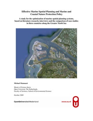
- 3. iii Colophon Author: Michael Mannaart Contact information: Email : mikemannaart@hetnet.nl Website : http://www.linkedin.com/in/mikemannaart Scientific Master of Science Course Final MSc project (number: 94310) Open University The Netherlands Faculty of Sciences, School of Environmental Science P.O. Box 2960 6401 DL HEERLEN The Netherlands Effective Marine Spatial Planning and Marine and Coastal Nature Protection Policy A study for the optimization of marine spatial planning systems, based on literature research, interviews and the comparison of case studies in three countries along the Greater North Sea Cover photo: An overview of the Maasvlakte Project, The Netherlands (Google Earth A, n.d.) ©Open University the Netherlands 2009. All rights reserved. No part of this publication may be reproduced without the written permission of the copyright holder or the author.
- 4. iv
- 5. v Effective Marine Spatial Planning and Marine and Coastal Nature Protection Policy A study for the optimization of marine spatial planning systems, based on literature research, interviews and the comparison of case studies in three countries along the Greater North Sea Effectieve mariene ruimtelijke ordening en natuurbeleid voor zee en kust Een studie naar de mogelijkheden voor optimalisatie van mariene ruimtelijke ordeningsystemen, gebaseerd op literatuuronderzoek, interviews en vergelijkende casestudies in drie landen aan de Grotere Noordzee
- 6. vi
- 7. vii Preface Marine Spatial Planning is a new topic at the horizon of spatial sciences and environmental management. My journey to explore this subject was an interesting one. Literature and the three cases I studied revealed interesting information I was not aware of before. Since I work in the field of environmental, coastal and marine management, this study was a valuable contribution to my professional knowledge that could be applied right away. This thesis is the conclusion of the final project for my scientific Master of Science course in Environmental Sciences at the Open University The Netherlands. This project was guided by an examination and research commission, which members were: Mrs. Cobi de Blécourt-Maas MSc chairperson of the commission and tutor, Open University The Netherlands Mr. P. Geluk MSc secretary of the commission, Open University The Netherlands Mrs. Daisy Tysmans PhD MSc 2nd tutor, Open University The Netherlands Mr. Prof. Ronald E. Waterman MSc external member, à titre personnel Mr. Rene Boesten MSc external member, à titre personnel Mr. Andrus Meiner PhD MSc external member, à titre personnel Conducting this research was not always easy, due to the unavailability of appropriate cases, information and a lack of responding experts, but nonetheless it was a pleasure to do. It would have never been possible without the support of a considerable number of people, which I would like to thank. Acknowledgements I am indebted to my tutors Mrs. Cobi de Blécourt-Maas MSc and Mrs. Daisy Tysmans PhD MSc, for their guidance, comments and the interesting conversations we had. Valuable support was provided by the external members of the research commission that consisted of: Mr. Prof. Ronald E. Waterman MSc, Mr. Rene Boesten MSc and Mr. Andrus Meiner PhD MSc. Their personal comments and constructive criticism were of great help in my quest for the appropriate scientific direction and sources of information. This study would not have been possible without the valuable contribution from experts working in the fields of spatial planning, nature conservation and civil engineering. Therefore I would like to thank especially: Mr. Stephen A. Jay PhD MSc, Mr. Tiedo Vellinga MSc, Mr. Karsten Mangor MSc, Mr. Marcel Rozemeijer PhD MSc, Mr. Leif Sjøgren MSc and Mr. James Eaton. They provided important information and very useful contacts. Additionally Mr. Jay, Mr. Sjøgren and Mr. Eaton provided important literature which is appreciated very much. Of course all experts that responded to the questionnaire are thanked for their important contribution: Mr. Ulrik Chr. Berggreen MSc, Mr. Holger Bisgaard MSc, Mrs. Mariska Harte MSc, Mr. Martin Hogeboom LLM, Mr. Stephen A. Jay PhD MSc, Jan de Jong MSc, Mr. Jos Kuijpers MSc, Mr. Karsten Mangor MSc, Mr. Frank Montanus LLM, Mr. John Pape PhD, Mr. Daniel Pullan MTP BSc, Mr. Prof. Marcel Stive PhD MSc and Mr. Ad Stolk MSc. Additional information was provided by Mr. Paul Davey, Mr. Roger Morris MSc, Mr. Per Sørensen MSc and Mrs. Jane Stanbridge Mike Mannaart October 19, 2009
- 8. viii
- 9. ix Table of Contents Preface Table of Contents Abstract in English and Dutch 1. Introduction......................................................................................................................1 1.1 A need for sustainable management of the natural resources of the marine and coastal environment................................................................................................................................... 1 1.2 The Greater North Sea, its characteristics and problems to be addressed...................................... 1 1.2.1 Geography ............................................................................................................................. 1 1.2.2 Ecological value..................................................................................................................... 2 1.2.3 Economic value ..................................................................................................................... 3 1.2.3.1 Navigation and coastal activities ................................................................................... 3 1.2.3.2 Industry (including offshore industry)............................................................................ 3 1.2.3.3 Fisheries and extraction of other marine living resources............................................. 3 1.2.3.4 Tourism........................................................................................................................... 4 1.2.4 Ecology versus economy....................................................................................................... 4 1.2.4.1 Activities and their impact on the Greater North Sea Ecosystem .................................. 4 1.2.4.2 Nature and gravity of the impact of activities on the Greater North Sea Ecosystem..... 4 1.2.5 The solution: an integrated spatial approach ......................................................................... 8 1.3 The structure of this thesis ............................................................................................................. 9 2. Aims and objectives........................................................................................................11 2.1 Introduction.................................................................................................................................. 11 2.2 Problem definition........................................................................................................................ 11 2.3 Research questions addressed ...................................................................................................... 12 3. Research methodology....................................................................................................15 3.1 Introduction.................................................................................................................................. 15 3.2 Literature research........................................................................................................................ 15 3.3 The selection of cases and experts involved ................................................................................ 15 3.3.1 Selection of cases................................................................................................................. 15 3.3.1.1 Selection of regions and countries ............................................................................... 15 3.3.1.2 Selection of projects ..................................................................................................... 16 3.3.1.3 The selected projects .................................................................................................... 20 3.3.2 Selection of experts.............................................................................................................. 21 3.4 Interviews of experts by means of a survey ................................................................................. 21 3.5 Data processing............................................................................................................................ 21 4. The framework for spatial planning..............................................................................23 4.1 Definition of spatial planning....................................................................................................... 23 4.2 Spatial planning in the European Community ............................................................................. 23 4.2.1 General EC policies and directives...................................................................................... 23 4.2.2 Spatial planning policies and directives with a land based character .................................. 24 4.2.3 Spatial planning policies and directives with a maritime character..................................... 24 4.2.4 Definition of marine spatial planning.................................................................................. 27 4.3 Spatial planning legislation and policy on the national level....................................................... 27 4.3.1 Spatial planning in Denmark ............................................................................................... 27 4.3.1.1 The Danish spatial planning system............................................................................. 27 4.3.1.2 Differentiation in land and sea..................................................................................... 28 4.3.1.3 Links with other types of legislation............................................................................. 29 4.3.2 Spatial planning in The Netherlands.................................................................................... 29 4.3.2.1 The Dutch Spatial planning system.............................................................................. 29 4.3.2.2 Differentiation in land and sea..................................................................................... 30 4.3.2.3 Links with other types of legislation............................................................................. 31
- 10. x 4.3.3 Spatial planning in The United Kingdom............................................................................ 32 4.3.3.1 The system for spatial planning in The United Kingdom............................................. 32 4.3.3.2 Differentiation in land and sea..................................................................................... 33 4.3.3.3 Links with other types of legislation............................................................................. 33 4.3.4 Conclusions concerning spatial planning ............................................................................ 33 4.3.4.1 Conclusion of the European Community’s spatial planning legislation and policy.... 33 4.3.4.2 Conclusions of the national spatial legislation and policy........................................... 34 5. The framework for nature conservation........................................................................35 5.1 Definition of nature conservation................................................................................................. 35 5.2 Nature conservation in the European Community ....................................................................... 35 5.3 Legislation and policy for nature conservation on the national level........................................... 37 5.3.1 Legislation and policy for nature conservation in Denmark................................................ 37 5.3.2 Legislation and policy for nature conservation in The Netherlands.................................... 38 5.3.3 Legislation and policy for nature conservation in The United Kingdom ............................ 38 5.3.4 Conclusions of the national nature conservation legislation and policy.............................. 39 5.3.4.1 Conclusion of the European Community’s nature conservation legislation and policy..................................................................................................................... 39 5.3.4.2 Conclusions of the national nature conservation legislation and policy ..................... 39 6. Coastal and marine spatial planning in practice...........................................................41 6.1 Introduction.................................................................................................................................. 41 6.2 The Danish case study: the Øresund Projects Cluster.................................................................. 41 6.3 The Dutch case study: the Maasvlakte II project ......................................................................... 43 6.4 The United Kingdom case study: the London Array Wind farm Project..................................... 45 6.5 Analysis of the cases studied........................................................................................................ 48 6.5.1 Characteristics of the cases assessed ................................................................................... 48 6.5.2 Conclusions derived from literature in relation to the opinions of the consulted experts.... 50 6.5.2.1 Spatial planning legislation.......................................................................................... 50 6.5.2.2 Nature conservation legislation ................................................................................... 51 6.5.2.3 Measures for nature protection.................................................................................... 51 7. Integrated systems for spatial planning.........................................................................55 7.1 Effectiveness of integrated spatial planning systems for nature protection................................. 55 7.2 What is needed to ensure nature protection at sea and in coastal areas?...................................... 55 7.2.1 Introduction.......................................................................................................................... 55 7.2.2 What is needed for effective spatial planning systems, the experts’opinions...................... 55 7.2.2.1 Legislation.................................................................................................................... 56 7.2.2.2 Vision............................................................................................................................ 56 7.2.2.3 Governing and coordinating body................................................................................ 56 7.2.2.4 Conclusion.................................................................................................................... 57 7.2.3 Characteristics of a system for Integrated terrestrial, coastal and marine spatial planning. 57 7.2.3.1 Can systems for terrestrial, coastal and marine spatial planning be integrated? ....... 57 7.2.3.2 Components of a framework for integrated Coastal & Marine Spatial Planning ....... 58 8. Conclusions and recommendations................................................................................61 8.1 Introduction.................................................................................................................................. 61 8.2 Discussion.................................................................................................................................... 61 8.2.1 Literature research ............................................................................................................... 61 8.2.2 Case studies ......................................................................................................................... 61 8.2.3 Survey.................................................................................................................................. 62 8.3 Conclusions of the main research question.................................................................................. 63 8.4. Recommendations....................................................................................................................... 64 9. References.......................................................................................................................67
- 11. xi Annexes Annex I. Glossary of the most important terms and abbreviations Annex II. A non limitative overview of the nature and impact of human activities on the marine and coastal ecosystem of the Greater North Sea. Annex III. An overview of assessed potential projects Annex IV.I Text of the questionnaire Annex IV.II.a List of experts who participated in the questionnaire Annex IV.II.b List of experts who provided additional information Annex IV.III.a Results of the questionnaire Annex IV.III.b Results of the interviews Annex V An extensive description of the Øresund Projects Cluster Annex VI. An extensive description of the Maasvlakte II project Annex VII. An extensive description of the London Array Wind farm project Annex VIII. A summarization of the answers to the research questions
- 12. xii
- 13. xiii Abstract & Samenvatting Abstract A large part of the human world population depends on the sea. Hence coastal and marine areas are extensively used for multiple purposes. This also applies to the Greater North Sea, which is one of the busiest seas in the world, which sea is of great ecological and economic importance. Considerable pressure on the North Sea’s marine and coastal ecological system is caused by a multiple number of uses. These uses however, are regulated by fragmented policies. A policy frame that sufficiently addresses all activities, plans and projects of a spatial nature does not yet exist in the European Community. Since the sea is used by a multiple number of countries and organisms and pollution do not stop at boundaries, the “Tragedy of the Commons” applies easily to this vulnerable area. These marine issues, however, cannot be approached effectively while neglecting the connection to the coast and hinterland. Therefore an integrated spatial approach, which includes the terrestrial, coastal and marine environment, is absolutely necessary. The European Community’s role is of utmost importance, since an international approach that goes beyond the national interests is the only way to solve this problem sufficiently. With this in mind, this thesis is aiming to give an adequate answer to the question: can the integration of spatial planning systems be optimized for both land and sea in Denmark, The Netherlands and The United Kingdom to ensure nature conservation? To provide for an answer, literature research was conducted to collect information concerning spatial planning with regard to nature conservation. Also cases where extensive projects were established in coastal and marine areas were studied. Three cases were selected: the Øresund Projects Cluster (Fixed Link and Amager Beach, Denmark), the Maasvlakte Peninsula (The Netherlands) and the London Array Offshore Wind Farm (The United Kingdom). Additionally a number of key experts involved in the projects were asked to participate in a survey and interviews were held that provided valuable additional information. Conclusions No system for spatial planning that included the terrestrial, coastal and marine part of the countries territory, were applied with regard to the three cases assessed in Denmark, The Netherlands and The United Kingdom. In all three cases assessed however, it was and is possible to formulate an umbrella legislation in which the system for terrestrial spatial planning and the system for coastal and marine spatial planning were and are connected. This umbrella legislation can optimize the protection of coastal and marine nature. An even stronger protection can be achieved when a framework for nature protection is included in the umbrella legislation itself. At the same time a strong connection to nature protection legislation has to be provided for. Recommendations The first recommendation is to provide for a legal basis for Marine Spatial Planning as part of Integrated Spatial Planning for all coastal states by means of a European Community Marine, Coastal & Terrestrial Spatial Planning Framework Directive. Additionally, an integrated spatial vision for all European and national coastal and marine territories should be created. Thus enabling addressing initiatives in the coastal and marine zone, to gear these to one another and to link these with the demands stated in the integrated vision. This provides a basis which enables taking action in a very early stage of the process, which leads to enhanced spatial planning and ensures nature protection. The requirements for such international and national integrated visions should be defined in the previously mentioned Marine, Coastal & Terrestrial Spatial Planning Framework Directive. Furthermore, the coastal and marine part of the Integrated Spatial Planning System has to include: 1) a legal and policy framework, 2) coordinating bodies, separately for the marine territory and the coastal territory (the marine coordinating body has to be of the national
- 14. xiv level and coastal coordinating bodies of a regional level); 3) data and information management, 4) regulations for consenting processes (including public consultation and appeal), 5) permitting, licensing and law enforcement) and 6) cross-border cooperation. In addition also the definition of the territories of the spatial planning system (terrestrial, coastal and marine) needs to be described. Inclusion of the Territorial Zone, Contiguous Zone and Exclusive Economic Zone in the coastal and marine part of the integrated spatial planning system is recommended. Due to its magnitude, phasing and internal zoning could be needed. Uses to be indicated and addressed in coastal and marine zoning plans should include at least: 1) coastal defence and land reclamation, 2) energy conversion, 3) exploitation and extraction, 4) housing, 5) industrial activities, 6) maritime projects, 7) transport facilities 8) recreation and leisure and 9) areas of importance to nature. Additionally, provisions need to be included in the national Spatial Planning Acts itself for monitoring of the impact of activities, plans and projects with regard to nature values. Finally, a framework for measures for protection, mitigation and compensation of marine and coastal nature values that might be affected has to be established in the Act as well. In addition a firm connection to legislation for nature conservation has to be realised. Samenvatting Een groot deel van de mensheid is afhankelijk van de zee, waardoor kust- en zeegebieden voor een groot aantal zaken door de mens worden gebruikt. Dit geldt ook voor de Grotere Noordzee, die een van de drukste zeeën ter wereld is en van grote ecologische en economische waarde. Door het grote aantal activiteiten rust er een aanzienlijke druk op het aanwezige ecosysteem. Nu worden deze activiteiten gereguleerd door een gefragmenteerd beleid. Een kader dat aansturing van alle ruimtelijke activiteiten omvat bestaat niet in de Europese Gemeenschap. Omdat de zee door veel landen wordt gebruikt, begrenzing op zee lastig is en organismen en vervuiling zich niets aantrekken van landgrenzen, is de “Tragedy of the Commons” is al snel van toepassing op dit kwetsbare gebied. Deze mariene zaken kunnen echter niet effectief worden aangepakt zonder rekening te houden met de sterke relatie die bestaat tussen zee, kustgebied en achterland. Daarom is een geïntegreerde aanpak van het mariene, kust- en landgebied absoluut noodzakelijk. De rol van de Europese Gemeenschap is hierbij van uitermate groot belang, omdat een internationale aanpak, die nationale deelbelangen overstijgt, de enige manier is om deze problematiek op te lossen. Met dit in het achterhoofd, wordt in deze afstudeerscriptie een antwoord op de volgende vraag gezocht: kan de integratie van ruimtelijke ordeningsystemen voor zowel land als zee, in Denemarken, Nederland en het Verenigd Koninkrijk worden geoptimaliseerd om natuur- bescherming te verzekeren? Om deze vraag te kunnen beantwoorden is literatuuronderzoek uitgevoerd naar ruimtelijke ordening en natuurbescherming. Tevens zijn drie grote cases in de kust- en zeezone onderzocht. Dit betreffen: Øresund Project Cluster (Fixed Link en het Amager Strandpark) in Denemarken, de Maasvlakte II in Nederland en het London Array Windmolenpark in het Verenigd Koninkrijk. Ook is een aantal sleutelfiguren geïnterviewd om aanvullende informatie te verzamelen. Conclusies Er bestaat geen ruimtelijk ordeningsysteem dat zowel het terrestrische, kust en mariene territoir omvat in de drie onderzochte landen. In alle drie de landen is het wel mogelijk om kader- wetgeving te creëren waarin het systeem voor ruimtelijke ordening voor land, kust en zee wordt opgezet. Hiermee kunnen de drie zones door ruimtelijke ordeningwetgeving met elkaar worden verbonden en geïntegreerd worden benaderd en beschermd. Deze kaderwetgeving kan de bescherming van kust- en zeenatuur optimaliseren. Als er een kader voor natuurbescherming in deze wet wordt opgenomen zal deze bescherming verder toenemen, welke uitermate wordt versterkt door een sterke verbinding met natuurbeschermingswetgeving te realiseren.
- 15. xv Aanbevelingen Er wordt ten eerste aanbevolen om een juridische basis voor ruimtelijke ordening op zee, als onderdeel van geïntegreerde ruimtelijke ordening, te creëren. Deze basis moet middels een richtlijn van de Europese Gemeenschap worden gerealiseerd: de Kaderrichtlijn Ruimtelijke Ordening voor Zee, Kust & Land. Deze richtlijn dient ook de randvoorwaarden voor het opstellen van een internationale, Europese visie voor het mariene en kustgebied te bevatten en regels voor het per land opstellen van een dergelijke visie. Het onderdeel van de ruimtelijke ordeningswet- geving dat zich richt op de kust- en zeezone, dient minimaal te bevatten: 1) een kader voor wetgeving en beleid, 2) coördinerende lichamen, afzonderlijk voor de mariene zone en de kustzone, 3) gegevensbeheer, 4) regels voor het besluitvormingsproces, 5) vergunningverlening en handhaving en 6) internationale samenwerking. Ook dienen de zones waarop de onderdelen van het ruimtelijke ordeningsysteem betrekking op heeft (land-, kust- en mariene zone) te worden beschreven. Activiteiten die minimaal in gebiedsplannen voor kust en zee dienen te worden opgenomen zijn: 1) kustverdediging en landaanwinning, 2) energie-conversie, 3) exploitatie en extractie, 4) woningbouw, 5) industriële activiteiten, 6) maritieme projecten, 7) transport- faciliteiten, 8) recreatie en 9) natuurgebieden. Ook dienen in de ruimtelijke ordeningswetgeving bepalingen voor beoordeling van de invloed van activiteiten, plannen en projecten op de natuur te worden opgenomen. Als laatste dient er een raamwerk met maatregelen voor ruimtelijke plannen, projecten en activiteiten ter bescherming van (inclusief mitigatie- en compensatiemaatregelen) de mariene en kustnatuurwaarden te worden opgenomen. Dit geheel dient te worden gecompleteerd door een sterke verbinding met natuurbeschermingswetgeving voor een optimale bescherming van de natuur.
- 16. xvi
- 17. Effective marine spatial planning and marine and coastal nature protection policy 1 1. Introduction 1.1 A need for sustainable management of the natural resources of the marine and coastal environment A large part of the human world population depends on the sea. At the beginning of the 21st century, around 80 % of the largest population centres in the world are found in coastal areas (Waterman, 2008). The sea, including its seabed, subsoil and its shorelines is of importance for trade routes, pipelines and cables for transport of energy, mass and information, climate regulation, sources of food and water (being both source and sink), energy, sand and gravel extraction and many other resources (Waterman, 2008; European Community, 1999). In addition it is also a favoured site for economic activities (e.g. ports and port related activities), citizen’s residences and recreation. Apart from the importance to mankind in general, the seas and coasts are probably of even more importance to nature. Numerous species depend on it and valuable ecosystems have evolved in this marine1 and coastal2 environment, which are extensively connected. The conservation of natural resources present is difficult due to its vulnerability and the fact that the marine environment is part of the territories of a large number of countries. An example of such a complex situation in the field of marine ecological issues is present at the Greater North Sea. With regard to navigation, the North Sea is the busiest sea in the world (Laane, Hisgen, Van Berge Henegouwen, Leeuwis & Colijn, 1991). It is extensively used for multiple purposes by the seven countries that border it also. That makes this sea a very interesting study area for the determination of parameters which are of importance for spatial planning in order to conserve the natural resources present. Therefore this study aims at this area. 1.2 The Greater North Sea, its characteristics and problems to be addressed 1.2.1 Geography The Greater North Sea is a semi-enclosed sea on the continental shelf of north-west Europe (referring to figure 1). It connects to the Atlantic Ocean to the north, and via the Channel to the south-west. It is also connected to the Baltic Sea in the east. For this study the North Sea is divided into the relatively shallow southern North Sea, the Central North Sea, the Northern North Sea, the Norwegian Trench and the Skagerrak. The latter is regarded to be a transitional zone between the Baltic and the North Sea. The Greater North Sea has a surface of approximately 750,000 km2 and a volume of about 94,000 km3 . This includes its estuaries and fjords (OSPAR Commission, 2000) (please refer to annex I, the glossary, for specific terms and abbreviations). Depths range from 30 to 200 meters, with an average depth of 90 meters (Hugenholtz, 2008). The sea is bounded by the coastlines of seven countries, which are in alphabetical order: Belgium, Denmark, France, Germany, Norway, and The Netherlands and The United Kingdom (including England and Scotland). 1 Marine refers to “marine waters”, which is defined as: "marine waters" meaning: a) waters, the sea-bed and subsoil on the seaward side of the baseline from which the extent of territorial waters is measured extending to the outmost reach of the area where a Member State has and/or exercises jurisdictional rights; and b) coastal waters as defined by Directive 2000/60/EC, their seabed and their subsoil, in so far as particular aspects of the environmental status of the marine environment are not already addressed through that Directive or other Community legislation (European Community, 2007B). 2 In this study “coastal” refers to the interface between sea and the land adjacent to it.
- 18. Effective marine spatial planning and marine and coastal nature protection policy 2 Figure 1: topography and catchment areas of the Greater North Sea (OSPAR Commission, 2000.) 1.2.2 Ecological value The North Sea is a very productive sea and of great ecological value. It is home to various species of marine life, birds and unique flora and fauna. Additionally it is of great socio- economic value and it is also one of the busiest seas in the world (Hugenholtz, 2008). The North Sea’s biodiversity is rich. Special habitat types are present and an extensive number of biological groups are present at the sea, including: phytoplankton, zooplankton, benthos, fish, seabirds, marine mammals and plants (algae) (OSPAR Commission, 2000; Walday & Kroglund, 2008). Considerable pressure on the ecological system is caused by inputs from industry, agriculture and 184 million people in the catchment area (OSPAR Commission, n.d.). This adds to the impact from extensive fisheries, offshore industry, intense shipping and a growing mariculture activity (Walday et al, 2008). Important habitat types of the Greater North Sea include: barrier islands, inter-tidal flats and estuaries. The latter two habitats are also an important nursery ground for North Sea fish stocks. Inter-tidal flats at the shallow Wadden Sea (referring to number 15 of figure 1) and around the British Isles are extremely important for many species. This is because the mild winter conditions and large tidal range expose large areas, which allows winter access to food for waders and wildfowl (Gubbay, 1995). Large numbers of organisms are present in the Greater North Sea including three important groups: plankton, benthos and nekton. Representatives of these groups which are present include: phytoplankton, algae, crustaceans, molluscs, annelids, echinoderms, coelenterates,
- 19. Effective marine spatial planning and marine and coastal nature protection policy 3 bryozoans, sea mammals, birds and others (OSPAR Commission, 2000). As the North Sea is shallow, there is a strong coupling between benthic and pelagic processes, making the region extremely productive (Walday et al, 2008). Approximately 230 species of fish are known to inhabit the North Sea. Of this number 13 species are the main targets of major commercial fisheries. Diversity is low in the shallow southern North Sea and eastern Channel, and increases westwards. Species diversity is generally higher inshore as there are more varied sediment types and spatial niches (OSPAR Commission, 2000). The bird populations of the North Sea area are of global importance. Some 10 million seabirds are present at most times of the year. In summer more than four million seabirds of 28 species breed along the coasts of the North Sea. The shallow Wadden Sea is of particular importance for both breeding and migratory bird populations. Six to twelve million birds of over 50 different species occur there annually. Sea mammals are also present in the area. Three species of seal and 16 of whale are more or less regularly observed in the North Sea. The most commonly observed cetacean is the harbour porpoise (Phocoena phocoena) which is estimated at 300,000 individuals (OSPAR Commission, 2000). 1.2.3 Economic value 1.2.3.1 Navigation and coastal activities With regard to navigation, the North Sea is the busiest sea in the world. Daily over 1000 ships travel to or from harbours located at the sea, resulting in a total number of 420.000 ship movements annually. This number excludes ferries and fishing craft (Laane et al., 1991). The North Sea, including its seabed, subsoil and its shorelines are important to trade routes, pipelines and cables, sources of food and water (being both source and sink), energy, sediment and many other resources. The coastal zone, being an important part of the North Sea as well, is a favoured site for all kind of functions like coastal defence and land reclamation to protect the land from the sea, and economic activities e.g. ports and port related activities like industry, agriculture, water extraction, military activities, citizen’s residences and recreation (Bosch, Slabbers, Ulijn & Verhoeff, 1995; Laane et. al, 1991; OSPAR Commission, 2000). 1.2.3.2 Industry (including offshore industry) There is a wide variety of industries located along the North Sea coasts (e.g. metal and metal-processing industry, chemicals, shipbuilding and nuclear power plants). Hydrocarbon resources in the region are rich, and the total production of oil in 1996–98 by Denmark, Germany, The Netherlands, Norway and The United Kingdom was 285.3 million tonnes per year and the total production of gas was 167.7 billion tonnes per year (OSPAR Commission, 2000). Discharges from offshore installations amount to 16–17,000 tonnes of oil per year (Walday et al, 2008). 1.2.3.3 Fisheries and extraction of other marine living resources The North Sea is one of the world's most productive areas for fish and a large number of commercially important species are caught in this area. The total biomass of all fish in the North Sea is estimated at approximately 10 million tonnes. The total landings of fish in 1999 amounted to approximately 2.3 million tonnes (Walday et al, 2008). Herring and mackerel are currently the most important species. The major commercial crustacean in the North Sea is the Norway lobster (Nephrops norvegicus) with landings between 12,000 and 20,000 tonnes per year. The total landings of prawns (Pandalus borealis and Crangon crangon) amount to 45,000 tonnes per year. But fishing also aims at molluscs, including scallop, cockle, blue mussel, and common whelk, and winkle and clam species. These harvesting activities are
- 20. Effective marine spatial planning and marine and coastal nature protection policy 4 concentrated to the east coast of England, the French Channel coast and the Wadden Sea. In the Thames estuary cockle fishing amounts to between 10,000 and 25,000 tonnes per year (OSPAR Commission, 2000). Alginate production is also present in the North Sea. Seaweed and kelp (Ascophyllum nodosum, Laminaria hyperborea and L. digitata) are harvested for industrial purposes along the west coast of Norway, the French Channel coast and along some parts of the coast of the UK (OSPAR Commission, 2000). 1.2.3.4 Tourism The North Sea also plays an important role as a recreational area for many people (Walday et al, 2008). 1.2.4 Ecology versus economy 1.2.4.1 Activities and their impact on the Greater North Sea Ecosystem An important conclusion of the previous section is the North Sea is an ecosystem of considerable importance for both nature and economy. Another conclusion is the area is utilized dramatically. Impacts of activities on the marine and coastal ecosystem can be of a negative but also of a positive nature, But what impact does this economic utilization have on the ecological values? In order to analyze this matrix has been established which is presented in annex II. This list is non limitative, and the derived overview of the impact of these activities, aims at the Greater North Sea but also contains some information of the Black Sea on topics which are similar to both areas. When all uses and activities presented in the previous section are analyzed, 8 major clusters of uses and activities by man can be defined. These are in alphabetic order: coastal defence and land reclamation, energy conversion, exploitation & extraction, housing, industrial activities, maritime projects, transport, recreation and leisure. 1.2.4.2 Nature and gravity of the impact of activities on the Greater North Sea Ecosystem Coastal and land reclamation The impact of the first topic, coastal and land reclamation is connected to construction and maintenance of coastal systems. Coastal systems often consist of dikes, dams and walls. Examples e.g. in The United Kingdom are the Thames Barrier and in The Netherlands the Oosterscheldt Surge Barrier, the Afsluitdijk and the Hondsbosche Zeewering. But also the construction of large sand dikes as coastal defence and planting of Marram grass (Ammophila arenaria) to prevent sand movement of dynamic dune systems is considered to be part of coastal defence. Constructing these defence systems can have a negative and a positive impact. Negative impact includes loss of land surface and coastal habitats, due to the creation of constructions on top of natural habitats. Also an alteration of coastal habitats remaining might occur, since these have decreased in size and become more vulnerable to external influence. But also the creation of new land and coastal habitats occur (Janssen, 2006). Extraction and movement of sediment is often needed to build constructions, which can have an impact on the natural environment. (Projectorganisatie Maasvlakte 2, 1996). In addition constructions often have an impact on coastal sedimentation processes (Arens & Mannaart, 2008; Van Wijk, Sanders, De Jong & Van Veen, 2005). Large dams or even artificial sand dikes block sediment transport from the sea to the hinterland, leading to a lack of nourishment of e.g. dynamic dunes (Arens & Mannaart, 2008), which leads to stagnation of geomorphological processes. All these activities have an impact on the coastal ecosystem and especially habitat types that are dependent on sediment transport. This can also have an international dimension, since an alteration of sediment transport from one country can impact a neighbouring country. The gravity of impact to nature is hard to determine, but the history
- 21. Effective marine spatial planning and marine and coastal nature protection policy 5 of the Dutch coast provides some insight in this which is presented in table 1. This table presents the decrease in area of three dynamic dune habitat types present in The Netherlands between 1850 and 1990. The size of the area of three on sediment dynamics dependent habitat types have decreased by over 80%. This is mainly due to activities to prevent sand dynamics which are related to coastal defence (Janssen & Salman, 1992). Table 1. Alterations of three natural dune habitats types in The Netherlands between 1850 and 1990 (source: Janssen & Salman, 1992). Habitat type Area in hectares in 1850 Area in hectares in 1990 Dynamic dunes 4.000 300 Breaches in coastal dunes where the sea can penetrate the land 4.000 1.500 Dune slacks 13.000 2.000 Notwithstanding these negative impacts, also opportunities with a positive impact can be created. Coastal defence systems that are constructed of sediment (sand) or trap sediment can produce ecologically rich coastal environments. An example is Lake Kennemermeer at IJmuiden, The Netherlands. Sand was trapped by the extension of harbour moles, creating a sand plain at the basis of the southern harbour mole. Subsequently an artificial lake was created and natural habitats evolved which attracted rare organisms (Janssen, 2006). Another interesting example was the predecessor of Maasvlakte 2, the so-called “Slufterdam” near the Port of Rotterdam in The Netherlands. This Slufterdam had a completed dune-beach protection along the North Sea. Within the design a demarcation line was projected. North of this line an area for port and port related activities on Rotterdam territory and south of it a new terrestrial nature reserve area. This successful new nature reserve area is part of a threesome of nature reserve areas: the unique European nature reserve area Voorne’s Dune, the seascape as mating and breeding ground for marine organisms and the successful new nature reserve area (Waterman, 2008) In addition, at the Zuid-Holland coast in The Netherlands, a pilot project has been started up to create land reclamation by means of an artificial body of sand offshore. This artificially created sandy island will be distributed naturally by means of currents and prevailing winds and is expected to nourish the present coastline by means of sedimentation. The name of this principle is “sand engine”. Apart from coastal defence, there is expected this will also created new chances for nature (Provincie Zuid-Holland, 2009). Energy conversion Since windy conditions are often present over sea and technology for building at sea has developed over time, this area has become a favoured location for the establishment of wind farms. Wind farms have an impact on the environment. Bruns, Andersson, & Thor (2002), determined changes in the hydrodynamic system at the location of the wind farms occur. However more impacts are recorded, including: • Changes of the sediment characteristics (Bruns et al., 2002). • Changes of the benthos composition (Bruns et al., 2002). • Changes of the fish fauna with possible implication to fisheries (Bruns et al., 2002). • Habitat disruption (London Array Limited, 2005b). • Colonization of structures (London Array Limited, 2005b). • Production of noise and vibrations (London Array Limited, 2005b). • Change in magnetic fields (London Array Limited, 2005b).
- 22. Effective marine spatial planning and marine and coastal nature protection policy 6 impact of energy conversion continued: • Physical change of the habitat of birds (i.e. resting areas) (Bruns et al., 2002). • Disturbance /avoidance effect of birds (effects on foraging of sea birds) (Bruns et al., 2002). • Collision risk of birds (Bruns et al., 2002). Exploitation/extraction Exploitation and extraction of biotic resources like sand, gravel, oil and gas have quite an impact on the ecosystem (Eisma, 1980). These effects for e.g. dredging on the ecosystem can be divided into: • Direct effects caused by the construction activities, and • Indirect effects caused by: - The release of chemical substances from dredging or disposed sediment. - Changes in the hydrographical regime and - Changes related to changes in land (sea) use (Bray, 2008). Extraction of sand and gravel can result in an 80% reduction in benthic biomass and complete recovery following cessation of extraction activities may take from 1 month up to 10 years or more. Shorter recovery times are possible in more dynamic sea areas (OSPAR Commission, 2000). To limit these impacts one needs to be aware of the effects that dredging and reclamation activities can have. Nonetheless, new insights show that when a proper approach is chosen the impacts can be reduced substantially. E.g. in case of extensive dredging activities it is of utmost importance to apply a systematic approach and to create an overall framework that includes project management, environment and design (Bray, 2008). When in addition environmentally friendly sand mining and dredging methods are applied, the impact will also be reduced (Bray, 2008; Waterman, 2008). These methods include amongst others: best selection of best sand mining areas, eco-efficient surface mining, exclusion of specific zones, no dredging in specific periods, mathematical model simulations, limiting the overflow losses, application of production limits and water quality criteria, usage of silt screens, monitoring of relevant ecosystems and restoration of soft sea-beds, sea-grass areas and coral reefs (Waterman, 2008). The impact of offshore oil and gas extraction is also present. Biological changes are detectable in benthic communities up to 5 km from drilling sites, but usually no further than 3 km. This is mainly due to the discharge of drilling wastes and cuttings. Production discharges cause pollution of benthos like mussels (OSPAR Commission, 2000). When larger amounts of oil products are spilled a considerable part of the ecosystem may be affected. The impact of fisheries on the Greater North Sea ecosystem is severe. This consists of both direct and indirect effects. The most obvious effect of fishing is the physical removal of fish and shellfish from its habitat. At present between 30 and 40% of the biomass of commercially exploited fish species in the North Sea is caught each year. At various times during the last 10 years the North Sea stocks of cod, haddock, whiting, saithe, plaice and herring have dropped to or below any previously recorded level. All major stocks of round fish and flatfish and also the herring stocks are considered by ICES3 to be close to or outside safe biological limits. But also non-commercial and small size fish and the seabed are affected by fishing activities (OSPAR Commission, 2000). In addition mariculture also affects the marine environment 3 ICES is the International Council for the Explorations of the Sea, which was established at Copenhagen in 1902 as a result of conferences held in Stockholm in 1899 and in Christiania in 1901 and entrusted with the task of carrying out a programme of international investigation of the sea (International Council for the Exploration of the Sea, 1964).
- 23. Effective marine spatial planning and marine and coastal nature protection policy 7 since sometimes exotic species are introduced which can cause a shift in the ecosystem’s equilibrium (Planbureau voor de Leefomgeving, 2008). Housing Housing causes mainly an impact on the landward side of the coastal environment. It can lead to an increase in recreation in coastal areas leading to disturbance and alteration of vegetation (Beije et al., 1994; Janssen & Salman, 1992). Industrial activities Industrial processes itself can lead to an increase of noise, smell, dust, light and external safety problems and to emissions to air, water and soil (Gemeentewerken Rotterdam, 1993; Projectorganisatie Maasvlakte 2, 1996). Especially industrial wastes that end up in the seas can have a severe impact. In addition this adds to the wastes and nutrients originating from agriculture. Maritime projects Maritime projects like the construction of artificial islands, the construction of piers or the enlargements of seaports will influence the environment. When large islands or coastal extensions are constructed off the coast the sea spray concentration may decrease, which can lead to an alteration of vegetation (LB&P, 1996). The construction of objects in the sea also leads to a hydrological transformation (Projectorganisatie Maasvlakte 2, 1996; Zaitsef, 2006) and an alteration of sedimentation processes (Projectorganisatie Maasvlakte 2, 1996). This will create an alteration of the landscape since sediment availability has decreased (Projectorganisatie Maasvlakte 2, 1996). In addition the present marine environments have disappeared: the surface of the sea, the available water column and the seabed are no longer present at that very location where a project has been constructed. At the other hand, this might also lead to an increased coastal area at the edge of the project of great ecological value, when constructed well. Compensation measures for this kind of activities (and land reclamation) might include: creation of a new flexible dynamic equilibrium coastline; compensation through the establishment of marine nature parks; compensation through sustainable fishery in the coastal zone (Waterman, 2005, 2008). When the construction of dams or dikes is planned, these can be constructed in such a way the environment can benefit from this. In that case structures can be developed to create an attractive substrate for organisms to attach to or to feed on. An example of this is the eco dam/eco dike design (Waterman, 2008). Transport Transport includes the movement of goods, energy and people and the activities connected to storage. Because movement of the means of transport (ships, trucks but also pipelines) can cause pollution and disturbance it impacts the environment. Another important side-effect is the introduction of exotic invasive species. An example is the shellfish Ensis directus, which is believed to be introduced to the North Sea by transport and release of ballast water from the United States (Roos, Woudenberg, Dorren, & Brunner, 2004) and of which the first discovery at Dutch coast was made in 1982 (Bruyne, 1994).The introduction of non-indigenous species can lead to alteration of the natural environment (Zaitsev, 2006). Recreation and leisure One of the major threats to coastal nature is believed to be tourism. An increase of tourism causes expansion of coastal villages, the construction of infrastructure and an increase in the number of people who visit nature reserves (Eisma, 1980). When coastal areas are visited by
- 24. Effective marine spatial planning and marine and coastal nature protection policy 8 large numbers of people, this can lead to disturbance and alteration of vegetation (Beije et al., 1994; Janssen & Salman, 1992). All activities mentioned previously, put considerable pressure on the ecological systems in the North Sea. But what is the overall gravity? That is hard to determine, but estimation can be made by using a case of the region. So is the quality of nature of the Dutch part of the North Sea, estimated to be approximately half of the quality which would be present in an undisturbed, natural situation (Planbureau voor de Leefomgeving, 2008). What this exactly means is not described. However, assumed may be this will have a dramatic effect on both the presence of species and the distribution in the area. 1.2.5 The solution: an integrated spatial approach How can all activities impacting the marine and coastal environment of the Greater North Sea be regulated effectively and how can the North Sea’s natural resources are utilized in a sustainable way? Sustainable use, sustainable development and sustainable entrepreneurship should be applied in general by all that utilise natural resources. Equally divided attention paid to people, planet (the environment) and profit is needed and is the very basis for the protection of the environment (Cramer, 2008). This will also safeguard the profit derived from the North Sea’s natural resources on the long term. Since this is not applied generally, and an extensive number of activities and interests are involved in the utilization of the Greater North Sea, an integrated approach only can lead to enhanced protection of the marine and coastal environment and its resources. The EC recommendation on Integrated Coastal Zone Management emphasized this also (European Community, 2007C). However an integration of legislation and policies that address the marine environment does not exist in the European Union yet. A need for integration of legislation and policies that address the marine environment is present, since for optimization of conservation and protection fine tuning is needed. This need should also be addressed from a subsidiary point of view: the EC is not supposed to make directives when a problem can be addressed by the individual Member States. Therefore a solution has to be found that goes beyond borders and provides the means to integrate legislation present. To find a solution to this matter the EC has drawn up and adopted the Marine Strategy Framework Directive, which will constitute the environmental pillar of the future maritime policy the European Commission is working on (European Community, 2008). The EC also started up to define an integrated maritime4 policy (European Community, 2007D). A first step towards a maritime directive is the: Green Paper, towards a future Maritime Policy for the Union: A European vision for the oceans and seas (European Community, 2006). Since marine and maritime are terms which are interconnected and confusing the definitions are presented in footnotes 1 and 3. Other definitions are presented in the glossary (annex I). What can be concluded out of the previous sections is that when an integrated approach is taken, an extensive number of problems that need to be addressed are of a spatial nature. Land use is often regulated by spatial legislation. This is e.g. applied in Denmark, The Netherlands and The United Kingdom. There is specified at what location what activity is allowed in a zoning plan and regulated. Specific areas for housing, recreation, agriculture and industry are designated. But also uses and activities can be regulated by this kind of plans: one might think of prevention of pollution and the extraction of e.g. water. Legislation in the field of spatial planning can be used as a basis to which other legislation, like e.g. legislation for the 4 Maritime is defined as: situated on or near the sea or pertaining to the sea or matters connected with the sea (Read, 1996).
- 25. Effective marine spatial planning and marine and coastal nature protection policy 9 conservation of natural habitats and wild flora and fauna is connected. Because of this importance this study focuses at that topic. 1.3 The structure of this thesis The next chapter (chapter 2) describes the aims and objectives of this study. Chapter 3 defines the research methodology applied. Next, the outcome of the study is presented in the chapters 4 until 7. Chapter 4 describes the international framework for spatial planning, while chapter 5 aims at the international framework for nature conservation. Then, three international cases are described. After which integrated systems for spatial planning are discussed in chapter 7. This leads to the discussion and conclusions (chapter 8). The final part of this thesis consists of the references and annexes.
- 26. Effective marine spatial planning and marine and coastal nature protection policy 10
- 27. Effective marine spatial planning and marine and coastal nature protection policy 11 2. Aims and objectives 2.1 Introduction An extensive number of the problems present in the Greater North that need to be addressed are of a spatial nature. This, in relation to an integrated approach can be the key to resolving the existing problems. Land use is frequently regulated by spatial legislation. This legislation is often applied as an umbrella to connect all or most activities involved. This is e.g. applied in Denmark, The Netherlands and The United Kingdom. There is specified at what location what activity is allowed in a zoning plan and regulated. Specific areas for housing, recreation, agriculture and industry are designated. But also uses and activities can be regulated by this kind of plans: one might think of prevention of pollution and the sustainable extraction of e.g. water. Legislation in the field of spatial planning can be used as a basis to which other legislation, like e.g. legislation for the conservation of natural habitats and wild flora and fauna is connected. Spatial planning is applied to land, but why not extend this concept to the sea? This idea is supported by the European Community. In the Green Paper the European Commission identifies that “as maritime activities continue to thrive, there will be increasing competition between them for the use of European coastal waters. Without some form of indicative planning, investment decisions will be hampered by uncertainty with respect to whether the activity in question will be licensed for a particular site” (European Community, 2006). Therefore the Commission believes that a system for spatial planning for maritime activities should be created. “Integrated maritime spatial planning across waters is a fundamental requirement for the continued sustainable development of maritime economic activities, because it provides a neutral tool to arbitrate between conflicting or competing activities or interests. However, it will yield its full benefits only if all coastal Member States introduce such systems, which are compatible and comparable systems, and learn from each other's experiences”. (European Community, 2007A) The need for this compatibility and comparability is caused by the fact that boundaries at sea are much vaguer than on land and that water is a much easier means of transport to organisms and pollutants. Spatial planning5 , when conducted well, can be a key instrument that has been identified as a suitable method for integrated maritime policy development. This integration not only includes integration of important issues and topics, but also has to incorporate all three important zones: the marine, coastal and terrestrial zone. When a real effective protection of the marine environment is pursued, a harmonization of the spatial planning systems and the connected systems for environmental protection and nature conservation is needed. Since these systems do not exist yet, a need for research is present. This idea is supported by the EC’s Integrated Maritime Policy. This need includes research to the limiting conditions of spatial planning in relation to the conservation of marine, coastal and the adjacent terrestrial nature. 2.2 Problem definition In the Greater North Sea tension exists between economic development and ecological values. A spatial planning system that addresses both land, the interface between sea and land, and land can be a solution to this. What conditions need to be met to set up an integrated system for spatial planning is not known yet. 5 Spatial planning refers to the methods used by the public sector to influence the distribution of people and activities in spaces of various scales. Spatial planning includes all levels of land use planning including urban planning, regional planning, environmental planning, national spatial plans, and in the European Union international levels (Wikipedia B, n.d.). In addition to definition stated above, in addtion to the terrestrial zone, the marine and coastal zone should be included as well.
- 28. Effective marine spatial planning and marine and coastal nature protection policy 12 2.3 Research questions addressed At the Greater North Sea, there is a need for a system for integrated spatial planning which includes the marine, coastal (the interface between sea and land) and terrestrial zones all together. A large number of activities are conducted at coastal and marine regions, while the ecological an economic importance of these regions is extensive, as well as its vulnerability. In order to protect these values an integrated maritime policy is being set up. An important part of this policy deals with spatial planning. Systems for spatial planning are commonly applied to land. The protection of natural resources is also part of the planning systems at least in some countries, like e.g. The Netherlands. However, neither at coastal areas nor at sea there exists a lot of experience with spatial planning systems which include nature conservation as well. If such a system in the EC will be set up, there has to be accounted for the fact that it might interfere with, or is even contradicting with land spatial planning systems and regulations in the member states. The main research question is divided into a large number of derived questions which aim at three topics: spatial planning, nature conservation and the integration of spatial planning and nature conservation. The questions addressed refer to the sections of the thesis that provide an answer. The general research question Can the integration of spatial planning systems be optimized for both land and sea in Denmark, The Netherlands and The United Kingdom to ensure nature conservation? Derived questions: Spatial planning: 1. What is spatial planning? (§ 4.1 ) 2. What European policies do apply to spatial planning on land? (§ 4.2.1 ) 3. What European policies do apply to spatial planning at sea? (§ 4.2.3) 4. What policies and systems for spatial planning on land exist in Denmark, The Netherlands and The United Kingdom? (§ 4.3.1.1; § 4.3.2.1 and § 4.3.3.1) 5. What policies and systems for spatial planning at sea exist in Denmark, The Netherlands and The United Kingdom? (§ 4.3.1; § 4.3.2 and § 4.3.3) 6. Do systems for terrestrial spatial planning have been applied to marine areas in Denmark, The Netherlands and The United Kingdom? (§ 6.5.2.1) 7. Can the terrestrial spatial planning systems be applied to marine areas in Denmark, The Netherlands and The United Kingdom? (§ 6.5.2.1 ) 8. What characteristics should a spatial planning system have that accounts for the marine zone, the adjacent terrestrial zone and the interface in between? (§ 7.2) Nature conservation: The term nature conservation referred to in this study includes: nature conservation itself which is emphasized, but also nature restoration, mitigation, compensation and the creation of conditions for nature development to net gain. With respect to nature conservation the questions described below include: 1. What is nature conservation? (§ 5.1) 2. What European policies do apply to nature conservation on land? (§ 5.2) 3. What European policies do apply to nature conservation at sea? (§ 5.2) 4. What policies and systems for nature conservation on land exist in Denmark, The Netherlands and The United Kingdom? (§ 5.3.1; § 5.3.2 and § 5.3.3) 5. What policies and systems for nature conservation at sea exist in Denmark, The Netherlands and The United Kingdom? (§ 5.3.1; § 5.3.2 and § 5.3.3)
- 29. Effective marine spatial planning and marine and coastal nature protection policy 13 Integration of systems for spatial planning and nature conservation 1. Do policies and systems for spatial planning on land connect to the policies and systems for nature conservation in Denmark, The Netherlands and The United Kingdom? (§ 4.3.1.2; § 4.3.2.3 and § 4.3.3.1) 2. Does this connection lead to a sufficient protection of natural resources in Denmark, The Netherlands and The United Kingdom? (§ 6.5.2.3) 3. Do policies and systems for spatial planning at sea connect to the policies and systems for nature conservation in Denmark, The Netherlands and The United Kingdom? (§ 4.3.1.2; § 4.3.2.3 and § 4.3.3.1) 4. Does this connection lead to sufficient nature conservation in Denmark, The Netherlands, and The United Kingdom? (§ 6.5.2.3) 5. Can all activities impacting the marine and coastal environment be regulated effectively? (§ 6.5.2.3)
- 30. Effective marine spatial planning and marine and coastal nature protection policy 14
- 31. Effective marine spatial planning and marine and coastal nature protection policy 15 3. Research methodology 3.1 Introduction The methodology applied to this research consists of three general parts: 1) literature research, 2) the selection of cases, and 3) interviews of experts by means of a questionnaire and interviews to obtain additional information. 3.2 Literature research Literature research conducted aimed primarily at legal and policy documents of the European Community, Denmark, The United Kingdom and The Netherlands. In addition also websites of the various governments and selected projects were examined and literature of the projects assessed was studied. The literature research aimed at spatial planning, project development and nature conservation issues in a broad sense. Issues concerning spatial development of static projects (like the construction of artificial island, wind farms et cetera) were examined. Issues that were not connected to the static activities mentioned, like fisheries or navigation were not included in this study. 3.3 The selection of cases and experts involved 3.3.1 Selection of cases At the start of this project, it was assumed that an assessment of a maximum number of three large maritime case studies in different countries was feasible. Therefore there was decided to select three cases for this study. This number enabled a comparison of topics of importance and the flow of processes involved. In order to diminish the influence of both cultural and social factors of one individual country, each case study had to be present in a different country. To allow a comparison, one geographic factor did not vary: the sea all projects bordered had to be shared. Since the study was conducted from The Netherlands, the study area had to be in Western Europe. It had to be accessible from The Netherlands by car easily and therefore less than 1000 kilometres distant. This, to enable research in the countries selected, when research by means of the internet did not deliver sufficient information. In order to allow the collection of useful information, the population of the selected countries needed to master English or Dutch to allow communication at project level. Additionally, extensive coastal or maritime projects had to be present. This led to the results presented below: 3.3.1.1 Selection of regions and countries In Western Europe, within a distance of a 1000 km drive from The Netherlands, only one extensive sea was present the (Greater) North Sea. Countries bordering the Greater North Sea are in alphabetic order: Belgium, Denmark, France, Germany, Norway, The Netherlands and The United Kingdom (England and Scotland). Countries of this selection, where by, own travel experiences, was assumed its population masters English or Dutch well were: Belgium, Denmark, The Netherlands and The United Kingdom. Of these counties it was known, The Netherlands and Denmark had very extensive coastal and maritime projects. Because The United Kingdom is a seafaring nation with an extensive number of harbours, it was assumed extensive coastal or maritime projects should be present.
- 32. Effective marine spatial planning and marine and coastal nature protection policy 16 3.3.1.2 Selection of projects At the level of projects, the selection criteria for one spatial maritime project per country were: a. It had to be a project at the border of or at the Greater North Sea (e.g. a large artificial island, a port expansion et cetera). b. The project had to be of an extensive nature. c. The project had to be established for multiple purposes. d. Important marine and coastal natural resources or nature reserves must have been present within the projects sphere of influence. e. All projects must be of a comparable nature. The areas initially selected per country are presented below, an overview of potential promising cases per country are presented in annex III. Denmark Five Danish locations were evaluated by a quick scan: 1. Amager Beach Park in relation to the Øresund Bridge (in this document this group of related projects is referred to as the “Øresund Projects Cluster”), 2. Byoghavn/Nordhavn harbour, 3. Esbjerg Harbour, 4. Hanstholm Harbour and 5.Hirtshals Harbour. Of these locations, Esbjerg Harbour (3), Hanstholm Harbour (4) and Hirtshals Harbour (5) were rejected in an early stage of the process. These rejections occurred due to the following facts: • Esbjerg Harbour: is very much shut off from the Greater North Sea by islands, meaning a direct impact on the North Sea will not be present (criterion a) and other projects that might be an option are present in Denmark. • Hanstholm Harbour: is very interesting because of its direct exposure to the North Sea, but evidence for extensive port expansions which occurred recently could not be found (criterion b). • Hirtshals Harbour: the same reason as Hanstholm Harbour (criterion b.). Cases 1. Øresund projects and 2. Byoghavn/Nordhavn seemed to meet the criteria and have therefore been assessed more thoroughly. The description of both projects is presented below. 1. Øresund Projects Cluster This case study involves two connected projects. Amager Beach Park (ABP) can be seen as part of the development of a greater area. Actually the beach park was initiated as a kind of compensation for nearby developments of two other projects (personal comment Mr. Karsten Mangor MSc, referring to Annex IV.III.b) which includes Prøvestenen Marina and the Øresund Bridge (Often referred to as the Fixed Link). Decided is to include Amager Beach Park and the Fixed Link together in this assessment. When looking at these Øresund projects in this context, it includes marine development, infrastructure and recreation. The natural island Salthom which lies nearby had RAMSAR status at the time of the construction of the Fixed Link project6 . Salthom and surroundings have now status of Natura 2000 area. A little more to the south another Natura 2000 area is present Vestamager og havet syd (Miljøministeriet, A, n.d.). Amager Beach Park comprises 138 ha only (Københavns Kummune, 2004). The Øresund Bridge however, has a length of 16 km and therefore comprises a much larger area. When the projects are considered in relation then criteria: b, c and d are met. Criterion e depends on the other selected cases. There was one hesitation 6 RAMSAR: The Convention on Wetlands is an intergovernmental treaty that provides the framework for national action and international cooperation for the conservation and wise use of wetlands and their resources. It was adopted in the Iranian city of Ramsar in 1971 and came into force in 1975 (Ramsar Secretariat, n.d.).
- 33. Effective marine spatial planning and marine and coastal nature protection policy 17 concerning criterion a: the area is at the very border of the Greater North Sea and the Baltic Sea. However, according to 7 OSPAR the area is part of the Greater North Sea, and therefore suitable for assessment. 2.Nordhavn harbour Nordhavn is the northernmost part of the Copenhagen docks and it houses various dock activities such as a container terminal and a passenger terminal. Nordhavn is located close to the central areas of Copenhagen and to the trains and the regional roads of the city. The development of the entire area of Nordhavn will with Indre Nordhavn with a first stage including at least 400,000 m2 of new buildings and 70,000 m2 in existing buildings. The second stage, starting in 2018, enables the development of a further 200,000 m2, and in the long term, the entire Nordhavn area may be developed to include buildings with a total floor area of 3 - 4 million m2 . In the long term development of the area will comprise 200 hectares. In 2009-2010 the City of Copenhagen will develop a planning basis for the area (Municipality of Copenhagen, 2008). It had to be a project at the border of or at the Greater North Sea (e.g. a large artificial island, a port expansion et cetera). The project meets criterion b because of its multiple purposes. Due to its small size, criterion c is not met as well as criterion d due to the lack of important coastal and or marine nature reserves. Conclusions for Denmark • The Nordhavn project is small, only in its planning phase, and an important nature reserve is not present. Because of these three facts this project does therefore not qualify. • The projects of the Øresund Projects Cluster in connection are of considerable size, multifunctional and in the vicinity an important coastal nature reserve is present. This qualifies this project cluster for Denmark (referring to figure 3 for an overview). The Netherlands Three projects in The Netherlands were subject to a quick scan and all qualified for further research. These projects are: 1. Delflandse Kust (Delfland Coast, seawards expansion) This area is located between Scheveningen and Hoek van Holland. Here the authorities plan to develop a coastal expansion. This expansion will include coastal defence, a harbour, recreational areas and nature reserves, housing and infrastructure. This project has been partly developed, including a nature reserve of 150 ha (the van Dixhoorn-Driehoek) (Waterman, 2005). The most extensive part of the project of 3,250 ha, however, is still in its planning phase. Two nature reserves Solleveld and Kapittelduinen, land based reserves protected under Natura 2000 are present in the vicinity of the project. Because of its size and nature criteria a to d are met. 2. Seaport Marina IJmuiden & Kennemerstrand (Seaport Marina IJmuiden and Kennemer Beach, seawards expansion) This project, which has been developed to a large extent, includes a nature reserve (Natura 2000), a fresh water lake, a beach strip, a marina with 625 berths, a double boulevard, shops, restaurants, and a parking lot. The overall area is 200 ha (Waterman, 2008). Extensive coastal nature reserves are present nearby: to the north: Noord-Hollands Duinreservaat (land reserve) and to the south: Kennemerland Zuid (land reserve). Both areas are protected under Natura 7 OSPAR: OSPAR is the mechanism by which fifteen Governments of the western coasts and catchments of Europe, together with the European Community, cooperate to protect the marine environment of the North-East Atlantic. It started in 1972 with the Oslo Convention against dumping (OSPAR Commission, n.d.).
- 34. Effective marine spatial planning and marine and coastal nature protection policy 18 2000. Because of the location and nature of the project criteria a, c and d are met. The relatively small seize of the project, especially when compared with the other Dutch projects resulted in rejection because of criterion b. 3. Maasvlakte II (seawards expansion) The Maasvlakte is a multifunctional peninsula attached to the greater Europort/Maasvlakte area as an extension of the Port of Rotterdam. By means of an extension of the Maasvlakte peninsula (Maasvlakte II) an estimated additional number of 30,000 sea-going vessels per year extra can enter and leave the port, making an overall number of 60,000. Navigation, industry, recreation and nature will be the main functions of this area. The overall size of the Maasvlakte II will be 2000 ha. The construction of the project has begun last year. The already established Slufterdam comprises 800 ha (Waterman, 2005, 2008). The southern part of the area borders the extensive Voordelta area which has both the status of SAC8 and SPA9 . The location, seize and nature of this project met the criteria a to d. Conclusions for The Netherlands • The Delfland Coast seaward expansion is a very interesting case study of extensive seize. The most important part of the project is in its planning phase only, which disqualifies this project. • The Seaport Marina IJmuiden and Kennemer Beach project is interesting but relatively small when compared with the other Dutch projects and is therefore rejected. • Maasvlakte II seawards expansion‘s size, multifuncionality and the fact extensive marine and coastal nature reserves are present in its vicinity qualify this area to be the case study for The Netherlands (referring to figure 4 for an overview). The United Kingdom For the selection of a project in The United Kingdom a quick search on the internet was conducted and literature studied. Since this did not lead to identification of projects of an extensive nature, a leading coastal expert of English Nature was asked for information (Mr. Roger Morris (referring to annex IV.II.b). In addition all the east coast between Land’s End in the south and Dunbar in the north had been studied by means of Google Earth. Both actions lead to seven potential locations, which have been assessed more thoroughly. This showed since 2000 capacity improvements at British ports have been proposed at 1. Felixstowe, 2. Bathside Bay, 3. London Gateway, 4. Liverpool, 5. Immingham and 6. Kingston upon Hull. Various smaller expansions have also been proposed (Morris & Gibson, 2007), but were not assessed because of their smaller seize. A seventh project which has been assessed was a beach management project involving beach nourishment at Poole (Poole and Christchurch Shoreline Management Plan, n.d.). Three projects were rejected in an early stage: • London Gateway: this project was rejected because of its distance of over 20 km to the sea (criterion a). • Liverpool Harbour: was rejected because it borders the Irish Sea and not the Greater North Sea (criterion a). • The Poole Shoreline Management Plan: was rejected because of its relatively small size (criterion b). 8 SAC: Special Area of Conservation, area that has been designated as nature reserve under the European Habitats Directive (European Community, 1992) 9 SPA: Special Protected Area, area that has been designated as nature reserve under the European Birds Directive (European Community, 1979)
- 35. Effective marine spatial planning and marine and coastal nature protection policy 19 Two clusters of projects remained: projects in the Humber Estuary and in the Stour and Orwell Estuary. These projects are described down below. Humber projects: The ports of Kinston upon Hull, Grimsby and Immingham are all located within the Humber estuary and therefore clustered and regarded to be one group of projects referred to as “Humber projects”. On the north bank of the River Humber, the Port of Hull is one of the UK’s leading foreign-trading ports. The Port of Hull is the only UK passenger port on the Humber, handling nearly one million passengers per year (Associated Britisch Ports A, n.d.). Together with its sister Port of Grimsby, Immingham is the UK’s largest port by tonnage (Associated Britisch Ports B, n.d.). A number of sites with a Natura 2000 status and of a coastal or marine nature present (Joint Nature Conservation Committee B, n.d.). Recent expansions at the Humber include: Construction of the Humber International Terminal (90 ha of reclaimed land) and the expansion of the outer harbour of Imming: including 11ha of foreshore within the Humber Estuary (which has a status as SPA, SAC and RAMSAR site), and 4 ha of inter-tidal area. The Humber projects cluster meets criterion c (multi purpose) and d (nature reserves present). The estuary borders the North Sea, but all projects are in the estuary. This means criterion a is partly met only. The size of the projects is 105 ha and therefore does not meet criterion b. Stour and Orwell projects: The ports of Felixstowe and Harwich (including Bathside Bay) are located within the Stour and Orwell estuaries. The expansion projects of this area are clustered and regarded to be one group of connected projects. Felixstowe is Britain’s largest container port (Department for Transport, n.d). A number of coastal reserves with a Natura 2000 status are present in the vicinity of the projects. Expansions in this area include: Felixstowe South Reconfiguration: the Felixstowe South Reconfiguration seeks to provide an increase in quay length at the Landguard Terminal from the present 554 metres to 1,350 metres. This would provide four deep water berths. They would be dredged to a depth of 16m (Department for Transport, n.d.)). At Harwich an expansion was carried out also, which includes Bathside Bay. Here a container terminal would be created for container vessels of over 325 m with a draft of 14 m. This causes a loss of 69 ha of inter-tidal SPA. The criterion met are c (multiple purposes) and d (nature reserves present). The Stour en Orwell projects cluster meets criterion c (multi purpose) and d (nature reserves present). The estuary borders the North Sea, but all projects are in the estuary. This means criterion a is partly met only. The size of the projects is 69 ha plus a new expansion of less than 30 ha, and therefore does not meet criterion b. Conclusions for The United Kingdom The selection process of a project of considerable size at the east coast of The United Kingdom was difficult. A considerable number of harbours is present, but extensive coastal expansions of the last 10 years which match the sizes of the selected projects in Denmark or The Netherlands could not be found. An additional problem was most expansion projects were located landwards and not seawards. This was the case for the Humber Projects, London Gateway and Stour and Orwell projects. Sizes of all projects assessed are considerable smaller than of those in the other two countries. The most promising cases assessed, the Humber projects cluster and the Stour and Orwell project cluster are both comparable concerning
- 36. Effective marine spatial planning and marine and coastal nature protection policy 20 nature and seize. But these projects are very small when compared with the Danish and Dutch cases. This problem had to be solved. The solution to this is a very interesting group of maritime projects that are very valuable for evaluation and have extensive added value to this research project. In the UK, a large number of offshore wind farms has been built, is under construction or is planned. A thorough assessment to the presence of locations of off shore wind farms at the websites of the British Wind Energy Association and Wikipedia, showed a large project off the coast of the Stour and Orwell Projects. This is the Great Gabbard Offshore Wind Farm. According to the British Wind Energy Association (British Wind Energy Association, n.d.) is the Great Gabbard Offshore Wind Farm. This wind farm will have a capacity of 500 MW produced by a maximum number of 140 turbines, and is the fourth largest wind farm project which is consented and under construction at the moment. The overall project area is approximately 147 km2 . The project is located 23 km off the coast of Suffolk in the Thames Estuary and is relatively close to the harbours of Felixstowe and Harwich. The nearby harbours will be the basis for construction and transportation of the turbines. Preparations started in 2008 and the construction of the park is planned in 2009. A number of studies have been conducted already, like the Environmental Impact Assessment. (British Wind Energy Association, n.d.). The combination of the Stour and Orwell projects cluster and the Greater Gabbard Offshore Wind Farm provided, both information on the aspects of land reclamation (which is of comparable nature of a part of the Danish and Dutch projects). But after a number of emails and telephone calls it was clear the project organization had no time available to participate in this study. Therefore another project organization of a wind farm off the East Coast of England was approached and its response was positive. This project meets all criteria of the Greater Gabbard and therefore this project has been selected: the London Array Wind Farm which will generate 1 MW of electricity. The project will consist of up to 271 turbines, that will be installed on the Long Sand and Kentish Knock banks midway between the Kent and Essex coastlines at a distance over 20 km off shore. It will occupy an area of up to 245 km2 in water depths ranging from 0 to 23 m. The project started in 2006 and will be completed in 2010 (London Array, 2005a) (referring for an overview to figure 5). 3.3.1.3 The selected projects The projects selected for further assessment are: • The Øresund Projects Cluster (Denmark). • The Maasvlakte II (The Netherlands). • London Array Offshore Wind Farm (England). All selected projects are at the border of or at the Greater North Sea and therefore meet criterion a, The projects are of an extensive nature (b), have been or are established for multiple purposes (c), and important marine and coastal natural resources or nature reserves are present within the projects sphere of influence (d). The nature of the projects varies (criterion e), but all share aspects like: construction of buildings or artificial objects in sea: including the seabed and water column, and at shore and a certain impact on nature. Due to the location at a distance or nearby land and the nature of the development projects, an extensive number of subjects that are part of Maritime Spatial Planning will be encountered, leading to an increased value of this research project.
- 37. Effective marine spatial planning and marine and coastal nature protection policy 21 3.3.2 Selection of experts Experts involved in the development of the selected spatial maritime projects were invited to take part in the assessment. At least experts were selected that had knowledge of: • Maritime project development. • Spatial planning and legislation. • Environmental legislation. • Nature conservation and legislation. • Governmental processes and policies. Experts that were consulted were policy officers, scientists and consultants. The names of these people were looked up in literature on the projects examined or asked for at project organizations and ministries involved. The number of experts that was consulted per country was one to two per topic. An overall number of 15 responding experts was regarded to be acceptable. 3.4 Interviews of experts by means of a survey Methodology A survey was has to be conducted in order to investigate the implementation process in the field. The propositions of this questionnaire had to be complementary to the information collected by literature research. Literature research shows primarily theoretical and legal data, while the prime objective of the assessment is to compare practical experiences. The questionnaire consists of three parts (referring to annex IV.I). The first part (A) contains questions of a general nature. This is meant to collect general information of the experts and the projects involved. The second part (B) consists of questions which allowed creating a more detailed overview of the background of the implementation process and organization of the projects involved. In the third part (C) questions are provided that allow one to choose one of five possible answers only. The answers to the propositions are fivefold: completely disagree, slightly disagree, neutral, slightly agree, and completely agree. The questionnaires will be sent by means of electronic mail. In order investigate how a system for marine and coastal planning should be established according to experts, these will be approached to participate in an interview by means of telephone. The number of experts to be approached for the survey will be: 10 for every country, adding up to an overall number of 30. A number of 15 participants is regarded to be acceptable. When problems in respondance arise, additional contact by telephone will be applied to encourage or even support experts to fill the questionnaires out. Final response The approach lead to the response per project of the following number of experts: Øresund Projects Cluster: 4 The Maasvlakte Peninsula project: 7 London Array Offshore Wind Farm:2 3.5 Data processing The information collected from literature will be described and, when possible, comparisons or connections made. The outcomes of the case studies will be described after which the characteristics of the cases will be analyzed. The characteristics of the three cases will be compared, which leads to conclusions. These conclusions will be used to describe the factors of importance for an spatial planning system that applies to sea. The results of the
- 38. Effective marine spatial planning and marine and coastal nature protection policy 22 questionnaire will be compared with the findings of the literature research. Subsequently, appropriate information from the questionnaire will be added to text with information derived from literature. Quantitative information of the questionnaire’s section c, collected by means of the application of the 5 point scale of Likert to questions (Hart, Boeije & Hox, 2005), will be depicted in graphs. In case experts do not know an answer to a question, of the five possible answers “neutral” is selected.
- 39. Effective marine spatial planning and marine and coastal nature protection policy 23 4. The framework for spatial planning 4.1 Definition of spatial planning This chapter describes the definition of spatial planning and the application of spatial planning in the European Community and Denmark, The Netherlands and The United Kingdom. Before this can be explained, first needs to be defined what spatial planning actually means. Spatial planning is concerned with: “The problem of coordination or integration of the spatial dimension of sectoral policies through a territorially-based strategy”. It addresses the tensions and contradictions among sectoral policies, for example for conflicts between economic development, environmental and social cohesion policies. The key role of spatial planning is to promote a more rational arrangement of activities and to reconcile competing policy goals” (United Nations Economic Commission for Europe, 2008). 4.2 Spatial planning in the European Community 4.2.1 General EC policies and directives The basis for spatial integration in the European Union is the European Spatial Development Perspective (ESDP) (European Community, 1999). This document aims at spatial development, which is of course not the same as spatial planning. However, to improve development effectively spatial planning is needed. By adopting the ESDP, the Member States and the Commission reached agreement on common objectives and concepts for the future development of the territory of the European Union. The aim of spatial development policies is to work towards a balanced and sustainable development of the territory of the European Union. This is important to ensure that the three fundamental goals of European policy are achieved equally in all the regions of the EC: • economic and social cohesion. • conservation and management of natural resources and the cultural heritage. • more balanced competitiveness of the European territory. (European Communities, 1999) The ESDP is a suitable policy framework for the sectoral policies of the Community and the Member States that have spatial impacts, as well as for regional and local authorities, aimed as it is at achieving a balanced and sustainable development of the European territory (European Community, 1999). A next step towards more enhanced spatial coordination is the Green Paper on Territorial Cohesion, turning territorial diversity into strength (European Community, 2008). But except for coordination, binding legislation in the field of spatial planning that applies to all the European Member States does not exist in the European Union yet. However, there are two Directives that aim at the environmental impact of plans including spatial plans and projects in general: the SEA and EIA Directives. These two directives address both projects and activities on land and at sea. SEA Directive The full title of this Directive is: Council Directive 2001/42 EC of the European Parliament and of the Council of 27 June 2001 on the assessment of the effects of certain plans and programmes on the environment. SEA means Strategic Environmental Assessment. This Directive requires a formal environmental assessment of certain plans and programmes which are likely to have significant effects on the environment (European Community, 2001; Acker
- 40. Effective marine spatial planning and marine and coastal nature protection policy 24 & Hodgson, 2008). When looked at the applicability of this directive for (Integrated) Marine Spatial Planning, the conclusion according to Schultz-Zehden, Gee & Scibior, (2008) is: SEA is an integrative tool to support cross-sectoral approaches. Its goal is long term sustainability of policies and it therefore can have added value for Integrated Marine Spatial Planning EIA Directive This is the EIA Directive (Council Directive 85/337/EEC of 27 June 1985 on the assessment of the effects of certain public and private projects on the environment). This Directive describes how Environmental Impact Assessment applies to the determination of the environmental effects of those public and private projects which are likely to have significant effects on the environment. According to Schultz-Zehden (2008) EIA is not applicable for Integrated Marine Spatial Planning. Since it is designated for one specific project and does not consider cumulative impacts, it is a post-evaluation tool alone, its scale is often local and EIA focuses on environmental impacts only and therefore is not cross-sectoral. 4.2.2 Spatial planning policies and directives with a land based character EC policies which address spatial issues include: “Community Competition Policy”, the “Trans-European-Networks”, the Structural Funds, Common Agricultural Policy, Environmental Policy, Research and Development, Loan activities of the European Investment Bank. Most of these policies do not have an immediate spatial character (European Community, 1999). There exists a number of EC Directives that have a spatial character but aim mainly at the management of natural resources. These are described in the chapter on nature conservation (chapter 5). 4.2.3 Spatial planning policies and directives with a maritime character A very important international law concerning marine and maritime affairs is the United Nations Convention on the Law of the Sea (UNCLOS). This law is the branch of (public) international law that regulates the rights and duties and other actors recognized by international law, such as the European Community, concerning the sea and maritime affairs. The scope of the UNCLOS is extremely broad. It describes e.g. maritime zones of countries, a basis for the preservation of the marine environment et cetera. All Member States of the European Community are parties to the UNCLOS (United Nations, 1982; Acker & Hodgson, 2008). With respect to spatial planning, a very important part of the UNCLOS is the definition of maritime zones, which have been divided into: Territorial Sea, Contiguous Zone and Exclusive Economic Zone (referring to figure 2). The definitions of the terms are: Territorial Sea: Every State has the right to establish a territorial sea up to a limit not exceeding 12 nautical miles, measured from its baselines10 (United Nations, 1982). The coastal state has sovereign rights over the territorial sea. Its sovereignty extends to the airspace, seabed and subsoil. In this respect, the territorial sea is similar to a state’s land territory. Ships of all states enjoy the "right of innocent passage" through the territorial sea, but they must operate under certain conditions respecting international norms (Fisheries and Oceans Canada, n.d.). 10 Normal Baseline: except where otherwise provided (in the UNCLOS), the normal baseline for measuring the breadth of the territorial sea is the low-water line along the coast as marked on large-scale charts officially recognized by the coastal State (United Nations, 1982).
- 41. Effective marine spatial planning and marine and coastal nature protection policy 25 Contiguous Zone: The contiguous zone may not extend beyond 24 nautical miles from the baselines from which the breadth of the territorial sea is measured 11 (United Nations, 1982). This area is a buffer zone where the coastal state may exercise control to prevent infringement of its customs, fiscal, immigration or sanitary laws and regulations within its territory or territorial sea. The coastal state may also punish such infringements (Fisheries and Oceans Canada, n.d.). The Exclusive Economic Zone: This zone (also known as EEZ) shall not extend beyond 200 nautical miles from the baselines from which the width of the territorial sea is measured (United Nations, 1982). Article 56 of the UNCLOS describes the rights a state has in the EEZ (which also includes the Contiguous Zone): In the exclusive economic zone, the coastal State has: sovereign rights for the purpose of exploring and exploiting, conserving and managing the natural resources, whether living or non-living, of the waters superjacent to the seabed and of the seabed and its subsoil, and with regard to other activities for the economic exploitation and exploration of the zone, such as the production of energy from the water, currents and winds. Jurisdiction as provided for in the relevant provisions of the UNCLOS with regard to: (i) the establishment and use of artificial islands, installations and structures; (ii) marine scientific research; (iii) the protection and preservation of the marine environment (United Nations, 1982). Figure 2. An overview of Maritime Zones defined by the United Nations Convention on the Law of the Sea (Fisheries and Oceans Canada, n.d.) (1 nm =1.8 km) 11 Normal Baseline: except where otherwise provided (in the UNCLOS), the normal baseline for measuring the breadth of the territorial sea is the low-water line along the coast as marked on large-scale charts officially recognized by the coastal State (United Nations, 1982).