
More Related Content
Similar to LookoutTowers
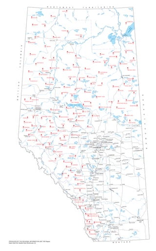
LookoutTowers
- 1. Petitot River River Hay Yates R. Whitesand River BuffaloR. Little Buffalo R. Salt R. Jackfish River Little Rapids Creek Steen River Hay R. ChinchagaRiver Ponton River Wentzel R. Old Fort R. Richardson River River Birch R. Boyer River Hay River Chinchaga M ikkwa River Birch River McIvor R. River Firebag Wabasca River W olverine River River Notikewin Ells River River MacKay Clearwater River River Loon Cadotte R. W hitemud River Peace River River Smoky Lubicon R. Trout R. Muskwa R. River Christina Winefred R. Lesser Slave R. Prairie East R. Little Smoky River Wapiti River River Sm oky Goose R. SwanR. SaulteauxR. La Biche R. R. Sand R.Beaver R. Pembina Freeman R. Sim onette River River Kakwa Berland R. River Wildhay SmokyR. McLeod River River Pembina Athabasca River River Brazeau Battle River Medicine Blindm an River R. Clearwater R. R. DeerRed Rosebud River Bow R. R. Elbow Highwood R. River Bow Little St.Mary River R. R. Waterton Belly R. Oldman Milk River Red Deer River Bow River South Saskatchewan R . River Oldman North Saskatchewan River N. Saskatchewan River River Battle Athabasca River Athabasca River Utikum a R. S. Heart R. Athabasca River River Slave River Peace Andrew Lake Bistcho Lake Colin L. Cornwall Lake Lake Claire Baril Lake Mamawi Lake Richardson Lake Gardiner Lakes Namur Lake McClelland L. Bison Lake Gordon LakeWillow Lake Graham Lake Peerless Lake Loon Lake Cadotte Lake Cardinal L. Lubicon L. Muskwa L. Garson Lake North Wabasca Lake South Wabasca Lake Utikuma Lake Kimiwan L. Winagami Lake Winefred Lake Calling Lake Lesser Slave Lake Bear Lake Sturgeon Lake Snipe Lake Sullivan Lake Gough Lake Wentzel LakeMargaret L. Hay L.Zama L. Heart Lake Cold L. Marie Lake Seibert Lake Pinehurst Lake Beaver L. Lac la Biche Flat Lake Muriel L. Frog L. Beaverhill Lake Lac Ste. Anne Wabamun L. Chip Lake Pigeon LakeBuck L. Brazeau Reservoir Gull Lake Buffalo Lake Sylvan L. Abraham Lake Gleniffer Lake Sounding Lake Newell Lake McGregor Lake Travers Res. Pakowki LakeSt. Mary Res. Lake Athabasca RAINBOW LAKE HIGH LEVEL Fort Vermilion Fort Chipewyan MANNING GRIMSHAW Berwyn PEACE RIVER FAIRVIEW SPIRIT RIVER FALHER McLENNAN HIGH PRAIRIE SEXSMITH GRANDE PRAIRIE WEMBLEY BEAVERLODGE VALLEYVIEW GRANDE CACHE FOX CREEK SWAN HILLS SLAVE LAKE BARRHEAD WHITECOURT MAYERTHORPE Sangudo LEGAL BON ACCORD MORINVILLE WESTLOCK Thorhild SMOKY LAKE ST. PAUL ELK POINT BONNYVILLE COLD LAKE VERMILION Kitscoty LLOYDMINSTER VEGREVILLE RyleyTOFIELD Sherwood Park BEAUMONT STONY PLAIN DEVONDRAYTON VALLEY MILLET DAYSLAND KILLAM SEDGEWICK HARDISTY WAINWRIGHT PROVOST STETTLER BASHAW LACOMBE BLACKFALDS SYLVAN LAKE ROCKY MOUNTAIN HOUSE SUNDRE BOWDEN OLDS PENHOLD INNISFAIL DIDSBURY CARSTAIRS CROSSFIELD COCHRANE BLACK DIAMOND TURNER VALLEY OKOTOKS HIGH RIVER NANTON STAVELY CLARESHOLM GRANUM FORT MACLEOD PINCHER CREEK CROWSNEST PASS COALHURST COALDALE RAYMONDMAGRATH CARDSTON MILK RIVER Warner Foremost BOW ISLAND REDCLIFF VAUXHALL BROOKS TABER BASSANO STRATHMORE CHESTERMERE DRUMHELLER TROCHU THREE HILLS Morrin HANNA OYEN Acadia Valley CORONATION CASTOR PONOKA RIMBEY CALMAR VIKING TWO HILLSMUNDARE BRUDERHEIM LAMONT REDWATER GIBBONS ATHABASCA LAC LA BICHE EDSON HINTON Jasper Lake Louise BANFF CANMORE Waterton Park PICTURE BUTTE VULCAN EDMONTON ST. ALBERT SPRUCE GROVE LEDUC WETASKIWIN AIRDRIE CAMROSE FORT SASKATCHEWAN MEDICINE HAT RED DEER LETHBRIDGE CALGARY FORT McMURRAY YATES STEEN PETITOT AMBER ADAIR CAMBRIAN ZAMA WATT MTN FOGGY MTN RAINBOW BASSET FONTAS KEG HAWK HILLS WADLIN BUFFALO JEAN LAKE LEGEND ELLS RIVER BITUMONT MUSKEG MTN JOHNSON LAKE RICHARDSON KEANE BUCKTON BIRCH MTN EDRA CHIPEWYAN LAKES PANNY TALBOT LAKE OTTER LAKES RED EARTH TROUT MTN TEEPEE LAKE LIVOCK SANDY LAKE MUSKWA WHITEFISH GIFT LAKE SALT PRAIRIE MERIDIAN MARTEN MTN FLAT TOP ENILDA SWEATHOUSE HOUSE MTN DEER MTN CHISHOLM ROCK ISLAND LAKE MAY GRANDE GORDON LAKE STONY MTN ALGAR COWPAR LAKE CONKLIN WINEFRED CHRISTINA BASIN ROUND HILL HEART LAKE SAND RIVER HOTCHKISS DOIG CHINCHAGA NOTIKEWIN BATTLE RIVER BISON LAKE DEADWOOD WHITEMUD CADOTTE KIMIWAN PUSKWASKAU SADDLE HILLS WHITE MTN PINTO BALD MTN ECONOMY CREEK SNUFF GOOSE MTN SWAN DIVE VEGA IMPERIAL EAGLE TONYSMOKY KAKWA TORRENS COPTON HAMELL SIMONETTE HUCKLEBERRY BERLAND PASS CREEK TOM HILL MAYBERNE WHITECOURT CARROT CREEK ANSELL OBED ATHABASCA ADAMS CREEK MOBERLY GRAVE FLATS YELLOWHEAD LOVETT BRAZEAU BLACKSTONE BALDY AURORA ROCKY RAM CLINE FALLS BASELINE LIMESTONE BLUE HILL MOCKINGBIRD HILL BARRIER LAKE MOOSE MTN KANANASKIS JUNCTION MTN RASPBERRY RIDGE HAILSTONE BUTTE SUGARLOAF LIVINGSTONE PORCUPINE IRONSTONE CARBONDALE PONTON CLEAR HILLS NOSE MTN SASKATCHEWAN N O R T H W E S T T E R R I T O R I E S M O N T A N A BRITISH COLUMBIA PRODUCED BY THE REGIONAL INFORMATION UNIT, NW Region Base Data from Spatial Data Warehouse Ltd.