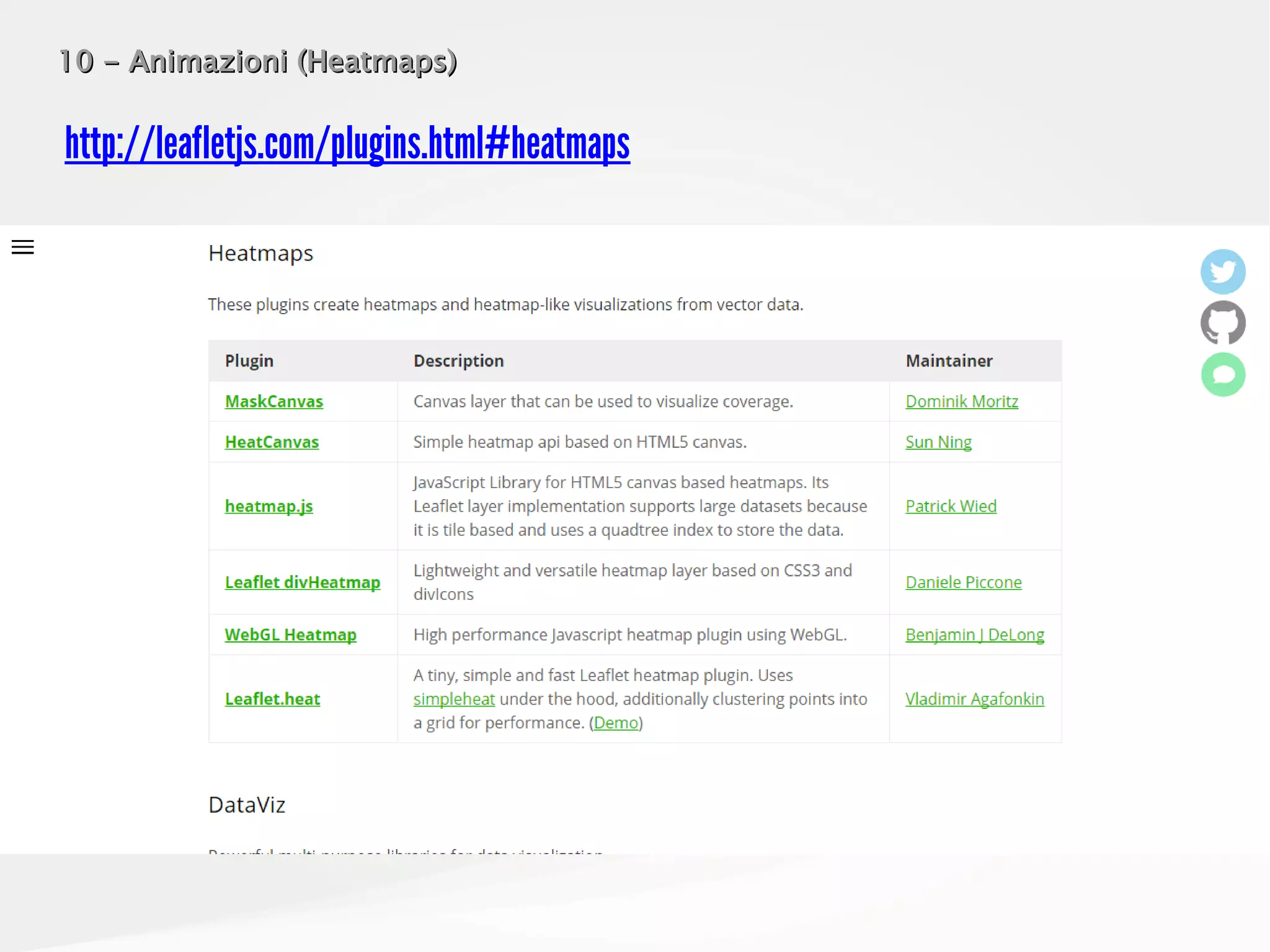
Download as PDF, PPTX


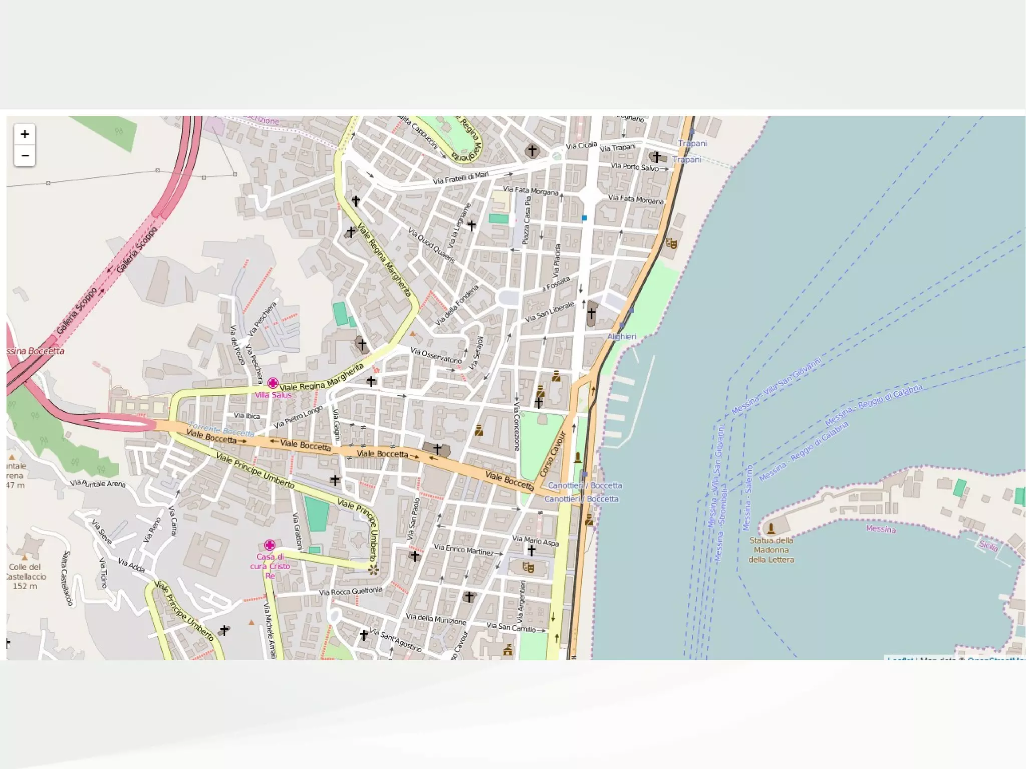
![Es. 2 – Il Tile LayerEs. 2 – Il Tile Layer
<div id="mapContainer" style="width: 100%; height: 100%"></div>
<script>
var mappa = L
.map('mapContainer')
.setView([38.19941,15.55602], 16); // LAT, LONG
L
.tileLayer(
'http://{s}.tile.openstreetmap.org/{z}/{x}/{y}.png',
{
attribution: 'Map data © <a
href="http://openstreetmap.org">OpenStreetMap</a>',
maxZoom: 20
}
)
.addTo(mappa);
</script>](https://image.slidesharecdn.com/odsleaflet-160906105629/75/LEAFLET-js-from-Zero-to-Hero-6-2048.jpg)
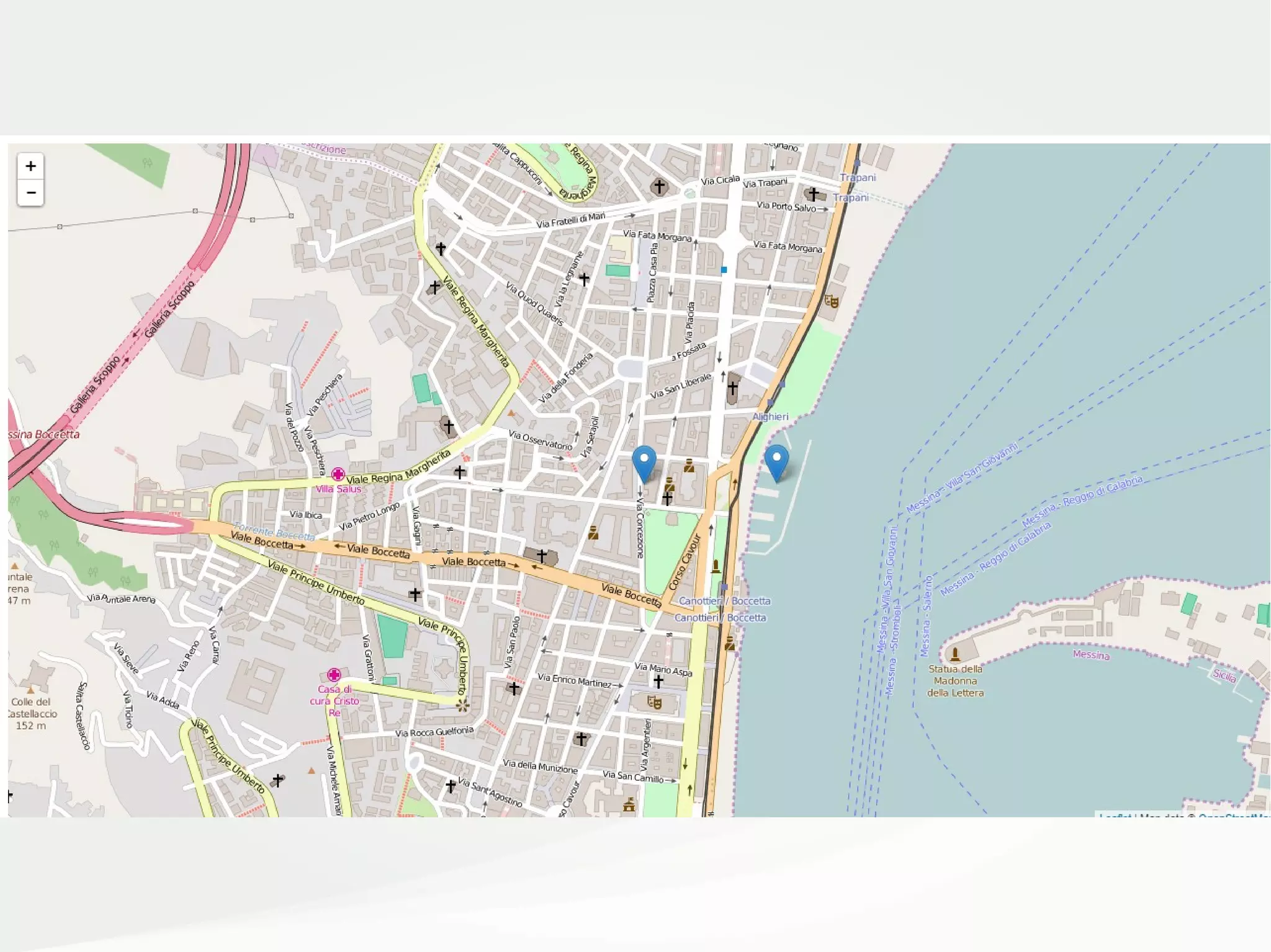
![Es. 3 – MarkersEs. 3 – Markers
<script>
var mappa = L
.map('mapContainer')
.setView([38.19941,15.55602], 16); // LAT, LONG
L
.tileLayer(
'http://{s}.tile.openstreetmap.org/{z}/{x}/{y}.png',
{
attribution: 'Map data © <a href="http://openstreetmap.org">OpenStreetMap</a>',
maxZoom: 20,
}
)
.addTo(mappa);
var markerCospecs = L.marker([38.19941,15.55602])
.addTo(mappa);
var markerMarina = L.marker([38.19943,15.55889])
.addTo(mappa);
</script>](https://image.slidesharecdn.com/odsleaflet-160906105629/75/LEAFLET-js-from-Zero-to-Hero-8-2048.jpg)
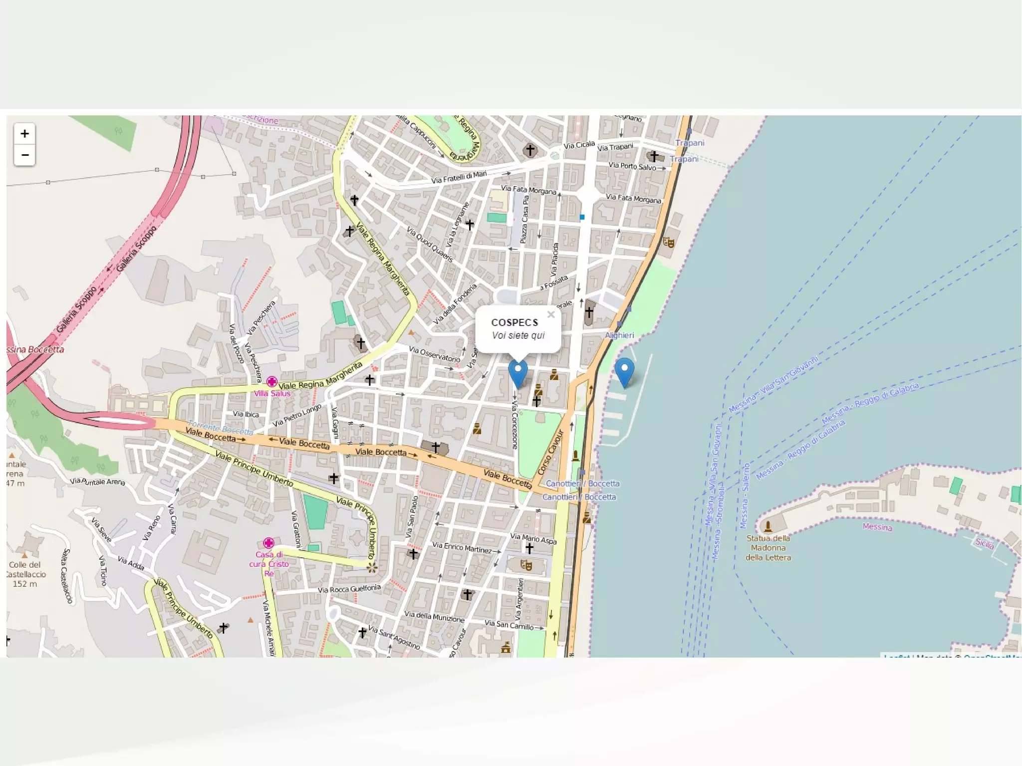
![Es. 4 – PopupsEs. 4 – Popups
<script>
var mappa = L
.map('mapContainer')
.setView([38.19941,15.55602], 16); // LAT, LONG
L
.tileLayer(
'http://{s}.tile.openstreetmap.org/{z}/{x}/{y}.png',
{
attribution: 'Map data © <a href="http://openstreetmap.org">OpenStreetMap</a>',
maxZoom: 20,
}
)
.addTo(mappa);
var markerCospecs = L.marker([38.19941,15.55602])
.addTo(mappa);
var markerMarina = L.marker([38.19943,15.55889])
.addTo(mappa);
markerCospecs
.bindPopup("<b>COSPECS</b><br><i>Voi siete qui</i>")
.openPopup();
markerMarina
.bindPopup("<b>Marina del Nettuno</b><br><i>Stasera si va
qui</i>");
</script>](https://image.slidesharecdn.com/odsleaflet-160906105629/75/LEAFLET-js-from-Zero-to-Hero-10-2048.jpg)
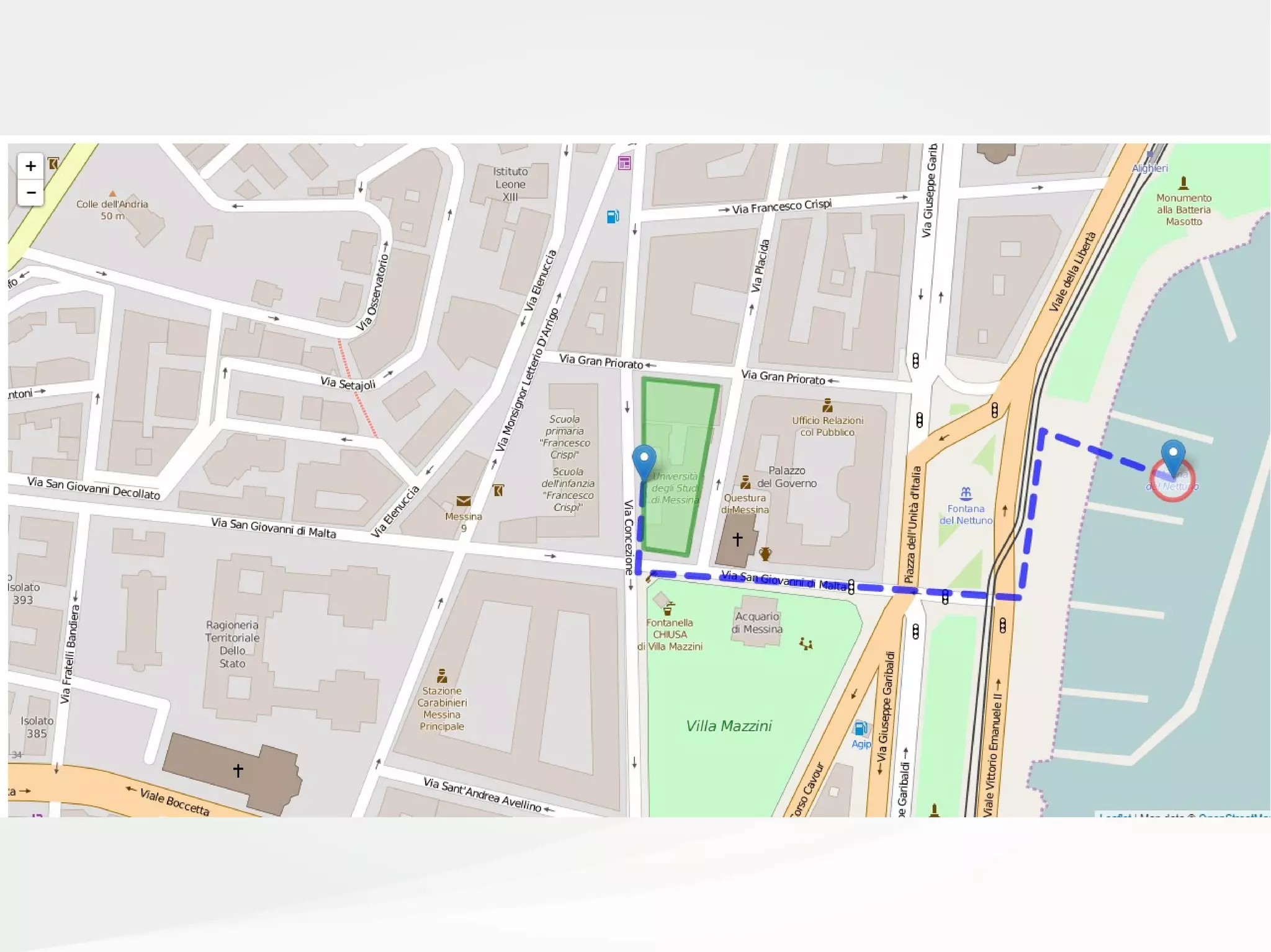
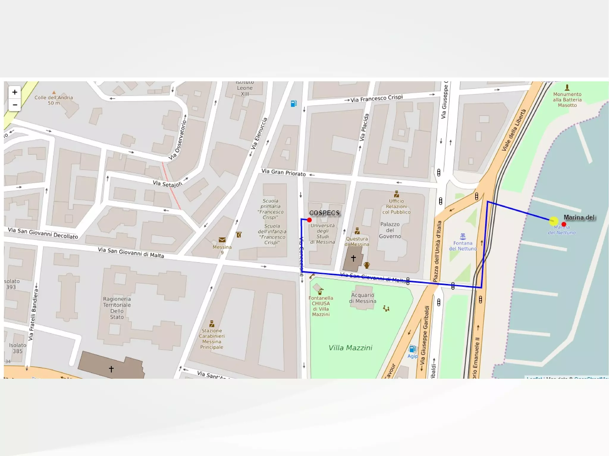
![Es. 5 – Linee, Cerchi e PoligoniEs. 5 – Linee, Cerchi e Poligoni
var percorso = L.polyline([
[38.19941,15.55602],
[38.199037,15.555988],
[38.198927,15.558060],
[38.199636,15.558178],
[38.19943,15.55889]
],
{
color: 'blue',
weight: 7,
opacity: .7,
dashArray: '20,15',
lineJoin: 'round'
})
.addTo(mappa);
var polyCospecs = L.polygon([
[38.199863 , 15.556016],
[38.199827 , 15.556423],
[38.199106 , 15.556257],
[38.199135 , 15.556021],
],
{
color: 'green',
fillColor: 'lightgreen',
fillOpacity: 0.5
})
.addTo(mappa);
var circleMarina = L.circle([38.19943,15.55889], 10, //raggio in mt.
{
color: 'red',
fillColor: '#FFF',
fillOpacity: 0.5
})
.addTo(mappa);](https://image.slidesharecdn.com/odsleaflet-160906105629/75/LEAFLET-js-from-Zero-to-Hero-12-2048.jpg)
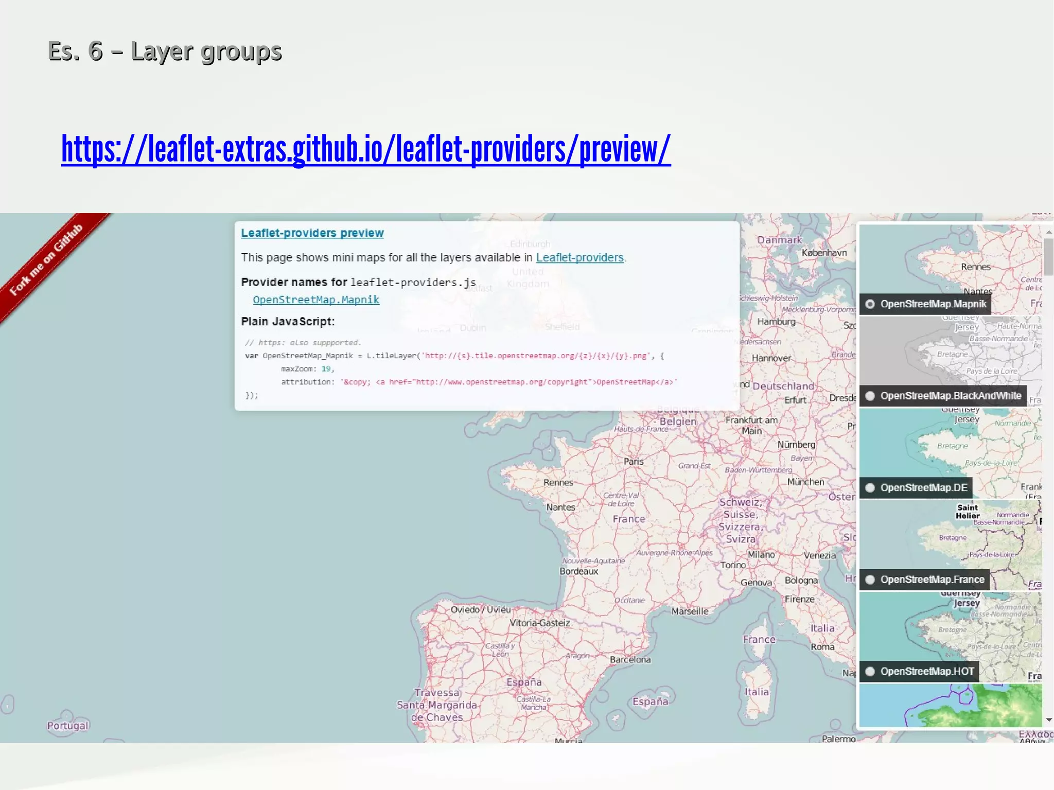
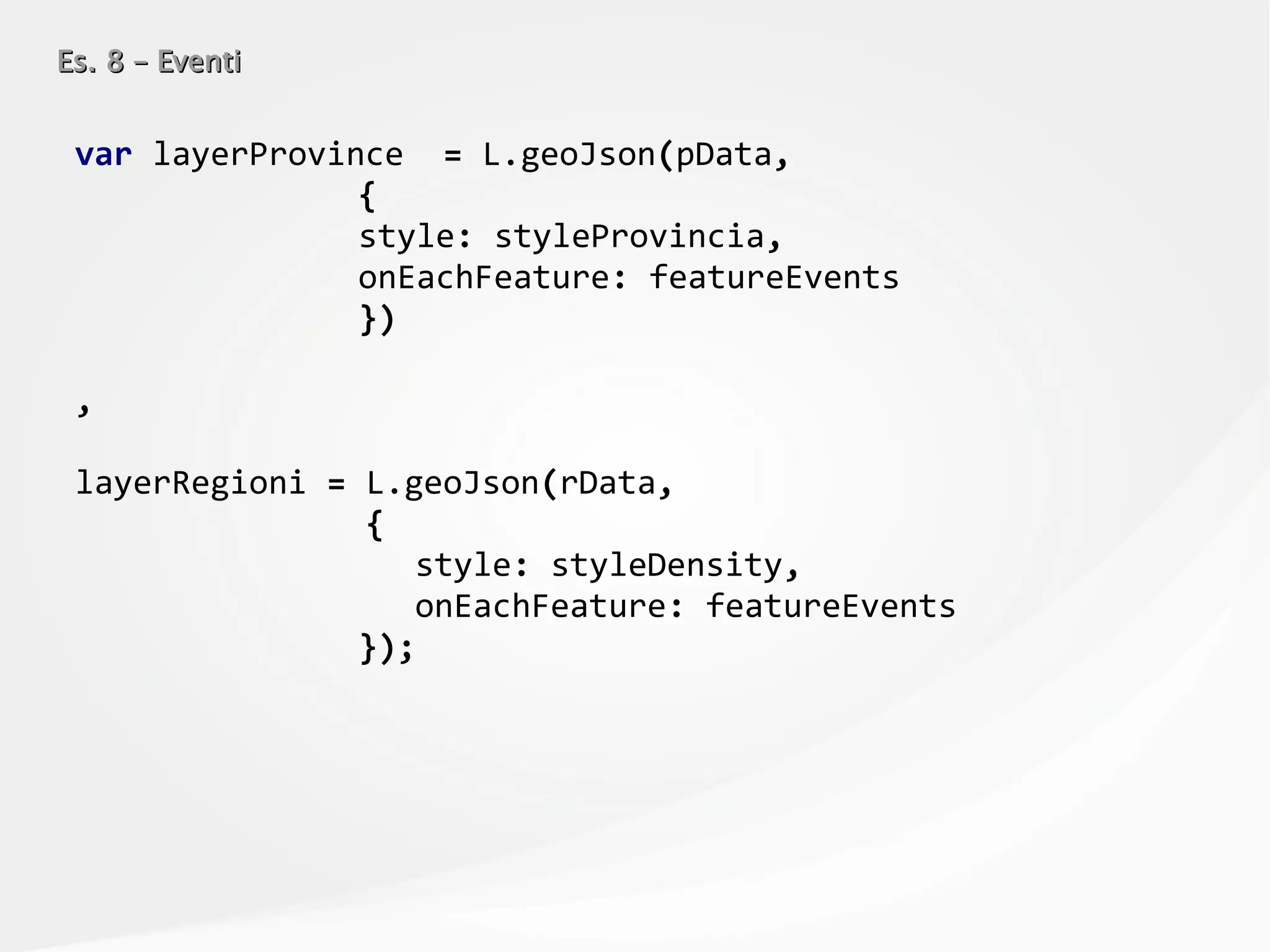
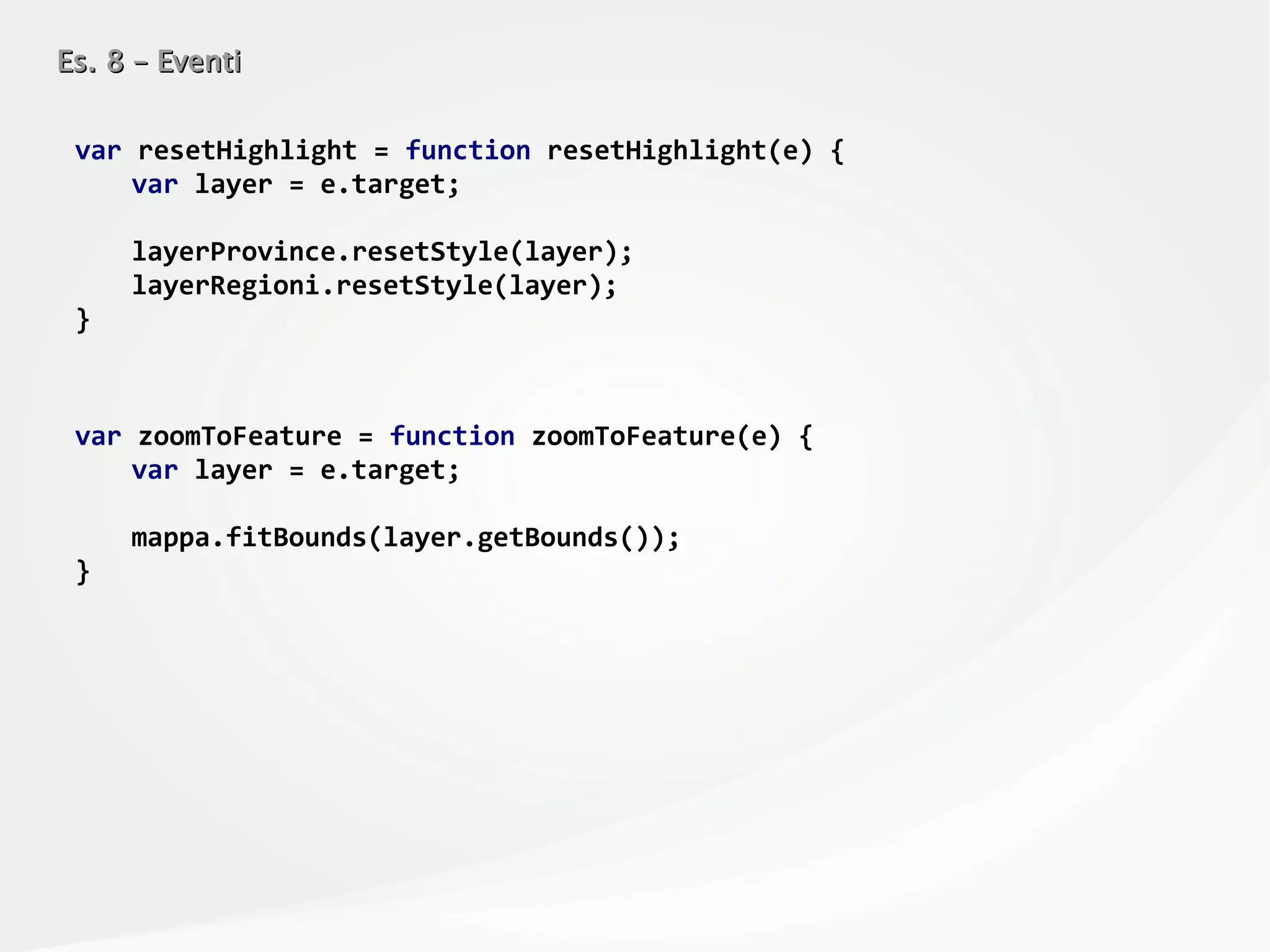
![Es. 6 – Layer groupsEs. 6 – Layer groups
var mappa = L.map('mapContainer')
.setView([38.19941,15.55602], 16); // LAT, LONG
var baseOpenStreetMap = L.tileLayer(
'http://{s}.tile.openstreetmap.org/{z}/{x}/{y}.png',
{
attribution: 'Map data © <a href="http://openstreetmap.org">OpenStreetMap</a>',
maxZoom: 18
}
)
.addTo(mappa);
var baseOpenTopoMap = L.tileLayer(
'http://{s}.tile.opentopomap.org/{z}/{x}/{y}.png',
{
attribution: 'Map data: © <a
href="http://www.openstreetmap.org/copyright">OpenStreetMap</a>, <a
href=”http://viewfinderpanoramas.org">SRTM</a> | Map style: © <a
href="https://opentopomap.org">OpenTopoMap</a> (<a href="https://creativecommons.org/licenses/by-
sa/3.0/">CC-BY-SA</a>)',
maxZoom: 18
}
);
var baseEsriWorldImageryMap = L.tileLayer(
'http://server.arcgisonline.com/ArcGIS/rest/services/World_Imagery/MapServer/tile/{z}/{y}/{x}',
{
attribution: 'Tiles © Esri — Source: Esri, i-cubed, USDA, USGS, AEX, GeoEye,
Getmapping, Aerogrid, IGN, IGP, UPR-EGP, and the GIS User Communit',
maxZoom: 18
}
);](https://image.slidesharecdn.com/odsleaflet-160906105629/75/LEAFLET-js-from-Zero-to-Hero-15-2048.jpg)
![Es. 6 – Layer groupsEs. 6 – Layer groups
var markerCospecs = L.marker([38.19941,15.55602]);
var markerMarina = L.marker([38.19943,15.55889]);
var percorso = L.polyline([
[38.19941,15.55602],
[38.199037,15.555988],
[38.198927,15.558060],
[38.199636,15.558178],
[38.19943,15.55889]
],
{
color: 'blue',
weight: 7,
opacity: .7,
dashArray: '20,15',
lineJoin: 'round'
});
var polyCospecs = L.polygon([
[38.199863 , 15.556016],
[38.199827 , 15.556423],
[38.199106 , 15.556257],
[38.199135 , 15.556021],
],
{
color: 'green',
fillColor: 'lightgreen',
fillOpacity: 0.5
});
var circleMarina = L.circle([38.19943,15.55889], 10, //raggio in mt.
{
color: 'red',
fillColor: '#FFF',
fillOpacity: 0.5
});](https://image.slidesharecdn.com/odsleaflet-160906105629/75/LEAFLET-js-from-Zero-to-Hero-16-2048.jpg)
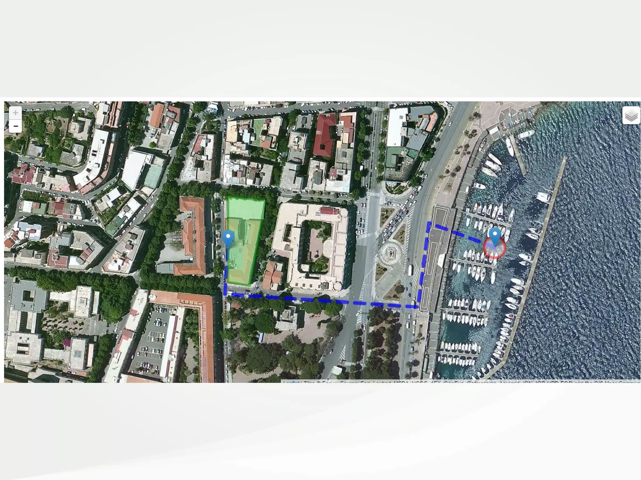
![Es. 6 – Layer groupsEs. 6 – Layer groups
var shapes = L.layerGroup([percorso, polyCospecs, circleMarina]);
var markers = L.layerGroup([markerCospecs, markerMarina]);
var baseLayers = {
"Strade": baseOpenStreetMap,
"Topografia": baseOpenTopoMap,
"Fotografica" : baseEsriWorldImageryMap
};
var overlays = {
"Edifici & Percorsi": shapes,
"Entrate": markers
};
L.control
.layers(baseLayers,overlays)
.addTo(mappa);](https://image.slidesharecdn.com/odsleaflet-160906105629/75/LEAFLET-js-from-Zero-to-Hero-17-2048.jpg)
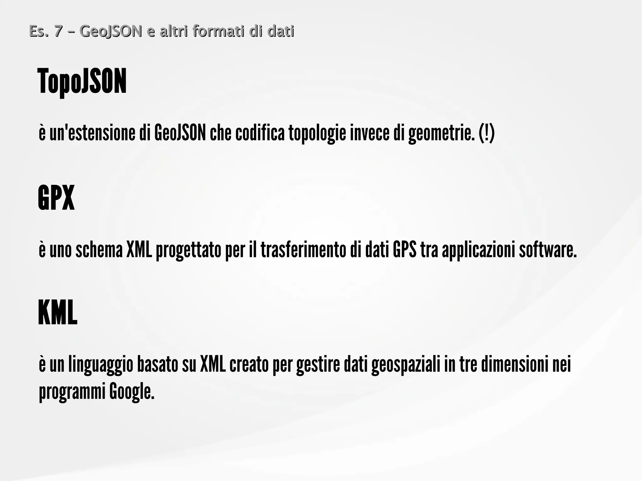
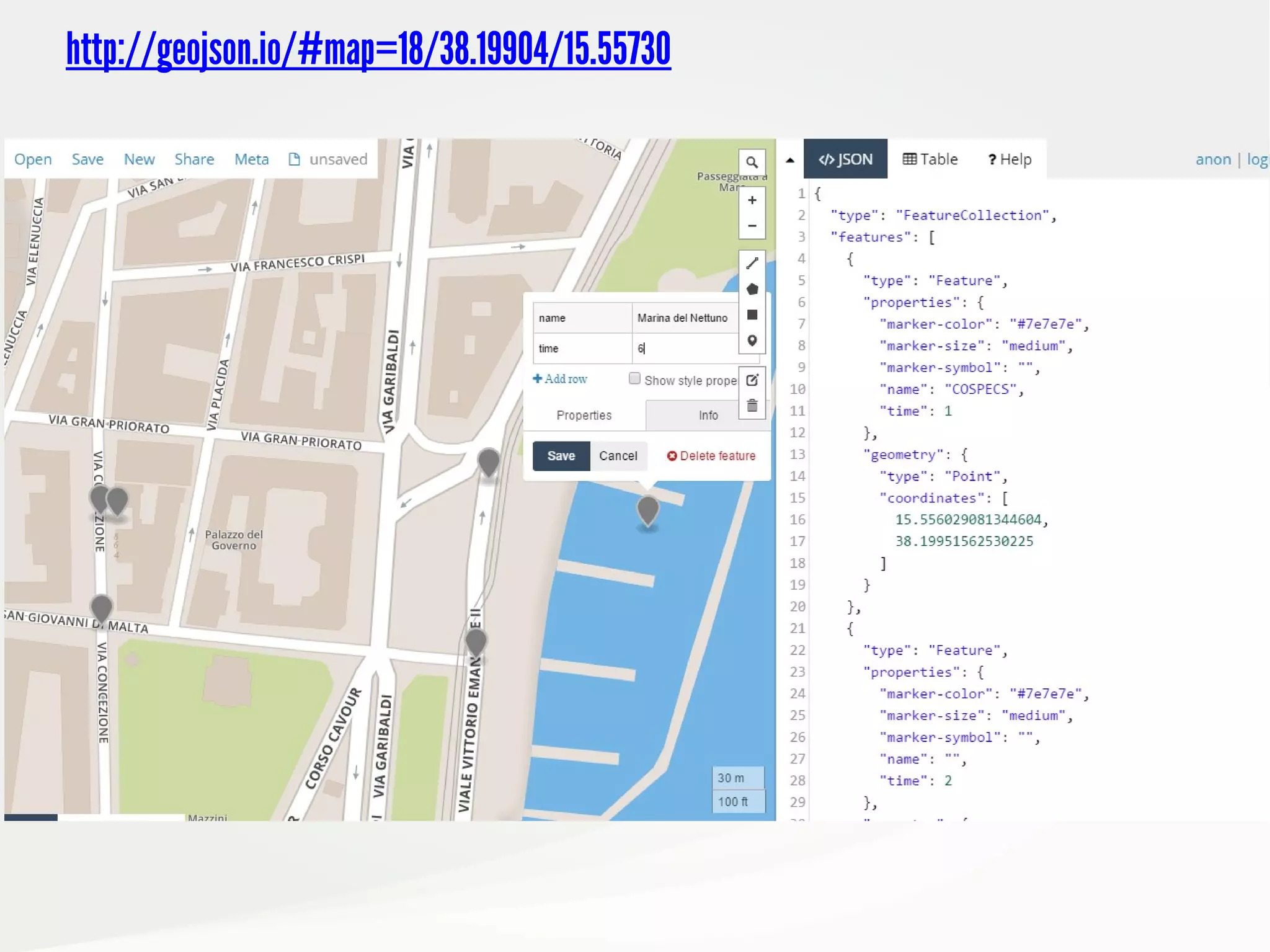
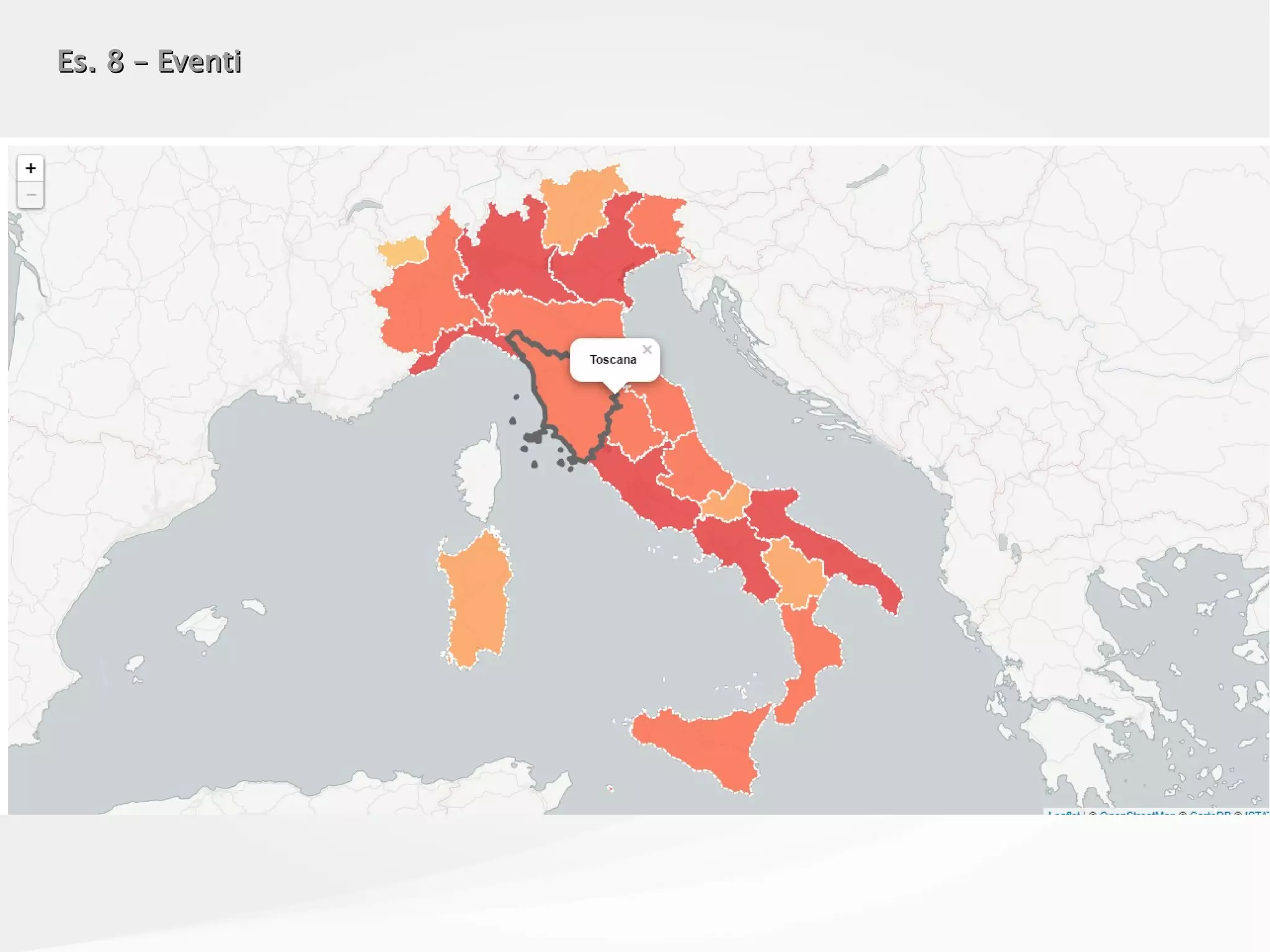
![Es. 7 – GeoJSON e altri formati di datiEs. 7 – GeoJSON e altri formati di dati
è un semplice formato per lo scambio di dati basato su un sottoinsieme del Linguaggio di
Programmazione JavaScript
JSON
var markers = [
{
"point":new GLatLng(40.266044,-74.718479),
"homeTeam":"Lawrence Library",
"awayTeam":"LUGip",
"markerImage":"images/red.png",
"information": "Linux users group meets second Wednesday of each month.",
"fixture":"Wednesday 7pm",
"capacity":"",
"previousScore":""
},
{
"point":new GLatLng(40.211600,-74.695702),
"homeTeam":"Hamilton Library",
"awayTeam":"LUGip HW SIG",
"markerImage":"images/white.png",
"information": "Linux users can meet the first Tuesday of the month to work out harward and
configuration issues.",
"fixture":"Tuesday 7pm",
"capacity":"",
"tv":""
}
]](https://image.slidesharecdn.com/odsleaflet-160906105629/75/LEAFLET-js-from-Zero-to-Hero-20-2048.jpg)
![Es. 7 – GeoJSON e altri formati di datiEs. 7 – GeoJSON e altri formati di dati
è un formato aperto utilizzato per archiviare una collezione di geometrie spaziali i cui
attributi sono descritti attraverso JSON.
GeoJSON
var someFeatures = [{
"type": "Feature",
"properties": {
"name": "Coors Field",
"show_on_map": true
},
"geometry": {
"type": "Point",
"coordinates": [-104.99404, 39.75621]
}
}, {
"type": "Feature",
"properties": {
"name": "Busch Field",
"show_on_map": false
},
"geometry": {
"type": "Point",
"coordinates": [-104.98404, 39.74621]
}
}];](https://image.slidesharecdn.com/odsleaflet-160906105629/75/LEAFLET-js-from-Zero-to-Hero-21-2048.jpg)
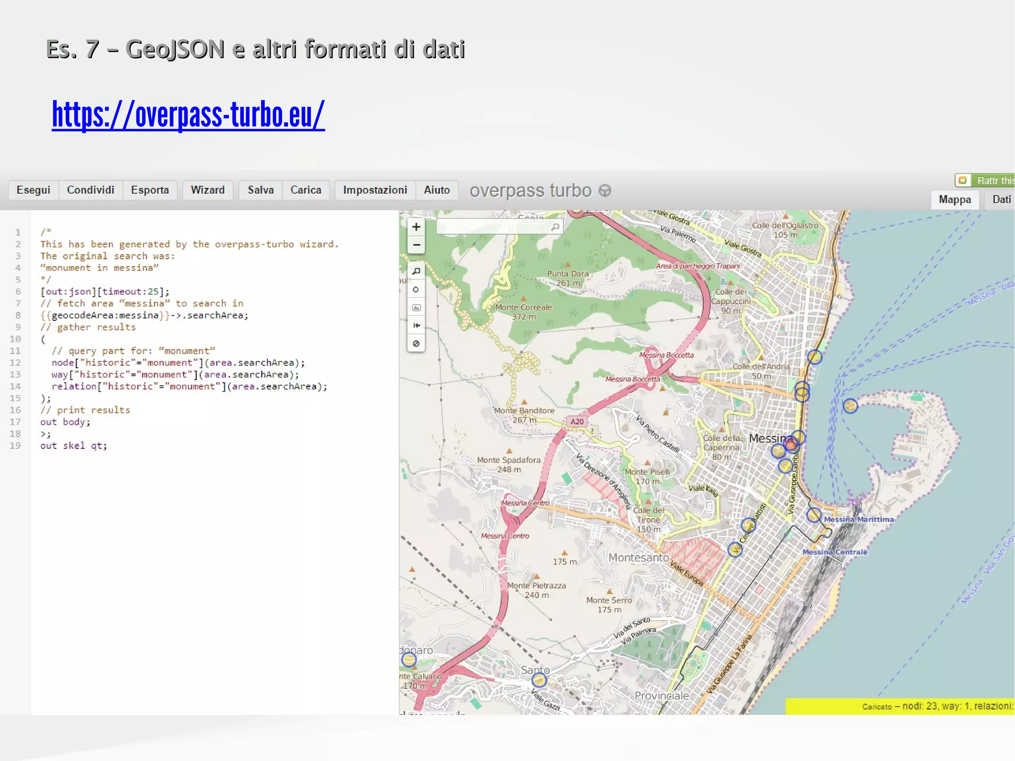
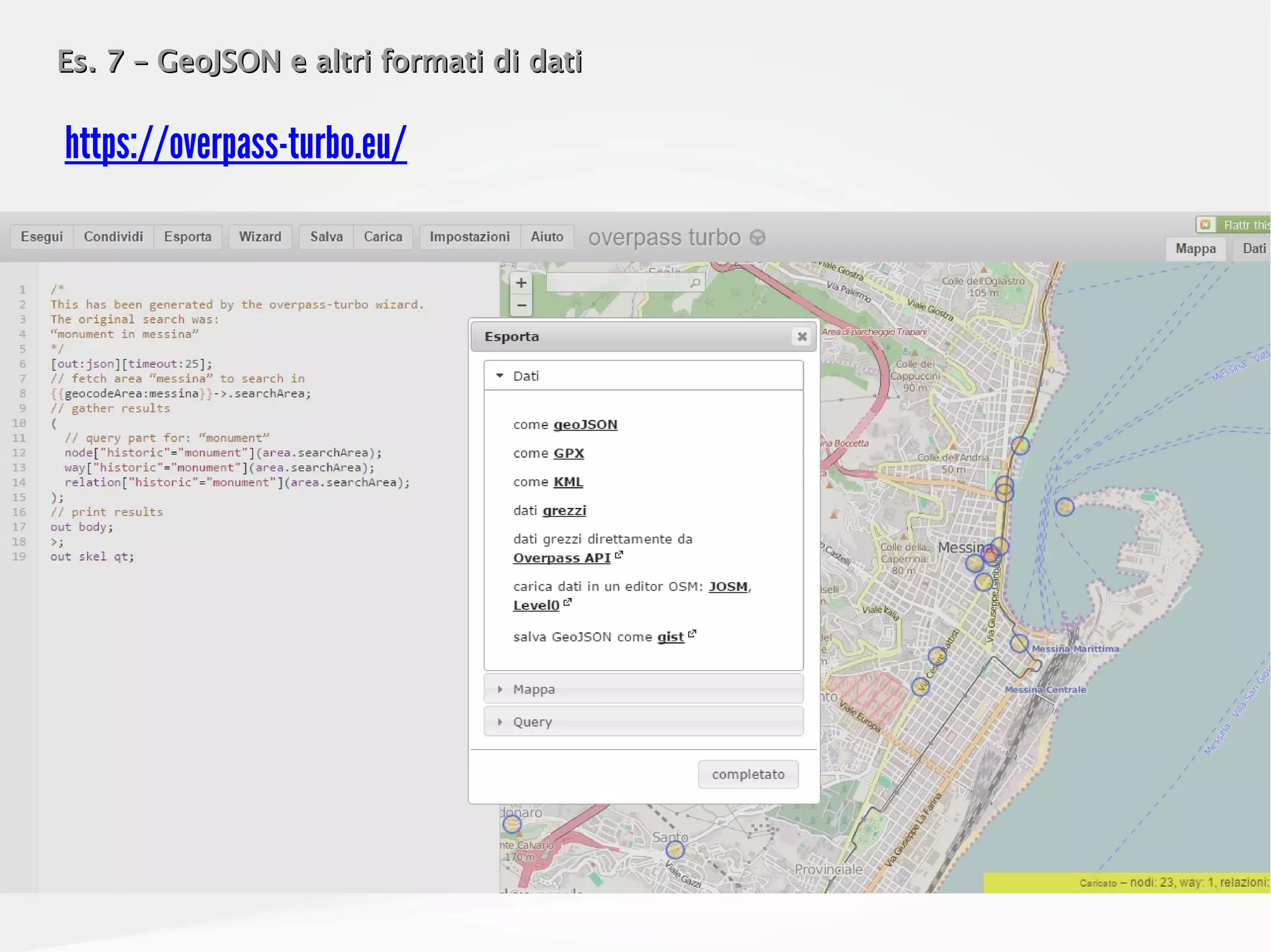
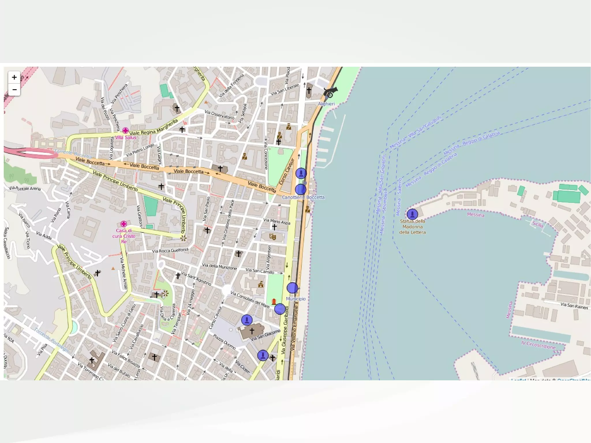
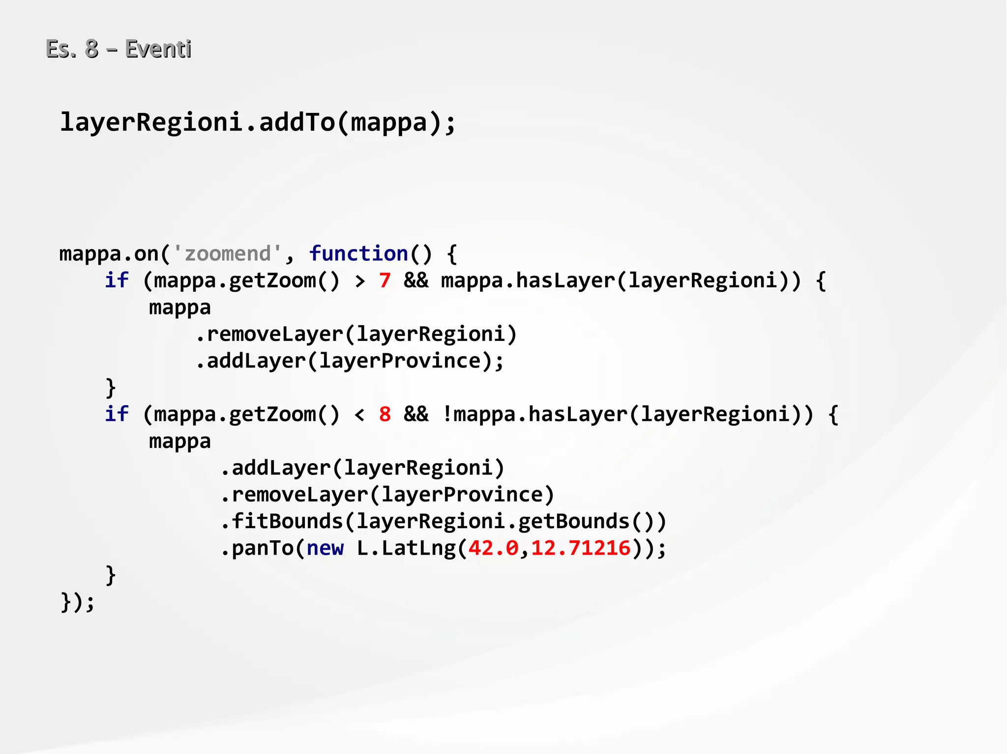
![Es. 7 – GeoJSON e altri formati di datiEs. 7 – GeoJSON e altri formati di dati
<script src="../lib/jquery-3.1.0.min.js"></script>
<script>
var mappa = L.map('mapContainer')
.setView([38.19941,15.55602], 16); // LAT, LONG
L.tileLayer(
'http://{s}.tile.openstreetmap.org/{z}/{x}/{y}.png',
{
attribution: 'Map data © <a href="http://openstreetmap.org">OpenStreetMap</a>',
maxZoom: 18,
}
)
.addTo(mappa);
var $req = $.ajax({
dataType: "json",
url:
'https://gist.githubusercontent.com/gpizzimenti/e0bdc49ae9511a8e55b0a52a696c65fe/raw/d3b0f0aef521cd28c
69bce52e089f71787d5f5ab/monumentsinmessina.overpass.geojson'
});
$.when($req)
.then(elaboraDati, gestisciErrore);
function elaboraDati(data) {
var layerMonumenti = L.geoJson().addTo(mappa);
layerMonumenti.addData(data);
};
function gestisciErrore() {
alert("Si è verificato un errore!");
};
</script>](https://image.slidesharecdn.com/odsleaflet-160906105629/75/LEAFLET-js-from-Zero-to-Hero-25-2048.jpg)
![Es. 7 – GeoJSON e altri formati di datiEs. 7 – GeoJSON e altri formati di dati
var geojsonMarkerStyle = {
radius: 12,
fillColor: "blue",
color: "#000",
weight: 1,
opacity: 1,
fillOpacity: 0.5
};
var cannonIcon = L.icon({
iconUrl: 'cannon.png',
iconSize: [32, 32],
iconAnchor: [16, 37],
popupAnchor: [0, -28]
});](https://image.slidesharecdn.com/odsleaflet-160906105629/75/LEAFLET-js-from-Zero-to-Hero-27-2048.jpg)
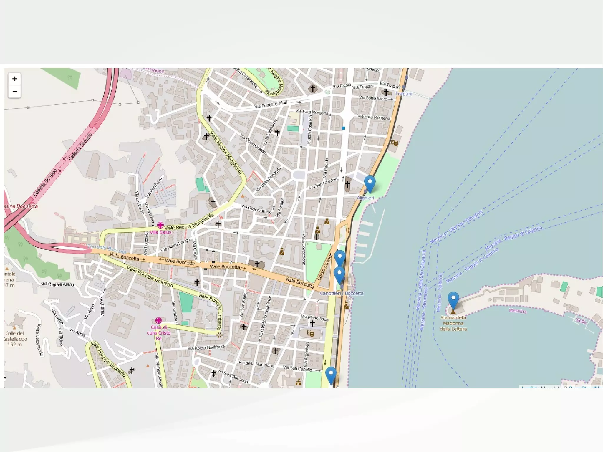
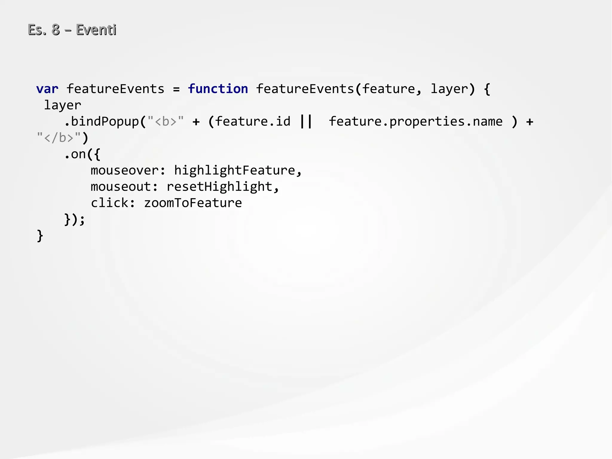
![Es. 7 – GeoJSON e altri formati di datiEs. 7 – GeoJSON e altri formati di dati
function elaboraDati(data) {
var layerMonumenti = L.geoJson(data, {
style: function(feature) {
if (feature.geometry.type == "Polygon") {
return {
color: "red",
fillColor: "gold",
fillOpacity: 0.5
}
}
},
pointToLayer: function (feature, latlng) {
if (feature.properties && feature.properties.name && feature.properties.name ==
"Monumento alla Batteria Masotto") {
return L.marker(latlng, {icon: cannonIcon});
} else {
return L.circleMarker(latlng, geojsonMarkerStyle);
},
onEachFeature: function (feature, layer) {
if (feature.properties && feature.properties.name) {
layer.bindPopup(feature.properties.name);
}
},
filter: function(feature, layer) {
return (feature.geometry.type == "Polygon" || feature.geometry.coordinates[0] > 15.50);
}
}).addTo(mappa);
};](https://image.slidesharecdn.com/odsleaflet-160906105629/75/LEAFLET-js-from-Zero-to-Hero-28-2048.jpg)

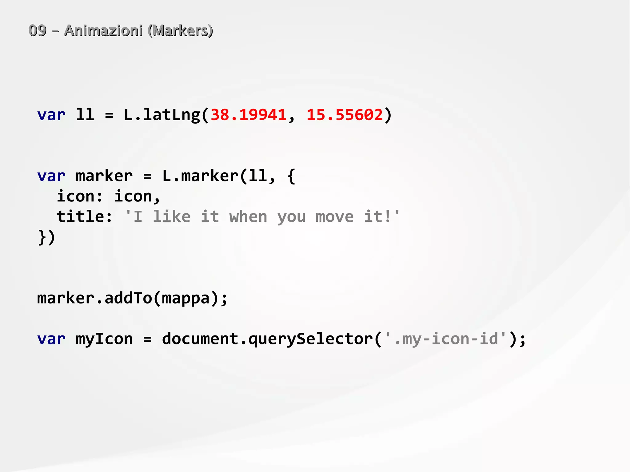
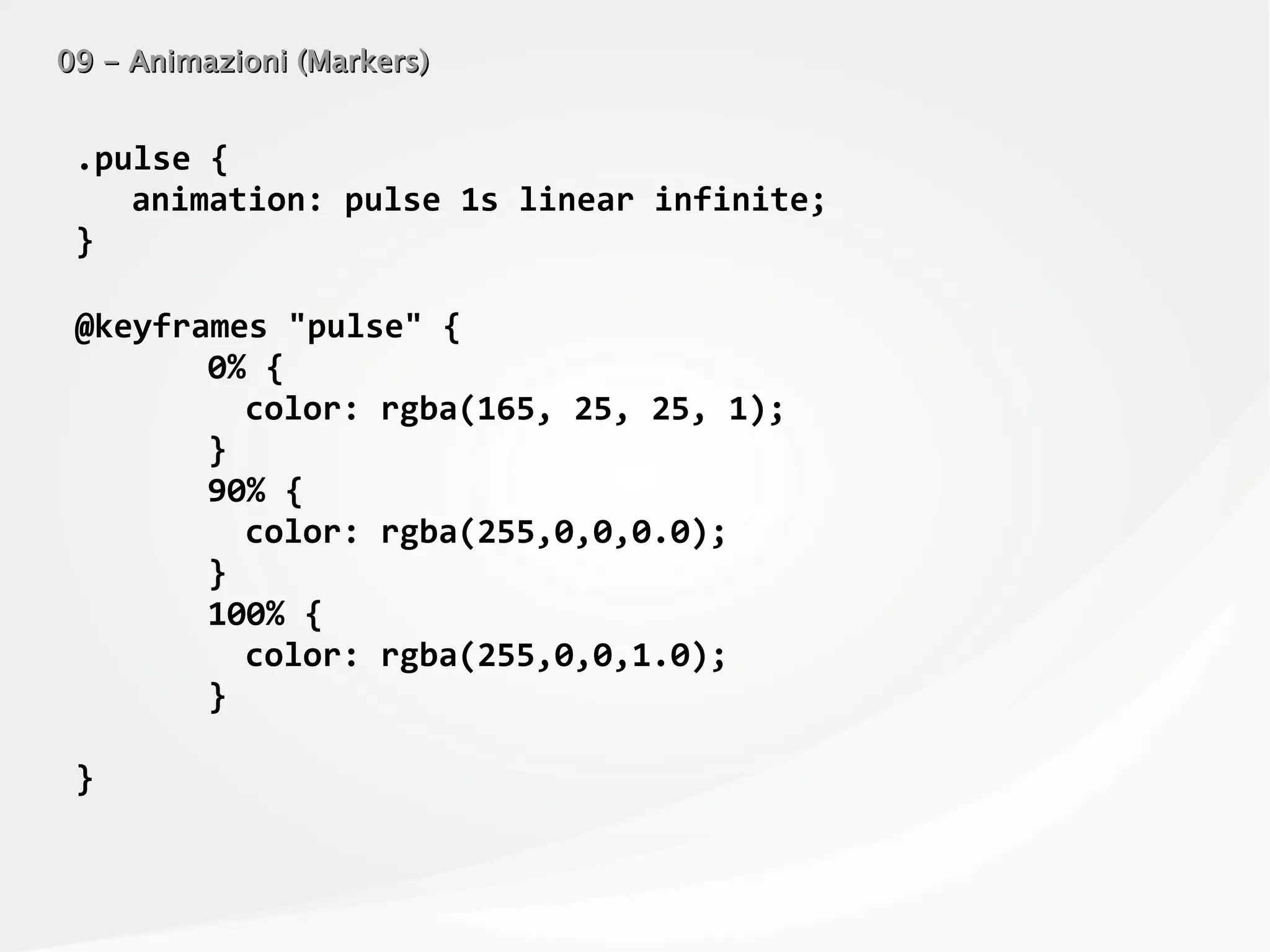
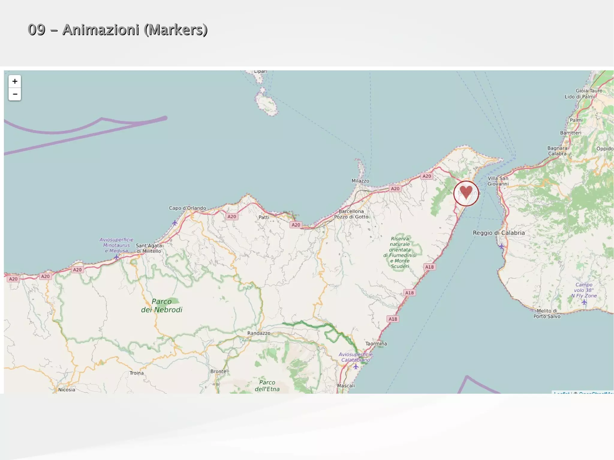
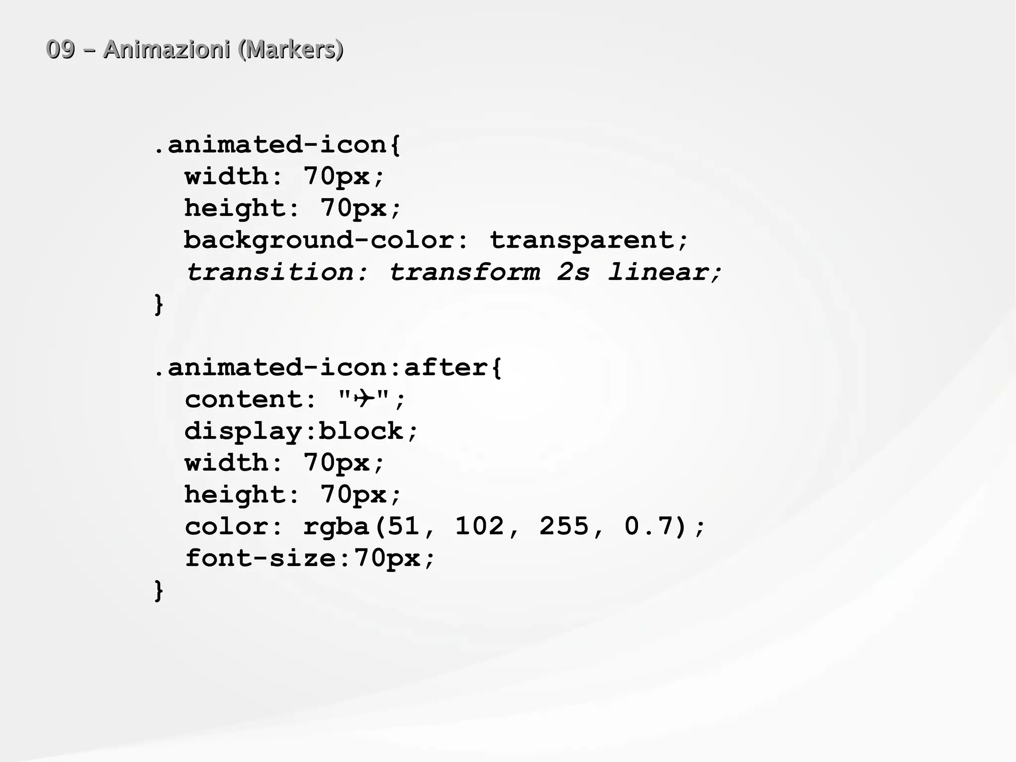
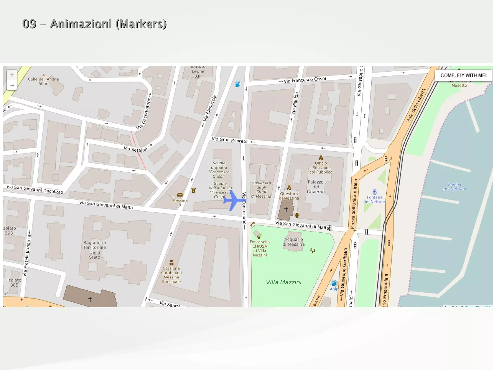
![09 - Animazioni (Markers)09 - Animazioni (Markers)
var icon = L.divIcon({
iconSize: [50, 50],
iconAnchor: [35, 20],
popupAnchor: [10, 0],
shadowSize: [0, 0],
className: 'animated-icon my-icon-id' ,
html : "<div class='animated-icon-content
pulse'>♥</div>"
})](https://image.slidesharecdn.com/odsleaflet-160906105629/75/LEAFLET-js-from-Zero-to-Hero-41-2048.jpg)
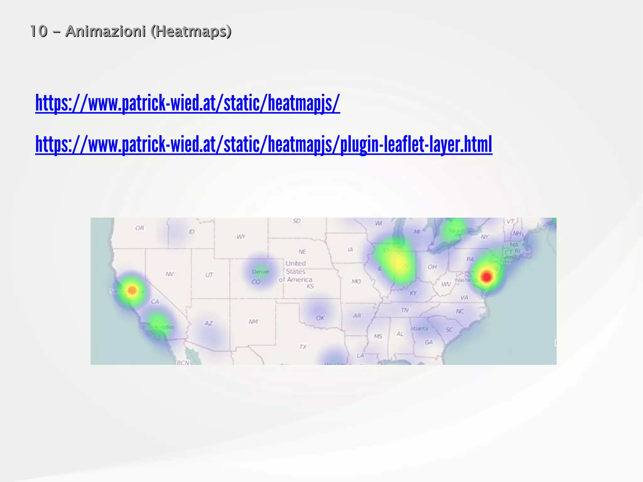
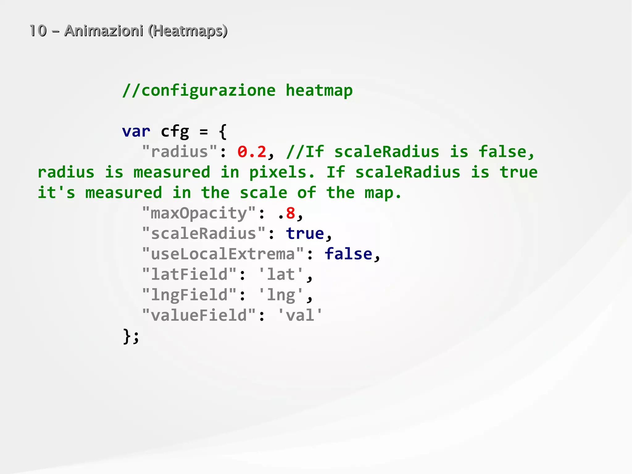
![10 - Animazioni (Heatmaps)10 - Animazioni (Heatmaps)
var heatmapLayer = new HeatmapOverlay(cfg);
heatmapLayer.addTo(mappa);
var heatData = {
max: 100,
min: 0,
data: [
{
lat: 38.19941,
lng: 15.55602,
val: 0,
ascending: true
}
]
};](https://image.slidesharecdn.com/odsleaflet-160906105629/75/LEAFLET-js-from-Zero-to-Hero-54-2048.jpg)
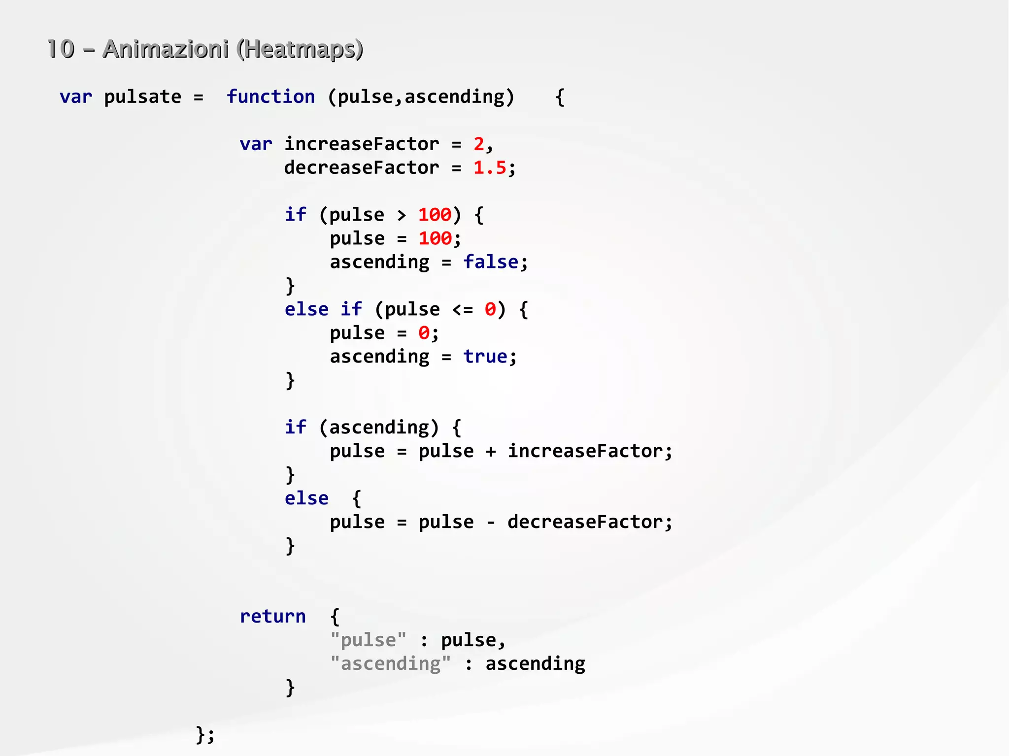
![10 - Animazioni (Heatmaps)10 - Animazioni (Heatmaps)
var eventPulsate = function () {
var data = heatData.data[0],
ret = pulsate(data.val,data.ascending);
data.val = ret.pulse;
data.ascending = ret.ascending;
heatmapLayer.setData(heatData);
};
setInterval(eventPulsate,10); //aggiorniamo ogni 10
millsecs](https://image.slidesharecdn.com/odsleaflet-160906105629/75/LEAFLET-js-from-Zero-to-Hero-56-2048.jpg)


This document provides examples for using Leaflet.js to create interactive maps. It begins with basic map components like adding a tile layer and markers. It then demonstrates more advanced features such as popups, polylines, polygons, circles, layer groups, and loading GeoJSON data to display points, lines and polygons from external files. The examples cover styling and filtering GeoJSON data, and provide references to plugins and other resources for working with different data formats and performing dynamic loading in Leaflet maps.


