1. SCHOOL OF ENVIRONMENTAL & BIOLOGICAL SCIENCES
RUTGERS, THE STATE UNIVERSITY OF NEW JERSEY
Volume 3 2013 / 2014
Jack Peters, Peruvian Fog Catcher, 2013
LANDSCAPEARCHITECTURE YEAR END REVIEW
4. Dear Friends,
As I sit down to write a brief introduction to our third edition of
Layer, I am challenged to convey all the passion, creativity, and
commitment that undergirds the work you see on its pages. Each
image of a project or activity displays not only the culmination of a
class assignment but also the bigger message of our department –
our belief in the capacity of Landscape Architecture to address the
pressing needs of the present and contribute to a better future. A
student completing our program – undergraduate or graduate –
is grounded with a strong foundation in environmental and social
science as well as technical skills, understands the complexity
of problems that may require multidimensional thinking, and
seeks to produce creative design solutions that are visionary and
achievable.
We began the 2013-14 academic year with a focus on Superstorm
Sandy recovery and the theme of resilience. On the first day
of class, all the faculty and students from four studios – juniors,
seniors, graduate year 1, and graduate year 2 – gathered in our
largest space to discuss shared and class-specific goals for the
semester. Each studio instructor identified a project that worked
within the learning objectives of the studio (i.e. housing and open
space, regional planning and design, ecology, etc.) and then made
personal connections with residents and officials in New Jersey shore
communities. Juniors in the Environmental Planning Studio, under the
leadership of Pippa Brashear and new faculty member David Smith,
studied ecological and social concerns facing Monmouth County
and developed design concepts for several shore communities. With
Wolfram Hoefer to guide them, students in the senior studio focused
on Union Beach, studying the varied implications of living behind a
sea wall, retreating to higher ground, and living with water. Graduate
students working with Kate Higgins explored hurricane recovery for
Long Beach Island, assisting residents struggling to rebuild their
homes according to new building codes and proposing new housing
and open space strategies. And lastly, third-year graduate students,
led by David Tulloch, studied alternative strategies for four towns
along the mainland side of southern Ocean County. The focus on New
Jersey and shore resiliency produced a new synergy between studios
that got students talking and sharing ideas. Not wanting to lose the
opportunity to convey the experience, we developed a series of six
videos, produced by William Atwater, that reveal the day-to-day work
of studio and share the perspectives of students and faculty involved.
These videos are available to view on our website: http://landarch.
rutgers.edu/.
Spring Praxis studio options again sought to provide a range of
opportunities for our juniors, seniors, and graduate students. This year
the three options included: 1) Somerville Brownfield Redevelopment,
taught by Frank Gallagher, 2) Nichol Avenue Project, taught by Richard
Alomar, and 3) It’s Only a Matter of Time: Roosevelt New Jersey, taught
by Kate John-Alder.
I also want to mention some of our other course sequences: history-
theory, visual representation, and construction. This year, we added
a new course to the history-theory sequence that explores social and
cultural aspects of design. Our representation sequence continues to
expand to meet the demands of the profession, and now includes hand
drawing, CAD, GIS, the Adobe Creative Suite,3-d modeling and 2-d
fabrication. Construction courses have embraced green and “smart”
technologies. This spring, our Material Tectonics course designed and
built an attractive “smart bus shelter” that was displayed at Rutgers
Day (aka Ag Field Day) and permanently installed at the Jardín de
Esperanza Community Garden in New Brunswick.
WORDS
FROM
THE
CHAIR
4
5. In Memoriam
Roy H. DeBoer
May 7, 1933 - March 17, 2014
Roy DeBoer began his 50+ year teaching
career in 1955 at Rutgers, founding the
Landscape Architecture Program, teaching
tirelessly, and continuing to support the
program through his retirement years. His
signature class, Environmental Design
Analysis, introduced thousands of Rutgers
students to design and planning. He was a
driving force behind professional recognition
and state licensure in New Jersey and was
presented with NJ Lic. #0001. [photos courtesy of
Joan and Roy K. DeBoer]
At the end of spring, we had the pleasure of seeing 37 undergraduates – 25 in the Bachelor of
Science in Landscape Architecture and 12 in Bachelor of Science in Environmental Planning and
Design - as well as 6 graduate students complete their education and receive their diplomas.
Congratulations to all!
We hope LAYER encourages you to stay in touch with our department. You can stay connected
in many ways – our website ( http://landarch.rutgers.edu/), the RULA list serve, Facebook, and
personal visits and communication. If you find yourself in New Brunswick, please stop by!
Sincerely,
Laura Lawson, ASLA, Ph.D., Professor
Department Chair
6. CONTENTSWords from the Chair
Contents
Lecture Series
Resiliency Studios
Graduate
550-533 Eco Landscape Architecture
550-535 Housing & Open Space
Undergraduate
550-431 Advanced Landscape Architecture
550-331 Environmental Planning
Praxis Studios
It’s Only a Matter of Time: Roosevelt, NJ
The Nichol Avenue Project: New Brunswick, NJ
Station Area & Landfill Redevelopment
Wetland Design Plan Proposal: Somerville, NJ
MLA 2014 Theses & Projects
MLA 2015 Theses & Project Proposals
Foundation Studios
Graduate
550-532
550-531
Undergraduate
550-232
550-231
Construction
550-342
550-441
Computer-Aided Design for Landscape Architects
Material Tectonics
4
6
7
8
10
18
26
34
44
50
56
62
71
72
78
84
90
96
97
98
99
UNDERGRADUATE BSLA
GRADUATE MLA
6
7. COMMON
LECTURE
fall2013
spring2014
La_Fac & Staff
Laura Lawson Professor
Department Chair
Richard Alomar Assistant Professor
Richard Bartolone Instructor
Dean Cardasis Professor
Graduate Program Director
Bruce Crawford Director, Rutgers Gardens
Luke Drake Research Associate
Frank Gallagher Instructor
Seiko Goto Assistant Professor
Jean Marie Hartman Associate Professor
Kate Higgins Instructor
Wolfram Hoefer Associate Professor
Undergraduate Program
Director
Tobiah Horton Assistant Professor
Kathleen John-Alder Assistant Professor
Marci Meixler Assistant Professor
Marcus Knowlton Staff and Part-time Lecturer
Gail McKenzie Secretarial Assistant III
Holly Grace Nelson Instructor
David Smith Instructor
Pam Stewart Administrative Assistant
David Tulloch Associate Professor
Part-time Lecturers
Anita Bakshi
Jeremiah Bergstrom
Pippa Brashear
Bryce Carmichael
Barry Chalofsky
Joseph Cherichello
Joan Furlong
Roy K. DeBoer
Dean Cardasis
Space, Spirit, Sustainability: James Rose and
the Modern American Garden
Wolfram Hoefer
Rutgers Study Abroad Program: Germany, 2013
Hans Hesselein
Vision and Transformation of the Gowanus Canal
Catherine Seavitt Nordenson
Dredge & Drift: Resilient Ecologies for an Urban Estuary
Roy DeBoer Travel Prize Presentations
Ilonka Angalet, Outstanding Alumni Award 2013 Lecture
Landscape Architecture and Preventing Wildlife Hazards
to Aviation: Rethinking Aiport land-cover paradigms
David Reed, Outstanding Alumni Award 2012 Lecture
A Life in the Temple of the Human Spirit
Melissa Murphy
Reading Conflicts and Congruencies:
The Socio-Materiality of Place
Margie Ruddick, Strom Memorial Lecture
Wild by Design
Rebecca McMakin
Brooklyn Bridge Park: Urban Ecology in a Public Park
Erika Svendsen
STEW Maps: Mapping Community in Jamaica Bay
M. Elen Deming
Garden City: Britain and the Body at Work
Carl Alderson
The Landscape Architect on edge.
Lessons, some learned, from the (water) front
Anita Bakshi
Is Green Always Good?
Landscapes of Division and Silence
Carolin Mees
The Potential of Urban Agriculture
Paul Imbarrato
Let It Grow
Wendy Andringa/Tobiah Horton
Building the Resilient Edge
Elizabeth Demaray
IndaPlant Project: An Act of Trans-Species Giving
Daniel Winterbottom
Restorative Gardens
Martin Barry
In-Site: Navigating the edge of landscape
David Seiter
Spontaneous Urban Plants
Barbara Wilks, Cekada Memorial Lecture
Structuring Confluence
Sungkyung Lee
Immaterial Landscape
Martin Janotta
Landscape Planning: Guidance Tools for
Nature Protection and Landscape Conservation
Cook Scholars: Project Presentations
Jessie Woods, Michelle Hartmann, Rebecca Cook
Steve Kristoph
Marci Meixler
Christine Pollack
David Hanrahan
Dominick Mondi
Geza Schenk
Tim Weiler
8. GEODESIGNHOUSING&OPENSPACELIVINGWITHWATER
REGIONALDESIGN
In Fall 2013, the Rutgers Department of Landscape Architecture
focused all advanced studios - graduate and undergraduate
- on design and planning issues facing New Jersey shore
communities as a result of Super Storm Sandy. Approximately
70 students participated in the four studios. Each studio was
unique due to the area of study or engagement, the instructor’s
approach to teaching, and the focus of the studio (i.e. housing,
regional, ecological planning, etc.). All the studios addressed
climate change, sea level rise, infrastructure resiliency,
community rebuilding, and future scenarios for development.
The studios worked together to coordinate lectures by experts,
field trips, and reviews. Students’ work was focused on their
studio project but there was also a sense of shared purpose
and connection with other studios at the same time.
The videos by Will Atwater capture the processes underway
over the course of the fall semester. The first video describes the
department’s commitment to engaged teaching and outlines
the overall Sandy Resiliency project. This is followed by a short
video for each studio that includes images from fieldwork,
studio time, and reviews. Through interviews with faculty and
students, you will hear individual perspectives
on the studio experience and work. Examples of
student work are interspersed in each video as
well. View the videos in their entirety, by scanning
the QR code with your smartphone.
FALL 2013 SPECIAL PROJECTS
RESILIENCE
STUDIOS
FALL13
8
9.
10. After Sandy devastated the Ocean County, the towns of Long
Beach Island became a regular stop on the news media’s
tours of the Jersey Shore. Less than a year later, boardwalks
and businesses are open again for a summer tourist season.
However, back on the mainland there are severely damaged
towns that are far from recovered and receiving little outside
attention. When rebuilding does happen, it often happens with
the same solutions that got us into this mess in the first place.
The Eco Landscape Architecture Design Studio investigated
how geodesign can provide help to the less well travelled areas
behind the barrier islands. The semester‐long project was a
regional design exploration of alternative approaches to future
development across the 4 towns of Little Egg Harbor Township,
Stafford
Township,
Tuckerton
Borough, and
Eagleswood
Township
in Ocean
County. The
final materials
included: a
written report
and posters
summarizing
the final design
solutions.
550.533
ECO LANDSCAPE ARCHITECTURE DESIGN David Tulloch, ASLA, Ph.D., Associate Professor
Ocean County, NJ
21
10
18. The Graduate MLA 02 Housing & Open Space Studio introduced
students to the key considerations in community design including
housing, sustainable development, resource efficiencies,
and open space planning and design. Students investigated
community design as an understanding of the reciprocity between
social forces and environmental processes in a particular cultural,
political and geographic context. Working at multiple scales of
impact from the individual homeowner to the neighborhood to
the community, students were simultaneously asked to develop
frameworks which identified and differentiated site conditions
as processes and developed adaptable models of housing and
open space that supported their understanding of landscape as a
dynamic, complex system and landscape architecture as a spatial
and temporal process. In the wake of Sandy, the studio focused
upon two primary questions: How can communities rebuild to
accommodate new coastal housing typologies while preserving
the local values and character of their neighborhoods? How
does a community move towards Adaptive Resilience and the
integration of natural systems in the planning processes?
The inter-relationship of economy, housing and social fabric along
the Jersey Shore underpins the immediate response from the
State to local level to rebuild - and rebuild quickly. The remarkable
efforts by the communities and local officials to substantially
repair and rebuild illustrates a resilient spirit. The immediacy of
the rebuilding process, however, results in a tendency towards
the repetition of the status quo. Herein lies an opportunity for
the design community to thoughtfully respond and rethink the
forms, spatial and social relationships that are resulting from - and
are anticipated to result from - this short term response and to
move towards long-term adaptive resilience. The lessons learned
from working at the local scale with individual homeowners were
applicableinmanywaystothelargerscaleofthecommunitydesign
project. Students gained an understanding of the important roles
of community engagement, the influence of communication and
representation, and a clear definition and reevaluation of their
own questions and goals throughout an iterative design process.
550.535
HOUSING & OPEN SPACE
Long Beach Island, NJ
Kate Higgins,
Assoc AIA, Instructor
1
18
20. 100
9
RESIDENTIAL DESIGN Students sought to understand the multi-
layered concept of “home” and explore the historical and shifting
relationships between interior and exterior spaces from the scale
of the yard to street to neighborhood. Based upon site visits to the
island,lectures,clientmeetingsandhomeassessments,eachstudent
identified issues and opportunities within one of three residential
sites. Creating space which responded to both programmatic and
future ecological needs, they developed a unified design proposal
for the client. In addition, students researched and explored short-
and long-term strategies to reimagine the emerging relationship
between open space and structure in this particular community,
seeking to integrate climate data, sustainable design methodologie
and materials as foundation for their proposals.
10
11
12
20
22. HOUSING & OPEN SPACE DESIGN Collectively, students created a flexible
matrix of design strategies for the future of housing and open space on LBI
focusing upon the Holgate community as an initial point of intervention for
Adaptive Resilience. Holgate represents the extremes of a coastal shoreline
neighborhood due to its tenuous geography and position between the
Bay, Ocean and the Forsythe Wildlife Refuge. A large vacated site provided
students with an opportunity to rethink the community’s strategy moving
forward in an innovative and progressive manner. Students began by
exploringthreemajorapproaches:
restore, rebuild or retreat. Having
revealed through their earlier
analysis that boundaries are not
hard and fast,they developed and
refined comprehensive design
frameworks at a site design
scale reflecting the municipal
level impacting zoning code,
the neighborhood scale and a
housing scale, projected over
25 and 50 years to test their
hypothesis over time. 18
221422
24. Jacqueline Abeltin 8, 30, 31
Jennifer Burkhalter 7,13,15,17,19,20,21,22
Justin Hyde 29
Kara Lugar 4,12
Miloni Mody 27, 28
Tekla Pontius Courtney 1, 24, 25
Ty Triplett 5,9,10,11,23
Xiaoxia Wang 3,6,26
Han Yan 2,14,16,18
25
26
24
24
26. Super Storm Sandy has thrown traditional experiences overboard.
The beauty of living with a bay view is now overshadowed by
significant danger. The next storm will happen, but we do not know
when and where. Getting ready for disaster is crucial; however,
the quality of our daily live should not be compromised by always
preparing for the worst. This Advanced Landscape Architecture
studio, with a focus on housing and open space, supported the
initiatives of the Borough of Union Beach to develop long term
resilient solutions for the town. Our goal was to find a balance
between the needs for protection from future storms, safe and
affordablehousingstructures,appealingstreetscapes,highquality
open spaces, and wildlife habitat. The students considered the
needs of local residents and businesses along with potentials for
tourism. The studio included site visits, discussions with residents
and policy makers, mapping and analysis, and development of
design alternatives. After site visits that revealed the devastation
of place and the hopes of people, students returned to studio
and engaged in lengthy conversations about their personal
impressions and how to channel the desire to help into creative
energy that would bring forward creative solutions.
The studio developed creative interpretations of the suburban
Raritan Bay landscape, addressing possible rebuilding and
reorganization in the context of housing opportunities, smart
streets, and green infrastructure. We explored the cultural
meaning and identity of the landscape considering existing uses,
buildings and open spaces, while proposing new building masses
that provide spatial framing for (sub)-urban public life. This led
to innovative urban design proposals in the form of conceptual
urban designs covering aspects of residential and commercial
uses, recreation, and historic as well as natural preservation.
A main goal was the development of housing and mixed use
concepts in accordance with ideas of sustainability, smart growth,
appropriate tourism and, last but not least, resilience.
1
550.431
ADVANCED LANDSCAPE ARCHITECTURE
Union Beach, NJ
Wolfram Hoefer, ASLA, RLA BAYAK, Dr.-Ing, Associate
Professor and David Hanrahan, ASLA, Part-time Lecturer
26
28. 100
Union Beach was very hard hit. 173 homes were so badly damaged
or destroyed that they required demolition; 103 homes are not
ready for demolition, but need substantial repairs. But the town is
coming back. For many residents the only solution is to lift up their
homes, making them resilient for future storms. Although that is
apparently a safe option, new questions for landscape architects
occur: How does that impact the relationship of the interior and
exterior of residential and commercial buildings? What are the
consequences for the spaces in between buildings - are they still
livable open spaces? What is a resilient streetscape? Or do we
start thinking in completely different directions....?
The second half of the studio developed innovative open space
concepts for residential zones and recreational areas at a site
design scale. Final products included a brochure that documents
acquired data, research papers, and reproductions of models and
drawings. The students explored possible (and not yet possible)
solutions through creative design and by widening their individual
perspectives. These ideas may support the public discussion
along with the Borough’s considerations on how to deal with the
challenges and opportunities of the future on the banks of Raritan
Bay. The only thing we know for sure: tomorrow will be different.
4
5 6
28
30. 100
Ben Antwi 2,3
Andrew Blackburn 1,2,3
George Brnilovich 2,3
Rebecca Cook 2,3,9
Marlon Davis 2,3
Alexandra Duro 2,3,12
Peter Ellis 1,2,3
Ryan Goodstein 1,2,3
Michelle Hartmann 2,3,9
Gwen Heerschap 2,3,11
Nate Kelly 2,3
Audrey Li 2,3,6
Deanna Lu 2,3,7,8
Brian Maher 2,3
Chris Marshall 2,3
Joshua Mieloch 2,3
Justin Morgan 2,3
Suhee Park Jung 2,3
Nick Patiro 2,3
Areli Perez 2,3,6
30
31. Chris Perez 2,3
Jack Peters 2,3
Kimberly Richmond 2,3
Ari Salant 2,3
Samantha Saydak 2,3,6
Michael Ticker 2,3
Alyssa Viani 2,3
Jessie Woods 2,3,9
Sara Yildirim 2,3,4,5,10
9
34. Regional and Ecological Design Studio is designed to introduce
students to the practice of regional landscape design and
planning. This semester the studio focused on the New Jersey
Coast and planning and design for the resiliency of New Jersey’s
coastal communities in the aftermath of Superstorm Sandy and in
the face of sea level rise and the increasing frequency and severity
of hurricanes and tropical storm events.
Superstorm Sandy had devastating immediate effects on the
communities on the New Jersey Coast, but it also called attention
to and provided concrete evidence of the vulnerability of homes,
infrastructureandentirecommunitiesontheState’scoast. Extreme
events such as Sandy test the limits of our resources, and can
wreak havoc on communities. They test our defense mechanisms
as well as our ability to bounce back from the damage they cause.
While these events can have equally destructive effects on us as
individuals and on singular sites, they also have severe impacts on
our physical and social infrastructure – the networks and systems
upon which we depend as a community or society. The studio
explored our role as designers to envision and craft resilient and
resistent infrastructure and landscape systems that will help allow
New Jersey to reduce the risks posed by future storm events while
sustaining our quality of life.
The studio focused not on one shore community but many.
Monmouth County was the “region” of focus. With coastlines
on the Atlantic, Raritan Bay, and inland waterways, the coastal
conditions in the county are highly varied, and impacted
communities across Monmouth County are geographically and
demographically diverse. In response to this diversity, students
developed a range of alternatives to address sea level rise, storm
predictions, and development.
550.331
ENVIRONMENTAL PLANNING STUDIO
Philippa Brashear, MLA, MUP, Part-time Lecturer
and David Smith, MS, Instructor
34
36. 100
2
3
4
5
Hurricanes and tropical storms such as Sandy are the result of global and
regional climate conditions. Their impact on a particular community is also
dependent on local and regional conditions of the landscape and built
environment, not to mention the social and political context of the coastal
communities which influence their preparedness and ability to respond.
Such events do not follow political jurisdictions and their impacts cut across
many boundaries – both human-made and “natural” - by which we define
our community or landscape. An overarching question of the studio is one
of scale: What is a “region” in the context of such storm events and sea
level rise? How do such events and risks impact the scale at which we need
to plan for the future? How might we craft solutions which reduce risk or
enhance resiliency for multiple communities? How might solutions for one
36
37. 6
community be adapted for multiple communities across a region? “Site” and
“program” have a different meaning here.
Students were asked to work at multiple scales and time frames, to explore the
county and its context, including various processes and issues influencing risk
and resiliency to multiple individual communities. There was an emphasis on
environmental processes and their role in the landscape, but also important
were the socio-cultural, economic, political, and infrastructural systems and the
interrelation of these systems with each other. Based on study and analysis of
individual towns, the larger county, and region impacted by Sandy,as well as,
local and regional priorities expressed in post-Sandy plans and policies, student
teams developed goals which guided the design, and the criteria against which
their success should be measured.
40. 10040
Students’ names
Peter Chang 14
Jacob DeBoer 1,2,5
Eugene Fernandez 10,11,12
Sandra Grosso
Grace Kinney
Evan Sparkman
Michael Young
Theodore Aretakis
Chelsea Beisswanger
James Cocorles
Ellen Gallagher 4,6
Arturo Hernandez 7,9,13
Theresa Hyslop 15,19,20
John Jacobs
Sarah Korapati 8
Mark Lacey 16,17,18
Scott Miller
Daniel Rodriguez
Thomas Wyllner 3
Nanxing Zheng
14
42. CD The Nichol Avenue Project: New Brunswick, NJ
OD It’s Only a Matter of Time: Roosevelt, NJ
EC Wetland Design Proposal: Somerville, NJ
During the spring semester of the second year of the MLA
curriculum and the junior and senior years of the undergraduate
program, students have the opportunity to select and
participate in a Praxis Studio based on their own interest areas
and the offerings provided by the faculty.
Praxis Studios focus on project design at various scales, utilizing
problems of a wide range of complexity and subject matter.
Often, the offerings align with faculty research areas, funded
projects, or timely concerns. The offerings are intended to
be distinct and are labeled according to broad categories
including: open space design, service-learning, urban design,
design/construction. The intentionally open labels contain a
flexibility that allows new categories to emerge in the future.
Praxis Studios are vertically integrated, allowing undergraduate
and graduate students to benefit from working together and
sharing a wide range of experiences and skill sets.
P R A X I SSPRING 2014
42
44. 1
P R A X I S
IT’S ONLY A MATTER OF TIME
ROOSEVELT, NEW JERSEY
Kate John-Alder, ASLA, RLA, M.E.D.,
Assistant Professor
The studio investigated landscape change over time. Its
strategy of examination and documentation began with two
basic premises. The first premise is that landscape consists
of multiple, constantly changing narratives. The second
premise is that change over time is best understood through
assemblages of information that synergistically interact to
provide critically acute and perhaps even conflicting, readings
of context.
Studio assignments explored temporality using models,
timelines, synoptic views, sequential framing, transects,
process mapping, ideograms, collage, juxtaposition, and
selective erasure.
The final product will be incorporated into an on-going
research investigation of the cultural landscape of New Jersey.
44
49. 7 8
9
10
Miloni Mody 2,3,5
Ty Triplett 1,2,3
Gwen Heerschap 1,2
Justin Morgan 1,2
Christophe Perez 2,10
Jack Peters 2,7,8,9,10
Sara Yildirim 2,10
Peter Chang 2
Tekla Pontius-Courtney 2,5
Thomas Wyllner 2
Sandra Grosso 2
Mark Lacey 1,2
Evan Sparkman 2
Theodore Aretakis 2
50. 1
Visible and invisible connections between
community and campus.
Like any town or city, a campus has visible and invisible
limits. These limits, be they legal (property lines), physical
(walls, fences and changes in topography), or socio-political
(campus vs. neighborhood, citizen vs. denizen) create edges
and borders that are specific or implied. Not all limits are
antagonistic or binary, but the edge of a campus, specifically
in urban areas, is complex and worth exploring.
This studio studied Nichol Avenue as an edge condition
between the Cook Campus and the adjacent neighborhood.
The studio proposed designs and programs based on
analysis, community workshops, digital and analog mapping,
campus site visits and social media. The goal of the studio
was to engage actively in the process of community design,
place making, and programming.
P R A X I S
THE NICHOL AVENUE PROJECT Richard Alomar, ASLA, RLA, Assistant Professor
50
54. The students held workshops and researched the variety of groups that constitute the
Rutgers / New Brunswick Community. In doing so they experienced the real-world
condition of conflicting opinions, multiple viewpoints and issue resolution. The fact that
the exploration was so extensive and multidisciplinary allowed the students to understand,
in practical terms, the multiple-input iterative design process and the relationship between
physical and social aspects of design.
Student engagement and design also focused on the current Rutgers Strategic and Master
Plans and how the studio findings could address the goals of each. The recommendations
for the final design report link the studio design to the larger university/community/city
goals demonstrating that the social interaction made possible through re-programming
open space can be the initial step in strengthening community bonds.
Jacqueline Abeltin 1
Jennifer Burkhalter 2, 6
Xiaoxia Wang 9
Nathaniel Kelly 6
Brian Maher 7
Joshua Mieloch 4, 6
Areli Perez 3
Chelsea Beisswanger 1
James Cocorles 7
Arturo Hernandez 3, 6
John Jacobs 5, 7
Scott Miller
Daniel Rodriguez 8
Eugene Fernandez 10, 11
7
8 9
54
56. 1 2
This studio examined the role open space plays in the
rehabilitation of postindustrial landscapes. The design
challenge was to develop a restoration plan, which will provide
a network of green spaces between the Raritan River and
the downtown core of the city of Somerville, New Jersey. In
addition, the plan will seek to define and maximize ecosystem
services.
Wetland restoration and the concept of “no net loss” has been
the cornerstone of efforts towards remediation/enhancement
since its inception as federal policy in 1989. This studio
explored the potential for enhancing and creating wetlands
within the disturbed landscape of an urban brownfield.
In partnership with the Township of Somerville, the studio
sought to complete the Township’s brownfield redevelopment
plan with a strong community participation element.
P R A X I S
STATION AREA & LANDFILL REDEVELOPMENT
Wetland Design Plan Proposal: Somerville, NJ
Frank Gallagher, Ph.D., Instructor
56
61. 17
18 19
Andrew Blackburn
Jacob DeBoer 17
Justin Hyde 5
Angela Johnson
Grace Kinney 8,11,12,13
Sarah Korapati 15,16
Kara Lugar 3
Kelly Popek
Kimberly Richmond 17
Han Yan 1,2,4,6,18,19
Michael Young 7,9,14
Nanxing Zheng 15,16
Theresa Hyslop 15,16
Ellen Gallagher 7,8,10,11
62. As awareness about the need to plan
and design our future environment
increases, the public demand for
more responsive, sensitive and
appropriate site design and land
planning also increases. The Rutgers
Master of Landscape Architecture
Program has been established to
respond to this need by providing
a studio-centered, problem-solving
pedagogy to students whose
undergraduate degrees are in
other areas (MLA 1); as well as by
providing a more custom-tailored,
post-professional program for
those who have already received a
professional design degree (MLA 2).
While all landscape architecture programs, including ours, address the history, theory
and practice of the profession, at Rutgers our graduate program additionally focuses
on the planning and design of build-out conditions—situations in which all available
land is constructed at specified densities according to a general plan. Clearly this is a
circumstance with which we are familiar in New Jersey, but it is also one that is rapidly
becoming the case in many other metropolitan areas across the nation (such as San
Diego, California and Atlanta, Georgia). As undeveloped land becomes scarcer and
more valuable to conserve, the importance of redressing past environmental excesses
and social inequities becomes evident. These are not easy issues to address in our
contentious public realm, and they involve finding ways to work in a collaborative manner
with others engaged in solving them. The MLA curriculum at Rutgers is designed to
provide students with theoretical grounding, approaches to complex problem solving,
design processes, communication skills, and more.
As a culmination of study at the master’s level, the student is responsible for the
development of an individually determined, semester-long project in response to defined
objectives, periodic critical commentary by committee, and formal review. Final faculty
review, and a project book containing a written as well as graphic theoretical component
are the forms of final presentation for this contribution to the field.
MLA Master Thesis Studio Advisor: Jean Marie Hartman, Ph.D.
MASTER
OF LANDSCAPE
ARCHITECTURE
2014
62
63. Large-scale community gardens are an increasingly common
feature in the suburbs of Central New Jersey, and yet the inner-
city model has essentially defined how we think of community
gardening. Community gardens indicate where people are, and
yet the literature bias towards urban community gardens neglects
this growing trend of large non-urban community gardens.
This study, therefore, investigates three large format suburban
community gardens – gardens that consist of one hundred or
more individual plots – that are removed from the urban setting.
The questions that this research seeks to answer are: Who is
participating in large-scale suburban community gardening,
and what are their reasons for participation? In answering these
questions, the intent is to also begin to understand the conditions
of suburbia that foster the impetus for creation of such gardens.
In order to understand the gardens spatially as they relate to their
contextual surroundings, I used methods of geospatial mapping.
To understand the gardens structurally as a place, I made use
of on-site observation and conducted interviews with garden
coordinators representing each site. In order to understand
the garden in terms of the user group, I conducted a series of
personal interviews with participating gardeners that focused
heavily on themes of community and social capital, food systems
and production, and recreation and well-being. The study shows
that gardeners participating in large-scale suburban efforts are
doing so for many of the same reasons cited in the literature and
by organizations such as the American Community Gardening
Association with regards to participation at urban locations;
however, the suburban context has a significant impact on how
these reasons are defined and the ways in which these reasons
are described.
Arianna Lindberg De Vries
Suburban Dirt: A Growing Element in New Jersey’s Community Gardening Trend
64. Urban areas cover 2.7 of the world’s surface and, since 2008, are
inhabited by the majority of the human population (Strohbach
et. al 2009). It is predicted that by 2030 more than 60% of the
world population will live in cities (Miller 2005). With more
people wanting to live in cities, as well as population increase,
comes the need for more living space. This means cutting into
the natural landscape to build houses, apartments, shopping
malls, and parking lots. The process of urbanization generally
leads to an environment that is favorable for humans, but also to
many environmental problems, including the loss of biodiversity.
Urbanization decreases biodiversity (Strobach et. al 2009). When
we urbanize, habitats can become fragmented or non-existent.
Cities try to remedy this by creating green space and parks, but
these spaces do not guarantee an increase in biodiversity.
But cities do possess a level of biodiversity, and recent literature
shows that there is more than previously thought. Urban
structures can provide a wide range of habitats depending on
the intensity of urbanization. They often contain bits and pieces
of natural or semi-natural ecosystems (Strobach et. al 2009). In
cities, these spaces can include systems that filter air, regulate
micro-climate, reduce noise, drain rainwater, and treat sewage
(Bolund and Hunhammar 1999).
To increase and enhance biodiversity in cities, I proposed a
design that implements habitat loss mitigation strategies onto
green roofs. Mitigating habitat loss is important for a multitude
of reasons. Repairing a site that was disturbed can create space
for future use: these habitats can be used by visiting organisms,
and can be observed by biologists, ecologists, nature-lovers,
and other residents of the buildings around the roofs. Habitat
restoration impacts human health. For example, healthy forests
and riparian zones help maintain clean drinking water and
control floods. Having good water quality increases fish and
amphibian populations. Lastly, nature is a thing of beauty. By
mitigating habitat loss we can accomplish two things: increase
wildlife in disturbed areas for people to enjoy and increase the
aesthetic properties that nature has to offer so that millions of
people live a mentally healthier life (Hill 2000).
Kristine Kopia
Mitigating Habitat Loss Through Green Roof Design
64
65. The project explores how transportation systems of National
Parks work as models for systems in highly sensitive areas. The
exploration begins with research on history of National Park
transportation systems from the early years of its establishment
to the middle era in 20th Century. Then, an existing situation
is introduced about conflicts between increasing visitors and
degraded environment. A study on typologies of transportation
systems is taken to explore to get a general idea about existing
transportation systems in National Parks. The study also helps to
figure out the relationship between physical conditions and ideas
of planning and design. In the end, as a way of testing how to
apply lessons from the typology and research into transportation
systems of national parks, the Pinelands National Reserve is
identified as the site of a hypothetical park design proposal.
Scenic drive and preservation corridors are the major techniques
that allow designers to preserve precious natural environments
while providing pleasant visitor experiences.
Yiqiong Li
Planning and Design of Transportation Systems in National Parks
66. My thesis in landscape architecture examines the concept of
territory in a self-reliant community. The question it seeks to
address is how territory is demarcated and maintained in the
absence of legally codified rules of ownership. The site for this
examination is Slab City: A 640 acre parcel located a few miles
east of the town of Niland, in Imperial County, California. The
site is about two and a half hour’s drive from San Diego or 3 and
half hour’s drive from Los Angeles. Slab City is a community that
varies seasonally between populations of about one hundred in
the summer to several thousand in the peak winter months, and
for the last half century has existed on the site of a former military
camp.
Imperial County is primarily an agricultural county, with large
swaths of farmland in the center and bordered by mountain
ranges to the east and west. Over geologic time, the Colorado
River deposited rich sediment in the valley, leaving soil capable
of industrial agriculture. The area is a typical desert climate,
regularly reaching over 110 degrees in the summer months,
and is exceptionally dry. Industrial agriculture is made possible
only by an extensive canal system that captures and distributes
water from the Colorado River. The concrete slabs for which Slab
City is named are the primary legacy of Camp Dunlap. During
World War II, the Unites States wanted a base that simulated the
conditions of the African theater, and the rugged, open terrain
between Niland and the Chocolate Mountain Range was ideally
suited.
In 1961, ownership of the area officially reverted to the state of
California. While Slab City is technically managed by the California
State Lands Commission, there is no formal state or local
governmental presence. In the late 1960s, groups of Snowbirds
began pulling their RVs into Slab City to overwinter. Eventually
these individuals became Slab City’s first Residents. There are
currently three main groups inhabiting Slab City: the Snowbirds,
the Residents and the Bush Bunnies. Tourists are also found in
slab city, but few stay for more than a few hours, and none have
any significant impact on the land, or spatial dynamics of the site.
While I went to Slab City with an open mind, ready to allow the site to reveal itself
to me on its own terms, it was only through the complementary methodologies of
theoreticalframingandhistoriographythatIwasablegainamorecriticaldistanceand
see the site for what it really was, not merely a unique place, but in fact a palimpsest
of landscape, overwritten by different forces. This started with the physical geology
and natural ecology of the place, continued with the development of the Imperial
Valley and its canal driven agricultural boom, the use of the site as a training camp
for war, and finally as seen today as self-reliant heterotopic community of neotribes.
Each group took turns erasing part of the past, and rewiring the landscape for its
own needs.
Andrew Op’t Hof
Slab City
66
67. In an effort to visualize Asbury Park’s complex physical structure,
Scenes From Asbury Park presents an exploratory representation
project that engages with site photography, analog drawing,
digital drawing and combined media illustration for the perception
and conception of landscape. Two major corridors in Asbury Park’s
spatialfabricbecamethefocusofthestudy:itsmilelongboardwalk
and an under-designed, yet frequently utilized pedestrian corridor
along Lake Avenue. Running east to west, Lake Avenue connects
Main Street and the city’s train station with the southern end of
the boardwalk, a convergence area punctuated by Asbury Park’s
historic casino and carousel house. Starting with a series of hand
drawings - as part of a larger cognitive mapping exercise - a
portion of my work aspired to extract spatial and physical qualities
found in the landscape spaces adjacent to the boardwalk. These
qualities, discovered through sensible drawing processes, were
used to inspire creative conceptions which embody improved
connectivity, sense of place, and human experience.
Zachary Rohde
Scenes From Asbury Park
68. Lawrence Brook Watershed 2007
Human development occupies most available, livable land along
the eastern coast of the United States. This development occurs
in a variety of ways with equally as many varying rates. Some re-
search on the subject has pointed out that development along
coastal communities occurs three times faster than non-coastal
communities (Conway, 2006). The writing later goes on to attri-
bute the process of development, in many cases, to water qual-
ity and habitat degradation. The process involves impacts from
the start of construction with the removal of the original land use
before the new land use base line impacts take place. Both im-
pact scenarios, which occur sequentially, alter the existing land
use. Some influences include sedimentation changes and nutrient
loading. The study also adds that previous research observed that
water quality begins to be impacted at the point when 10% imper-
vious cover occupies a region (Conway, 2006).
The article uses impervious surface cover as the indicator of
land use effects. This does not account for the influences of the
non-impervious land covers of the entire region. It also does not
display the effect of impervious surface on the rest of the sub-wa-
tersheds in terms of lateral runoff or load effects lacking some key
information in understanding the effects of land use on a water-
shed. What the article does manage to do is to speak to the fact
that even small human impacts can make influential changes on
an entire region.
Despite past research on development and negative land use im-
pacts, many planners still lack a full understanding of the regional
effects they impart. Typically, the lack of understanding of region-
al effects comes from the neglect of planners who are focused in
on the local scale. Since there is plenty of local focus and not a
lot on the regional scale focus when it comes to decision making,
the regional scale effects get ignored on a regular basis (Conway
and Lathrop, 2003). As a result, by lacking a knowledge base on
the subject of regional effects the regional effects get ignored;
and because regional effects get ignored, there often times is no
drive to research the subject and gain knowledge on it requiring
a research base to break the cyclic pattern.
Matthew Sudberg
Understanding Lateral Effects of Human Development Through the Use of Integrated Watershed Modeling Systems
68
69. Urban agriculture is becoming increasingly important in
developed or developing countries that are experiencing serious
environmental and social problems. Turkey as a developing
country has faced with some environmental, social and economic
issues in urban areas with typically irregular industrialization and
urbanization processes since the 1950s. In this study, community
gardening, is one of the urban agriculture practices, was
evaluated as a tool for sustainable urban development in the
Izmir Metropolitan area in Turkey. Potential of existing community
gardens were investigated with two case study sites in Bornova
and Buca regarding social, economic and environmental qualities
of the region. Mixed method approach includes historical
research, interviews, and diagramming. After the evaluation of
findings from site observations, open discussions and interviews,
the data was used to illustrate conceptual community garden
network in Izmir.
Hanifé Vardi Topal
Potential of Community Gardens for Sustainable Urban Development in Izmir, Turkey
70. My master’s project for the Department of Landscape Architecture
at Rutgers University is both an exploration of how to deal with the
relationship between old and new building in Shanghai, and also
a deeper journey into the heart of the city I love. I want people to
understand the history behind the old buildings, and learn to love
them the way I do. For many, old houses are temporary, neglected
and insignificant places in the perspective of urban planning, but
they also create unique, vivid memories of the city. As part of the
young generation2, I have watched how the rapid development
of China with its extensive destructing old buildings has forever
altered the form of the city, and thus my memory. The new reality
is that cities are changing every year. Under the shadow of a tall
building is the old street: the existence of old buildings such as
Shikumen seems a hint for us which memories were dominated by
the new. But, we cannot turn back to the past. The old buildings
of Shanghai, like the Shikumen, are gifts for us from time. They
are symbols of the city’s culture and give us a window onto the
past. Protecting the historic buildings is necessary, urgent and
significant - for us and for generations to come. How to deal with
old urban spaces and how to protect, transform and promote
them has become a controversial issue today.
My project explores the human-scale connection between the old
Shikumen houses, new buildings, green spaces and water system
in South Hongkou District4 of Shanghai. It also explores several
strategies and designs for rediscovering and revitalizing the
public spaces around the old Shikumen houses area, including
the consideration of their social, cultural and architectural value to
the city. My project also explores the tension between Shanghai’s
rich cultural heritage and its rapid growth. However, the aspect
of Shanghai that really caught my attention, was the stress
on the city’s infrastructure and residents caused by the rapid
development and expansion of the city’s central business center.
My project examines how to accommodate urban development,
preservation and protection, in a manner that pays homage to the
past, yet creates a transformational spatial design that improves
the living conditions of the existing Shikumen residents, as well as
evoke the local culture identity.
Mengni Zhou
Urban Structure and Local Culture: a study of Shikumen housing and public space in Shanghai
70
71. Candidates for the Master of Landscape Architecture
ABELTIN, JACQUELINE
Community Supported Agriculture: Closing the Hunger Gap in Monmouth
County
BURKHALTER, JENNIFER
Community Based Design with a Particular Focus on the Inclusion of Individuals
with Autism
HYDE, JUSTIN
Green Infrastructure Techniques: Stormwater Management on George Street,
New Brunswick
LUGAR, KARA
The Living Seawall: Balancing engineered solutions with functioning ecological
systems at Sandy Hook, Gateway National Recreation Area
MODY, MILONI
Studies of the development patterns of Liberty State Park, Paulus Hook, and
Port Liberté and investigation into their future survivals of the extreme weather
events over the time.
PONTIUS-COURTNEY, TEKLA
Early Representations of the Salton Sink: The Construction of Sea and Desert
TRIPLETT, TYSON
Best Management Practices for Warm Season Grass Meadows
WANG, XIAOXIA
Space Linking - by Sustainable Social-Ecotourism in Hawaii
YAN, HAN
Bridging social and land recovery at Liberty State Park - Artistic expression of
restoration ecological science
MLA 2015
72. 1
2
550.532
MLA STUDIO II: URBAN / SUBURBAN DESIGN Rich Bartolone, ASLA, RLA, Instructor
The graduate Studio II concentrates on both the aesthetic and
the practical applications of landscape architecture. Students
work to refine their design process and graphic skills through a
series of projects of an increased size and program complexity.
The projects address site planning, sustainability, principles of
vehicular circulation and basic landform manipulation. The goal
of the studio is to continue to advance the understanding and
use of the foundation principles utilized in Studio One and to
further explore the possibilities of landscape design to shape
the built environment. The studio continues the development
of investigation, rigor and the language of the landscape design
process.
The course is composed of lectures and studios. Lecture topics
introduce theories and methods relating to the assigned design
studies with an emphasis placed on the research and the practice
of Landscape Architecture. Students research topical issues as they
relate to varying scales of the Sustainable Sites Initiative. Projects
and associated assignments are intended to engage students
in an investigation of graphic language and representation,
form and proportion, spatial and material articulation and the
communication of design intent through 3-dimensional models
and drawing techniques.
[Project 1] Rutgers Gardens Farm Market Redesign: Students
explored design alternatives for the redesign of the Farm Market
vending area.
[Project 2] Residential Design: Students developed residential
design proposals after completeing a critical analysis of the past
award winners of the James Rose Center’s Suburbia Transformed
Residential Design Competition/Exhibition.
[Project 3] Rutgers Gardens Master Plan. The class explored
alternate master plan solutions after completing a critical analysis
of the recently completed preliminary plan.72
75. Students produced a master plan for Rutgers Gardens based upon the Sustainable Sites
Initiative criteria inclusive of an overall organizational design vocabulary for the separate
elements of the plan and a vision/concept plan for a selected portion of the site. Reinforcing
the semester’s emphasis on the design process and “green” site development, the project
demanded an increasing level of design and technical skills to create an arboretum that will
excite and educate both the dedicated gardener and the general public. 7
77. Joseph Abrams 10
Longjun Ju 1,2
Muzi Li 9
Ellen Oettinger 6,7
Bo Young Park 3,11,12
Megan Pilla 8
Andrew Schlesinger
Xiaoliang Zhao 4,5
9
11
10
12
78. MLA STUDIO I: FUNDAMENTALS Dean Cardasis, FASLA, RLA, Professor
The first course in the graduate studio sequence is divided into two
sections: the first is designed to help you explore the fundamentals of
landscape space and the second to apply this understanding to a real
site in the design of a small public space. The word “fundamental” can
be interpreted to mean “that without which nothing else matters,” so
it is understandable that in the arts---including the art of landscape---
it is the fundamentals that count. Indeed, considering, understanding
and achieving fluency of expression in the fundamentals of landscape
design is essential in all landscape design from the smallest back yard
to the largest, most complex regional landscape problem.
But what is involved in the decisions we as designers make which
influence our perception of being within something while still out of
doors? And how can one study and learn such things while stuck within
the walls of a building? What determines the making of landscape, of
garden, of community place? How do you start?
Begin by modeling space. Since in all landscape architecture we
explore through representation, it is logical to begin with that
form of representation closest to real physical landscape space---
hand-made, three-dimensional, physical models of space. Space
is the essence of landscape and it not only is governed by physical
processes but also is determined by political, cultural, and spiritual
will. The landscape is the human habitat whether it be an urban,
suburban, rural or wilderness environment. Consider the human need
for private intimate enclosures and for open community experience
in environments that can range from supportive to hostile. Consider
form itself as a generator of landscape space, modified by shape,
pattern, texture, tone and color. The modes of space include the
flat 2-D surface, the 3-D object, the architectural enclosure and the
open continuous landscape. Although each mode shares a central
concern for form, there is a quantum change in spatial experience as
we progress from surface, to object, to enclosure, to openness.
1
550.531
78
80. Consider each element of the landscape — landform, water, plants,
and structures — as the media that is manipulated by humans
to shape our earth space. These media are defined as elements
because they cannot be reduced to anything less physical and still
be recognized as a primary component of the landscape. They
are considered media in that they are manipulated (i.e. identified,
selected, shaped, arranged, and composed) to serve mundane
needs and sublime desires. The expression and function of the
landscape elements are governed by geologic, hydraulic, biotic,
and physical processes. The landscape media of landform, water,
plants, and structures are the solid physical mass used by a culture
to shape the less tangible, but equally real and eminently useful,
space occupied by people.
These considerations are some of the primary determinants of
landscape design. They form the pedagogical framework for the
making of four landscape scale models in the first part of this studio.
The tactile experience of making these models is counterpoised by
a set of related readings in design theory to illustrate the reciprocal
relationship between theory and practice.
4
5
6
80
82. In Part 2 of this studio you will begin to apply the lessons learned and
framework established in Part 1. What happens when abstract design
thinking and form giving must accommodate the realities of people and
places? How does one understand an existing landscape so that the
proposed design reflects an awareness of its geophysical, biological and
cultural character? What is the nature of the designer-client relationship?
The highest accomplishment in landscape design engages human
experience and purpose; beyond a functional narrative, a spatial analogy,
or/and an environmental metaphor, the design is a discreet event, a
sagacious space, based upon profound engagement of the landscape.
8
9
10
11
82
83. Joseph Abrams
Longjun Ju
Muzi Li 7
Ellen Oettinger 3,8,9,10,11
Bo Young Park 6,12,14
Megan Pilla 2,5,8,9,10,11
Andrew Schlesinger
Xiaoliang Zhao 1,4,12,13,14,15
12
13 14
15
84. As a beginning student in landscape architecture, how do you
start the design process? How do you analyze a site to understand
some of the underlying ecological and social issues inherent to this
particular context? Who is your client and who isn’t (and maybe
who should be?) What are the intended uses and what might be
some unintended but equally valuable ones? What inspires your
beginning design concept? How do you express your concept,
from site plan to details? How does who you are as a designer
influence what you end up designing? What influences the
ultimate form? And, how might the site change and evolve from
your concept as it ages? Some of these questions are answerable,
but for the most part they reflect the on-going questioning that is
part of the design process itself.
In this studio, students address design process and site. Lectures,
projects, and discussion expose students to different approaches
to interpreting site, expanding program, and developing design
frameworks. The process begins the 3-year journey to experiment
with design processes for various types of projects and scales.
Students explore the significance of the site as the fundamental
unit of landscape design – involving ecological, cultural and
experiential understanding of sites, and the creation of place-
specific designs. In this studio, students work to refine their process
and graphic skills through projects of increasing complexity and
magnitude. Studio projects address site planning, principles of
auto and pedestrian circulation, behavioral aspects of design,
and basic landform manipulation. Along with the design projects,
students are expected to maintain a design journal to record
questions, observations, inspirations, and design thinking.
1
2
550.232
INTRO TO ENVIRONMENTAL DESIGN II Holly Nelson, ASLA, RLA, Instructor
84
85. Gardens are places that people not only use but also enjoy. Places that are both
useful and functional should occur at all scales. The design of a residential garden
involves the fundamental concern to design a landscape of multiple areas (and uses)
that are linked in sequence. In part, the reason for undertaking a garden design is
based on professional demands: Garden design is the primary endeavor for some
in landscape architecture and many in the landscape architectural profession.
Garden designs often require that very complex programs be accommodated in
relatively small areas.
The residential design problem included two separate but related endeavors: Part
1---Garden Design Case Studies: This analysis project provided an opportunity
to learn by example and to see how a particular award-winning designer solved
problems of site and program in a specific instance. Part 2---Residential Design:
The Influence of Site, Architectural Program, & Client Needs and Desires on
Residential Design. Students explored increasingly more challenging relationships
between site and context, people & place, and indoors & outdoors.
Amber Betances 6,7
Richard Conti 9,10 ,11
Amanda DeSimone
Jonathon Foss
Seung In Hong 13
Stacy Martinez
Anthony Musso 8
Breanna Robles
Joshua Rodriguez
Austin Scott 6,7,12
Matthew Bowman
Paige Buzard 3,4,5
Michelle Lim
Karina Livshits 1,2
Christie Saliba 9,10,11
Alexis Schenker 8
Kevin Taylor
Alexander Thesing
Shaun Thomson
4
3
5
86. 100
What is home when you are living in a dormitory? Can a sense of home be
extended from indoors to the landscape? In a dwelling for many people,
can you make private outdoor areas as well as public, communal spaces?
Can you develop a site to include areas for different size gatherings? How
do you design a space that also accommodates user circulation in the
near context and makes larger campus connections?
In project 2 students were asked to take the lessons they had learned
from the first design project in terms of site, context, people and place,
program, and indoors and outdoors and apply them to a more complex
client and context. Students were asked to develop a landscape program
from conversations with the client and site observations. The second
project is a courtyard design for Helyar House, a dormitory located on
the wooded edge of campus. Helyar House, completed in 1968, is a
cooperative dormitory to provide students with affordable on‐campus
living. Originally established for male students only, it became co‐ed in
2002. Students are responsible for self‐governance. They work together
to achieve common goals, including common landscape desires.
Goals for the project included: the expression of contemporary ideas
through materials or the use of materials; and, reflection of the institutional
setting/ context of Rutgers. The site should also be considered relative to
the larger landscape context of the SEBS campus: the woods, the farm,
proximity to Route one and to College Farm Road; and classrooms.
6
7
8
86
90. The objective of the Intro to Environmental Design I studio is
to provide a foundation in the possibility of landscape design
to shape purposefully, productively, and (when at our best)
provocatively, the built environment. The studio is an introduction
to the rigor and language of the landscape design process, as
well as the tools, techniques, and creative speculation needed
to move through the various stages of that process. Studio
facilitates students in the expression of their design intentions,
providing guidance and opportunity to develop critical thinking
and creative skills. The studio methodology consists of 5 projects
of increasing complexity through which students are introduced
to design as a process wherein a concept is developed through
iterative exploration and revision.
[Project 1] 2 DIMENSIONAL COMPOSITIONS; 3 DIMENSIONAL
INTERPRETATION explores design fundamentals: balance, form,
composition and basic color theory.
[Project 2] TRAVERSING THE SITE introduces students to the site
visit and ways of seeing in the landscape through observation,
recording, analysis and representation.
[Project 3] SCULPTING WITH TIME is a quick, hands-on assignment
introducing students to the forces which shape landscape through
natural processes and time.
[Project 4] MAPPING THE BODY asks students to consider and
explore the relationship between the body and landscape.
[Project 5] SITE DESIGN is a multi-phased project that [re]
emphasizes the translation of an abstract idea and graphic
language into an organizational framework through inventory
and analysis, conceptual and measured drawings, and three-
dimensional models. The project advances the development of
representational skills and the coneptualization and production of
drawings as a means of generating landscape design strategies.
1
2
550.231
INTRO TO ENVIRONMENTAL DESIGN I
Rich Bartolone, ASLA, RLA, Instructor and
Joan Furlong, ASLA, RLA, Part-time Lecturer
90
93. Austin Scott 7
Matthew Bowman
Paige Buzard
Louis Cecala
Kevin Han
David Hong
Adrian Lee
Michelle Lim
Karina Livshits 23,24,27
Siyu Meng
Arthur Perpall
Stephanie Richardson
Anthony Cartagena 12,13
Christie Saliba 9,10,11
Alexis Schenker 21,22,26
Kevin Taylor
Alexander Thesing
Shaun Thomson 5,6,17
11 12
13
96. 100
The course introduces students to fundamental landscape architectural
materials and their physical, chemical and aesthetic properties. Hands-
on projects instill an understanding of how the landscape architectural
assembly of materials interacts with physical forces of structural
performance and the environment.
CONSTRUCTION II 11:550:342
Tobiah Horton, ASLA, Assistant Professor
CONSTRUCTION
96
97. The final course in the Construction Sequence; the goal is to take a project
from existing conditions to final construction drawings based on a specific
concept, performance requirement and scope of work. Student projects
focused upon the 2013 EPA Campus Rainworks Challenge.
CONSTRUCTION III 11:550:441
Richard Alomar, ASLA, RLA, Assistant Professor
98. 100
An introduction to the fundamentals of computer-
aided design and drafting [CADD] as both process
and communication tools in the practice of landscape
architecture. Computer programs covered in the course:
AutoCAD2013, Rhino3d, Adobe Creative Suite 6, and use
of the Fabrication Lab’s Epilog laser cutter.
CAD for LA11:550:350 Kate Higgins, Assoc AIA, Instructor
98
99. The course introduces LA students to an architectural discourse in order to foster productive and
collaborative working relationships with future colleagues while providing the platform for student-
driven innovation and invention. Approaching architecture as a material practice, the course seeks to
explore the theories, design-based research, and digital practices of the discipline as they relate to
material production, fabrication, and specification within the context of changing environmental and
social imperatives. Following a series of fabrication assignments, students designed and built a Smart Bus
Shelter prototype for Cook Campus integrating Arduino sensors to monitor input such as rainfall, solar
gain, and soil moisture to productively manage runoff. The shelter has been relocated and reimagined as
a teaching tool and rest area for the New Brunswick Community Garden [bottom right photo].
Mat Tec11:550:438 Kate Higgins, Assoc AIA, Instructor
100. cape may
slab city
bergen county
asbury park
voorhees
new brunswick
highland park
union beach
ewing
rumson
trenton
tuckerton
newark
lawrenceville
edison
toms river
long beach island
jersey city
manville
hoboken
sommerville
st. croix
eagleswood
perth amboy
milltown
roosevelt
paterson
vineland
shanghai
atlantic city
camden
stafford
bordentown
manhattan
monmouth county
philadelphia
east brunswick
montclair
woodbridge
little egg harbor
turkey
point pleasant
local impact / global reach
student
& faculty
projects
past and
present
![Layer is a publication of the Department of Landscape Architecture at
Rutgers, The State University of New Jersey, School of Environmental
and Biological Sciences.
Editor Kate Higgins
Co-Designers Kate Higgins
Han Yan
© 2014 of the volume, the Department of Landscape Architecture at
Rutgers, The State University of New Jersey, School of Environmental &
Biological Sciences
© 2014 of the works and respective authors
© 2014 of the text and respective authors
All rights reserved.
No part of this publication may be used or reproduced without the
written permission from the Department of Landscape Architecture at
Rutgers, The State University of New Jersey, School of Environmental &
Biological Sciences.
This publication was printed and bound by CRW Graphics in
Pennsauken, New Jersey, United States of America.
For more information about our programs in Landscape Architecture
contact:
The Department of Landscape Architecture
School of Environmental and Biological Sciences
Rutgers, The State University of New Jersey
93 Lipman Drive, Blake Hall 112
New Brunswick, NJ 08901-8524
http://landarch.rutgers.edu/
Pam Stewart, Administrative Assistant
[Undergraduate program information]
phone: 848.932.9317
email: stewart@aesop.rutgers.edu
Gail McKenzie, Graduate Program Secretary
[Graduate program information and events]
phone: 848.932.9311
email: Mckenzie@sebs.rutgers.edu
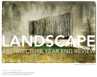
Cover Image:
John Peters, BSLA 2014
Jack Peters, a 2013 recipient of the Roy H. DeBoer Travel Prize, utilized
the award to travel to Peru in the summer of 2013 to study fog catchers,
a unique water collection system. The Prize is named to recognize the
dedication and contributions of Roy DeBoer to landscape architecture
education. To that end, the objective of the Prize is to stimulate
design exploration and discovery through travel. Travel experience is
perhaps one of the most valuable tools available to a designer. Images,
encounters and observations that result from exposure to new cultures
and landscapes are invaluable resources which enrich the design
process. Recipients of the Travel Prize give a presentation to the faculty
and student body as part of the following fall’s Common Lecture.
“The Roy H. DeBoer Endowed Scholarship in Landscape Architecture”
and “The Bruce “Doc” Hamilton Endowed Scholarship in Landscape
Architecture”
These two funds were established in honor of our two long-time
professors, Roy H. DeBoer and Bruce “Doc” Hamilton, for their
pioneering excellence in the field of landscape architecture, their positive
and profound impact on students, and their dedication to Rutgers
education. The funds will support undergraduate students enrolled in the
Department of Landscape Architecture who have excelled academically
and have shown innovation in their work and dedication to the profession
of landscape architecture.
Please consider contributing to these endowment funds. Log on to www.
support.rutgers.edu or call 1-888-RU-A-DONOR to discuss how to make
a gift or for any other questions you may have about supporting the
Department.
2](data:image/gif;base64,R0lGODlhAQABAIAAAAAAAP///yH5BAEAAAAALAAAAAABAAEAAAIBRAA7)