The document provides information about trade routes and goods in Africa, Asia, and Europe during the post-classical era. It includes a map showing trade routes such as the Silk Road from China to Europe, the Trans-Saharan routes from Africa to the Middle East, and maritime routes between India and East Africa. Accompanying the map are tables labeling commodities traded on each route, such as gold, silk, paper, and spices. Students are asked questions to test their understanding of the locations and goods being traded along these major land and sea trade networks.
This document provides information on various topics in world history from the Byzantine Empire and Russia to the Renaissance. It covers the location and role of Constantinople as the seat of the Byzantine Empire. It also discusses Byzantine achievements in art and architecture as well as their preservation of Greco-Roman culture. The document then moves to other topics like the origins and spread of Islam, the foundations of medieval European societies under the Roman Catholic Church, and the economic effects of the Crusades that stimulated trade and the use of banking. It concludes with discussing Renaissance figures like da Vinci and Michelangelo as well as humanist ideas that celebrated the individual and Greek/Roman culture.
1) Siddhartha Gautama was the founder of Buddhism who sent missionaries to spread Buddhism from India to other parts of Asia.
2) Qin Shi Huangdi built the Great Wall of China as the first Emperor of China.
3) Solon was a Greek tyrant who worked for reform in Athens. Homer and Herodotus were two Greeks who wrote drama and poetry.
This document provides images and brief descriptions related to notable works of art, architecture, and literature from different time periods and locations. It includes slides on Stonehenge, the Parthenon, the Colosseum, the Pantheon, Hagia Sophia, the Dome of the Rock, works by Da Vinci, Michelangelo, Machiavelli, Erasmus, Sir Thomas More, Gutenberg, and Petrarch. Additional slides provide context on Mesopotamia, Egypt, and the Phoenicians. The document is intended to highlight connections between these topics and provide key information about the locations, time periods, rulers, religions, and cultures represented in each work.
This document contains questions about famous people, works of art, landmarks, and historical periods. It asks about the book on display in the Library of Congress, discusses the Mona Lisa in the Louvre, and mentions locations like Notre Dame Cathedral and the Eiffel Tower. It also inquires about figures like Hammurabi, Charlemagne, and Augustus Caesar as well as the Renaissance period and Roman Empire.
This document is a study guide for a world history class that contains questions about identifying geographic locations, civilizations, countries, empires, and trade routes from around the world. It includes fill-in-the-blank and multiple choice questions about places like the Aegean Sea, Frankish Empire, Russia, Italy, Alps, Aztec, Inca, Japan, Baltic Sea, China, India, Maya, Iberian Peninsula, Scandinavian Peninsula, and trade routes like the Silk Road, Trans-Sahara route, routes through Western Europe and the Mediterranean, Indian Ocean, South China Sea, and Black Sea. The purpose is to test the student's knowledge of global geography.
The document discusses several major world religions including Shinto, polytheistic religions in Mesoamerica, Buddhism, Confucianism, Taoism, Hinduism, Islam, Judaism, Christianity, and their origins and geographic spread. It mentions Buddhism spreading from India to East Asia under Emperor Asoka, and that both Confucianism and Taoism are still practiced in some parts of the world today. The last sentences note that Christianity originated in Axum and Islam spread across the Sahara Desert, with some areas practicing a mix of Islam and animism.
This document provides a summary of key information about 9 world religions and 6 Roman emperors that are important to know for passing the World History SOL test. It lists the founders, main beliefs, holy books, and spread of Buddhism, Hinduism, Shintoism, Confucianism, Taoism, Judaism, Christianity, Islam, and Zoroastrianism. It also lists the names of 6 Roman emperors - Augustus, Marc Anthony, Julius Caesar, Constantine, Justinian, and Theodosius - and 1 or 2 important facts about each. The document was created by Lisa Gibson for her World History class at WWHS Portsmouth Virginia in 2012 to help students study for
The document contains a series of maps review worksheets for a World History I class focusing on SOL WHI.2, 3,5,6,7. The worksheets ask students to identify various geographical features like bodies of water, land masses, and straits on maps of Europe, Asia, and Africa. Students are also asked to identify the locations of important civilizations and cities from history like Athens, Rome, Egypt, and others.
This document provides resources and links for hands on archaeology including a YouTube channel with archaeology videos, a website offering free artifact loan kits for 2 week periods, and two Portaportal sites created for Lisa Gibson that can be accessed as a guest for world history and general social studies links.
This document is a comparison table for major world religions including Judaism, Hinduism, Buddhism, Confucianism, Taoism, and Zoroastrianism. It lists information about the geographic location of origin, important figures or founders, holy books, and how each religion spread. The main ideas are that some religions believe in one God while others believe in many gods.
The document discusses three major monotheistic religions: Judaism, Christianity, and Islam. It notes that Judaism was founded by Abraham and considers the Torah as its sacred text. Christianity was based on the teachings of Jesus Christ and views the Bible as sacred. Islam was founded on the teachings of Muhammad and considers the Quran sacred. All three religions recognize important prophets like Moses, Jesus, and Muhammad. They also have important holy cities (Jerusalem for Judaism, Rome for Christianity, and Mecca/Medina for Islam) and holidays (Hanukkah, Christmas, Ramadan).
The document provides instructions for using a "Four Square Review" activity in the classroom. Students fold paper into four squares and take turns writing what they learned in each square, sharing papers to fill all four squares. This allows students to review key concepts from class and create questions for each other in a collaborative, hands-on activity.
The document provides directions for conducting a jigsaw activity to teach students about a topic that has been divided into multiple segments. It explains how to divide the material and students into groups, have students become "experts" on one segment, then recombine into new groups to teach their segment to others. Key steps include dividing the material into segments, assigning student numbers and letters to form initial and subsequent groups, providing time for students to learn their segment, having them then teach it to a new group, and concluding with a class review.
The document contains instructions for a mental mapping activity where students are asked to identify countries and geographical features based on their shapes. Students are provided with simple shape descriptions and are asked to write the name and continent/region for each one. They are also asked to label a peninsula resembling a boot and identify an archipelago resembling a seahorse.
The document is a worksheet asking students to identify structures from Ancient Greece and Rome and their locations. It asks the student to:
1) Identify structures shown in images as the Parthenon, Colosseum, Aqueduct, and Pantheon.
2) State that the Parthenon is located in Greece and Athens.
3) Identify the Colosseum, Aqueduct, and Pantheon as being located in Rome.
4) Match the Parthenon with Greece on a timeline showing events in Roman history.
Important People you need to know for the World History I SOL test. Covers 23 people listed from SOL WHI.6 through SOL WHI.13 There are 23 people (46 slides). First is a description with 3 clues followed by name/picture answer slide for each. When you run it, you see one clue at a time as you advance.
Tech Day - Roman Contributions Project Instructions. Students will find images of Roman contributions to Western Culture and create a powerpoint in 9 slides.
1) Rome was located in central Italy near the western coast. The geography of flat fertile land supported farming and population growth.
2) Greek culture influenced the Romans in areas like architecture, literature, and religion. The Romans had their own pantheon of gods and built structures like the Pantheon, aqueducts, roads and arches.
3) Roman government had representatives and senators who made laws. Citizens were either patricians or plebeians. Consuls led the government and army.
The document discusses the major Greek and Roman gods and goddesses, including Zeus, Hera, Apollo, Artemis, Athena, and Aphrodite. It notes their associations, symbols, and Roman names. Greek and Roman mythology helped early civilizations explain natural phenomena and human experiences. Mythology also influenced later cultures through its use in literature, art, and architecture.
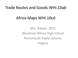
1. Trade Routes and Goods WHI.10ab
Africa Maps WHI.10cd
Mrs. Gibson 2012
Woodrow Wilson High School
Portsmouth Public Schools
Virginia
2. into the appropriate place of origin.
spices Buddhism waterwheels
Confucianism
Maritime routes Trans-Saharan routes Silk Roads windmills
gold compass sugar gold
silk Taoism paper Hinduism
printing paper money Animism
porcelain
China India Africa
Middle East:
3. China Persia
1. What trade item traveled the above path? _____________
China Muslim
World
Byzantium
?
2. What trade item traveled the above path? _____________
3. If you added a fourth location arrow, what would it be? ____________________
India Middle East
China Europe
4. What trade item traveled the above path? _____________
Student Name: _______________ Date: __ /__ /__ Block:___ World History I SOL 10d Mrs. Gibson 2012
4. Student Name: __________________________________ Date: ______ Block: ________
Label the 2 countries and 1 continent. What Trade Route is shown here?___________________________________
Hint: What body
of water is this?
5. African Civilizations
Identify the following locations:
1.__________
2.__________
3.__________
4.__________
Word Bank:
5.__________ •Axum
•Egypt
6.__________ •Nubia (Kush)
•Sahara Desert
•West African Kingdoms
Note: On SOL TEST (Ghana, Mali, Songhai)
maps, the land is grey and
the water is white. •Zimbabwe
Student Name: _______________ Date: __ /__ /__ Block:___ World History I SOL 10d Mrs. Gibson 2012
6. Rivers in Africa
Each location is located on what river(s)?
1.__________
2.__________
3.______ ___________ Note: On SOL
TEST
4.__________ maps, the
land is grey
Word Bank: and
5.__________ Niger the water
is white.
Nile (3x)
6.__________ None
Limpopo
Zambezi
Student Name: _______________ Date: __ /__ /__ Block:___ World History I SOL 10d Mrs. Gibson 2012
7. Africa
What letter shows the location that:
1. Practiced the Christian religion?
___ Name: ________________________
2. Facilitated the gold-salt trade with Europe & Asia?
___ Name: _________________________
3. Shows the people who used hieroglyphic writing?
___ Name: _________________________
4. Practiced the religions of Animism and Islam?
___ Name: _______ _______ ______________
5. Functioned as the African center of
trade and learning ?
___ Name: ____________________
Word Bank:
6. Prosperous , “Great” walled city?
___ Name: ___________________
Axum
Egypt
Ghana, Mali, Songhai
Trans-Sahara Route
Timbuktu Note: On SOL TEST
maps, the land is grey and
Zimbabwe the water is white.
Student Name: _______________ Date: __ /__ /__ Block:___ World History I SOL 10d Mrs. Gibson 2012