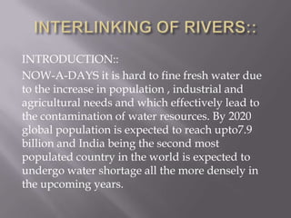
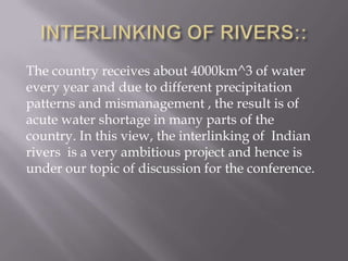
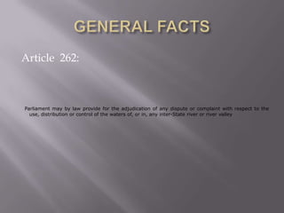
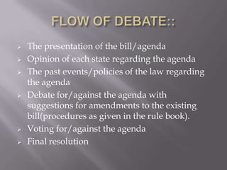
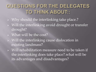
The document provides an introduction and study guide for delegates participating in the SSN Youth Parliamentary Conference on the agenda of interlinking rivers in India. It discusses the need for interlinking rivers due to increasing population and water shortage issues. It outlines India's major river water conflicts such as the Ravi-Beas and Cauvery disputes. The study guide explains the flow of debate at the conference and provides questions for delegates to consider regarding the costs, impacts and advantages/disadvantages of the proposed interlinking of rivers project.
This file contains a presentation on " interlinking of rivers in India ". Describing the efforts made in past, present scenario, possibilities, problems their solution and alternatives.
Interlinking rivers 2 - Interlinking Indian Rivers - Short Presentation 1 - R...Shivu P
This slide show make us understand about the need for Interlinking the Indian rivers on the national emergency basis, its relation with the life of the people - society - nation, the relation between the water and the disease, the need for identifying the safe - secure - surplus supply of water without disputes and make the nation developed at the top and the individuals at the root levels.
Inter Linking of Rivers_Shripad, Manthan Adhyayan Kendra_July 16,2014India Water Portal
What does ILR signify? A look at the core idea behind it, its justification,benefits and issues & problems associated with it.
The author would like to thank UNESCO-IHE for the use of a few slides.
River Interlinking Projects for Socio Economic TransformationShailesh Herale
This presentation highlights the concept of river interlinking, National River Linking Project(NRLP) of India, socio economic benefits, issues and possible alternatives of river interlinking.
Requirements of human are increasing tremendously with massive change along with the evolution of human and its development. This creates stress on the natural resources; such as water, lands, forest, etc. Freshwater demand is highly increased with the growing population and the change in lifestyle of people. Hence, the concept of interbasin water transfer was developed to minimize water scarcity and to distribute water as per requirements. However, this has brought lots of negative consequences that became a challenge to preserve the earth systems. The National River Linking Plan (NRLP) is developed by the Government of India to resolve water scarcity and that plan became controversial especially on the transboundary water right issues. Therefore, the purpose of this paper is to highlight all the major and minor consequences that might happen due to the NRLP project with the perspective of making sustainable environmental development. The study revealed that for the sustainable development; every issue related to nature, socio-cultural and transboundary water right must be addressed and water should be distributed in such a manner that it solves the issues of spatial and temporal water availability.
Field visit report of Moragahakanda reservoir project Deshan Arachchige
this report contain description about project and construction process,all information are gathered during visit by Kotelawela Defence University and literature.
ISSUES AND DISPUTES OF HYDRO POWER PROJECTS
EMPHASIZES ON ALMATTI DAM SITUATED IN NORTHERN PART OF KARNATAKA. AN IRRIGATION DAM SERVES WATER TO KARNATAKA AND ANDHRA PRADESH AND TELANGANA.
Interlinking rivers 4 - Interlinking Indian Rivers - Short Presentation 3 - M...Shivu P
This method (Reticular canal system) of interlinking rivers will give justice to both flood and drought prone areas to the maximum extent. There are many advantages from this system of irrigation like, It, irrigates most of the drought prone areas and thus supply adequate water for agriculture - industry - irrigation, we need not construct costly structures like dams - reservoirs and thus protecting the same, the course of the surface canal will make the water to distribute to all the needy areas and the water will reach the destiny (Sea) only when no area wants the water for any reasons, issues like generation of back water and shifting villages and cities will not arise, we will be able to generate enormous electricity by the hydroelectricity projects – that, we will be able to create at multiple places where the Primary canal discharges its water, water can be provided / released on the needy basis - with sufficiency, surface water storing capacity in the canal becomes more as it a long canal and it makes the underground water to rise, we can expect more rain and less cyclonic effect as there is better generation of the clouds over the land almost as equivalent as that of the clouds generated over the sea, thin forest can be converted in to thick forest and thus we can make the forest cover of the land with the peoples participation, most of the natural water pathway which remains dry in most of the periods can be made to flow continuously as per our need and we need not construct big structures for this purpose - simple structures like a barrier wall/weir will divert the water from the rivers to the primary canals, farmers looking in to the sky for rain and complications in agriculture due to less rain fall can be prevented, all the present dry well will be filled with water, all the present dams and reservoirs can be made to maintain optimum level of water in all the seasons without depending on the rain from the same river basin, it is possible to eradicate the land classification based on the irrigation like 'dry - semi irrigated - irrigated land' and we can make all the land in to 'irrigated land'. The beauty of the nature can increased with greenery everywhere and small attractive waterfalls at many places.
SKY HIGH - The 7 Most Remarkable Tall Building Projects in the WorldDarwin Jayson Mariano
Tall building construction has gone a remarkable transformation over the past couple of years. Architects, engineers and building owners are now much more attuned to the latest innovations that will wow even the most seasoned construction professional. In this special issue, marvel at the most remarkable tall building projects in the world today – from Australia to Singapore to the Middle East – and find out how high a super tall skyscraper these days can be.
OnPath SharePoint Training Solution Written JustificationShadeed Eleazer
The following is a written justification for MindSharp's OnPath solution, which enables Administrators to deploy flash videos to a SharePoint site collection fully integrated with the current security model.
Presentation: Justification for WA SB5844Vanessa Vaile
PPT Presentation by Jack Longmate, Washington PT Faculty Association, explaining justification for SB 5844, which would no longer oblige community and technical part-time faculty to be members of the same bargaining units as full-time tenured faculty.
Internet development report of asia pacific 2016- least developed countries (...Shreedeep Rayamajhi
Internet Development Report of Asia-Pacific 2016- Least Developed Countries (LDCs) and Their Challenges, the research report focuses on issues and problems of lower economies in respect of internet governance process .
EDEN IAS - WEEKLY CURRENT ROUND-UP 17 June 2018EDEN IAS
Cauvery, also known as Dakshin Ganga (The Ganges of the South), has been the economic life-line of the states through
which it flows. If you look at the map of India, you will notice that the river cuts across two Indian states, Karnataka and
Tamil Nadu. It originates at Talacauvery in Kodagu district in Karnataka. While it flows mainly through Karnataka and Tamil
Nadu, a lot of its basin area is covered by Kerala and the Karaikal area of Puducherry. Hence Karnataka, Tamil Nadu, Kerala
and Puducherry all have rightful claims over the river. However the socio-economic impact of the river is most resounding
in the states of Karnataka and Tamil Nadu, where the river is treated as Mother Goddess and is entwined with the identity
of the people.
Presented by Panchali Saikia, International Water Management Institute
Revitalizing the Ganges Coastal Zone Conference
21-23 October 2014, Dhaka, Bangladesh
http://waterandfood.org/ganges-conference/
Current Affairs for Civil Services and other state level exams. for more query please contact us: 9454721860
and also visit our website : www.iasnext.com
and follow for more on instagram and facebook
Current Affairs for Civil Services and other state level exams. for more query please contact us: 9454721860
and also visit our website : www.iasnext.com
and follow for more on instagram and facebook
The present water crisis has many components of an
environmental, economic and social origin; over uses of water,
pollution, changes in availability, and water mismanagement are
some of the current problems. To cope with these problems and
enhance strategies for long term management, the following
programmes and approaches are presented: (a) A watershed
approach, integrating research, monitoring, database and
management; (b) An improved water governance system based
on participation of stakeholders and the public and private
sectors; (c) Strategic studies considering water and the economy,
water and metropolitan region, water and energy; (d) A
framework for international cooperation on shared watersheds;
(e) An economic evaluation of water resources services (surface
and underground lakes, rivers and reservoirs); (f) A capacity
building program for managers, with an integrated, predictive
and hydrographic basin approach.
we are here to help you in the duration of your preparation
feel free to contact us for any query regarding your exam
contact us at : 9454721860, 0522-4241011
or log on to our website : www.iasnext.com
we are here to help you in the duration of your preparation
feel free to contact us for any query regarding your exam
contact us at : 9454721860, 0522-4241011
or log on to our website : www.iasnext.com
11. Questions for the delegates to think about------------------------------------ pg 18
12. LETTER OF INVITATION:: DEAR DELEATES, Welcome to the 2011 SSN Youth Parliamentary Conference!! The SSN Youth parliamentary Conference, or SSNYPC as we refer to it, is a hypothetical simulation of an agenda based parliamentary discussion. It was designed with the ‘mandate’ to provide students with the opportunity to explore and debate the crucial and most vital issues that India faces today in a competitive environment. SSNYPC promises to be one of the most challenging events you will ever participate in –working not only your levels of intellect, but your debating, deliberating and collaboration skills as well.
13. ABOUT THE SSNYPC:: The SSNYPC – the first of its kind in Chennai promises to set the bar high in terms of sheer quality of debate and discussion in its first edition itself. The new agendas with interesting topics will ensure a high level of debate with extensive qualitative and substantive support from secretariat staff in form of well researched study guides which will also cater to the participants. The focus of the SSNYPC is on intense and solid debate with a view to generating real solutions on the porblems prevalent in India today. It was designed with the ‘mandate’ to provide students with the opportunity to the intricacies of Politics in a competitive environment. SSNYPC promises to be one of the most challenging events you will ever participate in –working not only your levels of intellect, but your debating, deliberating and collaboration skills as well.The SSNYPC promises to be the best collegiate youth conference in Chennai in terms of background preparation, committee sessions and quality of debate as well as the prize money.
14. INTRODUCTION TO THE AGENDA THE AGENDA FOR THE PURPOSE OF DISCUSSION IS INTERLINKING OF RIVERS AND THE FOLLOWING PAGES PROVIDE THE COMPLETE ANALYSIS OF THE AGENDA SO THAT THE DELEGATE IS ABLE TO ESTABLISH A FIRM GROUND ON HIS/HER STATE’S POLICY WITH THAT AGENDA.THE DELEGATE. PLEASE ENJOY READING THE STUDY GUIDE AND WE ARE EXCITED INSEEING YOU ALL AT THE SSNYPC 2011!!
15. INTERLINKING OF RIVERS:: INTRODUCTION:: NOW-A-DAYS it is hard to fine fresh water due to the increase in population , industrial and agricultural needs and which effectively lead to the contamination of water resources. By 2020 global population is expected to reach upto7.9 billion and India being the second most populated country in the world is expected to undergo water shortage all the more densely in the upcoming years.
16. INTERLINKING OF RIVERS:: The country receives about 4000km^3 of water every year and due to different precipitation patterns and mismanagement , the result is of acute water shortage in many parts of the country. In this view, the interlinking of Indian rivers is a very ambitious project and hence is under our topic of discussion for the conference.
18. GENERAL FACTS:: River Boards Act 1956 Inter-state Water Disputes Act 2002 National Water Policy 2002 ( the details of the above acts and policies are to be known for the ease of discussion in the debate)
19. INDIA’S EXPERIENCE IIN THE PAST::EVENTS OF CONTROVERSY The following are the conflicts:: 1). Ravi-Beas conflict 2). The Cauvery dispute 3). Krishna-Godavari water dispute
20. RAVI-BEAS CONFLICT:: With the construction of the Hansi-Butanacanal by the Haryana government, to arbitrarily draw water from the Sutlej-Beas rivers; the water issue acquired a new dimension in already complicated disputes between Punjab and Haryana. Haryana had dug a 109km long canal with a cost of Rs.260 crores . It was ready for use, but its functioning was stalled by the Supreme Court of India, entertaining a Special Leave Petition from the Punjab government and referred the case to Central Water Commission for examination.
21. RAVI-BEAS CONFLICT:: Haryana had put logic that it would draw its own share of water from Bhakhra Main Line and not encroach upon the water rights of neighbouring states. But it seemed to be a ploy to construct an alternative canal till final decision on Sutlej Yamuna Link (popularly known as SYL) was arrived at. The Supreme Court has already decided in favour of Haryana to complete the SYL.
22. RAVI-BEAS CONFLICT:: A sea change had occurred than the conditions of agriculture needs of Punjab on the eve of reorganization. Eighty-three percent of all arable land of Punjab had come under cultivation and it is not possible to bring more area under tilling. Cultivable land under irrigation had been increased from 70 % in 1971 to 95% in 2001-02. Number of bore wells had increased to 0.95 million from 0.19 million during the same period. Number of diesel and electricity run pump sets was 0.10 million and 0.09 million respectively. This number was increased to 0.17 million and 0.77 million in 2002.
23. THE CAUVERY WATER DISPUTE:: The sharing of waters of the river Kaveri had been the bone of contention of a serious conflict between the Indian states of Karnataka and Tamil Nadu . The genesis of this disparity, itself, lies in two controversial agreements, one signed in 1892 and another in 1924, between the Madras Presidency and the Princely State of Mysore.
24. THE CAUVERY WATER DISPUTE:: The state of Karnataka felt that it has not got its due share of water utilization viva vis Tamil Nadu. Karnataka claimed that these agreements were skewed heavily in favour of the Madras Presidency, and has since demanded a renegotiated settlement based on "equitable sharing of the waters". Tamil Nadu, on the other hand, pleaded that it had already developed almost 3,000,000 acres (12,000 km2) of land and as a result has come to depend very heavily on the existing pattern of usage. Any change in this pattern, it says, will adversely affect the livelihood of millions of farmers in the state.
25. THE CAUVERY WATER DISPUTE:: Decades of negotiations between the parties bore no fruit. The Government of India then constituted a tribunal in 1990 to look into the matter. After hearing arguments of all the parties involved for the last 16 years, the tribunal delivered its final verdict on 5 February 2007. In its verdict, the tribunal allocated 419 billion ft³ (12 km³) of water annually to Tamil Nadu and 270 billion ft³ (7.6 km³) to Karnataka; 30 billion ft³ (0.8 km³) of Kaveri river water to Kerala and 7 billion ft³ (0.2 km³) to Puducherry. The dispute however, seems far from over with all four states deciding to file review petitions seeking clarifications and possible renegotiation of the order.