Prometheus' Shield is an incident management system that uses satellite GPS tracking to provide real-time location tracking of firefighters and equipment. It displays their locations on a touchscreen map at the incident command post. This helps prevent tragedies like the 19 firefighters who perished at the Yarnell Hill Fire by guaranteeing communication between firefighters and command. The system utilizes satellite technology, electronic ID tags, and aerial imagery to provide situational awareness and ensure firefighter safety.
Help Prevent Another Yarnell Hill Tragedy Bill King
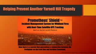
This presentation describes the operation of the Prometheus' Shield Wildland Fire Incident Management System. This system can plot the position of firefighters real-time.
Help Prevent Another Yarnell Hill Tragedy Bill King
This presentation describes the operation of the Prometheus' Shield Wildland Fire Incident Management System. This system can plot the position of firefighters real-time.
Drones are shaping the construction industry as we know it. There are obvious - and less obvious - applications of these flying wonders for the construction and engineering industries. In this post, we look at the ‘state of the art’ as it is today, and touch on a few key themes for the future.
The use of RPAS by the emergency services is growing and their impact is significant. In this session attendees heard examples of how RPAS have been implemented in Europe, their impact and how the identified challenges are being met.
This is an introduction to the Prometheus' Shield Incident Management System. It includes a satellite-based GPS tracking system for plotting the position of firefighters in the field.
Using the Iridium Satellite Network to Protect Wildland FirefightersBill King
A comprehensive, web-based wildland fire incident management program that includes a real-time GPS tracking system and complete online fillable ICS forms for NIMS reporting.
Using Esri ArcGIS Mapping to Manage Wildland FiresBill King
A revolutionary program that utilizes GIS mapping and imagery analysis to help incident commanders manage wildland firefighting operations and help protect the lives of emergency responders.
Citymesh, the pioneers in wireless connectivity, launched one-of-a-kind solution called "Safety Drone Program" which is intended to assist emergency services in collecting information more quickly and efficiently during accidents using a combination of private 5G network, AI, and autonomous drone-in-a-box technology.
Read the following case study to learn how they are helping the Belgium City of Genk with Safety Drone Program powered by FlytNow.
Asset & Risk Management for Critical InfrastructuresSim-CI
Sim-CI, or Simulation Critical Infrastructures is a aimed at supporting and facilitating resilience of Critical Infrastructures by enabling integral network management across interconnected CI's such as utility, telecom, security and so forth. The product suite spans from dynamic network planning facilitating asset and risk management, to operational workflow management and wearables enabling Field Service Engineers to accurately and safely assess and secure a contained area of a CI/CI's whilst limit any damage on the CI and related CI's (cascading effects) by containing and restoring the network.
Teamnet International offer a quick and accessible way to obtain high-quality ground images: orthophoto maps for vast surfaces, 3D digital elevation models or live video capture by means of our technological systems in the field of air vehicles and unmanned systems.
Teamnet International SA
22 Tudor Vladimirescu Blvd., Green Gate, District 5, Bucharest – 050883, Romania
Website: http://www.teamnet.ro
Mail: office@teamnet.ro
Tel: +4 021 311.66.31/ +4 021 311.66.32
Fax: +4 021 311.66.34/ +4 021 311.66.36
Augmented and Mixed Reality Solutions for Aerospace & Defensethirdeyegen65
Aerospace and defense entities are encountering heightened MRO (Maintenance, Repair, and Operations) requirements like never before. From accelerated repairs to enhanced production rates and a seamless transition from classroom to field operations, the challenges abound. However, ThirdEye's X Series MR Glasses offer a transformative solution, delivering immediate benefits such as swifter onboarding and heightened MRO efficiency in the field.
For More Details Visit Here: https://realeye.thirdeyegen.com/
Drone Guardian: Countering the drone threat to commercial airportsNicholas Meadows
L3 Technologies is currently live trailing its pioneering Drone Guardian technology in both commercial and non-commercial settings. Our whitepaper explores the risk factors associated with drones at commercial airports and considers how a flexible and scalable system such as Drone Guardian can be deployed to counter an ever-growing threat from the illegal and hostile use of both commercial and military drones.
Aircraft safety systems are a major concern today and the aviation industry is working hard on technologies that will help improve flight safety. Read this Aranca report to know more.
Aircraft Safety Systems: In The Spotlight - An Aranca ReportAranca
Aircraft safety systems are a major concern today and the aviation industry is working hard on technologies that will help improve flight safety. Read this Aranca report to know more.
Similar to How You Can Help Save the Life of a Firefighter! (20)
The Only Satellite GPS tracking Service for Firefighters and Emergency Repson...Bill King
Introducing the only program for wildland fire management with satellite GPS tracking. This comprehensive, web-based system was designed specifically to protect the lives of emergency responders.
Introducing the first incident management program for wildland fires with satellite GPS tracking. This comprehensive, web-based system was designed specifically to protect the lives of emergency responders.
New Satellite GPS service for FirefightersBill King
Introducing the first incident management program for wildland fires with satellite GPS tracking. This comprehensive, web-based system was designed specifically to protect the lives of emergency responders.
Introducing the first incident management program for wildland fires. This comprehensive, web-based system was designed specifically to protect the lives of emergency responders.
Help Us Prevent Another Yarnell Hill Tragedy! Bill King
This presentation highlights the capabilities of a new wildland fire incident management program. Prometheus' Shield is a comprehensive system designed specifically to protect the lives of wildland firefighters and emergency responders in the field.
2. On June 30th 2013, 19 firefighters from
Prescott, Arizona perished while working
on the Yarnell Hill Fire.
Since that time, little has been done
to prevent it from happening again.
Until now…
The Challenge Behind the Project
3. “
”
The mission objective was relatively simple. Create a
communications link between the firefighter and incident
command that works anywhere on the planet, Guaranteed.
Unfortunately, the mission plan proved to be a little more
complex. We had to become experts at technology that hadn’t
been developed yet.
Bill King
CEO and Senior Design Engineer
Our Mission Statement
4. A New Approach to and Old Problem
Since the first Roman fire brigades under Emperor Nero took the idea of organized firefighting from
Marcus Crassus to form the Vigiles in AD 60 and began to combat fires using bucket brigades and
pumps, firefighting has cost lives.