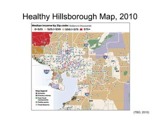
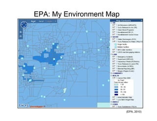
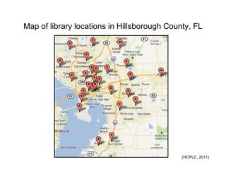
This document contains a collection of maps and data compiled by the Health Equities Coalition Resource Mapping Group to illustrate demographic trends in Hillsborough County, Florida. It includes maps showing population density, median household income, changes in poverty, distributions of Hispanic and black residents, cancer death rates, locations of libraries and parks, and bicycle infrastructure suitability. Data sources include the US Census Bureau, Florida Department of Health, EPA, Tampa Bay Times, and Hillsborough County agencies. The maps are intended to inform understanding of health disparities by visualizing socioeconomic factors at the census tract level.