Download to read offline

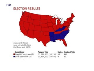
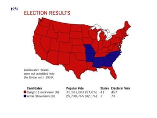
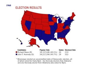
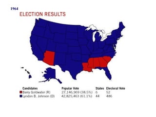
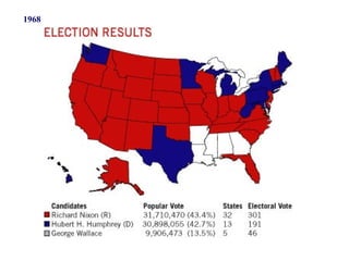
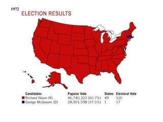
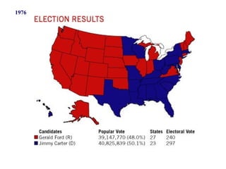
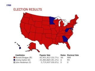
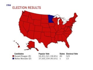
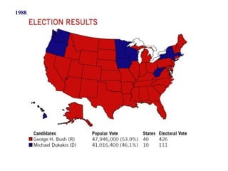
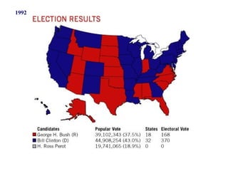
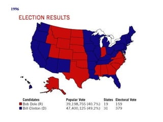
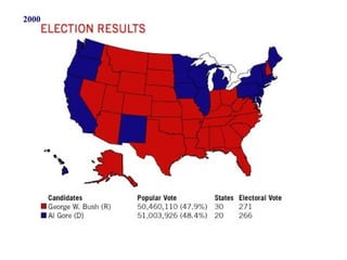
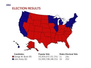
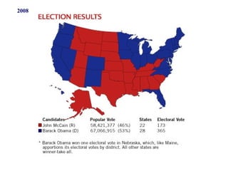
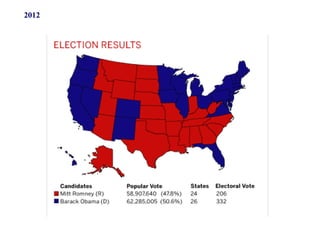
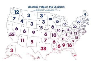
This document shows U.S. electoral maps from 1952 to 2012, with each presidential election year labeled. It provides a visual overview of how the Republican and Democratic party strongholds have changed across different regions of the country over this 60-year period.


