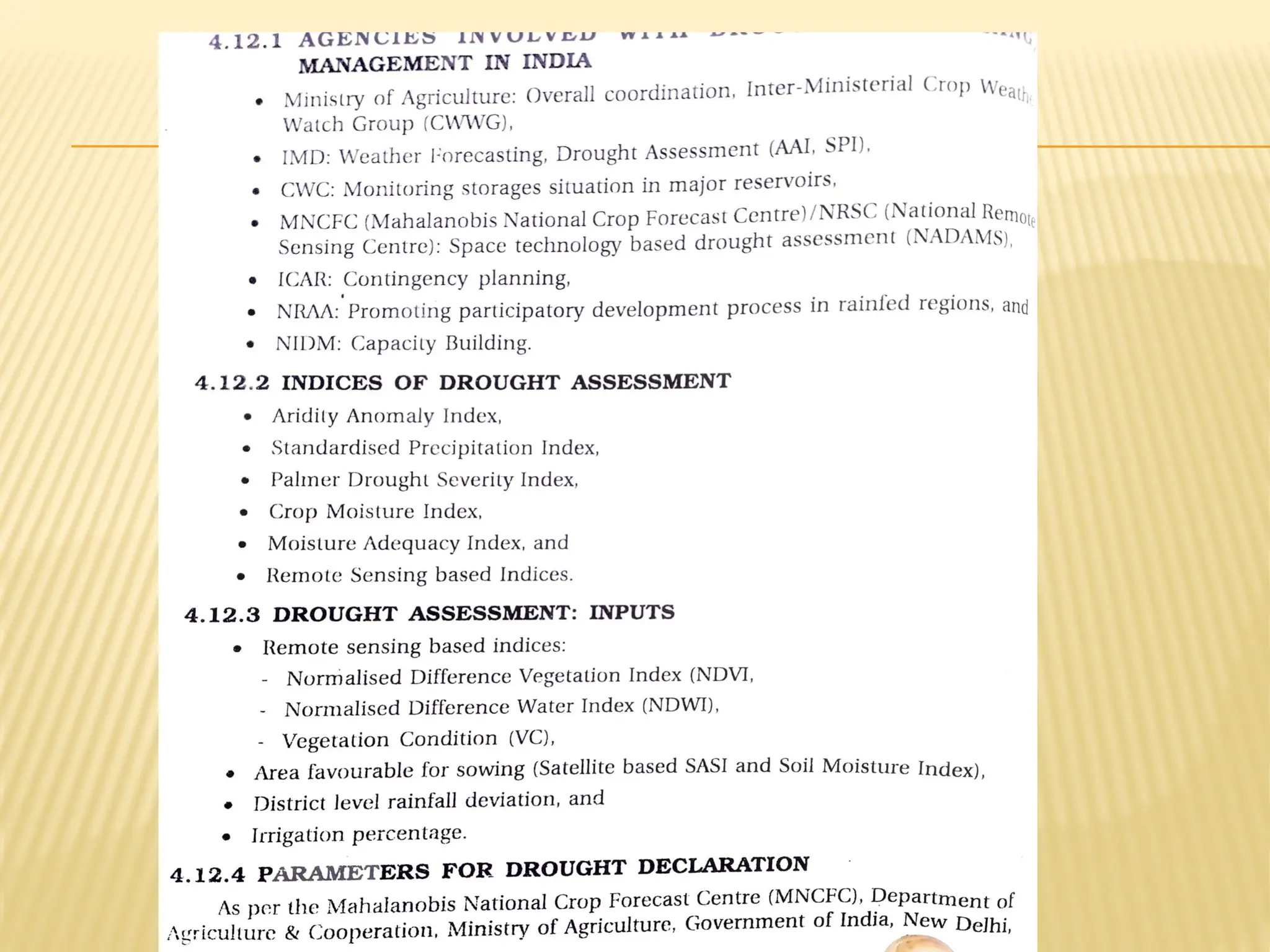
DROUGHT
• When wehave a drought, it can affect our communities and our environment in many
different ways.
• Everything in the environment is connected, just like everything in our communities is
connected.
• Each different way that drought affects us is what we Call an impact of drought.
• Drought affects our lives in many different ways because water is such an important
Part of so many of our activities.
• We need water to live and animals and plants do too.
• We need water to grow the food we eat.
• We also use water for many different things in our lives, like washing dishes, cooking,
bathing and swimming or river rafting.
• Water is also used to make the electricity we use to run the lights in our houses and the
video
•
-
•
3.
IMPACTS OF DROUGHT
Shortages in food production due to failure of crops;
Shortages of fodder and drinking water for cattle,
migration of livestock populations, and even a decrease
in the animal population
Shortages of resources for agricultural operations during
the subsequent year as a result of decreases in the
animal population; and
Deforestation to meet the fuel shortage for cooking in
rural areas because of non-availability of agricultural
wastes and crop residues
4.
IMPACTS OF DROUGHT
One of the sectors where immediate impact of
drought is felt is agriculture.
With increased intensity or extended duration of
drought prevalence, a significant fall in food
production is often noticed.
Drought results in crop losses of different
magnitude depending on their geographic
incidence, intensity and duration.
Drought not only affects food production at farm
level but also national economy and overall food
security as well.
5.
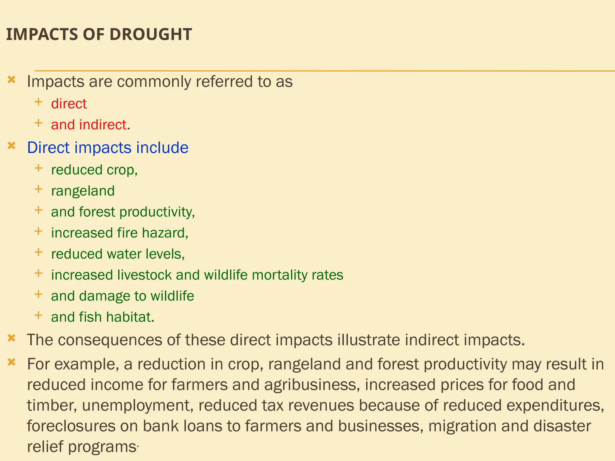
IMPACTS OF DROUGHT
Impacts are commonly referred to as
direct
and indirect.
Direct impacts include
reduced crop,
rangeland
and forest productivity,
increased fire hazard,
reduced water levels,
increased livestock and wildlife mortality rates
and damage to wildlife
and fish habitat.
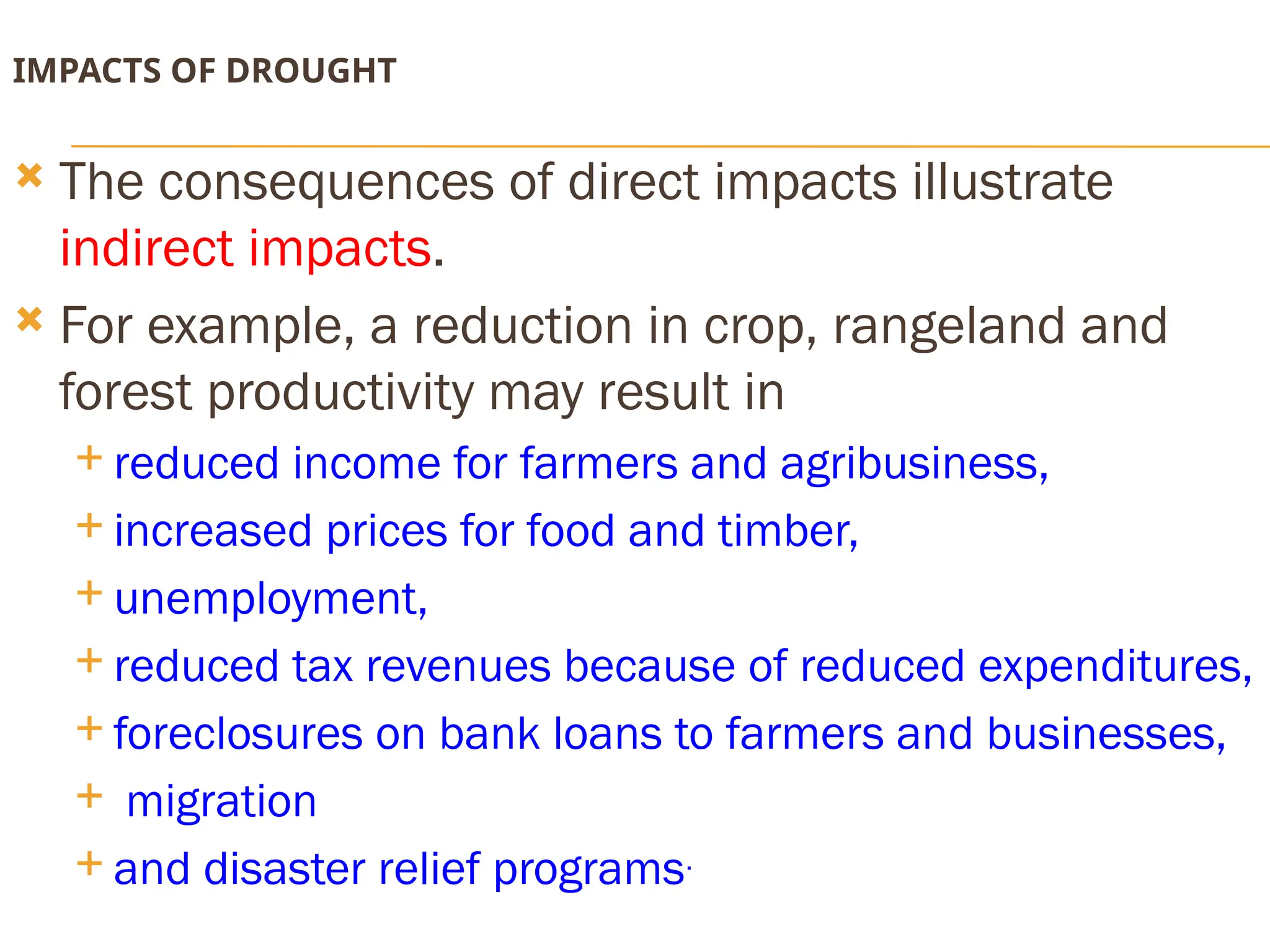
The consequences of these direct impacts illustrate indirect impacts.
For example, a reduction in crop, rangeland and forest productivity may result in
reduced income for farmers and agribusiness, increased prices for food and
timber, unemployment, reduced tax revenues because of reduced expenditures,
foreclosures on bank loans to farmers and businesses, migration and disaster
relief programs.
6.
IMPACTS OF DROUGHT
The consequences of direct impacts illustrate
indirect impacts.
For example, a reduction in crop, rangeland and
forest productivity may result in
reduced income for farmers and agribusiness,
increased prices for food and timber,
unemployment,
reduced tax revenues because of reduced expenditures,
foreclosures on bank loans to farmers and businesses,
migration
and disaster relief programs.
7.
ECONOMIC IMPACTS
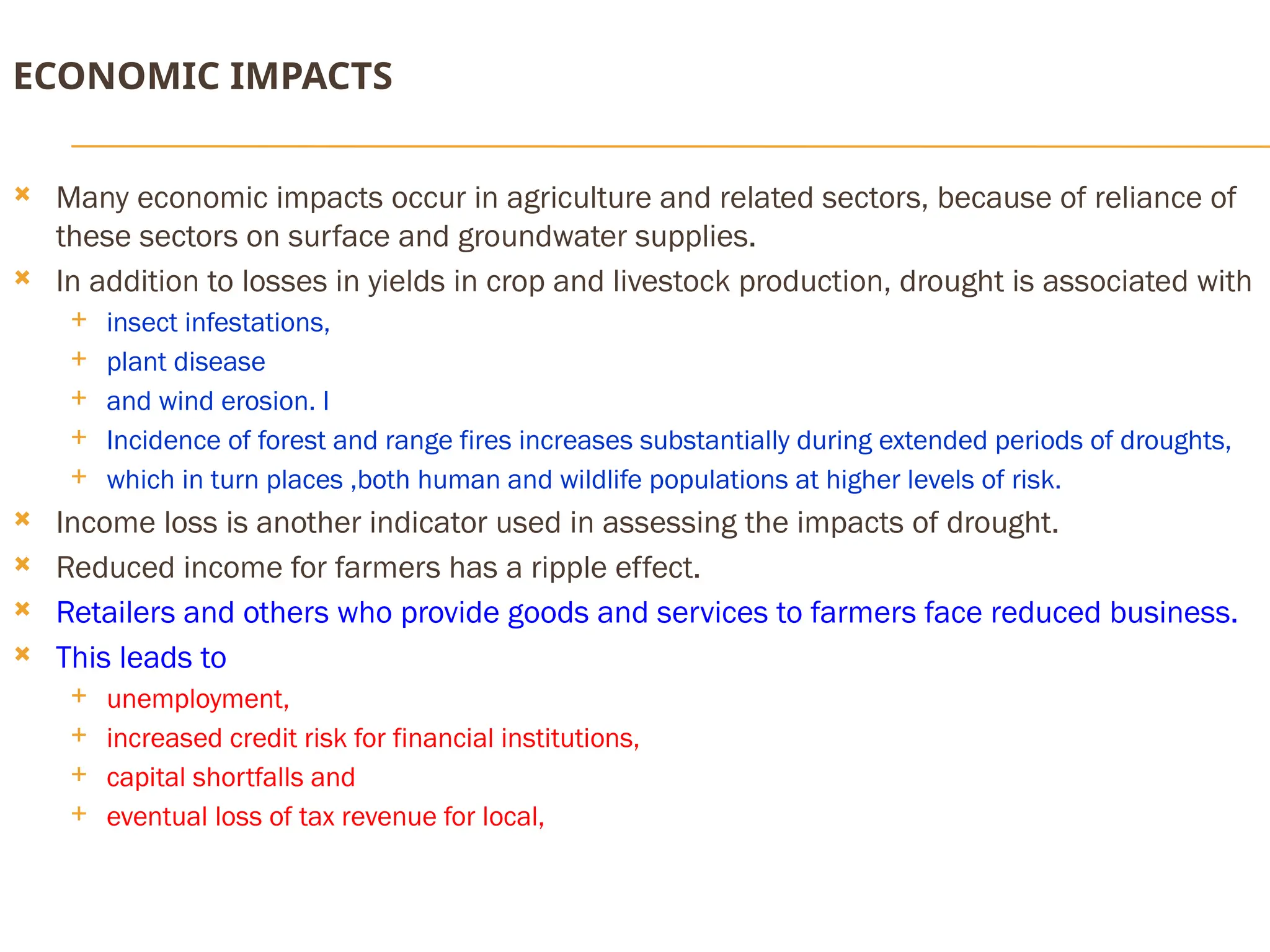
Manyeconomic impacts occur in agriculture and related sectors, because of reliance of
these sectors on surface and groundwater supplies.
In addition to losses in yields in crop and livestock production, drought is associated with
insect infestations,
plant disease
and wind erosion. I
Incidence of forest and range fires increases substantially during extended periods of droughts,
which in turn places ,both human and wildlife populations at higher levels of risk.
Income loss is another indicator used in assessing the impacts of drought.
Reduced income for farmers has a ripple effect.
Retailers and others who provide goods and services to farmers face reduced business.
This leads to
unemployment,
increased credit risk for financial institutions,
capital shortfalls and
eventual loss of tax revenue for local,
12.
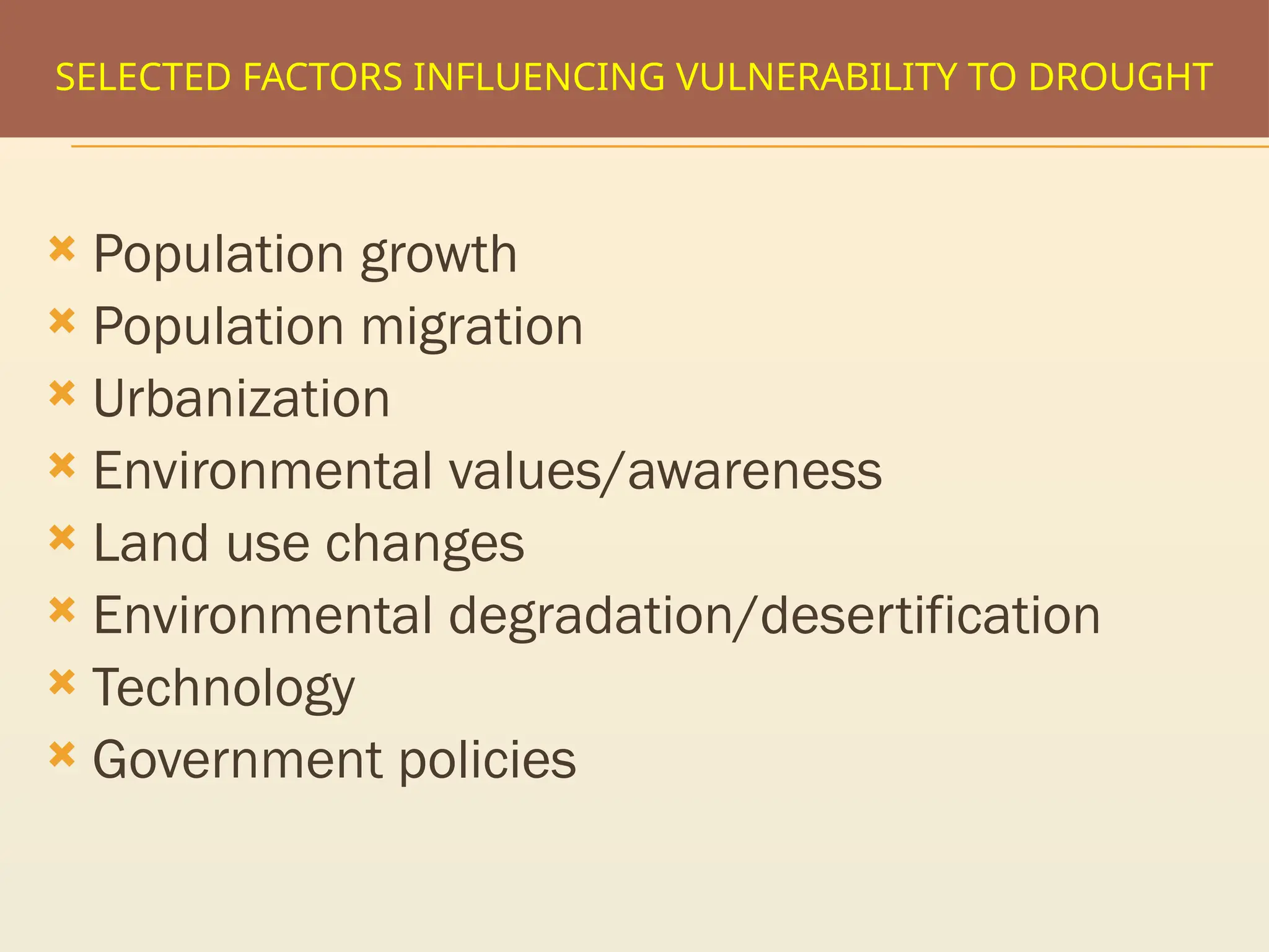
SELECTED FACTORS INFLUENCINGVULNERABILITY TO DROUGHT
Population growth
Population migration
Urbanization
Environmental values/awareness
Land use changes
Environmental degradation/desertification
Technology
Government policies
13.
DROUGHT MANAGEMENT STRATEGY
Close monitoring of the emerging drought scenario so as
develop an advance warning system
Relief measures required for providing immediate
succour to the affected population and the upkeep of the
cattle wealth, and if possible to integrate it with long term
objectives and
Hammering out an alternative crop strategy for maximum
possible retrieval of the Kharif crop and a better ensuing
Rabi crop
14.
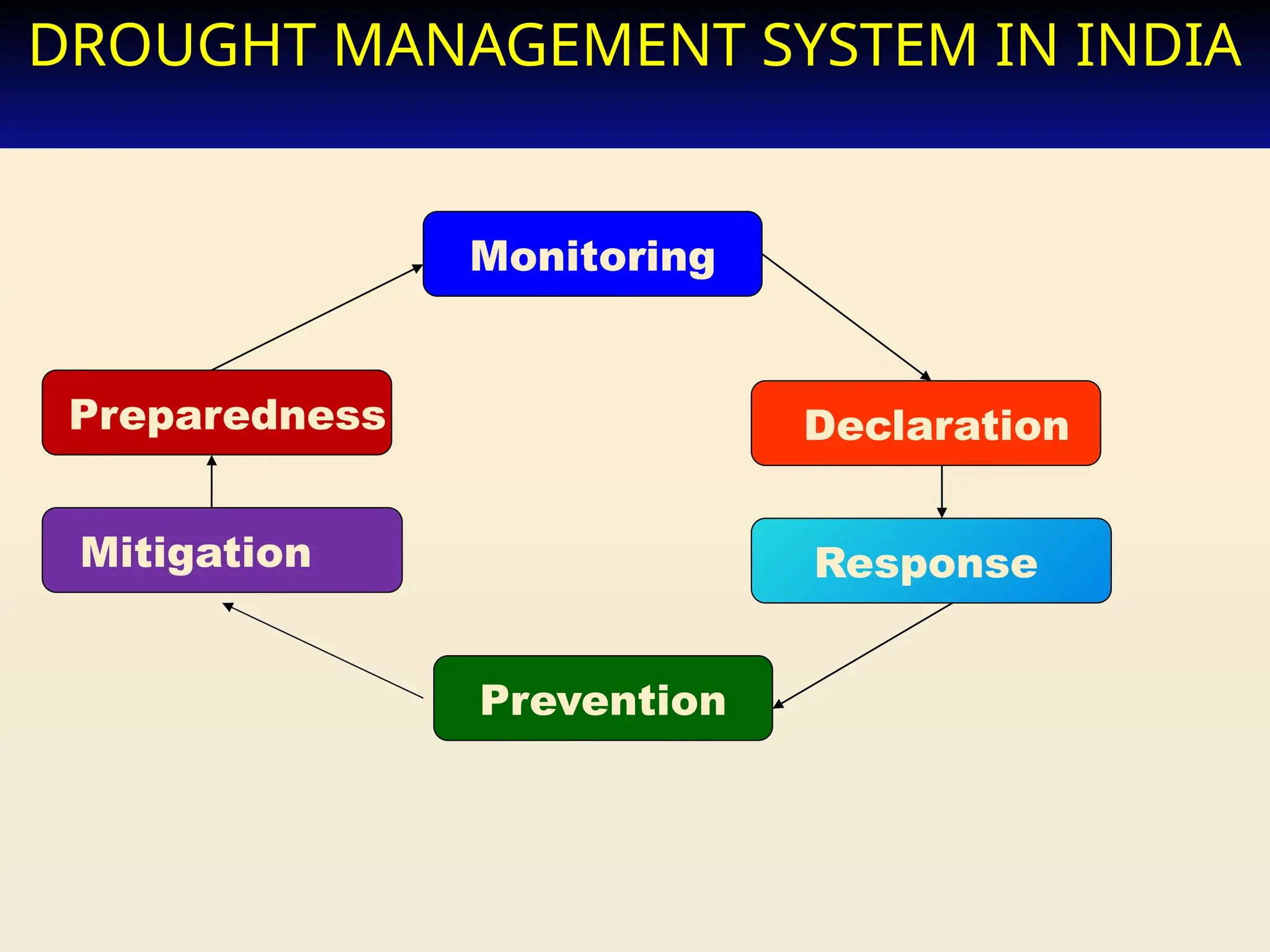
DROUGHT MANAGEMENT SYSTEMIN INDIA
Monitoring
Preparedness Declaration
Mitigation
Prevention
Response
15.
DROUGHT FORECASTING
IndianMeteorological Department’s Long-range
Forecast on the basis of its national network of
rainfall observatories
National Center for Medium Range Weather
Forecasting (NCMRWF) provides medium-range
weather forecasts (3–10 days in advance)
Central Research Institute for Dryland Agriculture
(CRIDA) assesses drought through its network of
agro-meteorological observatories and AWS in
country
16.
PREDICTION OF DROUGHT
Empirical studies conducted over the past century
have shown that drought is never the result of a
single cause.
It is the result of many causes, often synergistic
in nature.
17.
GLOBAL WEATHER PATTERNS
A great deal of research has been conducted in recent years
on the role of interacting systems or teleconnections, in
explaining regional and even global patterns of climatic
variability.
These patterns tend to recur periodically with enough
frequency and with similar characteristics over a sufficient
length of time that they offer opportunities to improve our
ability for long-range climate prediction, particularly in the
tropics.
One such teleconnection is the El Nino/Southern Oscillation
(ENSO).
18.
HIGH PRESSURE
Immediatecause of drought is predominant sinking motion of air (subsidence)
that results in compressional warming or high pressure, which inhibits cloud
formation and results in lower relative humidity and less precipitation.
Regions under the influence of semi-permanent high pressure during all or a
major portion of the year are usually deserts, such as the Sahara and Kalahari
deserts of Africa and the Gobi Desert of Asia.
Most climatic regions experience varying degrees of dominance by high
pressure, often depending on the season.
Prolonged droughts occur when large-scale anomalies in atmospheric
circulation patterns persist for months or seasons (or longer).
The extreme drought that affected the United States and Canada during 1988
resulted from the persistence of a large-scale atmospheric circulation anomaly.
19.
TOO MANY VARIABLES
Scientists don't know how to predict drought a month or more in
advance for most locations.
Predicting drought depends on the ability to forecast two
fundamental meteorological surface parameters, precipitation and
temperature. From the historical record we know that climate is
inherently variable.
We also know that anomalies of precipitation and temperature
may last from several months to several decades.
How long they last depends on air-sea interactions, soil moisture
and land surface processes, topography, internal dynamics and the
accumulated influence of dynamically unstable synoptic weather
systems at the global scale.
The potential for improved drought predictions in the near future
differs by region, season and regime.
20.
THE TROPICAL OUTLOOK
In the tropics, for example, meteorologists have made
significant advances in understanding the climate system.
Specifically, it is now known that a major portion of the
atmospheric variability that occurs on time scales of
months to several years is associated with variations in
tropical sea surface temperatures.
The Tropical Ocean Global Atmosphere (TOGA) project has
produced results that suggest that it may now be possible
to predict certain climatic conditions associated with
ENSO events more than a year in advance.
21.
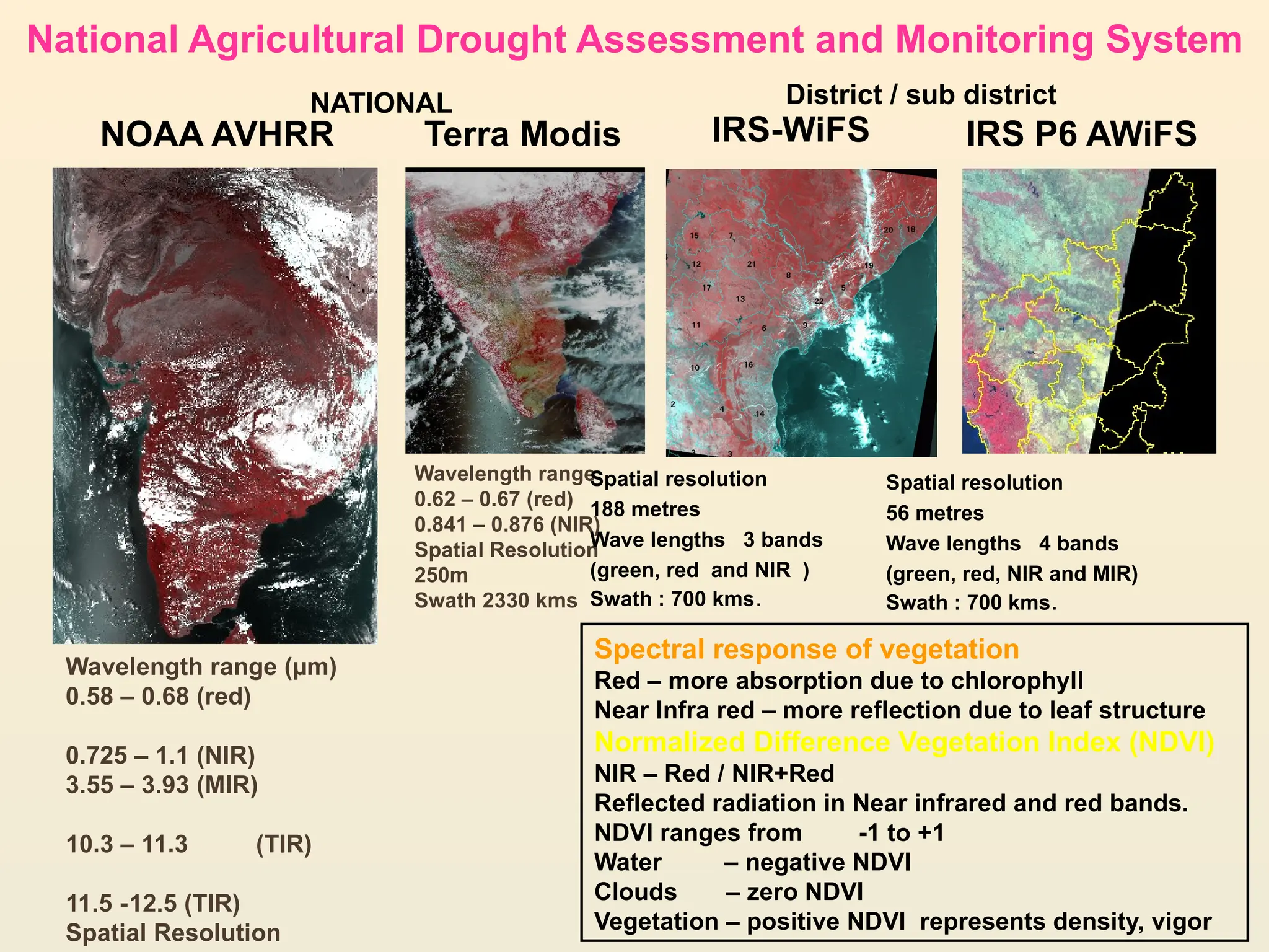
Wavelength range
0.62 –0.67 (red)
0.841 – 0.876 (NIR)
Spatial Resolution
250m
Swath 2330 kms
IRS-WiFS IRS P6 AWiFS
Spatial resolution
56 metres
Wave lengths 4 bands
(green, red, NIR and MIR)
Swath : 700 kms.
Terra Modis
NOAA AVHRR
Spatial resolution
188 metres
Wave lengths 3 bands
(green, red and NIR )
Swath : 700 kms.
Wavelength range (µm)
0.58 – 0.68 (red)
0.725 – 1.1 (NIR)
3.55 – 3.93 (MIR)
10.3 – 11.3 (TIR)
11.5 -12.5 (TIR)
Spatial Resolution
NATIONAL District / sub district
Spectral response of vegetation
Red – more absorption due to chlorophyll
Near Infra red – more reflection due to leaf structure
Normalized Difference Vegetation Index (NDVI)
NIR – Red / NIR+Red
Reflected radiation in Near infrared and red bands.
NDVI ranges from -1 to +1
Water – negative NDVI
Clouds – zero NDVI
Vegetation – positive NDVI represents density, vigor
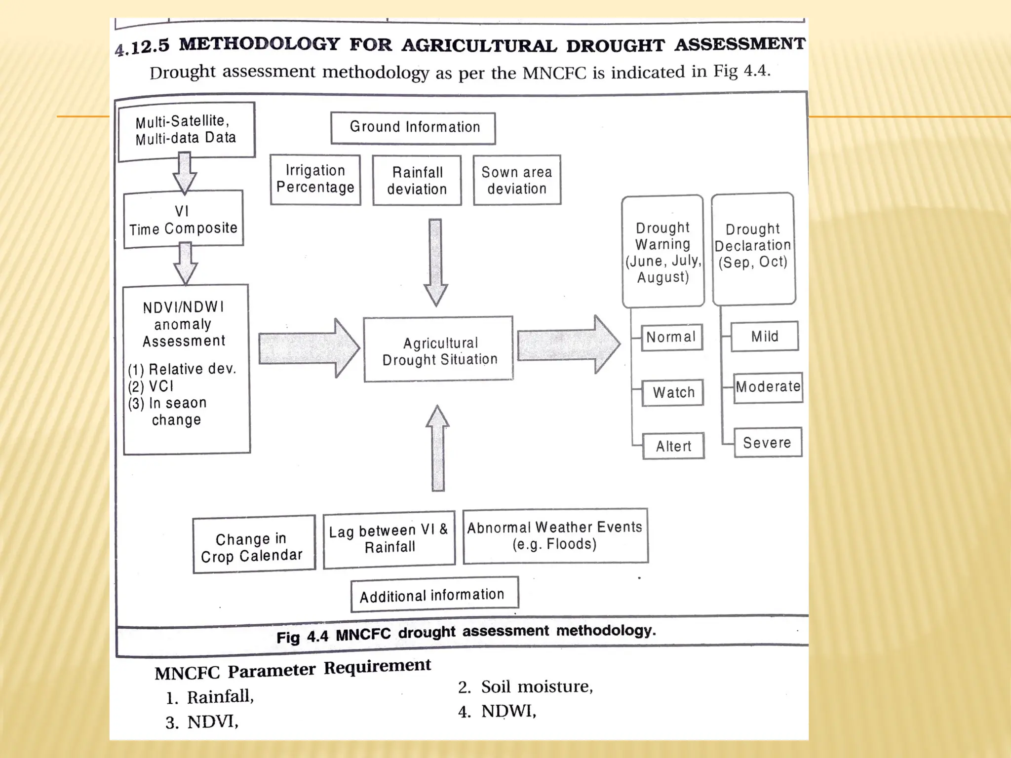
National Agricultural Drought Assessment and Monitoring System
22.
.
-100
-50
0
50
100
150
200
250
300
.
12/6 19/6 6/63/710/7 17/7 24/7 31/7 7/8 14/8 21/8 28/8 4/9 11/9 18/9 25/9
%
deviation
Drought assessment in NADAMS
Combination of indices for assessment
Augmented ground data base
Sub-district level assessment
More objective information (user friendly)
More interaction with user departments
0
0.1
0.2
0.3
0.4
0.5
0.6
June July Aug. Sept. Oct. Nov.
Month
NDVI
Normal delayed season Drought
(1) relative deviation from normal,
(2) vegetation Condition Index,
(3) in season rate of transformation
Integration with ground data
.
0
10
20
30
40
50
60
70
80
90
100
5
Jun
12
Jun
19
Jun
26
Jun
3
Jul
10
Jul
17
Jul
24
Jul
31
Jul
7
Aug
14
Aug
21
Aug
31
Aug
11
Sep
18
Sep
25
Sep
30
Sep
%
of
normal
Seasonal NDVI profiles for drought assessment
Weekly deviations of rainfall
Weekly progression of sown areas
23.
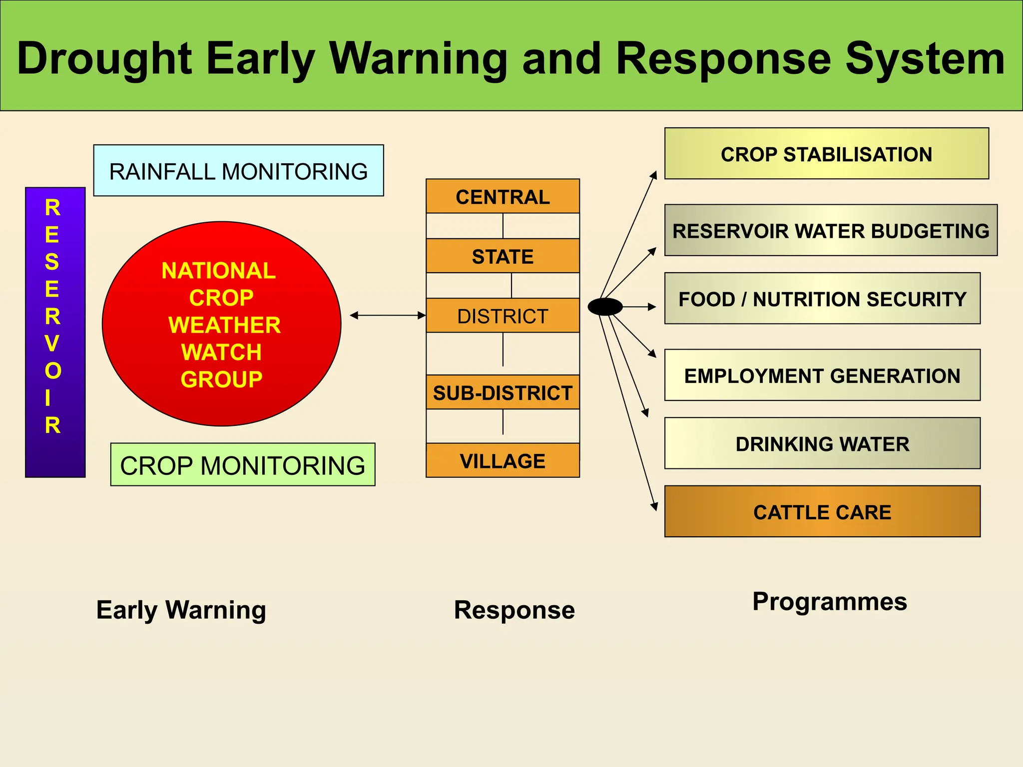
Drought Early Warningand Response System
Early Warning Response Programmes
NATIONAL
CROP
WEATHER
WATCH
GROUP
RAINFALL MONITORING
R
E
S
E
R
V
O
I
R
CROP MONITORING
CENTRAL
STATE
DISTRICT
SUB-DISTRICT
VILLAGE
CROP STABILISATION
RESERVOIR WATER BUDGETING
FOOD / NUTRITION SECURITY
EMPLOYMENT GENERATION
DRINKING WATER
CATTLE CARE
24.
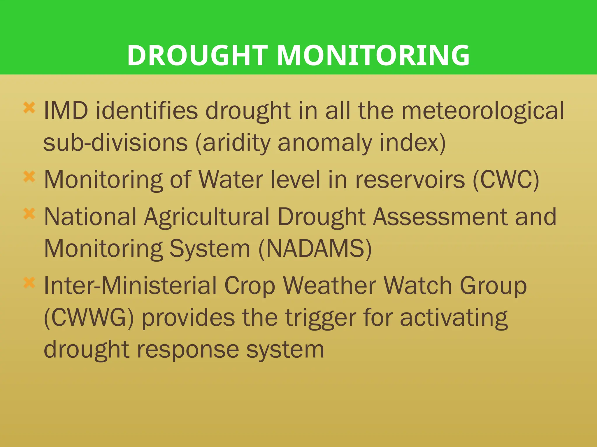
DROUGHT MONITORING
IMDidentifies drought in all the meteorological
sub-divisions (aridity anomaly index)
Monitoring of Water level in reservoirs (CWC)
National Agricultural Drought Assessment and
Monitoring System (NADAMS)
Inter-Ministerial Crop Weather Watch Group
(CWWG) provides the trigger for activating
drought response system
25.
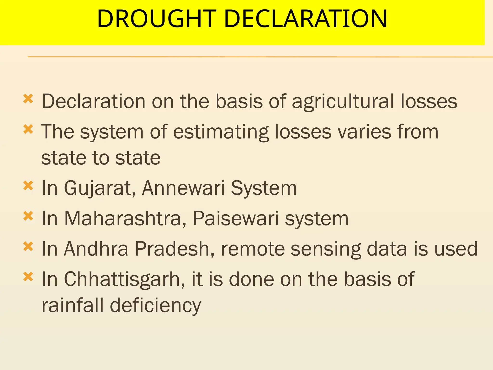
DROUGHT DECLARATION
Declarationon the basis of agricultural losses
The system of estimating losses varies from
state to state
In Gujarat, Annewari System
In Maharashtra, Paisewari system
In Andhra Pradesh, remote sensing data is used
In Chhattisgarh, it is done on the basis of
rainfall deficiency
26.
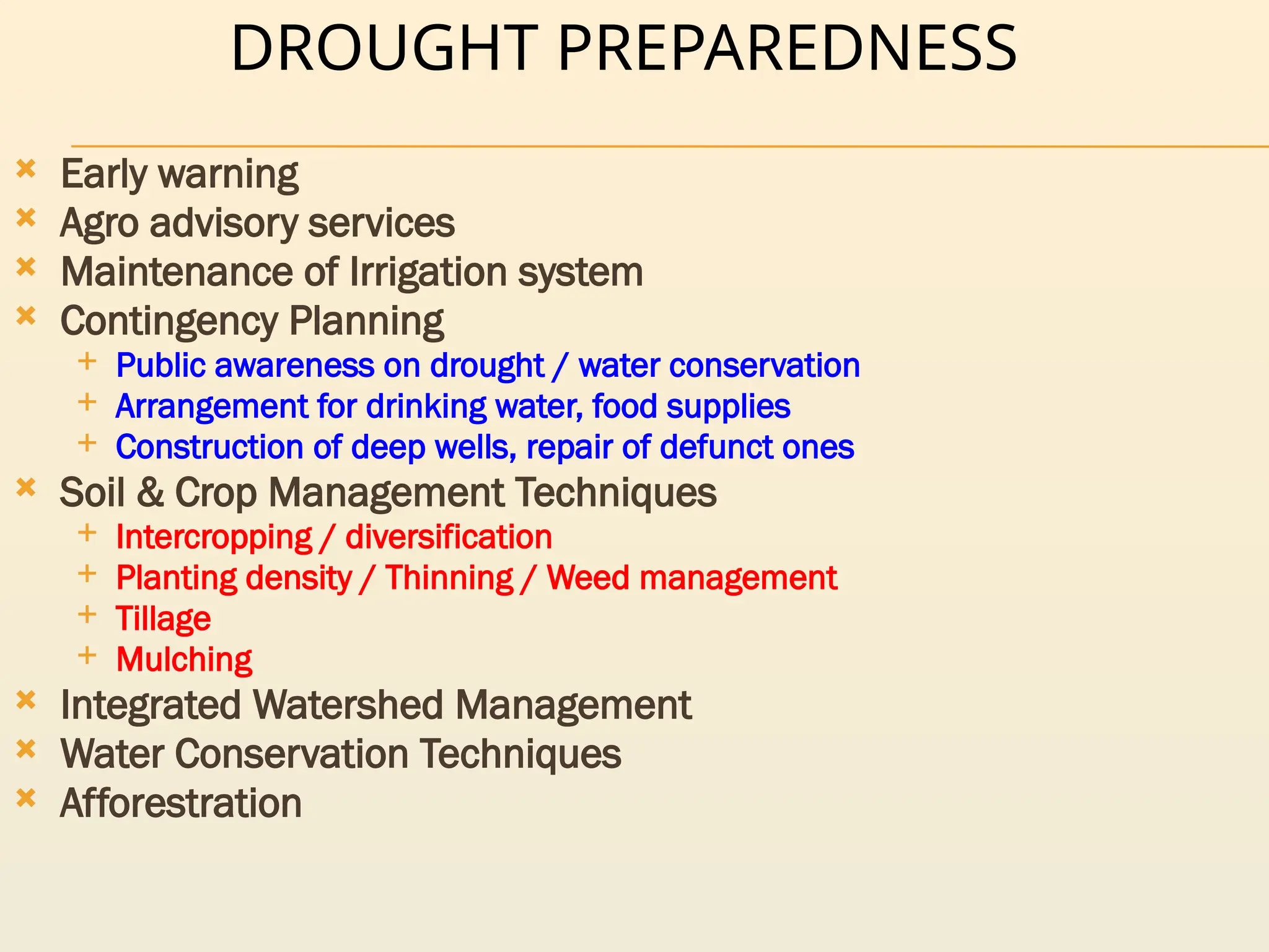
DROUGHT PREPAREDNESS
Earlywarning
Agro advisory services
Maintenance of Irrigation system
Contingency Planning
Public awareness on drought / water conservation
Arrangement for drinking water, food supplies
Construction of deep wells, repair of defunct ones
Soil & Crop Management Techniques
Intercropping / diversification
Planting density / Thinning / Weed management
Tillage
Mulching
Integrated Watershed Management
Water Conservation Techniques
Afforestration
27.
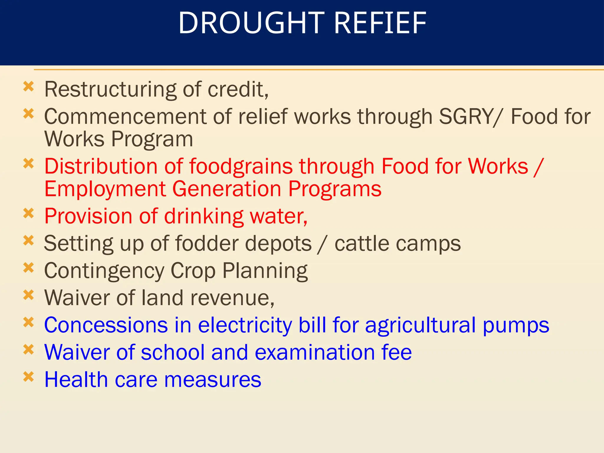
DROUGHT REFIEF
Restructuringof credit,
Commencement of relief works through SGRY/ Food for
Works Program
Distribution of foodgrains through Food for Works /
Employment Generation Programs
Provision of drinking water,
Setting up of fodder depots / cattle camps
Contingency Crop Planning
Waiver of land revenue,
Concessions in electricity bill for agricultural pumps
Waiver of school and examination fee
Health care measures
28.
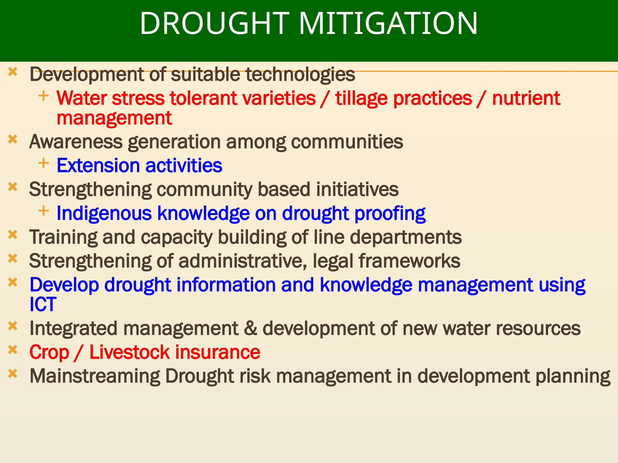
DROUGHT MITIGATION
Developmentof suitable technologies
Water stress tolerant varieties / tillage practices / nutrient
management
Awareness generation among communities
Extension activities
Strengthening community based initiatives
Indigenous knowledge on drought proofing
Training and capacity building of line departments
Strengthening of administrative, legal frameworks
Develop drought information and knowledge management using
ICT
Integrated management & development of new water resources
Crop / Livestock insurance
Mainstreaming Drought risk management in development planning
29.
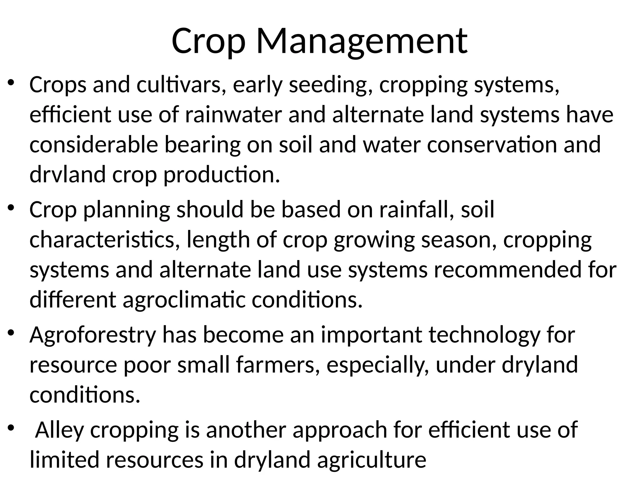
Crop Management
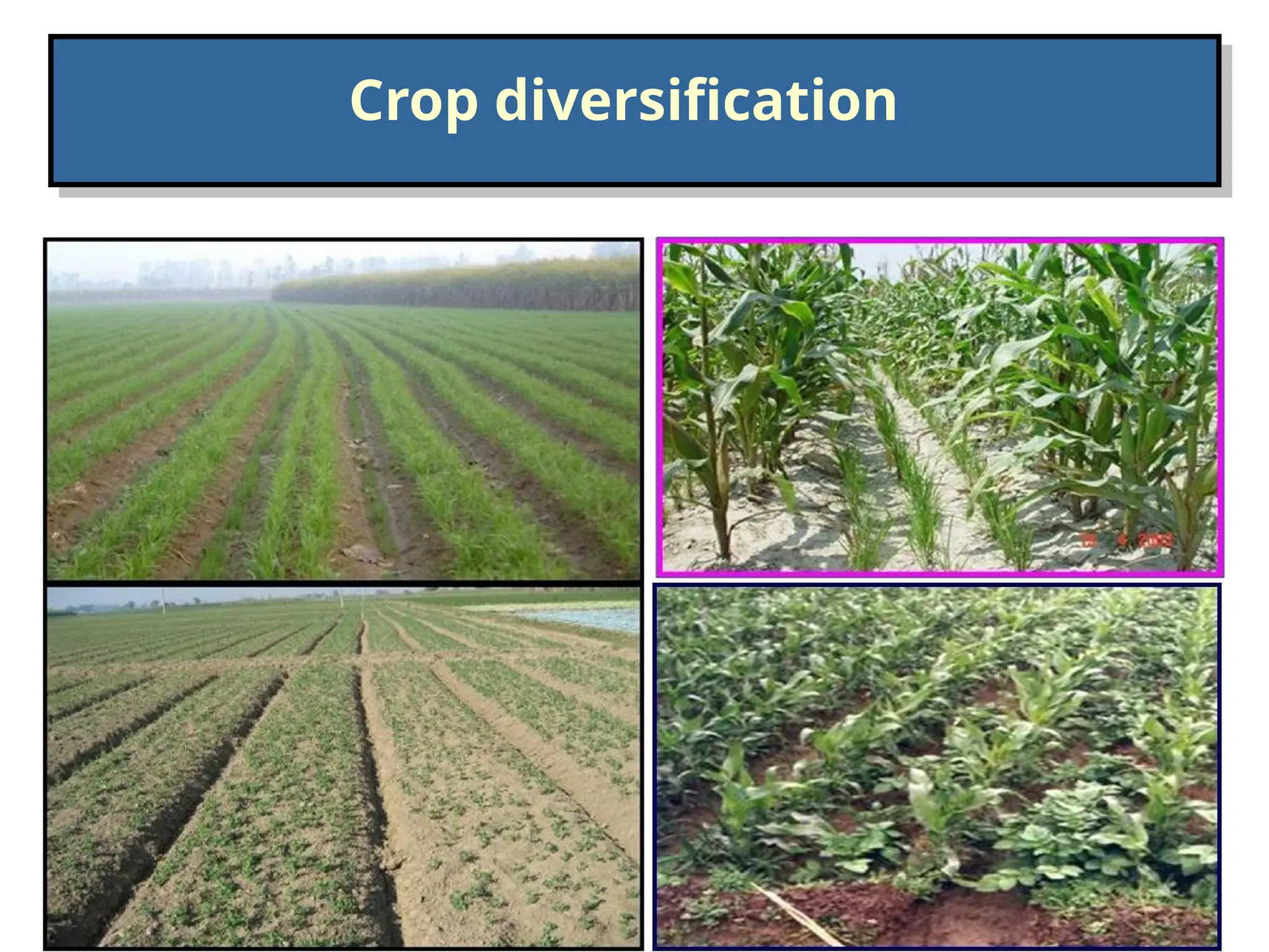
• Cropsand cultivars, early seeding, cropping systems,
efficient use of rainwater and alternate land systems have
considerable bearing on soil and water conservation and
drvland crop production.
• Crop planning should be based on rainfall, soil
characteristics, length of crop growing season, cropping
systems and alternate land use systems recommended for
different agroclimatic conditions.
• Agroforestry has become an important technology for
resource poor small farmers, especially, under dryland
conditions.
• Alley cropping is another approach for efficient use of
limited resources in dryland agriculture
30.
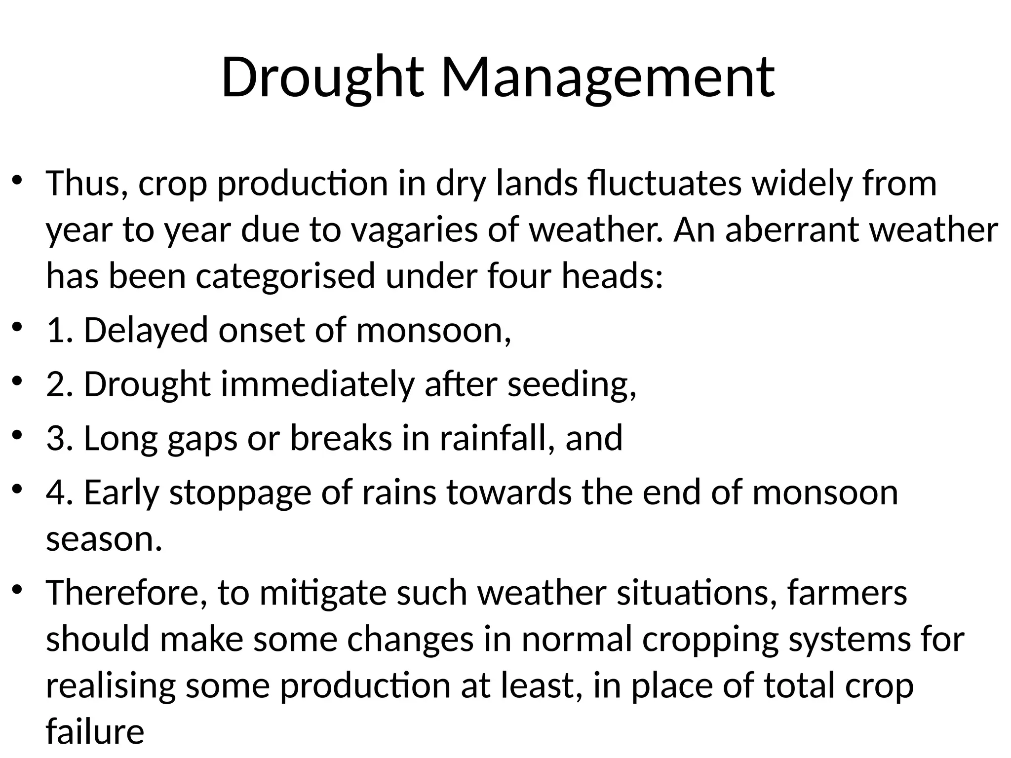
Drought Management
• Thus,crop production in dry lands fluctuates widely from
year to year due to vagaries of weather. An aberrant weather
has been categorised under four heads:
• 1. Delayed onset of monsoon,
• 2. Drought immediately after seeding,
• 3. Long gaps or breaks in rainfall, and
• 4. Early stoppage of rains towards the end of monsoon
season.
• Therefore, to mitigate such weather situations, farmers
should make some changes in normal cropping systems for
realising some production at least, in place of total crop
failure
31.
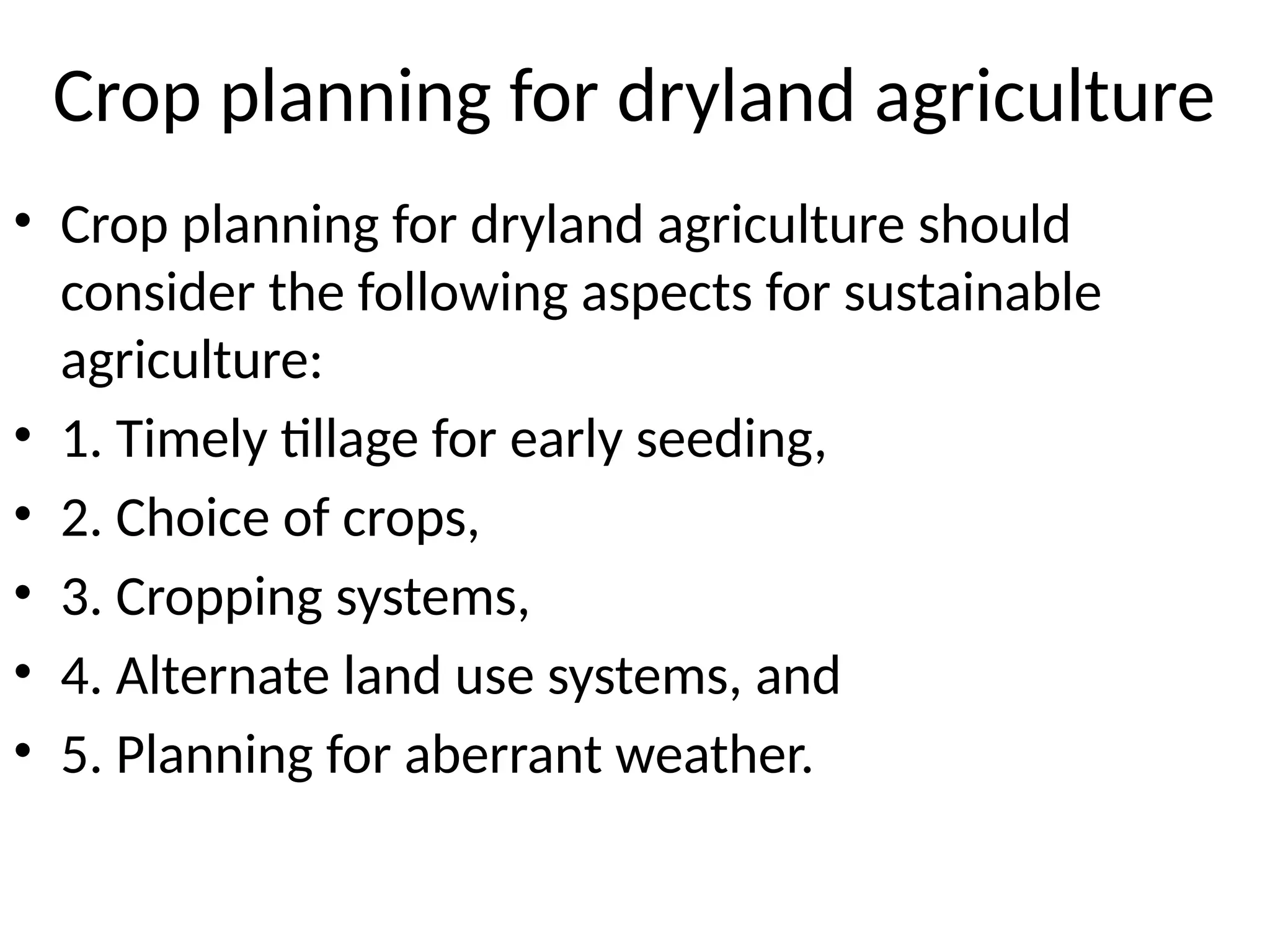
Crop planning fordryland agriculture
• Crop planning for dryland agriculture should
consider the following aspects for sustainable
agriculture:
• 1. Timely tillage for early seeding,
• 2. Choice of crops,
• 3. Cropping systems,
• 4. Alternate land use systems, and
• 5. Planning for aberrant weather.
32.
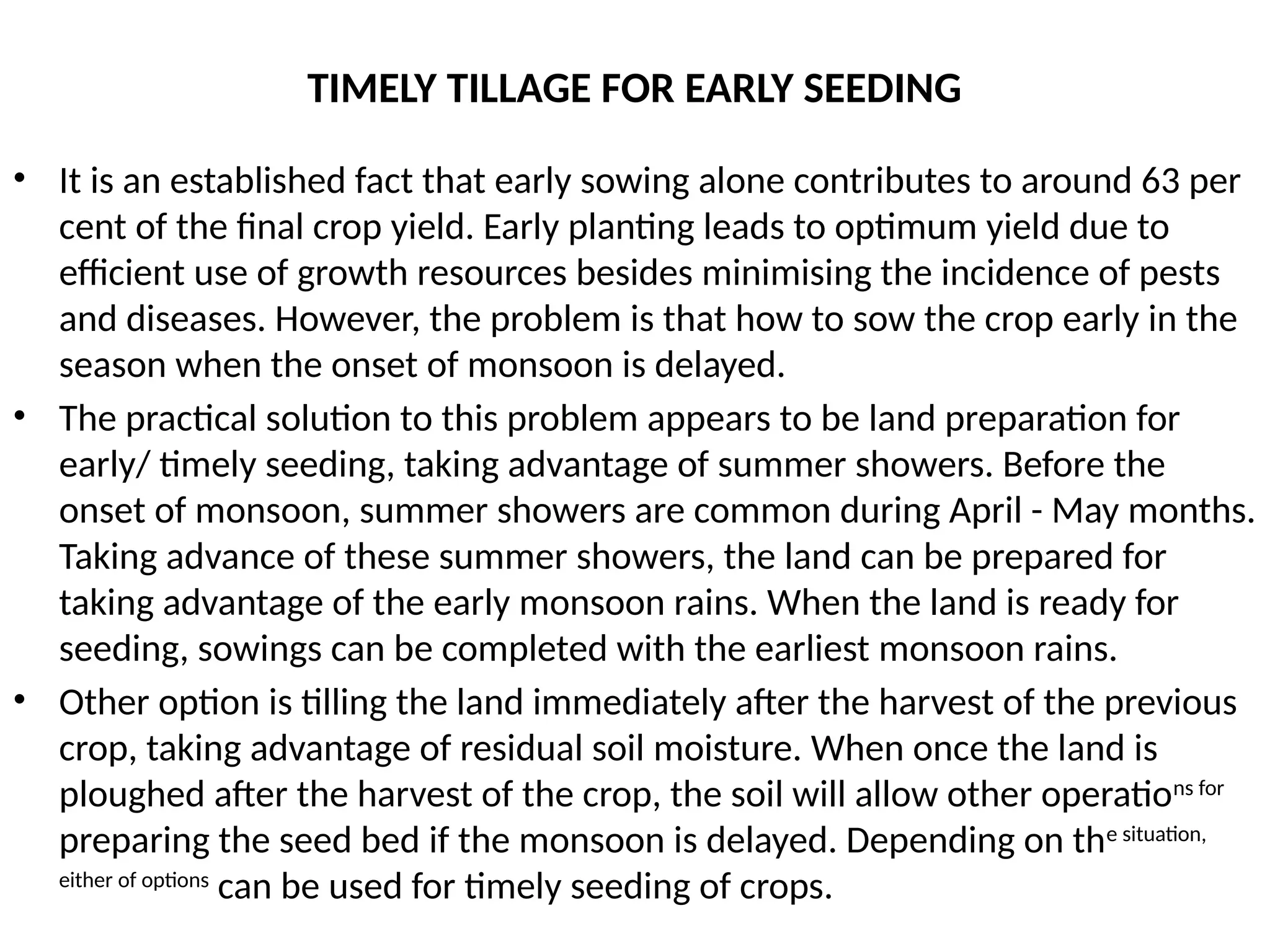
TIMELY TILLAGE FOREARLY SEEDING
• It is an established fact that early sowing alone contributes to around 63 per
cent of the final crop yield. Early planting leads to optimum yield due to
efficient use of growth resources besides minimising the incidence of pests
and diseases. However, the problem is that how to sow the crop early in the
season when the onset of monsoon is delayed.
• The practical solution to this problem appears to be land preparation for
early/ timely seeding, taking advantage of summer showers. Before the
onset of monsoon, summer showers are common during April - May months.
Taking advance of these summer showers, the land can be prepared for
taking advantage of the early monsoon rains. When the land is ready for
seeding, sowings can be completed with the earliest monsoon rains.
• Other option is tilling the land immediately after the harvest of the previous
crop, taking advantage of residual soil moisture. When once the land is
ploughed after the harvest of the crop, the soil will allow other operations for
preparing the seed bed if the monsoon is delayed. Depending on the situation,
either of options
can be used for timely seeding of crops.
33.
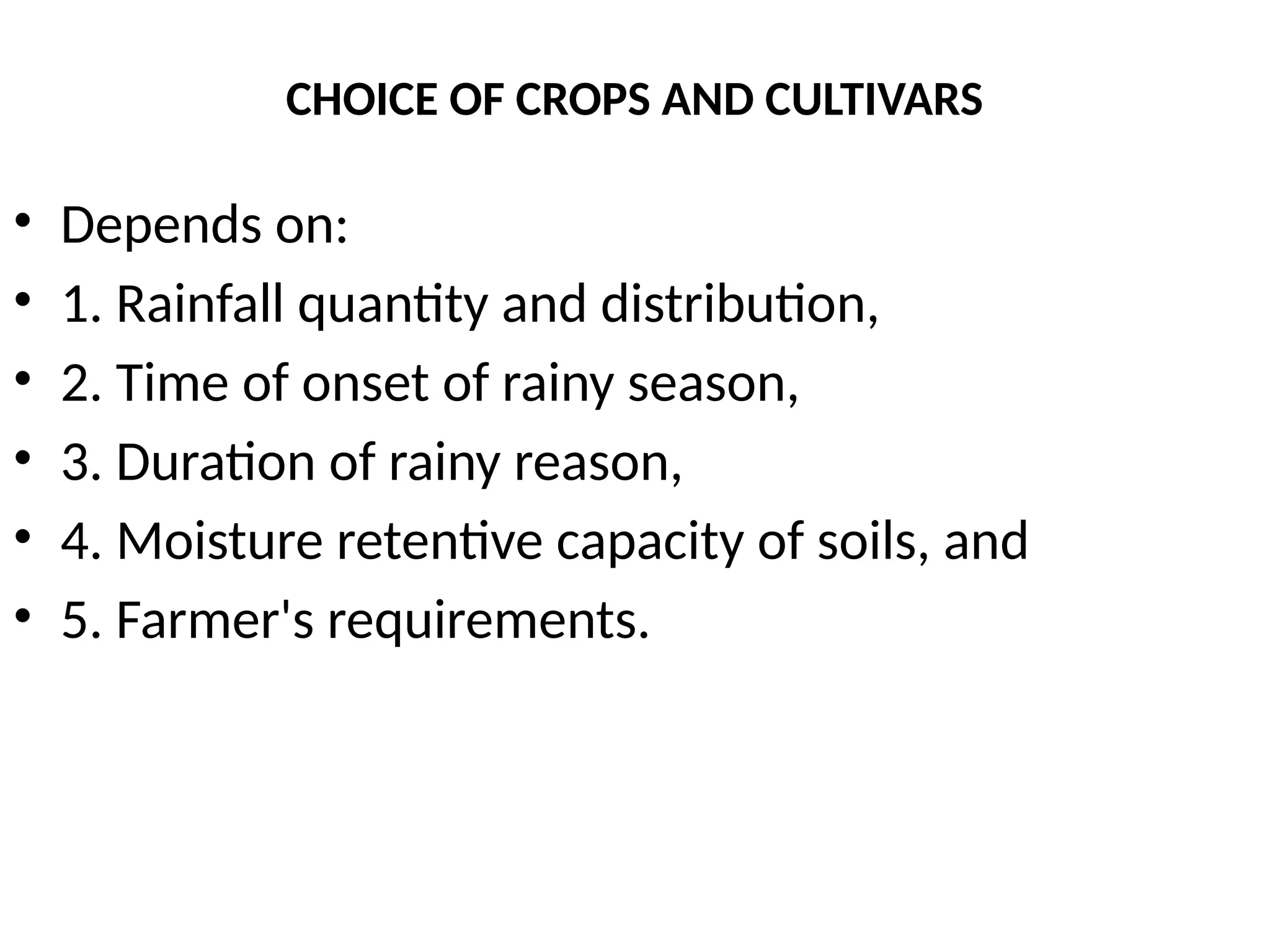
CHOICE OF CROPSAND CULTIVARS
• Depends on:
• 1. Rainfall quantity and distribution,
• 2. Time of onset of rainy season,
• 3. Duration of rainy reason,
• 4. Moisture retentive capacity of soils, and
• 5. Farmer's requirements.
34.
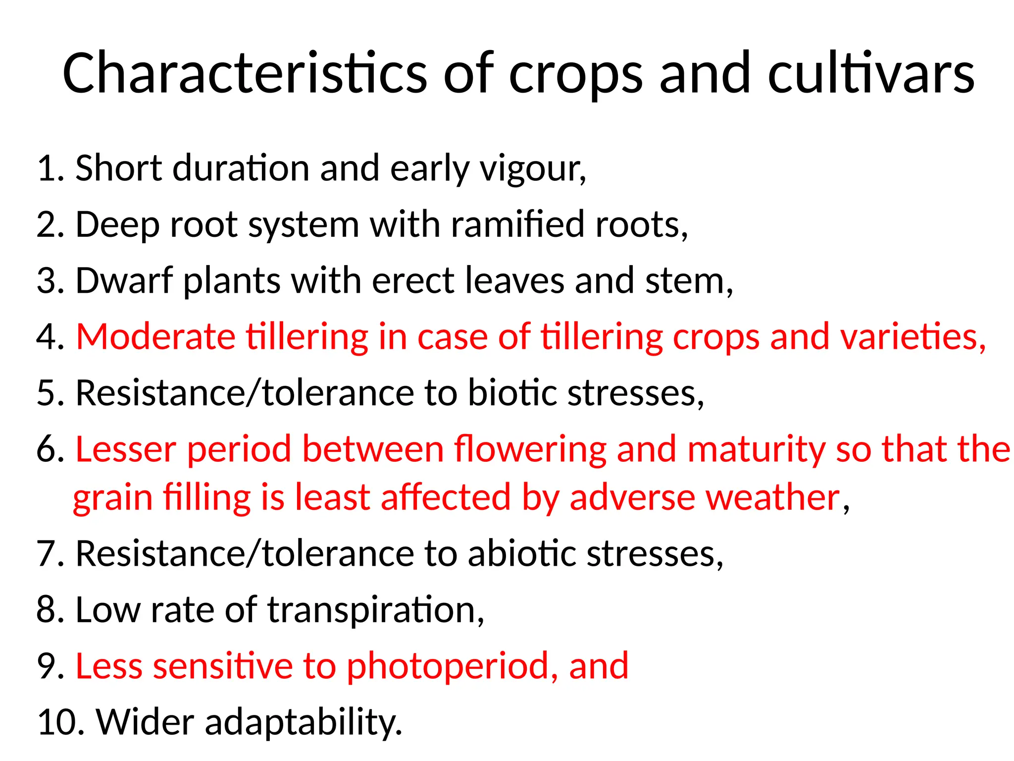
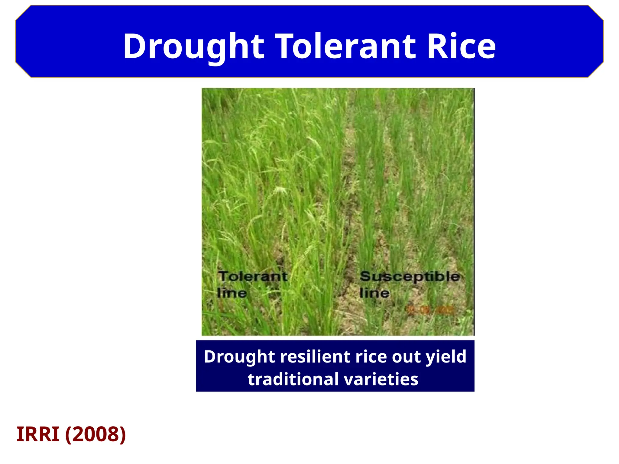
Characteristics of cropsand cultivars
1. Short duration and early vigour,
2. Deep root system with ramified roots,
3. Dwarf plants with erect leaves and stem,
4. Moderate tillering in case of tillering crops and varieties,
5. Resistance/tolerance to biotic stresses,
6. Lesser period between flowering and maturity so that the
grain filling is least affected by adverse weather,
7. Resistance/tolerance to abiotic stresses,
8. Low rate of transpiration,
9. Less sensitive to photoperiod, and
10. Wider adaptability.
35.
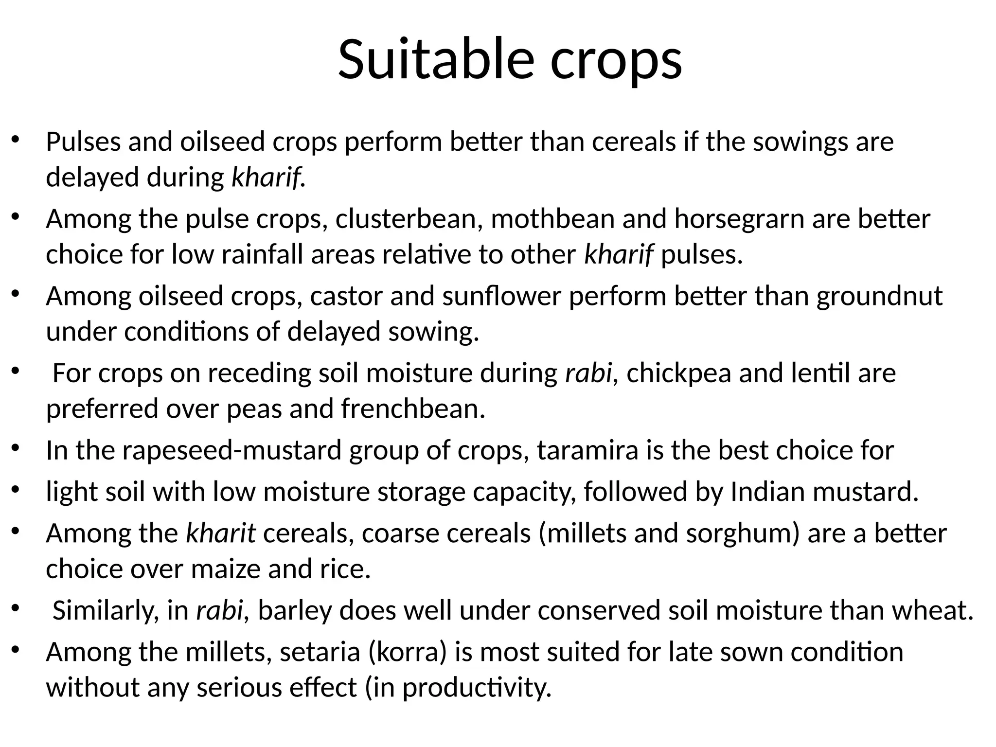
Suitable crops
• Pulsesand oilseed crops perform better than cereals if the sowings are
delayed during kharif.
• Among the pulse crops, clusterbean, mothbean and horsegrarn are better
choice for low rainfall areas relative to other kharif pulses.
• Among oilseed crops, castor and sunflower perform better than groundnut
under conditions of delayed sowing.
• For crops on receding soil moisture during rabi, chickpea and lentil are
preferred over peas and frenchbean.
• In the rapeseed-mustard group of crops, taramira is the best choice for
• light soil with low moisture storage capacity, followed by Indian mustard.
• Among the kharit cereals, coarse cereals (millets and sorghum) are a better
choice over maize and rice.
• Similarly, in rabi, barley does well under conserved soil moisture than wheat.
• Among the millets, setaria (korra) is most suited for late sown condition
without any serious effect (in productivity.
36.
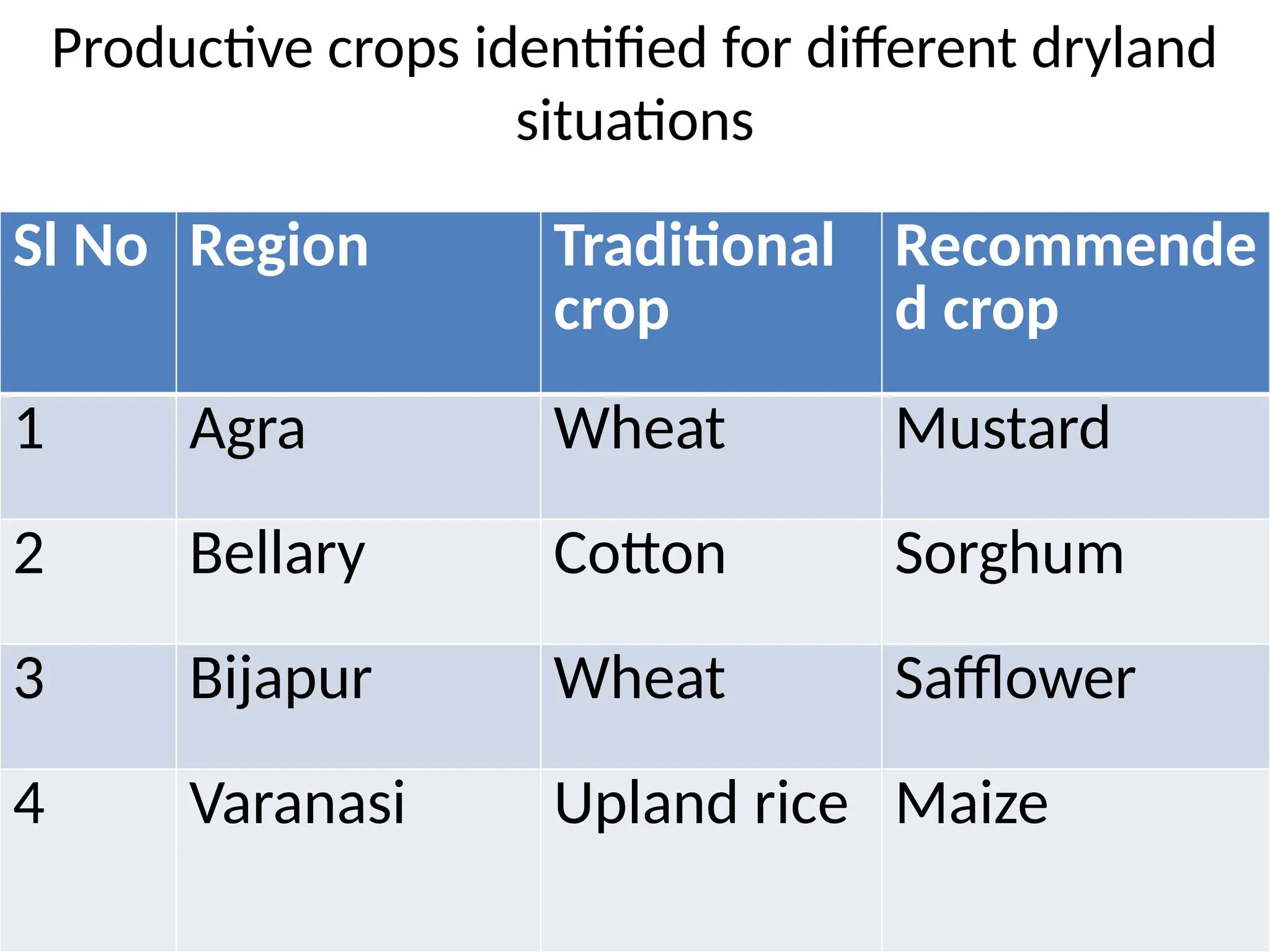
Productive crops identifiedfor different dryland
situations
Sl No Region Traditional
crop
Recommende
d crop
1 Agra Wheat Mustard
2 Bellary Cotton Sorghum
3 Bijapur Wheat Safflower
4 Varanasi Upland rice Maize
37.
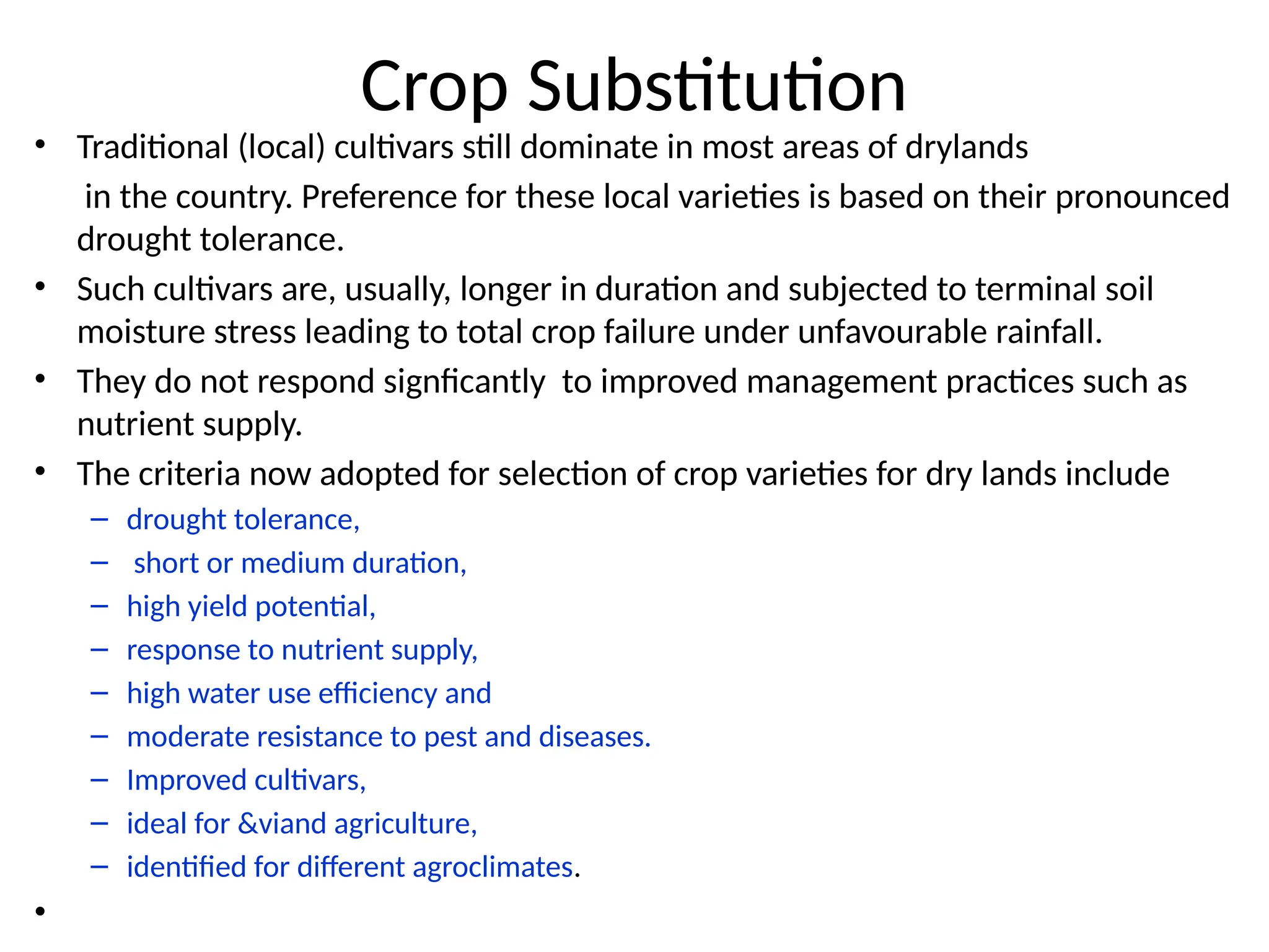
Crop Substitution
• Traditional(local) cultivars still dominate in most areas of drylands
in the country. Preference for these local varieties is based on their pronounced
drought tolerance.
• Such cultivars are, usually, longer in duration and subjected to terminal soil
moisture stress leading to total crop failure under unfavourable rainfall.
• They do not respond signficantly to improved management practices such as
nutrient supply.
• The criteria now adopted for selection of crop varieties for dry lands include
– drought tolerance,
– short or medium duration,
– high yield potential,
– response to nutrient supply,
– high water use efficiency and
– moderate resistance to pest and diseases.
– Improved cultivars,
– ideal for &viand agriculture,
– identified for different agroclimates.
•
38.
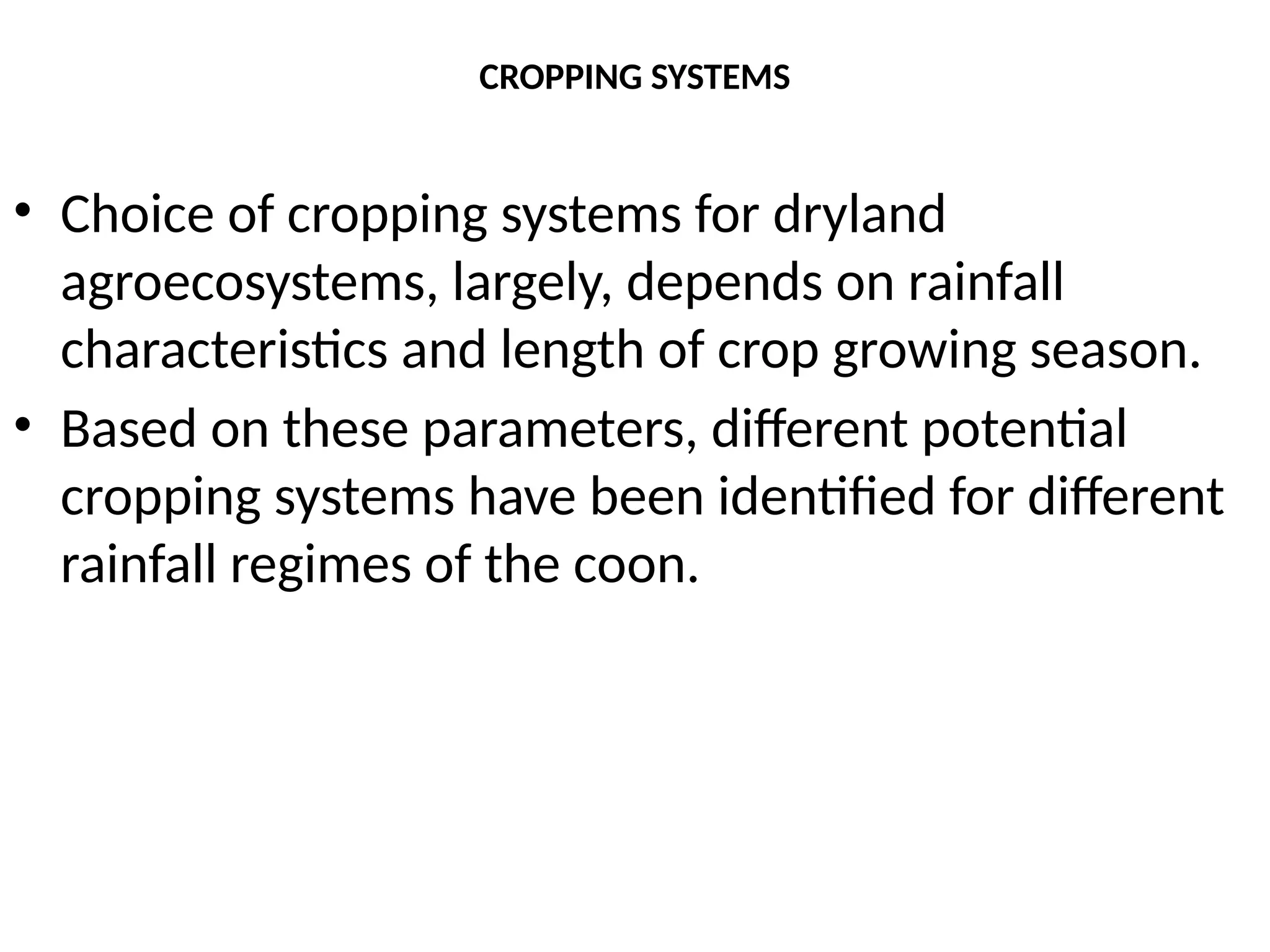
CROPPING SYSTEMS
• Choiceof cropping systems for dryland
agroecosystems, largely, depends on rainfall
characteristics and length of crop growing season.
• Based on these parameters, different potential
cropping systems have been identified for different
rainfall regimes of the coon.
39.
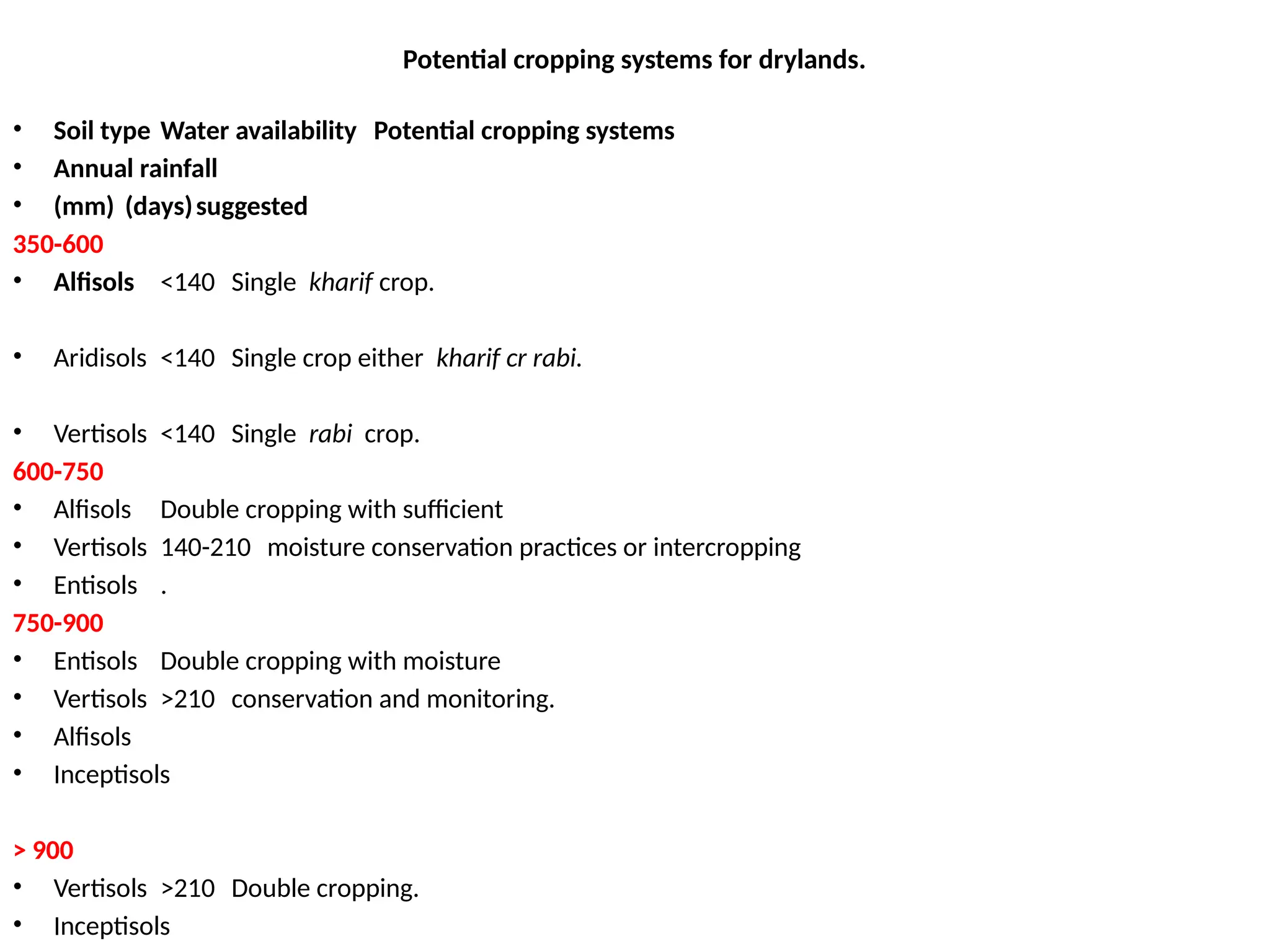
Potential cropping systemsfor drylands.
• Soil type Water availability Potential cropping systems
• Annual rainfall
• (mm) (days)suggested
350-600
• Alfisols <140 Single kharif crop.
• Aridisols <140 Single crop either kharif cr rabi.
• Vertisols <140 Single rabi crop.
600-750
• Alfisols Double cropping with sufficient
• Vertisols 140-210 moisture conservation practices or intercropping
• Entisols .
750-900
• Entisols Double cropping with moisture
• Vertisols >210 conservation and monitoring.
• Alfisols
• Inceptisols
> 900
• Vertisols >210 Double cropping.
• Inceptisols
40.
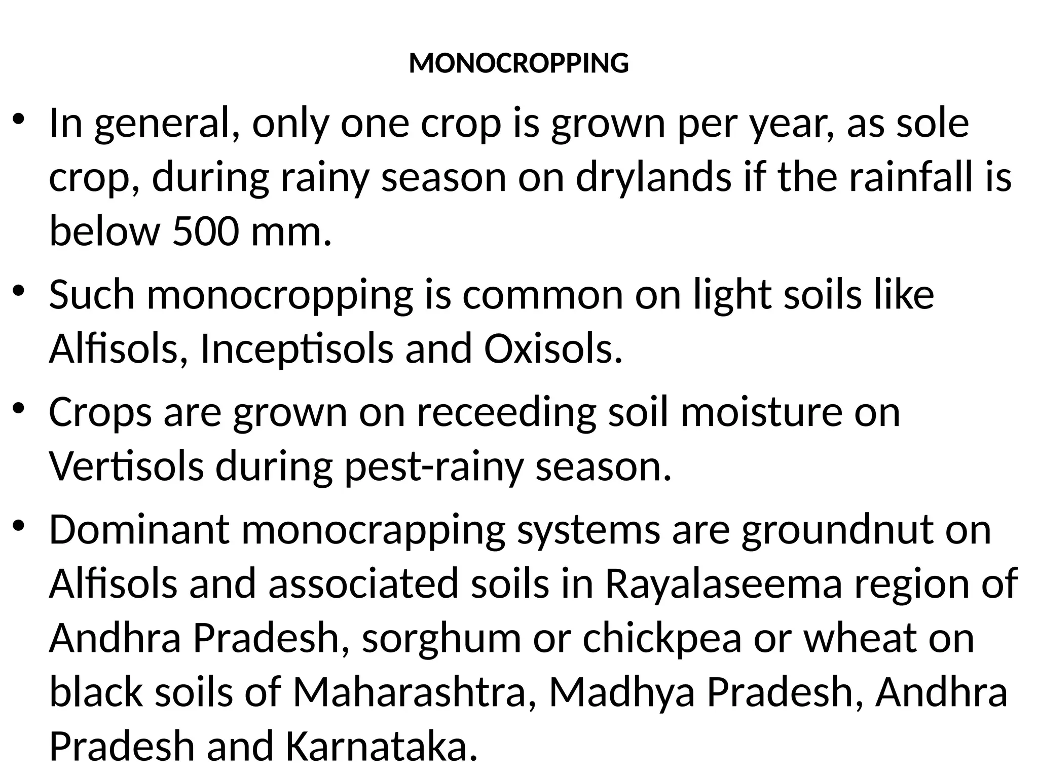
MONOCROPPING
• In general,only one crop is grown per year, as sole
crop, during rainy season on drylands if the rainfall is
below 500 mm.
• Such monocropping is common on light soils like
Alfisols, Inceptisols and Oxisols.
• Crops are grown on receeding soil moisture on
Vertisols during pest-rainy season.
• Dominant monocrapping systems are groundnut on
Alfisols and associated soils in Rayalaseema region of
Andhra Pradesh, sorghum or chickpea or wheat on
black soils of Maharashtra, Madhya Pradesh, Andhra
Pradesh and Karnataka.
41.
INTERCROPPING
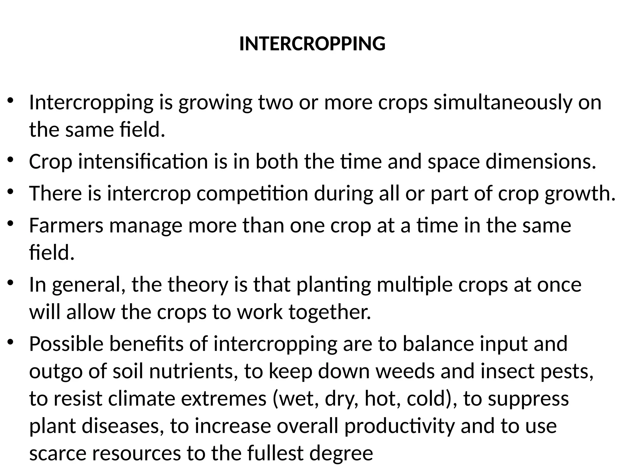
• Intercropping isgrowing two or more crops simultaneously on
the same field.
• Crop intensification is in both the time and space dimensions.
• There is intercrop competition during all or part of crop growth.
• Farmers manage more than one crop at a time in the same
field.
• In general, the theory is that planting multiple crops at once
will allow the crops to work together.
• Possible benefits of intercropping are to balance input and
outgo of soil nutrients, to keep down weeds and insect pests,
to resist climate extremes (wet, dry, hot, cold), to suppress
plant diseases, to increase overall productivity and to use
scarce resources to the fullest degree
42.
Advantages of Intercropping
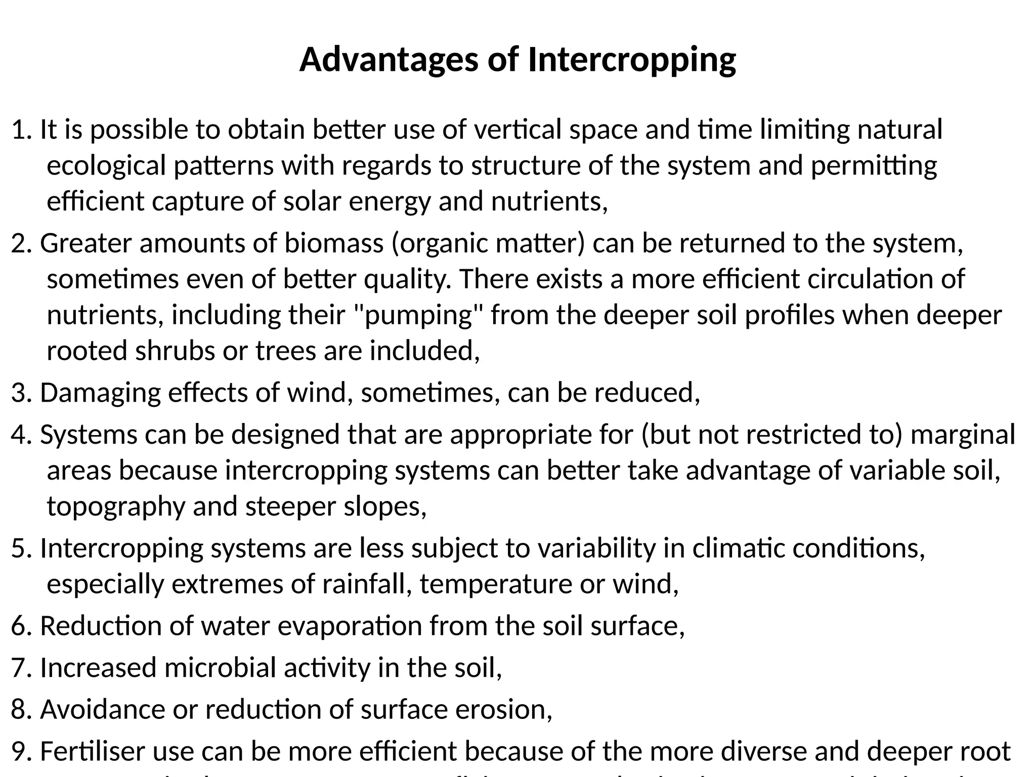
1.It is possible to obtain better use of vertical space and time limiting natural
ecological patterns with regards to structure of the system and permitting
efficient capture of solar energy and nutrients,
2. Greater amounts of biomass (organic matter) can be returned to the system,
sometimes even of better quality. There exists a more efficient circulation of
nutrients, including their "pumping" from the deeper soil profiles when deeper
rooted shrubs or trees are included,
3. Damaging effects of wind, sometimes, can be reduced,
4. Systems can be designed that are appropriate for (but not restricted to) marginal
areas because intercropping systems can better take advantage of variable soil,
topography and steeper slopes,
5. Intercropping systems are less subject to variability in climatic conditions,
especially extremes of rainfall, temperature or wind,
6. Reduction of water evaporation from the soil surface,
7. Increased microbial activity in the soil,
8. Avoidance or reduction of surface erosion,
9. Fertiliser use can be more efficient because of the more diverse and deeper root
43.
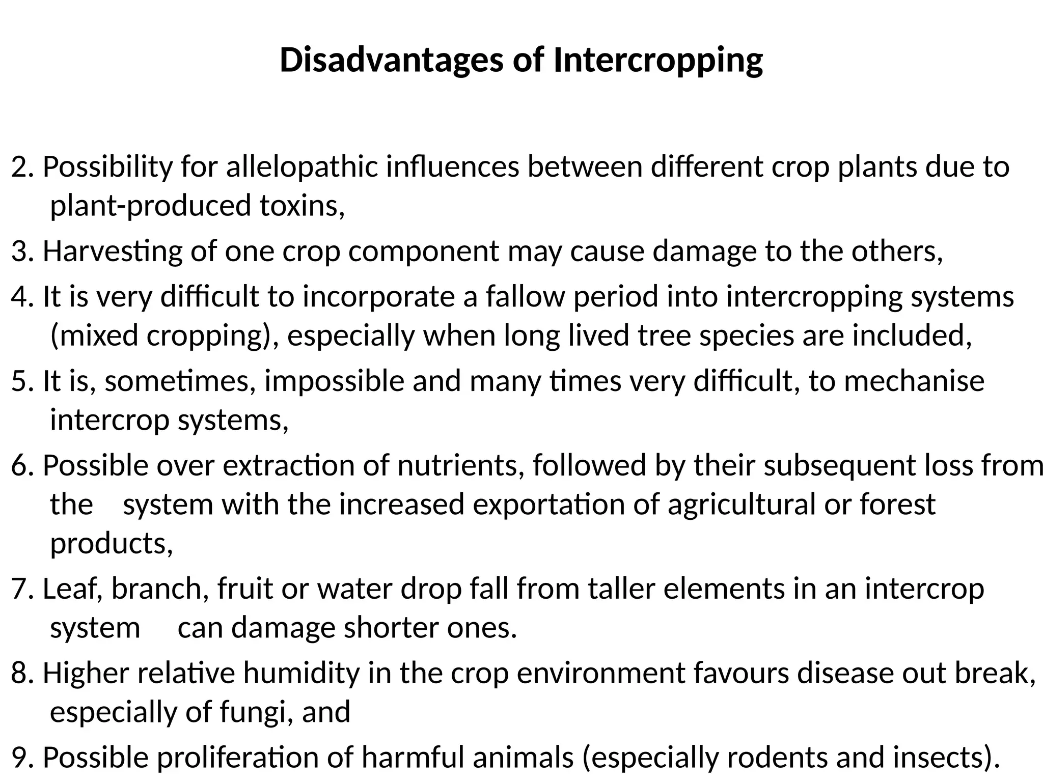
Disadvantages of Intercropping
2.Possibility for allelopathic influences between different crop plants due to
plant-produced toxins,
3. Harvesting of one crop component may cause damage to the others,
4. It is very difficult to incorporate a fallow period into intercropping systems
(mixed cropping), especially when long lived tree species are included,
5. It is, sometimes, impossible and many times very difficult, to mechanise
intercrop systems,
6. Possible over extraction of nutrients, followed by their subsequent loss from
the system with the increased exportation of agricultural or forest
products,
7. Leaf, branch, fruit or water drop fall from taller elements in an intercrop
system can damage shorter ones.
8. Higher relative humidity in the crop environment favours disease out break,
especially of fungi, and
9. Possible proliferation of harmful animals (especially rodents and insects).
44.
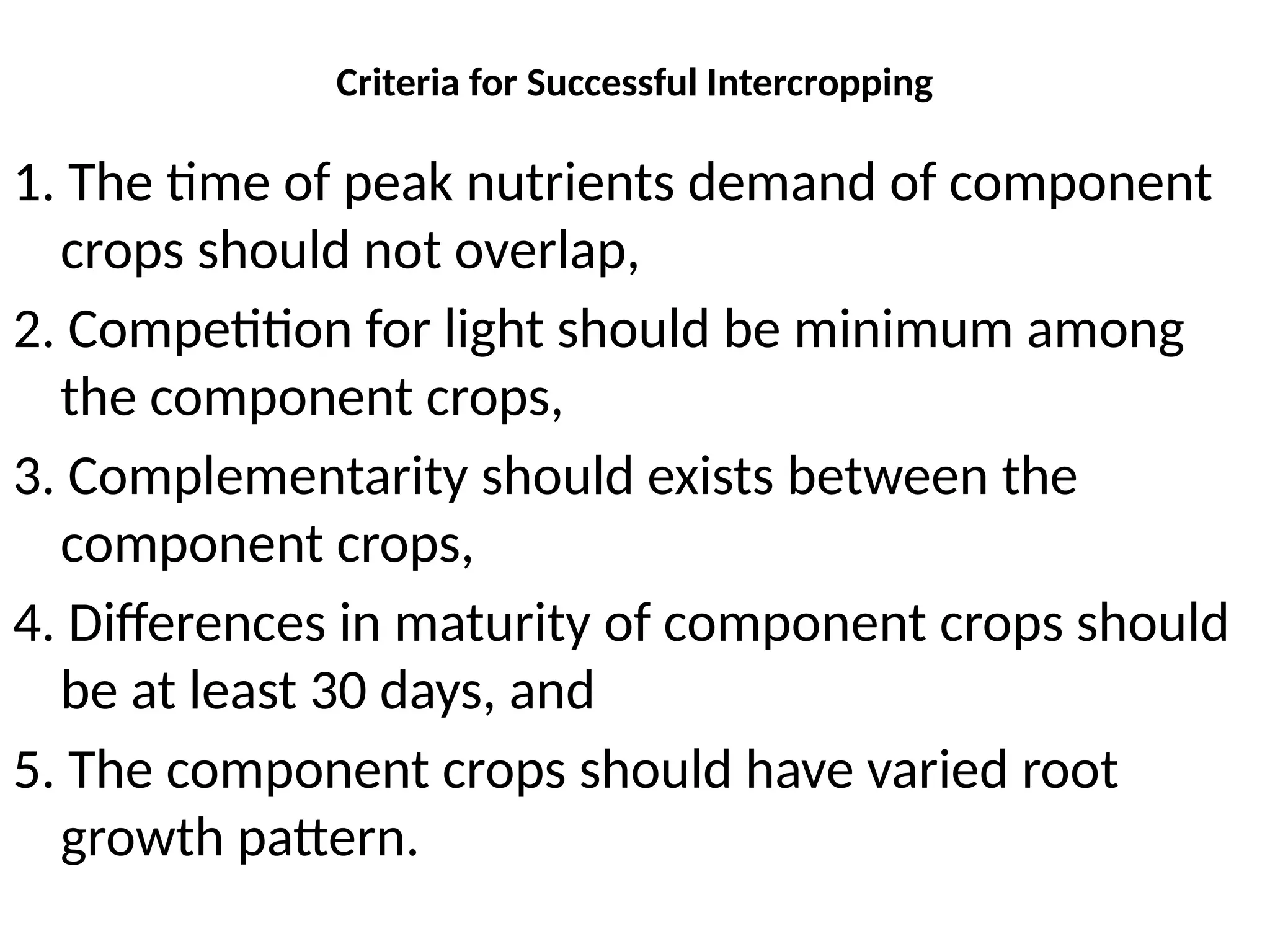
Criteria for SuccessfulIntercropping
1. The time of peak nutrients demand of component
crops should not overlap,
2. Competition for light should be minimum among
the component crops,
3. Complementarity should exists between the
component crops,
4. Differences in maturity of component crops should
be at least 30 days, and
5. The component crops should have varied root
growth pattern.
45.
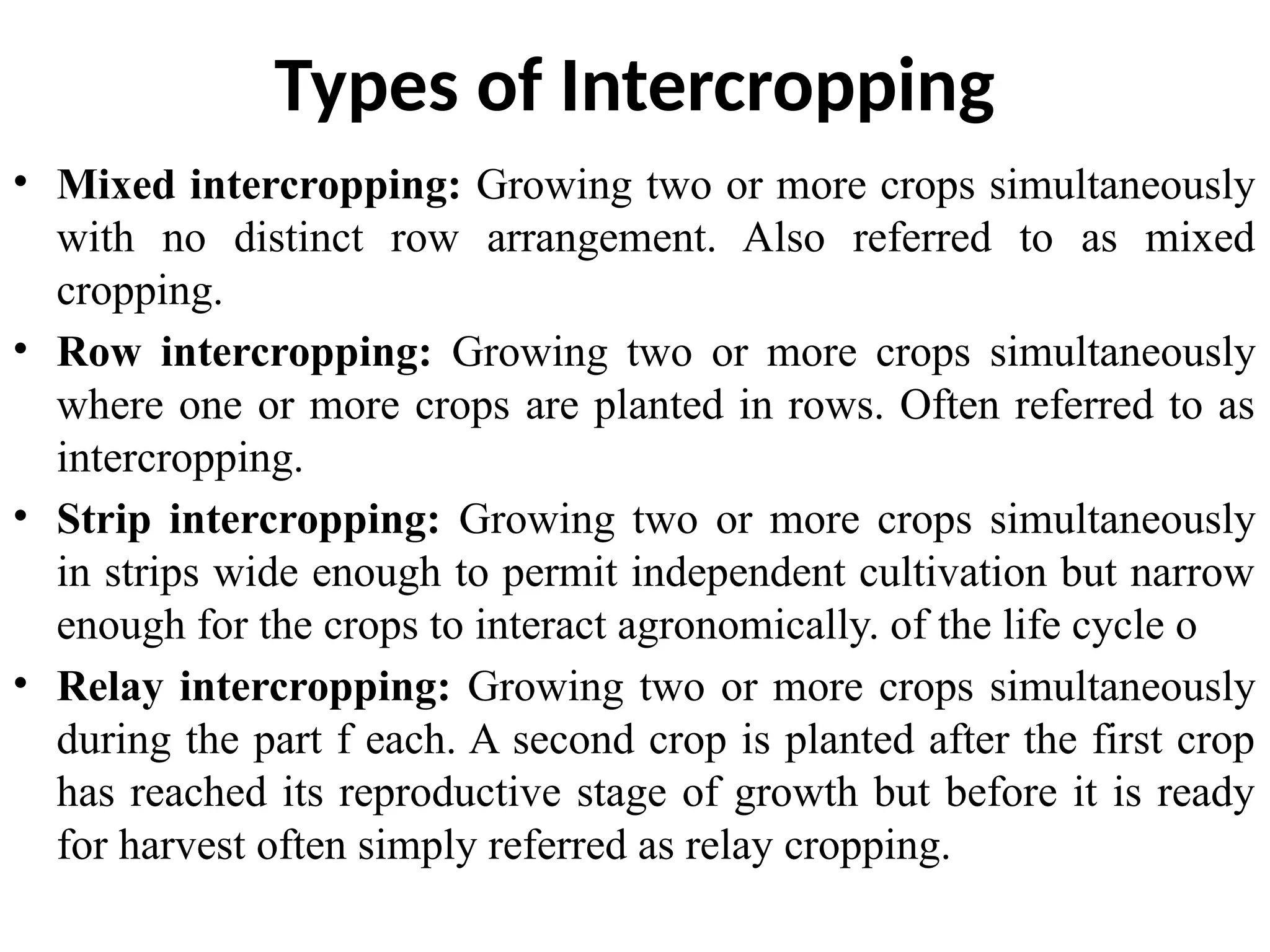
Types of Intercropping
•Mixed intercropping: Growing two or more crops simultaneously
with no distinct row arrangement. Also referred to as mixed
cropping.
• Row intercropping: Growing two or more crops simultaneously
where one or more crops are planted in rows. Often referred to as
intercropping.
• Strip intercropping: Growing two or more crops simultaneously
in strips wide enough to permit independent cultivation but narrow
enough for the crops to interact agronomically. of the life cycle o
• Relay intercropping: Growing two or more crops simultaneously
during the part f each. A second crop is planted after the first crop
has reached its reproductive stage of growth but before it is ready
for harvest often simply referred as relay cropping.
46.
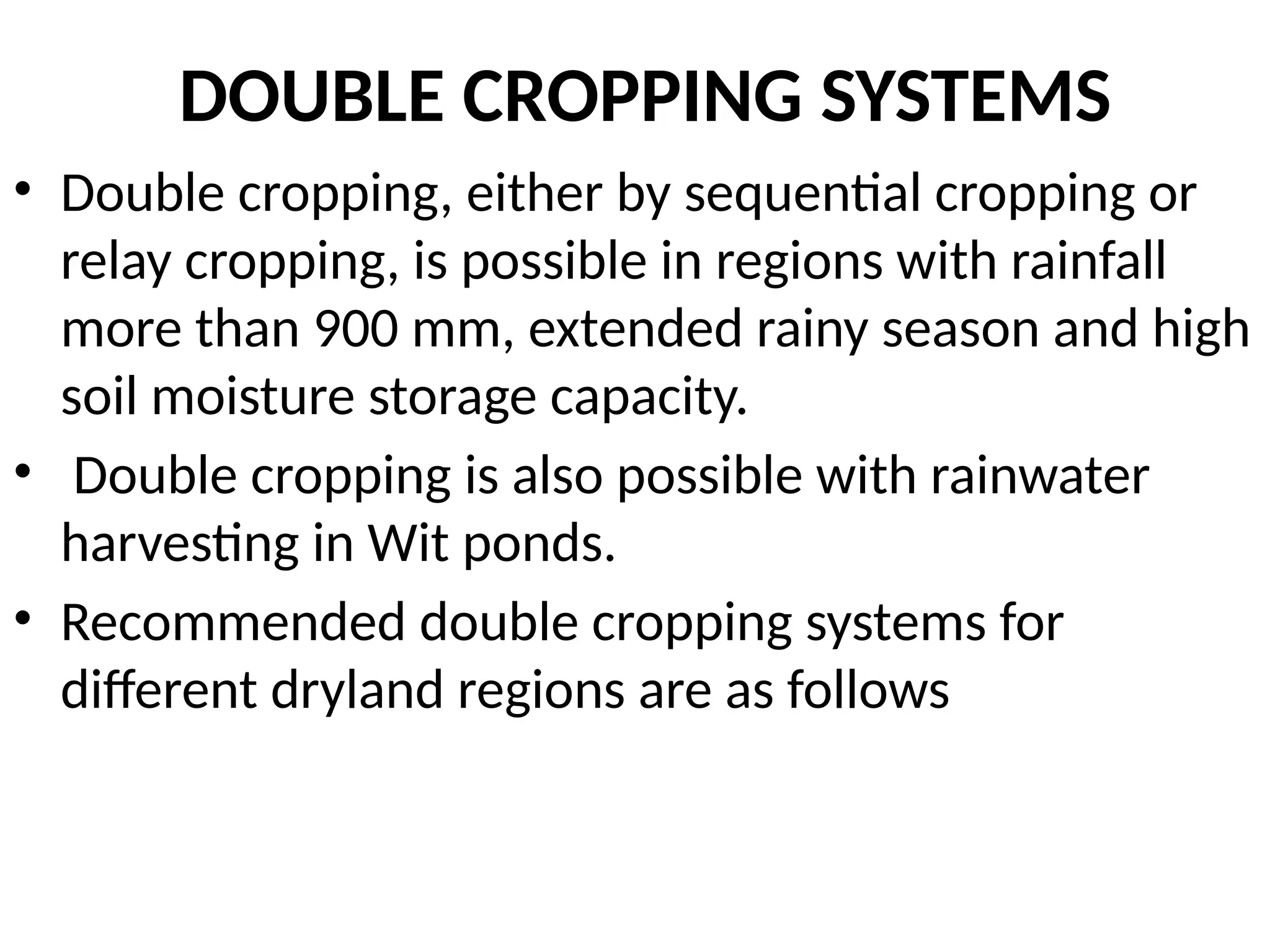
DOUBLE CROPPING SYSTEMS
•Double cropping, either by sequential cropping or
relay cropping, is possible in regions with rainfall
more than 900 mm, extended rainy season and high
soil moisture storage capacity.
• Double cropping is also possible with rainwater
harvesting in Wit ponds.
• Recommended double cropping systems for
different dryland regions are as follows
48.
ALTERNATE CROPPING ANDLAND USE STRATEGY
• All drylands are not suitable for crop production. Some
lands may be suitable for range/pasture management,
while others for tree farming and agroforestry systems.
• All these systems that are alternatives to crop production
are called as alternate land use systems.
• This system helps in generating much needed off-season
employment.
• In monocropped drylands, it also minimises risk, utilises
off-season rains which may otherwise go waste as runoff,
prevents degradation of soils and restores balance in
ecosystem.
49.
ALTERNATE CROPPING ANDLAND USE STRATEGY
• Crop production may be disastrous in the years of drought,
where as drought resistant grasses and trees could be
remunerative, Many alternate land use systems aapopriate
for different agroecological situations have been developed.
• These are alley cropping, agri-horticultural system, silvi-
pastoral systems etc that utilise the resources in better way
for increased and stabilised production from drylands.
• Choice of land use systems viz. monocropping, double
cropping, mixed cropping, mixed farming, agri-horticulture
and silvi-pastoral and their success under drylands largely
depend up on the rainfall, soil type and temperature.
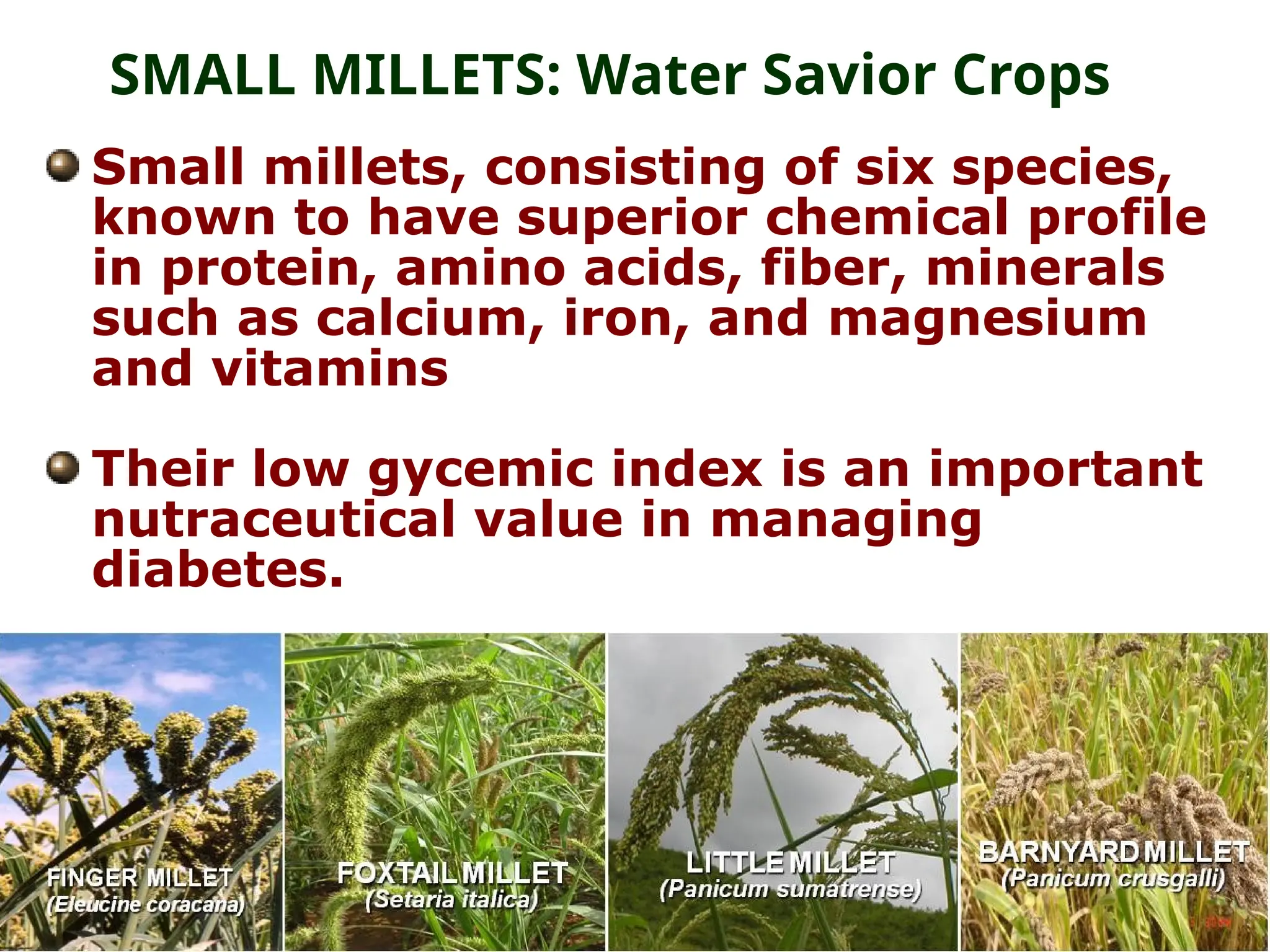
Small millets, consistingof six species,
known to have superior chemical profile
in protein, amino acids, fiber, minerals
such as calcium, iron, and magnesium
and vitamins
Their low gycemic index is an important
nutraceutical value in managing
diabetes.
SMALL MILLETS: Water Savior Crops
57.
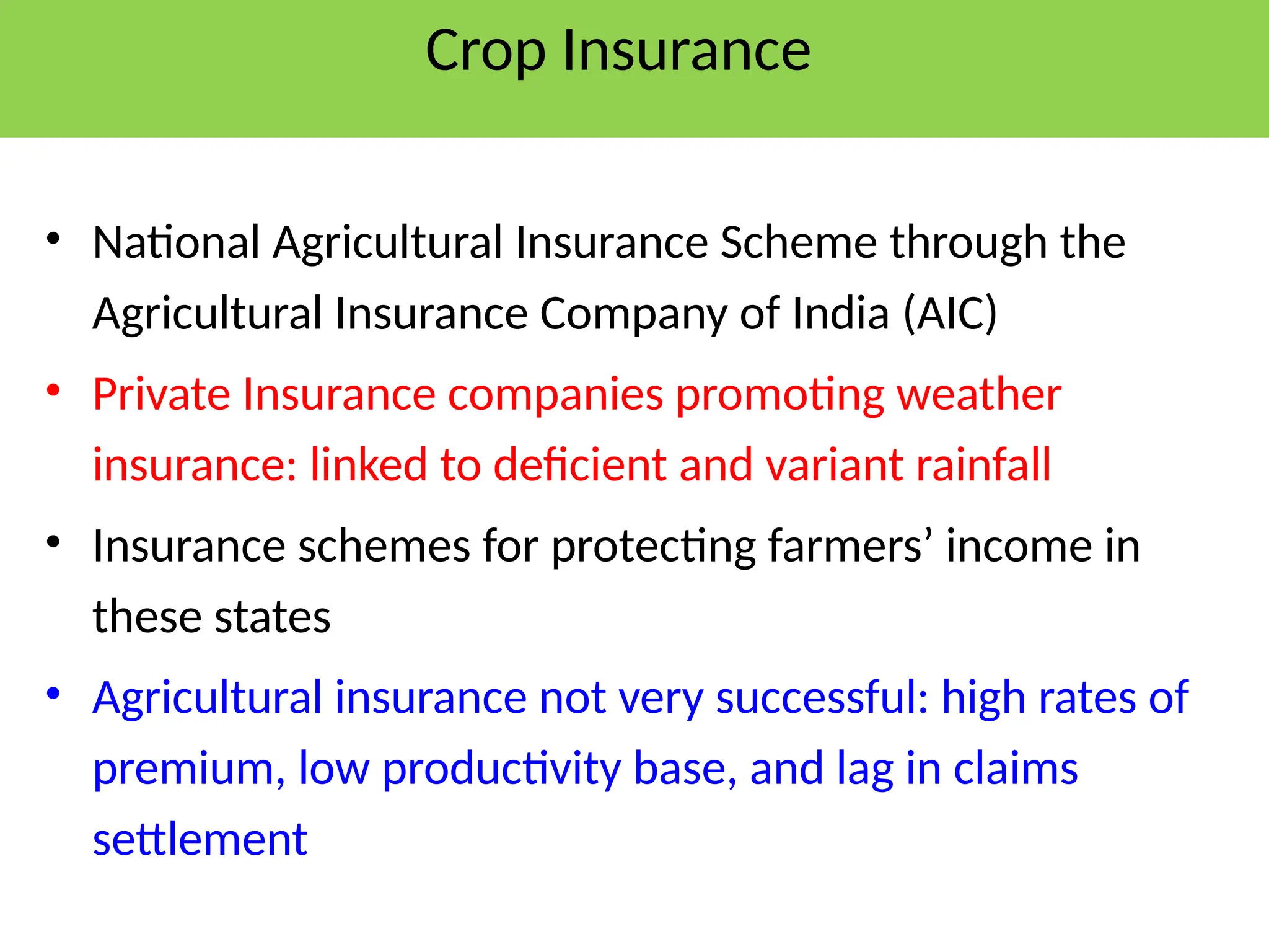
Crop Insurance
• NationalAgricultural Insurance Scheme through the
Agricultural Insurance Company of India (AIC)
• Private Insurance companies promoting weather
insurance: linked to deficient and variant rainfall
• Insurance schemes for protecting farmers’ income in
these states
• Agricultural insurance not very successful: high rates of
premium, low productivity base, and lag in claims
settlement
58.
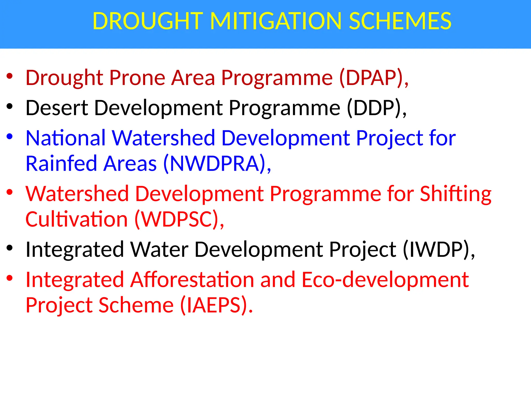
DROUGHT MITIGATION SCHEMES
•Drought Prone Area Programme (DPAP),
• Desert Development Programme (DDP),
• National Watershed Development Project for
Rainfed Areas (NWDPRA),
• Watershed Development Programme for Shifting
Cultivation (WDPSC),
• Integrated Water Development Project (IWDP),
• Integrated Afforestation and Eco-development
Project Scheme (IAEPS).
59.
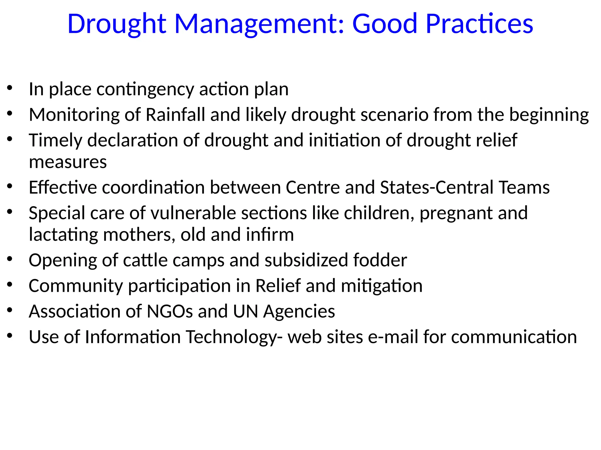
Drought Management: GoodPractices
• In place contingency action plan
• Monitoring of Rainfall and likely drought scenario from the beginning
• Timely declaration of drought and initiation of drought relief
measures
• Effective coordination between Centre and States-Central Teams
• Special care of vulnerable sections like children, pregnant and
lactating mothers, old and infirm
• Opening of cattle camps and subsidized fodder
• Community participation in Relief and mitigation
• Association of NGOs and UN Agencies
• Use of Information Technology- web sites e-mail for communication
#23 Early warning of drought is felt need for mitigating the impact
It helps in generating response and activating programmes
The National Crop Weather Watch Group (CWWG) acts as Early Warning System
CWWG in Central Ministry of Agriculture meets every Monday to take stock of emerging weather scenario, water stock, crop situation, inputs availability, pest & diseases etc.
In emerging crisis situation, responses are generated in the administrative hierarchy
Programmes modules are activated
Monitoring intensified