1. My training was thorough and
extensive. Agriculture Canada
provides broad initial training.
On-site tutelage was provided by
my Supervisor, additional Soil
Scientists and Ag. Canada’s GIS
Analyst. I was also sent to
Abbotsford for a three day
course on Soil Classification run
by PRSSS and the University of
the Fraser Valley.
“Digital Soil Maps”
-Soil Information on a Raster Grid
“Science on the Coastal
Margin”
-Hakai Institute
I had the opportunity to
go to Calvert Island to
take part in a similar
digital soil mapping
project of the Kwakshua Channel.
Agriculture Canada flew me by
float plane to Calvert Island. I was
hosted by the Hakai Institute for
two weeks, alongside an additional
summer student and
two soil scientists. Working by boat
and helicopter, the project was an
exciting new experience.
“I get paid to do
this!?”
-Amelia Galuska NRS Co-op
Summer Student
My experience this
summer with Agriculture
Canada was extremely positive.
The research centre in
Summerland BC, is not only very
scenic, but occupied by
professionals who are
knowledgeable, patient and
accommodating. Everyone goes
out of their way to create a
dynamic workplace for the
summer students. I would
definitely recommend Ag. Canada
for future Co-op students.
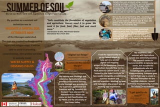
Sample sites were produced using a random
sampling technique. Limitations were set based on
proximity to roads within the Okanagan basin.
Consequently, sites were often in marginally
accessible forestry locations. Utilizing forestry roads,
we were able to reach the majority of sites.
Once a site was pinpointed by GPS, I would dig a soil
pit, determine the soil classification based on BEC
zone, parent material , bedrock type & slope, take
photos of the soil profile and surrounding
landscape, and record the data.
At the office my duties included: gathering &
applying spatial data from multiple sources,
determining the most efficient route to access
sites, creating field maps in ArcGIS used to guide
us to the sites, organizing GPS data in Pathfinder,
sorting & recording soil samples in the lab and in
Excel.
"Soils constitute the foundation of vegetation
and agriculture. Forests need it to grow. We
need it for food, feed, fiber, fuel and much
more.“
-José Graziano da Silva, FAO Director-General
International Year of Soils 2015
My position as a assistant soil
technician was to
of the Okanagan watershed.
The map was created by disaggregating
legacy soil polygon maps. It will be
able to assist in providing
comprehensive, 25m gridded soil data
to spatially model
within the Okanagan basin.
Amelia Galuska: Fourth Year NRS Co-op Student.
Calvert Island, BC