SlideShare a Scribd company logo
Досвід використанням ГІС-
технологій при розробці
функціонального зонування
РЛП “Пристинські плавні”
Бодня О. В.
Кафедра фізичної географії
та картографії
Актуальність роботи
РЛП
“Пристинські
плавні”
 Територія Пристинських плавнів
є ключовим елементом
Оскільського природного
коридору, що входить в
Пан’Європейську екологічну
мережу.
 Пристинські плавні мають
міжнародне значення як місце
гніздування мігруючих птахів.
Потенційні території
Проектування РЛП “Пристинські плавні”
Зонування території РЛП
Порівняння результатів проектування
Проектування потенційних території для
розширення РЛП “Пристинські плавні”
 Проектування
об’єктів природно-
заповідного фонду за
інженерним підходом
передбачає
кадастрово-
топографічні зйомки
території.
Проектування потенційних території для
розширення РЛП “Пристинські плавні”
Крім того, здійснюється
визначення територій з
кутами нахилу схилів
(більше 3 градусів) на
основі ЦМР
Визначені території:
 ліси І і ІІ категорії та
полезахисні лісосмуги
 лісовкриті балки,
 луки та сіножаті,
 заболочені землі.
Дані території на момент
дослідження зазнають
найменшого
антропогенного впливу.
Дякую за увагу!

More Related Content

Viewers also liked

ArcGIS for Mobile
ArcGIS for MobileArcGIS for Mobile
ArcGIS for Mobile
gisproject
 

Viewers also liked (20)

Prilutsky О. Storage and management of natural information with database
Prilutsky О. Storage and management of natural information with databasePrilutsky О. Storage and management of natural information with database
Prilutsky О. Storage and management of natural information with database
 
Download Savchenko A. DEM of the national park "Gomilshansky lessy"
  Download	Savchenko A. DEM of the national park "Gomilshansky lessy"  Download	Savchenko A. DEM of the national park "Gomilshansky lessy"
Download Savchenko A. DEM of the national park "Gomilshansky lessy"
 
Kleshnin A. PostGIS-open solution for spatial data-database
Kleshnin A. PostGIS-open solution for spatial data-databaseKleshnin A. PostGIS-open solution for spatial data-database
Kleshnin A. PostGIS-open solution for spatial data-database
 
Bodnja-gis-mapping-of-the-landscape-of-the-national-park-dvurechansky
Bodnja-gis-mapping-of-the-landscape-of-the-national-park-dvurechanskyBodnja-gis-mapping-of-the-landscape-of-the-national-park-dvurechansky
Bodnja-gis-mapping-of-the-landscape-of-the-national-park-dvurechansky
 
YarotskiyYarotskiy V. - Field-Map for the study of natural objects
YarotskiyYarotskiy V. - Field-Map for the study of natural objects YarotskiyYarotskiy V. - Field-Map for the study of natural objects
YarotskiyYarotskiy V. - Field-Map for the study of natural objects
 
QGIS Plugins
QGIS PluginsQGIS Plugins
QGIS Plugins
 
OSM for Conservation
OSM for ConservationOSM for Conservation
OSM for Conservation
 
Ukraiski P. Decoding the burned areas and monitoringтравяные палы
Ukraiski P. Decoding the burned areas and monitoringтравяные палыUkraiski P. Decoding the burned areas and monitoringтравяные палы
Ukraiski P. Decoding the burned areas and monitoringтравяные палы
 
Ukraiski P. WEB-GIS nature reserve "Belogorie"
Ukraiski P. WEB-GIS nature reserve "Belogorie"Ukraiski P. WEB-GIS nature reserve "Belogorie"
Ukraiski P. WEB-GIS nature reserve "Belogorie"
 
ArcGIS for Mobile
ArcGIS for MobileArcGIS for Mobile
ArcGIS for Mobile
 
Kozyr m. use big data in the exploration zoning protected areas, gomylshans...
Kozyr m.   use big data in the exploration zoning protected areas, gomylshans...Kozyr m.   use big data in the exploration zoning protected areas, gomylshans...
Kozyr m. use big data in the exploration zoning protected areas, gomylshans...
 
Pylypiuk a. Experience cavern mapping in podilski tovtry national park and ...
Pylypiuk a.   Experience cavern mapping in podilski tovtry national park and ...Pylypiuk a.   Experience cavern mapping in podilski tovtry national park and ...
Pylypiuk a. Experience cavern mapping in podilski tovtry national park and ...
 
Brusentsova n. gis-analysis spatial distribution poinly objects in the ecol...
Brusentsova n.   gis-analysis spatial distribution poinly objects in the ecol...Brusentsova n.   gis-analysis spatial distribution poinly objects in the ecol...
Brusentsova n. gis-analysis spatial distribution poinly objects in the ecol...
 
Baryshnikov o. georeference maps of protected areas in arc gis and digitizi...
Baryshnikov o.   georeference maps of protected areas in arc gis and digitizi...Baryshnikov o.   georeference maps of protected areas in arc gis and digitizi...
Baryshnikov o. georeference maps of protected areas in arc gis and digitizi...
 
Khlyestkova a., bodnia o. exploration of not sanction recreation on the nat...
Khlyestkova a., bodnia o.   exploration of not sanction recreation on the nat...Khlyestkova a., bodnia o.   exploration of not sanction recreation on the nat...
Khlyestkova a., bodnia o. exploration of not sanction recreation on the nat...
 
Sizo r. Not a single landsat. to meet the sentinel
Sizo r.   Not a single landsat. to meet the sentinelSizo r.   Not a single landsat. to meet the sentinel
Sizo r. Not a single landsat. to meet the sentinel
 
Bezrodnova o.v. turboveg possibilities for data storage and processing of e...
Bezrodnova o.v.   turboveg possibilities for data storage and processing of e...Bezrodnova o.v.   turboveg possibilities for data storage and processing of e...
Bezrodnova o.v. turboveg possibilities for data storage and processing of e...
 
Sizo r. Society for conservation gis
Sizo r.   Society for conservation gisSizo r.   Society for conservation gis
Sizo r. Society for conservation gis
 
Korotyeyeva a. the study of water quality of wetlands in slobozhansky natio...
Korotyeyeva a.   the study of water quality of wetlands in slobozhansky natio...Korotyeyeva a.   the study of water quality of wetlands in slobozhansky natio...
Korotyeyeva a. the study of water quality of wetlands in slobozhansky natio...
 
Ovcharenko a., bodnia o. identification of landscapes by overlay gis analysis
Ovcharenko a., bodnia o.   identification of landscapes by overlay gis analysisOvcharenko a., bodnia o.   identification of landscapes by overlay gis analysis
Ovcharenko a., bodnia o. identification of landscapes by overlay gis analysis
 

More from Anton Biatov

More from Anton Biatov (20)

Anton Biatov - How to effectively collect data for biologists
Anton Biatov - How to effectively collect data for biologistsAnton Biatov - How to effectively collect data for biologists
Anton Biatov - How to effectively collect data for biologists
 
Anton Biatov - GIS for fieldworker Biologists.
Anton Biatov - GIS for fieldworker Biologists. Anton Biatov - GIS for fieldworker Biologists.
Anton Biatov - GIS for fieldworker Biologists.
 
University ITMO - the first non-classical university of Russia in the field o...
University ITMO - the first non-classical university of Russia in the field o...University ITMO - the first non-classical university of Russia in the field o...
University ITMO - the first non-classical university of Russia in the field o...
 
Anton Biatov - Report about ArcGIS using by ESRI conservation program in GIS...
Anton Biatov - Report about ArcGIS using  by ESRI conservation program in GIS...Anton Biatov - Report about ArcGIS using  by ESRI conservation program in GIS...
Anton Biatov - Report about ArcGIS using by ESRI conservation program in GIS...
 
Anton Biatov - Geocoding museum collection as basic tool for studying animal ...
Anton Biatov - Geocoding museum collection as basic tool for studying animal ...Anton Biatov - Geocoding museum collection as basic tool for studying animal ...
Anton Biatov - Geocoding museum collection as basic tool for studying animal ...
 
Yuriy Strus An attempt to study the biotope distribution of black stork by ...
Yuriy Strus   An attempt to study the biotope distribution of black stork by ...Yuriy Strus   An attempt to study the biotope distribution of black stork by ...
Yuriy Strus An attempt to study the biotope distribution of black stork by ...
 
Yuriy Protsenko Annual experience of using the GIS of the Pyriatynsky natio...
Yuriy Protsenko   Annual experience of using the GIS of the Pyriatynsky natio...Yuriy Protsenko   Annual experience of using the GIS of the Pyriatynsky natio...
Yuriy Protsenko Annual experience of using the GIS of the Pyriatynsky natio...
 
Yevhen Skubak Use of GIS to map northern predators of mammals into the Svya...
Yevhen Skubak   Use of GIS to map northern predators of mammals into the Svya...Yevhen Skubak   Use of GIS to map northern predators of mammals into the Svya...
Yevhen Skubak Use of GIS to map northern predators of mammals into the Svya...
 
Volodymyr Pasternak Application of GIS-technologies for research of forest ...
Volodymyr Pasternak   Application of GIS-technologies for research of forest ...Volodymyr Pasternak   Application of GIS-technologies for research of forest ...
Volodymyr Pasternak Application of GIS-technologies for research of forest ...
 
Vladimir Kletenkin Practical use of GIS in the Dvurechansky national park i...
Vladimir Kletenkin   Practical use of GIS in the Dvurechansky national park i...Vladimir Kletenkin   Practical use of GIS in the Dvurechansky national park i...
Vladimir Kletenkin Practical use of GIS in the Dvurechansky national park i...
 
Vasyl Korets The experience of using the geographic information system qgis...
Vasyl Korets   The experience of using the geographic information system qgis...Vasyl Korets   The experience of using the geographic information system qgis...
Vasyl Korets The experience of using the geographic information system qgis...
 
Svetlana Vinokurova Visualization of time, web map of the dynamics of the r...
Svetlana Vinokurova   Visualization of time, web map of the dynamics of the r...Svetlana Vinokurova   Visualization of time, web map of the dynamics of the r...
Svetlana Vinokurova Visualization of time, web map of the dynamics of the r...
 
Svetlana Vinokurova Assessment of the condition of reed associations in the...
Svetlana Vinokurova   Assessment of the condition of reed associations in the...Svetlana Vinokurova   Assessment of the condition of reed associations in the...
Svetlana Vinokurova Assessment of the condition of reed associations in the...
 
Sergei Gorodilov Geocoding. What, why and how
Sergei Gorodilov   Geocoding. What, why and howSergei Gorodilov   Geocoding. What, why and how
Sergei Gorodilov Geocoding. What, why and how
 
Roman Sizo Society for conservation gis - ua
Roman Sizo   Society for conservation gis - uaRoman Sizo   Society for conservation gis - ua
Roman Sizo Society for conservation gis - ua
 
Roman Sizo open software and data - history, license types, beer
Roman Sizo   open software and data - history, license types, beerRoman Sizo   open software and data - history, license types, beer
Roman Sizo open software and data - history, license types, beer
 
Oleg Prilutsky Experience in organizing distributed data collection for mus...
Oleg Prilutsky   Experience in organizing distributed data collection for mus...Oleg Prilutsky   Experience in organizing distributed data collection for mus...
Oleg Prilutsky Experience in organizing distributed data collection for mus...
 
Natalia Kasyanova Development of gis-project of Dvorichansky national park ...
Natalia Kasyanova   Development of gis-project of Dvorichansky national park ...Natalia Kasyanova   Development of gis-project of Dvorichansky national park ...
Natalia Kasyanova Development of gis-project of Dvorichansky national park ...
 
Natalia Brusentsova Cerviformes seu artiodactyla monitoring organization in...
Natalia Brusentsova   Cerviformes seu artiodactyla monitoring organization in...Natalia Brusentsova   Cerviformes seu artiodactyla monitoring organization in...
Natalia Brusentsova Cerviformes seu artiodactyla monitoring organization in...
 
Natalia Atamas Using a meteorological sounding balloon with a video camera ...
Natalia Atamas   Using a meteorological sounding balloon with a video camera ...Natalia Atamas   Using a meteorological sounding balloon with a video camera ...
Natalia Atamas Using a meteorological sounding balloon with a video camera ...
 

Bodnya O.V. - GIS technology in the development of zoningбодня зонирование рлп
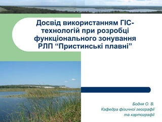