SlideShare a Scribd company logo
Практичне застосування ГІС
в НПП “Дворічанський”
Начальник віддіу науки, моніторингу
та еколого-освітньої роботи НПП
«Дворічанський»
Клетьонкін В.Г.
Використання технічного
обладнання
Для збору даних (місця зустрічі рідкісних тварин і рослин, облік
тварин та рослин на облікових ділянках, картування ареалів рослин ЧКУ,
маршрутів, факторів антропогенного впливу, порушень на території парку
(браконьєрство, пожежі, розорювання, проведення уточнення меж
заказників тощо), створення бази даних використовується пристрій HTC
HD2 та планшети, надані в рамках програми „ГІС та заповідні території”,
смартфони працівників парку та GPS-навігатор Garmin.
Для обробки зібраних даних, виготовлення картографічного
матеріалу, розробки маршрутів тощо використовувалась комп’ютерна
техніка, надана в рамках програми „ГІС та заповідні території”, на якій
встановлене програмне забезпечення ArcGIS. Крім вказаного ПО окремі
задачі вирішувались за допомогою QGIS, яке встановлене на інших
комп’ютерах. Для вивчення розповсюдження об’єктів використовуючи
різноманітні характеристики екологічної ніші застосовувалось ПО MaxEnt,
а детальна обробка моделей проводилась у ArcGIS та QGIS.
Здійснюється картування території парку
(урочища з їх місцевими назвами)
Продовжується робота, з використанням ГІС, по
дослідженню крейдяних відслонень та проведенню
просторового моніторингу рослинних угруповань цінних
і рідкісних видів тварин
Картування постійних маршрутів та
облікових ділянок
Картування результатів науково-дослідної роботи на
постійних маршрутах та облікових ділянках
Термокарта
відображає стан
колишньої
заселеності
поселення бабака
степового: чим
більше червоного
кольору, тим
більшою є
щільність нір
Моніторинг видів тварин
Розповсюдження бобра
європейського на території
Дворічанського району
Місця дослідження сфекоїдних ос
Картування гнізд хижих птахів
Проведення кількісних обліків птахів і тварин
Закартовано розташування гнізд білого лелеки
Проведена інвентаризація сарни європейської
(Capreolus capreolus) на території парку та
суміжних територіях. При проведенні обліків
використовувалася метод весняного обліку
ратичних по дефекації (Основы охотустройства
УССР…, 1985, Шейгас и др., 1991). При
виявленні зимових дефекацій козулі
здійснювалась їх реєстрація за допомогою GPS-
навігатора, і запис результатів обліків для даної
облікового точки і опису відповідного біотопу.
Здійснюється моніторинг
рідкісних видів флори та
фауни національного парку,
його околиць та в інших
регіонах області та країни.
Створюються охоронні зони
для рідкісних видів.
Ведеться робота по
створенню бази даних
рослин і тварин
Проводиться аналіз антропічних чинників тиску на природні
комплекси НПП „Дворічанський”
Моніторинг малих ПЗО району
Продовжено
картування та
обстеження території
заказників
Дворічанського району
з метою їх моніторингу
ДЯКУЮ ЗА
УВАГУ!
ДЯКУЄМО ЗА
УВАГУ!!!
Фото: В.Клетьонкін
Картографічний матеріал: А.А. Атемасов, М.В. Банік, В.Г. Клетьонкін,
В.І. Ронкін, А.І. Тупіков

More Related Content

Viewers also liked

Oleg Prilutsky Experience in organizing distributed data collection for mus...
Oleg Prilutsky   Experience in organizing distributed data collection for mus...Oleg Prilutsky   Experience in organizing distributed data collection for mus...
Oleg Prilutsky Experience in organizing distributed data collection for mus...
Anton Biatov
 
Dmitry Lyashenko Geoinformation environmental mapping in Ukraine
Dmitry Lyashenko   Geoinformation environmental mapping in UkraineDmitry Lyashenko   Geoinformation environmental mapping in Ukraine
Dmitry Lyashenko Geoinformation environmental mapping in Ukraine
Anton Biatov
 
Natalia Brusentsova Cerviformes seu artiodactyla monitoring organization in...
Natalia Brusentsova   Cerviformes seu artiodactyla monitoring organization in...Natalia Brusentsova   Cerviformes seu artiodactyla monitoring organization in...
Natalia Brusentsova Cerviformes seu artiodactyla monitoring organization in...
Anton Biatov
 
Natalia Kasyanova Development of gis-project of Dvorichansky national park ...
Natalia Kasyanova   Development of gis-project of Dvorichansky national park ...Natalia Kasyanova   Development of gis-project of Dvorichansky national park ...
Natalia Kasyanova Development of gis-project of Dvorichansky national park ...
Anton Biatov
 
Natalia Atamas Using a meteorological sounding balloon with a video camera ...
Natalia Atamas   Using a meteorological sounding balloon with a video camera ...Natalia Atamas   Using a meteorological sounding balloon with a video camera ...
Natalia Atamas Using a meteorological sounding balloon with a video camera ...
Anton Biatov
 
Anton Biatov the experience of using ua vs for surveying the natural areas ...
Anton Biatov   the experience of using ua vs for surveying the natural areas ...Anton Biatov   the experience of using ua vs for surveying the natural areas ...
Anton Biatov the experience of using ua vs for surveying the natural areas ...
Anton Biatov
 
Vasyl Korets The experience of using the geographic information system qgis...
Vasyl Korets   The experience of using the geographic information system qgis...Vasyl Korets   The experience of using the geographic information system qgis...
Vasyl Korets The experience of using the geographic information system qgis...
Anton Biatov
 
Yuriy Strus An attempt to study the biotope distribution of black stork by ...
Yuriy Strus   An attempt to study the biotope distribution of black stork by ...Yuriy Strus   An attempt to study the biotope distribution of black stork by ...
Yuriy Strus An attempt to study the biotope distribution of black stork by ...
Anton Biatov
 
Galina Guz Web-database biodiversity of lugansk nature reserve in literary ...
Galina Guz   Web-database biodiversity of lugansk nature reserve in literary ...Galina Guz   Web-database biodiversity of lugansk nature reserve in literary ...
Galina Guz Web-database biodiversity of lugansk nature reserve in literary ...
Anton Biatov
 
Mykola Kozyr Git Hub and GIS from user to developer
Mykola Kozyr   Git Hub and GIS from user to developerMykola Kozyr   Git Hub and GIS from user to developer
Mykola Kozyr Git Hub and GIS from user to developer
Anton Biatov
 
Dmitry Dyadin the experience of using mobile gis applications for urban env...
Dmitry Dyadin   the experience of using mobile gis applications for urban env...Dmitry Dyadin   the experience of using mobile gis applications for urban env...
Dmitry Dyadin the experience of using mobile gis applications for urban env...
Anton Biatov
 
Yevhen Skubak Use of GIS to map northern predators of mammals into the Svya...
Yevhen Skubak   Use of GIS to map northern predators of mammals into the Svya...Yevhen Skubak   Use of GIS to map northern predators of mammals into the Svya...
Yevhen Skubak Use of GIS to map northern predators of mammals into the Svya...
Anton Biatov
 
Svetlana Vinokurova Assessment of the condition of reed associations in the...
Svetlana Vinokurova   Assessment of the condition of reed associations in the...Svetlana Vinokurova   Assessment of the condition of reed associations in the...
Svetlana Vinokurova Assessment of the condition of reed associations in the...
Anton Biatov
 
Ivan Oliynikov Using data of multiscale mapping to analyze the development ...
Ivan Oliynikov   Using data of multiscale mapping to analyze the development ...Ivan Oliynikov   Using data of multiscale mapping to analyze the development ...
Ivan Oliynikov Using data of multiscale mapping to analyze the development ...
Anton Biatov
 
Roman Sizo Society for conservation gis - ua
Roman Sizo   Society for conservation gis - uaRoman Sizo   Society for conservation gis - ua
Roman Sizo Society for conservation gis - ua
Anton Biatov
 
Irina Yakovleva Prospects for using modern technologies and adaptations in ...
Irina Yakovleva   Prospects for using modern technologies and adaptations in ...Irina Yakovleva   Prospects for using modern technologies and adaptations in ...
Irina Yakovleva Prospects for using modern technologies and adaptations in ...
Anton Biatov
 
Svetlana Vinokurova Visualization of time, web map of the dynamics of the r...
Svetlana Vinokurova   Visualization of time, web map of the dynamics of the r...Svetlana Vinokurova   Visualization of time, web map of the dynamics of the r...
Svetlana Vinokurova Visualization of time, web map of the dynamics of the r...
Anton Biatov
 
Yuriy Protsenko Annual experience of using the GIS of the Pyriatynsky natio...
Yuriy Protsenko   Annual experience of using the GIS of the Pyriatynsky natio...Yuriy Protsenko   Annual experience of using the GIS of the Pyriatynsky natio...
Yuriy Protsenko Annual experience of using the GIS of the Pyriatynsky natio...
Anton Biatov
 
Volodymyr Pasternak Application of GIS-technologies for research of forest ...
Volodymyr Pasternak   Application of GIS-technologies for research of forest ...Volodymyr Pasternak   Application of GIS-technologies for research of forest ...
Volodymyr Pasternak Application of GIS-technologies for research of forest ...
Anton Biatov
 
Anton Biatov - Report about ArcGIS using by ESRI conservation program in GIS...
Anton Biatov - Report about ArcGIS using  by ESRI conservation program in GIS...Anton Biatov - Report about ArcGIS using  by ESRI conservation program in GIS...
Anton Biatov - Report about ArcGIS using by ESRI conservation program in GIS...
Anton Biatov
 

Viewers also liked (20)

Oleg Prilutsky Experience in organizing distributed data collection for mus...
Oleg Prilutsky   Experience in organizing distributed data collection for mus...Oleg Prilutsky   Experience in organizing distributed data collection for mus...
Oleg Prilutsky Experience in organizing distributed data collection for mus...
 
Dmitry Lyashenko Geoinformation environmental mapping in Ukraine
Dmitry Lyashenko   Geoinformation environmental mapping in UkraineDmitry Lyashenko   Geoinformation environmental mapping in Ukraine
Dmitry Lyashenko Geoinformation environmental mapping in Ukraine
 
Natalia Brusentsova Cerviformes seu artiodactyla monitoring organization in...
Natalia Brusentsova   Cerviformes seu artiodactyla monitoring organization in...Natalia Brusentsova   Cerviformes seu artiodactyla monitoring organization in...
Natalia Brusentsova Cerviformes seu artiodactyla monitoring organization in...
 
Natalia Kasyanova Development of gis-project of Dvorichansky national park ...
Natalia Kasyanova   Development of gis-project of Dvorichansky national park ...Natalia Kasyanova   Development of gis-project of Dvorichansky national park ...
Natalia Kasyanova Development of gis-project of Dvorichansky national park ...
 
Natalia Atamas Using a meteorological sounding balloon with a video camera ...
Natalia Atamas   Using a meteorological sounding balloon with a video camera ...Natalia Atamas   Using a meteorological sounding balloon with a video camera ...
Natalia Atamas Using a meteorological sounding balloon with a video camera ...
 
Anton Biatov the experience of using ua vs for surveying the natural areas ...
Anton Biatov   the experience of using ua vs for surveying the natural areas ...Anton Biatov   the experience of using ua vs for surveying the natural areas ...
Anton Biatov the experience of using ua vs for surveying the natural areas ...
 
Vasyl Korets The experience of using the geographic information system qgis...
Vasyl Korets   The experience of using the geographic information system qgis...Vasyl Korets   The experience of using the geographic information system qgis...
Vasyl Korets The experience of using the geographic information system qgis...
 
Yuriy Strus An attempt to study the biotope distribution of black stork by ...
Yuriy Strus   An attempt to study the biotope distribution of black stork by ...Yuriy Strus   An attempt to study the biotope distribution of black stork by ...
Yuriy Strus An attempt to study the biotope distribution of black stork by ...
 
Galina Guz Web-database biodiversity of lugansk nature reserve in literary ...
Galina Guz   Web-database biodiversity of lugansk nature reserve in literary ...Galina Guz   Web-database biodiversity of lugansk nature reserve in literary ...
Galina Guz Web-database biodiversity of lugansk nature reserve in literary ...
 
Mykola Kozyr Git Hub and GIS from user to developer
Mykola Kozyr   Git Hub and GIS from user to developerMykola Kozyr   Git Hub and GIS from user to developer
Mykola Kozyr Git Hub and GIS from user to developer
 
Dmitry Dyadin the experience of using mobile gis applications for urban env...
Dmitry Dyadin   the experience of using mobile gis applications for urban env...Dmitry Dyadin   the experience of using mobile gis applications for urban env...
Dmitry Dyadin the experience of using mobile gis applications for urban env...
 
Yevhen Skubak Use of GIS to map northern predators of mammals into the Svya...
Yevhen Skubak   Use of GIS to map northern predators of mammals into the Svya...Yevhen Skubak   Use of GIS to map northern predators of mammals into the Svya...
Yevhen Skubak Use of GIS to map northern predators of mammals into the Svya...
 
Svetlana Vinokurova Assessment of the condition of reed associations in the...
Svetlana Vinokurova   Assessment of the condition of reed associations in the...Svetlana Vinokurova   Assessment of the condition of reed associations in the...
Svetlana Vinokurova Assessment of the condition of reed associations in the...
 
Ivan Oliynikov Using data of multiscale mapping to analyze the development ...
Ivan Oliynikov   Using data of multiscale mapping to analyze the development ...Ivan Oliynikov   Using data of multiscale mapping to analyze the development ...
Ivan Oliynikov Using data of multiscale mapping to analyze the development ...
 
Roman Sizo Society for conservation gis - ua
Roman Sizo   Society for conservation gis - uaRoman Sizo   Society for conservation gis - ua
Roman Sizo Society for conservation gis - ua
 
Irina Yakovleva Prospects for using modern technologies and adaptations in ...
Irina Yakovleva   Prospects for using modern technologies and adaptations in ...Irina Yakovleva   Prospects for using modern technologies and adaptations in ...
Irina Yakovleva Prospects for using modern technologies and adaptations in ...
 
Svetlana Vinokurova Visualization of time, web map of the dynamics of the r...
Svetlana Vinokurova   Visualization of time, web map of the dynamics of the r...Svetlana Vinokurova   Visualization of time, web map of the dynamics of the r...
Svetlana Vinokurova Visualization of time, web map of the dynamics of the r...
 
Yuriy Protsenko Annual experience of using the GIS of the Pyriatynsky natio...
Yuriy Protsenko   Annual experience of using the GIS of the Pyriatynsky natio...Yuriy Protsenko   Annual experience of using the GIS of the Pyriatynsky natio...
Yuriy Protsenko Annual experience of using the GIS of the Pyriatynsky natio...
 
Volodymyr Pasternak Application of GIS-technologies for research of forest ...
Volodymyr Pasternak   Application of GIS-technologies for research of forest ...Volodymyr Pasternak   Application of GIS-technologies for research of forest ...
Volodymyr Pasternak Application of GIS-technologies for research of forest ...
 
Anton Biatov - Report about ArcGIS using by ESRI conservation program in GIS...
Anton Biatov - Report about ArcGIS using  by ESRI conservation program in GIS...Anton Biatov - Report about ArcGIS using  by ESRI conservation program in GIS...
Anton Biatov - Report about ArcGIS using by ESRI conservation program in GIS...
 

Vladimir Kletenkin Practical use of GIS in the Dvurechansky national park in 2016

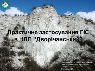
  • 1. Практичне застосування ГІС в НПП “Дворічанський” Начальник віддіу науки, моніторингу та еколого-освітньої роботи НПП «Дворічанський» Клетьонкін В.Г.
  • 2. Використання технічного обладнання Для збору даних (місця зустрічі рідкісних тварин і рослин, облік тварин та рослин на облікових ділянках, картування ареалів рослин ЧКУ, маршрутів, факторів антропогенного впливу, порушень на території парку (браконьєрство, пожежі, розорювання, проведення уточнення меж заказників тощо), створення бази даних використовується пристрій HTC HD2 та планшети, надані в рамках програми „ГІС та заповідні території”, смартфони працівників парку та GPS-навігатор Garmin. Для обробки зібраних даних, виготовлення картографічного матеріалу, розробки маршрутів тощо використовувалась комп’ютерна техніка, надана в рамках програми „ГІС та заповідні території”, на якій встановлене програмне забезпечення ArcGIS. Крім вказаного ПО окремі задачі вирішувались за допомогою QGIS, яке встановлене на інших комп’ютерах. Для вивчення розповсюдження об’єктів використовуючи різноманітні характеристики екологічної ніші застосовувалось ПО MaxEnt, а детальна обробка моделей проводилась у ArcGIS та QGIS.
  • 3. Здійснюється картування території парку (урочища з їх місцевими назвами)
  • 4. Продовжується робота, з використанням ГІС, по дослідженню крейдяних відслонень та проведенню просторового моніторингу рослинних угруповань цінних і рідкісних видів тварин
  • 5. Картування постійних маршрутів та облікових ділянок
  • 6. Картування результатів науково-дослідної роботи на постійних маршрутах та облікових ділянках Термокарта відображає стан колишньої заселеності поселення бабака степового: чим більше червоного кольору, тим більшою є щільність нір
  • 7. Моніторинг видів тварин Розповсюдження бобра європейського на території Дворічанського району Місця дослідження сфекоїдних ос
  • 9. Проведення кількісних обліків птахів і тварин Закартовано розташування гнізд білого лелеки Проведена інвентаризація сарни європейської (Capreolus capreolus) на території парку та суміжних територіях. При проведенні обліків використовувалася метод весняного обліку ратичних по дефекації (Основы охотустройства УССР…, 1985, Шейгас и др., 1991). При виявленні зимових дефекацій козулі здійснювалась їх реєстрація за допомогою GPS- навігатора, і запис результатів обліків для даної облікового точки і опису відповідного біотопу.
  • 10. Здійснюється моніторинг рідкісних видів флори та фауни національного парку, його околиць та в інших регіонах області та країни. Створюються охоронні зони для рідкісних видів. Ведеться робота по створенню бази даних рослин і тварин
  • 11. Проводиться аналіз антропічних чинників тиску на природні комплекси НПП „Дворічанський”
  • 12. Моніторинг малих ПЗО району Продовжено картування та обстеження території заказників Дворічанського району з метою їх моніторингу
  • 13. ДЯКУЮ ЗА УВАГУ! ДЯКУЄМО ЗА УВАГУ!!! Фото: В.Клетьонкін Картографічний матеріал: А.А. Атемасов, М.В. Банік, В.Г. Клетьонкін, В.І. Ронкін, А.І. Тупіков