SlideShare a Scribd company logo
Использование
видеозонда для учета
в тростниковых
колониях
водоплавающих
(цапли) на Днепре
Атамась Н.С.,
г. Киев
Институт зоологии им. И.И.
Шмальгаузена НАН Украины
Квадрикоптер
DJI Phantom 3
Камера GoPro
Hero
Общая
стоимость – .
Биотоп, где проводились учеты
Май 2013, Каневское
водохранилище,
Киевская обл.
Специфика работы:
• Работа на воде и с воды
• Байдарки, резиновые лодки и т.д.
• Тростник образует ленточные заросли
вдоль берегов или островные куртины
Грузоподъемность:
• Видеорегистратор fullHD 1080 с
дополнительной камерой заднего вида – 100
грамм
• Универсальный источник питания с USB-
выходом емкостью 5,6 А/ч – 100 грамм
• Система крепежа зонда к земле (леска
двойная на 15 кг и сетка для зонда) – 100
грамм
• И еще 100 грамм для подъема
• Итого: объем зонда должен быть 1000 литров
(1 куб)
Метеозонд 1,5 м в
диаметре:
внешний вид
Цена истории:
• Метеозонд – 9 $ + 8 $
• Видеорегистратор – 35 $
• Универсальный источник питания - 10 $
• Спиннинг – 3-5 $
• Самое дорогое дело – газовый баллон с
гелием В; 10 литров на 150 атм. Стоимость
баллона – 200-300 гр. Стоимость заправки –
450 гр. Одного баллона хватает на 1,5
заправки зонда.
Как это работает:
• Двойная леска на катушке для спиннинга 100 м;
• Очень небольшой ровный ветер без порывов;
• Подплывать с наветренной стороны;
• Герметично упаковать видеорегистратор и
элемент питания на случай опускания в воду
Получение снимков:
• Работа в VirtualDub
• Разбивание видео на кадры, вырезание ключевых файлов
1. 96 гнезд на фото 1
2. Индекс плотности К=L/R,
где L -средний диаметр
лотка, а R - среднее
растояние между
центрами соседних гнезд;
3. R меряется на рисунке в
AutoCad 12 или схожих
графических программах
К = 0,32
Средний d гнезда – 1,19 м
(для 10 гнезд)
R = 18, 1 единицы = 3,7 м
(для 41 гнезда)
Наименьшие расстояния между
гнезд – AutoCad 12
Недостатки метода:
• Невозможно использования
в сильный и средней силы
ветер;
• Тяжелые, дорогие и
неудобные баллоны для газа
• Наиболее удобен для
использования над
островными тростниковыми
куртинами, а не над
сплошными массивами
тростника.
• Качество изображения - .
Планы:
• Телевизионный передатчик с камерой (30
гр.) и телевизионный приемник с 5-
дюймовым LCD-дисплеем (12-вольтовый
аккумулятор) – 100-150 метров.
• Передатчики на смартфон с Wi-Fi – 30-40
метров ???
Спасибо за внимание!

More Related Content

Viewers also liked

Galina Guz Web-database biodiversity of lugansk nature reserve in literary ...
Galina Guz   Web-database biodiversity of lugansk nature reserve in literary ...Galina Guz   Web-database biodiversity of lugansk nature reserve in literary ...
Galina Guz Web-database biodiversity of lugansk nature reserve in literary ...
Anton Biatov
 
Natalia Kasyanova Development of gis-project of Dvorichansky national park ...
Natalia Kasyanova   Development of gis-project of Dvorichansky national park ...Natalia Kasyanova   Development of gis-project of Dvorichansky national park ...
Natalia Kasyanova Development of gis-project of Dvorichansky national park ...
Anton Biatov
 
Anton Biatov the experience of using ua vs for surveying the natural areas ...
Anton Biatov   the experience of using ua vs for surveying the natural areas ...Anton Biatov   the experience of using ua vs for surveying the natural areas ...
Anton Biatov the experience of using ua vs for surveying the natural areas ...
Anton Biatov
 
Dmitry Lyashenko Geoinformation environmental mapping in Ukraine
Dmitry Lyashenko   Geoinformation environmental mapping in UkraineDmitry Lyashenko   Geoinformation environmental mapping in Ukraine
Dmitry Lyashenko Geoinformation environmental mapping in Ukraine
Anton Biatov
 
Natalia Brusentsova Cerviformes seu artiodactyla monitoring organization in...
Natalia Brusentsova   Cerviformes seu artiodactyla monitoring organization in...Natalia Brusentsova   Cerviformes seu artiodactyla monitoring organization in...
Natalia Brusentsova Cerviformes seu artiodactyla monitoring organization in...
Anton Biatov
 
Oleg Prilutsky Experience in organizing distributed data collection for mus...
Oleg Prilutsky   Experience in organizing distributed data collection for mus...Oleg Prilutsky   Experience in organizing distributed data collection for mus...
Oleg Prilutsky Experience in organizing distributed data collection for mus...
Anton Biatov
 
Egor Yatsjuk Experience in collecting and organizing data using next gis an...
Egor Yatsjuk   Experience in collecting and organizing data using next gis an...Egor Yatsjuk   Experience in collecting and organizing data using next gis an...
Egor Yatsjuk Experience in collecting and organizing data using next gis an...
Anton Biatov
 
Mykola Kozyr Git Hub and GIS from user to developer
Mykola Kozyr   Git Hub and GIS from user to developerMykola Kozyr   Git Hub and GIS from user to developer
Mykola Kozyr Git Hub and GIS from user to developer
Anton Biatov
 
Volodymyr Pasternak Application of GIS-technologies for research of forest ...
Volodymyr Pasternak   Application of GIS-technologies for research of forest ...Volodymyr Pasternak   Application of GIS-technologies for research of forest ...
Volodymyr Pasternak Application of GIS-technologies for research of forest ...
Anton Biatov
 
Irina Yakovleva Prospects for using modern technologies and adaptations in ...
Irina Yakovleva   Prospects for using modern technologies and adaptations in ...Irina Yakovleva   Prospects for using modern technologies and adaptations in ...
Irina Yakovleva Prospects for using modern technologies and adaptations in ...
Anton Biatov
 
Sergei Gorodilov Geocoding. What, why and how
Sergei Gorodilov   Geocoding. What, why and howSergei Gorodilov   Geocoding. What, why and how
Sergei Gorodilov Geocoding. What, why and how
Anton Biatov
 
Yuriy Protsenko Annual experience of using the GIS of the Pyriatynsky natio...
Yuriy Protsenko   Annual experience of using the GIS of the Pyriatynsky natio...Yuriy Protsenko   Annual experience of using the GIS of the Pyriatynsky natio...
Yuriy Protsenko Annual experience of using the GIS of the Pyriatynsky natio...
Anton Biatov
 
Svetlana Vinokurova Visualization of time, web map of the dynamics of the r...
Svetlana Vinokurova   Visualization of time, web map of the dynamics of the r...Svetlana Vinokurova   Visualization of time, web map of the dynamics of the r...
Svetlana Vinokurova Visualization of time, web map of the dynamics of the r...
Anton Biatov
 
Ivan Oliynikov Using data of multiscale mapping to analyze the development ...
Ivan Oliynikov   Using data of multiscale mapping to analyze the development ...Ivan Oliynikov   Using data of multiscale mapping to analyze the development ...
Ivan Oliynikov Using data of multiscale mapping to analyze the development ...
Anton Biatov
 
Yevhen Skubak Use of GIS to map northern predators of mammals into the Svya...
Yevhen Skubak   Use of GIS to map northern predators of mammals into the Svya...Yevhen Skubak   Use of GIS to map northern predators of mammals into the Svya...
Yevhen Skubak Use of GIS to map northern predators of mammals into the Svya...
Anton Biatov
 
Svetlana Vinokurova Assessment of the condition of reed associations in the...
Svetlana Vinokurova   Assessment of the condition of reed associations in the...Svetlana Vinokurova   Assessment of the condition of reed associations in the...
Svetlana Vinokurova Assessment of the condition of reed associations in the...
Anton Biatov
 
Dmitry Dyadin the experience of using mobile gis applications for urban env...
Dmitry Dyadin   the experience of using mobile gis applications for urban env...Dmitry Dyadin   the experience of using mobile gis applications for urban env...
Dmitry Dyadin the experience of using mobile gis applications for urban env...
Anton Biatov
 
Anton Biatov - Report about ArcGIS using by ESRI conservation program in GIS...
Anton Biatov - Report about ArcGIS using  by ESRI conservation program in GIS...Anton Biatov - Report about ArcGIS using  by ESRI conservation program in GIS...
Anton Biatov - Report about ArcGIS using by ESRI conservation program in GIS...
Anton Biatov
 

Viewers also liked (18)

Galina Guz Web-database biodiversity of lugansk nature reserve in literary ...
Galina Guz   Web-database biodiversity of lugansk nature reserve in literary ...Galina Guz   Web-database biodiversity of lugansk nature reserve in literary ...
Galina Guz Web-database biodiversity of lugansk nature reserve in literary ...
 
Natalia Kasyanova Development of gis-project of Dvorichansky national park ...
Natalia Kasyanova   Development of gis-project of Dvorichansky national park ...Natalia Kasyanova   Development of gis-project of Dvorichansky national park ...
Natalia Kasyanova Development of gis-project of Dvorichansky national park ...
 
Anton Biatov the experience of using ua vs for surveying the natural areas ...
Anton Biatov   the experience of using ua vs for surveying the natural areas ...Anton Biatov   the experience of using ua vs for surveying the natural areas ...
Anton Biatov the experience of using ua vs for surveying the natural areas ...
 
Dmitry Lyashenko Geoinformation environmental mapping in Ukraine
Dmitry Lyashenko   Geoinformation environmental mapping in UkraineDmitry Lyashenko   Geoinformation environmental mapping in Ukraine
Dmitry Lyashenko Geoinformation environmental mapping in Ukraine
 
Natalia Brusentsova Cerviformes seu artiodactyla monitoring organization in...
Natalia Brusentsova   Cerviformes seu artiodactyla monitoring organization in...Natalia Brusentsova   Cerviformes seu artiodactyla monitoring organization in...
Natalia Brusentsova Cerviformes seu artiodactyla monitoring organization in...
 
Oleg Prilutsky Experience in organizing distributed data collection for mus...
Oleg Prilutsky   Experience in organizing distributed data collection for mus...Oleg Prilutsky   Experience in organizing distributed data collection for mus...
Oleg Prilutsky Experience in organizing distributed data collection for mus...
 
Egor Yatsjuk Experience in collecting and organizing data using next gis an...
Egor Yatsjuk   Experience in collecting and organizing data using next gis an...Egor Yatsjuk   Experience in collecting and organizing data using next gis an...
Egor Yatsjuk Experience in collecting and organizing data using next gis an...
 
Mykola Kozyr Git Hub and GIS from user to developer
Mykola Kozyr   Git Hub and GIS from user to developerMykola Kozyr   Git Hub and GIS from user to developer
Mykola Kozyr Git Hub and GIS from user to developer
 
Volodymyr Pasternak Application of GIS-technologies for research of forest ...
Volodymyr Pasternak   Application of GIS-technologies for research of forest ...Volodymyr Pasternak   Application of GIS-technologies for research of forest ...
Volodymyr Pasternak Application of GIS-technologies for research of forest ...
 
Irina Yakovleva Prospects for using modern technologies and adaptations in ...
Irina Yakovleva   Prospects for using modern technologies and adaptations in ...Irina Yakovleva   Prospects for using modern technologies and adaptations in ...
Irina Yakovleva Prospects for using modern technologies and adaptations in ...
 
Sergei Gorodilov Geocoding. What, why and how
Sergei Gorodilov   Geocoding. What, why and howSergei Gorodilov   Geocoding. What, why and how
Sergei Gorodilov Geocoding. What, why and how
 
Yuriy Protsenko Annual experience of using the GIS of the Pyriatynsky natio...
Yuriy Protsenko   Annual experience of using the GIS of the Pyriatynsky natio...Yuriy Protsenko   Annual experience of using the GIS of the Pyriatynsky natio...
Yuriy Protsenko Annual experience of using the GIS of the Pyriatynsky natio...
 
Svetlana Vinokurova Visualization of time, web map of the dynamics of the r...
Svetlana Vinokurova   Visualization of time, web map of the dynamics of the r...Svetlana Vinokurova   Visualization of time, web map of the dynamics of the r...
Svetlana Vinokurova Visualization of time, web map of the dynamics of the r...
 
Ivan Oliynikov Using data of multiscale mapping to analyze the development ...
Ivan Oliynikov   Using data of multiscale mapping to analyze the development ...Ivan Oliynikov   Using data of multiscale mapping to analyze the development ...
Ivan Oliynikov Using data of multiscale mapping to analyze the development ...
 
Yevhen Skubak Use of GIS to map northern predators of mammals into the Svya...
Yevhen Skubak   Use of GIS to map northern predators of mammals into the Svya...Yevhen Skubak   Use of GIS to map northern predators of mammals into the Svya...
Yevhen Skubak Use of GIS to map northern predators of mammals into the Svya...
 
Svetlana Vinokurova Assessment of the condition of reed associations in the...
Svetlana Vinokurova   Assessment of the condition of reed associations in the...Svetlana Vinokurova   Assessment of the condition of reed associations in the...
Svetlana Vinokurova Assessment of the condition of reed associations in the...
 
Dmitry Dyadin the experience of using mobile gis applications for urban env...
Dmitry Dyadin   the experience of using mobile gis applications for urban env...Dmitry Dyadin   the experience of using mobile gis applications for urban env...
Dmitry Dyadin the experience of using mobile gis applications for urban env...
 
Anton Biatov - Report about ArcGIS using by ESRI conservation program in GIS...
Anton Biatov - Report about ArcGIS using  by ESRI conservation program in GIS...Anton Biatov - Report about ArcGIS using  by ESRI conservation program in GIS...
Anton Biatov - Report about ArcGIS using by ESRI conservation program in GIS...
 

Natalia Atamas Using a meteorological sounding balloon with a video camera to record in the reed colonies of waterfowl (herons) on the dnieper

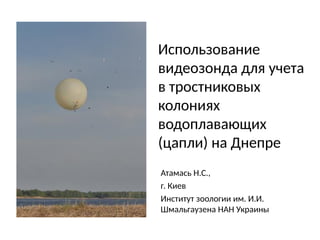
  • 1. Использование видеозонда для учета в тростниковых колониях водоплавающих (цапли) на Днепре Атамась Н.С., г. Киев Институт зоологии им. И.И. Шмальгаузена НАН Украины
  • 2. Квадрикоптер DJI Phantom 3 Камера GoPro Hero Общая стоимость – .
  • 3. Биотоп, где проводились учеты Май 2013, Каневское водохранилище, Киевская обл.
  • 4. Специфика работы: • Работа на воде и с воды • Байдарки, резиновые лодки и т.д. • Тростник образует ленточные заросли вдоль берегов или островные куртины
  • 5. Грузоподъемность: • Видеорегистратор fullHD 1080 с дополнительной камерой заднего вида – 100 грамм • Универсальный источник питания с USB- выходом емкостью 5,6 А/ч – 100 грамм • Система крепежа зонда к земле (леска двойная на 15 кг и сетка для зонда) – 100 грамм • И еще 100 грамм для подъема • Итого: объем зонда должен быть 1000 литров (1 куб)
  • 6. Метеозонд 1,5 м в диаметре: внешний вид
  • 7. Цена истории: • Метеозонд – 9 $ + 8 $ • Видеорегистратор – 35 $ • Универсальный источник питания - 10 $ • Спиннинг – 3-5 $ • Самое дорогое дело – газовый баллон с гелием В; 10 литров на 150 атм. Стоимость баллона – 200-300 гр. Стоимость заправки – 450 гр. Одного баллона хватает на 1,5 заправки зонда.
  • 8. Как это работает: • Двойная леска на катушке для спиннинга 100 м; • Очень небольшой ровный ветер без порывов; • Подплывать с наветренной стороны; • Герметично упаковать видеорегистратор и элемент питания на случай опускания в воду
  • 9. Получение снимков: • Работа в VirtualDub • Разбивание видео на кадры, вырезание ключевых файлов
  • 10. 1. 96 гнезд на фото 1 2. Индекс плотности К=L/R, где L -средний диаметр лотка, а R - среднее растояние между центрами соседних гнезд; 3. R меряется на рисунке в AutoCad 12 или схожих графических программах К = 0,32 Средний d гнезда – 1,19 м (для 10 гнезд) R = 18, 1 единицы = 3,7 м (для 41 гнезда)
  • 12. Недостатки метода: • Невозможно использования в сильный и средней силы ветер; • Тяжелые, дорогие и неудобные баллоны для газа • Наиболее удобен для использования над островными тростниковыми куртинами, а не над сплошными массивами тростника. • Качество изображения - .
  • 13. Планы: • Телевизионный передатчик с камерой (30 гр.) и телевизионный приемник с 5- дюймовым LCD-дисплеем (12-вольтовый аккумулятор) – 100-150 метров. • Передатчики на смартфон с Wi-Fi – 30-40 метров ???