Downloaded 18 times
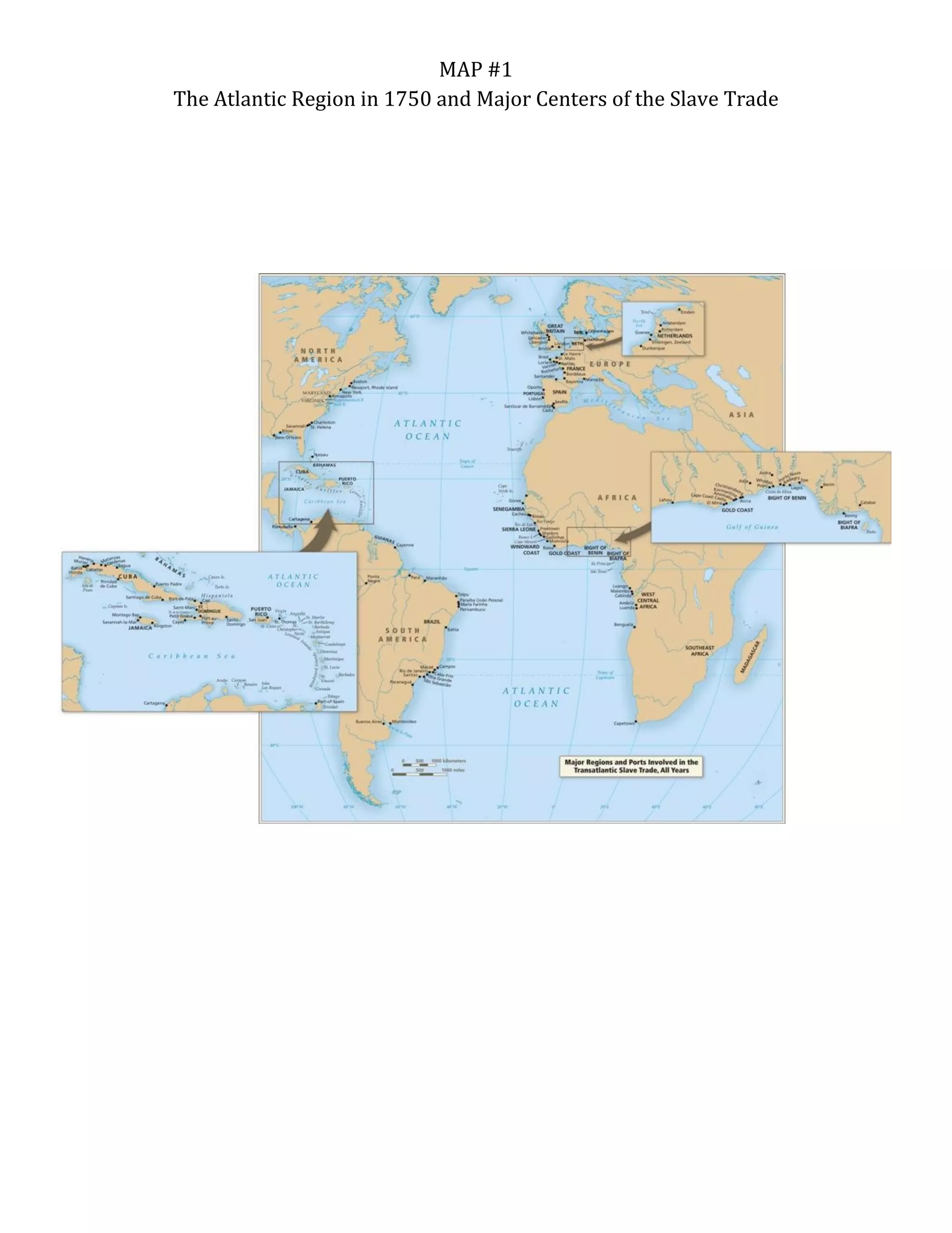
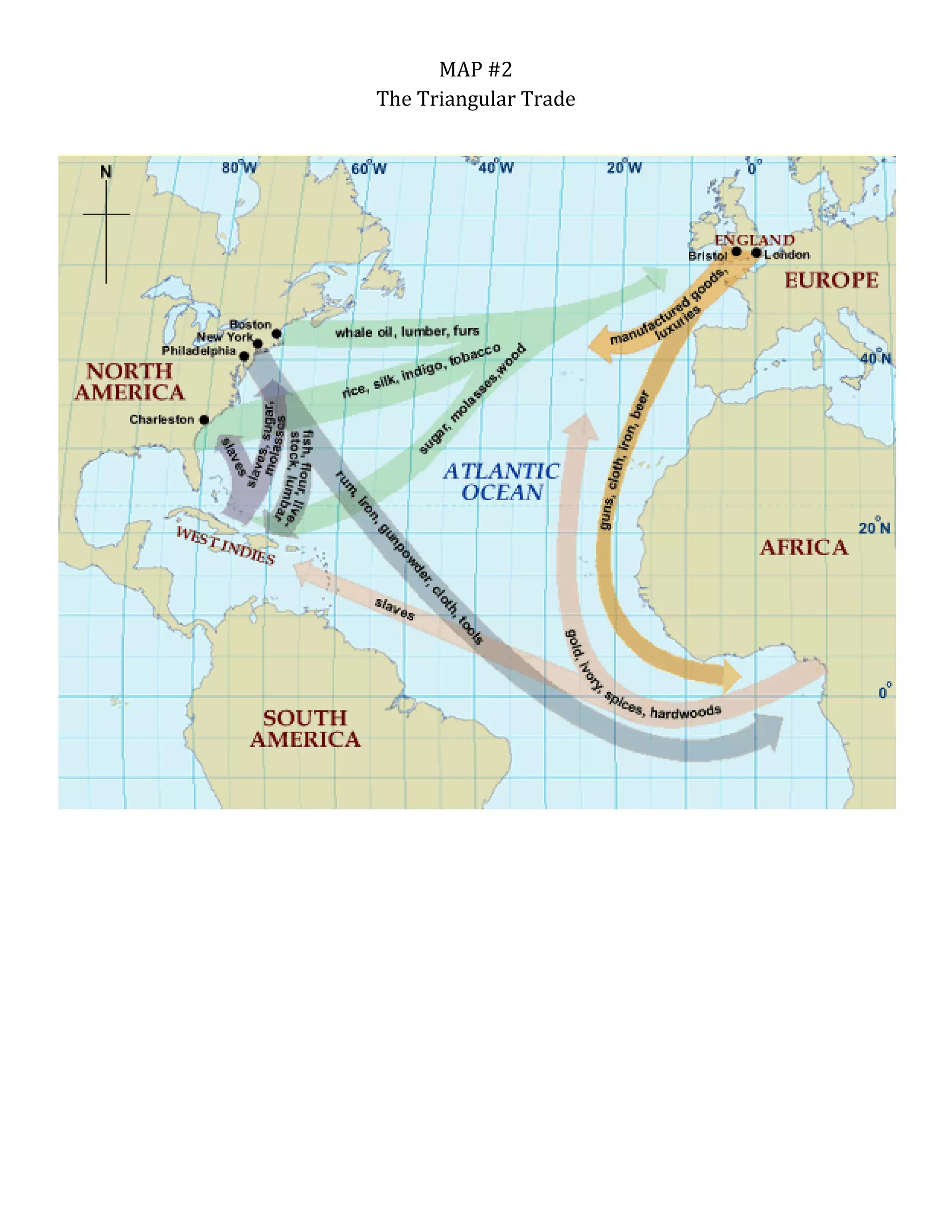
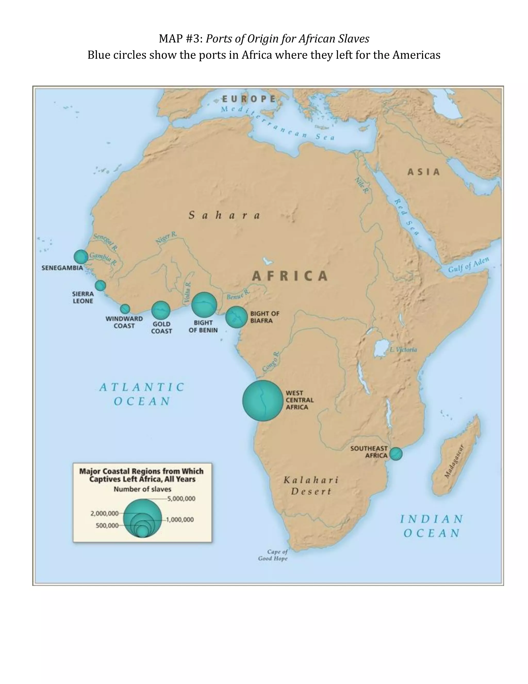
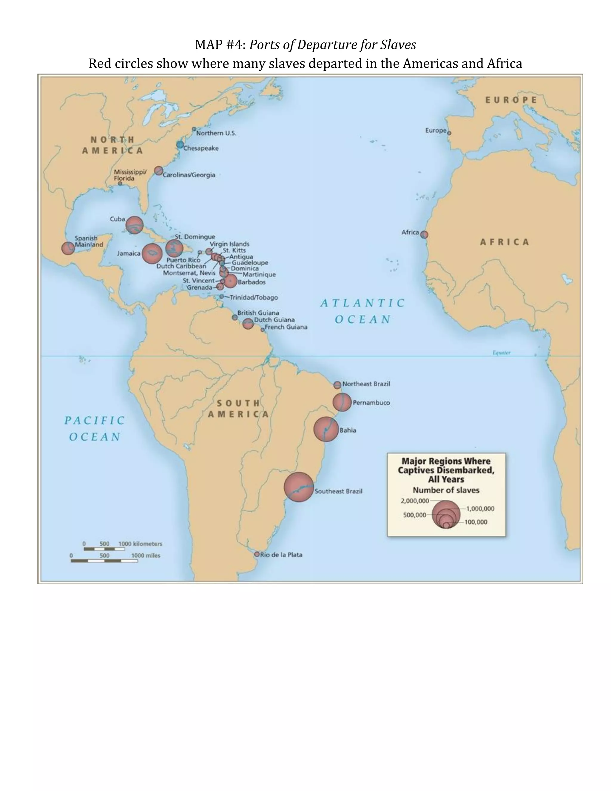

This document contains 4 maps related to the slave trade: Map 1 shows the Atlantic region and slave trade centers in 1750; Map 2 depicts the triangular trade route; Map 3 identifies African ports of origin for slaves; Map 4 marks ports where many slaves departed from locations in Africa and the Americas.


