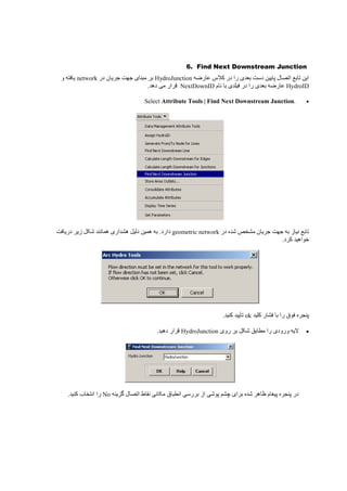
Downloaded 13 times

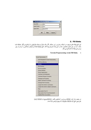
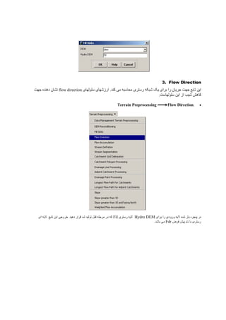
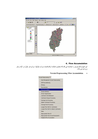
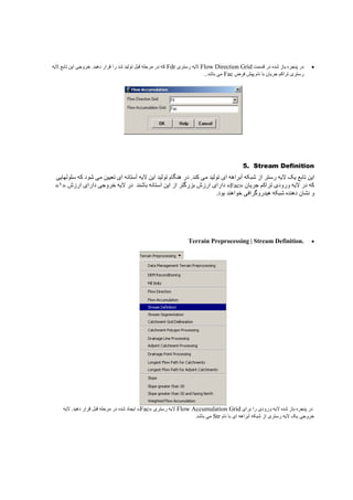
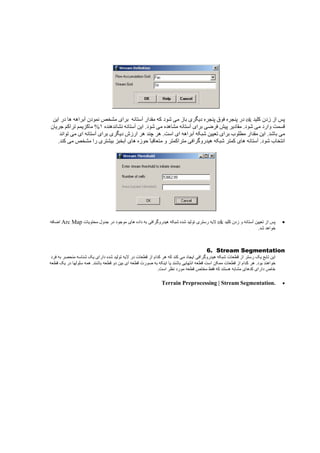
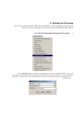
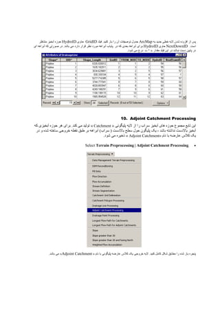
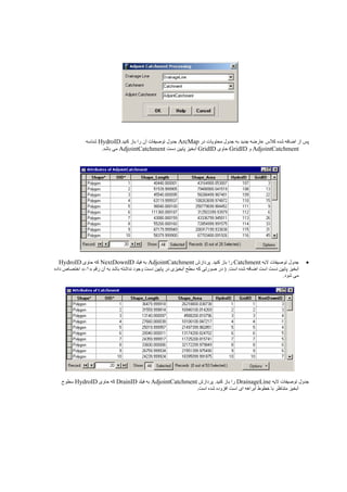
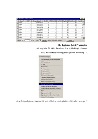
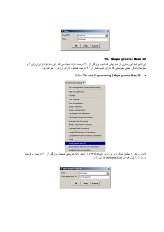
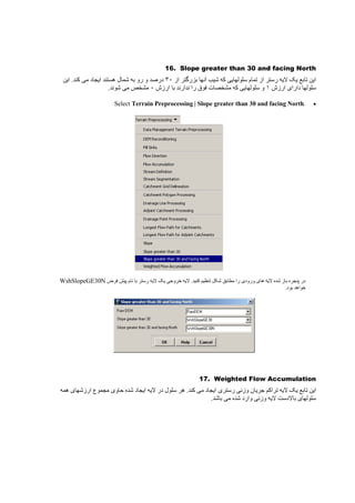
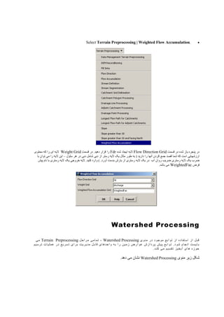
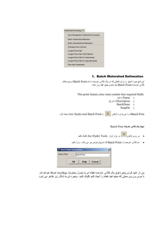
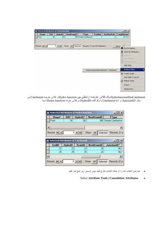
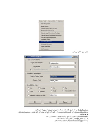
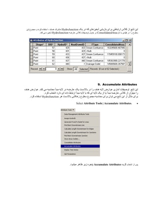
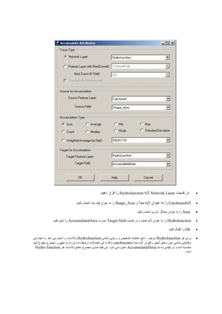
The document discusses Arc Hydro Tools, which is an extension for ArcGIS that allows users to perform hydrological analysis and modeling. It provides instructions on how to add the Arc Hydro Tools toolbox to ArcMap and customize the tools. It also describes how to set up datasets and preprocess terrain data, such as DEM reconditioning, before performing watershed processing tasks.