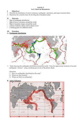
1) The document describes an activity to map the boundaries of tectonic plates by tracing the distributions of earthquakes, volcanoes, and mountain ranges on plastic sheets. Students are asked to observe patterns in these distributions and relate them to the scientific basis for dividing the lithosphere into plates.
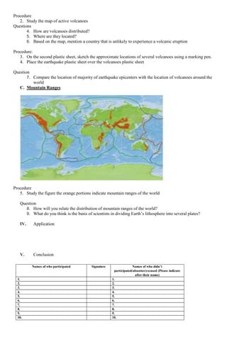
2) Maps show earthquake epicenters clustered along plate boundaries, as well as the locations of active volcanoes, which tend to be near the same boundaries. Mountain ranges also occur in orange-shaded regions associated with plate boundaries.
3) By overlaying the earthquake and volcano maps, students can see that the majority of seismic and volcanic activity aligns along the same boundaries, providing evidence for the theory of plate t