
Recommended
More Related Content
What's hot
Viewers also liked
Viewers also liked (20)
Similar to Scugdale & Live Moor Medium Walk - Cleveland Way Panoramic Views
Similar to Scugdale & Live Moor Medium Walk - Cleveland Way Panoramic Views (20)
More from John C
Recently uploaded
Recently uploaded (20)
Scugdale & Live Moor Medium Walk - Cleveland Way Panoramic Views
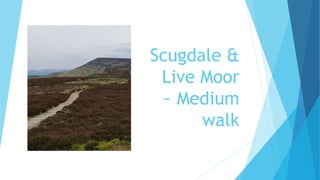
- 1. Scugdale & Live Moor ~ Medium walk
- 2. A walk that takes you onto the moors for open moor walking, enjoy the silence of the moors as you join the Cleveland Way. Starting at Husthwaite Green which is just outside Swainby, an ideal walk if you wish to experience some peace and solitude. Apply suncream or take a waterproof for your journey across the exposed moors though!
- 3. Getting There From Middlesbrough, go up Ormesby Bank and follow the road to Stokesley. Follow the A172 at a roundabout before Stokesley and look for a left hand turning for Swainby. Drive through Swainby and look for a left turning which is Scugdale Road. Look for a handful of houses on the left just before the road spilts two ways. Park next to the post box which is just near a sign for the Cleveland Way.
- 4. Map of the Scugdale Live Moor walk
- 5. The Walk From the post box near where you have parked, follow the road ahead which is still the Scugdale Road. Follow the road and enjoy the pleasant views around you. Look for where the road bends to the right just after you pass Sparrow Hall and take a left turning.
- 6. Turn left onto the gently rising farm track away from the road. Walk towards the farm, Fog Close Farm but before you come to the farm itself look for a gate on the right half way up the track. Go through the gate and another gate. Look for a sign and follow this very steeply uphill alongside a stream.
- 7. If you follow the stream up the steep climb you will come to the boundary of the farm to the moors.
- 8. Look for two gate posts and go onto the moor which climbs gently and avoid the marsh just after the gate. Your walking stick will come in handy here to test the ground is firm. Remember if you get lost here, there is an excellent GPS signal to check your position in Google Maps and you will soon find your bearings. You need to aim uphill through bracken until you come to a stile and join a sandy track.
- 9. Turn right on the sandy track which is quite wide. Follow this track and before it climbs and turns to the right keep your eye open for a path to the left. Follow this path and checking your GPS you will realise you are heading for the Cleveland Way.
- 11. Follow the Cleveland Way and if you look to the right in the distance you will see Roseberry Topping. Also you will pass two groups of stones or cairns where the Cleveland Way climbs. Don't forget to place another stone on the top of the cairns!
- 12. Follow the Cleveland Way until you come to the edge of a wood and go through the gate.
- 13. Follow the steep steps downward taking extra care. Follow the path back which will then exit onto the road where you left your car near the post box. I would recommend stopping for refreshments at the lovely village of Swainby which has plenty of pubs and good food.