Geographical Importance of District Zhob.

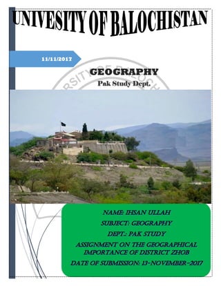
Zhob District Elevation: 7,500-10,000 feet Area: 20,297 Sq Km Zhob means oozing water, a reference perhaps to the spring which constitutes the source of Zhob River. Karez water can be seen everywhere when there is no drought situation. The Zhob district is located in the Balochistan Province in the north east of Pakistan. It lies close to the Afghanistan border. Zhob town is just east of Zhob river on an open plain. To the north is a ridge, about 150 ft high, on which is a castle from the time when the British colonized the area. In the winter, the weather is cold and the snow is normal. In the summer, although the temperature can get up to 100 degrees Fahrenheit, there is little moisture, so it is not uncomfortable. Zhob is a picturesque valley known for its beautiful mountains, treks and archeological sites. It starts from the Muslim Bagh (7500 feet) and ends at the Afghan border at Fort Sandeman (10000 feet). It expands to beautiful, breathtaking views throughout the valley. With an abundance of fruit orchards there is one dangerous little thing found amongst them, and that is the scorpion. In the month of April the flowers bloom and you'll be able to see an extraordinary site with flowers and snow together.

Recommended
Recommended
More Related Content
What's hot
What's hot (20)
More from EHSAN KHAN
More from EHSAN KHAN (20)
Recently uploaded
Recently uploaded (20)
Geographical Importance of District Zhob.
- 2. Page 1 of 16 Table of Contents Geographical Importance of District Zhob...........................................................................3 Zhob District ...............................................................................................................................3 History: .........................................................................................................................................3 Geography:....................................................................................................................................4 RIVERS AND STREAMS.......................................................................................................4 CLIMATE....................................................................................................................................5 Flora & Fauna:............................................................................................................................5 Agriculture ...................................................................................................................................5 Forestry.........................................................................................................................................6 Horticulture.................................................................................................................................6 Livestock.......................................................................................................................................6 Irrigation ......................................................................................................................................6 Trade & Industries.....................................................................................................................6 Communication: .......................................................................................................................... 7 Ethnicity and Tribes................................................................................................................... 7 RELIGION ................................................................................................................................. 7 MOTHER TONGUE................................................................................................................8 Culture & Traditions: ................................................................................................................8 Food ...............................................................................................................................................9 Dress And Ornaments................................................................................................................9 Marriages in Zhob ......................................................................................................................9 Role of Women Zhob................................................................................................................10 Arms in Zhob ............................................................................................................................. 11 Housing in Zhob........................................................................................................................ 11 Construction Material Used in Housing: .............................................................................12 Sources of Energy .....................................................................................................................12 Drinking Water and Sanitation .............................................................................................12 Places to See: .............................................................................................................................13 Zhob Town .................................................................................................................................13 Muslim Bagh..............................................................................................................................13 Qilla Saifullah............................................................................................................................13
- 3. Page 2 of 16 Sandeman TangiFort Sandeman ...........................................................................................13 Shrines ........................................................................................................................................13 Historical And Archeological Sites........................................................................................13 Paryano Ghundi ........................................................................................................................14 Rana Ghundi..............................................................................................................................14 Occupations................................................................................................................................14 Population Size and Growth...................................................................................................14 Rural/Urban Distribution.......................................................................................................14 Literacy.......................................................................................................................................15 Education Attainment..............................................................................................................15 Immunization ............................................................................................................................15 Zhob in Comparison to Rest of Balochistan........................................................................15
- 4. Page 3 of 16 Geographical Importance of District Zhob Zhob District Elevation: 7,500-10,000 feet Area: 20,297 Sq Km Zhob means oozing water, a reference perhaps to the spring which constitutes the source of Zhob River. Karez water can be seen everywhere when there is no drought situation. The Zhob district is located in the Balochistan Province in the north east of Pakistan. It lies close to the Afghanistan border. Zhob town is just east of Zhob river on an open plain. To the north is a ridge, about 150 ft high, on which is a castle from the time when the British colonized the area. In the winter, the weather is cold and the snow is normal. In the summer, although the temperature can get up to 100 degrees Fahrenheit, there is little moisture, so it is not uncomfortable. Zhob is a picturesque valley known for its beautiful mountains, treks and archeological sites. It starts from the Muslim Bagh (7500 feet) and ends at the Afghan border at Fort Sandeman (10000 feet). It expands to beautiful, breathtaking views throughout the valley. With an abundance of fruit orchards there is one dangerous little thing found amongst them, and that is the scorpion. In the month of April the flowers bloom and you'll be able to see an extraordinary site with flowers and snow together. History: Camel Caravan in ZhobThe tribes inhabiting the area are indigenous to the land. Zhob is the cradle of the Afghan race. Qais Abdul Rashid, who is believed to be one of the progenitors of the Pashtoons or Afghans, lived in the Suleiman mountains near Zhob. He was born in 575 AD and died in 661 AD. Natives call the place where he is buried "Da Kase Ghar" (the mountain of Qais). He is buried near the Takht-e-Suleiman. The Chinese pilgrim Hiven Tsiang who visited India in 629 AD, described the Afghans as living in Zhob. The inhabitants of Zhob valley gave tough resistance to Mehmood Ghazni, when he initiated his raids on India. Later, however they joined ranks with him. Subsequently the area came under the rule of Nadir Shah from 1736 to 1747 and later Ahmed Shah Abdali from 1747 to 1773. Zhob remained under the rule of Durranis and Barakzais till British captured it. Preceding this event was a period of fifty years of anarchy when Zhob was dubbed as 'Yaghistan" or the land of the rebels. A number of areas now in Zhob, Killa Saifullah, and Pishin districts were ceded to British India after signing of Durand Treaty in 1893. They soon became a district Sir Robert Sandeman, the first Agent to the governor General in Balochistan occupied Zhob in 1889 extending his forward policy to the region with the subjugation of the tribes inhabiting the Suleman range and occupation and control of numerous passes through it to the south. He also secured the great Gomal pass and the carvanic routes to Ghazani and Kandhar. Captain Mac Ivor
- 5. Page 4 of 16 had been appointed the first political agent in Zhob with formation as the Political Agency in 1890. Zhob district is the second oldest existing district of Balochistan, after Quetta. Zhob was formed as a Political Ageny under the British rule in 1890. The district and its town acquired the name of Zhob in 1975. Previously, it was known as Fort Sandeman after Sir Robert Sandeman; who was then Political Agent to the Governor General in Balochistan. It was Sir Robert Sandeman who extended British Rule into this region. The name was changed on July 30 1976 by the then Prime Minister of Pakistan; Zulfiqar Ali Bhutto. The hand written remarks inserted by him into the visitors book; preserved at the Zhob Militia Mess, says "Today we have taken a decision to eliminate the last vestige of colonialism in this historical place by changing the name to Zhob instead of Sandeman; the British conqueror and oppressor of Pathan and Baloch people and of the country." Traditionally, Fort Sandeman was called Appozai, named after a village situated two kilometres away. Geography: The district lies between 30 � 30� to 32 � 05� north latitudes and 67 � 26� to 70 � 00� east longitudes. It is bounded on the north by Afghanistan and South Waziristan agency of FATA, on the east by the tribal area adjoining Dera Ismail Khan district of NWFP and Musakhel district, on the south and south-west by Loralai and Killa Saifullah districts. Total area of district is 20297 square kilometers. The district has an important geo-strategic location. It links Afghanistan, South Waziristan Agency, D.I.Khan district, Killa Saifullah, Loralai, and MusaKhel. Topographically, the district is covered with mountains and hills intersected by the broad valley of Zhob and its tributaries. The Toba Kakar range covers the western half of the district extending from the boundary of Afghanistan up to the Zhob River. The Suleman range locally called as the Kasi Ghar lies on the eastern boundary of the district. The famous Takht-e-Sulaiman or Solomon's Throne is the highest peak of this range. It is about 3441 meters above sea level and located just outside the boundary. The Sindh Ghar, Tor Ghar and Sur Ghar ranges are also situated in the eastern side of the district. The two mountainous regions are of different character. The great part of the district, beyond the left bank of the Zhob, consists almost entirely beyond the district boundary. The general elevation of the district is 1500 to 3000 meters (7,500-10,000 feet) On the south of Zhob valley, a succession of parallel ridges running from north-east to south-west divide the drainage of the Zhob from that of the Bori valley in the Loralai district. RIVERS AND STREAMS The two principal drainage channels of the district are the Zhob and the Kundar Rivers, both flow into the Gomal River. The Zhob river has a total length of about 410 kilometres. Zhob River is the only river in the country that follows a north eastern course. It springs from the Kan Metarzai range (Tsari Mehtarazai Pass), passes about 4 kilometre from Zhob city and finally flows into the Gomal river near Khajuri Kach. The broad plain of the Zhob River is occupied by the alluvial formation. The Kundar River rises from the central and highest point of the Toba Kakar range, a few
- 6. Page 5 of 16 kilometers northeast of the Sakir. It constitutes boundary between Pakistan and Afghanistan territory for a considerable length. The other subsidiary rivers or streams are the Baskan, Chukhan, Sri Toi, Sawar, Surab, etc. CLIMATE Camel Caravan in ZhobThe climate of the district is hot and dry in summer and cold in winter. June is the hottest month with mean maximum and minimum temperature of about 37�C and 23�C respectively. January is the coldest month with mean maximum and minimum temperature of about 13�C and -1�C degree respectively. The dust storms occur in summer from July to September accompanied by thunderstorms. In winters the wind blows from the west and is very cold. The winds from the Southwest and east are also common, the later invariably brings rain. The wind from the north occasionally blows during September to April bring drought and damage standing crops. Rainfall is scanty and varies with the altitude. Most of the rainfall is received during winter seasons. Flora & Fauna: Principal trees and plants found in Zhob district are wild olive (shinay), pistachio, chilgoza or edible pine and wild almond in ghigh lands. Other trees include willow, tamarisk (along the beds of streams) pastawana (grewia oppositifolio) and spalnai (calotropis gigantea). Wild animals are wolves, jackals, hyenas, foxes, deer, and porcupines. Leopards and black bear are occasionally found in the high hills in Suleman range. Wild pigs are seen along Zhob river while straight horned markhors, wild goats, are present in moderate numbers in Shinghar mountains. Among the game bird chakor, partridge and pigeon are numerous i n higher altitudes, Sand grouse, quails, and bustard are found in plains. Other birds are doves, hoopoe, starlings and vegetals, Jay black birds, wood pigeons, cuckoos and thrush live in high ranges while wild duck and pelican are seen along the Zhob river in winter. Snake and scorpion are common every where in Zhob. Fish (Mahsir) are found in every running stream and in Zhob river some of which weigh up to 8 pounds. Agriculture Most part the area is hilly and barren with every limited water resources for agriculture purposes. However, during recent years tube wells have become quite abundant with the result that agricultural activity has registered a rise and a total of 36170 acre of land is under cultivation in the district. Sowing and harvesting are still largely carried out in traditional manner but the use of agricultural machinery is increasing day by day. However, there is very little scope for a radical increase in the area under cultivation as the area is mostly "Barani". There are two cropping seasons, Kharif and Rabi. Rabi crops are sown between October and mid February and harvested in June. Kharif crops are sown from April to July and harvested by the end of October.
- 7. Page 6 of 16 Forestry The district has big potential for social and natural forestry and vegetation cover in the district is quite extensive. There are two forest reserves in the district. The total area under forest cover (including social forest) is around 10,010 hectares. Commercial forestry in the district is for the production of pine nut and timber. The pine- nut forests are very profitable. Commercial forestry or cutting of timber for commercial purposes exists in Sherani sub-division. Horticulture Grapes are grown in abundance on the foothills of the mountains. Other is almond, apricot and apple. Livestock Livestock raising is an important source of livelihood for the rural population and this has a great potential. There are four veterinary hospitals in the district, with 57 veterinary dispensaries. There is also one Artificial Insemination Center (A.I) and one Disease Investigation Laboratory (D.I.L). Irrigation Only 16,206 acres of land is irrigated throughout the district. Majority of the area in the district is irrigated by springs. The following forms of irrigation are found in the district: Perennial Irrigation Schemes - 35 Flood Irrigation Schemes - 10 Delay Action Dam/Storage Dam - 5 Flood Protection Schemes - 6 Political Parties in Zhob Two political parties play an active role in the district. They are Jamiat-e-Ullemah Islam (JUI) and Pakhtoon Milli Awami Party (PKMAP). However, the JUI is a stronger political group than the PKMAP. It is more disciplined and organised on ideological grounds. Since its establishment in 1947, the Pakistan Muslim League received only little support in Zhob district. However, since 1988, support for the Pakistan Muslim League Nawaz (PML-N) has increased, after its candidate Jaffar Khan Mandokhel started winning election. Still he is supported for tribal (Mandokhel) than for party-political reasons. There are two Senators from the Zhob district, Zariff Khan Mandokhel and Subedar Khan Mandokhel; both are members of the PML-Nawaz. Previously there was another Senator, Rahim Khan Mandokhel from PKMAP, but he resigned after his election to the Provincial Assembly. Trade & Industries Trade and trading activity in the district is largely in the informal sector because of proximity with Afghanistan. Regular formal trade is relatively limited and mostly confined to consumable items.
- 8. Page 7 of 16 Apart from two flourmills located in Zhob town, no industry worth the name exist in the district. Communication: Zhob is linked by air with major cities of the country. A fokker flight operate from Quetta linking Zhob with Multan, Dera Ismail Khan, Peshawar and Islamabad. Zhob is 320kilometers from Quetta, 225 kilometer from Dera Ismail Khan. However, the road linking with Dera Ismail Khan is for most part a dirt track passing through water streams and only 48 kilometers is metalloid. The poor condition of the road acts as a deterrent for an increase in inter-provincial transportation and commercial exploitation of the route. The narrow railway linking Quetta with Zhob became moribund in 1984 and the service is no longer available. While it functioned, the railway was a romantic reminder of yesteryears highest railway-station of the country, enroute namely Kan Mehtarzai (altitude 2800 meters). The total length of the track of the track was 295 kilometers with 11 railway stations on the way. A radio station is functioning at Zhob, broadcast from which are widely listened to in the district to in the district. In the urban television sets are common. The signal is transmitted from the booster located at Loralai. The use of dish antennas is also growing. Zhob is linked through the Nation Wide Dialing system to the country and other telecommunication facilities such fax and telegraph are also available. Postal service in Zhob is based on departmental arrangements. There are three departmental post offices at Zhob City, Zhob GPO and Qamardin Karez respectively. There are nine extra- departmental branches one each at Killi Appozai, Killi Ibrahim Khel, Kili Gohar Appozai, Killi Lowara, Mani Kwa, Mir Ali Khel, Sambaza, Shinghar and Sharan Jogezai. Ethnicity and Tribes The district is inhabited by Mandokhels, Kakars, Sheranis, Haripals, Babars, Lawoons, Khosty and Syeds. Sulemankhels, Nasars, Kharots, and other tribes of Afghan origin are also present. RELIGION The population of the district is almost Muslim. They constitute 99.43 percent of the total population, with a breakup of 99.67 percent in rural and 98.15 percent in urban areas.The absolute majority of the muslims living in Zhob district belongs to the Sunni sect of Islam. A very small number of Shia people lives in the district. There are Syeds living in the district but they belong to Sunni sect as well. There is no "Imam Bara" found in the district. The two major festivals are Eid- ul-Fitr and Eid-ul-Azha. They are occasions of great jubilation and joy. Other festivals are "Eid- Miladuld Nabi, and Sab-e-Barat". During these festivals alms are given to the poor and relatives give each other presents. The population of Zhob district are religiously very conservative and strict. There is large attendance in mosques, routine prayers, and religious observance. The performing of "Hajj" (pilgrimage to Mecca) is common. Also poor people have performed Hajj. During the Ramzan, the observance of fasting is generally very strict.
- 9. Page 8 of 16 The role of the "Mullah" (religious leader) is very important in the performance of rituals. The role of Mullahs is still strong in rural areas where literacy is low. A Mullah is respected for being the leader in prayers, profound knowledge of the Quran and performing rituals. Sick persons visit him to be healed. There are very few Christians, Hindu, Qadiani/Ahmadi, Scheduled Caste and other communities which are only 0.58 percent of the total population. The district used to have a huge Hindu population, but since partition of the sub-continent most of them have migrated. The Hindu population left behind is not seen celebrating "Diwali" and "Holi". MOTHER TONGUE The predominant mother tongue of the population of the district is Pushto which is spoken by 96.82 percent of the total population followed by Saraki at 1.27 percent. The proportion of the population speaking Pushto is higher in rural areas at 99.65 percent as compared to 81.93 percent in urban areas. In contrast the proportion of Saraiki is higher in urban areas at 7.71 percent in comparison to that in rural areas at 0.05 percent. The proportion of the population speaking Urdu, Punjabi, Sindhi, Balochi and others is 1.91 percent. Culture & Traditions: The dominating life style is still nomadic. Scattered mud huts exist for seasonal habitation; summer is spent in highlands and winter in lower plains for feeding cattle in tribal reserved pastures. The people are deeply religious and their lives are marked by strict adherence to tribal norms and values.There are two major channels for conflict resolution in the district: namely the traditional/tribal and the government/ institutional. The traditional/tribal channel however has proved more effective than the latter. In the past jirga system operated in the region which was the traditional system where by tribal elders sat together to settle disputes and mete out justice to offenders. The system stands annulled by a decision of the Supreme Court of Pakistan in 1991. The government however, still forms informal jirgas (comprising of notables from the tribes) for conflict resolution, as they have proven to be very effective. A high order of social cooperation exists among the people both on occasions of happiness and sorrow. In case of death of a relative neighbor or friend, food is supplied to the deceased's household for two to three days. Majority of the people living in Zhob district belongs to the Sunni sect of Islam with a marginal number of people belonging to the Shia sect of Islam. There are two major channels for conflict resolution in the district namely the traditional/tribal and the government/institutional. The traditional /tribal channel however, has proved more effective than the latter. In the past the jirga system operate in the region which was proved more effective than the latter. In the Past the Jirga system operated in the region which was the traditional system where by tribal elders sat together to settle disputes and mete out justice to offenders. The system stands annulled by a decision of the Supreme Court of Pakistan in 1991. The Government however, still forms informal jirgas (comprising notable's etc) for conflict resolution, as they have proven to be very effective.
- 10. Page 9 of 16 Food Majority of the people have two meals daily, one in the morning and other at sunset. Only well- to-do families have a third meal. An average meal consists of nan, locally called "marai" with pulses, vegetables/meat broth and butter milk (lassi). Consumption of landhi, or dried meat is common during winters. Sheep are specially fattened so that they may be more suitible for preparing "landhi" Dress And Ornaments The majority of the male population wears shalwar kameez and a turban to cover their heads both in summer and in winter with a chadder (piece of cloth) slung across the shoulders. The women wear a wrapper and a long shirt reaching to the knees. Women belonging to the middle and upper classes dress in the manner of other urban women in the province and also wear gold ornaments. Marriages in Zhob The marriage system is more or less the same for all tribes living in the district. Marriage is regarded as an important institution. The age for a man to marry is from 20 to 25 years. Women are 13 to 18 years old when they marry. The majority of marriages is pre-arranged and the bride and groom often come from the same family. Marriages within the family with first or second (paternal/maternal) cousins are common. The marriage is settled by the families of the bride and bride-groom. Compared to women, men have a bigger say in the selection of their brides than women have in the selection of their future husbands. Yet the mutual families play the biggest role. Polygamy is practised. A large number of men has two wives. Hardly any man has three or four wives. When the husband dies, the wife has little chance of remarrying. When the wife dies, the husband easily marries again, no matter how many children he has. Through a girl is valuable asset in an Afghanistan family by virtue of the bride price that she fetches yet no joy attends her birth while the birth of a baby boy is celebrated in a joyous manner with the offering of shots in the air. The system of vulvar (bride-price) is widely practised in the district. Money is paid by the groom for a proposal to the guardians/parents of the girl. The amount varies from case to case. In case of close family marriages, the amount may be smaller or waived completely. The payment of vulvar is imputed at the time a proposal of marriage is made. There are no fixed rules about the amount of vulvar. The amount of vulvar may be paid by the bridegroom, his parents/guardians or relatives. The demanded price is usually raised when a proposal is repeated to the bride's side or when the one proposed to is very beautiful; or when the man proposing is very rich and already married. The centuries old system of exchanging girls for marriage is commonly practised. It is called "tsarai". The system is strongly practised in semi-nomadic and the lower classes of society. In tsarai, a girl is married to a man in exchange for a bride for her brother. The system brings down marriage expenses as no vulvar has to be paid. Under the system girls are left with no choice. They are not asked for their consent. After their daughters are married, parents become almost indifferent towards their future welfare. The newly wedded wives remain at the mercy of their husband and in-laws. It is observed that under an exchange system of marriages, retaliation may be shown by
- 11. Page 10 of 16 the husband's side against his wife in case his sister is not happy with his wife's brother. A second marriage on the side may result in marriage break-up or ill treatment of the wife. The major expenses involved in marriages, other than vulvar, are the arrangement of the wedding and the purchase of jewellery and dresses. Gifts are given by relatives and friends to bride and bride-groom. The bride is wearing a typical red bridal dress designed for the occasion, with her hands and feet dyed red with henna. In Zhob district, where society is close, a man marrying outside the family under an arranged marriage is not allowed to see his bride before the wedding night. Marriage proposals, vulvar arrangements are verbal agreements. Though nothing is on paper, they are respected by and large. A marriage is regarded as a way to strengthen tribal or family relations. Marriages can be used to settle tribal or family disputes. Refusal of a marriage if proposed may result in the weakening of a family relationship. However, the spread of education and literacy are mitigating this kind of considerations. The educated class of Zhob society is less rigid in the following of traditional rules, though they are not totally free from them. Role of Women Zhob The entire society of Zhob district is male and tribally dominated. Men decide on politics and the fate of the family and tribe. Therefore, they assume a predominant role in both the community and family decision making. The rate of literacy amongst women is very low. Because of illiteracy and unawareness, women enjoy fewer civil amenities and fundamental rights. Human rights of women are frequently violated without any report. Politically women are without any say. The women's seats of the Union Councils are filled, but they do not participate in meetings. Female participation in elections has increased since 1985. Previously, women were discouraged to vote. Women play a minor role in decision-making, but they play an important role in the household and agricultural affairs of the district. Though a woman shares the economic burden of the family as she contributes to the household and productive work outside the house in fields, nonetheless, her household work is not considered an economic contribution, and seldom credit is given to her by husband or elders for her significant contribution to the family and society. In rural areas, women are commonly observed to be involved in looking after horses, camels and sheep, assisting in cultivation and doing traditional embroidery work. Society constrains them to remain illiterate and to endure problems related to polygamy, vulvar and a generally low social status. In case of polygamy, the first wife's opinion is not considered when a man wants to marry a second wife. A change in the women's status is observed in areas with more female literacy. Educated women have more influence in decision making and have more authority. Interest in female education is rising, but there are not enough schools. Cases of Siakari, or adultery, are very rarely reported. Because of the tribalism and Pashtoon code of honour, such an incident if happens is not reported. A number of females found suspected of
- 12. Page 11 of 16 having illegal relationship are believed to have been put to death (by shooting or beheading) without being reported officially. The man she was involved with may be killed as well. The discussion of the act is regarded as taboo. Arms in Zhob The population possess a large number of weapons. According to the Political Agent office report, both traditional and advanced weapons have been used in different situations. They include traditional rifles and 12-bore shot-guns, and advanced weapons. The use of rocket launchers and mortar gun has been reported as well. Political Agent Fort/House in ZhobIn the tribal "B" area, the role of the police is limited. It is easy to obtain a licence for small arms, but there are many unlicensed arms in the district, particularly amongst tribes living close to the borders where many arms are smuggled in from Afghanistan. The frontier towns are believed to have stored arms and ammunition for supply into Pakistan during the Afghan revolution (1979 to 1994). The frontier town Kamardin Karez, at a distance of 224 kilometres from Zhob, had a famous arms market where one could buy a variety of arms including rocket launchers. Housing in Zhob Houses in the district are mostly solid buildings of stone-blocks and mud. In both urban and rural areas, the use of the stone is very frequent in the construction of houses. They are coated with thick mud. Well-off people coat their houses with cement or concrete. The use of clay bricks and baked bricks is common in the construction of houses in Zhob city and some other areas. The use of clay bricks is common for roofs, boundary walls and barns. The majority of the houses has roofs made of tin or iron, which are curved because of the snow fall in winter. The construction of double storey buildings is uncommon. There are a few in Zhob city. In rural areas a courtyard may enclose a number of the houses, both for reasons of safety and social affinity. The housing characteristics are more or less similar all over the district. The houses are knit together in villages which may comprise few or many houses. Seventy-five percent of the houses in rural areas are without latrine and bath-room. Eighty-five percent of all houses in the district is without proper drainage, human waste disposal arrangements and sewerage system. However, because of the mountains and hills, the absence of drainage does not cause sewerage problems. Eighty percent of the houses in the district are owned. The ratio of rented houses other than in Zhob city is 5 to 8 percent. The rest of the houses is let to tenants. The ratio of rented houses in the district is higher in Zhob city. In Zhob city, the ratio of rented houses is 35 to 40 percent, because of the large number of army, FC, and government officers. In Zhob city and the surrounding area there are buildings constructed during the British period. In Zhob city the British built a huge airforce/military garrison, the Zhob Militia Mess and residences for Political Agent and Assistant Political Agents. Most of them were built during the period 1893 to 1910. Buildings which are important from an historical point of view are the Political Agent's Official residence known as "The Castle" and the Zhob Militia Mess the centennial of which was celebrated in 1989. All VIPs to Zhob can, if desired, stay overnight in one of these two buildings.
- 13. Page 12 of 16 There are a number of officers' bungalows, now under the occupation of army officers, situated on the VIP lane which are 80 to 100 years old. The APA house is also very old and nowadays accommodates the Assistant Commissioner. At Shinghar, at a distance of 82 km from Zhob, at the height of 2850 metres above sea level, are a number of huts which were used by British officers. The place was the summer camp for the British Political Agent, the Assistant Political Agent, the Commandant Zhob militia, and other few officers. Arrangements were made for the pumping of water and transportation. The site is now abandoned because the present Pakistani district administrators do not seem to show the least of interest in the place. It appears a ghost town where occasionally people go for an adventurous over- night stay or a picnic. A number of forts exist in the surrounding of the district which were built by the British for the deployment of militia troops. Some of them are abandoned and have collapsed. Others are in use by the Frontier Corps and Levy. The important ones are at Mir Ali Khel, Dana Sher and Mughalkot. There is one in Qamardin Kariz under the use of FC. Construction Material Used in Housing: As mentioned earlier, the houses in the district are made of stone, clay and baked bricks with thick clay or mud topping and iron or steel roofing. Doors, windows and ventilators are made of wood. Iron grills are rare. Most houses have a room with a ventilator. The use of cement is not common. It is mostly found in case of government buildings and upper class people housing. There are a number of houses which are over 100 years old. The height of the houses is usually not more than 3 metres. Sources of Energy Twenty-five percent of the area of the district is electrified. Gas is not available in the district except in cylinders by those who can afford buying them. For industrial and mechanical/agricultural purpose, the use of electricity is the only source. For the purpose of cooking and heating electricity, dung-cake and wood are used. The use of coal for heating is less common after the railway service was abandoned. In winter time, the rural population has difficulty finding sources of energy for heating. Therefore, they start storing wood in summer. Drinking Water and Sanitation The major source of drinking water in the district is spring water. The drinking water in urban area of Zhob is supplied through gravity source by storage tanks. There are six reservoirs with each 120,000 gallon capacity. There is no regular sanitation system except in Zhob city which is however not properly maintained. As mentioned, because of the hilly slop and lack of mud, the rain water is soon absorbed.
- 14. Page 13 of 16 Places to See: Zhob Town Zhob situated at a distance of 320 kilometers from Quetta was previously called Fort Sandeman. It still contains relics that harkens back to its grand past, one is the Zhob Militia mess and the other is the officials residence of Political Agent, Zhob known as the "castle". The British cemetery at Zhob, which was another reminder of the "Raj", has been vandalized and lies in ruins. Muslim Bagh Muslim Bagh is the center of Chromate Mines and is located 96 kilometers north east of Quetta. Coming to Muslim Bagh and not visiting the chromate mines is a waste of a tour. The Muslim Bagh is known as an Oasis of Orchards. Yet another place to see in Muslim Bagh is Asia's highest Railway Station Kanmehtarzai Pass, which is on the road that connects Fort Sandeman with Bostan. Qilla Saifullah Qila Saifullah is the seat of the famous Jogezai family located on the ancient Carvan routes. It is famous for its Apples, Pistachio Nuts, and some beautiful scenery spots. Its community is known to be the earliest agricultural community in the Indo-Pak Subcontinent, which flourished at the beginning of 3000 BC. The climate here is heavy, but enthrallingly seductive for adventure travelers! Sandeman TangiFort Sandeman Fort Sandeman is at the Afghan-Pakistan border and is sorrounded with beautiful scenery. Sheen Ghar (Green Mountain) at this height is covered with Pine forests and is the best area in the valley to shoot Chakor. Shrines There are two well-known shrines in the district. They are of Hazrat Nazar Nika at six km from Zhob and Hazrat Khostoo Baba 100 km from Zhob in the direction of Waziristan. Two other shrines are Zakoo Nika near Zhob and Palwand Baba in the Mughalkot area. Visits to shrines is not common in Zhob. There are no shrines in the district where regular "urs" (annual celebrations) are observed. The tomb of Qais Rashid on the top of Suleiman mountain is also a place to visit. However, as the mountain is steep and high, visits are difficult to make. People who reach the top take goats for sacrifice for the fulfilment of their desires and for the sake of the saint. Historical And Archeological Sites A number of mounds, ruins, and caves dot the expanse of the district, which have historical and archeological importance. The general consensus among most experts is that they belong to the Mughal period.
- 15. Page 14 of 16 The region is rife with many legends. One legend relates that on their way back to Palestine, Prophet Suleman was requested by his newly wed Indian bride who was a princess that she be allowed to take a last look at her ancestral land India and Soloman Landed his "takht" or flying throne on the mountains. Paryano Ghundi Paryan-o-Ghundi, which means a hill of fairies, is at two miles distance to the west of Zhob town. It was excavated by Sir Aural Syien in 1924. It was visited in 1950 by Fair resemblance with that found in Harapa. Unfortunately, the mound has been completely destroyed by the local people. Rana Ghundi Rana Ghundi is an archeological site having mounds from which remains of a culture have been found with affinities spread to the Hisar culture of North East Iran dating back to 3500 BC. Red Pottery has also been found, which is estimated to belong to a period earlier than the Indus valley civilization. Occupations Animal husbandry, small-scale farming and Government service are the major occupations. The Mandokkhels are an enterprising lot who dominate the realm of Government contractor-ship in Balochistan and as far away as Karachi and Islamabad, while numerous members of the Shirani tribe are serving in the Gulf countries, mostly as laborers. Population Size and Growth The population of Zhob district is 275.14 thousands in 1998 as compared to 213.29 thousands in 1981 recording an increase of 29.00 percent over the last 17 years i.e. 1981-98. The increase of 113.50 and 99.36 percent was observed during intercensal period 1972-81 (8.46 years) and 1961- 72 (11.67 years) respectively. Overall the population of the district has increased rapidly showing substantial increase of 449.07 percent during the last 37 years i.e. 1961-98 which is five and a half times. The total are of the district is 20297 square kilometers having population density 13.6 persons per square per square kilometer in March 1998. Rural/Urban Distribution The rural population of the district is 231.30 thousands constituting 84.07 percent of the total population. The average annual growth rate of rural population during 1981-98 is 1.44 percent which was 9.74 and 5.96 percents during 1972-81 and 1961-72 respectively. The urban population of the district is 43.84 thousands constituting 15.93 percent of the total population. The average annual growth rate of the urban population during 1981-98 is 1.88 percent which was 7.52 and 6.76 percent during 1972-81 and 1961-72 respectively
- 16. Page 15 of 16 Literacy A person was treated as literate in the 1998 census if he could read a newspaper and write a simple letter in any language. The literacy ration of the district among the population aged 10 years and above is 16.78 percent, 47.84 percent for urban areas, and 10.40 percent for rural areas.The literacy ratio of the district among the population aged 10 years and above is 16.78 percent, 47.84 percent is urban areas and 10.40 percent in rural areas. The male literacy ratio is 24.53 percent compared to 6.90 percent for female. Education Attainment During the 1990s, the enrollment of children in schools nearly doubled in the Zhob district. For boys, it went from 15136 in 1993 to 21841 in 1997. For girls, it more than doubled, from 3046 in 1993 to 6789 in 1997. A large variation exists in the ratio of educated persons by sex and area. The percentage of educated males is 23.72 percent and of females, 6.33 percent. It is 47.65 percent for urban areas as against 9.58 for rural areas. Immunization 53.34 percent of the children under 10 years of age have been reported as vaccinated, while 21.01 percent have been reported as not vaccinated, leaving the rest 25.65 as not known. Zhob in Comparison to Rest of Balochistan The main objective of the series of District Profiles is to provide information on a wide range of sectors and subjects for each of the 26 districts in Balochistan. The result however creates the possibility to compare the districts among themselves and to compare the situation in each of them with the situation in Balochistan as a whole. To introduce this perspective, 32 indicators have been selected on which this comparison can take place. These indicators, and others, can be found on the following two pages. Each district can be ranked on each of the indicators. The relative position of Zhob district is reflected in the diagram on the third page. The diagram gives a bottom-up ranking: position nr.1 means the lowest score on that particular indicator, while position nr.26 implies the highest score. An overall ranking of districts is not given, because that would mean attaching as certain weight to each of the indicators. As far as Zhob district is concerned, the following observations can be made. With its 16,520 square kilometer, Zhob is about 3,000 square kilometer bigger than the average size of districts in Balochistan; the size of the area gives the district position nr.20, while the population (projected to be 344,122) puts it one position lower. The density of population is the same as the density for the whole of the province. The quantity of fruit production is comparatively high (fifth highest in the province), while the overall agricultural production puts the district in the middle category. The agricultural production value per hectare is the third highest, which might indicate a reasonably favourable productivity.
- 17. Page 16 of 16 Zhob district scores relatively high as far as the number of livestock units is concerned; it takes however a fairly low position in the ranking on pasture area and available pasture area per livestock unit. This would suggest that expansion of the livestock sector is only feasible through more intensive methods of production. The current value of livestock off-take per capita puts the district in the upper half of the ranking. The enrolment figures in primary education for both boys and girls belong to the middle category (position nr.13 and 10 respectively); while the pupils/teacher ratio is on the high side compared to the other districts (position nr.21 for boys and nr.17 for girls). All of the four health indicators fall in the middle category of rankings with the lowest score for the population per doctor ratio (position nr.9), although the number of population per bed is nearly twice the average in the province as a whole. Although exact figures on the coverage of water supply are not available, the impression is that also on this indicator the district takes a position in the middle. The density of metalled roads (length of road per square kilometer) is about 50% higher than the average in the province and gives Zhob district position nr.16. The situation with regard to shingle roads is less favourable: position nr.9 and a density which is 20% lower than the provincial average.