Joint Spatial Plan newsletter
•
1 like•2,414 views

This newsletter summarises the West of England's Joint Spatial Plan, which will set out where new housing would will be provided until 2036. Find out more on www.jointplanningwofe.org.uk

Recommended
Recommended
More Related Content
What's hot
What's hot (20)
Similar to Joint Spatial Plan newsletter
Similar to Joint Spatial Plan newsletter (20)
Recently uploaded
Recently uploaded (20)
Joint Spatial Plan newsletter
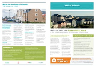
- 1. The plan provides you with a chance to tell us how you think homes, transport and infrastructure should be provided in the West of England over the next 20 years. It’s essential that people take this early opportunity to get involved in shaping this plan. It will play such an important part in the future of our area. Find out more and have your say, visit www.jointplanningwofe.org.uk HAVE YOUR SAY What are we trying to achieve? The vision for 2036 By 2036, the West of England will be one of Europe’s fastest- growing and most prosperous areas, with the gap between disadvantaged and other communities closed and a rising quality of life for all. The area’s rich and diverse environmental character will be integral to health and economic prosperity. Patterns of development and transport will support healthy and sustainable lifestyles. Communities will be well integrated, attractive and desirable, supported by the necessary infrastructure. New development will be resilient to, and reduce the impacts of, climate change. OBJECTIVES The development of the Joint Spatial Plan will be guided by some key objectives. Housing and wellbeing: The plan should account for enough new and affordable homes to meet needs until 2036 whilst ensuring enough short term supply to provide flexibility and choice on a local level. The pattern, location and nature of development should promote healthy lifestyles. Economy: It should support economic growth of existing employment centres and in new locations able to support the scale and type of job generation identified in the Strategic Economic Plan for the West of England. Transport and infrastructure: It should ensure new development is provided with the necessary infrastructure and should not exacerbate existing pressures. New housing and employment locations should facilitate public transport and active travel methods, rather than exacerbate unsustainable travel patterns. Environment: It should maintain and enhance the environmental quality, attractiveness and character of the West of England’s towns, cities, villages and countryside and respond to the challenges of climate change. The use of brownfield land should be maximised. WHAT DO YOU THINK? The scenarios all have their pros and cons and we want people to tell us what they think. Here are some of the questions we’re considering: • Have we identified all the issues that we will need to consider? Are there any issues missing? • Do you have any comments on the proposed vision? • Have we identified all the objectives that we will need to consider? Are there any others you would like to see? • Do you have any comments about the employment issues we have identified? Do you have any thoughts about where it could be located? • Do you have any comments about the number of homes we are planning for? • Is our approach to building more homes in Bristol and our main towns appropriate? • Do you think we have identified all of the potential strategic locations for new homes? How suitable do you think they are? Are there any missing? • Which spatial scenario, or mix of scenarios, do you think would best deliver the homes the area needs? • What transport and other infrastructure do you think these scenarios would need? 14 WHAT NEXT? This is just the start. We want to hear your views on the Joint Spatial Plan – your views are important and will help shape the Plan as we go forward to prepare the Draft Plan next year. Comments can be made on anything relating to the Plan until 5pm on Friday 29 January 2016. Find out more and make comments via our website: www.jointplanningwofe.org.uk You can also email any comments to: comment@jointplanningwofe.org.uk Alternatively, information is available from main council offices, any of our libraries and one stop shops. All completed response forms or any other correspondence should be posted to: West of England Joint Planning Consultation, c/o South Gloucestershire Council, PO Box 299, Corporate Research and Consultation Team, Civic Centre, High Street, Kingswood Bristol, BS15 0DR. NOTE: All comments will be published and made publicly available. Please note that the name of the person or organisation responding cannot be kept confidential. Once the consultation period closes, all responses will be carefully considered and used to help prepare the next stage of the Plan – the Draft Plan, which we aim to publish during Autumn 2016. This will be another chance for you to have your say before the four authorities agree on the Joint Spatial Plan that will be submitted to government. Again, this will go out to consultation, before submission in mid-2017. Following examination in public, the Joint Spatial Plan could be adopted in early 2018. WEST OF ENGLAND JOINT SPATIAL PLAN A new framework for meeting our housing and transport needs People across the West of England have the opportunity to shape a new blueprint for development which will help determine where new homes and workplaces would be built over the course of the next generation. The West of England’s four local authorities are working together to prepare a new Joint Spatial plan, which will set out its ambitions for new housing and associated infrastructure needed to secure its continued economic growth and create stronger sustainable communities. Launched in June 2015 alongside a Joint Transport Study, the plan will see Bath and North East Somerset Council, Bristol City Council, North Somerset Council and South Gloucestershire Council work together to deliver a prospectus for sustainable growth. By developing a joint strategy that integrates with a transport plan, the four local authorities are leading the way in tackling what is now a serious issue across the UK. The West of England is an economically successful area, and is worth around £26bn to the UK economy every year. But it faces challenges in delivering new housing and bringing forward transport programmes and other infrastructure that will create strong communities and support future prosperity. There is a real and growing need for new and affordable homes to be built in the West of England. Estimates state that the area needs at least 85,000 new homes by 2036, nearly 29,000 more than what’s already planned. If we are to continue to prosper economically and enjoy the good quality of life and environment that makes the West of England such a great place to be, we need an inclusive plan that sets the parameters for development in the right areas for the next generation. Let’s be clear from the start • This plan is about delivering the homes needed for future generations: affordable, well-designed, well-located and well-connected. • The West of England needs to plan for more homes if it is to meet the area’s growing need for housing and continue to be economically successful. • The West of England’s local authorities are committed to providing the homes and transport that the area needs in a sustainable way. The Joint Spatial Plan will set out their commitment to a forward-thinking approach to guide future housing development in the West of England. • Securing funding for infrastructure and transport is an essential part of our long-term approach. The Joint Spatial Plan will support the provision of infrastructure to unlock the homes the area needs. • We recognise that the need for growth and new homes must be balanced by maintaining quality of life and a strong environment: these are things that make the West of England so successful. • The focus for new housing should be on previously developed land. We aim to make best use of urban sites and minimise the need for development on green spaces.
- 2. Key information - the options What are we planning for? 32 Our research suggests that we need to plan for and build at least 85,000 homes over the next 20 years. Around 56,000 homes are already planned for with planning permission or sites already allocated. So where could the additional 29,000 homes be built? We also need to plan for employment growth alongside transport and other essential infrastructure such as schools and health facilities. Our plan is being prepared alongside work on a Joint Transport Study which will be completed at the end of 2016, with the preferred packages incorporated in the draft Joint Spatial Plan. Further information about the transport issues is in the transport summary document. HOW CAN WE DELIVER THE HOMES WE NEED AND WHERE CAN THEY GO? Nothing has been decided yet as to where the locations of new housing and employment sites for the next 20 years will go. The Joint Spatial Plan is strategic, rather than specific, and it will identify broad locations for growth. Following testing and further research, some of these locations may be deemed inappropriate; meanwhile other locations not detailed here may come into consideration. Not all the locations identified will be developed. There are various forms of development which could deliver the needs for new homes and employment. These feature significantly in the ideas set out here. These are: URBAN INTENSIFICATION: Opportunities to deliver additional development within urban areas. There are opportunities for urban development in our larger urban areas, where sites once used for other purposes could usefully be repurposed for housing. Developments within urban areas are able to benefit from existing transport systems although this has to be balanced with the potential impact on congestion. URBAN EXTENSION: A planned expansion of the urban area into adjacent countryside. In parts of South Gloucestershire to the north and east of Bristol, there are areas that could be expanded. South West Bristol, an area taking in land in Bristol City Council and North Somerset Council, is also a possibility. An extension to Weston-super- Mare could also be considered. Within the Bath and North East Somerset local authority area, there are potential locations on the south eastern edge of Bristol. TOWN EXPANSION: Planned expansion of existing towns which are detached from our main urban areas. There could be potential for expansion of our towns in North Somerset, South Gloucestershire and the Bath and North East Somerset area. OTHER LOCATIONS: This generally covers smaller opportunities, such as village expansion or a cluster of sites being brought together to form a strategic option. We have also identified that housing growth could be delivered through development of new settlements - although no specific locations are currently identified. Five Spatial Scenarios Taking into account national planning policy, here are five different scenarios for the way that this development could potentially be delivered. Each of the scenarios is assessed as to how it would impact in four key areas: housing and wellbeing; economy; transport and infrastructure; and the environment. #1. PROTECTION OF THE GREEN BELT BACKGROUND: There is a Green Belt around Bristol and Bath which covers nearly half of the West of England. The Government attaches great importance to Green Belt areas and boundaries should only be altered in exceptional circumstances. Our Green Belt is highly valued and has made a substantial contribution to the character and sense of place within our area. In addition to development within our urban areas there are areas outside the Green Belt where growth could be located. THE CASE FOR: Retention of the Green Belt prevents urban sprawl, demarcates existing towns and villages in the Green Belt and encourages regeneration and the re-use of brownfield land. However, it is possible that not all the new homes required can be provided elsewhere within the area, which could lead to some changes to the Green Belt. The impact on things like the supply of affordable homes, investment in transport and potential increase in commuting are all factors that would need to be considered here. There remain significant areas where sustainable growth could be located while protecting the general extent of the Green Belt. ALTHOUGH: There is a wide distribution of potential sites, meaning that delivery of housing would most likely be consistent over time. Development outside the Green Belt could add to the urbanisation of other areas and mean that development would be more remote from Bristol, making the case for transport investment stronger. KEY IMPACTS? Green field land close to Bristol is retained, but development beyond the Green Belt would be potentially less effective at supporting sub-regional growth than other scenarios and could lead to a rise in commuting. #2. CONCENTRATION AT BRISTOL URBAN AREA BACKGROUND: Bristol is an important and vibrant regional centre, and the main focus for jobs, housing, facilities and services in the West of England area. It is thus seen by many as the main economic driver, the engine of growth for the whole area. The objective of this scenario is to test the implications of focusing as much growth as possible within Bristol. THE CASE FOR: By focusing as much growth as possible in and around the urban Bristol area, it will maximise accessibility to jobs and services. Concentrating development in Bristol would mean less impact on more rural parts of the West of England. ALTHOUGH: Housing would be delivered in large sites, potentially reducing choice. Urban extensions require long lead-in times and may require significant infrastructure investment. It could also impact on the inner edge of the Green Belt. KEY IMPACTS? There could be changes to the inner edge of the Green Belt which could have a significant impact on the countryside surrounding Bristol. The impact on transport could be mixed, with shorter travel times and alternatives to the car available, although it has the potential to increase congestion and may require significant infrastructure investment. #3. TRANSPORT-FOCUSED DEVELOPMENT BACKGROUND: This scenario is focused on locations judged to work due to their access to sustainable transport choices – urban areas that already have good travel choices are the priority for development. There could be a combination of urban intensification, South Bristol urban extensions and public transport focused development. THE CASE FOR: Commuter distances tend to be shorter, meaning more walking and cycling, while there could also be a focus on locations with rail access. In addition, the critical mass of people in urban areas supports more viable public transport. It’s an opportunity to create sustainable new communities with good accessibility to urban areas. ALTHOUGH: The impact of development on congestion is a factor that cannot be ignored, and means that a package of transport measures is essential to support this scenario. The need for transport investment first means it might be more difficult to deliver homes in the short term. It could also mean changes to the Green Belt. KEY IMPACTS? It scores well on housing and wellbeing, economy and transport and infrastructure, but could have an impact on parts of the Green Belt and on some areas of the countryside outside the Green Belt. #4. A MORE EVEN SPREAD OF DEVELOPMENT – BRISTOL AND OTHER TOWNS BACKGROUND: This scenario explores the benefits of a more even spread of development across the area, rather than focusing mainly on Bristol – recognising the West of England is a diverse area with a wide range of towns, villages and cities each possessing different qualities and offering different opportunities. This scenario could use different locations for development, potentially including a mix of urban extensions, town expansions and development in other settlements. THE CASE FOR: A greater variety of locations could mean homes are built more quickly and could help to support development in different areas. It could also respond to local community needs in locations across the West of England. A greater range of sites is also likely to have housing delivery benefits in terms of providing more variety, choice and increasing housebuilding levels. ALTHOUGH: This scenario may be much less effective in transport terms and some alteration to the Green Belt may be necessary. KEY IMPACTS? This scenario could be less effective in transport terms but may provide the opportunity for targeted investment in certain areas. In terms of the economy, it is less focused on Bristol, but has the potential to support local objectives. #5. FOCUS ON A NEW SETTLEMENT OR A LIMITED NUMBER OF EXPANDED SETTLEMENTS BACKGROUND: This scenario considers opportunities to concentrate development into a single or small number of strategic new locations which would complement the overall functioning of the plan area. THE CASE FOR: This scenario would see settlements – villages and small towns, existing or new - expand over the lifespan of the plan and beyond. It’s an opportunity to create new, balanced communities, and there is also the potential to develop significant new employment hubs. There is unlikely to be a significant impact on the Green Belt. ALTHOUGH: Delivery is potentially an issue: there are no current plans for a major new settlement within the plan period. It is likely to require significant investment in transport and other infrastructure, reducing the ability to address pressing issues elsewhere. It would mean a significant change to the local environment where a new settlement is located. KEY IMPACTS? Potentially long lead-in times mean that this scenario doesn’t score well on housing and wellbeing in the shorter term, and it would also require a lot of transport and infrastructure investment. It does score well on economy however, as it has the potential to deliver new employment. A38A38 A370A370 A37A37 A4A4 A4174A4174 A46A46 A46A46 A36A36 A420A420 A38A38 M5M5 M5M5 M4M4 M32M32 M48M48 M49M49 M4M4 Note: Locations are illustrative only and must not be taken to imply any specific development site or a preference for identified options Urban intensification Mapping the strategic locations Urban extension Town expansion Other settlements/locations Motorway Railway line A Road Council boundary River Green Belt Portishead Keynsham Winterbourne, Frampton, Coalpit Heath Pucklechurch Saltford Pill Long Ashton Bristol Port South West Bristol WhitchurchWeston-super-Mare Hicks Gate North of M4 / M5 East of Bridgeyate/Oldland East of Kingswood/Warmley Peasedown St John Temple Cloud / Clutton Weston-super-Mare Bath BATH & NE SOMERSET BRISTOL NORTH SOMERSET SOUTH GLOUCESTERSHIRE Bristol Clevedon Midsomer Norton & Radstock Yate/Chipping Sodbury Thornbury Charfield Avonmouth (employment) / Severnside Backwell Churchill Banwell Yatton Nailsea Bristol AirportBristol Airport Note: Locations are illustrative only and must not be taken to imply any specific development site or a preference for identified options