Virginia History of Roads, V-DOT
•
1 like•2,008 views

Virginia History of Roads, Created and Presented by V-DOT. Brought To You By; Gloucester County, Virginia Links and News

Recommended
More Related Content
What's hot
What's hot (20)
Viewers also liked
Viewers also liked (17)
Similar to Virginia History of Roads, V-DOT
Similar to Virginia History of Roads, V-DOT (20)
More from Chuck Thompson
More from Chuck Thompson (20)
Recently uploaded
Recently uploaded (20)
Virginia History of Roads, V-DOT
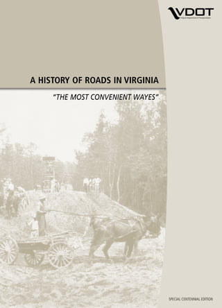
- 1. A HISTORY OF ROADS IN VIRGINIA “THE MOST CONVENIENT WAYES” A HISTORY OF ROADS IN VIRGINIA “THE MOST CONVENIENT WAYES” Amherst County road today An 850-gallon basin water fountain was installed at the Amherst traffic circle at the intersection of Route 60 and Route 29 Business in June 2006. It is the oldest traffic circle in Virginia. The exact location of the 1910 cover photo showing removal of wet subgrade in Amherst County is unknown, but it is believed to be Route 60. Produced by the Virginia Department of Transportation Office of Public Affairs 1401 E. Broad Street Richmond, VA 23219 VirginiaDOT.org ©2006, Commonwealth of Virginia 5m/October 2006 SPECIAL CENTENNIAL EDITION
- 2. A HISTORY OF ROADS IN VIRGINIA “THE MOST CONVENIENT WAYES” Produced by the Virginia Department of Transportation Office of Public Affairs 1401 E. Broad Street Richmond, VA 23219 (804) 786-2802 (TTY users, call 711) vdotinfo@VirginiaDOT.org VirginiaDOT.org © 2006, Commonwealth of Virginia, 7.5m/October 2006
- 4. A HISTORY OF ROADS IN VIRGINIA 3 A HISTORY OF ROADS IN VIRGINIA “THE MOST CONVENIENT WAYES” The Virginia settlers, who arrived at Jamestown Island aboard three small ships on Early colonists considered May 13, 1607, had little need for a road system. waterways to be the most important Barely more than 100 in number, their first concerns were disease, hunger, shelter, and transportation links. protection from the often hostile Indians who had lived on the land for generations. In those first rigorous years, survival demanded the full energy of the colonists in the wilderness. The waterways were there for transportation—the great rivers that emptied into the Chesapeake Bay and that were to become known as the James, the York, the Rappahannock, and the Potomac. As the colonists hunted for food and cautiously began exploring the forest, they discovered a crude network of paths made long before by Indians and wild animals. The colonists used these, and many of the paths were to shape the Virginia road pattern for years to come. The settlers also found roughly built bridges made of tree trunks and limbs, which they at first believed to be Indian-planted traps rather than bridges. By 1610, with new arrivals from England, the colony numbered 210. The road along the River Bank, probably a former Indian path, was used to haul supplies from the ships to the Jamestown Fort. The Greate Road appears to have been Jamestown’s main street, and it was of early commercial importance. It crossed the isthmus connecting the island with the mainland at Glass House Point, where in 1608 glass was manufactured for export. Faint traces of the road are evident today at Glass House Point.
- 5. 4 A HISTORY OF ROADS IN VIRGINIA Eventually, the Greate Road extended on the mainland to Middle Plantation, a settlement to become known as Williamsburg and destined to be the capital of the Virginia colony and the hub of the colonial road system. The first bridge recorded as having been built by the English settlers was constructed in 1611 at Jamestown Island. It wasn’t really a bridge, but a wharf about 200 feet long from the bank of the James to the river channel, where the settlers docked their ships. The colony’s first agricultural crops raised for export were rolled to these ships. John Rolfe had begun experimenting with the cultivation of tobacco in 1612 and two years later exported a shipment to England. In less than 20 years, tobacco exports had reached 500,000 pounds annually; tobacco would remain the foundation for the Virginia economy throughout the colonial period. Inevitably, the success of the tobacco crop was to influence the colony’s transportation needs as well. The tobacco fields spread on the mainland, and a number of the old Indian paths became tobacco rolling roads. The name came from the practice of packing the harvested tobacco in barrels called hogsheads and rolling them to the wharves, frequently a distance of miles. The rollers ordinarily tried to follow the high ground and avoid the fords, or shallow stream crossings, because water leaking through the barrels would damage the tobacco. The practice of following the old paths and branching off from time to time on higher ground accounts for many of the early meandering country roads. After two decades, the colony’s population was near 5,000 and growing. The frontier had been pushed well beyond its original boundaries, and while much of the settlers’ travel was still by boat, an increasing proportion was on land.
- 6. A HISTORY OF ROADS IN VIRGINIA 5 AMERICA’S FIRST ROAD LAW The need for improving roads to better serve the social and economic life of the colony Much manual labor was the was among the matters facing members of the House of Burgesses as they met in requirement for building and Jamestown in September 1632. maintaining early roads. Before adjournment, they had passed the first highway legislation in American history, an act providing, in the language of the day, that, “Highwayes shall be layd in such convenient places as are requisite accordinge as the Gov. and Counsell or the commissioners for the monthlie corts shall appoynt, or accordinge as the parishioners of every parish shall agree.” The first legislation also required each man in the colony to work on the roads a given number of days each year, a custom dating at least from the feudal period of the Middle Ages in England, or to pay another to work in his place. This labor law, to remain in effect for more than 250 years, provided the main source of workers for road and bridge construction. Twenty-five years later, probably in March 1657, the colony’s basic road law was broadened to provide “that surveyors of highwaise and maintenance for bridges be yearly kept and appointed in each countie cort respectively…” In 1661, the surveyors were empowered to select locations for roads, choosing “the most convenient wayes to Church, to the Court, to James Towne, and from County to County.” By the end of the 17th century, many miles of primitive roads threaded throughout Tidewater Virginia. The colony’s population had reached 70,000. While horseback
- 7. 6 A HISTORY OF ROADS IN VIRGINIA was the most frequent means of overland travel, horse-drawn carts became more numerous, and some carriages and coaches gradually appeared. In 1705, the legislature passed a new road act providing for “making, clearing, and repairing the highways and for clearing the rivers and creeks... for the more convenient traveling and carriage, by land, of tobaccos merchandise, or other things within this dominion… ” The new road act provided for further extension of the road system and required that the roads “be kept well cleared from woods and bushes, and the roots well grubbed up, at least thirty feet broad.” The new law also provided for skilled labor to erect bridges larger than could be built by the local surveyors, and when such a bridge was to cross a county line, its cost would be divided “proportionable to the number of tithables in each county.” Other road laws came quickly in the early years of the 18th century. Owners of mill dams were required to provide a 10-foot passage on dams and spillways; it became mandatory for a county in which an iron furnace was operated to provide “good roads to be laid out and made from such works to the nearest place upon some navigable river or creek.” Establishment of public ferries was authorized by the legislature. In 1716, Alexander Spotswood, regarded by many as perhaps the best of the colonial governors, led his “Knights of The Golden Horseshoe” up the summits of the “Great Mountains,” the Blue Ridge, and looked down in amazement at the splendor of the Shenandoah Valley. Spotswood, a former soldier, recognized that settlement of the valley could help protect eastern Virginia from hostile forces. It was in the next quarter-century that the valley and much of the Piedmont, the rolling country between the mountains and Tidewater, were settled by pioneers moving inland and by many others who came down into the valley from Pennsylvania and New Jersey. Extending north and south through the valley was a relatively good Indian path, called by various names including the Appalachian Warriors’ Path and the Shenandoah Hunting Path. By the mid-18th century, it had been developed into the Great Wagon Road, which eventually led from Pennsylvania southward through the valley and on to Georgia. Toward the southern end of the valley, the Great Wagon Road separated into two branches near Big Lick, later to become Roanoke. While one branch left the valley and went due south, the other continued west and crossed Cumberland Gap through the Allegheny Mountains at what now is the junction of the Virginia, Kentucky, and Tennessee borders. After Daniel Boone and a band of frontiersmen cleared a path into Kentucky about 1775, the western branch became known as the Wilderness Road, and it was to become the main pioneer route along which traveled the first waves of the great migration to the West. East of the mountains, two principal routes led from where Richmond stands today deep into the interior. One was a path to the settlements that were to become Lynchburg and Roanoke, a course now followed approximately by U.S. Routes 60 and 460. The other was the Three-Chopt Road or Three-Notched Road to Albemarle, where it connected with another path leading across the mountains at Afton and into the valley. Its name came from the way it was marked to guide travelers, with notches cut on the trees.
- 8. A HISTORY OF ROADS IN VIRGINIA 7 In his “Notes on the State of Virginia” in 1785, Thomas Jefferson described the approach to handling road matters. “The roads are under the government of county courts, subject to be controlled by the general court. They order new roads to be opened wherever they think them necessary. The inhabitants of the county are by them laid off into precincts, to each of which they allot a convenient portion of the public roads to be kept in repair. Such bridges as may be built without the assistance of artificers (skilled workers or craftsmen), they are to build. If the stream be such as to require a bridge of regular workmanship, the county employs workmen to build it at the expense of the whole county. If it be too great for the county, application is made to the General Assembly, who authorizes individuals to build it and to take a fixed toll from all passengers, or gives sanction to such other propositions as to them appear reasonable. Ferries are admitted only at such places as are particularly pointed out by law, and the rates of ferriage are fixed.”
- 9. 8 A HISTORY OF ROADS IN VIRGINIA
- 10. A HISTORY OF ROADS IN VIRGINIA 9 TURNPIKE ERA Road building in the latter stages of the 18th century and much of the 19th century was The ravages of Civil War marked by the development of many turnpikes or toll roads. As Jefferson observed, toll campaigns left many of financing provided a means of building highway facilities for which there was a need Virginia’s roads in ruins. but which were too complex and costly to be constructed by the counties alone. For the most part, Virginia counties were impoverished and exhausted from their contributions of men, supplies, and other resources to the Revolutionary War. The turnpike era offered a new way of meeting road needs. The turnpike got its name from its toll gate. When first designed, the gate was a turnstile consisting of two crossed bars pointed at their outer ends and turned on a vertical bar or pole. In 1772, the Virginia legislature cleared the way for what probably was the first toll road in America, when it authorized Augusta County to build a highway over the mountain between Jenning’s Gap and Warm Springs and to establish a toll gate. The road, as outlined by the legislature, was to be financed with 300 pounds advanced by the colony and 900 pounds raised by a lottery. Revenue collected from travelers was to be spent for the upkeep of the road and “towards building... housing for the reception of the poor sick resorting to the said springs.” In 1785, five years after Richmond had become the state’s capital, the legislature appointed a commission to erect toll gates on existing roads in the Alexandria area to increase road revenue. The Fairfax and Loudoun Turnpike Road Company was chartered in 1795 to construct an improved road between Alexandria and Little River in Fairfax County. It accomplished little, however, and was followed in 1802
- 11. 10 A HISTORY OF ROADS IN VIRGINIA by the Little River Turnpike Company which, in 1811, completed a 20-foot- wide turnpike extending west from Alexandria for about 34 miles. It operated as a toll road for nearly a century, and its completion touched off construction of many turnpikes in Virginia by the time of the Civil War. Virginia’s population by 1800 had climbed to 880,200, with settlers in most of the major regions that make up the present state. This growth and expansion led the General Assembly in February 1816 to establish the nation’s first state board of public works and to create a fund for internal improvement. The board, with the governor serving as president, was empowered to appoint a “principal engineer” for the state, and it existed until 1902. Its formation coincided with the beginning of the nation’s canal era. The board was responsible for chartering, finding, and supervising internal improvements. The fund, amounting to more than a million dollars, was created to transfer shares, owned by the state, in the stock of the Little River Turnpike Company, the Dismal Swamp, Appomattox, Potomac, and James River Canal companies and in two banks. Money in the fund was to be used to match private capital in financing improvements. The office of the principal engineer provided important resources for the location, design, and construction of transportation facilities in Virginia for years to come. The first principal engineer, Laommi Baldwin Jr., held office from 1816 until 1818, when he resigned. Baldwin was succeeded by Thomas Moore, who served until his death in 1822. Moore then was followed by Claudius Crozet, an engineer who was to have deep influence on Virginia transportation. Crozet had been a French artillery officer under Napoleon Bonaparte before coming to America. He also had been a distinguished teacher at the United States Military Academy at West Point. In Virginia, he served two terms as principal engineer, 1823-31 and 1838-43. The break in his service reflects the continuing dilemma of those faced with the responsibility for applying the results of a rapidly changing technology to large-scale public works. One of the major efforts supported by the board of public works was the James River and Kanawha Canal, which was intended to improve communication and trade between the populous and politically powerful eastern Virginia and the comparatively isolated western regions of the state. Development of the canal had started in 1785, but it had not advanced as rapidly as its promoters had hoped. A new and serious obstacle to its success appeared in 1829, when the Stourbridge Lion, an early locomotive, was imported to the United States from England. A year later, Crozet suggested that in view of this exciting new invention, a steam railroad would be preferable to the canal to link east and west. It was a bold idea indeed, because until then no railroad using steam locomotives had been operated in this country. Moreover, it was a controversial idea; powerful forces in the state wanted completion of the canal. Largely as an outgrowth of the controversy, the board of public works was reorganized by the legislature in 1831 with a requirement for annual legislative approval of the principal engineer. In addition, Crozet’s salary was reduced from $3,500 to $2,500. Crozet resigned and spent the next six years in Louisiana.
- 12. A HISTORY OF ROADS IN VIRGINIA 11 Crozet returned to his former position in Virginia at the beginning of 1838, and although his position favoring railroads over canals ultimately proved correct, the controversy remained. It ended in 1843 with an act stating “that the office of chief engineer of the state be and the same is hereby abolished.” Shortly afterwards, Crozet became principal of Richmond Academy in downtown Richmond, but in 1849 he responded to the pleas of his former opponents and returned to engineering to direct construction of a rail road through the mountains. The community of Crozet in Albemarle County is named for him. During calmer days as state engineer, Crozet also was responsible for building highways through the mountains, as well as in other regions. One of the principal roads was the Northwestern Turnpike, which emerged in 1827 as Virginia’s bid for the profitable trade of the territory northwest of the Ohio River. Legislation incorporating the turnpike authorized subscriptions from the townspeople of Winchester, where the road was to begin, and of the other communities along the way. But its authors chose a route to serve the most populous towns without much regard for the difficult terrain. Little progress was made. In 1831, the legislature provided for a company, with the governor as president of its board of directors, to borrow money and construct the turnpike with a minimum width of 12 feet “from Winchester to some point on the Ohio River to be situated by the principal engineer.” The turnpike eventually reached the Ohio River, and its gentle grades and alignment, developed largely under Crozet’s direction, made it one of the good roads of its day. The course it followed is largely that used today by U.S. Route 50. The Valley Turnpike was another important 19th century road developed during this period. Incorporated in 1834, the Valley Turnpike Company was authorized by the legislature to improve the route between Winchester and Harrisonburg — part of the ancient Indian Warriors’ Path and the Great Wagon Road followed by the early pioneers. The improvements were financed largely with $25 shares sold to private citizens and were completed in 1840.
- 13. 12 A HISTORY OF ROADS IN VIRGINIA
- 14. A HISTORY OF ROADS IN VIRGINIA 13 EARLY PAVING METHODS While most roads remained dirt and in miserable condition, the turnpikes, relying on Plank roads were introduced income from travelers for their existence, were provided in most instances with gravel, from Canada in the 19th broken stone, wood, or macadam surfaces. century, sometimes with jarring results. The old Manchester Pike near Richmond had been surfaced with gravel in 1808 and was recognized as the first “artificial” or paved road in the state. The widely used macadam surface was named after its developer, John Loudon McAdam, a Scottish- born engineer who began building roads in England in the early 19th century. McAdam is credited as the first to recognize that dry soil itself generally would support the weight of traffic and that pavement was necessary only to provide a smooth riding surface and to ensure dryness. The macadam pavement consisted of crushed rock packed tightly into thin layers, with a top surface of sand or finely crushed stone rolled to provide a well-bound surface resistant to the penetrating damage of rain, ice and snow. McAdam generally specified a uniform thickness of seven to 10 inches for the finished road, although some ranged at least to 18 inches in thickness. The specifications for one macadam road provided for the first layer of stone to be “cast on with a shovel to a depth of six inches, after the manner of sowing grain.” It was to be compacted with a cast-iron roller, “prepared with a box, or a cart bed, to carry two or three tons of sand” and rolled until “sufficiently solid and compact to receive the second layer.” After dressing the surface “with a rake or otherwise,” the second layer, three or four inches thick was to be “put on, rolled, and prepared in all respects as the first stratum was, until in a state of firmness and solidity, proper to admit the third or last stratum, which can then be put on, and the surface
- 15. 14 A HISTORY OF ROADS IN VIRGINIA raked and dressed to such shape and form as may be required, and also rolled until satisfactorily compacted.” Part of the Lynchburg-Salem Turnpike was the first segment of road to be macadamized in Virginia. The Valley Turnpike and the Southwestern Turnpike, between Salem and Seven Mile Fork near Marion, were others. Wooden pavements were also used widely in the turnpike era, perhaps naturally, since standing timber was abundant over much of the state. “Corduroy” roads were built by placing small logs side by side along a cleared path and covering them with dirt for smoothness. The “plank” road was introduced in the United States from Canada, where some 500 miles were laid between 1834 and 1850. A typical plank road had a single track about eight feet wide, with the planks placed crosswise. Later, they were inclined slightly to allow rainwater to drain. By the mid-19th century, the railroads Crozet had favored were handling much of the long-distance movement of passengers and freight. This posed a new problem for the turnpikes, many of them already financially troubled. The railroads gained such great popularity that apathy developed toward road improvements. For the turnpikes, it meant reduced use and revenue. For other roads, it meant that many remained little more than dirt paths, impassable after heavy rains or during winter thaws and raising choking clouds of dust at other times. With the outbreak of the Civil War in 1861, roads and railroads became immensely important to both Confederate and Union armies. The transportation arteries often governed the outcome of battles. The armies fought over them, guarded them, rebuilt them and constructed new ones. Food, clothing, medical supplies, guns, ammunition, and men moved by road and by rail. In September 1861, Gen. Robert E. Lee, writing from a mountain encampment to Gov. John Letcher, said, “Our greatest difficulty is the roads. It has been raining in these mountains about six weeks. It is impossible to get along. It is that which has paralyzed all our efforts.” Two years later, then commander of the Army of Northern Virginia, Lee wrote, “It has been raining a great deal… making the roads horrid and embarrassing our operations.” Some wagons simply broke down on the road from the mud and rocks. Other military commanders on both sides could tell similar stories of how road conditions often hindered their operations. Poor to begin with, the roads and bridges were damaged and destroyed as the armies fought over them repeatedly. The company that operated the Valley Turnpike reported that its revenue collections were negligible because “of the army destroying bridges, injuring toll houses, and we are getting very little tolls.” For most of the turnpike companies, the war was the final blow from which they could not recover, and many passed from private to county ownership. Toll collections on most of the turnpikes never had been enough to pay operating and maintenance costs or to do much toward retiring the indebtedness, and the extensive but financially weak turnpike era was nearing an end.
- 16. A HISTORY OF ROADS IN VIRGINIA 15 A few toll facilities, the Little River and Valley turnpikes among them, somehow managed to recover sufficiently from the rages of war to remain in operation into the early 20th century. But a constitutional amendment in 1874 decreed that the state government could no longer invest in turnpike company stock. The risk was too great. After the war, the state’s board of public works turned mainly to matters other than roads, and in the counties there developed a widely varying patchwork of road development practices. Twenty-five years after the war, Virginia’s roads were far worse than when the war began. This was true despite the fact that, in the Reconstruction period, the General Assembly enacted much road legislation. The problem was that much of it was confusing and meaningless, and sometimes humorous. One law made it illegal to drive or lead a bear on a public highway, and another set a fine of $5 for a pedestrian who crossed a bridge at a pace greater than a walk. A series of events late in the 19th century and early in the 20th century, however, were about to revolutionize man’s mode of travel.
- 17. 16 A HISTORY OF ROADS IN VIRGINIA
- 18. A HISTORY OF ROADS IN VIRGINIA 17 AUTO AGE BEGINS In Springfield, Mass., in September 1893, what generally is accepted as the first Pulling autos out of the mud American gasoline-powered automobile was given a short road test by its builders, was a sideline business for brothers Charles E. and J. Frank Duryea. many Virginia farmers. That same year in Washington, the Congress established the United States Office of Road Inquiry, directing the Secretary of Agriculture “to make inquiries in regard to the system of road management throughout the United States,” to investigate methods of road building and to assist in disseminating information about the nation’s roads. Good roads societies were organized in many states, and in Virginia this movement dates at least to 1894. It was then that the Young Business Men’s League of Roanoke took leadership in forming the Virginia Good Road Association. Local meetings and statewide conventions were held, and enthusiasm grew swiftly. In September 1895, the Duryea brothers established the first American company to manufacture gasoline driven cars, the Duryea Motor Wagon Company. In 1904 the Ford Motor Company produced 1,695 cars, and by 1907 had increased its production to 14,887. The last decade of the 19th century was called the Gay ‘90s, and the daring new mobility was a part of the mood. What is believed to have been the first automobile of any kind operated in Virginia was driven along Norfolk streets in 1899, powered by kerosene. Eleven years before that significant event, the world’s first commercially successful streetcar system had begun in Richmond. The state’s population had grown to 1,854,184, and while the population was about 85 percent rural, Richmond could count 85,000 residents.
- 19. 18 A HISTORY OF ROADS IN VIRGINIA Throughout Virginia, as throughout the nation, the public’s delight with the automobile was mounting by leaps and bounds. But in most places, the roads weren’t ready for this “horseless carriage.”
- 20. A HISTORY OF ROADS IN VIRGINIA 19 GETTING ORGANIZED FOR BETTER ROADS Two governors in this period gave strong support to the mushrooming good roads An early Virginia roadway movement. They were Andrew Jackson Montague, the state’s chief executive from crew stops work to pose 1902 to 1906, and his successor, Claude A. Swanson, who served until 1910. Their for a photograph. recommendations to the General Assembly in 1906 helped set the state government’s course in road development for the years ahead. Meeting in Richmond, the legislature created the first State Highway Commission, giving final approval to the legislation on March 6, 1906. A state highway commissioner was appointed by the governor with General Assembly confirmation. Legislation required that the commissioner be a Virginia citizen, as well as a “civil engineer and a person well-versed in road-building.” Legislation also dictated that the commission was to include three professors of civil engineering, one each from the University of Virginia (U.Va.), Virginia Military Institute (VMI), and what was then Virginia Agricultural and Mechanical College and Polytechnic Institute at Blacksburg. These commission members were chosen by the boards of visitors at the respective institutions. Gov. Swanson appointed Philip St. Julien Wilson, a Powhatan County native and a civil engineering graduate in the class of 1886 at VMI, as the first commissioner. Wilson was 38 and serving as assistant city engineer for Richmond at the time of his appointment. Joining Wilson on the first commission were William M. Thornton, dean of the engineering department at U.Va.; Col. T. A. Jones, civil engineering professor at VMI; and Col. R. A. Marr, dean of engineering at Virginia Agricultural and Mechanical College and Polytechnic Institute.
- 21. 20 A HISTORY OF ROADS IN VIRGINIA The law specified that the commissioner “shall have a general supervision of the construction and repair of the main traveled roads in the state; the Commissioner may recommend to the local road authorities of any county, and to the Governor, needed improvements in the public roads; he shall supply technical information on road building to any citizen or officer in the state, and from time to time publish for public use such information as will be generally useful for road improvement.” While the counties kept the responsibility for actually making the improvements, they now had a new state agency to which they could turn for help. For example, they could apply to the commissioner for civil engineering advice, and if he concluded that a proposed project would be permanent and on a main road and that it was practical, his office would prepare detailed plans and specifications and, at the county’s expense, assign a civil engineer to supervise construction. The 1906 legislature also established the state convict road force as a source of labor. “All prisoners convicted of a crime and sentenced to either hard labor on the public roads or to imprisonment in jail and all persons imprisoned in jail for the non-payment of fine and costs, shall, when delivered upon order of the superintendent of the penitentiary for such purpose, constitute the state convict road force,” the statute read. For some years before, convict labor had been available to the counties for road work, but not more than half of the counties used it. After the 1906 legislation, the convict labor was channeled to roads that would benefit the whole state. The commissioner also encouraged county officials to look beyond their own borders to the importance of working toward a coordinated, statewide highway system because still, to the frustration of early motorists, an improved road in one county might shrink to a rutted trail or disappear entirely in another. Boat or train remained the most certain means of traveling long distances in reasonable comfort. In the commission’s first annual report to the governor and General Assembly in October 1907, Wilson shed light on the first year’s operation: “This department being newly established some time was necessarily required for organization and preparation for carrying out the provisions of the law to the best advantage,” he wrote. “Efforts along this line proved that men in the state who were familiar with the work of permanent road improvement were difficult to secure. Competent engineers and foremen are obtainable, but comparatively few with any experience in modern highway construction, and without the services of such men road work cannot be carried on to the best advantage.” Moreover, he added, “Much preliminary work had to be done by the county authorities before they were actually ready to begin work. The problem of raising the necessary funds to defray the counties’ portion of the expense was, in most instances, a difficult one, and met with many obstacles and delays. The machinery and equipment furnished by the counties has been, in several instances, very inadequate for the proper handling of the work.” For some months, he wrote, “great difficulty was experienced in securing prisoners from jails for service in the state convict road force, and the number of convicts in the state penitentiary who, under the law, were available for road work was very limited.
- 22. A HISTORY OF ROADS IN VIRGINIA 21 As a consequence, the organization of the first force was not completed until October 1906, and it was not until well on in December 1906, that we were able to put to work as many as five forces of about 50 men each.” Wilson observed that while criticism had been voiced in several quarters “about the undesirability, even inhumanity, of using convict labor on public works, all of which may have been justified,” the fact was that “the men in the road camps seem satisfied, and many have expressed to me a preference for this work to remaining in jail.” The commissioner, after barely more than a year on the job and engaged in what had become largely a mission of public education, also commented on the inadequacy of funds available for road maintenance. It was a problem that had plagued the turnpikes a century before, and it would continue for another decade. “This is a matter of the greatest importance, as even the best constructed roads require frequent, though not expensive, attention to keep them in good condition and to prevent the extensive and costly repairs that the lack of such attention will necessitate,” he wrote. “I would suggest than an amendment to the law be made to the effect that state aid will be extended to the construction of a road only upon condition that the county applying for such aid agree to make suitable provision for the up-keep of the improved road.” The first improvement project completed with the help of the commission was the road between Williamsburg and Jamestown Island. Most of the road was surfaced with gravel and a mixture of sand and clay; about two miles were macadamized. The General Assembly in 1906 had appropriated $16,000 to support the fledgling road program for the period from July 1, 1906, when the legislation became effective, to Feb. 28, 1908. It was to pay the salaries of the small staff—the commissioner, his assistant, a bridge engineer, a draftsman, a clerk, and a stenographer—and to furnish the offices and to purchase supplies.
- 23. 22 A HISTORY OF ROADS IN VIRGINIA
- 24. A HISTORY OF ROADS IN VIRGINIA 23 FIRST CONSTRUCTION APPROPRIATION IN 1909 By 1908, the need for better roads had reached the point that the legislature made its An Erie steam shovel first appropriation for construction purposes under the new state program—$25,000 is pictured in operation annually, beginning March 1, 1909, “out of any money in the state treasury not otherwise along with mule-drawn appropriated.” It was intended mainly for use in counties where convict labor was not dump wagons. available and was to be matched equally by the counties paying for road improvements. “This law does more than provide a very considerable additional fund for road improvement, as its requirement that a county shall raise an amount equal to its share of the fund before it can be obtained arouses the people to the importance of making extra efforts to provide money for improving the roads,” Wilson said. During this period, state law directed the counties to levy a road tax of up to 40 cents for each $100 in value on real estate and personal property, with the revenue to cover the counties’ share of improvements and to buy road equipment. In addition, the counties were authorized to issue bonds “for the purpose of macadamizing or otherwise permanently improving the public roads… or building bridges… ” By 1910, Virginians owned 2,705 motor vehicles, and the General Assembly decided the time had come to regulate their use. That year, the state’s first registration and licensing of motor vehicles was required, with registration fees of $5 for autos of 20 horsepower or less, $10 for those with 20 to 45 horsepower, and $20 for vehicles with more than 45 horsepower. A $2 registration fee was set for motorcycles and 235 were registered in 1910. The fees were to be paid into the state treasury as a special fund to be spent for improving main roads. Total revenue from the first year’s collections amounted to $21,656.
- 25. 24 A HISTORY OF ROADS IN VIRGINIA In 1910, the General Assembly also enacted the first controls on motor vehicle speeds in Virginia. Twenty miles an hour was the established limit in open country, while eight miles an hour was established in towns, around curves, and at key intersections. Three years later, with more than 10,000 motor vehicles in the state and the road program continuing to grow, Commissioner Wilson left Virginia to become chief engineer for the U.S. Office of Public Roads and Rural Engineering in Washington, an agency that had followed the Office of Road Inquiry. Wilson was succeeded by George P. Coleman, who had been his assistant since 1906. Even as the changeover in administration was occurring, Wilson again cited the nagging problem of inadequate road maintenance: “The expenditure of considerable amounts of money derived from long-term bonds by the various counties in the state for the construction of roads, and the evident lack of care of these roads after they have been constructed, demonstrates that unless some more adequate means for the maintenance of these roads is provided than has yet been provided by the several counties in which they have been constructed, there will come a time when the counties have little left but the debt which they have incurred,” Wilson said. Wilson also stressed that unless stringent maintenance requirements were imposed, “the expenditures made and the work of this department during the past seven years will have been as naught.” By that time, the counties had issued approximately $7 million in bonds. George Coleman agreed with his predecessor that this investment wasn’t being protected. Increasing use of roads made the problem even more urgent. By 1916, more than 37,000 motor vehicles were registered in the state. It would be a pivotal year for the road program in Virginia and nationally. In Richmond, the General Assembly passed an automobile maintenance law providing that income from vehicle license fees be placed in a special maintenance fund to be administered by the commission, in cooperation with county authorities and with expenditures to be matched equally by the counties. The legislature also began curing the headache of the state’s disjointed roads, some of which were smooth and hard-surfaced in one county and rutted dirt in the next. A study committee — consisting of three members of the state Senate, four from the House of Delegates, and the highway commissioner — was appointed to develop a plan for a state highway system to include the main roads between population centers. In Washington, meanwhile, increasing attention was being focused on the problems of improving roads that connected various states. Coleman had been a chief organizer of the American Association of State Highway Officials (later became AASHTO) in 1914. The group was formed by highway administrators in the states to provide a forum for discussion of technical, legislative, and economic matters and to strengthen the state-federal relationship on roads. One of the association’s first moves was to designate a committee to prepare proposed legislation for the Congress authorizing federal participation in construction of highways and encouraging better state-to-state coordination. Coleman was chairman of that legislation drafting committee.
- 26. A HISTORY OF ROADS IN VIRGINIA 25 The committee’s proposals were submitted to Congress in 1916 and were approved that year largely as presented. The new law provided for construction of rural public roads and defined them as “any public road over which the United States mails now are or may hereafter be transported.” Federal funds were not to exceed 50 percent of the cost of constructing improvements, and the states were to have the responsibility for maintaining the completed facilities. President Woodrow Wilson signed the Federal Aid Road Act on July 11, 1916. It was the federal government’s first comprehensive law aimed at establishing a nationwide highway system. When it was passed, America had 2,578,078 miles of public roads, 294,569 miles or 11.4 percent of which were surfaced. For the 1916-17 fiscal year, Virginia received approximately $100,000 in federal funds. The road between Hansonville and the Washington-Russell County line at Moccasin Gap, now U.S. Route 19, was the first road in the state to be improved with federal aid.
- 27. 26 A HISTORY OF ROADS IN VIRGINIA
- 28. A HISTORY OF ROADS IN VIRGINIA 27 STATE SYSTEM APPROVED; WWI INTERRUPTS PROGRESS During its 1918 session in Richmond, the General Assembly approved establishment of Route 1 near Dumfries the first state highway system, a network of 4,002 miles for which construction and as it appeared (from left) maintenance would be the direct responsibility of the highway commissioner and his staff. in 1919, the early 1930s, 1989 and 2006. Among the roads to be included was the old Valley Turnpike between Winchester and Staunton, which still was being operated as a toll road in 1918. As late as 1926, it remained the only hard-surfaced road of much distance. The so-called Richmond-Washington Highway, the often muddy predecessor of U.S. Route 1 and Interstate 95, also was included in the system. At the time, it was gravel and soil except for a short section of concrete south of Alexandria and a short macadamized segment north of Richmond. As on many roads, cars frequently had to be pulled by other vehicles or by horses through swamp-like areas in rainy weather and in winter thaws. A fully paved Route 1 was not completed until 1927. In 1918, the legislature also continued the convict road force, but limited its use to the new state system. In 1922, a law authorized the commission to expand the system each year by an amount of mileage equal to 21/2 percent of the original system. Subsequent additions also were made by other legislative action. In an extra session in 1919, the General Assembly made a significant change in commission organization. It was expanded from four to five members, who were to be appointed by the governor with the advice and consent of the Senate. More importantly, members were to be private citizens chosen to represent major geographic regions of the state. In addition, the governor was to appoint the commissioner, who would administer day-to-day operations.
- 29. 28 A HISTORY OF ROADS IN VIRGINIA Virginia’s road development was about to be interrupted, however, by circumstances far beyond the state’s borders with the outbreak of World War I. Coleman spoke of it this way: “The year opened up with orders from the federal government restricting the use of all cars and the practical confiscation of road materials for war purposes. The declaration of war by this country was followed immediately by a serious labor shortage and a consequent increase in the cost of labor and materials. These restrictions and increased costs were largely on such road materials as steel, cement, stone, gravel, sand, bitumens, and so forth… Approximately 80 percent of the engineers and specially trained men of the department entered the service of their country… We are making every effort to meet this condition with the funds at hand.” The state’s population had exceeded 2.3 million and more than 145,000 motor vehicles were registered.
- 30. A HISTORY OF ROADS IN VIRGINIA 29 FINANCING THE ROADS After the war, the road development program regained momentum and sought to Wet subgrade is removed in keep up with the growing popularity of the auto. More than 25,000 vehicles would be an Amherst County project. added to the state’s roads in a year’s time. Inevitably, questions persisted about how to raise additional highway revenue to meet the mounting needs. The state Constitution of 1869 had prohibited any state debt except to meet casual deficits in the revenue, to redeem previous liabilities, or to protect the state in the event of insurrection or war. The same restriction remained in a revised Constitution of 1902, but a later amendment, pushed by the Good Roads Association and approved by 61,000 votes in a 1920 referendum, had permitted the legislature to issue bonds to build or repair roads. Statewide political debate developed about using that permissive borrowing power, however. State Sen. Harry F. Byrd Sr. of Winchester, chairman of the Virginia Senate Roads Committee, opposed bonds and urged the levying of a tax of three cents on a gallon of gasoline to produce the revenue. Early in 1923, Gov. E. Lee Trinkle called an extra “roads” session of the General Assembly to decide a course of action. He recommended a temporary “pay-as-you-go” policy until the question of bonds could be considered again by the voters in a referendum. The legislature approved the Byrd gasoline proposal and ordered that a suggested $50 million bond issue be submitted to referendum in November. By a margin of some 46,000 votes, the citizens this time rejected the bond issue idea in what was considered in many ways a victory for rural voters. Only 19 counties voted for the bond issue, while it won approval in 17 of the state’s cities. The gasoline tax was destined to become the largest single source of revenue for
- 31. 30 A HISTORY OF ROADS IN VIRGINIA road building and maintenance and was to be increased gradually over the years. At the national level, a gasoline tax approved by Congress was to become the principal revenue source for the federally aided road program as well. Motor Vehicle Registration YEAR ����� ����� ����� �������� ����� ������������ ����� �������������� ����� ���������������������� ����� ��������� ����� ��������� ����� ��������� ����� ��������� ����� ��������� ����� ��������� � ��������� ��������� ��������� ��������� ��������� ��������� ��������� ��������� During the debate about financing, Virginia’s highway organization continued to be refined. In 1922, the legislature directed that the state be divided geographically into eight highway districts and that available funds be distributed among them in equal shares. Other organizational changes in the commission led to the appointment of Henry G. Shirley, who had been Maryland’s highway administrator, as chairman. Coleman stayed as highway commissioner until his resignation in 1923, and later the positions of chairman and commissioner were combined. In 1927, as part of a reorganization of state government, the Department of Highways was formally established as a state agency, although the commission staff had been called the “highway department” since the outset. As disconnected sections of improved roads were linked into continuous long- distance routes crossing many states, travelers found themselves steadily more bewildered by a confusing array of directional and informational signs. There was little continuity or standardization from state to state, and it was easy for motorists to get lost in unfamiliar territory. At the request of the American Association of State Highway Officials, the U.S. secretary of agriculture appointed a committee in March 1925 “to undertake immediately the selection and designation of a comprehensive and uniform scheme for designating such routes in such manner as to give them a conspicuous place among the highways of the country as roads of inter-state and national significance.” It was this move that led to the beginning of route numbers and to uniform signs for the convenience of motorists throughout the nation, and that produced
- 32. A HISTORY OF ROADS IN VIRGINIA 31 greater continuity in marking Virginia’s roads. The basic plan provided generally for assigning even numbers to east-west routes and odd numbers to north-south roads. By 1930, a total of 386,664 motor vehicles were registered in the state. The license tax produced $6,564,000 in revenue, and the gasoline tax produced $7,251,000. The state highway system had been increased to 7,191 miles. The counties, however, still were plagued by problems of improving and maintaining the local roads for which they were responsible. Most of those roads remained in extremely poor condition. Few counties had engineers on their staffs, and not many had the necessary equipment. And yet about two-thirds of the state’s workers earned their livelihoods from the land and faced the continuing need of hauling farm products to market. The Depression that swept the nation brought more serious problems, and most rural Virginians had little money to pay the property taxes that had continued as the main source of income for the county roads. In Richmond and in the district highway offices that had been established around the state, adjustments were made in road operations to aid as many families as possible during the economic crisis of the Depression years. During the fall of 1931, the commission found that under normal work schedules it could provide employment and wages for only a few additional workers. But a “stagger system,” providing jobs for one force of men one week and another force the next week and continuing the procedure through the construction season, made jobs and income available for 8,000 additional workers. The commission kept this system in effect throughout the Depression.
- 33. 32 A HISTORY OF ROADS IN VIRGINIA
- 34. A HISTORY OF ROADS IN VIRGINIA 33 THE SECONDARY SYSTEM It was against this background that the General Assembly in 1932 approved a means Highways and road by which the counties could be relieved of road construction and maintenance signs were vastly responsibility. The “Byrd Road Act” inspired by the former Winchester senator who improved by the 1930s. two years before had completed a term as governor, authorized the establishment of the state “secondary” road system. It permitted each county, if it wished, to give its road responsibility to the Highway Commission. One economist estimated that this action would reduce rural taxes by $2,895,102 annually. Four counties - Arlington, Henrico, Nottoway and Warwick - chose to keep the responsibility; the other counties joined the new secondary system. In 1933, Nottoway reversed its earlier decision and joined the system. Years later, Warwick gave up its county status to become a city that eventually merged with Newport News. Arlington and Henrico counties continued to operate their own local roads. When the secondary system was established, it totaled 35,900 miles. It included 2,000 miles hard-surfaced, 8,900 miles with soil or gravel surfaces, and more than 25,000 miles, or almost 70 percent, of largely unimproved dirt roads. Some counties had no hard-surfaced roads at all. Within a decade, the amount of hard-surfaced roads had tripled, the mileage of soil or gravel roads had doubled, and the unimproved roads had been reduced by almost half. With the arrival of the secondary system, the main roads for which the state had been responsible became known as the “primary” highway system. In August 1939, with motor vehicle registration approaching a half million, Commissioner Henry Shirley reported that “The demand for a road that can be
- 35. 34 A HISTORY OF ROADS IN VIRGINIA used throughout the year is becoming greater and greater, and such a road has become a necessity. Practically all horse-drawn equipment has vanished from the highways, and motor equipment taken its place, requiring a road that can be traveled the year-round.”A year later, Shirley reported another development that was to become a major part of road operations in Virginia and elsewhere. “All the main highways are being marked with traffic lines, and the system adopted we hope will be the means of saving many lives. Under no condition should a vehicle cross a solid line when it is next to the vehicle, or two solid lines,” he said. Despite the precautions, however, safety problems continued to trouble highway engineers as the number of autos grew. Brig. Gen. James A. Anderson, who had taught civil engineering and been dean of the faculty at VMI, was on furlough from the academic world and was serving as coordinator of the State Defense Council at the time of Shirley’s death in July 1941. Anderson was appointed highway commissioner, a position he held until his retirement in 1957. Virginia’s Highway System Mileage Year Interstate Primary Secondary Urban Total 1918* 4,002 4,002 1930 7,191 7,191 1940 9,404 37,660 228 47,292 1950 8,643 39,189 2,527 50,359 1960 154 7,926 41,823 4,337 54,240 1970 825 7,781 42,303 6,954 57,863 1980 1,019 7,895 43,851 8,166 60,931 2000 1,118 8,012 47,247 10,224 66,601 2006 1,118 8,074 49,993 10,491 69,676 *The first state highway system was established in 1918. “Accidents on the highways are increasing daily, and every care and precaution within the power of the commission is being taken to reduce this heavy toll of life,” Anderson said shortly after his appointment. “It is imperative that something be done to reduce the speed of automobiles on the highways, and to educate the drivers to the courtesy of the road.”
- 36. A HISTORY OF ROADS IN VIRGINIA 35 ANOTHER WORLD WAR BEGINS Within months, the thoughts of Virginians and other citizens throughout the land were The Highway Building in to be diverted by the entry of the United States into World War II. Richmond was dedicated in 1939. The entablature “The war emergency has multiplied our responsibilities. Today as never before in history, across the Neo-Greek the highways of the nation must be adequate at all times of the year to handle the style building reads, modern mechanized army, and at the same time keep civilian transportation involving “Dedicated to the comfort and safety of those who largely, as it does, the marketing of farm and food supplies and the carrying of defense travel the highways of the workers to industrial plants, on the move without delay,” the State Highway Commission Commonwealth of Virginia.” told Virginians. “Under ordinary circumstances, these would not have been serious problems for us to handle. The foresightedness of previous years had modernized our major trunk highways to such a degree that they are equipped to handle their normal traffic load. The problem that has confronted us the most has been the need for rapid development and newly created feeder and access roads to the defense areas.” As had occurred a quarter-century before, employees left to join the armed forces and, in some instances, to take jobs in defense industries. Materials and supplies were in short supply. Tire and gasoline rationing reduced travel, but also cut the accompanying revenue from road-user taxes. “All but the most urgent and important work… has been postponed until conditions improve,” the commission said. Commission members sought to bring “our highways through the war winters without undue interruption to traffic or serious loss of capital investment” and to aid as best they could in the nation’s defense efforts. At one point, 3,000 pieces of federal equipment were repaired or overhauled at the Department of Highways’ equipment depot in Richmond.
- 37. 36 A HISTORY OF ROADS IN VIRGINIA Farm labor was hired to help with road maintenance, and students were employed and trained during the summers to assist in drafting rooms. In 1942, the General Assembly expanded the commission from five to nine members — one from each of the eight highway districts, with the full-time commissioner serving as chairman — and the enlarged group set about planning for the future. “Under the heavy pounding of war-time traffic and inadequate maintenance, some of the older highway surfaces and bridges are failing and cannot endure for any length of time without costly failure,” the commission said. “The reconditioning or replacement of these will furnish one of the most important salvage jobs in post-war activities.” The winter of 1945-46 was described as “the worst experienced during the history of the department… 20,000 miles of low-type road went to pieces. The continued shortage of labor, equipment, and materials had greatly handicapped efforts to make these roads serviceable throughout the year.” The winter added to the post-war recovery woes, which were about to be tackled.
- 38. A HISTORY OF ROADS IN VIRGINIA 37 20-YEAR PLAN: UPGRADE ALL ROADS; REPLACE MOST FERRIES Just after the war, Commissioner Anderson set a new objective for the state’s regrouping In 1948, the department highway forces: Not a school day lost because of mud. Muddy roads remained a took over operation of problem in many areas, particularly in winter thaws, and Anderson’s idea was to solve the ferryboat service in that dilemma while providing a solid goal toward which maintenance forces could work. Hampton Roads. The service ended in 1957 when the Hampton Roads Moving in other new directions, the commission began implementing a 20-year plan Bridge-Tunnel opened. for upgrading all road systems and embarked on a new program intended to replace most of the state’s remaining ferries. As authorized by a revenue bond act passed earlier by the General Assembly, the commission decided during the 1946-47 fiscal year to construct toll bridges to replace ferry crossings on the York River at Yorktown and the Rappahannock River at Grey’s Point and to acquire from private owners the ferries that carried vehicles across Hampton Roads between the Norfolk and Lower Peninsula areas. Later, the commission was to construct a modern bridge-tunnel to replace the Hampton Roads ferries. Through separate legislation, the General Assembly would establish a special authority to replace the Chesapeake Bay ferries between the mainland and Eastern Shore with a 17.6-mile toll bridge-tunnel facility and would authorize toll financing for a few other facilities that were considered essential but for which other funds were not available. Unlike the turnpike era a century and a half earlier, this was not to be another period of widespread toll financing for roads. Relatively few were constructed in the 20th century.
- 39. 38 A HISTORY OF ROADS IN VIRGINIA State Secondary System Mileage Year Hard-Surface Soil or Gravel Unsurfaced Total 1932* 2,000 8,900 25,000 35,900 1940 6,093 17,742 13,825 37,660 1950 12,092 22,906 4,191 39,185 1960 20,615 19,424 1,784 41,823 1970 25,808 16,074 421 42,303 1980 30,637 12,952 262 43,851 1990 34,978 10,370 137 45,485 2000 37,561 9,551 135 47,247 2004 38,390 9,467 137 47,994 *The state secondary system was established By mid-1948, the state’s road program generally had recovered from the wartime slowdown. A few deferred construction projects had been completed, and many others had been started. The commission said the secondary roads were in better condition than ever before and proudly announced that “for the second consecutive winter, not one school bus day was lost because of mud on the roads.” With that objective producing dividends, another goal was set: A reasonably passable year-round road to every reasonably located farm and rural dwelling in Virginia. It reflected the commission’s belief that “there is no comfortable living in rural Virginia without a motor vehicle and a passable year-round road.” Progress truly was remarkable in those immediate post-war years. From 1945 to 1947 alone, the unsurfaced secondary system mileage was reduced by more than half — from 11,151 miles to 5,184 miles. As the state entered the second half of the century, its road development program was about to enter its busiest time. Virginia in 1950 had a population of 3.3 million. Motor vehicle registration was approaching a million. The U.S. census that year would be the last showing a majority of the state’s citizens living in rural areas. Urban dwellers had grown from 35.3 percent to 47 percent of the total between 1940 and 1950. By the time of the 1960 census, 56 percent of all Virginians would be in urban areas. Traffic volumes were exceeding estimates, and in August 1950, the commission said that many “roads designed 10, 15, and 20 years ago were incapable of handling the growing mass of heavy, fast-moving traffic. Throughout the commonwealth, the demand for road improvement was intensified… In most instances, no immediate relief is in sight… Funds simply are not available for the overnight modernization of the entire highway system… In the municipalities, the problem of providing free movement for traffic became increasingly acute. Huge sums will be required to alleviate traffic congestion in Virginia towns and cities.” Five years later, the commission said again that it felt “a growing concern regarding Virginia’s highway needs. People who use our highways are continuing to pay a big price in lives and money because of inadequacies on our roads. Statistics prove that the better road is the safer road. Highways with controlled intersections, with entrances and exits only at designated points, have fewer fatalities in relation to traffic volumes than do highways that lack such controls.” It was almost as if the commission knew what was around the next corner.
- 40. A HISTORY OF ROADS IN VIRGINIA 39 THE INTERSTATE SYSTEM In 1923, a Delaware business executive named T. Coleman DuPont had built a three- Interstate construction mile stretch of divided highway with his personal funds and had given it to the state of in 1964 progresses Delaware. Road historians generally regard that segment of road as representing the along the I-81 corridor. origin of the concept of the superhighway. But Depression, war and catching up on other basic needs had slowed the spread of the concept. Before his death in 1941, Henry Shirley had seen the need for such a facility in the rapidly urbanizing Northern Virginia suburbs of the District of Columbia. Active planning got under way in the mid-1940s, and the road was built in the late ‘40s and early ’50s. It was Virginia’s first superhighway, and the commission named it for Shirley. Development of a nationwide system of such highways was first seriously considered in 1938, when Congress asked the federal highway agency, by then called the Bureau of Public Roads, to study the feasibility of a toll-financed system of three east-west and three north-south superhighways. The study report encouraged the concept of a superhighway system, but said that it would be far from self-supporting if built on a toll-road basis. It proposed, instead, a network of toll-free roads for which the federal government would pay more than the normal 50 percent federal-aid rate. The idea was studied further, and in the Federal Aid Highway Act of 1944, Congress called for the designation of a national system of interstate highways that was “so located as to connect by routes, as direct as practicable, the principal metropolitan areas, cities, and industrial centers, to serve the national defense, and to connect at suitable border points with routes of continental importance.” It was not until the passage of the Federal-Aid Highway Act of 1956 that sufficient funding was provided for development of the system to begin in earnest. This act created the National System of Interstate and Defense Highways. Eventually, the
- 41. 40 A HISTORY OF ROADS IN VIRGINIA system was to total 42,700 miles. It would represent little more than 1 percent of the nation’s total road and street mileage, but it would carry 23 percent of the traffic. It was to be financed with 90 percent federal and 10 percent state funds. Virginia’s share was more than 1,070 miles (eventually 1,118 miles), and the Highway Commission assessed what development of the interstate system would mean to Virginia: “Construction of this modern road network… involves many problems and radical changes in thought. Under the new program, interstate highways will be insulated from marginal traffic generated by motels, service stations, other types of businesses, and dwellings. Traffic entering and leaving these highways will do so at designated points. Cross movements of traffic, with which we are so familiar, will be eliminated. “The benefits of controlled-access construction are numerous. A modern controlled- access road transforms, in many ways, the area through which it passes. Land values increase. This type of road promotes safety, saves travel time, reduces the strain on drivers, and aids the economic development of the area. Controlled-access standards also protect the state’s investment in its highways,” the commission observed, even before the first mile of the interstate system had been built. The commission members recognized, as well, the size of the job before them. “We are now embarked on the most accelerated road program in the state’s history. Unprecedented sums of money will be spent… to provide Virginia with modern adequate highways. Present traffic patterns will be changed, new areas will be opened for business, and residential and recreational development. The future will present a challenge greater than any we have faced in our highway development. What we accomplish will depend largely on public understanding, acceptance, and support.” An extensive series of public hearings was held around the state to discuss plans for interstate system projects with citizens and local governing officials. The first interstate system hearing in Virginia was held by the Department of Highways on Feb. 20, 1957. It concerned a 10-mile segment of Interstate 95 south of Petersburg. Within the next four months, 10 more hearings were conducted on interstate projects, and construction began on the state’s first project on the new system — the six-mile Interstate 95 bypass of Emporia. Early emphasis was on the 1-95 facility because it was to parallel U.S. Route 1, which by the mid-1950s had become the most heavily traveled throughroad in Virginia and one of the nation’s busiest highways. The Emporia bypass also was the first interstate project to be completed in the commonwealth. It was opened to traffic Sept. 8, 1959. The first major interstate route to be completed fully was Interstate 495, the Virginia portion of a beltway circling the District of Columbia, with its final section being opened on April 2, 1964. By the early 1970s, the interstate system was about 75 percent finished, and it was fulfilling to a large degree the expectations expressed by the commission at the outset of the program. Accident rates on the new superhighways were only about one- half the rates on the older conventional roads; travel time was reduced an hour or more on cross-state auto trips; the new roads stimulated extensive commercial, industrial, and residential growth; and this, in turn, provided broader tax bases for local governments. A new generation of Virginians, growing up with the interstate system, could hardly remember what travel was like without it.
- 42. A HISTORY OF ROADS IN VIRGINIA 41 A NEW STUDY, A NEW NETWORK It soon became evident, however, that the interstate routes alone would not adequately Two additional lanes are serve the burgeoning population and the increasing desire for mobility by Virginians in constructed parallel with the the second half of the 20th century. The spreading suburban growth that marked lanes of Route 460 in Giles Virginia and other states in the years after World War II was induced in large part by County in 1969 to create a the flexible mobility permitted by the family auto. Suburban housing development was divided arterial highway. followed by suburban shopping centers and office buildings. It all placed new demands on the state’s roads and streets. The 20-year improvement plan that had been implemented by the commission in the immediate post-war years had to be revised and updated frequently to keep pace with changing needs and growth patterns. In 1962, the General Assembly established a new study commission to examine and evaluate highway needs, revenue, fund distribution procedures, and the organization of the Department of Highways. It consisted of one member from each of the eight construction districts and two citizens at large. The study commission members were appointed by Gov. Albertis S. Harrison Jr., in May 1962, with Sen. William F. Stone of Martinsville, an experienced legislator who had been a chief patron of the act calling for the study, chosen as chairman. For more than a year, the study commission went about its assignment, reviewing nearly every aspect of the highway program. The commission itself probably was the most important highway study group since the 1916 committee that recommended the establishment of the first state highway system. The Stone commission submitted its report to the governor and the General Assembly in December 1963, in time for its recommendations to be considered at the legislative session beginning the following month.
- 43. 42 A HISTORY OF ROADS IN VIRGINIA Among its points: “One of the prime factors in inducing business management to select a state for expansion or a new location is a good highway system, which not only is needed for transportation of goods and raw materials but enables employees to be drawn from a wide radius. Some other states have moved ahead of Virginia in expanding their highway systems. We cannot afford to be left behind.” The study commission also described the motor vehicle as “an essential and integral part of our everyday life. Its impact upon our economy and way of life has reached dimensions which have exceeded all forecasts.” In an effort to keep up, the commission said, a new arterial network should be developed to supplement the interstate system. Douglas B. Fugate, who joined the department shortly after graduating from VMI with a degree in civil engineering in 1927, was serving as assistant chief engineer at the time and in 1964, was appointed commissioner by Gov. Harrison. Fugate proposed the arterial network concept to the study commission and thus became chief architect of the network. “The arterial road program, when completed, will in conjunction with the interstate system connect every city within the commonwealth of 5,000 or more and nearly every town having a population of 3,500 to 5,000. When completed, there will be an arterial route or interstate route within a 40-mile radius of every town in Virginia,” the study commission said. Development of the network was authorized by the 1964 General Assembly, which also provided additional revenue through increases in the state’s motor vehicle registration and operator’s license fees. As approved, it totaled more than 1,700 miles and was to be developed chiefly by building new two-lane roadways parallel to existing two-lane primary routes to create four-lane, divided facilities. More than 70 bypasses of cities and towns were to be constructed, to free local streets for local traffic, and many of the bypasses would be constructed virtually to interstate standards. The arterial network was half-finished within seven years after it was begun. In some quarters, the network was described as a “model for the nation because of the orderly way in which it ensured up-grading of older primary roads while the interstate system development was still under way.” In the mid-1950s, when the interstate program was beginning, Virginia had about 300 miles of multi-lane divided highways. With interstate and arterial completion, it later would have slightly more than 3,000 miles of such roads.
- 44. A HISTORY OF ROADS IN VIRGINIA 43 STRENGTHENING THE ORGANIZATION Other study commission recommendations led in 1964 to steps aimed at equipping the A mowing crew works on Department of Highways to better meet the growing challenge. The General Assembly the median of I-95 north established the urban street system as a separate entity for the distribution of highway of Ashland in 1965. funds and directed that it receive a minimum of 14 percent of all revenue exclusive of federal interstate funds. The urban system was to include extensions of the state’s primary routes within cities and towns and other local streets of adequate width and surface. Eighty-five percent of the cost of building improvements on this system was to be paid for with state highway funds or with a combination of state and federal funds, with the local governments providing the remaining 15 percent. In addition, millions of dollars in state road-user revenue were to be returned to the cities and towns each year for maintenance of local streets. As another result of the study commission, the Department of Highways was reorganized to reduce the number of individuals reporting directly to the commissioner, giving him more hours a day to concentrate on broad policy and administrative issues. The new organizational structure provided for the commissioner to carry out his assignment largely through the delegation of responsibility to two persons — a deputy commissioner-chief engineer and a director of administration. The division organization also was to be changed somewhat to more effectively meet the public’s highway needs. Its landscape division, organized in 1930 to deal mainly with erosion control, beautification, and outdoor advertising control, was expanded into an environmental quality division to coordinate increasing ecological considerations. A metropolitan transportation planning division was established to