More Related Content
Similar to GEOG501_Cairo_Poster_Final
Similar to GEOG501_Cairo_Poster_Final (20)
GEOG501_Cairo_Poster_Final
- 1. RESEARCH POSTER PRESENTATION DESIGN © 2015
www.PosterPresentations.com
Flooding events results in serious impact to humans and the economy of the
area. To better manage floods in the US, Congress established National Flood
Insurance Program (NFIP) in 1968 which necessitates the delineation of
floodplains. The Federal Emergency Management Agency (FEMA) maintains
Flood Insurance Rate Maps (FIRM) which are now digitized and are available
in the format supported by GIS programs.
This study was conducted to explore the analyses that can be done in the GIS
environment to better interpret these flood zone maps and effectively
present concerns related to flood management to the average person. For
this, historic city of Cairo, Illinois (Figure 1) that is prone to frequent flooding
was selected.
INTRODUCTION
http://www.legendsofamerica.com/il-cairo.html
Cairo, Illinois
The community is trying to avoid the abandonment of Cairo and bring new
opportunities in the region. For this, the concerned authorities would
definitely need to study the present situation to properly plan the future
development of the city which is what this study encompasses.
METHODS
Cairo, IL, is the lowest point in the state with a mean sea level of 318-feet.
Through a combination of this elevation and its location between the
Mississippi and Ohio Rivers, Cairo had also been prone to flooding. The city
reached its zenith in the early 20th century. However, the citizens and
community leaders are attempting to keep their town from completely
disappearing. Constant flooding can hamper these efforts and this project is
an attempt to wwexplore the analyses that can be carried out in the GIS
environment to better interpret these flood zone maps and effectively
present concerns related to flood management to the average person.
RESULTS AND DISCUSSION SUMMARY
Cairo is a small, flood prone town in
Southern Illinois. Although the city
passed its zenith in the early 20th century,
citizens and community leaders are
interested in preserving the past and
encouraging new growth. Knowledge of
the sort generated by this study will
facilitate their efforts.
Flood zone information provided by
FEMA can be used to do the visual
analysis for effective management of
flood and planning its response. With the
reliable prediction of flood events, the
likely precautionary measures that could
be adopted to mitigate its devastating
effects can be analyzed in GIS
environment and presented to general
people and concerned authority in an
intelligible manner.
REFERENCES
Federal Emergency Management
n.d. FEMA Flood Map Service Center, https://msc.fema.gov/portal,
accessed December 2, 2016.
United States Census Bureau
n.d. United States Census Bureau, Data, http://census.gov/data.html,
accessed December 2, 2016.
United States Geological Survey
n.d. The National Map, http://nationalmap.gov/, accessed December 2,
2016.
n.d. USGS Current Water Data for the Nation,
http://waterdata.usgs.gov/nwis/rt, accessed December 4, 2016.
Weiser, Kathy
2016 Illinois Legends: Cairo, Illinois-Death by Racism,
http://www.legendsofamerica.com/il-cairo.html, accessed December 2,
2016.
Wikipedia
n.d. Cairo, Illinois. Wikipedia,
https://en.wikipedia.org/wiki/Cairo,_Illinois, accessed December 2, 2016.
Cairo is the southernmost city in Illinois and the county seat of Alexander
County. The city is located at the confluence of the Mississippi and Ohio
Rivers (Figure 2). Cairo has the lowest elevation of any location in Illinois. As
a consequence, Cairo is the on city within the state that is completely
surrounded by levees.
The area is highly prone to flooding and in more than once instance, levees
along the Mississippi River have been breached by the Army Corps of
Engineers to preserve the city (Figure 3). During the historic 2011 flooding,
several levees downstream from Cairo were breached in order to save the
areas above the breach along both the Ohio and Mississippi rivers. In
addition, the entire city was evacuated because of fears that the flood would
top the levees at the city.
The area has been hit with hard economic time and has trouble attracting
new employers to the area. As a result, it is one of the poorest areas in the
state. These issues are only exacerbated by the frequent threat of flooding.
This study represents one attempt at understanding the impacts of this
flooding (Figure 4 and 5).
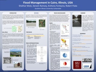
Southern Illinois University Carbondale
Shekhar Mote, Darwin Ramsey, Anthony Fonteyna, Robert FIiala
Flood Management in Cairo, Illinois, USA
Figure 1. The Location of the Study Area
Figure 3. Breaching a Levee near
Cairo During the 1937 Flood
Figure 4. Flood Wall in Cairo labelled
Showing the Depths of Various Floods
Figure 2. Aerial View of Cairo
Showing the Confluence of the
Mississippi and Ohio Rivers
• Census Tracts shapefile was
created by selecting them in TIGER
data available and then clipping
them using GIS Clip Tool.
• Flood zones around the Cairo city
area were delineated using the
flood zones layer available for
Alexander County. GIS tools like
the Clip Tool and Union Tool were
used to obtain the particular
required 100-year flood zone
within the study area (Figure 6).
• Base maps were used to digitize
the road networks within the flood
zone of our study area.
• Demographic analysis was done
separately from the census data.
• Maps were created from the
Layout View in ArcGIS to visually
present the analysis (Figure 7).
Figure 6. Flood Zone
Figure 5. Cairo, IL Flooding 2011
Figure 7. Flowchart Illustrating
the Research Process
The following sources served as the foundation of this research
Data Sources
SN Data Type Source
1 Flood Maps FEMA Map Service Center website
2 Demographic Data/TIGER Data US Census Bureau website
3 Transportation Network Data The National Map Viewer website
4 Land Cover Data The National Map Viewer
Steps in the Research Process
Where is the danger?
The 100-year flood zone, as
delineated by FEMA, for the study
area are presented in Figure 6. It was
found that majority of the urban
area around the city of Cairo falls
within the flood zone indicated by
FEMA.
Planning the Response:
The Road Network
From the GIS analysis, we could
see that the two major roadways- US
Interstate 57 and US Highway 51,
both passes through the main areas
of the flood risk (Figures 8 and 12).
The Flood Management Team can
disseminate this information to
general public about the possible
detour they would want to take to
avoid these areas during the flood
events. In addition, we could see
that the rail line and the airport
runways are also likely to be affected
by flood in this area.
Demographic Impact: Which
population groups would be affected
by flood?
• Two census tracts that contain
our flood zone study area have a
total population of 2969 (based
on 2010 US Census Data).
• Highlighted on the demographics
map are the census
neighborhoods that are
considered by FEMA to be at risk
in the 100-year flood zone (Figure
9).
• Of these 2969 individuals, 16.6%
were over the age of 65, and
26.7% of households had children
under the age of 18 living with
them (Figure 10).
• According to the National
Institute of Health, children and
the elderly are at the greatest risk
of both physical and psychological
danger due to flooding.
• 33.5% of the population in our
study area live below the Federal
Poverty Line, including 20.9% of
those over age 65 (Figure 11).
Naturally, it is harder for those
with fewer resources to
adequately prepare for surviving
a flood or evacuating in case of
severe danger
Results
Figure 8. Roadways that Would be
Affected by a 100-year Flood
Figure 9. Neighborhoods in Danger
Figure 10. Age Distribution in the Cairo
Figure 11. Poverty Overview of Cairo
Figure 12. US 51 During the 2011 Flood