Physically Based Runoff and Sediment Modelling of Rawal Watershed
Arable Farming - May 2015
1. 50 ARABLE MAY 2015FARMING
FEATURE PRECISION FARMING
A far better understanding of soil variations than most sampling systems permit is essential to
improving arable cropping performance and resilience, argues one precision farming expert.
Address yield limitations
with soil characterisation
A
ccurate soil char-
acterisation is the
most Important
fundamental in
making the most
of modem arable improvement
opportunities, believes Agrii's
new head of integrated crop
technology Dr Shamal
Mohammed, who until recently
managed HGCA's natural
resources research programme,
with responsibility for precision
farming, soil and water
management projects.
He says: "Yield mapping can
identify the major in-field varia-
tions which bear much of the
responsibility for the perform-
ance plateau we've seen in
commercial crop production
over the past 10-15years. But it
tells us nothing about the key
limiting factors causing these
variations. Nor how we can best
and most cost-effectively
address them,
"To do this we need to really
understand our most important
resource - the soil - and its
spatial variability, for which a
traditional sample per hectare is
nowhere near enough in most
cases. And more samples taken
more widely are also of little
value unless they adequately re-
flect the spatial variation of the
land in question."
In theory, Dr Mohammed
explains in most cases about 200
samples/hectare would be
required on a simple grid-based
system to be sure of obtaining a
sufficiently accurate picture of
soil variation. But as this would
be prohibitively expensive, an
alternative approach is required
11 _
to balance resolution and
affordability.
In his experience, the greatest
resolution can be obtained at the
least expense by GPS-based
sampling across field zones
previously identified as broadly
similar through electrical
conductivity scanning. This
approach allows sampling to be
targeted to give the best possi-
ble understanding of soil
variations across each field.
tr As well as sufficient resolu-
tion through this sort of
'intelligent sampling' we need
the right degree of accuracy in
our soil analyses," says Dr
Mohammed. "Rather than
manual texturing which can
mask major variations in sand,
silt and clay contents, for
instance, laboratory laser tex-
ture analysis gives us a precise
breakdown of particle size
distribution for each field zone.
Implications
"Among oilier areas of manage-
ment, this can have major
implications for potash
fertilisation, liming strategy,
compaction risk, slug and
black-grass threats and spring N
responsiveness.
"Through our SoilQuest
mapping, we've also found how
widely field zones can differ in
their phosphate, potash and pH
status - not to mention organic
matter, magnesium and a range
of different micro-nutrients.
"We need to characterise each
of these key components so
variable inputs and sowing
rates can be managed to make
the most of every part of every
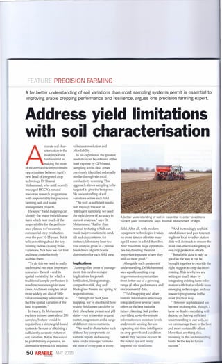
A better understanding of soil is essential in order to address
current yield limitations, says Shamal Mohammed, of Agrii.
field. After all, with modem
equipment technologies it takes
no more time or effort to man-
age 11 zones in a field than five.
And this offers huge opportuni-
ties for directing the most
important inputs to where they
will do most good."
Alongside such greater soil
understanding, Dr Mohammed
sees equally exciting crop
improvement opportunities
from better use of a growing
range of other performance and
environmental data.
"Yield mapping and other
historic information effectively
integrated over several years
offers us the best basis for
future planning. Soilprobes
providing up-to-the-minute
information on moisture levels
and remote sensing devices
capturing real-time intelligence
on crop growth and condition
before they become evident to
the naked eye will really
improve our timeliness.
"And increasingly sophisti-
cated disease and pest forecast-
ing from local weather station
data will do much to ensure the
most cost-effective targeting of
our crop protection efforts.
"But all this data is only as
good as the way it can be
brought together to provide the
right support to crop decision-
making. This is why we are
setting so much store by
integrating existing farm infor-
mation with that available from
emerging technologies and our
research programme in the
most practical way.
"However sophisticated we
become in doing this, though, I
have no doubt everything will
depend on having sufficient
understanding of our soils, so
we can manage them to the best
and most sustainable effect.
More than anythingelse,
investing in this understanding
has to be the key to future
success."