2. LAND USE
Currently there a slew of parking lots, and garages along Schermerhorn and Living-
ston Street. These parking garages do not foster an appealing, safe streetscape for
pedestrians. These spaces can be converted into more family and pedestrian friendly
spaces. Also, adding trees would be cost effective and would improve air quality and
general health of the community. “The direct effect of planting trees around a build-
ing or using reflective materials on roofs or walls is to alter the energy balance and
cooling requirements of that particular building” (Akbari, Taha and Pomerantz 2001).
DEMOGRAPHIC ANALYSIS
The subject area, is currently a space that is inhabited by municipalities, commercial
offices, a number of academic institutions, historical sites, religious institutions few resi-
dential buildings. As shown in Figure 1 , Red is indicative of commercial land use.
The area is set to undergo a number of rezoning measures. These rezoning mea-
sures are being considered to generate revenue and to draw interest from companies
outside of New York, as a more viable option to facilitate office space, than New
Jersey. To accomplish this goal, the Department of City Planning plans to build Class
A buildings to attract higher high paying clientele. Class A buildings, are buildings
that are of the highest quality. These buildings look better; maintain better infrastruc-
ture and provide better accessibility (Golden 2015). In the proposed plan, the subject
area is being rezoned to facilitate residential and retail space to accommodate an
influx of new residents, in search of living space close to Manhattan.
Transportation
In this area there are multiple forms of
transportation that exist. Transportation include
the: A,C,F,G,2,3,4,5; and buses: B41, B103,
B26, B52, B38. Commuters vans, also called
“Dollar vans,” also operate along this stretch
land. The City’s goal is to improve the tran-
sit network of Downtown Brooklyn. Improv-
ing access to train transfers, would alleviate
the number of straphanger dollars spent on
transfers that require them having to leave
a station, to walk one block to then pay a
second fare. Below ground transfers would
likely increase the number of subway riders,
moving through this area of research.
HISTORY
Brooklyn is most notably recognized for The
Brooklyn Bridge, The Brooklyn Dodgers and
Coney Island. In the Early 20th Century, there
was a huge population expansion. This expan-
sion allowed for transportation between outer
boroughs to be created (Thirteen-WNET New
York 2015). Downtown Brooklyn became a new
hub for commerce. Brooklyn maintained the
largest Sugar refining industry, in the nation,
located Down Town Brooklyn; along with dock-
yards, gas refineries, slaughterhouses, sweat-
shops, factories for pencils, glue, beers and a
host of other goods (Thirteen-WNET New York
2015).
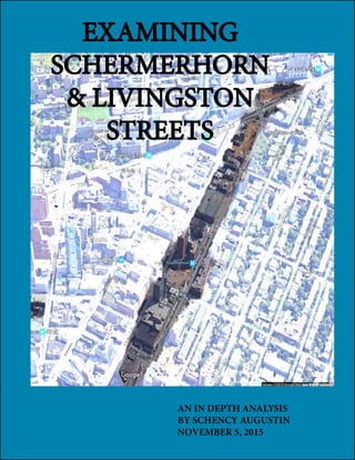
The study area, stretches throughout 2,827.19ft
(861.73m), is situated just north of Fulton
Street. Fulton Street is most notably known
as a shopping center. To date, Schermerhorn
Street and Livingston Street are home to two
municipalities: The Kings County Criminal Court
house, with neighboring Brooklyn Detention Cen-
ter; and the Metropolitan Transit Authority head-
quarters. This neighborhood, has a low tenant
occupancy rate, as the majority of buildings are
utilized as office space. The neighborhood has
taken on a dank dreary appearance, with a
number of renovations taking place. Proper land
use in this neighborhood, could lead to new
developments that would enrich the look and
feel of the area.
Courtesy of: AMNew York
Schermerhorn and Hoty Street
Corner of Nevins & Schermerhorn Streets
Courtesy of:Newyorky-
Courtesy of: Curbed Courtesy of: Brownstoner
Courtesy of: NewYork-
Figure 1
40 Nevins Street & 300 Schermerhonr St.
Smith and Schermerhorn Street
NYC Department of City Planning. Zola Map