TECHNIQUES OF UNDERWATER STRUCTURE INSPECTION AND WHO TO CONTACT FOR THE JOB
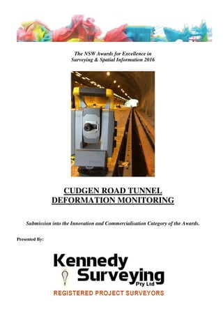
Cudgen Road Tunnel Deformation Monitoring
1. The NSW Awards for Excellence in
Surveying & Spatial Information 2016
CUDGEN ROAD TUNNEL
DEFORMATION MONITORING
Submission into the Innovation and Commercialisation Category of the Awards.
Presented By:
2. NSW Excellence Awards 2016 Cudgen Road Tunnel
Innovation & Commercialism Deformation Monitoring
Page 1
Table of Contents
Table of Contents 1.
Executive Summary 2.
Statement of Excellence 3.
Specific Criteria
Design of Original Solutions or Ingenious Adaptation of
Existing Solutions 4.
Innovative Application of Emerging or Developing
Technologies and Degree of Applied Lateral Thinking 5.
Market Take-up of the Innovation 8.
Commercial Viability 9.
Difficulty of the Task or of the Existing Problem to
Overcome 10.
Economic or Sociological Benefit to the Industry or the
Community 11.
Concise Overview 12.
Project Image 12.
3. NSW Excellence Awards 2016 Cudgen Road Tunnel
Innovation & Commercialism Deformation Monitoring
Page 2
Executive Summary
The twin Cudgen Road Tunnels form part of the dual carriageway of the Pacific Highway and
are situated in Stotts Creek, Northern NSW. The tunnels provide an underpass for the Highway
under the local Duranbah Road and were constructed as part of the Yelgun to Chinderah
section of the Pacific Highway upgrade completed in 2002.
The Cudgen Road tunnel is the first road tunnel to be built as part of a rural road project in
New South Wales. They are each approximately 135 metres long, have 17-20m large spans and
unlike the newer, modern tunnels at nearby Saint Helena that are ‘dry’ tunnels with pre-
fabricated, solid, water-proof walls, Cudgen road tunnels are described as ‘wet’ tunnels, where
there is no pre-cast wall structures.
The geology of the area consists of Permian highly deformed slates, metagreywacke and chert.
The southbound tunnel was in very high strength material with only minor jointing and
fracturing, whilst the northbound tunnel was in highly fractured material and a vertical 20m
wide shear zone was encountered with closely spaced shears containing clay gouge.
The tunnel walls and portals were pre-supported with rockbolts and grouted dowells, shotcrete
and wire mesh, with gabion walls installed above the portals. Since their construction, the
tunnels have been plagued with seepage and destabilisation from groundwater that poses a
serious potential hazard to the live traffic lanes.
Kennedy Surveying was tasked by Roads and Maritime Services (RMS) to develop a
comprehensive method of monitoring the possible deformation of the tunnels under a regular
observation program that would identify the size and location of deformation areas along with
the rate of change and any new incidents of deformation occurring.
4. NSW Excellence Awards 2016 Cudgen Road Tunnel
Innovation & Commercialism Deformation Monitoring
Page 3
Statement of Excellence
As a ‘wet’ tunnel, where the tunnel walls are simply wire meshed and covered in shotcrete, the
Cudgen tunnel has been experiencing seepage and deformation due to groundwater for some
time.
Kennedy Surveying was tasked by Roads and Maritime Services (RMS) to develop a
comprehensive method of monitoring the possible deformation of the tunnels under a regular
observation program that would identify the size and location of deformation areas along with
the rate of change and any new incidents of deformation occurring.
The resultant program developed by Kennedy Surveying of deformation monitoring through
the comparison of regular interval High Definition Laser Scanning of the tunnel walls has
given the Client (RMS) a cost-effective, quick turn-around, safe method of monitoring the
tunnel walls at a very high accuracy whilst also providing 100% coverage of the entire tunnel
wall surface – exactly what was needed for these troubled tunnel surfaces.
“The tunnel deformation monitoring regime devised and implemented by Kennedy Surveying
has allowed RMS to track any changes to any part of the entire tunnel wall surfaces to an
extremely high degree of accuracy and certainty. The resultant deliverables are brilliant – they
are easy to watch and interpret and also allow us to quickly go out and locate on-site any ‘hot
spots’ that require remedial work.” – Peter Young
Bridge Works Manager
Northern Regional Maintenance Delivery
Asset Maintenance
5. NSW Excellence Awards 2016 Cudgen Road Tunnel
Innovation & Commercialism Deformation Monitoring
Page 4
Design of Original Solutions or Ingenious Adaptation of Existing Solutions
The challenge with this project was to identify which parts of the tunnel surface may be
experiencing subsidence and therefore pose a threat to the public passage. Traditional fixed
target monitoring was considered but due to the free-form shape of the tunnel surface this
method seemed largely insufficient in its ability to identify all areas of potential movement so an
alternative solution was explored.
To ensure the safety of the public transport corridor Kennedy Surveying have implemented a
highly detailed, regular interval monitoring system and program to identify potential areas of
subsidence within the North and South bound lanes of the tunnel alignment.
Comparison of regular interval data sets of high degree accuracy rendered point cloud generated
surfaces has allowed a fully comprehensive comparison of the entire tunnel surface rather than
the conventional method of monitoring a finite number of control point targets affixed to certain
locations only within the tunnel.
The unique deliverables have incorporated various forms of media including animation and high
definition imagery to aid in the conceptualization of problem areas for effective decision making.
6. NSW Excellence Awards 2016 Cudgen Road Tunnel
Innovation & Commercialism Deformation Monitoring
Page 5
REPEAT MONITORING SCANS
Point to Surface Comparisons Deviation Analysis Reports
BASELINE SURFACE MODEL GENERATION
Precise Solid CAD Model Millions of Polygons
BASELINE LASER SCAN SURVEY
Data Registration Optimisation & Cleaning
CONTROL ESTABLISHMENT
Data Reductions Generation of Precise Control
Innovative Application of Emerging or Developing Technologies and Degree of
Applied Lateral Thinking
Detailed laser scanning surveys combined with innovative post processing techniques have
demonstrated a more cost effective and efficient monitoring solution than ever before.
With recent expansion into laser scanning, Kennedy Surveying has implemented the technology
to solve the monitoring problem of the Cudgen Road Tunnel.
A baseline survey was first conducted to build a comprehensive surface model of each tunnel
and then subsequent laser scans have been compared to this original surface to assess any areas
of movement and identify potential ‘hot-spots’.
The methodology is summed up in the below chart.
To ensure a rigid baseline survey Kennedy Surveying traversed a precise network through both
tunnel alignments. The accuracy of this control network was vital for repeat measurements and
has formed the basis for reliable laser scan data.
7. NSW Excellence Awards 2016 Cudgen Road Tunnel
Innovation & Commercialism Deformation Monitoring
Page 6
A ‘High Definition’ laser scan survey was then undertaken using the Leica P20 Scanstation. The
data of this instrument and Leica’s range of new generation instruments has been excellent. Very
crisp and clean data with little surface noise – essential for this project.
Baseline data was then registered, cleaned and optimized to generate a useable point cloud free
from the clutter of vehicles captured during the scan and other features such as electrical boxes
that were not of interest for the monitoring scope.
With a clean point cloud, optimized for surface generation, a 3D-polygn mesh surface was
created as the baseline shell object for the tunnels. This surface model generation is a key step in
the monitoring process as all future measurements will be assessed against this model.
Generating a true representation of the tunnel profile by triangulation is a multistep process
involving many filtration sequences and quality controls. Kennedy Surveying’s in-house team of
experts has a unique understanding of this process that has proved invaluable for the successful
completion of this project.
POINT TO SURFACE MODEL
GENERATION
8. NSW Excellence Awards 2016 Cudgen Road Tunnel
Innovation & Commercialism Deformation Monitoring
Page 7
The next step in the monitoring process is to conduct subsequent laser scan surveys and compare
the points against the baseline model.
Hundreds of millions of points are measured with each tunnel and as is often the case with laser
scan data, delivering a useable product can be challenging with such large datasets. Kennedy
Surveying has employed an innovative solution to clearly identify which points have moved out
of the millions of points measured. The method delivers a colour coded deviation result. A blue
to red spectrum has been utilised with graduated colour scales at mm increments.
A colour coded system such as this permits rapid identification of ‘hot-spot’ movement areas that
can be deemed unacceptable and where action is required. This spectrum can be tailored to
project tolerances and parameters adjusted for millimetre interrogations of surface movement.
Lateral thinking was applied to the project through the promotion and inclusion of a video
deliverable that has proven to be very popular with the RMS Engineers responsible for the
tunnel’s maintenance.
A sample video has been developed to explain the methodologies employed and can be view via
the following hyperlink:
https://drive.google.com/file/d/0B4de7urhjYslTXZhMUdTbUVyN28/view?usp=drivesdk
SURFACE MODEL DEVIATION ASSESSMENT
9. NSW Excellence Awards 2016 Cudgen Road Tunnel
Innovation & Commercialism Deformation Monitoring
Page 8
Market Take-up of the Innovation
Whilst High Definition (HD) Laser Scanning has experienced substantial growth in Europe and
America, the uptake of this modern technology to date in Australia has largely been restricted to
mining applications.
Quality, cost effective HD Laser Scanning programs such as that developed by Kennedy
Surveying for the Cudgen Road Tunnels are paving the way for the use of these modern
techniques and equipment in a number of areas such as:
• Road and rail tunnels and bridge structures
• Areas of congested/intricate infrastructure elements such as pipe networks
• Heritage buildings and facades
• Confined spaces
Considering current solutions, laser scanning is at the spearhead of monitoring systems. It is used
widely for slope stability monitoring in mining and various systems exist around the world for
mobile mapping both road and rail environments. Laser scanning is rapidly gaining popularity in
Australia and a project such as this is an excellent showcase for the technology and the surveying
industry.
10. NSW Excellence Awards 2016 Cudgen Road Tunnel
Innovation & Commercialism Deformation Monitoring
Page 9
Commercial Viability
The project has proven beyond doubt the commercial viability of HD Laser Scanning
technologies and methodologies.
For only a relatively small increase in project costs, the extremely high accuracy, total coverage,
user-friendly deliverables resulting from HD Laser Scanning provide a far greater, better quality,
more cost effective solution over conventional singular target measurement for deformation
monitoring.
With regard to the growth of our industry, an exciting prospect for surveyors is the wide
availability of point cloud processing software, namely within the open-source public domain
where it is becoming increasingly powerful. This indicates a promising future for surveyors
where software is prohibitively expensive, especially within the laser scanning market.
11. NSW Excellence Awards 2016 Cudgen Road Tunnel
Innovation & Commercialism Deformation Monitoring
Page 10
Difficulty of the Task or of the Existing Problem to Overcome
The challenge with this project was to identify which parts of the tunnel surface may be
experiencing subsidence and therefore pose a threat to the public passage.
Difficulties encountered both at inception and during the course of progress to deliverables
included:
• The ineffectiveness of conventional methods
• The high level degree of accuracy required throughout the entire tunnel surface
• The repeatability of positional accuracy through survey data sets over time
• The live traffic lanes and difficulty in accessing the tunnels for survey
One particular aspect of difficulty that was thwarted was the need to conduct the survey in
daylight hours. The Pacific Highway is a very busy, high traffic volumes at high speed
thoroughfare.
This problem is easily overcome by HD Laser Scanning because it can be conducted at night. At
night, the traffic volumes are far less which allowed for only partial closure of the tunnels (only
one of the two lanes) so that even the small numbers of cars present could move through the
tunnel without the need for full road closure and detouring.
Night time scanning also results in less pickup of moving cars in the data set which in turn
requires less data clean up and better accuracy of results.
12. NSW Excellence Awards 2016 Cudgen Road Tunnel
Innovation & Commercialism Deformation Monitoring
Page 11
Economic or Sociological Benefit to the Industry or the Community
Economically, this project exemplifies the cost and safety benefits of laser scanning as a
deformation analysis solution.
The ability of this type of solution vs fixed point static targets to effectively identify surface
movement over large areas is far greater.
The implications this has for safety, especially in a busy public corridor such as the pacific
highway are clearly evident and as a tool for efficient and effective slope stability and surface
analysis Laser scanning offers a solution that has both economic and social benefits to both the
Community and for the Surveying Profession.
13. NSW Excellence Awards 2016 Cudgen Road Tunnel
Innovation & Commercialism Deformation Monitoring
Page 12
Concise Overview
Kennedy Surveying were engaged by the NSW RTA to establish a monitoring system for the
Cudgen Road Tunnel in Stotts Creek, Northern NSW. The Tunnel encompasses a critical part of
the busy Pacific Highway and is experiencing seepage and potential destabilization from ground
water.
To ensure the safety of the public transport corridor Kennedy Surveying have implemented a
highly detailed monitoring system to identify potential areas of wall surface deformation within
the North and South bound lanes of the tunnel alignment.
Detailed laser scanning surveys combined with innovative post processing techniques have
demonstrated a more cost effective and efficient monitoring solution than ever before.
The unique deliverables have incorporated various forms of media including animation and high
definition imagery to aid in the conceptualization of problem areas for effective decision making.
Project Image