Archaeological sites can be located through accidental discovery, written sources, aerial surveys, and surveying techniques. Aerial surveys use crop marks, soil marks, shadow marks, and satellite imagery to identify sites from above. Geophysical surveys like resistivity, magnetometry, and ground-penetrating radar can map subsurface features. Together these methods help archaeologists understand a site's history and pinpoint areas for excavation.
3. LOCATING AN
ARCHAEOLOGICAL SITE
Main concern in excavating a site is to understand its
history.
Ways of locating sites:
AccidentalPloughing, land
reclamation, building, quarrying, dredging, constructin
g infrastructure (highways, railways, etc) and war.
Written SourcesLiterary clues, folklore, maps, legends and place
names.
4. Tells
The gradual build of debris from human occupation may led
to the creation of mounds or “tells”
5. What do you see?
What does an archaeologist see?
6. AERIAL SURVEY
Ancient sites can be discovered from the air in several
ways.
CROP MARKS
Crops grow irregularly and slower when planted over
the remains of walls, buildings roads.
Crops growing over ancient pits and trenches grow
faster and taller.
From the air outline ancient remains are clear.
Infrared photography makes this clearer.
9. SOIL/SCORCHED MARKS
After a field has been freshly ploughed areas where
the soil is darker may indicate a pit, ditch or mound
is located below the surface.
SHADOW MARKS
Visible from air where low earthworks or mounds
existed and cast shadows when the Sun is low in the
sky (early morning, sunset and winter).
11. SATELLITE PHOTOGRAPHY
Used to find lost city of Ubar in the Persian
Gulf (5,000 years old).
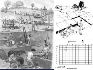
SURVEYING TECHNIQUES
Simple observation - field walking where
physical features are noted and finds
recorded.
Location of finds are plotted on a site map.
Concentration of finds would indicate a
good place to start excavation.
14. An electric current is passed through two
metal probes in the ground.
Buried structures have a high resistance
reading.
Pits and trenches have a low resistance
reading.
.
RESISTIVITY SURVEY
15. This method determines the magnetic
properties of the soil’s subsurface.
High readings indicate the presence of
iron, bricks and/or burnt soil.
Low readings suggest the ground has been
disturbed and/or decayed organic materials.
MAGNETIC SURVEYING
16. Exercise
Select three of the following sites and explain what they are
and the clues/methods used to locate them.
Sutton Hoo
Staffordshire Hoard
The Dead Sea Scroll
The Maiden Hall treasure
Palace of Knossos
Machu Picchu
Catul Huyuk