SlideShare a Scribd company logo
1 of 29
Download to read offline
© 2015 Pearson Education, Inc.
SOUTH AFRICAN
GEOMORPHOLOGY
PART 1
GR2BFET
2022
© 2015 Pearson Education, Inc.
1. Landscapes
2. The characteristics and processes associated with the
development of horizontally layered rocks
3. Hilly landscapes
4. Basaltic plateaus
5. Canyon landscapes
6. Desert Landscapes
– The Kalahari
– The Karoo
7. Dome
8. Valley
9. Cliff
10.Mass Movement
In this theme, you will learn about:
© 2015 Pearson Education, Inc.
1. Landscapes
2. The characteristics and processes associated with the
development of horizontally layered rocks
3. Hilly landscapes
4. Basaltic plateaus
5. Canyon landscapes
6. Desert Landscapes – The Kalahari
Video: Gr 11: Geomorphology-
Horizontally layered rocks
Duration: 51:09 (Very long)
https://www.youtube.com/watch?v=SpJpVIoOtdw
In Part 1:
© 201 Pearson Education, Inc.
1. Landscapes
• A landscape is part of the
Earth’s surface that can
be viewed at one time
from one place.
• It consists of the
geographic features that
mark, or are
characteristic of, a
particular area.
• A natural landscape is
made up of a collection of
landforms, such as
mountains, hills, plains,
and plateaus.
• Lakes, streams, soils,
and natural vegetation
are other features of
natural landscapes
© 2015 Pearson Education, Inc.
• You learned about the Rock Cycle – Metamorphic
(change), Igneous (lava), and sedimentary (layered
sediment).
• When this rock is exposed, the horizontal layers of
visible rock are called strata (alternating horizontal layers
of rock)
• Layers of horizontal rock can also be formed from lava
flows. When this type of rock is eroded, it forms canyons
and plateaus.
2. The characteristics and processes associated
with the development of horizontally layered rocks
© 2015 Pearson Education, Inc.
The parallel layers are formed by sediments accumulating over
a long geological period
There are a number of landscapes associated with horizontally
layered rocks. These will be briefly discussed.
© 2015 Pearson Education, Inc.
• Hilly landscapes are regions where the strata have a
similar or equal resistance to erosion results in hills with
steep rounded slopes.
• These regions typically have high rainfall, with the water
eroding and smoothing the hills creating domed peaks.
• An example of such a landscape can be found in KwaZulu-
Natal’s Valley of a Thousand Hills.
3. Hilly landscapes
© 2015 Pearson Education, Inc.
3.1 Valley of 1000 Hills - KZN
• The Valley of a Thousand Hills – steep and deep valleys,
some still wild, others densely populated
• Comprises a highly dissected ridge of crystalline
basement, measuring roughly 30 x 25 km, and now eroded
below the level of the surrounding countryside.
© 201 Pearson Education, Inc.
• The main players in the formation of this spectacular valley
system are the down-cutting Mgeni River
• The deeply weathered basement, constitutes rocks that are
far more easily eroded than the overlying hard Natal
sandstone
3.1 Valley of 1000 Hills - KZN
Video: Valley of a
1000 Hills by Drone
| Cinematic | HD
Duration: 2:35
https://youtu.be/Em
PE9sUYR04
© 201 Pearson Education, Inc.
3.2 Drakensberg Escarpment
• Around 160 mya, immense
pressure deep within the Earth
caused Gondwanaland to begin
to split apart.
• vast lava flows poured out
through fractures in the Earth’s
crust and hardened into layers
of basalt.
• Along the escarpment, erosion
followed fracture planes that
formed deep within the rock and
broad cliff faces formed.
• Today, towering basalt peaks
remain.
• Sediments formed the small
cliffs in the foothills of the
Drakensberg.
© 201 Pearson Education, Inc.
3.2 Drakensberg Escarpment
Video: Drakensberg, South Africa in 4K Ultra HD
Duration: 7:21
https://youtu.be/fIHjo2g6R-c
© 2015 Pearson Education, Inc.
• The layers are easily recognised
due to the way they sparkle in
the sun.
• The glistening is due to tiny
quartz crystals, which form a
cement between the sand grains
• These layers also contain early
dinosaur fossils - can be found in
the sandstone caves of the
foothills.
• The eroded debris from this long
process has been churned into a
black soil that supports the
grasses that cover the slopes
below.
3.2 Drakensberg Escarpment
© 2015 Pearson Education, Inc.
• Basaltic plateaus are large high-lying regions formed initially
from lava flows covering thousands of square kilometres.
• This rock is eroded predominantly by water forming high, flat
landforms and deep canyons.
• Other landforms formed by erosional processes are mesas,
buttes and domes.
4. Basaltic plateaus
© 2015 Pearson Education, Inc.
• Most of South Africa is a plateau,
with high ground on all but its
northern border. This high land
drops steeply towards the coast.
• As the South African plateau heads
south, three parallel steps form the
rim, each separated by a strip of
level ground between them.
• The Great Karoo makes up the
largest of these gaps between
steps. The Karoo and the Kalahari
Desert (perched on the plateau)
are dry and arid.
4. Basaltic plateaus
© 2015 Pearson Education, Inc.
• For canyons to form, the original layers of rock are level.
• The harder layers of rock resist erosion and the softer layers or
faults are susceptible to erosion, especially from the action of
water.
• The down cutting action by rivers, maintains the narrow, vertical
profile, thus creating a canyon or gorge.
• The freezing and expansion of water trapped in the cracks and
faults of the rock strata, results in physical weathering.
• This process is also responsible in the formation of canyons
and gorges
5. Canyon Landscapes
© 2015 Pearson Education, Inc.
• The Blyde River (also known as the Motlatse) Canyon
Nature Reserve is situated in Mpumalanga.
• It is the third largest canyon on Earth and is situated below
the confluence of the Blyde and Treur rivers
• It extends for 25kms along the lip of the great African
escarpment.
• It is on average, around 750 metres deep.
• Blyde River Canyon is the largest 'green canyon' due to its
lush subtropical foliage.
• It is the second largest canyon in Africa, after the Fish River
Canyon in Namibia, and is known as one of the great
wonders of nature on the continent.
5.1 Blyde River Canyon
© 2015 Pearson Education, Inc.
Video: Three Rondavels, Blyde River Canyon,
South Africa.
Duration: 2:44
https://youtu.be/z6CzX_npZd0
5.1 Blyde River Canyon
© 2015 Pearson Education, Inc.
• In geography, a desert is a landscape form or region that
receives very little precipitation.
• Generally deserts are defined as areas that receive an
average annual precipitation of less than 250 mm.
• 'True deserts' where vegetation cover is exceedingly sparse,
correspond to the 'hyperarid regions of the earth, where
rainfall is exceedingly rare and infrequent eg. Sahara Desert
• Deserts are however part of a wider classification of regions
that, on an average annual basis, have a moisture deficit
(i.e. they can potentially lose more than is received).
• These areas are collectively called 'drylands.’
Video: Deserts 101 | National Geographic
Duration: 3:52
https://www.youtube.com/watch?v=n4crvs-KTBw
6. Desert landscapes
© 201 Pearson Education, Inc.
6.1 Kalahari Desert
Kalahari Desert
• Stretches approximately
900 000 km² across
Botswana, Namibia and
South Africa.
• The Kalahari Desert is
not a true desert
because it receives too
much rainfall - between
120 and 250 mm annually
© 201 Pearson Education, Inc.
6.1 Kalahari Desert
• The Kalahari sand dunes,
some of which stretch west
to the Namib Desert,
compose the largest
continuous expanse of sand
on earth. That is because
although the Sahara Desert
is larger overall, sand
dunes make up only about
15% of its area
• In summer, the heat can top
45 degrees Celsius; on
winter nights, lows can drop
to -15 degrees Celsius
© 2015 Pearson Education, Inc.
6.1. Kalahari Desert - Physiography and geology
• The Kalahari Desert is a featureless, gently undulating,
sand-covered plain, 900 metres or more above sea level.
• Bedrock is exposed only in the vertical-walled hills,
called koppies, that rarely but conspicuously rise above
the general surface
• Aside from the koppies, three surfaces characterize
virtually all of the Kalahari:
– sand sheets,
– longitudinal dunes, and
– vleis (pans).
Video: The Kalahari, Northern Cape (to give you an idea of the different
landscapes)
7:44
https://www.youtube.com/watch?v=33ApWjlEpYM
© 201 Pearson Education, Inc.
6.1 Kalahari Desert - The sand sheets
• sandy flat areas
• formed during
the Pleistocene (about
2,588,000 to 11,700 years
ago), and they have been
fixed in place since then.
• In some areas they appear
to have been of fluvial
origin, the result of sheet
flooding in times of much
greater precipitation, but by
far the greater part of them
were wind-formed.
• They occupy the eastern
part of the Kalahari.
• Their surface elevation
varies only slightly
• the sand is red, the result
of a thin layer of iron oxide
that coats the grains of
sand.
© 201 Pearson Education, Inc.
6.1 Kalahari Desert - Sand dunes
• a hill of sand near an
ocean or in a desert that is
formed by the wind
• The entire western Kalahari
Desert is characterized by
long chains of dunes,
oriented roughly to the
north or northwest.
• The dunes measure at
least 1.6km in length,
several hundred metres in
width, and 6m to 60m in
height.
• Each dune is separated from
its neighbour by a broad
parallel depression locally
called a straat (“street,” or
“lane”), because
each constitutes the easy
way to travel.
© 2015 Pearson Education, Inc.
6.1 Kalahari Desert - Vleis, or pans
• are the terminal (end) features of desert drainage
systems, the “dry lakes” at the end of short-
lived streams.
• Many are remnant features from an earlier period of
greater precipitation.
• Very little water ever flowed to the sea from the
Kalahari.
• Rather, each stream ended its course in a slightly
lower depression from which there was no outlet.
• As the stream dried up, the fine silt particles carried in
suspension by the sluggish stream were deposited
along with soluble calcium minerals and salts
precipitated out of the evaporating water.
© 201 Pearson Education, Inc.
6.1 Kalahari Desert - Vleis, or pans
• As the stream dried up, the
fine silt particles carried in
suspension by the sluggish
stream were deposited
along with soluble calcium
minerals and salts
precipitated out of the
evaporating water.
.
• The results are pans—flat
surfaces devoid of vegetation
that are gleaming white when
dry, hardened by the
cementing action of the
soluble minerals, and, on
occasion, covered by a
shallow layer of standing
water.
• Where the salt content is low,
pans may become covered
with grasses after a rain
© 2015 Pearson Education, Inc.
6.1 Kalahari Desert - soil
• Soils in the Kalahari Desert are largely based on sand,
are reddish in colour, and are low in organic material.
• Chemically, they are relatively alkaline, and they are
extremely dry.
• In and near the pans, the soils tend to be highly
calcareous or saline, and frequently they are toxic to
most vegetation.
© 2015 Pearson Education, Inc.
End of Part 1
• Online class test on SA Geomorphology
Part 1 on Monday 1st August 2022 @
12h00 
© 2015 Pearson Education, Inc.
• Blaauw, M., Brouard, J., Gitlin, A., Gunter, A., Mofokeng, M., and Oberholster, E. (2012): Spot On Geography Learners Book
Grade 11. Heinemann Publishers (Pty) Ltd, Sandton.
• Britannica online for Kids (2016): The Columbia Plateau. Accessed online from http://kids.britannica.com/comptons/art-
149596/The-Columbia-Plateau-is-uniformly-covered-with-basaltic-lava-flows on 27 January 2016.
• Durban Tourism (2012): 1000 Hills Experience. Available online from:
http://www.durbanexperience.co.za/What_To_Do/Explore_Durban/Pages/1000_Hills_Experience.aspx Accessed 21 March 2016
• Du Toit, J. (2014): Karoo Facts and Stats. Available online from: http://karoospace.co.za/karoo-facts-stats/ Accessed 02 March
2016
• Government of Newfoundland and Labrador (n.d): Natural Resources, Geologic Survey, Sedimentary Structures. Accessed online
from www.nr.gov.nl.ca on 27 January 2016
• IMNH (Idaho Museum of Natural History. (2016): What is Mass Movement? Available online from:
http://imnh.isu.edu/digitalatlas/geo/basics/massmvnt.htm Accessed 21 March 2016
• Innovate Us. (2013): Where is the Vredefort Dome? Available online at : http://www.innovateus.net/innopedia/where-vredefort-
dome Accessed 02 March 2016
• Kalahari Desert (2013): Kalahari Desert. Available online from: http://www.kalaharidesert.net/ Accessed 02 March 2016
• National Geographic (nd): Landscape Available online from: http://education.nationalgeographic.org/encyclopedia/landscape/
Accessed 02 March 2016
• Lagesse, C. and Lagesse, S (2016) Choosy Travellers. The Palms Guest House. Accessed online from
www.choosytravellers.co.za on 27 January 2016
• News24 (2013): PICS: Severe mudslide on Chapman's Peak Drive. Article featured online on 16 November 2013:
http://www.news24.com/Travel/South-Africa/Chapmans-Peak-Drive-closed-due-to-severe-mudslide-20131116 Accessed 21
March 2016
References
© 2015 Pearson Education, Inc.
• One Geology (nd): Mass Movement. Available online from:
http://www.onegeology.org/extra/kids/earthprocesses/massMovements.html Accessed 21 March 2016
• PEI Education (2016): Valleys: face of the earth. Available online from: http://www.edu.pe.ca/southernkings/face.htm Accessed 21
March 2016
• Singh, R.G. (2009): Landslide Classification, Characterization and Susceptibility Modeling in Kwazulunatal. Unpublished
dissertation submitted to the Faulty of Science, University of the Witwatersrand, Johannesburg.
• South African Tourism (2016): The Blyde River Canyon Nature Reserve, Mpumalanga Available online from
http://www.southafrica.net/za/en/articles/entry/article-southafrica.net-the-blyde-river-canyon-nature-reserve Accessed 29 January
2016
• Sutcliffe, T. (2010): Karoo Landscape Available online from http://www.tomsutcliffe.co.za/2013-07-15-19-14-44/themed-
galleries/may-2010/landscape-karoo-steynsberg2-1-858.html. Accessed 29 January 2016
• SA Geography (2016): Horizontally Layered Rocks. Available online from http://sageography.myschoolstuff.co.za/wiki/grade-11-
caps/grade-11-caps-geomorphology/horizontally-layered-rocks/. Accessed 29 January 2016
• SouthAfrica.info (nd): Rock climbing in South Africa. Available from:
http://www.southafrica.info/travel/adventure/climbing.htm#.VxO0IzB97IU Accessed 12 March 2016
• World Landforms (2015): Dome Landforms. Available online from: http://worldlandforms.com/landforms/dome/ Accessed 02
March 2016
• https://www.britannica.com/place/Kalahari-Desert
• https://www.geocaching.com/geocache/GC1YRN0_valley-of-a-1000-hills?guid=b5aa4355-4ea4-4742-910c-0406f6de5a7a
References

More Related Content

Similar to SA Geomorphology: Landforms of Horizontally Layered Rocks

Meandering channels.ppt
Meandering channels.pptMeandering channels.ppt
Meandering channels.pptSaadTaman
 
Point bar.ppt
Point bar.pptPoint bar.ppt
Point bar.pptSaadTaman
 
Revision booklet 2015 OCR B Geography
Revision booklet 2015 OCR B GeographyRevision booklet 2015 OCR B Geography
Revision booklet 2015 OCR B GeographyMrs Coles
 
Dynamic planet revision long ans
Dynamic planet revision long ansDynamic planet revision long ans
Dynamic planet revision long ansMrOH
 
Dynamic Planet - revision long ans
Dynamic Planet - revision long ansDynamic Planet - revision long ans
Dynamic Planet - revision long ansMrOH
 
SEDIMENT CHARACTERSTICES IN DESERTIC ENVIRONMNET.pptx
SEDIMENT  CHARACTERSTICES IN DESERTIC ENVIRONMNET.pptxSEDIMENT  CHARACTERSTICES IN DESERTIC ENVIRONMNET.pptx
SEDIMENT CHARACTERSTICES IN DESERTIC ENVIRONMNET.pptxTribhuvan University
 
Tectonic control of sediments
Tectonic control of sedimentsTectonic control of sediments
Tectonic control of sedimentsArshad Ayub
 
Education 87_18G5EC3_2020121104273423.ppt
Education 87_18G5EC3_2020121104273423.pptEducation 87_18G5EC3_2020121104273423.ppt
Education 87_18G5EC3_2020121104273423.pptjaysonoliva1
 
Floodplain presentation 2
Floodplain presentation 2Floodplain presentation 2
Floodplain presentation 2samirpinal
 
TheSubmarineCanyons.pdf
TheSubmarineCanyons.pdfTheSubmarineCanyons.pdf
TheSubmarineCanyons.pdfYogesh Rm
 
TheSubmarineCanyons.pdf
TheSubmarineCanyons.pdfTheSubmarineCanyons.pdf
TheSubmarineCanyons.pdfYogesh Rm
 
AFRICA - THE CENTRAL CONTINENT 2.pptx
AFRICA - THE CENTRAL CONTINENT 2.pptxAFRICA - THE CENTRAL CONTINENT 2.pptx
AFRICA - THE CENTRAL CONTINENT 2.pptxMVHerwadkarschool
 
Crevasse splay.ppt
Crevasse splay.pptCrevasse splay.ppt
Crevasse splay.pptSaadTaman
 
03 Global occurence of Sedimentary Rocks prove a Global Flood
03 Global occurence of Sedimentary Rocks prove a Global Flood03 Global occurence of Sedimentary Rocks prove a Global Flood
03 Global occurence of Sedimentary Rocks prove a Global FloodJamesARobertson
 
Geomorphology - irrigation on riverine plains
Geomorphology - irrigation on riverine plainsGeomorphology - irrigation on riverine plains
Geomorphology - irrigation on riverine plainsPramoda Raj
 
CONTINENTAL ENVIRONMENTS.ppt
CONTINENTAL ENVIRONMENTS.pptCONTINENTAL ENVIRONMENTS.ppt
CONTINENTAL ENVIRONMENTS.pptSaadTaman
 
Water disasters
Water disastersWater disasters
Water disastersEcoTour20
 

Similar to SA Geomorphology: Landforms of Horizontally Layered Rocks (20)

Meandering channels.ppt
Meandering channels.pptMeandering channels.ppt
Meandering channels.ppt
 
Point bar.ppt
Point bar.pptPoint bar.ppt
Point bar.ppt
 
Tectonics
TectonicsTectonics
Tectonics
 
Revision booklet 2015 OCR B Geography
Revision booklet 2015 OCR B GeographyRevision booklet 2015 OCR B Geography
Revision booklet 2015 OCR B Geography
 
Dynamic planet revision long ans
Dynamic planet revision long ansDynamic planet revision long ans
Dynamic planet revision long ans
 
Dynamic Planet - revision long ans
Dynamic Planet - revision long ansDynamic Planet - revision long ans
Dynamic Planet - revision long ans
 
SEDIMENT CHARACTERSTICES IN DESERTIC ENVIRONMNET.pptx
SEDIMENT  CHARACTERSTICES IN DESERTIC ENVIRONMNET.pptxSEDIMENT  CHARACTERSTICES IN DESERTIC ENVIRONMNET.pptx
SEDIMENT CHARACTERSTICES IN DESERTIC ENVIRONMNET.pptx
 
Tectonic control of sediments
Tectonic control of sedimentsTectonic control of sediments
Tectonic control of sediments
 
Landforms
LandformsLandforms
Landforms
 
Education 87_18G5EC3_2020121104273423.ppt
Education 87_18G5EC3_2020121104273423.pptEducation 87_18G5EC3_2020121104273423.ppt
Education 87_18G5EC3_2020121104273423.ppt
 
Floodplain presentation 2
Floodplain presentation 2Floodplain presentation 2
Floodplain presentation 2
 
TheSubmarineCanyons.pdf
TheSubmarineCanyons.pdfTheSubmarineCanyons.pdf
TheSubmarineCanyons.pdf
 
TheSubmarineCanyons.pdf
TheSubmarineCanyons.pdfTheSubmarineCanyons.pdf
TheSubmarineCanyons.pdf
 
AFRICA - THE CENTRAL CONTINENT 2.pptx
AFRICA - THE CENTRAL CONTINENT 2.pptxAFRICA - THE CENTRAL CONTINENT 2.pptx
AFRICA - THE CENTRAL CONTINENT 2.pptx
 
Crevasse splay.ppt
Crevasse splay.pptCrevasse splay.ppt
Crevasse splay.ppt
 
03 Global occurence of Sedimentary Rocks prove a Global Flood
03 Global occurence of Sedimentary Rocks prove a Global Flood03 Global occurence of Sedimentary Rocks prove a Global Flood
03 Global occurence of Sedimentary Rocks prove a Global Flood
 
Geomorphology - irrigation on riverine plains
Geomorphology - irrigation on riverine plainsGeomorphology - irrigation on riverine plains
Geomorphology - irrigation on riverine plains
 
CONTINENTAL ENVIRONMENTS.ppt
CONTINENTAL ENVIRONMENTS.pptCONTINENTAL ENVIRONMENTS.ppt
CONTINENTAL ENVIRONMENTS.ppt
 
Water disasters
Water disastersWater disasters
Water disasters
 
Levees.ppt
Levees.pptLevees.ppt
Levees.ppt
 

More from Mphow Parvo

Literature Review presentation (1).pdf
Literature Review presentation (1).pdfLiterature Review presentation (1).pdf
Literature Review presentation (1).pdfMphow Parvo
 
Can we Teach Ethics-1.pdf
Can we Teach Ethics-1.pdfCan we Teach Ethics-1.pdf
Can we Teach Ethics-1.pdfMphow Parvo
 
What is education and what is it for(1)-1.pdf
What is education and what is it for(1)-1.pdfWhat is education and what is it for(1)-1.pdf
What is education and what is it for(1)-1.pdfMphow Parvo
 
Subjectivism and Cultural relativism-1.pdf
Subjectivism and Cultural relativism-1.pdfSubjectivism and Cultural relativism-1.pdf
Subjectivism and Cultural relativism-1.pdfMphow Parvo
 
Unit 9a - Chemical Reactivity and Mechanisms.pptx
Unit 9a - Chemical Reactivity and Mechanisms.pptxUnit 9a - Chemical Reactivity and Mechanisms.pptx
Unit 9a - Chemical Reactivity and Mechanisms.pptxMphow Parvo
 
GR3AFET Chapter 8 part 2 Fronts.pdf
GR3AFET Chapter 8 part 2 Fronts.pdfGR3AFET Chapter 8 part 2 Fronts.pdf
GR3AFET Chapter 8 part 2 Fronts.pdfMphow Parvo
 
TPACK IN A GEOGRAPHY CLASSROOM.pptx
TPACK IN A GEOGRAPHY CLASSROOM.pptxTPACK IN A GEOGRAPHY CLASSROOM.pptx
TPACK IN A GEOGRAPHY CLASSROOM.pptxMphow Parvo
 
Teaching geography with cartoons (1).pptx
Teaching geography with cartoons (1).pptxTeaching geography with cartoons (1).pptx
Teaching geography with cartoons (1).pptxMphow Parvo
 

More from Mphow Parvo (8)

Literature Review presentation (1).pdf
Literature Review presentation (1).pdfLiterature Review presentation (1).pdf
Literature Review presentation (1).pdf
 
Can we Teach Ethics-1.pdf
Can we Teach Ethics-1.pdfCan we Teach Ethics-1.pdf
Can we Teach Ethics-1.pdf
 
What is education and what is it for(1)-1.pdf
What is education and what is it for(1)-1.pdfWhat is education and what is it for(1)-1.pdf
What is education and what is it for(1)-1.pdf
 
Subjectivism and Cultural relativism-1.pdf
Subjectivism and Cultural relativism-1.pdfSubjectivism and Cultural relativism-1.pdf
Subjectivism and Cultural relativism-1.pdf
 
Unit 9a - Chemical Reactivity and Mechanisms.pptx
Unit 9a - Chemical Reactivity and Mechanisms.pptxUnit 9a - Chemical Reactivity and Mechanisms.pptx
Unit 9a - Chemical Reactivity and Mechanisms.pptx
 
GR3AFET Chapter 8 part 2 Fronts.pdf
GR3AFET Chapter 8 part 2 Fronts.pdfGR3AFET Chapter 8 part 2 Fronts.pdf
GR3AFET Chapter 8 part 2 Fronts.pdf
 
TPACK IN A GEOGRAPHY CLASSROOM.pptx
TPACK IN A GEOGRAPHY CLASSROOM.pptxTPACK IN A GEOGRAPHY CLASSROOM.pptx
TPACK IN A GEOGRAPHY CLASSROOM.pptx
 
Teaching geography with cartoons (1).pptx
Teaching geography with cartoons (1).pptxTeaching geography with cartoons (1).pptx
Teaching geography with cartoons (1).pptx
 

Recently uploaded

_Math 4-Q4 Week 5.pptx Steps in Collecting Data
_Math 4-Q4 Week 5.pptx Steps in Collecting Data_Math 4-Q4 Week 5.pptx Steps in Collecting Data
_Math 4-Q4 Week 5.pptx Steps in Collecting DataJhengPantaleon
 
call girls in Kamla Market (DELHI) 🔝 >༒9953330565🔝 genuine Escort Service 🔝✔️✔️
call girls in Kamla Market (DELHI) 🔝 >༒9953330565🔝 genuine Escort Service 🔝✔️✔️call girls in Kamla Market (DELHI) 🔝 >༒9953330565🔝 genuine Escort Service 🔝✔️✔️
call girls in Kamla Market (DELHI) 🔝 >༒9953330565🔝 genuine Escort Service 🔝✔️✔️9953056974 Low Rate Call Girls In Saket, Delhi NCR
 
Solving Puzzles Benefits Everyone (English).pptx
Solving Puzzles Benefits Everyone (English).pptxSolving Puzzles Benefits Everyone (English).pptx
Solving Puzzles Benefits Everyone (English).pptxOH TEIK BIN
 
Separation of Lanthanides/ Lanthanides and Actinides
Separation of Lanthanides/ Lanthanides and ActinidesSeparation of Lanthanides/ Lanthanides and Actinides
Separation of Lanthanides/ Lanthanides and ActinidesFatimaKhan178732
 
POINT- BIOCHEMISTRY SEM 2 ENZYMES UNIT 5.pptx
POINT- BIOCHEMISTRY SEM 2 ENZYMES UNIT 5.pptxPOINT- BIOCHEMISTRY SEM 2 ENZYMES UNIT 5.pptx
POINT- BIOCHEMISTRY SEM 2 ENZYMES UNIT 5.pptxSayali Powar
 
Introduction to ArtificiaI Intelligence in Higher Education
Introduction to ArtificiaI Intelligence in Higher EducationIntroduction to ArtificiaI Intelligence in Higher Education
Introduction to ArtificiaI Intelligence in Higher Educationpboyjonauth
 
SOCIAL AND HISTORICAL CONTEXT - LFTVD.pptx
SOCIAL AND HISTORICAL CONTEXT - LFTVD.pptxSOCIAL AND HISTORICAL CONTEXT - LFTVD.pptx
SOCIAL AND HISTORICAL CONTEXT - LFTVD.pptxiammrhaywood
 
Incoming and Outgoing Shipments in 1 STEP Using Odoo 17
Incoming and Outgoing Shipments in 1 STEP Using Odoo 17Incoming and Outgoing Shipments in 1 STEP Using Odoo 17
Incoming and Outgoing Shipments in 1 STEP Using Odoo 17Celine George
 
Software Engineering Methodologies (overview)
Software Engineering Methodologies (overview)Software Engineering Methodologies (overview)
Software Engineering Methodologies (overview)eniolaolutunde
 
Enzyme, Pharmaceutical Aids, Miscellaneous Last Part of Chapter no 5th.pdf
Enzyme, Pharmaceutical Aids, Miscellaneous Last Part of Chapter no 5th.pdfEnzyme, Pharmaceutical Aids, Miscellaneous Last Part of Chapter no 5th.pdf
Enzyme, Pharmaceutical Aids, Miscellaneous Last Part of Chapter no 5th.pdfSumit Tiwari
 
ECONOMIC CONTEXT - LONG FORM TV DRAMA - PPT
ECONOMIC CONTEXT - LONG FORM TV DRAMA - PPTECONOMIC CONTEXT - LONG FORM TV DRAMA - PPT
ECONOMIC CONTEXT - LONG FORM TV DRAMA - PPTiammrhaywood
 
How to Make a Pirate ship Primary Education.pptx
How to Make a Pirate ship Primary Education.pptxHow to Make a Pirate ship Primary Education.pptx
How to Make a Pirate ship Primary Education.pptxmanuelaromero2013
 
Class 11 Legal Studies Ch-1 Concept of State .pdf
Class 11 Legal Studies Ch-1 Concept of State .pdfClass 11 Legal Studies Ch-1 Concept of State .pdf
Class 11 Legal Studies Ch-1 Concept of State .pdfakmcokerachita
 
Call Girls in Dwarka Mor Delhi Contact Us 9654467111
Call Girls in Dwarka Mor Delhi Contact Us 9654467111Call Girls in Dwarka Mor Delhi Contact Us 9654467111
Call Girls in Dwarka Mor Delhi Contact Us 9654467111Sapana Sha
 
Paris 2024 Olympic Geographies - an activity
Paris 2024 Olympic Geographies - an activityParis 2024 Olympic Geographies - an activity
Paris 2024 Olympic Geographies - an activityGeoBlogs
 
Concept of Vouching. B.Com(Hons) /B.Compdf
Concept of Vouching. B.Com(Hons) /B.CompdfConcept of Vouching. B.Com(Hons) /B.Compdf
Concept of Vouching. B.Com(Hons) /B.CompdfUmakantAnnand
 
URLs and Routing in the Odoo 17 Website App
URLs and Routing in the Odoo 17 Website AppURLs and Routing in the Odoo 17 Website App
URLs and Routing in the Odoo 17 Website AppCeline George
 

Recently uploaded (20)

_Math 4-Q4 Week 5.pptx Steps in Collecting Data
_Math 4-Q4 Week 5.pptx Steps in Collecting Data_Math 4-Q4 Week 5.pptx Steps in Collecting Data
_Math 4-Q4 Week 5.pptx Steps in Collecting Data
 
call girls in Kamla Market (DELHI) 🔝 >༒9953330565🔝 genuine Escort Service 🔝✔️✔️
call girls in Kamla Market (DELHI) 🔝 >༒9953330565🔝 genuine Escort Service 🔝✔️✔️call girls in Kamla Market (DELHI) 🔝 >༒9953330565🔝 genuine Escort Service 🔝✔️✔️
call girls in Kamla Market (DELHI) 🔝 >༒9953330565🔝 genuine Escort Service 🔝✔️✔️
 
Model Call Girl in Bikash Puri Delhi reach out to us at 🔝9953056974🔝
Model Call Girl in Bikash Puri  Delhi reach out to us at 🔝9953056974🔝Model Call Girl in Bikash Puri  Delhi reach out to us at 🔝9953056974🔝
Model Call Girl in Bikash Puri Delhi reach out to us at 🔝9953056974🔝
 
Solving Puzzles Benefits Everyone (English).pptx
Solving Puzzles Benefits Everyone (English).pptxSolving Puzzles Benefits Everyone (English).pptx
Solving Puzzles Benefits Everyone (English).pptx
 
Separation of Lanthanides/ Lanthanides and Actinides
Separation of Lanthanides/ Lanthanides and ActinidesSeparation of Lanthanides/ Lanthanides and Actinides
Separation of Lanthanides/ Lanthanides and Actinides
 
TataKelola dan KamSiber Kecerdasan Buatan v022.pdf
TataKelola dan KamSiber Kecerdasan Buatan v022.pdfTataKelola dan KamSiber Kecerdasan Buatan v022.pdf
TataKelola dan KamSiber Kecerdasan Buatan v022.pdf
 
POINT- BIOCHEMISTRY SEM 2 ENZYMES UNIT 5.pptx
POINT- BIOCHEMISTRY SEM 2 ENZYMES UNIT 5.pptxPOINT- BIOCHEMISTRY SEM 2 ENZYMES UNIT 5.pptx
POINT- BIOCHEMISTRY SEM 2 ENZYMES UNIT 5.pptx
 
Introduction to ArtificiaI Intelligence in Higher Education
Introduction to ArtificiaI Intelligence in Higher EducationIntroduction to ArtificiaI Intelligence in Higher Education
Introduction to ArtificiaI Intelligence in Higher Education
 
SOCIAL AND HISTORICAL CONTEXT - LFTVD.pptx
SOCIAL AND HISTORICAL CONTEXT - LFTVD.pptxSOCIAL AND HISTORICAL CONTEXT - LFTVD.pptx
SOCIAL AND HISTORICAL CONTEXT - LFTVD.pptx
 
9953330565 Low Rate Call Girls In Rohini Delhi NCR
9953330565 Low Rate Call Girls In Rohini  Delhi NCR9953330565 Low Rate Call Girls In Rohini  Delhi NCR
9953330565 Low Rate Call Girls In Rohini Delhi NCR
 
Incoming and Outgoing Shipments in 1 STEP Using Odoo 17
Incoming and Outgoing Shipments in 1 STEP Using Odoo 17Incoming and Outgoing Shipments in 1 STEP Using Odoo 17
Incoming and Outgoing Shipments in 1 STEP Using Odoo 17
 
Software Engineering Methodologies (overview)
Software Engineering Methodologies (overview)Software Engineering Methodologies (overview)
Software Engineering Methodologies (overview)
 
Enzyme, Pharmaceutical Aids, Miscellaneous Last Part of Chapter no 5th.pdf
Enzyme, Pharmaceutical Aids, Miscellaneous Last Part of Chapter no 5th.pdfEnzyme, Pharmaceutical Aids, Miscellaneous Last Part of Chapter no 5th.pdf
Enzyme, Pharmaceutical Aids, Miscellaneous Last Part of Chapter no 5th.pdf
 
ECONOMIC CONTEXT - LONG FORM TV DRAMA - PPT
ECONOMIC CONTEXT - LONG FORM TV DRAMA - PPTECONOMIC CONTEXT - LONG FORM TV DRAMA - PPT
ECONOMIC CONTEXT - LONG FORM TV DRAMA - PPT
 
How to Make a Pirate ship Primary Education.pptx
How to Make a Pirate ship Primary Education.pptxHow to Make a Pirate ship Primary Education.pptx
How to Make a Pirate ship Primary Education.pptx
 
Class 11 Legal Studies Ch-1 Concept of State .pdf
Class 11 Legal Studies Ch-1 Concept of State .pdfClass 11 Legal Studies Ch-1 Concept of State .pdf
Class 11 Legal Studies Ch-1 Concept of State .pdf
 
Call Girls in Dwarka Mor Delhi Contact Us 9654467111
Call Girls in Dwarka Mor Delhi Contact Us 9654467111Call Girls in Dwarka Mor Delhi Contact Us 9654467111
Call Girls in Dwarka Mor Delhi Contact Us 9654467111
 
Paris 2024 Olympic Geographies - an activity
Paris 2024 Olympic Geographies - an activityParis 2024 Olympic Geographies - an activity
Paris 2024 Olympic Geographies - an activity
 
Concept of Vouching. B.Com(Hons) /B.Compdf
Concept of Vouching. B.Com(Hons) /B.CompdfConcept of Vouching. B.Com(Hons) /B.Compdf
Concept of Vouching. B.Com(Hons) /B.Compdf
 
URLs and Routing in the Odoo 17 Website App
URLs and Routing in the Odoo 17 Website AppURLs and Routing in the Odoo 17 Website App
URLs and Routing in the Odoo 17 Website App
 

SA Geomorphology: Landforms of Horizontally Layered Rocks

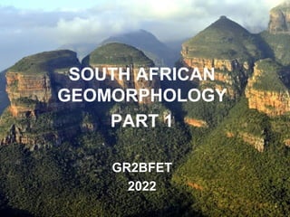
  • 1. © 2015 Pearson Education, Inc. SOUTH AFRICAN GEOMORPHOLOGY PART 1 GR2BFET 2022
  • 2. © 2015 Pearson Education, Inc. 1. Landscapes 2. The characteristics and processes associated with the development of horizontally layered rocks 3. Hilly landscapes 4. Basaltic plateaus 5. Canyon landscapes 6. Desert Landscapes – The Kalahari – The Karoo 7. Dome 8. Valley 9. Cliff 10.Mass Movement In this theme, you will learn about:
  • 3. © 2015 Pearson Education, Inc. 1. Landscapes 2. The characteristics and processes associated with the development of horizontally layered rocks 3. Hilly landscapes 4. Basaltic plateaus 5. Canyon landscapes 6. Desert Landscapes – The Kalahari Video: Gr 11: Geomorphology- Horizontally layered rocks Duration: 51:09 (Very long) https://www.youtube.com/watch?v=SpJpVIoOtdw In Part 1:
  • 4. © 201 Pearson Education, Inc. 1. Landscapes • A landscape is part of the Earth’s surface that can be viewed at one time from one place. • It consists of the geographic features that mark, or are characteristic of, a particular area. • A natural landscape is made up of a collection of landforms, such as mountains, hills, plains, and plateaus. • Lakes, streams, soils, and natural vegetation are other features of natural landscapes
  • 5. © 2015 Pearson Education, Inc. • You learned about the Rock Cycle – Metamorphic (change), Igneous (lava), and sedimentary (layered sediment). • When this rock is exposed, the horizontal layers of visible rock are called strata (alternating horizontal layers of rock) • Layers of horizontal rock can also be formed from lava flows. When this type of rock is eroded, it forms canyons and plateaus. 2. The characteristics and processes associated with the development of horizontally layered rocks
  • 6. © 2015 Pearson Education, Inc. The parallel layers are formed by sediments accumulating over a long geological period There are a number of landscapes associated with horizontally layered rocks. These will be briefly discussed.
  • 7. © 2015 Pearson Education, Inc. • Hilly landscapes are regions where the strata have a similar or equal resistance to erosion results in hills with steep rounded slopes. • These regions typically have high rainfall, with the water eroding and smoothing the hills creating domed peaks. • An example of such a landscape can be found in KwaZulu- Natal’s Valley of a Thousand Hills. 3. Hilly landscapes
  • 8. © 2015 Pearson Education, Inc. 3.1 Valley of 1000 Hills - KZN • The Valley of a Thousand Hills – steep and deep valleys, some still wild, others densely populated • Comprises a highly dissected ridge of crystalline basement, measuring roughly 30 x 25 km, and now eroded below the level of the surrounding countryside.
  • 9. © 201 Pearson Education, Inc. • The main players in the formation of this spectacular valley system are the down-cutting Mgeni River • The deeply weathered basement, constitutes rocks that are far more easily eroded than the overlying hard Natal sandstone 3.1 Valley of 1000 Hills - KZN Video: Valley of a 1000 Hills by Drone | Cinematic | HD Duration: 2:35 https://youtu.be/Em PE9sUYR04
  • 10. © 201 Pearson Education, Inc. 3.2 Drakensberg Escarpment • Around 160 mya, immense pressure deep within the Earth caused Gondwanaland to begin to split apart. • vast lava flows poured out through fractures in the Earth’s crust and hardened into layers of basalt. • Along the escarpment, erosion followed fracture planes that formed deep within the rock and broad cliff faces formed. • Today, towering basalt peaks remain. • Sediments formed the small cliffs in the foothills of the Drakensberg.
  • 11. © 201 Pearson Education, Inc. 3.2 Drakensberg Escarpment Video: Drakensberg, South Africa in 4K Ultra HD Duration: 7:21 https://youtu.be/fIHjo2g6R-c
  • 12. © 2015 Pearson Education, Inc. • The layers are easily recognised due to the way they sparkle in the sun. • The glistening is due to tiny quartz crystals, which form a cement between the sand grains • These layers also contain early dinosaur fossils - can be found in the sandstone caves of the foothills. • The eroded debris from this long process has been churned into a black soil that supports the grasses that cover the slopes below. 3.2 Drakensberg Escarpment
  • 13. © 2015 Pearson Education, Inc. • Basaltic plateaus are large high-lying regions formed initially from lava flows covering thousands of square kilometres. • This rock is eroded predominantly by water forming high, flat landforms and deep canyons. • Other landforms formed by erosional processes are mesas, buttes and domes. 4. Basaltic plateaus
  • 14. © 2015 Pearson Education, Inc. • Most of South Africa is a plateau, with high ground on all but its northern border. This high land drops steeply towards the coast. • As the South African plateau heads south, three parallel steps form the rim, each separated by a strip of level ground between them. • The Great Karoo makes up the largest of these gaps between steps. The Karoo and the Kalahari Desert (perched on the plateau) are dry and arid. 4. Basaltic plateaus
  • 15. © 2015 Pearson Education, Inc. • For canyons to form, the original layers of rock are level. • The harder layers of rock resist erosion and the softer layers or faults are susceptible to erosion, especially from the action of water. • The down cutting action by rivers, maintains the narrow, vertical profile, thus creating a canyon or gorge. • The freezing and expansion of water trapped in the cracks and faults of the rock strata, results in physical weathering. • This process is also responsible in the formation of canyons and gorges 5. Canyon Landscapes
  • 16. © 2015 Pearson Education, Inc. • The Blyde River (also known as the Motlatse) Canyon Nature Reserve is situated in Mpumalanga. • It is the third largest canyon on Earth and is situated below the confluence of the Blyde and Treur rivers • It extends for 25kms along the lip of the great African escarpment. • It is on average, around 750 metres deep. • Blyde River Canyon is the largest 'green canyon' due to its lush subtropical foliage. • It is the second largest canyon in Africa, after the Fish River Canyon in Namibia, and is known as one of the great wonders of nature on the continent. 5.1 Blyde River Canyon
  • 17. © 2015 Pearson Education, Inc. Video: Three Rondavels, Blyde River Canyon, South Africa. Duration: 2:44 https://youtu.be/z6CzX_npZd0 5.1 Blyde River Canyon
  • 18. © 2015 Pearson Education, Inc. • In geography, a desert is a landscape form or region that receives very little precipitation. • Generally deserts are defined as areas that receive an average annual precipitation of less than 250 mm. • 'True deserts' where vegetation cover is exceedingly sparse, correspond to the 'hyperarid regions of the earth, where rainfall is exceedingly rare and infrequent eg. Sahara Desert • Deserts are however part of a wider classification of regions that, on an average annual basis, have a moisture deficit (i.e. they can potentially lose more than is received). • These areas are collectively called 'drylands.’ Video: Deserts 101 | National Geographic Duration: 3:52 https://www.youtube.com/watch?v=n4crvs-KTBw 6. Desert landscapes
  • 19. © 201 Pearson Education, Inc. 6.1 Kalahari Desert Kalahari Desert • Stretches approximately 900 000 km² across Botswana, Namibia and South Africa. • The Kalahari Desert is not a true desert because it receives too much rainfall - between 120 and 250 mm annually
  • 20. © 201 Pearson Education, Inc. 6.1 Kalahari Desert • The Kalahari sand dunes, some of which stretch west to the Namib Desert, compose the largest continuous expanse of sand on earth. That is because although the Sahara Desert is larger overall, sand dunes make up only about 15% of its area • In summer, the heat can top 45 degrees Celsius; on winter nights, lows can drop to -15 degrees Celsius
  • 21. © 2015 Pearson Education, Inc. 6.1. Kalahari Desert - Physiography and geology • The Kalahari Desert is a featureless, gently undulating, sand-covered plain, 900 metres or more above sea level. • Bedrock is exposed only in the vertical-walled hills, called koppies, that rarely but conspicuously rise above the general surface • Aside from the koppies, three surfaces characterize virtually all of the Kalahari: – sand sheets, – longitudinal dunes, and – vleis (pans). Video: The Kalahari, Northern Cape (to give you an idea of the different landscapes) 7:44 https://www.youtube.com/watch?v=33ApWjlEpYM
  • 22. © 201 Pearson Education, Inc. 6.1 Kalahari Desert - The sand sheets • sandy flat areas • formed during the Pleistocene (about 2,588,000 to 11,700 years ago), and they have been fixed in place since then. • In some areas they appear to have been of fluvial origin, the result of sheet flooding in times of much greater precipitation, but by far the greater part of them were wind-formed. • They occupy the eastern part of the Kalahari. • Their surface elevation varies only slightly • the sand is red, the result of a thin layer of iron oxide that coats the grains of sand.
  • 23. © 201 Pearson Education, Inc. 6.1 Kalahari Desert - Sand dunes • a hill of sand near an ocean or in a desert that is formed by the wind • The entire western Kalahari Desert is characterized by long chains of dunes, oriented roughly to the north or northwest. • The dunes measure at least 1.6km in length, several hundred metres in width, and 6m to 60m in height. • Each dune is separated from its neighbour by a broad parallel depression locally called a straat (“street,” or “lane”), because each constitutes the easy way to travel.
  • 24. © 2015 Pearson Education, Inc. 6.1 Kalahari Desert - Vleis, or pans • are the terminal (end) features of desert drainage systems, the “dry lakes” at the end of short- lived streams. • Many are remnant features from an earlier period of greater precipitation. • Very little water ever flowed to the sea from the Kalahari. • Rather, each stream ended its course in a slightly lower depression from which there was no outlet. • As the stream dried up, the fine silt particles carried in suspension by the sluggish stream were deposited along with soluble calcium minerals and salts precipitated out of the evaporating water.
  • 25. © 201 Pearson Education, Inc. 6.1 Kalahari Desert - Vleis, or pans • As the stream dried up, the fine silt particles carried in suspension by the sluggish stream were deposited along with soluble calcium minerals and salts precipitated out of the evaporating water. . • The results are pans—flat surfaces devoid of vegetation that are gleaming white when dry, hardened by the cementing action of the soluble minerals, and, on occasion, covered by a shallow layer of standing water. • Where the salt content is low, pans may become covered with grasses after a rain
  • 26. © 2015 Pearson Education, Inc. 6.1 Kalahari Desert - soil • Soils in the Kalahari Desert are largely based on sand, are reddish in colour, and are low in organic material. • Chemically, they are relatively alkaline, and they are extremely dry. • In and near the pans, the soils tend to be highly calcareous or saline, and frequently they are toxic to most vegetation.
  • 27. © 2015 Pearson Education, Inc. End of Part 1 • Online class test on SA Geomorphology Part 1 on Monday 1st August 2022 @ 12h00 
  • 28. © 2015 Pearson Education, Inc. • Blaauw, M., Brouard, J., Gitlin, A., Gunter, A., Mofokeng, M., and Oberholster, E. (2012): Spot On Geography Learners Book Grade 11. Heinemann Publishers (Pty) Ltd, Sandton. • Britannica online for Kids (2016): The Columbia Plateau. Accessed online from http://kids.britannica.com/comptons/art- 149596/The-Columbia-Plateau-is-uniformly-covered-with-basaltic-lava-flows on 27 January 2016. • Durban Tourism (2012): 1000 Hills Experience. Available online from: http://www.durbanexperience.co.za/What_To_Do/Explore_Durban/Pages/1000_Hills_Experience.aspx Accessed 21 March 2016 • Du Toit, J. (2014): Karoo Facts and Stats. Available online from: http://karoospace.co.za/karoo-facts-stats/ Accessed 02 March 2016 • Government of Newfoundland and Labrador (n.d): Natural Resources, Geologic Survey, Sedimentary Structures. Accessed online from www.nr.gov.nl.ca on 27 January 2016 • IMNH (Idaho Museum of Natural History. (2016): What is Mass Movement? Available online from: http://imnh.isu.edu/digitalatlas/geo/basics/massmvnt.htm Accessed 21 March 2016 • Innovate Us. (2013): Where is the Vredefort Dome? Available online at : http://www.innovateus.net/innopedia/where-vredefort- dome Accessed 02 March 2016 • Kalahari Desert (2013): Kalahari Desert. Available online from: http://www.kalaharidesert.net/ Accessed 02 March 2016 • National Geographic (nd): Landscape Available online from: http://education.nationalgeographic.org/encyclopedia/landscape/ Accessed 02 March 2016 • Lagesse, C. and Lagesse, S (2016) Choosy Travellers. The Palms Guest House. Accessed online from www.choosytravellers.co.za on 27 January 2016 • News24 (2013): PICS: Severe mudslide on Chapman's Peak Drive. Article featured online on 16 November 2013: http://www.news24.com/Travel/South-Africa/Chapmans-Peak-Drive-closed-due-to-severe-mudslide-20131116 Accessed 21 March 2016 References
  • 29. © 2015 Pearson Education, Inc. • One Geology (nd): Mass Movement. Available online from: http://www.onegeology.org/extra/kids/earthprocesses/massMovements.html Accessed 21 March 2016 • PEI Education (2016): Valleys: face of the earth. Available online from: http://www.edu.pe.ca/southernkings/face.htm Accessed 21 March 2016 • Singh, R.G. (2009): Landslide Classification, Characterization and Susceptibility Modeling in Kwazulunatal. Unpublished dissertation submitted to the Faulty of Science, University of the Witwatersrand, Johannesburg. • South African Tourism (2016): The Blyde River Canyon Nature Reserve, Mpumalanga Available online from http://www.southafrica.net/za/en/articles/entry/article-southafrica.net-the-blyde-river-canyon-nature-reserve Accessed 29 January 2016 • Sutcliffe, T. (2010): Karoo Landscape Available online from http://www.tomsutcliffe.co.za/2013-07-15-19-14-44/themed- galleries/may-2010/landscape-karoo-steynsberg2-1-858.html. Accessed 29 January 2016 • SA Geography (2016): Horizontally Layered Rocks. Available online from http://sageography.myschoolstuff.co.za/wiki/grade-11- caps/grade-11-caps-geomorphology/horizontally-layered-rocks/. Accessed 29 January 2016 • SouthAfrica.info (nd): Rock climbing in South Africa. Available from: http://www.southafrica.info/travel/adventure/climbing.htm#.VxO0IzB97IU Accessed 12 March 2016 • World Landforms (2015): Dome Landforms. Available online from: http://worldlandforms.com/landforms/dome/ Accessed 02 March 2016 • https://www.britannica.com/place/Kalahari-Desert • https://www.geocaching.com/geocache/GC1YRN0_valley-of-a-1000-hills?guid=b5aa4355-4ea4-4742-910c-0406f6de5a7a References