
Recommended
Recommended
More Related Content
Similar to 46.GREEN-INFRAESTRUCTURE david rouse 2015.pdf
Similar to 46.GREEN-INFRAESTRUCTURE david rouse 2015.pdf (20)
Recently uploaded
Recently uploaded (20)
46.GREEN-INFRAESTRUCTURE david rouse 2015.pdf
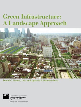
- 1. www.planning.org David C. Rouse, aicp, and Ignacio F. Bunster-Ossa American Planning Association Planning Advisory Service Report Number 571 Green Infrastructure: A Landscape Approach Green Infrastructure A merican Planning Association PAS Report Number 571
- 2. The Planning Advisory Service is a subscription service offered by the Research Department of the American Planning Association. Four reports are produced each year. Subscribers also receive PAS Memo and PAS QuickNotes, and they have access to the Inquiry Answering Service and other valuable benefits. To learn more, visit www.planning.org/pas/index.htm. W. Paul Farmer, faicp, Chief Executive Officer; Sylvia Lewis, Director of Publications; William R. Klein, aicp, Director of Research. Planning Advisory Service Reports are produced in the Research Department of APA. Timothy Mennel, Editor; Lisa Barton, Design Associate. Missing and damaged print issues: Contact Customer Service, American Planning Association, 205 N. Michigan Ave., Suite 1200, Chicago, IL 60601 (312-431-9100 or customerservice@planning.org) within 90 days of the publication date. Include the name of the publication, year, volume and issue number or month, and your name, mailing address, and membership number if applicable. © January 2013 by the American Planning Association. APA’s publications office is at 205 N. Michigan Ave., Suite 1200, Chicago, IL 60601–5927. APA headquarters office is at 1030 15th St., NW, Suite 750 West, Washington, DC 20005–1503. E-mail: pasreports@planning.org David C. Rouse, aicp, is a planner and landscape architect at Wallace, Roberts & Todd (WRT) in Philadelphia. His projects include comprehensive plans for cities, counties, and regions; parks and open space system plans; urban design plans; and zoning and development regulations. Rouse is an active participant in national initiatives of the American Planning Association and speaks across the country on topics ranging from the role of planning and design in pub- lic health to green infrastructure and urban forestry. Ignacio F. Bunster-Ossa is a landscape architect and urban designer whose work is consistently recognized for design innovation. He is a leading practitioner of Landscape Urbanism, an approach to urban design based on the fusion of ecology, community identity, infrastruc- ture, recreation, and public art. Bunster-Ossa directs WRT’s landscape architecture studio in Philadelphia as well as many of the firm’s large-scale landscape projects. He is a Harvard Loeb Fellow and periodically lectures, teaches, writes, and serves on design award juries. Contributors Bj Adigun is program coordinator at CH2M Hill in Syracuse, New York. Patrice Carroll is senior planner for the City of Seattle. Bill Cesanek, aicp, is vice president in the Edison, New Jersey, office of CDM Smith. Andrew Dobshinsky, aicp, is an associate at WRT in Philadelphia. Greg Dorolek is senior associate and landscape architect at Wenk Associates in Denver. Dave LaClergue is an urban designer for the City of Seattle. Tom Leader is principal of Tom Leader Studio in Berkeley, California. Mia Lehrer is president of Mia Lehrer + Associates in Los Angeles. Brian Marengo is senior water resources technologist in the Philadelphia office of CH2M Hill. Dee Merriam works on the relationship between health and the built environ- ment; she has a particular interest in developing synergies between water management and public access to outdoor space. Leah Rominger is staff consultant and landscape designer in the Philadelphia office of CH2M Hill. Terry Schwarz, aicp, is the director of Kent State University’s Cleveland Urban Design Collaborative. Eric Tamulonis is a landscape architect at WRT in Philadelphia who focuses on the planning and design of parks and open space systems, as well as institutional, historical, and academic landscapes. Nancy Templeton, aicp, is an associ- ate at WRT in Philadelphia. Karen Walz, faicp, is principal of Strategic Community Solutions, a consulting firm based in Dallas. Bill Wenk is founder and president of Wenk Associates in Denver. Cover design by Lisa Barton; this report is printed on recyclable paper. Cover image: Aerial visualization of green infrastructure practices in Philadelphia, as envisioned by the Philadelphia Water Department’s Green City Clean Waters Program. Prepared by WRT
- 3. GREEN INFRASTRUCTURE: A LANDSCAPE APPROACH Chapter 1: Introduction................................................................................................................ 1 Chapter 2: Landscape Planning, Design, and Green Infrastructure........................................... 5 Historic Antecedents......................................................................................................6 Definitions of Landscape and Green Infrastructure................................................10 Key Concepts................................................................................................................. 11 Chapter 3: Green Infrastructure in Practice.............................................................................. 17 Planning and Design Principles..................................................................................18 Scales of Planning Practice..........................................................................................22 Green Infrastructure in the Planning Process...........................................................28 Landscape Architecture and Green Infrastructure...................................................36 Conclusion.....................................................................................................................41 Chapter 4: Case Studies............................................................................................................. 47 Green Infrastructure at the Regional Scale Cleveland and Northeast Ohio: Green Infrastructure for a City in Transition....48 North Texas: Returning to the Trinity........................................................................56 Green Infrastructure in Large Cities Philadelphia: Making the Greenest City in America...............................................68 Seattle: A City’s Journey toward Sustainability........................................................76 Green Infrastructure in Smaller Communities Lancaster, Pennsylvania: Managing Stormwater Pollution and Enhancing Community through Green Infrastructure........................................84 Lenexa, Kansas: Rain to Recreation............................................................................93 Onondaga County, New York: Save the Rain.........................................................100 Parks, Greenways, and River Corridors as Green Infrastructure Birmingham, Alabama: A Green Infrastructure Movement.................................107 Los Angeles River: Using Green Infrastructure to Revitalize a City................... 118 Louisville Metro, Kentucky: Application of Green Infrastructure from Region to Site.................................................................................................125 Menomonee Valley Park and Redevelopment, Milwaukee..................................135 Summarizing the Case Studies.......................................................................................141 Appendix: A Model Regulatory Framework for Green Infrastructure..................................... 145 References................................................................................................................................ 155 David C. Rouse, aicp, and Ignacio F. Bunster-Ossa TA B L E O F C O N T E N T S
- 5. 1 In recent years the term “green infrastructure” has assumed a lead- ing position in the lexicon of planners and designers. At the city and regional scales, it has been defined as a multifunctional open- space network. At the local and site scales, it has been defined as a stormwater management approach that mimics natural hydrologic processes. This PAS Report explores the unifying concept of land- scape as green infrastructure—the visible expression of natural and human ecosystem processes that work across scales and contexts to provide multiple benefits for people and their environments. CHAPTER 1 Introduction ▲
- 6. 2 Green Infrastructure: A Landscape Approach Infrastructure is commonly defined as the facilities and services necessary for a society, community, or economy to function. In this definition, facilities and services can be grouped into two broad categories: “hard” and “soft” infrastructure. Hard infrastructure generally refers to transportation (roads, mass transit, etc.), utilities (water, sewer, etc.), and other physical networks. Soft infrastructure encompasses the institutional systems (education, health care, governance, etc.) that are required to meet the economic, social, and other needs of a community. While green infrastructure has an important role to play as soft infrastructure (e.g., by building capacity—improved health, job opportunities, community cohesion, etc.), this report addresses it primarily in the context of hard infrastructure. In the 20th century, hard infrastructure most often referred to the physical or “gray” systems engineered and constructed by humans, such as roads, utilities, and flood control works. In this paradigm, natural or “green” sys- tems and the services they provide for society were treated separately. Today, however, our green infrastructure lens views “gray” and “green” systems as interconnected ones that must be considered together to sustain a func- tioning society, community, or economy. In particular, the “green” systems are active, visible, and integrated into the human-shaped landscape—a fundamental paradigm shift. This broader view recalls an earlier time when natural factors determined the trajectory of a civilization and its built infra- structure. From the beginning of recorded history, the natural environment shaped where people chose to settle. Early towns and cities were built on sites where natural features provided key advantages, such as access to a navigable river or harbor, pro- tection from attack, or efficient disposal of waste and effluent. Where the terrain was accessible, roadways and aqueducts were built to connect settlements and sustain them with water. Urban development often flourished where such advantages coalesced. Over time, infrastructure evolved from being primarily the work of nature (landscape conditions influenced by people to meet their needs) to the work of humankind. Constructed infra- structure proliferated with the Industrial Revolution, as more sophisticated water supply and waste disposal works were needed to support growing urban populations and as new forms of transportation—first the railroad and then the automobile—led to metropolitan expansion. By the middle of the 20th century, engineered infrastructure had eclipsed landscape (in its role as nature-based infrastructure) as the primary driver of urban development. The availability of transportation, utility, and other gray infrastructure systems enabled accelerated metropolitan expansion in the post–World War II era. Between 1950 and 2000, the U.S. population increased by 80 percent while the nation’s urban land area, following auto-oriented development patterns, increased at a much greater rate (over 400 percent by one measure). Awareness of the environmental impacts of this urbanization—industrial pollution, resource depletion, degraded air and water quality, and so on— increased during the 1960s; in 1969 a “tipping point” was reached when an oil slick and debris on the Cuyahoga River in Cleveland caught fire, attracting national attention. Soon after, the first Earth Day was celebrated onApril 22, Streetside swale and adjacent pervious concrete sidewalk in the High Point neighborhood of Seattle U.S. Environmental Protection Agency
- 7. Chapter 1. Introduction 3 1970, marking the germination of the contemporary environmental move- ment and a growing chorus of citizen concerns about issues such as loss of open space, traffic congestion, and urban decline. State and local govern- ments have as a result undertaken comprehensive planning and growth management initiatives, with planners playing key roles. Grass only partially covered by a perforated surface makes for a pervious parking lot. iStockphoto.com/Oks_Mit Key to these developments was a growing awareness of landscape as both a vital resource needing protection and a countervailing force that could be used to positively shape city and regional development patterns. Landscape architect Ian McHarg was a seminal figure in raising environ- mental awareness through his writings, television show (The House We Live In), professorship at the University of Pennsylvania, and practice with the firm Wallace McHarg Roberts & Todd. His book Design with Nature (1969) established an influential methodology for analyzing land’s suitability for development or conservation, while his work as an advisor to the federal government during the Johnson administration led to establishment of the National Environmental Policy Act (NEPA), “the world’s first institutional- ized system of environmental impact reviews” (Yaro 1998, xi). NEPArequires analysis of the impacts of any proposed federal or federally funded action determined to significantly affect the quality of the human environment. This groundwork has become ever more critical to today’s planning and urban design practitioners, as they grapple with key questions such as: How can cities and regions become environmentally, economically, and socially sustainable? How can cities large and small, some of which have experienced decades of population decline, become more desirable, attractive, and equi- table places of opportunity for greater numbers of people to live? And how can the urban environment integrate a working landscape that promotes the health and well-being of people and ecosystems at all scales, from the region and city to singular development sites? In essence, what is the urban and regional pattern for a sustainable future, how can it be implemented, and how can planners and designers play leading roles in addressing these issues? A key to answering these questions lies in the use of the landscape to perform ecological functions—such as cleansing urban waters, replenish- ing aquifers, scrubbing airborne pollutants, sequestering carbon, absorbing floodwaters, moderating microclimates, and sheltering wildlife—while simultaneously supporting societal functions such as physical activity and recreation, mobility, food and fiber production, economic productivity, cul- tural identity, and community cohesion. Taken broadly to mean a network of spaces, places, and design elements—natural or constructed, public or private, local or regional—that provides such benefits, landscape looms large as a catalyst to achieving sustainable futures for cities and regions.
- 8. 4 Green Infrastructure: A Landscape Approach This report explores the concept of landscape as green infrastructure— the physical manifestation of complex, multifunctional systems that span disciplines (planning and design); contexts (urban, suburban, and rural); and scales (region, city, neighborhood, and site). Chapter 2 elaborates on the evolution and basic attributes of this concept. Chapter 3 addresses its implications for practitioners, with a focus on integrating the work of urban planners and landscape architects. It lays out a set of unifying principles that can be used by different professions to advance green infrastructure solutions. Chapter 4 presents case studies drawn from communities across the United States that are implementing these principles through green infrastructure initiatives in a variety of contexts and across scales. Millennium Park in downtown Chicago, with its mix of built and landscape infrastructural elements, has become a major tourist destination. Carolyn Torma
- 9. 5 What is a “landscape” approach to green infrastructure? How is it more than just implementing green infrastructure measures at vari- ous scales, from green roofs and rain gardens to regional greenways and open space? The answer lies in conceiving of landscape as an integrated whole, as the “scene” across the land that encapsulates the adaptation and manipulation of natural form and processes for the purpose of human habitation. A landscape approach to green infrastructure entails a design vision that translates planning strat- egy into physical reality while heeding the ecological and cultural characteristics of a particular locale—whether a region or an indi- vidual building site. It is, by necessity, an approach that involves aesthetics: what a place should look like as informed by the people who live on the land, their past, and their aspirations. CHAPTER 2 Landscape Planning, Design, and Green Infrastructure ▲
- 10. 6 Green Infrastructure: A Landscape Approach In this context, green infrastructure becomes both “effective” as an agent of environmental quality and “affective” as an expression of local conditions. A landscape approach to green infrastructure requires considering not only how infrastructure could improve water or air quality but also how, say, a rain garden, constructed wetland, or greenway might engender a sense of community identity. It raises the question: How and where should green infrastructure be placed on the land? It is more than a strictly functional question, as it both enriches and complicates practice. This chapter provides an overview of the evolution of the idea of land- scape as green infrastructure, followed by a discussion of key concepts explored in Chapters 3 and 4. HISTORIC ANTECEDENTS Human settlements have long been integrated into the larger landscape. The Mesa Verde cliff dwellings in Colorado, inhabited between about 550 and 1300 by the Anasazi, are an advanced and dramatic example, where pueblo architec- ture seems fused with its sandstone surround- ings (Figure 2.1). Similarly, pre-Columbian Machu Picchu in Peru is built from the rocks on which it stands, with stone walls angled to match the slopes of the supporting mountain, mimicking the larger landscape.Ancient Babylon is etched in the imagination as a garden city with the allure of bountiful and soothing urban nature—an image that migrated throughout the Middle East, Moghul India, Moorish Spain, and beyond to theAmericas during Spanish coloniza- tion, where it took the form of the walled garden and tree-laden courtyard. Such forms also tended to have a practical, infrastructural component— the gardens of Alhambra, constructed by the Moorish rulers of Granada in the 14th century, incorporated water features that helped cool the complex (Figure 2.2). Figure 2.2. The gardens of Alhambra, in Spain WRT Figure 2.1. Mesa Verde National Park WRT
- 11. Chapter 2. Landscape Planning, Design, and Green Infrastructure 7 In 1681, William Penn advanced the integration of landscape and city in America by envisioning Philadelphia as a “Green Country Towne.” Penn had witnessed firsthand the devastation in London wrought by the bubonic plague followed soon after by the great fire. His vision of a city comprising large estates, each well-buffered from neighbors, thus had as much to do with public health and safety as with lush greenery. In 1858, Philadelphia established Fairmount Park (today one of the largest urban parks in the nation) as a way to improve and protect the Schuylkill River as the city’s main water supply while also providing access to cooling breezes, expansive views, and recreational space (Figure 2.3). The idea of landscape as infrastructure gained further currency through Frederick Law Olmsted’s 1870s proposal for Boston’s Back Bay, a “noxious tidal swamp” that lay stagnant with effluent, as part of an “Emerald Necklace,” a seven-mile corridor of parkland connecting Boston Common with Franklin Park. In addition to providing needed parkland, Olmsted’s design for the “Fens” improved drainage, help- ing to flush and cleanse the waters and mitigate local flooding. In the early 1900s, Frederick Law Olmsted Jr., as a member of the McMillan Commission, extended the concept of the Boston Fens to the Anacostia River in Washington, D.C. The commission was entrusted with the renovation of the National Mall and other key public areas to com- memorate the 100th anniversary of the founding of the nation’s capital. In an effort to rid the Potomac River of its “malarial flats” and bring about a healthier, recreation-oriented landscape, Olmsted proposed the addition of wetlands that could trap and filter urban effluent—a clear use of nature to promote public health and well-being. Other professionals advanced the practice of landscape-level planning and design during an era in which landscape architecture and urban planning were not separate professions. Examples include Charles Eliot’s Plan for the Metropolitan Park System of Boston (1899) and his nephew Charles Eliot II’s Open Space Plan for the Commonwealth of Massachusetts (1928). Perhaps best known for his parks and boulevard plan for Kansas City, Missouri, imple- mented between 1890 and 1920, George Kessler also designed a comprehen- Figure 2.3. Fairmount Park, Philadelphia WRT
- 12. 8 Green Infrastructure: A Landscape Approach sive open-space system of drainageways, parks, and boulevards for Dallas after the devastating flood of 1908. Renowned for his naturalistic approach to garden design, the versatile Warren Manning in 1923 prepared a plan for the entire United States that delineated “future urban areas, recreation areas, commercial tracks, and recreation ways” (Figure 2.4). While Manning’s plan was never published in its entirety, it represents an early example of landscape planning at a “mega” scale. Olmsted’s concept of a “working nature” was preempted for decades as automobiles proliferated and the construction of highways and other gray infrastructure fueled metropolitan expansion in the post–World War II era. But it reemerged as a core method for urban planning and design in the latter part of the 20th century as popular concern over the effects of development grew. In Design with Nature (1969), Ian McHarg established natural process as the basis for limiting development impacts on natural resources, and he pioneered the so-called overlay or “layer cake” method of analyzing a landscape to determine its fitness for development. This method begins with overlay mapping of multiple ecological factors, including climate, geology, hydrology, soils, vegetation, and wildlife. A suitability analysis based on synthesis of these factors is then conducted to reveal the land’s intrinsic abil- ity to withstand the impact of development on valuable natural resources. McHarg, in essence, established the notion of ecological services—that na- ture has a direct and measurable value to human well-being by providing benefits such as air quality, water quality and supply, soil conservation, and wildlife protection. The precepts of Design with Nature have been absorbed by several generations of landscape architecture and planning professionals and institutionalized in federal and state environmental regulations, thus influencing the development of much of America’s urban landscape. For example, the federal National Environmental Policy Act (NEPA), California Environmental Quality Act (CEQA), and similar legislation in several other states require the documentation of environmental and social factors as a Figure 2.4. Warren Manning’s national plan
- 13. Chapter 2. Landscape Planning, Design, and Green Infrastructure 9 basis for the evaluation of development alternatives, leading to preferred alternatives that reduce impacts on those resources. McHarg’s work was further advanced by Anne Whiston Spirn, his suc- cessor as chair of the University of Pennsylvania’s landscape architecture program, in The Granite Garden: Urban Nature and Human Design (1984). This book focused on the ecology of urban areas: the matrix of noise, dust, pollution, insolation, stormwater runoff, wind, wildlife, and the like that can be mitigated and improved via urban landscapes. The book’s opening paragraph sets the ethical basis for design: Nature pervades the city, forging bonds between the city and the air, earth, water, and living organisms within and around it. In themselves, the forces of nature are neither benign nor hostile to humankind. Acknowledged and harnessed, they represent a powerful resource for shaping a beneficial urban habitat; ignored or subverted, they magnify problems that have plagued cities for centuries, such as floods and landslides, poisoned air and water. (Spirn 1984, xi) The impetus to reintegrate nature into patterns of human settlement has acquired greater urgency today. This stems in part from the need to mitigate and adapt to the effects of climate change by establishing more energy- efficient mobility systems and creating resilient cushions against trends such as increased heat, drought, flooding, and sea level rise. Moreover, such reintegration can promote sustainability by abetting increases in the density of urban settlements. While denser settlements can help conserve energy (in part by facilitating the use of public transportation, bicycling, and walking as alternatives to automobiles), they also heighten the need for greenery and opportunities for outdoor recreation as development catalysts. These forces have led to a search for new, integrative modes of practice in which planning and design concerns overlap and disciplinary boundaries become blurred. A prime example is landscape urbanism, which positions landscape as the foundation for urban design on all scales, from the macro (e.g., floodways, greenways, and parks) to the micro (e.g., the pattern and character of blocks, streets, and public spaces). In this approach, buildings integrate landscape features such as vegetated walls and roofs as part of a systems approach to conserving energy, sequestering carbon, moderating microclimates, and absorbing stormwater runoff. Other similar approaches that favor integration of natural processes with the built environment include sustainable urbanism (Farr 2007); ecological urbanism (associated with the Harvard Graduate School of Design; see Mostafavi and Doherty 2010); and biourbanism, which “focuses on the urban organism, considering it as a hypercomplex system, according to its internal and external dynamics and their mutual interactions” (www.biourbanism.org/biourbanism). At the city and regional scales, open space planning has gained promi- nence in recent decades as a means to protect natural, agricultural, and other open lands from development pressures. The following is a typical definition of open space: Open space may be defined as an area of land or water that either remains in its natural state or is used for agriculture, free from intensive development for resi- dential, commercial, industrial or institutional use. Open space can be publicly or privately owned. It includes agricultural and forest land, undeveloped coastal and estuarine lands, undeveloped scenic lands, public parks and preserves. It also includes water bodies such as lakes and bays. The definition of open space depends on the context. In a big city, a vacant lot or a small marsh can be open space. A small park or a narrow corridor for walking or bicycling is open space, though it may be surrounded by developed areas. Cultural and historic resources are part of the heritage of New York State and are often protected along with open space. (New York 2009)
- 14. 10 Green Infrastructure: A Landscape Approach In contemporary planning practice, open space plans and variations such as parks and recreation plans, resource conservation plans, and greenway and trail plans are prepared either as stand-alone documents or as topical elements of comprehensive plans. Greenways—linear open-space corridors like those along watercourses and abandoned rail lines that provide multiple ecological, recreational, economic, and cultural / historic values—have seen a rise in interest in recent decades. Open space and greenway plans are in- creasingly being repurposed as green infrastructure plans that emphasize the environmental, economic, and social benefits provided by physical re- source networks. At area and site scales, the term “green infrastructure” is often used to refer to stormwater management practices that mimic natural hydrological processes as opposed to “hard” engineered solutions. These two definitions of green infrastructure are discussed below. DEFINITIONS OF LANDSCAPE AND GREEN INFRASTRUCTURE Landscape has traditionally been defined as an aesthetic resource, such as an expanse of scenery, or as the overall geography of a region. In the words of theAmerican Society of LandscapeArchitects (ASLA), “landscape architects design the built environment of neighborhoods, towns and cities while also protecting and managing the natural environment, from its forests and fields to rivers and coasts. Members of the profession have a special commitment to improving the quality of life through the best design of places for people and other living things” (www.asla.org/nonmembers/What_is_Asla.cfm). Green infrastructure is relatively new to the lexicon of urban plan- ning and landscape design. According to Firehock (2010), the term was first used in a 1994 report on land conservation strategies by the Florida Greenways Commission. The intent was to elevate the societal value and functions of natural lands and systems to the same level of importance as gray infrastructure: The Commission’s vision for Florida represents a new way of looking at conser- vation, an approach that emphasizes the interconnectedness of both our natural systems and our common goals and recognizes that the state’s ‘green infrastructure’ is just as important to conserve and manage as our built infrastructure. (Florida Greenways Commission 1994) Mark Benedict and Ed McMahon (2006) of the Conservation Fund defined green infrastructure as a strategically planned and managed network of wilderness, parks, greenways, conservation easements, and working lands with conservation value that supports native species, maintains natural ecological processes, sustains air and water re- sources, and contributes to the health and quality of life forAmerica’s communities and people. More recently, a second definition of green infrastructure evolved from the need to address the water-quality impacts of urban stormwater runoff in response to the Clean WaterAct and related regulatory mandates.According to the U.S. Environmental Protection Agency (EPA; www.epa.gov/owow/ NPS/lid), green infrastructure refers to “systems and practices that use or mimic natural processes to infiltrate, evapotranspirate (the return of water to the atmosphere either through evaporation or by plants), or reuse stormwater or runoff on the site where it is generated.” While the Florida Greenways Commission and Conservation Fund definitions emphasize large landscape elements such as parks, natural areas, greenways, and working (agricultural and forest) lands, the EPA identifies smaller-scale features in urban contexts—green roofs, trees, rain gardens, vegetated swales, pocket wetlands, infiltration planters, vegetated median strips, and so on—as typi- cal components of green infrastructure. As professions, planning and land- scape architecture share common roots. Founded in 1900, the nation’s first Department of LandscapeArchitecture at Harvard University’s Graduate School of Design addressed a wide range of scales and included what may have been the first course in city planning. Over time, how- ever, a split between design and planning occurred within the department, with landscape architects focusing on smaller- scale design (e.g., of country estates) while the nation’s first Department of City and Regional Planning was founded in 1923 to address large-scale physical planning (Steiner 2010). The bifurcation of the fields foreshadowed a broader societal trend in the 20th century toward specialization and separation of professional disciplines. In the 21st century, interrelated problems such as automobile dependency and traf- fic congestion, combined sanitary and storm sewer overflows, degraded air and water quality, and chronic diseases related to lifestyle (e.g., obesity and dia- betes) are making the limitations of “silo” thinking increasingly apparent. Because of its multifunctional, integrative nature, green infrastructure can play a major role in addressing these problems. Compared to other, more specialized professions, planners and landscape architects are es- pecially well-suited to bring holistic green infrastructure solutions to the planning and design of cities, neighborhoods, and other aspects of the physical environment. In doing so, they can reestablish the com- mon ground of the two professions. ▲ GREEN INFRASTRUCTURE AND THE PROFESSIONS OF PLANNING AND LANDSCAPE ARCHITECTURE ▲
- 15. Chapter 2. Landscape Planning, Design, and Green Infrastructure 11 This report seeks to bring these two definitions together and enrich them by viewing green infrastructure through the lens of landscape—the physical manifestation of processes that connect the built and natural environments, performing multiple functions and yielding associated benefits for the health and well-being of people and wildlife. This per- spective links physical form and aesthetics with function and outcomes (benefits); natural habitats with landscapes managed by humans for specific purposes; and green infrastructure with gray infrastructure. It envisions green infrastructure as a three-dimensional “envelope” that surrounds, connects, and infuses buildings, streets, utilities, and the like. As such it is not separate from gray infrastructure but forms the ground on which it exists. In other words, there is no fixed boundary between the two. The erasure of boundaries compels a holistic and interdisciplinary approach to the planning and design of infrastructure. KEY CONCEPTS This report is intended for planners, landscape architects, architects, civil engineers, scientists, and others interested in the spatial structure, func- tions, and values (environmental, economic, and social) of natural and built landscapes. In traditional practice, these professionals have tended to operate independently of one another. The concept of landscape as green infrastructure provides a potent platform for integrating the work of physical designers, policy planners, and others and leveraging this collaboration to achieve larger societal goals. ▲ Completed in 2006, the Sidwell Friends Middle School expansion in Washington, D.C., involved renovating a 55-year old, 33,500-square-foot building and constructing a 39,000-square-foot addition. Integrated water management tied to the school’s environmen- tal ethic and curriculum was central to the project design. Green roofs are used to retain and filter stormwater, and a wetland garden is used to treat wastewater before recycling it as graywater for flushing the school toilets. The system requires holding and a sewage separator tank powered by rooftop photovoltaic panels—a clear integration of gray and green infrastructures. Students grow vegetables and herbs for the kitchen on the green roofs. The site design includes a pond, rain garden, and filters and swales to absorb and purify stormwater runoff (Figure 2.5). Other features include bicycle storage and showers, underground parking, and native plantings. INTEGRATING GREEN WITH GRAY INFRASTRUCTURE: AN EXAMPLE ▲ Figure 2.5. Sidwell Friends Middle School garden, Washington, D.C. Andropogon
- 16. 12 Green Infrastructure: A Landscape Approach A related concept is ecosystem services (i.e., the benefits that natural ecosystems provide for people). These services can be broken down into provisioning services (e.g., food and water production); regulating services (e.g., improved air and water quality, carbon sequestration); supporting services (e.g., nutrient cycling, crop pollination); and cultural services (e.g., recreation, community bonding, and spiritual inspiration). Chapter 3 expli- cates an emerging practice model designed to promote an integrated process for making green infrastructure a reality. Several overarching concepts thread through it, including • the importance of green infrastructure to the “triple bottom line” of sus- tainability; • the contributions green infrastructure can make to public health, broadly conceived; and • the performance of green infrastructure as a system, interacting with other systems in ways that shape and connect the natural and built environments. Sustainability: Realizing the Multiple Benefits of Green Infrastructure Central to the concept of green infrastructure is that it provides a wide suite of benefits. The three “Es” of sustainability (environment, economy, and equity)—also referred to as the triple bottom line (people, prosperity, and planet)—offer a useful framework for characterizing these benefits. Environment • Green infrastructure can absorb stormwater, reducing runoff and associ- ated impacts such as flooding and erosion. • It can improve environmental quality by removing harmful pollutants from the air and water. • It can moderate the local climate and lessens the urban heat island effect, contributing to energy conservation. • It can preserve and restore natural ecosystems and provide habitats for native fauna and flora. • It can mitigate climate change by reducing fossil fuel emissions from vehicles, lessening energy consumption by buildings, and sequestering and storing carbon. Economy • Green infrastructure can create job and business opportunities in fields such as landscape management, recreation, and tourism. • Studies have shown that it can stimulate retail sales and other economic activity in local business districts (Wolf 1998 and 1999). • It can increase property values (Neelay 1988; Economy League of Greater Philadelphia 2010). • It can attract visitors, residents, and businesses to a community (Campos 2009). • It can reduce energy, healthcare, and gray infrastructure costs, making more funds available for other purposes (Heisler 1986; Simpson and McPherson 1996; Economy League of Greater Philadelphia 2010).
- 17. Chapter 2. Landscape Planning, Design, and Green Infrastructure 13 Community • Green infrastructure can promote healthy lifestyles by providing outdoor recreation opportunities and enabling people to walk or bike as part of their daily routines. • It can improve environmental conditions (e.g., air and water quality) and their effects on public health. • It can promote environmental justice, equity, and access for underserved populations. • It can provide places for people to gather, socialize, and build community spirit. • It can improve the aesthetic quality of urban and suburban development. • It can provide opportunities for public art and expression of cultural values. • It can connect people to nature. Studies have shown that better health outcomes, improved educational performance, and reduced violence can be among the resulting benefits (Ulrich 1984; Kaplan 1995; Berman et al. 2008; Kuo and Sullivan 1996, 2001a, and 2001b). • It can yield locally produced resources (food, fiber, and water). Akey question for planners and designers is: How can we measure these benefits to demonstrate the value green infrastructure brings to society? Indicators are quantitative or qualitative measurement tools that track prog- ress toward goals and objectives. They are useful in characterizing complex system changes over time in relatively simple terms. Early indicator systems were developed largely to address human impacts on natural ecosystems, but their scope has broadened to encompass other dimensions of sustainability, often structured around the triple bottom line. Many of the above benefits lend themselves to quantitative measurement, for example: • Environmental Indicators: stormwater volume reduction, harmful pol- lutants removed from the air, tree canopy coverage, carbon storage and sequestration, etc. • Economic Indicators: jobs created, property values increased, reductions in building energy use, etc. • Social (Community) Indicators: parks and open space access (typically measured in terms of walking distance to the nearest resource), parks and open space equity (typically measured in terms of distribution relative to demographics), public health outcomes, etc. Other benefits, such as improved aesthetic quality, support of public art, and facilitation of cultural expression, are harder to measure, though they are central to the practice of landscape architects and other design professionals. Thus, an important challenge is to develop meaningful ways to define the qualitative benefits provided by landscape as green infrastructure. Public Health: Expanding the Scope of Green Infrastructure Public health is an overarching concern that cuts across the triple bottom line of sustainability. It has become an increasingly important issue for society as health-care costs have escalated and awareness has grown of the broader im- pacts of environment, lifestyle, and community conditions on health. Marya Trees are arguably the largest structural component of green infrastructure. Their habitats range from naturally occurring forests and managed timber stands to the physical fabric of suburban and urban communities, where they are planted or regenerate in private yards and vacant lots, on institutional campuses, along streets, in parks and preserves, and elsewhere. The National Urban and Community Forestry Advisory Council (NUCFAC) defines urban forestry as “the art, science, and technology of managing trees and forest resources in and around urban community ecosystems for the physiological, sociological, economic, and aesthetic benefits trees provide society” (NUCFAC 2004). Schwab (2009) describes the environ- mental, economic, and social benefits of the urban forest, defining general and design principles, and presenting case studies illustrating how an effective urban forestry program can be part of a “new planning agenda.” That report empha- sizes the importance of valuing the urban forest as an investment that makes sense from a triple-bottom-line perspective. One valuable tool in this area is i- Tree, a suite of free software programs developed by the U.S. Forest Service with cooperating partners. I-Tree can be used by communities of all sizes to inventory, evaluate, and quantify the benefits of their urban forest resources (www.itreetools. org). I-Tree uses field data from complete inventories or randomly located plots to calculate the dollar value of benefits provided by a community’s urban for- est, such as pollution removal, carbon storage and sequestration, and structural (replacement) value. ▲ THE URBAN FOREST: A KEY COMPONENT OF THE URBAN LANDSCAPE AND GREEN INFRASTRUCTURE ▲
- 18. 14 Green Infrastructure: A Landscape Approach Morris (2006) refers to the “social”—as opposed to the “medical”—model of health, under which public health addresses the health of the community as a whole, rather than focusing on symptoms and diseases suffered by in- dividuals. The health of a community is inextricably linked to the health of its environment as reflected in the landscape, and green infrastructure can bring important public health benefits. Examples of these benefits include: • Green infrastructure can improve environmental conditions such as air and water quality and their associated impacts on human health (exposure to hazardous substances, asthma, etc.). • It can encourage walking, biking, and other forms of outdoor activity.1 • It can improve health by bringing people into contact with nature. Richard Louv (2011) proposes a “Natural Health Care System” to capitalize on the restorative effects of such experiences on physical and mental health. For example, many health care professionals are issuing “park” or “nature” prescriptions for their patients to exercise outdoors in parks or on trails. Another example is the Medical Mile greenway trail in downtown Little Rock, Arkansas. Created through a collaboration among parks, recreation, and public health organizations, it is both a walking / biking trail and an outdoor “health museum” designed to encourage people to make healthy living choices. • It can provide a safer environment for outdoor activity through design, thus counterbalancing crime, traffic, and other deterrents. • It can improve conditions in poor and marginalized communities that too often bear a disproportionate burden from environmental and health hazards (thus addressing the equity component of the three “Es”). Green infrastructure can provide a range of health benefits for the residents of such communities, including improved water quality, reduced air pollu- tion, increased opportunities for physical exercise, and access to locally grown food (Dunn 2010). Green Infrastructure and Systems Thinking Green infrastructure lends itself to an integrated, systems-thinking approach, one that overcomes the limitations of more specialized or “silo” methods of problem-solving. Whereas traditional, mechanistic analysis dissects a system into individual pieces, systems analysis focuses on how the pieces interact to produce the behavior of a system (Aronson 1996–1998).2 Aparticular system can, in turn, be both influenced by the behavior of smaller subsystems and nested within a larger system (a concept referred to as “systems hierarchy”). From this perspective, systems defined by separate structures, functions, and processes intersect in the landscape, working together to determine its overall behavior as green infrastructure. But how does such an approach apply in practice and what are its implica- tions for planners and designers? Recognizing the boundary of the system in question—the sphere of influence of a specific problem—is the first step in a systems-thinking approach. Next, tracing connections to other systems inevitably widens the context of the problem. It is this focus on interactions that defines a systems approach. To delve further into the topic, it is useful to understand the basic char- acteristics of systems. Noted scientist, author, and systems analyst Donella Meadows defined a system as “A set of elements or parts that is coherently organized or interconnected in a pattern or structure that produces a char- acteristic set of behaviors, often classified as its ‘function’ or ‘purpose’”
- 19. Chapter 2. Landscape Planning, Design, and Green Infrastructure 15 (Meadows 2008, 188). Applying this definition, green infrastructure is a system that comprises constituent parts (e.g., trees, soil, and constructed infrastructure); that is organized into a pattern (the landscape); and that performs functions (e.g., stormwater management and the removal of air and water pollutants) that have a purpose (the benefits described above). Moreover, green infrastructure is part of a hierarchy: it incorporates multiple subsystems (e.g., hydrology, vegetation, and movement) and in turn is a sub- system within a larger system (e.g., region, city, or neighborhood), where it interacts with other systems (e.g., transportation, economy, and governance). The following are additional attributes of systems: • Interconnections are relationships that hold the parts of a system together. Examples include flows of resources (e.g., water or energy); flows of infor- mation (e.g., the communication of knowledge); and interactions among functional subsystems (e.g., intermodal connections among forms of transportation such as walking, biking, driving, and transit). • Astock is the material or information that has accumulated over time from flows through the system (e.g., the biomass within a mature forest). • Afeedback loop is a circular (as opposed to linear) pathway formed by an effect returning to its cause and generating either more or less of the same effect. A balancing feedback loop tends to counteract or resist any small change in system behavior (e.g., by keeping the system’s stock within a stable range, thus maintaining its equilibrium over time).Areinforcing feedback loop tends to enhance or augment any small change in system behavior in a positive or negative direction (e.g., a disturbance that causes the system to cross a critical “threshold” beyond which it is unable to return to its previous condition). • A leverage point occurs when a targeted intervention results in a significant change in the behavior of the system. For green infrastructure, this implies that a solution that addresses multiple problems and “leverages” improve- ment throughout a system can be more effective than one dealing with a problem in isolation (e.g., maintaining or restoring the natural hydrologic processes of a river and floodplain system rather than piecemeal construc- tion of flood protection devices). • Resilience is the ability of a system to recover from or adapt to disturbance or change. (See Walker and Salt 2006.) First developed by ecologists to help understand the dynamics of natural ecosystems, this concept has broad implications for planning practice. For example, a city with a diverse eco- nomic base is less vulnerable to a sudden economic downturn than one that relies on a single large employer or industry cluster, just as a diverse plant community is more resistant to insects and disease than a monoculture. Figure 2.6 conceptualizes how green infrastructure operates as part of a hi- erarchy of nested systems, each of which contains stocks of assets held together by interconnections (flows and interactions between systems). In this diagram, green and gray infrastructure are shown as subsystems that together make up the urban landscape. Landscape is a system that bridges multiple levels of scale across higher-level systems: environment, community, and economy. Flows of resources (e.g., energy, materials, and information) are drawn from the higher-level systems into interactions that generate the various stocks of assets that make up the landscape (green infrastructure compo- nents such as trees and rain gardens; gray infrastructure components such as buildings and streets). While for diagrammatic purposes green and gray infrastructure are shown as separate, interlocking systems, in reality they can overlap in design elements such as green buildings and green streets.
- 20. 16 Green Infrastructure: A Landscape Approach Figure 2.6 shows the generation of green and gray infrastructure as par- allel processes. Systems at similar (parallel) levels will often compete for limited resources (e.g., funding from the eco- nomic system), but coop- eration is also possible. Systems thinking can help identify opportunities for cooperation (i.e., sharing of resources) rather than competition among paral- lel systems. The green and gray in- frastructure assets in the urban landscape produce feedback loops that have positiveornegativeimpacts on higher level systems. Public health is shown as a leverage point that can yield triple-bottom-line Figure 2.6. Green and gray infrastructure are subsystems that together make up the urban landscape. David Witham, WRT improvement in the community, economy, and environment systems. This underscores the potential of connecting green infrastructure to public health. Application of the three key concepts—the “triple bottom line” of sustainability, the connection to public health, and systems thinking—can enrich the practice of green infrastructure. Chapter 3 further explores how they can be used to inform the work of urban planners, landscape architects, engineers, and others involved in planning and design of green infrastructure. ENDNOTES 1. Frank, Engelke, and Schmid (2003) differentiate between “recreational” and “utilitarian” exercise: “Recreational forms of exercise are those undertaken for discretionary reasons on someone’s leisure time…. Utilitarian forms of physical activity are those that are worked into one’s daily habits” (56–88). They hold that utilitarian physical activity (e.g., walking or biking to work or to shop) is likely to more significantly affect a person’s health than recreational activity. 2. The biologist Ludwig Von Bertalanffy, a seminal figure in the development of systems thinking and author of General System Theory (1969), referred to this paradigm as “the whole is greater than the sum of its parts.”
- 21. 17 CHAPTER 3 Green Infrastructure in Practice ▲ The practice of green infrastructure falls under the purview of vari- ous professions, including urban planning, landscape architecture, civil engineering, parks and recreation, and architecture. To suc- cessfully create green infrastructure at the landscape scale, these professions must transcend conventional “silo” modes of thinking and instead pursue an integrated approach to planning, design, and implementation. This chapter explores how the concepts introduced in Chapters 1 and 2 can be incorporated into planning and landscape architecture practice to realize the triple-bottom-line potential of green infrastructure.
- 22. 18 Green Infrastructure: A Landscape Approach While the landscape approach integrates green and gray infrastructures across scales from site design to regional planning, conventional public- and private-sector organizational structures do not lend themselves to this holistic approach. In the public sector, planners address infrastructure to varying degrees through their core functions of long-range planning at the district, citywide, and regional scales; codification of zoning and development regula- tions; and review of current development applications for conformance with those regulations. Meanwhile, engineers usually housed in a separate depart- ment such as public works or utilities design hard infrastructure systems for transportation, utilities, and stormwater, and they review development drawings for compliance with engineering standards. Landscape architects most often work in a parks and recreation department, where they design parks, streetscapes, and other landscape elements. Because they have differ- ent training, typically work in separate departments with singular missions, and deal with dissimilar types and scales of projects, opportunities for these professionals to work together to achieve broader goals are often limited. In the private sector, consulting firms typically have core specialties such as planning, landscape architecture, engineering, or architecture. Where multiple disciplines are housed in one firm, or when firms with different specialties form teams to pursue project opportunities, the opportunity for collaboration across disciplines is greater. However, similar barriers to those encountered in the public sector (different professional training, project types and scales, etc.) make a truly integrated approach to planning and design more difficult. Some of the most successful examples of disciplinary integra- tion have come when an agency specifies in a request for proposals (RFP) or a design competition for a project such as a park master plan, corridor / streetscape improvement, or revitalization plan that it seeks to harness the triple-bottom-line outcomes of a green infrastructure approach. So what, specifically, can planners do to promote green infrastructure? Internally within their organization (e.g., a municipality or private consult- ing firm), they can build connections across different types of programs and projects (e.g., from comprehensive planning goals and policies to site-level design), with other departments (public works, transportation, watersheds, etc.), and with other professionals (engineers, landscape architects, architects, etc.). They can also collaborate with outside partners that deal with issues related to green infrastructure, such as sewer and water authorities charged with addressing Clean Water Act mandates, regional land-conservation organizations, and park districts or agencies. The key is to find common interests across disciplinary and organizational boundaries to make green infrastructure a vital part of the fabric of our communities and landscapes. This chapter defines a set of unifying principles intended to accomplish this. It indicates how green infrastructure can be woven into the established mis- sions, services, and methods of planning and other professions. PLANNING AND DESIGN PRINCIPLES Six principles inform the planning and design of green infrastructure across different disciplines and scales of professional practice: 1. Multifunctionality 2. Connectivity 3. Habitability 4. Resiliency 5. Identity 6. Return on investment While this report primarily addresses the workofplannersandlandscapearchitects, civil engineers have an important role to play in advancing green infrastructure solutions through the design of storm- water and other infrastructure systems. The Zofnass Program for Sustainable Infrastructure at the Harvard Graduate School of Design and the Institute for Sustainable Infrastructure (founded by the American Society of Civil Engineers, the American Council of Engineering Companies, and the American Public Works Association) have taken an im- portant step in this direction by de- veloping the Envision Rating System. Envision provides a holistic framework for evaluating and rating the community, environmental, and societal impacts and benefits of transportation, water supply, wastewater treatment, and other types of civil infrastructure projects. Credits used to develop numeric ratings of projects are grouped into five categories: • Quality of Life (benefits to and impacts on communities affected by the project) • Leadership (communication and col- laboration in project development) • Resource Allocation (quantity, source, and characteristics of materials and other resources used in project con- struction and operations) • Natural World (impacts on natural systems) • Climate and Risk (resiliency vis-à-vis short-term hazards such as flooding and long-term changes such as sea level rise) Examples of specific credits relevant to green infrastructure include encouraging alternative modes of transportation (i.e., trails, bikeways, transit, etc.—Quality of Life), managing stormwater (Natural World), and managing heat island effects (Climate and Risk). See www.asce.org /Sustainability/ISI-Rating-System. ▲ GREEN INFRASTRUCTURE AND THE PROFESSIONS OF PLANNING AND LANDSCAPE ARCHITECTURE ▲
- 23. Chapter 3. Green Infrastructure in Practice 19 Multifunctionality This principle builds on the concept of the triple bottom line—the environ- mental, economic, and community benefits provided by green infrastructure. Also called ecosystem services, these benefits derive from the multiple and overlapping functions provided across the different systems—hydrology, transportation, energy, economy, and so on—that can intersect in green infra- structure. The multifunctionality principle calls on planners and designers to maximize value for the communities they serve by using green infrastructure to achieve seemingly disparate goals such as flood control, reduced depen- dence on imported energy, and improved public-health outcomes. Spanning more than 15 years of plan- ning and design, the Trinity River Corridor Project seeks to transform the 2,300-acre floodway of the Trinity River near downtown Dallas into a sustainable, city-building green infrastructure catalyst (Figure 3.1). The project is guided by five interre- lated and overlapping improvement strands—flood control, environ- ment, recreation, transportation, and economic development—woven into the overriding goal of maximiz- ing the value of new infrastructure. The project will achieve this goal by modifying existing levees to achieve greater flood protection and reliev- ing downtown traffic congestion through construction of a new toll road, while inducing the level of green amenity and environmental health necessary to spur a new generation of sustainable development in the city’s core. The linkage between green amenity and infrastructure has been established, for example, by sizing and configuring on-site “bor- row areas” (from which fill materials needed for the expanded levees and toll road are extracted) into recreational lakes laced with marshlands and dotted with “floating wet- lands” (rings of suspended aquatic vegetation)—features that provide water cleansing, aquatic habitat, and recreational value. In this and other ways the floodway will emerge as a massive public work of green infrastructure, changing the function and identity of a heretofore little-seen and even less-used public resource. (See the related case study of the North Texas region in Chapter 4.) ▲ THE MULTIFUNCTIONALITY PRINCIPLE AT WORK: TRINITY RIVER CORRIDOR PROJECT, DALLAS ▲ Figure 3.1. The Trinity River Corridor Project, Dallas WRT Connectivity This principle means that green infrastructure is most effective in provid- ing services and benefits when it is part of a physically connected system across the landscape (e.g., a natural reserve or a park). For example, a natural reserve that is connected to others by a corridor of native vegetation (e.g., along a river or stream) is more valuable (all other factors being equal) than one surrounded by urban development because it allows for wildlife move- ment between different habitat areas. Similarly, a park that is connected to other parks via a regional hiking or biking trail serves more people than one surrounded by a local residential neighborhood.
- 24. 20 Green Infrastructure: A Landscape Approach To create a connected green infrastructure system at the landscape scale, planners and designers should establish physical and functional linkages across urban, suburban, and rural landscapes and across scales to connect site, neighborhood, city, and region. For example, vegetated corridors along major watercourses can connect rural, suburban, and urban areas within a region, providing multiple benefits such as wildlife habitat, recreation, and management of water quantity and quality. The form of this corridor may vary, taking shape as a native riparian woodland in a rural (agricultural) context, more actively managed landscape plantings in a suburban context, or intensively designed landscape treatments that function as movement corridors and gathering spaces in an urban context. Green boulevards and streets that incorporate native or indigenous plantings to benefit wildlife, natural stormwater management features, and safe accommodations for pe- destrians and bicyclists can serve as green infrastructure connections in more densely developed suburban and urban areas. In creating connected green infrastructure systems, planners and designers can draw on basic concepts of landscape ecology (patch, corridor, edge, and matrix as the large-scale structural components of landscapes). Habitability The habitability principle positions green infrastructure as visible space that provides outdoor habitat for people, flora, and fauna. The mission of the public health profession—to foster conditions in which people can be healthy—is central to the idea of habitable green infrastructure. Examples of green infrastructure planning and design outcomes that advance this prin- ciple include improved air and water quality (resulting in improved health of humans and ecosystems), increased opportunity for outdoor recreation and exercise, and restoration of native habitats. Resiliency Defined as the ability to recover from or adapt to disturbance and change, resiliency is particularly relevant in a time when natural and human eco- systems are experiencing accelerating change and instability, ranging from higher energy prices to economic shocks to the projected effects of climate change. Examples of how green infrastructure can increase community resiliency across scales include: • Trees and green roofs can counteract the urban heat island effect at the city scale and reduce the cooling needs of individual buildings. • A community can reduce its vulnerability to storms and the cost of pro- tective gray infrastructure by maintaining the natural flood absorption capacity of coastal or riparian wetlands and floodplain areas. • Tree plantings, green and “blue” roofs, permeable pavement, rain gardens, and other techniques that absorb rainfall on-site can reduce the impacts of urban runoff during storms (e.g., overburdened storm sewers, street flooding, and combined sanitary / storm sewer overflows into rivers and streams).1 Green infrastructure can increase community resiliency over short and long timeframes (e.g., reduced damage and faster recovery from natural disasters, increased ability to adapt to climate change). One study concluded that green infrastructure treatments (increased tree cover, green roofs, etc.) could significantly reduce the stormwater runoff and surface temperature increases projected in the 2080s as a result of greenhouse gas emissions (Gill et al. 2007). LANDSCAPE ECOLOGY TERMS, CONNECTIVITY, AND GREEN INFRASTRUCTURE Commonly referred to as a “hub” or “node” by planners and designers of green infrastructure systems, a “patch” is defined by landscape ecologists as a discrete area of the landscape that differs from its surroundings (e.g., a park or natural reserve). A “corridor” is a linear element that links natural habitat patches. Riparian habitat along a river or stream is a common example, while roadways are important corridors in urban and suburban landscapes. An “edge” is the transition area between different land- scape elements (e.g., patches and corri- dors). Finally, the “matrix” is the overall landscape structure or pattern within which patches, corridors, and edges are embedded. While green infrastructure network design typically focuses on creating hubs and connecting corridors (often called links), the role of the matrix in fostering connectivity—e.g., an urban or suburban community with a healthy urban forest—should not be overlooked. From a systems perspective, connectivity encompasses both natural ecological func- tions such as providing habitat routes for wildlife and human ones such as promot- ing social equity by connecting people to green infrastructure. One good working definition of land- scape ecology overall is: “The study of native landscape structure, function, and change at the scale of the entire landscape, as well as the application of the results to the design and management of both natural and human dominated areas” (Benedict and McMahon 2006, 283). ▲ ▲
- 25. Chapter 3. Green Infrastructure in Practice 21 Identity Design of landscape elements to create a perceptible identity and sense of place is a central moti- vation of landscape architects. Planners often use the term “com- munity character” to express the special and valued attributes that make a place desirable to live in or visit. The identity principle addresses the potential of green infrastructure to contribute to the visual definition of a place. A tree, for example, can act as a carbon sink and, through shading, contribute to energy conservation, both of which functions can be quantified. But what kind of tree is it and in what location? Is it appropriate for the native terrain, vegetation, and climate? What added recreational or spiritual benefit does it provide? Does it have any aesthetic or cultur- ally significant effect? In this context, the integration of art within the public sphere becomes a relevant consideration. In recent decades Ecological Art or “Eco-Art” has emerged as a distinctive genre within the field of public art.2 One early practitioner is Seattle artist Buster Simpson, whose work “Beckoning Cistern” captures roof stormwater from a loft building and directs it via inventive scuppers and storage tanks to streetside rain gardens. This project fully captures the potential of green infrastructure to engender a unique sense of place. Thinking across scales, could a recurring motif expressed through stormwater or other forms of green infrastructure help visually define a neighborhood, city, or region? WATERSHED SCULPTURE: PUBLIC ART AS GREEN INFRASTRUCTURE Artists Daniel McCormick and Mary O’Brien describe their work thus: “We want our sculptures to have a part in influencing the ecological balance of compromised environ- ments. We are compelled by the idea of using sculpture in a way that will allow the damaged areas of a watershed to reestablish themselves. As it has evolved, our art has become focused on strategically congregating sculptural components made from riparian materials back into the watershed system. They are are intended to give advantage to the natural system, and after a period of time, as the restoration process is established, the artists’ presence shall no longer be felt” (http://danielmccormick.blogspot.com). A recent example of McCormick and O’Brien’s watershed sculpture is in downtown Charlotte, North Carolina. Constructed with volunteer help out of branches and other natural materials, this installation is located on Little Sugar Creek near the Charlotte Nature Museum in Freedom Park. The Little Sugar Creek greenway is part of the Carolina Thread Trail, a regional network of greenways and trails that extends through 15 counties in North Carolina and South Carolina. Under the leadership of Dr. Reed Perkins, students at Queens University of Charlotte are conducting a study of the effects of the sculpture on the water quality of Little Sugar Creek. Figure 3.2. Daniel McCormick’s “Intersections” sculptures, sited along the Carolina Thread Trail in Freedom Park, Charlotte, North Carolina, are both art and public infrastructure. The sculptures help capture the runoff from bordering streets by spreading and sinking it and preventing an excess of silt and surface pollution from entering Little Sugar Creek, the city’s largest urban creek. Daniel McCormick ▲ ▲
- 26. 22 Green Infrastructure: A Landscape Approach Return on Investment In a time of scarce financial resources, this principle calls on plan- ners and designers to demonstrate how green infrastructure can reduce costs and yield positive financial outcomes for govern- ments, institutions, businesses, and citizens. Examples of ways that green infrastructure can generate monetary value include increasing land values, providing a catalyst for economic devel- opment, lessening energy consumption, and reducing gray infra- structure costs. Planners and designers should use cost-benefit analyses to justify green infrastructure approaches, to plan and design green infrastructure components to achieve goals such as reduced energy use and increased revenue, and to establish targets and indicators to monitor whether these goals are being met in implementation. SCALES OF PLANNING PRACTICE Planners and designers of the physical environment can apply the green infrastructure principles to achieve triple-bottom-line benefits at different scales in different contexts. While important work has been done at the state level, we focus here on four in- terrelated scales: regional, local government, subarea / district / neighborhood, and site.3 • At the regional scale, green infrastructure can help shape the pattern and form of development to promote outcomes such as urban revitalization, rural land preservation, reduced costs of publicly provided infrastructure and services, and increased opportunities for walking, biking, and transit use. • At the scale of the local government, planning policy, regula- tions, and capital investments can be used to incorporate communitywide green infrastructure systems such as parks and greenways, a healthy urban forest, and green streets and boulevards into the physical fabric of existing and new devel- opment. • The district, subarea, or neighborhood scale lends itself to use of green infrastructure features (green streetscapes, community parks and gathering places, etc.) in master planning and urban design to achieve local benefits such as enhanced air and water quality, greater recreational opportunity, an improved business climate, and increased social interaction and exchange. • At the site scale, housing or mixed use developments, campuses, parks and public places, and other project types can incorporate green infrastructure design interventions such as green storm- water infrastructure, green roofs, living walls, and so on. Planners can to help the communities they serve achieve the triple-bottom-line benefits provided by green infrastructure by consistently applying the six guiding principles across diverse scales and project types. Table 3.1 (pp. 24–25) provides illustra- tive examples of how the principles can be applied in different contexts. EXAMPLES OF THE RETURN-ON- INVESTMENT PRINCIPLE AT WORK • The triple-bottom-line analysis conducted for Green City Clean Waters, the Philadelphia Water Department’s Long-Term Control Plan Update (Philadelphia 2009), found that green stormwater infrastructure investments (green streets, green roofs, pervious pavement, etc.) would yield a $2.2 billion return on $1.01 billion spent over a 40-year period. Monetary values were calculated for eight different factors, yielding projected benefits such as roughly 250 people employed in green jobs, one million or more additional recreational user-days, six million fewer kilowatt-hours of electricity and eight billion fewer BTUs of fuel used annually, and about 140 fewer heat-related deaths over 40 years. (Green City Clean Waters is included as a case study in Chapter 4.) • According to Economy League of Greater Philadelphia et al. (2010), protected open space in southeastern Pennsylvania adds $16.3 billion to housing property values, generates $240 mil- lion annually in local property tax revenues, and generates more than 6,900 jobs and $299 million in annual earnings. In addition, health-related cost savings (avoided workers’ compensation costs and productivity losses) from physical activity on protected open space total $1.3 billion per year.) • Many studies have documented the positive eco- nomic impacts of trails at regional and larger scales. For example, on the Great Allegheny Passage— a150-miletrailbetweenPittsburghandCumberland, Maryland—the “Trail Towns” program aims to realize the economic potential of the trail, which has been calculated to generate over $40 million in annual direct spending by users and $7.5 mil- lion in annual wages attributed to trail businesses. Approximately 40 percent of trail users plan an overnight stay, averaging 30 to 40 miles and $98 in spending a day (Campos 2009). • The Trinity River Corridor in Dallas is envisioned as the catalyst for the potential redevelopment of a square mile of adjoining lands, mostly older ware- housing and small-scale industrial uses. The value of such redevelopment could ultimately reach $8 billion, depending on density, building typologies, and use—tenfold the projected cost of the corridor’s green infrastructure improvements. The return on investment will be compounded by energy savings and health benefits accruing from denser develop- ment supported by public transit in close proximity to the city’s downtown. ▲ ▲
- 27. Chapter 3. Green Infrastructure in Practice 23 Regional Scale At the scale of the metropolitan region, planning for green infrastructure can make connections (e.g., regional greenway and trail systems) and address natural landscape features (e.g., watersheds and ecological zones) across jurisdictional boundaries. Planners and policy makers can promote green infrastructure at the regional level by: • Integrating green infrastructure with regional patterns of growth and conservation • Directing investments in regional systems such as transportation, storm- water drainage, and open space toward green infrastructure • Facilitating partnerships among public agencies, nonprofit land conserva- tion organizations, institutions, businesses, and developers who stand to benefit from green infrastructure solutions • Leveraging resources for implementation (e.g., by tapping public and private funding streams for green infrastructure projects and programs) In the United States, regions are typically defined to include a core city (or cities) and surrounding suburban and rural communities, with in some cases a metropolitan planning organization (MPO) or council of govern- ments serving as a regional planning agency. Formal regional governance models are generally limited to combined city-county governments (e.g., Indianapolis and Marion County, Louisville Metro) and special legislative entities established to manage land use and protect high-quality resources within designated areas (e.g., the Lake Tahoe Regional PlanningAgency and New Jersey Pinelands Commission). While MPOs focus on transportation GREEN INFRASTRUCTURE AND THE TRANSECT Under the landscape approach, green infrastructure assumes different typologies and physical characteristics in urban, suburban, and rural contexts and the transitions among them. This continuum is analogous to the rural-to-urban transect planning model promulgated by planning firm Duany Plater-Zyberk and Company (DPZ). The Transect consists of six zones of increasing density with associated design standards: Rural Preserve, Rural Reserve, Sub-Urban, General Urban, Urban Center, and Urban Core (downtown or central business district) (www.dpz.com/transect.aspx). Using this analogy, green infrastructure in rural contexts corresponds to either the Rural Preserve (as wilderness) or to the Rural Reserve (as “working lands with conservation value” [Benedict and McMahon 2006]). In more-developed suburban contexts, green infrastructure takes on forms such as nature preserves surrounded by development, parks with active recreational facilities, and private gardens. Green infrastructure merges with the built environment in dense urban contexts (Urban Center and Urban Core), where it is expressed in streetscapes, urban parks and public gathering spaces, green stormwater infrastructure, and so on. ▲ ▲ Figure 3.3. The Transect Duany Plater-Zyberk and Company
- 30. 26 Green Infrastructure: A Landscape Approach planning, since they are conduits for federal funding of transportation proj- ects and programs, in recent years many have broadened their purviews to address other regional issues. For example, the Mid-Ohio Regional Planning Commission, the MPO for the Greater Columbus region, has established a Center for Energy and Environment that administers programs on topics such as greenways and water quality, sustainable growth, local foods, and energy efficiency. Some regional planning agencies have launched initiatives specifically focused on green infrastructure. There are two general types of these initia- tives: comprehensive regional plans (e.g., Vision North Texas; see Chapter 4) and functional master plans that address specific systems such as transporta- tion, housing, or natural resources and open space. Examples of functional planning for green infrastructure at the regional level include: • The Hudson Valley Regional Council is leading a green infrastructure plan- ning project to protect and restore watersheds in the Hudson Valley region of New York State (https://sites.google.com/site/greeninfrastructure planning). • In North Carolina, the Land-of-Sky Regional Council’s green infrastruc- ture initiative establishes “a regional framework for conservation and development that will strategically guide future growth for Madison, Buncombe, Henderson, and Transylvania counties while respecting the integrity of the region’s ecosystems” (www.landofsky.org/planning /p_linking_lands.html). • The Richmond and Crater Planning District Commissions (Virginia) part- neredona“blue-green”infrastructureinitiative,RegionalBlue-GreenInfra- structure Project: Green Infrastructure Planning Tools for Connected Com- munities (www.richmondregional.org/planning/green%20infrastructure .htm). The federal Sustainable Communities Partnership, which includes the U.S. Department of Housing and Urban Development (HUD), the Department of Transportation, and the EPA, has provided a new impetus for regional plan- ning. In 2010 and 2011, HUD awarded grants to regions across the country to develop Regional Plans for Sustainable Development. Led by Regional Consortiums comprising public, private, and nonprofit sector partners, these plans are intended to integrate and coordinate housing, transporta- tion, economic development, environmental quality, and land-use decision making at the regional level. Local Government Scale Units of local government have the primary legal authority for planning, regulation, and public capital investment within their jurisdictions. Local governmental planning can address green infrastructure by: • Setting policy direction for decision makers in long-range planning documents • Incorporating green infrastructure into capital improvement programs and projects • Enacting regulatory requirements and incentives for green infrastructure (e.g., ordinances protecting sensitive environmental resources or increased density for subdivisions that maintain valuable open space and greenway connections) • Establishing partnerships and leveraging resources for implementation
- 31. Chapter 3. Green Infrastructure in Practice 27 While the local governmental scale facilitates direct implementation of green infrastructure through actions such as capital improvements and changes to development regulations, it does not necessarily address how green infrastructure within a jurisdic- tion fits into a regional system (e.g., by con- necting to greenway and trail networks in adjacent communities). Local governments can address green infrastructure through a variety of planning applications. The comprehensive plan (re- ferred to as the general plan in California and master plan in New Jersey) is the primary policy document of local governments and as such is the perhaps the best mechanism for promoting the triple bottom line of sustain- ability: economic prosperity, environmental quality, and social equity. Comprehensive plans are typically organized into functional elements such as land use, transportation, housing, and economic development, but a more integrated approach treats these ele- ments as interrelated systems rather than as separate topics (Godschalk and Anderson 2012). Because it connects multiple systems and functions, green infrastructure is an obvious candidate to help implement such an approach. For example, comprehensive plans can include green infrastructure as a core element (in place of a more traditional open space and natural resources element) and identify connections with land use, transportation, and other elements in the plan goals, policies, strategies, and imple- mentation actions. (On developing a green infrastructure element in a comprehensive plan, see the appendix to Schwab 2009.) Planning for communitywide functions (systems) such as housing and transporta- tion is another planning responsibility of local jurisdictions.Anumber of counties and municipalities have developed stand-alone plans that address green infrastructure as a communitywide system. County plans typi- cally follow the model of green infrastructure as a large-scale, predominantly natural landscape network. Examples include Kingston-Lenoir County and Lancaster County, Pennsylvania; Prince George’s County, Maryland; and Saratoga County, NewYork. Green infrastructure plans by mu- nicipalities such as Philadelphia, Lancaster, Pennsylvania (see Chapter 4), and New York City typically focus on green stormwater infrastructure. GREENSCAPES: LANCASTER COUNTY GREEN INFRASTRUCTURE PLAN Located in southeastern Pennsylvania about 40 miles west of Philadelphia, Lancaster County is renowned for its agricultural landscape and the cultural heritage of its Plain Sect (Amish and Mennonite) communities (Figure 3.4). Its 944 square miles encompass 60 municipalities and a population of 519,445 as of 2010. In 2009 the Lancaster County Board of Commissioners adopted Greenscapes to replace the 1992 Regional Open Space Plan as an official element of the Lancaster County Comprehensive Plan. Lancaster County’s rich natural resources have been extensively altered by agriculture (accounting for approximately 54 percent of the county’s land area) and residential, commercial, and industrial development (approximately 18 percent). Greenscapes complements the growth management element of the comprehen- sive plan, which establishes goals, strategies, and tools for municipalities to use in managing growth and land preservation in designated urban and rural areas. Greenscapes defines green infrastructure as “Lancaster County’s essential natural life support system … a network of natural areas, green spaces, and greenways Figure 3.4. Lancaster County, Pennsylvania, landscape WRT in rural, suburban, and urban areas that sustains ecological functions and values and provides a broad array of benefits for the people of Lancaster County and the surrounding region.” The plan describes the basic structural components of the network using landscape ecology concepts: hubs (core natural habitat areas) and majorgreenwayconnectorsatthecountywidescale;nodesandlinks(smallersystem components) at the intermediate to local scale; and the matrix of urban, suburban, and rural landscapes within which these components are located. It establishes goals, objectives, and strategies for the green infrastructure system based on four primary system functions: preservation of exceptional natural resources (e.g., rare, threatened, and endangered species habitat); conservation or stewardship of important natural resources (e.g., forests) and the essential life support services they provide; restoration of natural resource systems and ecological connections (e.g., riparian vegetation along stream corridors through agricultural and urban areas); and recreation and improved community health (e.g., development of a countywide trail network). Finally, it identifies an action plan with specific tools in four categories—policy and planning, regulation, capital investment, and educa- tion and outreach—that the County, municipalities, and private and public-sector partners can employ to realize the goals, objectives, and strategies. ▲ ▲
- 32. 28 Green Infrastructure: A Landscape Approach The opportunity to include green infrastructure approaches in other functional plans should not be overlooked. For example, green stormwater infrastructure, “complete street” concepts, and trail / greenway systems can be incorporated into transportation plan goals, objectives, strategies, and actions.4 The implementation elements of comprehensive and functional plans should specify actions, priorities, and responsibilities for implementing green infrastructure approaches. Development regulations and codes can promote green infrastructure in private development (e.g., stormwater management ordinances requiring green approaches; green building incentives; and re- quirements or incentives for open space set-asides and protection of natural resources). Capital improvement programming and project planning (e.g., for parks, trails, green streets, and green stormwater infrastructure) provide another means for local governments to implement green infrastructure. Subarea / District / Neighborhood Scale Similar to the way that a regional plan can set the framework for planning at the local governmental scale, a communitywide comprehensive plan, functional plans, and development ordinance can set the framework for more detailed planning, design, and implementation of green infrastructure within smaller geographic areas of a jurisdiction. Planning applications at this scale include subarea or district plans (referred to as specific plans in California) and district or overlay regulations (e.g., a form-based or regu- lating code that addresses a defined district or an overlay ordinance that addresses a specific resource type, such as riparian zones). Site Scale Approaches such as green stormwater infrastructure, green roofs and building treatments, and dedicated open space and recreation areas become physical reality at the site scale. While landscape architects, engineers, and architects are the primary designers at this scale, planners set important design parameters for their work by administering development regulations, standards, and review of subdivisions, site plans, and planned unit developments. GREEN INFRASTRUCTURE IN THE PLANNING PROCESS Landscapearchitects,civilengineers,andalliedprofessionalsimplementgreen infrastructure through site planning and project design. Planners can play an equally vital role by integrating green infrastructure concepts and approaches into all levels of planning, from visioning to plan and policy development to implementation mechanisms such as regulations and capital improvement programs. This does not require radically different ways of planning, but it does mean that planners should stress integrating green with gray and other conventional approaches; optimizing triple-bottom-line results; and using sys- tems thinking to create connections and synergies across project types, scales, and disciplines. The six planning and design principles provide a framework and direction for applying green infrastructure in planning practice. Given their responsibilities to the communities and elected officials they serve, planners have a responsibility to raise awareness of the value of green infrastructure, which is a term not all laypersons will recognize. Emphasizing the tangible benefits green infrastructure can provide is key to success- fully communicating its importance. For example, the Philadelphia Water Department’s Green City, Clean Waters website includes a page describing how residents, businesses, schools, and community groups can benefit from green infrastructure projects and programs (www.phillywatersheds.org/ whats_in_it_for_you). The national success rate of voter referendums for open space protection indicates broad public understanding of the value of
- 33. Chapter 3. Green Infrastructure in Practice 29 green infrastructure investments.5 In the current economic climate, where priorities compete for scarce fiscal resources, the multifunctionality and return-on-investment principles in particular can be used to justify and build support for community green infrastructure initiatives. One place where many municipalities can begin is with stormwater infra- structure. For municipalities, institutions, and developers, federal, state, and local regulatory requirements increasingly position green stormwater infra- structure as a viable and preferable alternative to conventional engineering solutions. The Federal Water Pollution ControlAmendments of 1972 and 1977 (the Clean Water Act) established a basic structure for regulating pollutant discharges by “point” sources (e.g., pipes and drains) under the National Pollutant Discharge Elimination System (NPDES). The Water Quality Act of 1987 expanded the NPDES permit requirements to apply to “nonpoint” (dispersed) sources. The requirements were issued in two parts. Phase 1 (1990) requires municipalities of 100,000 or more, industrial dischargers, and construction sites of at least five acres to obtain NPDES permits. Phase 2 (1999) extends the requirements to municipalities with populations between 50,000 and 100,000 and a density of at least 1,000 persons per square mile, construction sites of one or more acres, and large property owners such as hospitals, universities, and school districts. The Environmental Protection Agency (EPA), which is responsible for Clean Water Act administration and enforcement, “strongly encourages” the use of green infrastructure to fulfill NPDES permit requirements and to address water-quality violations caused by combined sanitary and sewer overflows (CSO; see the Cleveland and Philadelphia case studies in Chapter 4). The EPA has released a series of policy memos and fact sheets on incor- porating green infrastructure into NPDES and CSO programs, and in July 2012 it announced the selection of 17 communities in 16 states to receive a total of $950,000 in technical assistance for projects including code review, green infrastructure design, and cost-benefit assessments (http://water.epa .gov/infrastructure/greeninfrastructure/gi-support.cfm). At the state and local levels, many jurisdictions have promulgated storm- water regulations that encourage green infrastructure approaches, along with code requirements protecting natural green infrastructure components such as wetlands, floodplains, stream buffers, and mature trees. Maryland’s Stormwater Management Act of 2007, for example, “requires that environ- mental site design (ESD), through the use of nonstructural best management practices and other better site design techniques, be implemented to the maxi- mum extent practicable.” ESD is defined as “using small-scale stormwater management practices, nonstructural techniques, and better site planning to mimic natural hydrologic runoff characteristics and minimize the impacts of land impact on water resources” (an approach commonly referred to as “low-impact development”). Abroader approach is also possible, such as in Atlanta, which has enacted a suite of environmental regulations. Befitting a city that places a high value on its urban forest as central to its identify and sense of place, Atlanta’s tree ordinance is one of the strictest of any major American city. Administered by the Arborist Division of the Department of Planning and Community Development, the ordinance’s stated purpose is to achieve “no net loss” of trees. Private property owners are required to obtain permits to remove trees above a minimum size (six-foot diameter at breast height [dbh] for hardwoods and12-inchdbhforpines).OtherenvironmentalregulationsinAtlantainclude: • APostdevelopment Stormwater Management Ordinance that encourages the use of nonstructural stormwater management and site design practices, including “the preservation of greenspace and other conservation areas to the maximum extent practicable.”